
2012
Type of resources
Available actions
Topics
Keywords
Contact for the resource
Provided by
Years
Formats
Representation types
Update frequencies
-
None
-
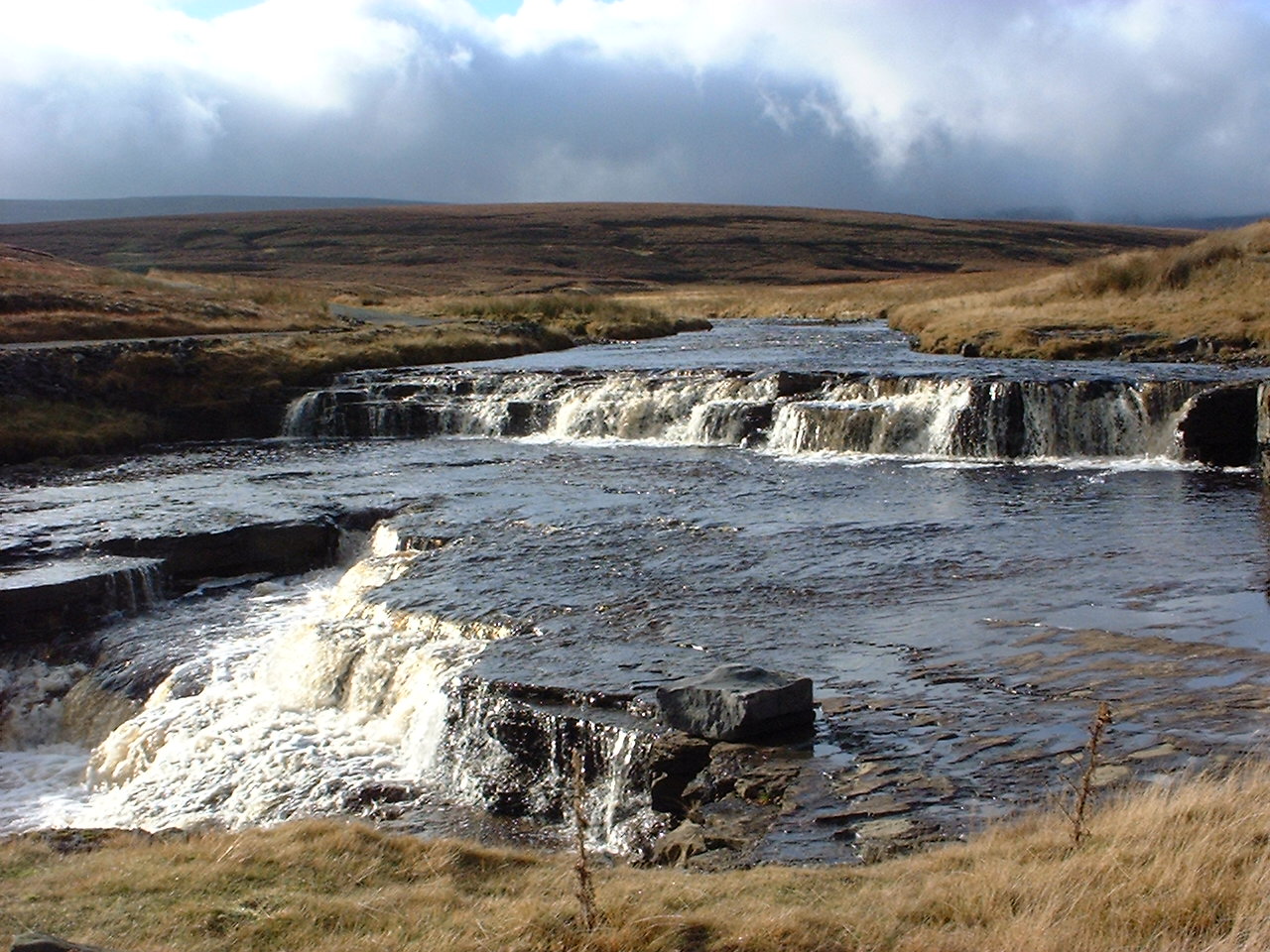
UK ECN site. The Trout Beck is a headwater stream of the River Tees, which drains Great Dun Fell, Hard Hill and Knock Fell in the North Pennines. The ECN sampling point (Grid Ref NY758335) is at 535m altitude and the catchment above this covers 1146 ha, rising to 848m altitude. The geology is alternating strata of Carboniferous limestones, sandstone and shales. Blanket peat covers 90% of the catchment with skeletal soils towards the fell tops and small areas of limestone soils and alluvial soils. Vegetation is dominated by ling heather (Calluna vulgaris), cotton grass (Eriophorum spp) and Sphagnum moss. The catchment lies in Moor House National Nature Reserve which is owned by Natural England. Discharge is measured at a gauging station operated by the Environment Agency. The pH of Trout Beck has wide fluctuations associated with the discharge. The site has a long history of ecological research. Note: this site is a single point sampling location on a river. The site is co-located with the Moor House-Upper Teesdale ECN site (the catchment lies entirely within this site). It is also included in the UK's Upland Waters Monitoring Network (UWMN). The shape file indicates the Moor House-Upper Teesdale ECN site.
-
None
-
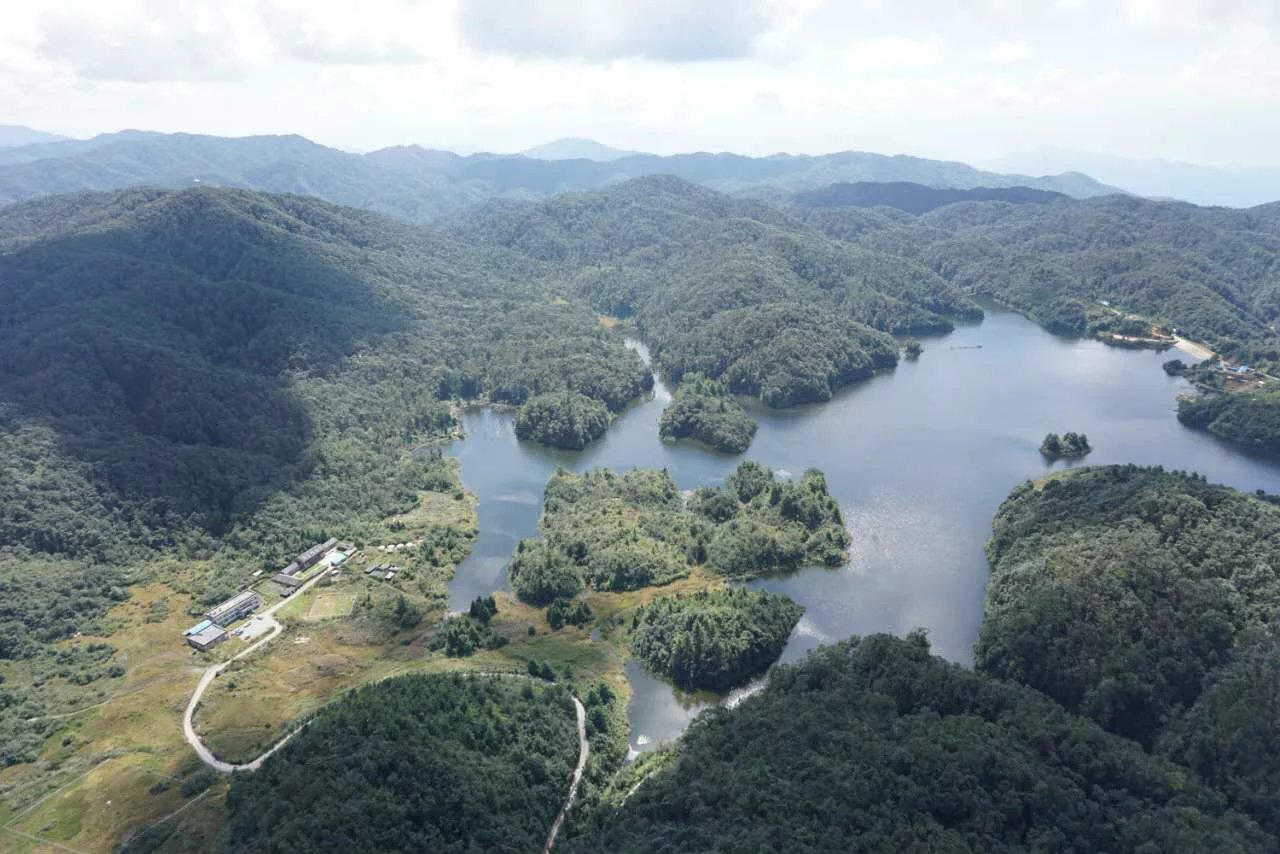
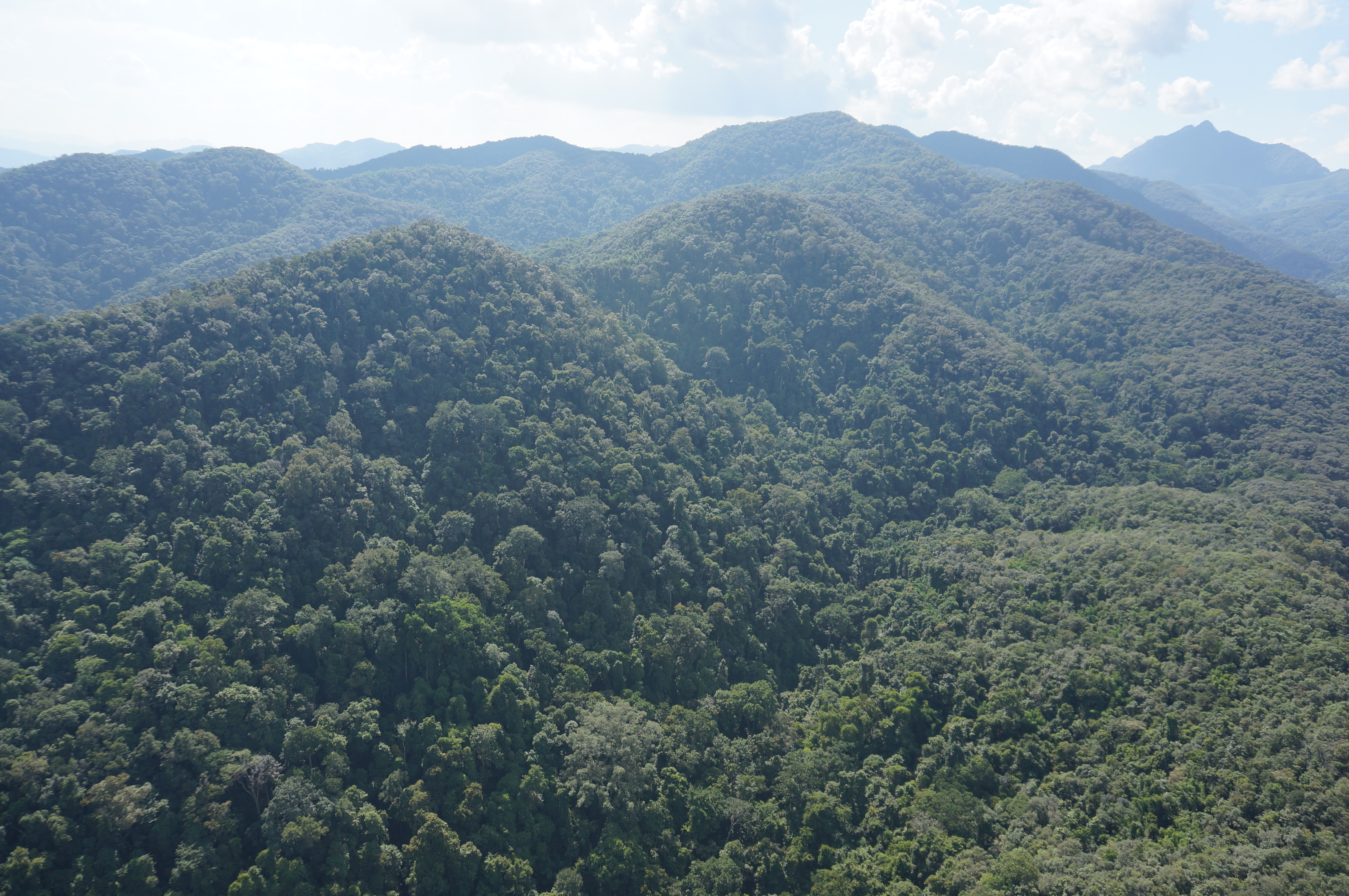
Located in Jingdong County, Yunnan Province, China. The annual mean air temperature was 11.3 °C, with a minimum monthly mean temperature of 5.7 °C in January and a maximum monthly mean temperature of 15.6 °C in July. Average annual rainfall was 1778 mm, with 86.0% of this falling in the rainy season (May–October). The dominant tree species in the forest are Lithocarpus xylocarpus, Lithocarpus hancei, and Castanopsis wattii.
-
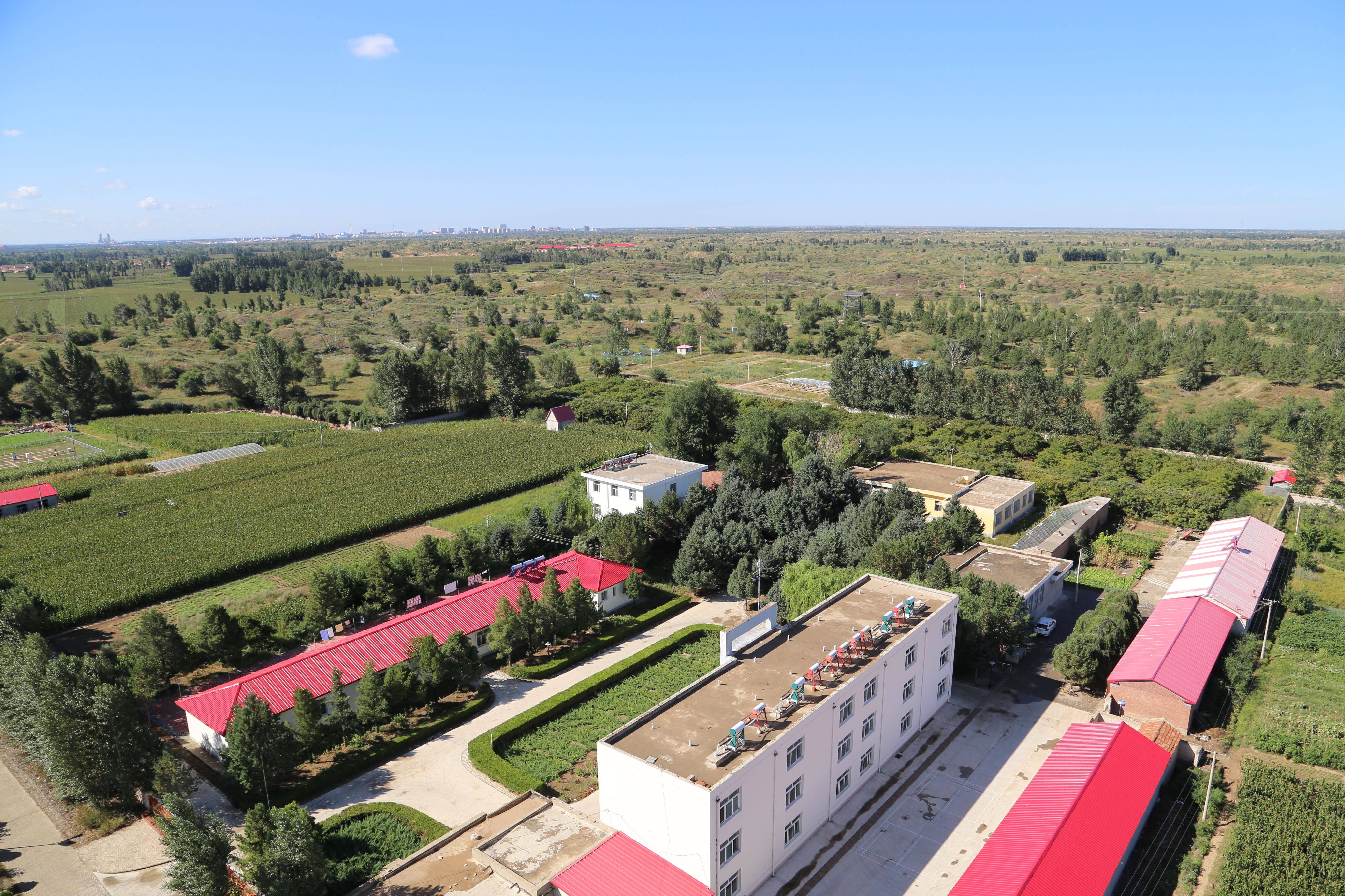
Naiman Desertification Research Station (NDRS), Cold and Arid Regions Environmental and Engineering Research Institute (CAREERI),Chinese Academy of Sciences (CAS) was officially estabilished in 1985, locating at Naiman County Inner Mongolia. The station is also affiliated to the Chinese Ecosystems Research Network (CERN) and Chinese National Ecosystem Research Network (CNERN).
-
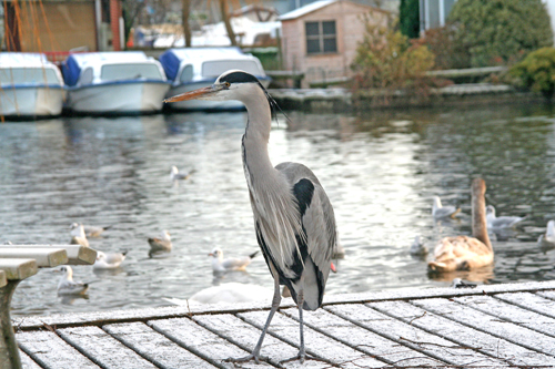
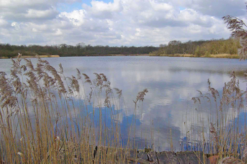
UK ECN site. Wroxham Broad is a shallow, lowland lake formed from the flooding of mediaeval peat diggings that were abandoned in the 14th century. The broad has an area of 34.4 ha and an average depth of 1.3m. It is located in the middle reach of the River Bure, close to the upper tidal limit, at an elevation of less than 10m above o.d.. The lake lies on the west side of the river with two navigable openings onto the river. It is separated from the river channel by a narrow bank covered with trees. The broad has been subject to serious eutrophication, largely as a result of the discharge of treated sewage effluent to the river Bure. Since 1986, a programme of phosphorus removal at the major sewage treatment works affecting the river has been in operation, and this stretch of river is now designated a Sensitive Area under the Urban Waste Water Treatment Directive. The low gradients of the area, and seasonally low flows of recent years, mean that the flushing rate of the lake is slow, although exact retention times are unknown. The surrounding catchment is underlain by Quaternary deposits of Norwich Crag, with chalk at depth, and superficial glacial till and outwash deposits. The area is subject to intensive agricultural activity, although surrounding the broad itself there are small areas of wet woodland (alder carr). The broad is used extensively for recreational purposes, particularly in the summer months. [Photo copyright Philip Ashton/NWT Natural Connections]
-
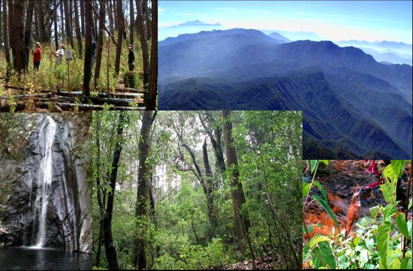
La Reserva de la Biosfera de Manantlan es un área protegida ubicada en los límites de los estados de Jalisco y Colima cuya importancia para la conservación radica en su diversidad de ecosistemas y especies, y en el papel que desempeñan sus bosques en la protección de cabeceras de cuencas que abastecen de agua a la región. En la RBSM se presenta la transición de las selvas bajas y medianas de las partes bajas a bosques de encino, mesófilo de montaña, pino y oyamel de las zonas altas. La variación en el sustrato geológico, la geomorfología y los suelos, y una larga historia de influencia humana a través de la agricultura, la ganadería, las actividades forestales y el uso del fuego, han contribuido a la heterogeneidad del paisaje.
-
Xishuangbanna Research Station of Tropical Forest was located in Mengla County, Yunnan Province, China. The annual mean air temperature was 21.5 °C, with a minimum monthly mean temperature of 15.5°C in January. Average annual rainfall was 1557 mm. The dominant tree species in the forest are Pometia tomentosa,Terminalia myriocarpa Vaniot Huerck et Muell.-Arg.
-
UK ECN site. Upton Broad is a shallow lowland lake, formed by the flooding of peat diggings, which were abandoned in the 14th century. It has an area of 6.9ha and an approximate mean depth of 0.8m. The broad lies in the valley of the River Bure, at an elevation of less than 10m, but is isolated from the river system, and is groundwater fed, with some drainage from surrounding land. Geologically, the area is underlain by Quaternary deposits of Norwich Crag, with glacial till and outwash deposits at the surface. The broad forms part of the Upton Broad and Marshes Site of Special Scientific Interest (SSSI). It is considered to have been relatively unaffected by the eutrophication that has damaged most of the lakes in the region, and supports a population of the nationally rare aquatic macrophyte Najas marina. The broad is surrounded by a band of alder carr (wet woodland). To the north of the broad are drained grazing marshes forming part of the Broads Environmentally Sensitive Area (ESA), and to the south the catchment is given over to the more intensive arable agriculture. The broad is used for angling by a private club; there is no other public access to the lake. [Photo copyright Norfolk Wildlife Trust]
-
Lake Como is the deepest italian lake (425metres) and is part of the group of deep lakes located south of the Alps in one of the most densely populated and highly idustrialized area of Italy.Owing to its shape, resembling an upside-down “Y”, Lake Como may be subdivided in three sub-basins, i.e. the Western, the Eastern and the Northern basins with different bathymetric , hydrological characteristics. Lake Como, originally oligotrophic, has undergone a process of eutrophication since the 60's that culminate in the '80s when the concentration of total phosphorus at Como was detected in 80 μg l-1. In this phase, the composition of the phytoplankton population has undergone considerable variations with the gradual growth in the importance of some species such as Planktothrix rubescens, Stephanodiscus hantzschii, Fragilaria crotonensis and M. aeruginosa thata gave rise an extensive bloom in 1983 in Como. The data relating to zooplanktonic community showed an increase of cladocerans especially Eubosmina sp. The subsequent reduction of loads, that caused the decrease of total phosphorus concentration in the lake up to 46 and 40 μgP l-1, respectively in the west basin and along the north-eastern axis , led to the decline of the biomass. Even the zooplankton community has recorded a decrease of the density of cladocerans (Daphnia hyalina and Eubosmina sp.) and an increase in that of Diaptoms (Eudiaptomus padanus). The decrease of the concentration of total phosphorus concentration is continued up to reach 35 μgP l-1 in 1999 without determining significant variations nor the specific composition of the phytoplankton communities , in this period occasionaly dominated by P. rubescens (up to 50,000 cell ml-1 at Como), either in its abundance expressed as total biovolume.In Lake Como, only few studies were carried out irregularly by various Institutions up to the end of the 1990s. Since the beginning of the 2000, with the establish of the Envinromental Protection Agency of Lombardia (ARPA Lombardia), continuous monthly samplings and measurements were carried out by our envinromental agency.The data collected at monthly frequency since 2000 includes water temperature and oxygen. Phytoplankton and chemistry data were collected since 1997, while zooplankton were collected from 2004 to 2006 and since 2010. In 2008 and 2009 were characterized the communities of the macrophytes and benthic macroinvertebrates (sublittoral and profundal zone) of the entire lake.