
2013
Type of resources
Available actions
Topics
Keywords
Contact for the resource
Provided by
Years
Formats
Representation types
Update frequencies
-
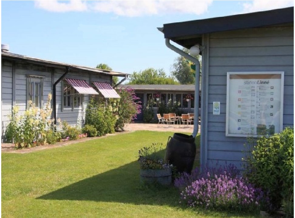
Station Linné has its roots in the Uppsala University Research Station on Öland. The research station is situated in Ölands Skogsby, adjacent to Stora Alvaret and the UNESCO World Heritage Site “Södra Ölands odlingslandskap”. The station was inaugurated in 1963 and was run by Uppsala University until June 30, 2008. Since May 1, 2010, however, the station is run by an independent foundation, the Station Linné Foundation (Stiftelsen Station Linné). The mission of the Foundation is to support research, education and outreach within sustainable development. Currently, the foundation supports its mission primarily by running the research station in Ölands Skogsby. The station has a tradition since 1963 committed research on the flora and fauna of Öland and documented in several hundreds scientific papers. Although the station is small, it is visited yearly by about 100 scientists and students from Swedish and foreign institutions. Since 2005, the station is also the permanent base for the Swedish Malaise Trap Project, a comprehensive inventory of the entire Swedish insect fauna, which is internationally unique in that it is the most ambitious ATBI (all-taxa biodiversity inventory) targeting a sizable insect fauna yet. Since 2000, the station has also organized outreach activities for the general public, not the least for children and youngsters. Future plans include collaboration with local authorities, the station also hopes to be involved in the creation of a future Visitor Centre for the adjacent World Heritage Site. The station will continue to provide support for visiting scientists and students, and we hope to add more lodging facilities, and expand the station's educational and research activities for young adults.
-
Lake Trasimeno (Umbria, Italy) is a shallow meso-eutrophic lake of a remarkable naturalistic importance (Natura 2000 site, S.C.I., S.P.Z. and Regional Park). Despite its large extension, the lake is very shallow and its bathymetry very smooth, with a maximum nominal depth of 6.3 m, which can only be reached when the water level exceeds the artificial outlet threshold located at 257.50 m a.s.l.
-
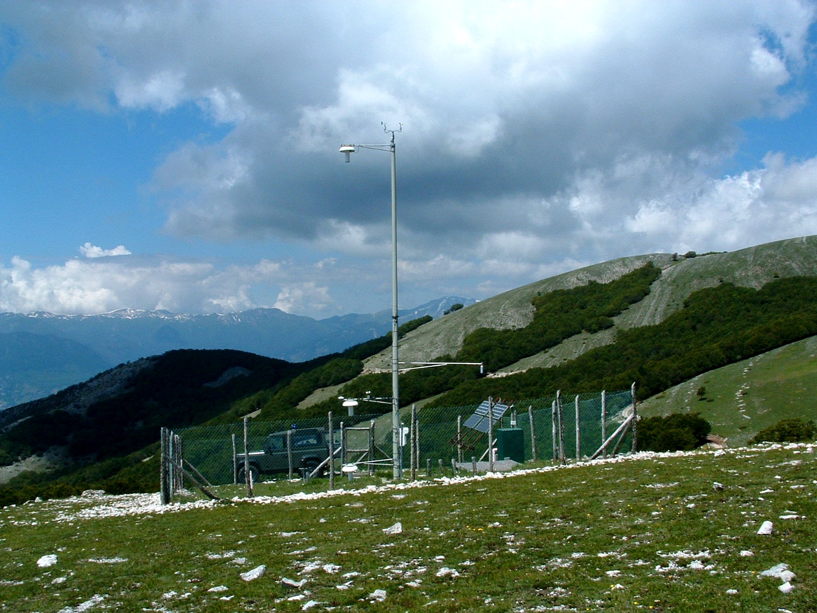
The site is the parent site of three research sites, performing long-term research and monitoring in Apennines forests (mostly beech - Fagus sylvatica L. - forests) and meadows located within those forests.
-
The Höglwald is a Norway spruce-dominated forest of about 370 ha surrounded by farmland in the hilly landscape of Southern Bavaria, approx. 70 km north of the Alps and 40 km west of Munich at 11° 5' E and 48°18' N. The Höglwald site (560 m asl) is operated by IMK-IFU permanently since 1993. The site is equipped with 2 fully automated, remotely controlled measuring and data acquisition systems in standard containers for continuous quantification of net exchange of trace gases (CO2, N2O, CH4, NOX) at the soil-atmosphere interface in high temporal resolution using static and dynamic chamber techniques and two towers (3 m and 50 m height) for quantification of net ecosystem exchange of CO2, H2O and sensible heat.
-
Vertical profiles of salinty are collected on a monthly basis in the Gulf of Trieste – time series station using a CTD multiparametric probe. The site is part of the LTER-North Adriatic site. Data are used to characterize the temporal dynamic of hydrological properties in the coastal Long Term Ecosystem Research station of the Gulf of Trieste, in the northernmost part of the Adriatic Sea and of the Mediterranean basin. General information can be found at: http://nettuno.ogs.trieste.it/ilter/BIO/index.html
-
Zemaitija station (LT03) was founded in the strict reserve zone of Zemaitija national park, at the basin of right side Uođa river tributary - Juodupis brook. The area of the basin is 147.3 ha. The lowest place - 147.0 m, the highest elevation - 180.0 m above sea level. The geographical co-ordinates of the basin are: longitude - 21*51*56*-21*53*10*, latitude - 56*00*19*-56*01*05*. Zemaitija station is situated at 50 km distance from the Baltic Sea, which generally defines the climatic conditions of this territory. High humidity, cloudiness and abundant precipitation are typical for the assessment location. The perennial air temperature is 5.9 C, the perennial average amount of precipitation reaches up to 788 mm and is significantly higher than in other stations. The length of vegetation period is 187 days. The geomorphologic structure of the basin is also relatively complicated. Different than in other locations, in this station the marsh accumulation forms with organic sediments transfer into limnoglacial accumulative forms and glacioacval accumulative sandy hilly formations with typical limnoglacial sand. Saturation of Juodupis river water had very little mineralisation, with oxygen levels of 9.6 mg/l and average yearly mineralisation of 163 mg/l, and the pH fluctuated in the limits of 6.65-7.90, being slightly alkaline. Annual yearly concentration of nitrates is 0.37 mgN/l. Significant increases in the number of nitrate ions were indicated in 1997, i.e., concentration increased twice compared to 1996. Concentrations of nitrogen are not significant. Concentrations of common phosphor and silicon are very small. Conifers dominate the basin of this brook, which are mainly spruce with up to a 20-30% pine mixture. Abundant spruce under layer is common for these stands. A significant territory of the basin is also covered by pure spruce stands. However, as a rule in these forest stands we can find an abundant second spruce layer or under layer. The number of birch and black alder stands is even lower in Zemaitija station. They can be found only at the source of the river, where marsh habitat types are dominating. Forest stands with two or more age classes are dominating in Zemaitija station. This is mainly multi-layered spruce stands and pure pine or pine mixed with abundant spruce under layer forest stands. A slightly smaller territory is occupied by mature forest stands and young forests. The main vegetation communities are: sub-oceanic blueberry western taiga, marsh boreal spruce forests and boreal marsh Scotch pine forests. Eleven plant communities can be identified in the river basin.
-
The Hesse site is beech forest plot equipped since 1996 with an eddy covariance system to measure continuously (half-hourly) the net fluxes of CO2, H2O and energy exchanged between ecosystem and atmosphere. Supplementary sensors provide the main meteorological data (temperature, humidity, radiation) and edaphic status (soil water content, soil temp.). Additional field campaigns give information about ecosystem characteristics evolution (Leaf Area Index, trees growth, fine roots biomass), carbon allocation to ecosystem compartments (soil and stem CO2 efflux, heterotrophic respiration) and their isotopic signature (13C).
-
“The Ecotron” is a unique facility for controlled environment ecological experiments, designed to bridge the gap between the complexity of real field communities and the simplicity of laboratory or greenhouse studies. The facility has been extensively described in the scientific literature and includes 16 separate walk-in chambers with computer-controlled climatic conditions. Recent modifications of the facility allow it to emulate real weather data (temperature, humidity, light, rainfall and water table) for large mesocosms (up to 130 x 85 x 40cm).
-
The infrastructure is an experiment aimed at determining the carbon, water, energy and nutrient balances of short rotation forests dedicated to biomass and wood production. The infrastructure comprises two sites located in Cestas and Salles. The Salles site (60 ha plot of pine forest), is fully operational since 2000 with an eddy flux tower (CO2, H2O, heat, radiation), nitrogen wet and dry depositions, soil moisture, micrometeorological and ancillary measurements. It is connected to the main power and satellite data transmission. The Cestas site is in construction. It will be composed of (1) a set of 32 plots organized into complete randomized blocks where forest management alternatives are compared and (2) a set of four large plots (10-12 ha) designed for carbon, nitrogen and water fluxes monitoring to be launched in 2012.
-
The study site is located in Tolfa-Allumiere, in Central Italy not far from the Tyrrhenian coast at an elevation of about 500 m above sea level. A Mediterranean evergreen woodland was selected for a large through-fall manipulation experiment. The experimental design included three large (1 ha each) un-replicated plots (1 Control, 1 Dry, 1 Wet) for eddy-flux measurements, and nine smaller (8x12 m2) plots (3 Control, 3 Dry, 3 Wet) for replicated ecological studies. These plots were equipped with automated soil respiration systems, dendrometers, litterbags and others environmental sensors. This facility is suitable for testing short and long term effects of precipitation changes in Mediterranean ecosystems.