
2019
Type of resources
Available actions
Topics
Keywords
Contact for the resource
Provided by
Years
Formats
Representation types
Update frequencies
status
Scale
-
Since 1981 a pollen trap ("Seven-Day Recording Volumetric Spore Trap"; Burkhard Manufacturing Co Ltd) is automatically collecting plant pollen at the University Centre Obergurgl.
-
None
-
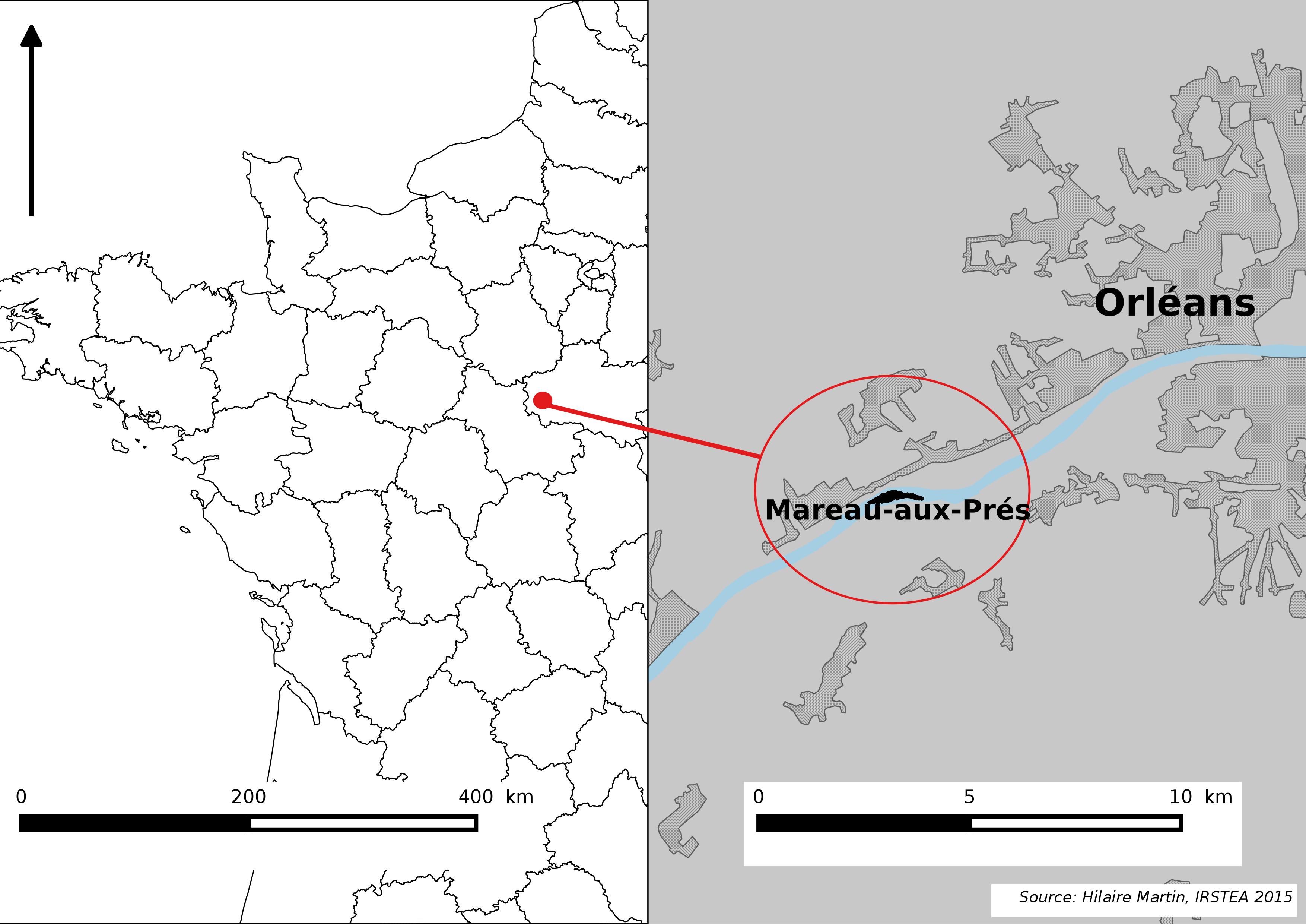
The Mareau-aux-Prés islands, along the Loire river, are characterized by a multiple channel pattern, where natural limestone riffles influence the morphology and spatial distribution of vegetated islands, secondary channels and alluvial bars. Within these islands, in september 2012, fluvial management operations (FMO) were launched. The vegetation of the central sandy-gravelly bar (3 ha area) was uprooted and the bar level lowered in order to maintain the flow capacity of the river. A new sandy-gravelly bar appeared in spring 2013, ideal field support for studying long-term ecological issues. A multidisciplinary research program (‘BioMareau’ project) is currently being conducted from 2012 to 2019, focusing on biodiversity recolonization and on interactions and feedbacks between biotic and abiotic compartments.
-
Aquatic macroinvertebrates are widely used as bioindicators for water quality assessments involving different kinds of disruptive factors, such as hydrological regime variations or pollutant spills. Recently, they demonstrated to be effective in monitoring effects of climate change in alpine stream and rivers. Indeed, since the distribution of macroinvertebrates in glacier-fed streams has been succesfully investigated and described by several authors, the discrepancy in presence/absence and quantity of specific taxa from the established models may represent an early warning of the effects of climatic changes occurring in alpine riverine ecosystems. Here, we provide a dataset covering a period of 6 years (2010-2015) sampling of aquatic macroinvertebrates along a longitudinal transect of a glacier-fed stream located in the Italian Alps, inside the International Long Term Ecological Research (ILTER) macrosite of Matsch|Mazia (IT-25). Data were collected during the glacial melt period (April - September), with monthly resolution. Owing to the unique temporal resolution of the dataset, we aim to produce a reliable tool (i.e. reference point) for future ecological assessment on the same stream, but also to similar streams worldwide.
-
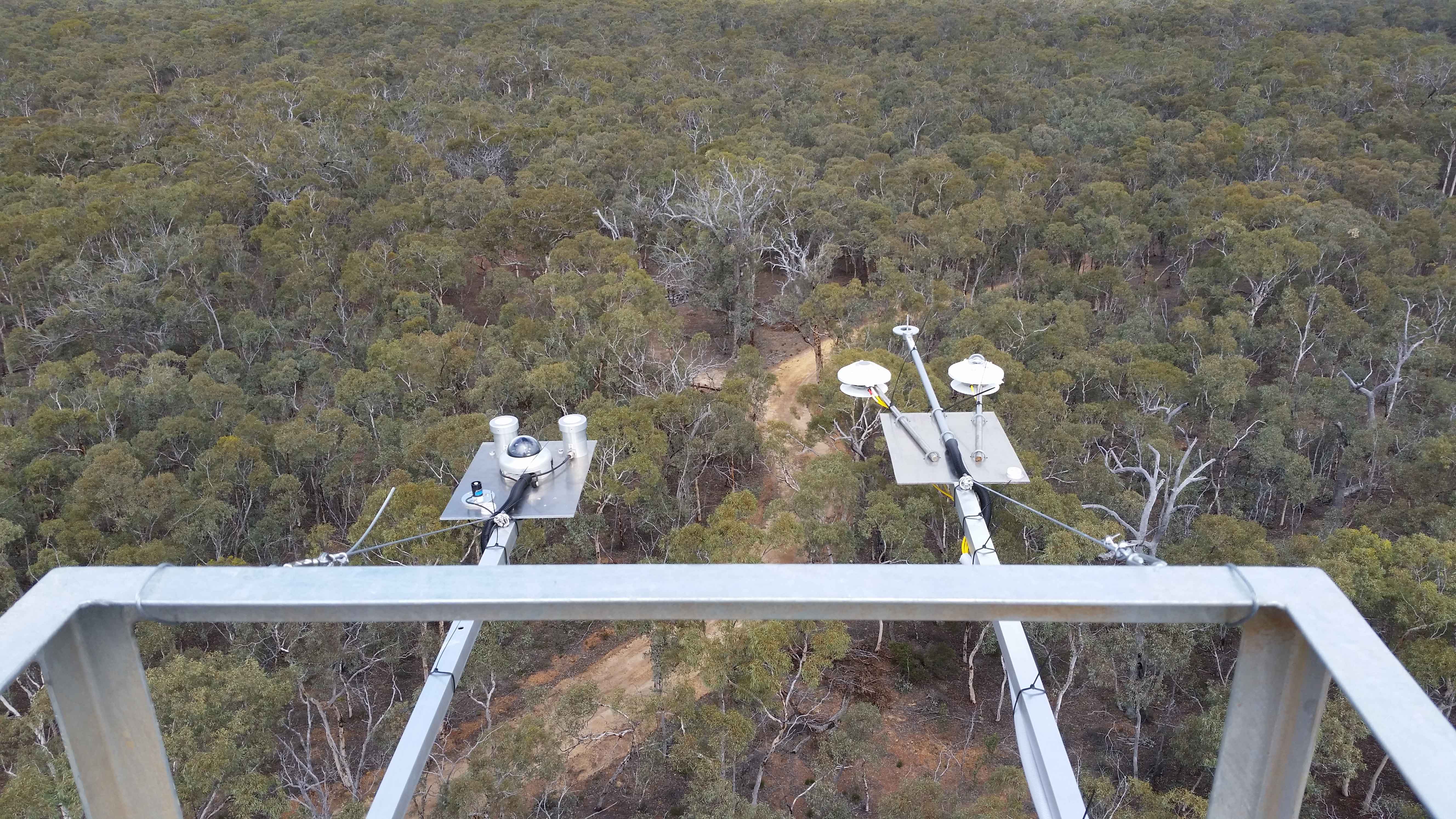
The Boyagin Wandoo Woodland SuperSite was established in September 2017 by the University of Western Australia. Located in the Boyagin Nature Reserve, approximately 12 km west of Pingelly, Western Australia the SuperSite monitoring activities complement the Avon River Catchment Critical Zone Observatory at the UWA Future Farm in Pingelly that focusses on managed landscapes (rotational dryland wheat cropping and grazing pastures for sheep). The climate is Semi-arid (Dry) Warm Mediterranean. The Boyagin SuperSite is collocated with the Land Ecosystem Atmosphere Program (LEAP) - Boyagin. Boyagin SuperSite is located in the Avon Wheatbelt (AW2-Re-juvenated Drainage subregion) and has a high density of rare and geographically restricted flora and supports populations of several marsupials subject to fox predation (Numbat, Quenda, Woylie, Tammar, Red-tailed Phascogale, Brushtail Possum) that have disappeared from most of the Australian or Western Australian mainland. The Noongar people are the traditional owners at Boyagin.
-
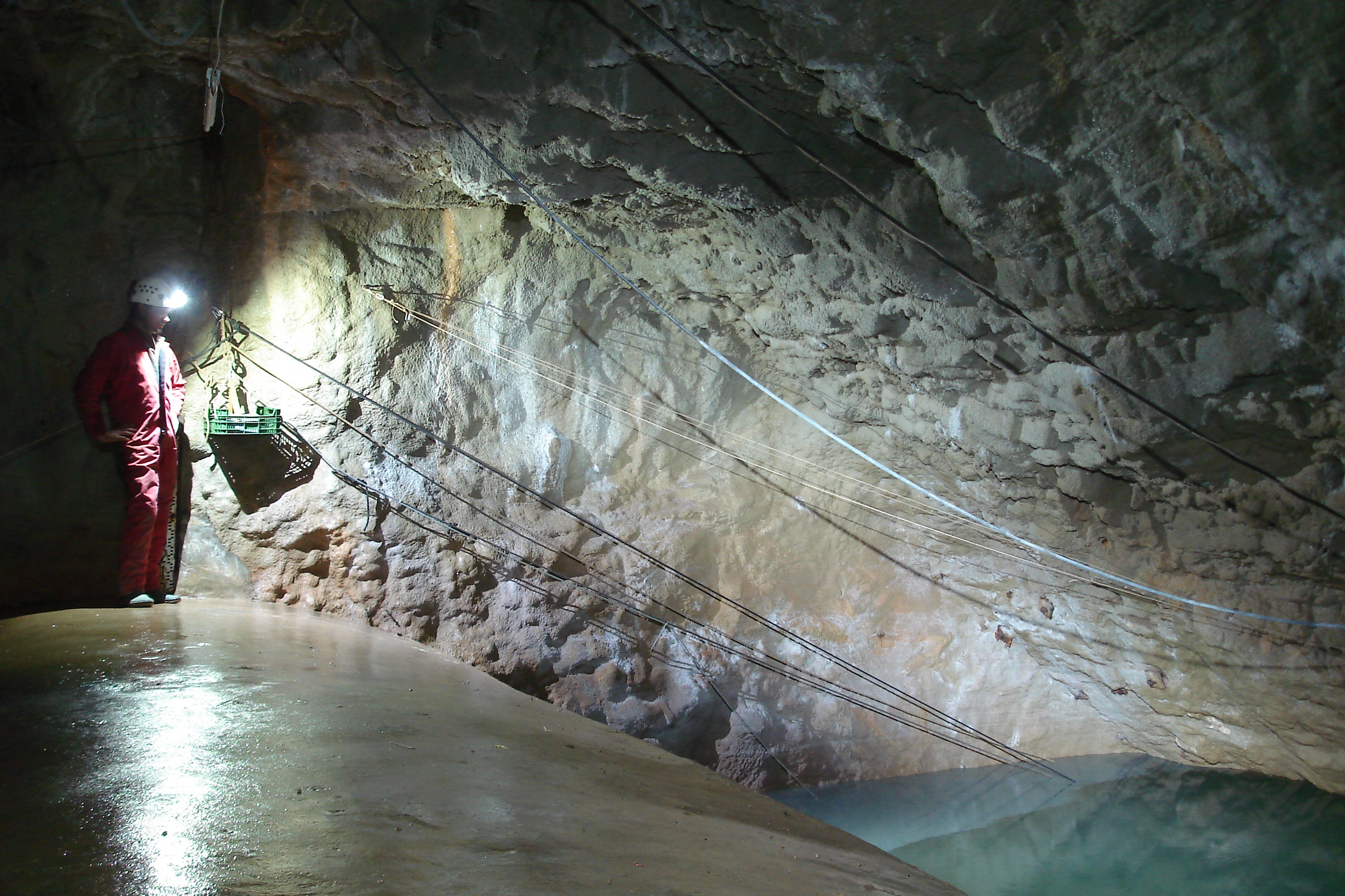
The Mediterranean and coastal site of Port-Miou is a wide regional carbonate aquifer, with a catchment area around 400 km², in south of France (Provence, France). It extends mainly over natural land, in the vicinity of one of the main city of France (Marseille), facing recent urban expansion and future groundwater resources management issues. Top of the recharge area culminates at 1100 m asl, and the main outlets are submarine springs. Karst features are observed in surface (polje, intermittent rivers, sinkholes, karren, caves) and underground. Many karst networks have been explored in the unsaturated zone of the aquifer, but also in the saturated zone below the sea level. Karst features and conduits drive the groundwater flows to the main outlets. The Port-Miou submarine springs outflow from huge flooded karst conduits, explored by cave diving over several kilometers inland, and to -235 m deep. Groundwater is brackish, polluted by seawater intrusion. The Port-Miou observation site includes flow rate, salinity and temperature monitoring at the main brackish spring, in an in-situ underground laboratory located 500 m inland from the seashore, directly in the main karst conduit. Rainfall is also recording in the catchment area, and rain water samples are collected for water isotopes observation.
-
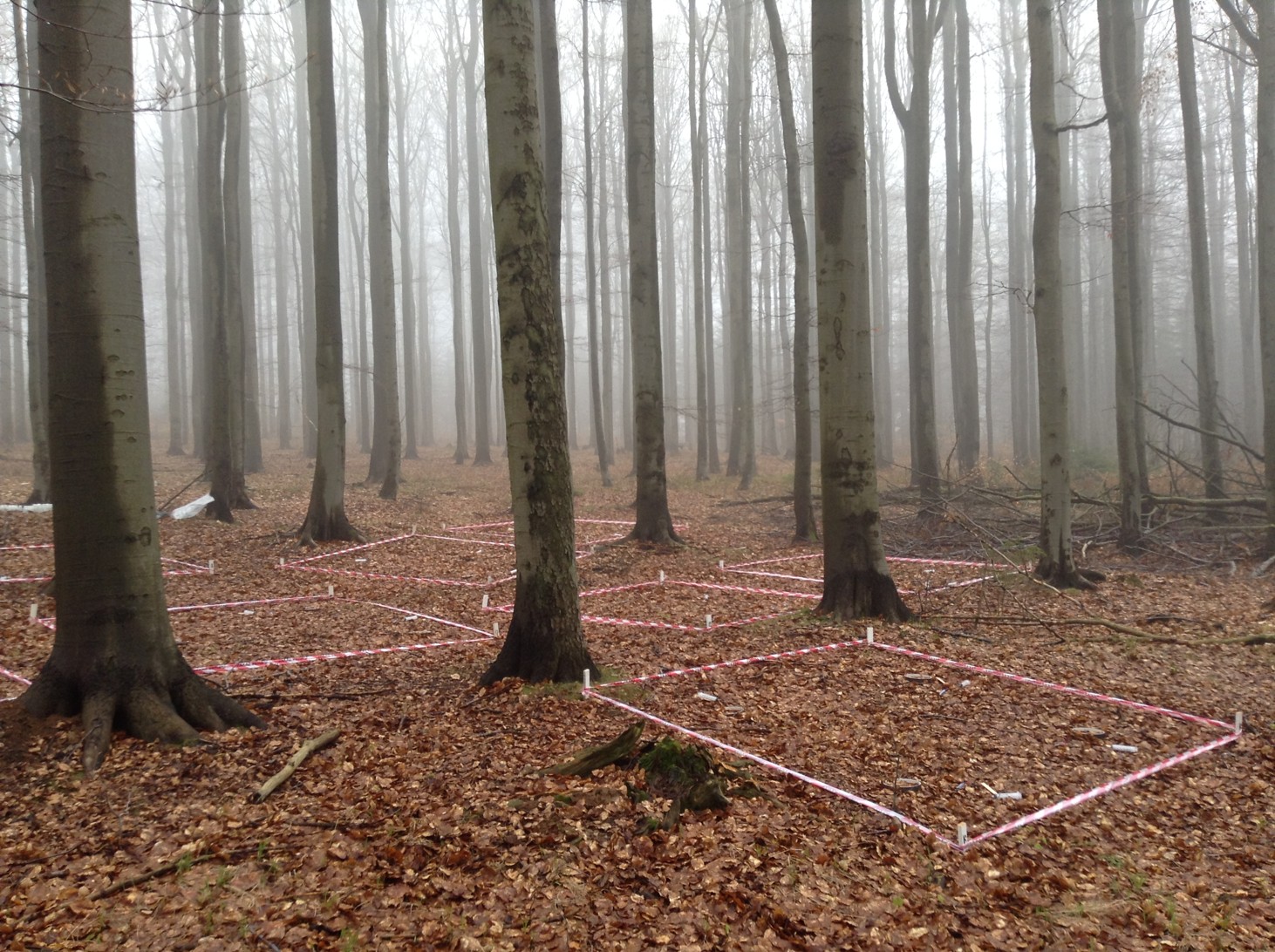
The spruce and beech stands under study are located in the Czech Republic in the Ore Mountains near the German border, close to the village of Načetín (50_35026” N, 13_15014” E). Both of the stands lie close to each other (ca. 700 m), so they are exposed to the same geological and climatic conditions. The average annual temperature is 7.1 _C and average annual precipitation is 1110 mm (2005–2017). Paragneiss underlies both stands, which are sloped to the north-west. The dominant soil type is dystric cambisol. The spruce stand lies at an elevation of 784ma.s.l. and it is covered by 80 years old monoculture of Norway spruce (Picea abies). The beech stand is situated at an elevation of 823 m a.s.l. and it is composed predominantly of European beech trees (Fagus sylvatica) that are approximately 140 years old.
-
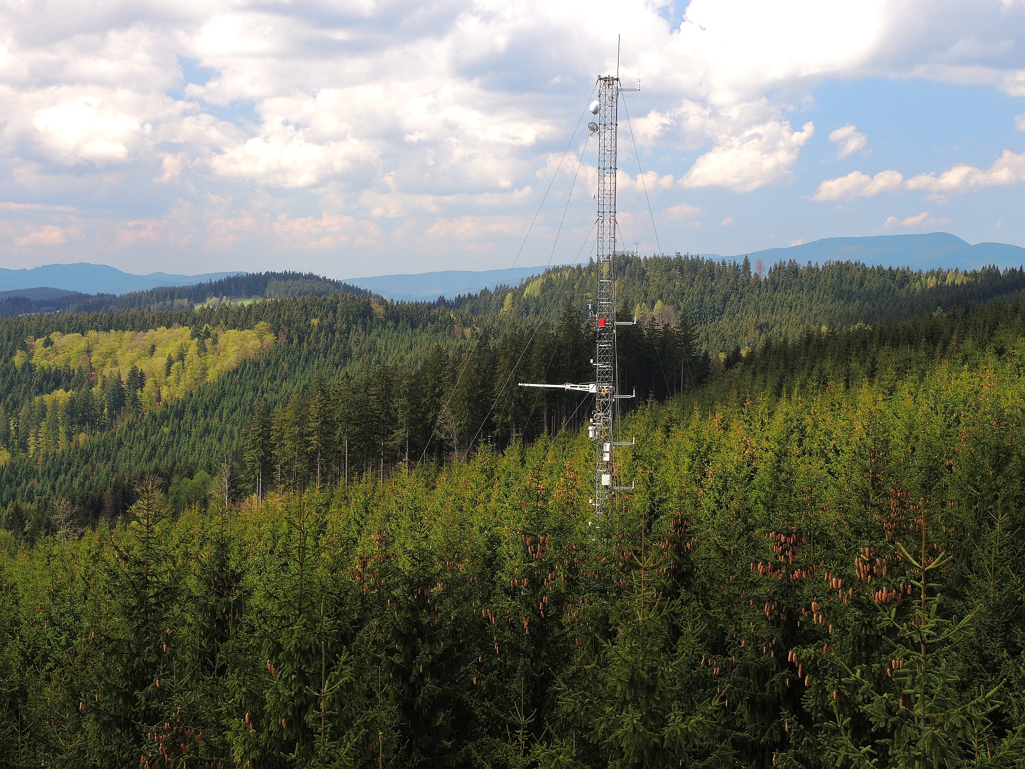
The site Bily Kriz (Bílý Kříž) is located in Moravian-Silesian Beskids Mountains. Ecosystem type: Managed secondary pure Norway spruce stand. Prevailing species: Norway spruce (Picea abies [L.] Karst.) Height of the stand: 17 m (2016) Understory: Vaccinium myrtillus L. Year of plantation: 1981 by 4 years old seedlings
-
The present database contains observations for 21 parameters of abiotic, phyto and zooplankton data collected in the Northern Adriatic Sea region (Italy). It relies on a Comma Separated Values file and it is composed by 108687 records. Due to its long temporal coverage, it is classifiable as Long Term Ecological data. Due to the long temporal coverage, the great part of parameters changed collection and analysis method in time. These variations are reported in the database. A long term database can be useful for multiple purposes. This database has been released under a research project focused on Open Science principles application to marine ecology.
-
Between Börnchen and Dittersdorf a MOSES test campaign was performed from the 20.05.2019 to the 23.07.2019