
2020
Type of resources
Available actions
Topics
Keywords
Contact for the resource
Provided by
Years
Formats
Representation types
Update frequencies
status
Scale
-
None
-
None
-
None
-
Average values along the water column of reactive silica collected in the Lake Bidighinzu
-
The NEON site McRae Creek (MCRA) is a relocatable aquatic site located within the HJ Andrews Experimental Forest, 80 km east of Eugene, OR in the Western Cascade Mountains. It is a third-order stream that drains an old-growth coniferous forested watershed. HJ Andrews is a 15,800 acres ecological research site that is administered by Oregon State University, the USDA Forest Service's Pacific Northwest Research Station, and the Willamette National Forest. It has been a part of the National Science Foundation's Long-Term Ecological Research Program since 1980. It mainly consists of dense forests filled with cedar, hemlock, and Douglas fir trees; many of which are at least 300 years old and can grow as high as 75 meters. The Domain hosts a total of three other field sites, one more aquatic and two terrestrial; all of which are located in Washington state. Remote sensing surveys of this site collect lidar, spectrometer and high resolution RGB camera data. This site has one meteorological station located in the riparian area. The met station is outfitted with a subset of the same sensors used at terrestrial sites. Measurements include wind speed and direction, air temperature, barometric pressure, relative humidity, shortwave radiation, and PAR. This site has one upstream sensor station and one downstream sensor station. Measurements include PAR, temperature, water quality [specific conductivity, chlorophyll a, dissolved oxygen content, pH, turbidity, and fluorescent dissolved organic matter (only downstream)], and nitrate is measured at the downstream station. Due to logistical and permitting issues, this aquatic site does not have groundwater wells. Field ecologists collect the following types of observational data at this site: aquatic organisms (Aquatic Microbes (surface water),macroinvertebrates microalgae, plants and macroalgae, zooplankton. Biogeochemical data on plants,sediment water and particulates.As well as physical aquatic data on bathymetric maps, stage,secchi depth and depth profiles, and riparian assessment.
-
The Lyndon B. Johnson National grasslands (CLBJ) is a core terrestrial within NEON's Domain 7: Southern Plains. CLBJ is located in the Great Plains region of north-central Texas, about an hour drive from the Dallas-Fort Worth metroplex. LBJ occupies approximately 20,000+ acres of public lands managed by the U.S. Forest Service. The grasslands are home to Black Creek Lake, which hosts an established recreation site consisting of seven picnic units, seven walk-in camp units, one improved boat ramp and an accessible fishing bridge. There are nearly 75 miles of established trails on site great for hiking, mountain biking, horseback riding, photography, and wildlife viewing. Remote sensing surveys of this field site collect lidar, spectrometer and high-resolution RGB camera data. The flux/meteorological tower at this site is 72 with 5 measurement levels. The tower top extends above the vegetation canopy to allow sensors mounted at the top and along the tower to capture the full profile of atmospheric conditions from the top of the vegetation canopy to the ground. The tower collects physical and chemical properties of atmosphere-related processes, such as humidity, wind, and net ecosystem gas exchange. Precipitation data are collected by a Double Fence Intercomparison Reference (DFIR) near the tower and a series of throughfalls located in the soil array. This site has one phenocam on the top of the flux tower and one near the bottom of the tower. This site has five soil plots placed in an array within the airshed of the flux tower. Field ecologists collect the following types of observational data at this site: Terrestrial organisms (birds, ground beetles, mosquitoes, plants, small mammals, soil microbes, ticks), Biogeochemical data, and soil data.
-
The Caribou-Poker Research Watershed hosts a set of co-located terrestrial and aquatic field sites on land owned by the University of Alaska Fairbanks and the Alaska Department of Natural Resources. Just 35 minutes outside of Fairbanks, the sites are easy to access from the Steese Highway. Remote sensing surveys of this field site collect lidar, spectrometer and high-resolution RGB camera data. The flux/meteorological tower at this site is 59’ with 5 measurement levels. The tower top extends above the vegetation canopy to allow sensors mounted at the top and along the tower to capture the full profile of atmospheric conditions from the top of the vegetation canopy to the ground. The tower collects physical and chemical properties of atmosphere-related processes, such as humidity, wind, and net ecosystem gas exchange. Precipitation data are collected by a Double Fence Intercomparison Reference (DFIR) near the tower and a series of throughfalls located in the soil array. This site has five soil plots placed in an array within the airshed of the flux tower. Field ecologists collect the following types of observational data at this site: Terrestrial organisms (birds, ground beetles, mosquitoes, plants, small mammals, soil microbes, ticks), Biogeochemical data, and and soil data. Total data products planned for this site: 117.
-
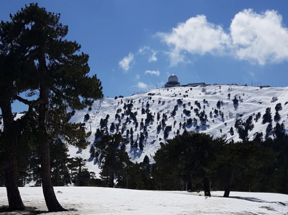
The highest location in Cyprus. The location will allow CAO to sample from the free troposphere during the cooler half of the year, when the boundary layer is below 2,000 meters.
-
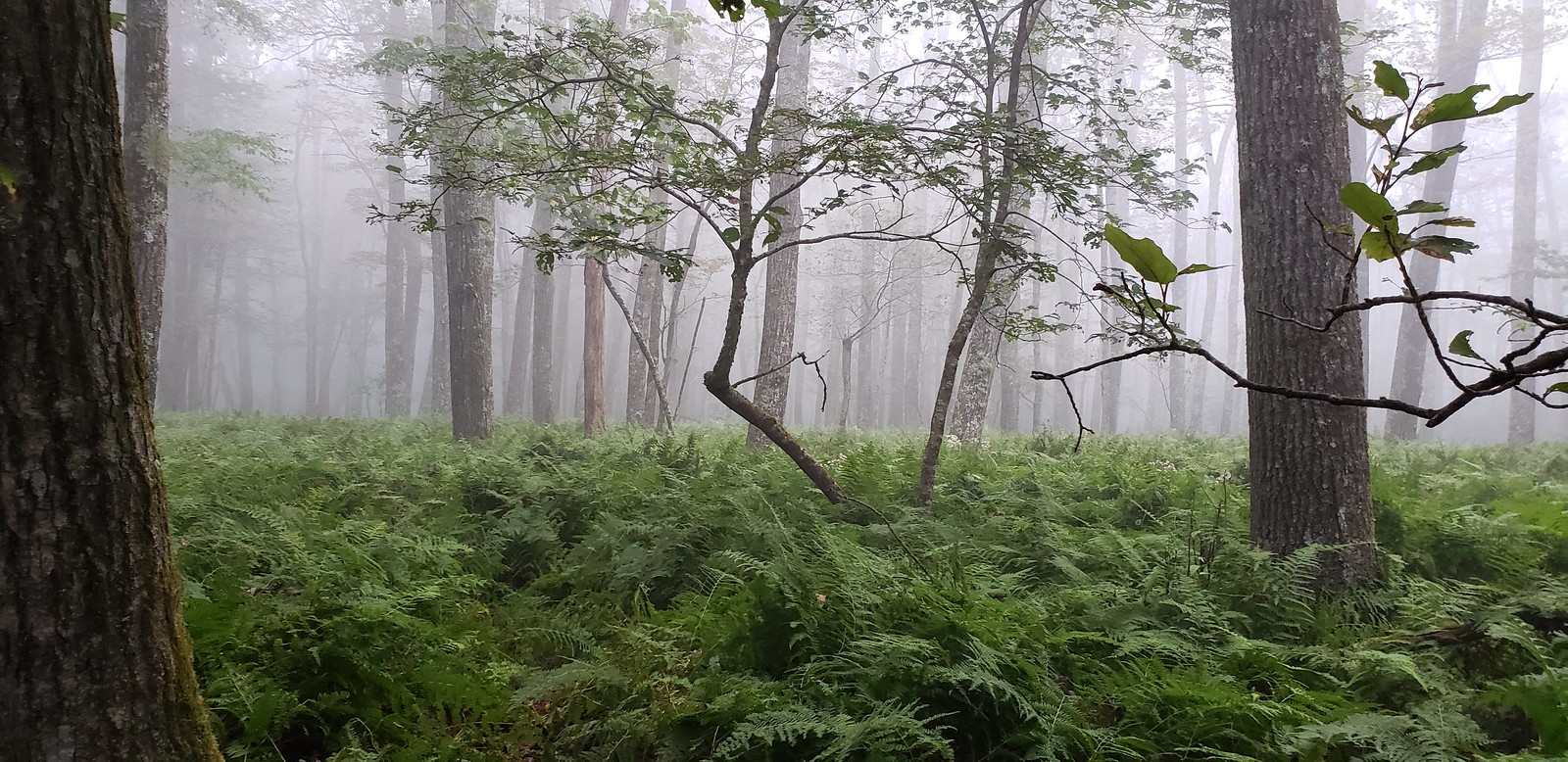
Mountain Lake Biological Station is located in a remote, but accessible southern portion of the Appalachian Mountain Chain in southwestern Virginia, approximately 20 km northwest of Blacksburg, VA. The Jefferson National Forest is contiguous to the station, with 42.5 km2 of woodland is designated as NFS Wilderness. The relocatable terrestrial NEON site is comprised of three parcels of land, with the northern two segments owned by the US Forest Service and the southern portion hosted by the University of Virginia. The 11.14 km2 site is situated on the elevated divide between the Atlantic and Mississippi drainage basins and is characterized by abrupt changes in environmental gradients and fine-scale variances in ecological niches. It is the only NEON Appalachians & Cumberland Plateau Domain site located in Virginia, as the other four domain 07 sites are found in Tennessee. Remote sensing surveys of this field site collect lidar, spectrometer and high-resolution RGB camera data. The flux/meteorological tower at this site is 94 with 6 measurement levels. The tower top extends above the vegetation canopy to allow sensors mounted at the top and along the tower to capture the full profile of atmospheric conditions from the top of the vegetation canopy to the ground. The tower collects physical and chemical properties of atmosphere-related processes, such as humidity, wind, and net ecosystem gas exchange. Precipitation data are collected by a tipping bucket at the top of the tower and a series of throughfalls located in the soil array. This site has five soil plots placed in an array within the airshed of the flux tower. Field ecologists collect the following types of observational data at this site: Terrestrial organisms (birds, ground beetles, mosquitoes, plants, small mammals, soil microbes, ticks), Biogeochemical data, and soil data. Total data products planned for this site: 115
-
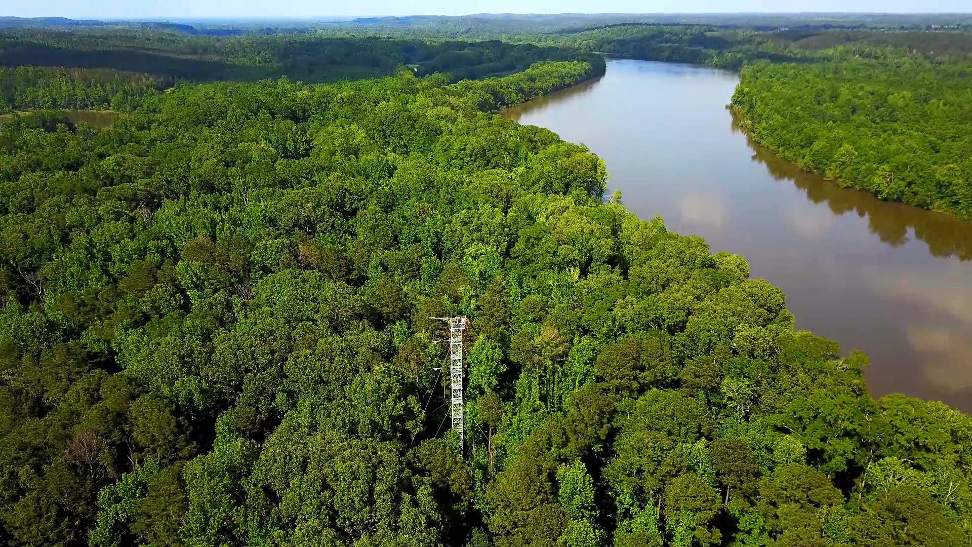
The Lenoir Landing (LENO) relocatable terrestrial site is part of NEON's Ozarks Complex Domain 7. LENO is located across the 4,218-acre Choctaw National Wildlife Refuge and Lenoir Landing Park. The site is located in southwest Alabama approximately 129km (80 mi) north of Mobile. Lenoir Landing Park hosts the Data Tower and tower plots and is managed by the U.S. Army Corp of Engineers. The distributed plots are located 5 km south of the tower shed on the Choctaw National Wildlife Refuge managed by the U.S. Fish and Wildlife Service. The site is characterized by Hardwood bottomland with seasonal flooding and is located along the Tomgigbee River which hosts the Lower Tombigbee river aquatic site. Remote sensing surveys of this field site collect lidar, spectrometer and high-resolution RGB camera data. The flux/meteorological tower at this site is 149 with 6 measurement levels. The tower top extends above the vegetation canopy to allow sensors mounted at the top and along the tower to capture the full profile of atmospheric conditions from the top of the vegetation canopy to the ground. The tower collects physical and chemical properties of atmosphere-related processes, such as humidity, wind, and net ecosystem gas exchange. Precipitation data are collected by a tipping bucket at the top of the tower and a series of throughfalls located in the soil array. This site has five soil plots placed in an array within the airshed of the flux tower. Field ecologists collect the following types of observational data at this site: Terrestrial organisms (birds, ground beetles, mosquitoes, plants, small mammals, soil microbes, ticks), Biogeochemical data, and soil data.