
2022
Type of resources
Available actions
Topics
Keywords
Contact for the resource
Provided by
Years
Formats
Representation types
-
Platform for interdisciplinary ecosystem research - with connection to several sub-sites
-
None
-
None
-
None
-
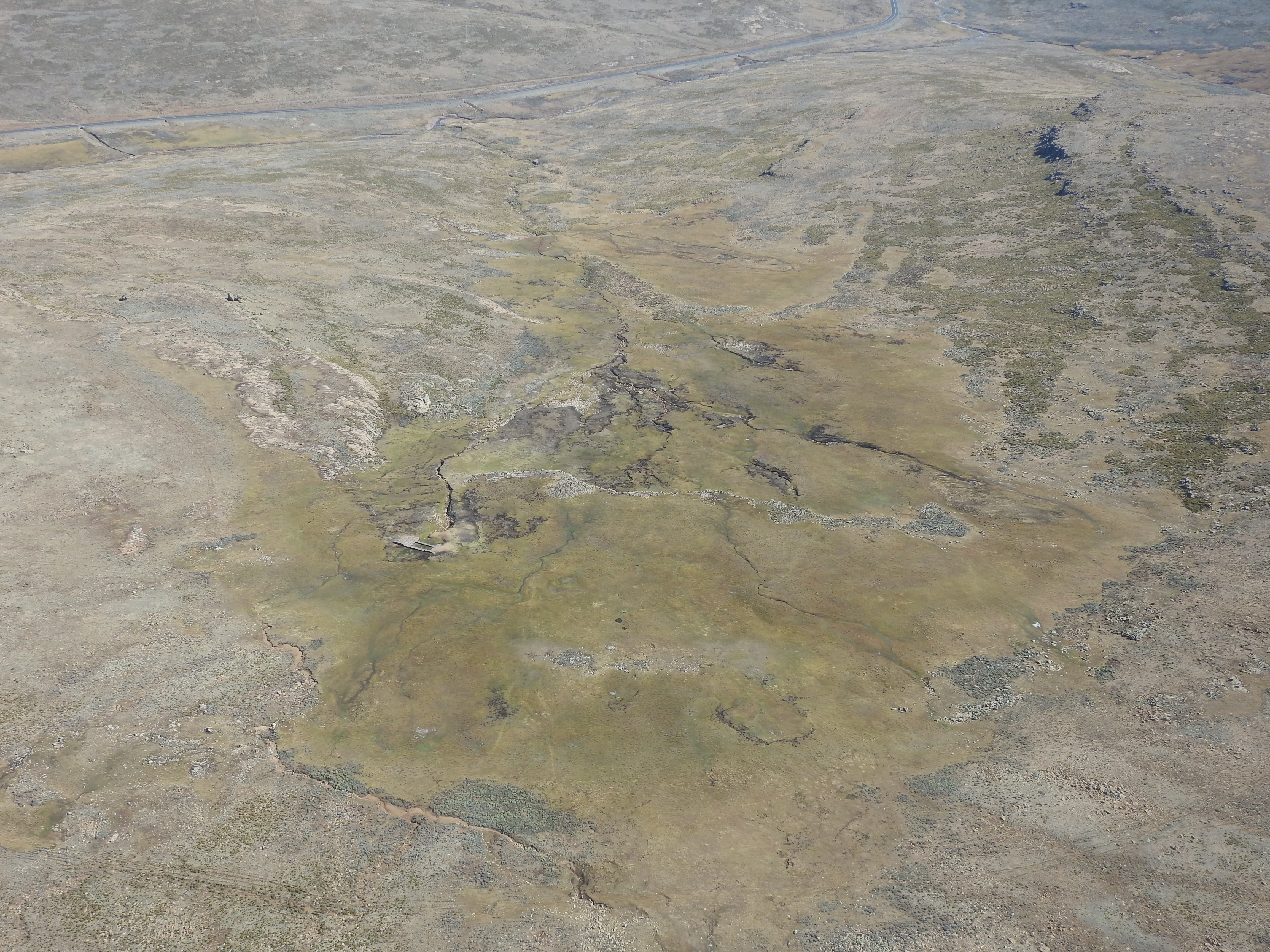
The area is considered especially important from a wetland perspective because rivers such as the Tugela, Vemvane, Khubelu, Motete, Matseng and Malibamatso all have their origins in these alpine wetland systems. Notable mammals that inhabit these wetlands are domesticated sheep and horses, as well as ice rats. Within and close to the area of the MaS-LTSER are the Tšehlanyane National Park, Lucapa Diamond Mine, Letseng Diamond Mine, Matsoku Mine, Kao Mine, and Liqhobong Mine. Some of the alpine wetlands in the area are experiencing degradation, and there are some that can be considered severely degraded. Wetland degradation in this alpine region can lead to loss of ecosystem services as well as livelihood of the locals.
-
None
-
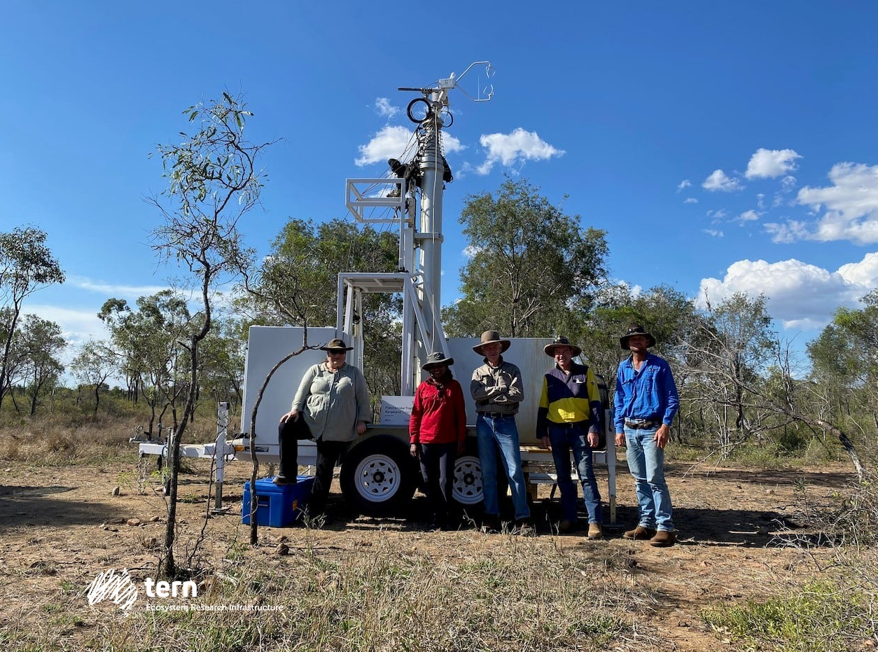
Fletcherview Tropical Rangeland SuperSite was established in 2021 at James Cook University’s Fletcherview Research Station, a fully operational outback cattle station located 50 km west of Townsville, Queensland. The site is used for cattle grazing and is characterised by tall open savanna. The area around this SuperSite is used for cattle grazing. Black and red basalt soils and alluvial river flats support a wide variety of flora and fauna across open savanna woodland, dry rainforest, lava flows, three creek systems and the Burdekin River. The vegetation is dominated by native grasses such as blackspear and kangaroo grasses, as well as introduced species like buffel grass, signal grass and leucaena. Fletcherview typically experiences a dry and wet season, with most rainfall occurring between January and April. This site sits on Gugu-Badhun land.
-
- Crown condition assessments (annual) - Soil water sampling (continuously) and analysis - Throughfall sampling (continuously) and analysis - Foliar sampling and analysis (every 2 years) - Solid soil analysis (every 10-15 years) - Increment measurements (every 5 years) - Ground vegetation analysis (every 5 years)
-
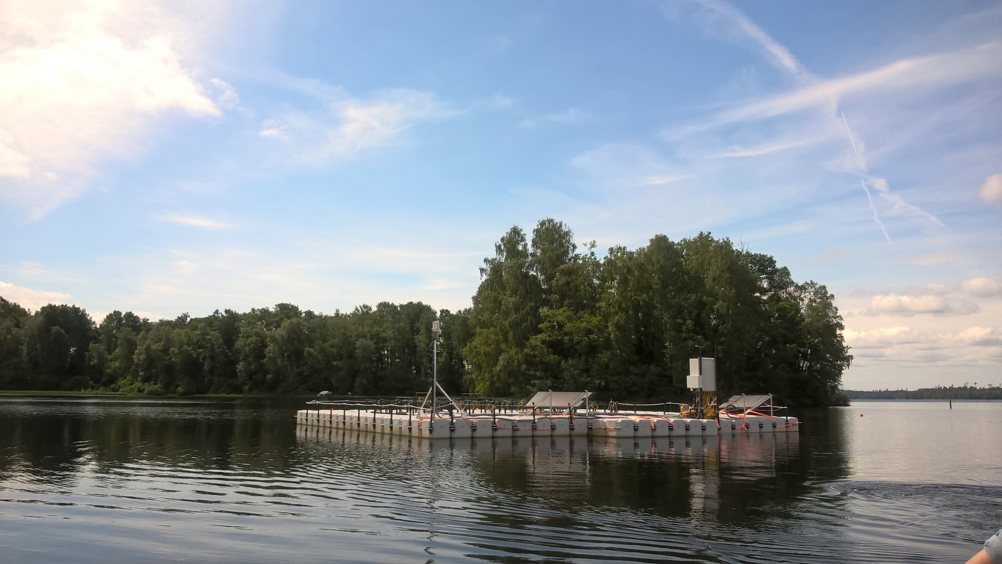
Bolmen Research Station is located in Tiraholm, by Lake Bolmen in Hylte municipality. The research at the station primarily focuses on environmental monitoring, fish conservation and management, water conservation and the effects of climate change on freshwater ecosystems.
-
- Crown condition assessments (annual) - Soil water sampling (continuously) and analysis - Throughfall sampling (continuously) and analysis - Foliar sampling and analysis (every 2 years) - Increment measurements (DBH every 2-4 weeks, heights every 5 years) - Ground vegetation analysis (every 5 years) - Solid soil analysis (every 10-15 years)