
2023
Type of resources
Available actions
Topics
Keywords
Contact for the resource
Provided by
Years
Formats
Representation types
Update frequencies
status
-
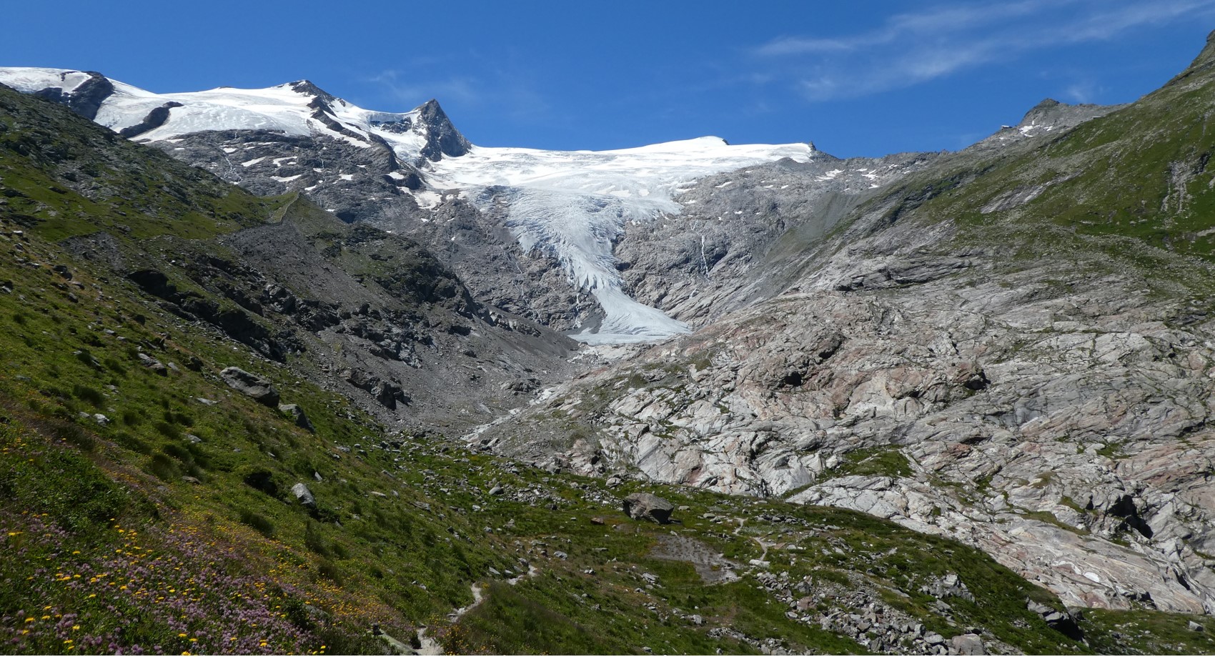
The Hohe Tauern National Park (NPHT) and its region has been conducting specific monitoring programs for research purposes for years, all with links to eLTER. The platform includes a number of measuring facilities, which are all described in specific research sites each, i.e. LTER Hohe Tauern National Park (NPHT), Sonnblick Observatory, Oberes Stubachtal, Mullwitzkees, Venedigerkess and Pasterze. This LTSER platform picks up all possible monitoring acvities within the NPHT region and makes them available for eLTER. The platform is able to carry out and promote natural and social science work.
-
This site is part of the BFW project "Klimaforschungswald". The aim of this research project is to evaluate which tree species will fullfil the important tasks and functions of the forest ecosystem in the future. Furthermore, temperature and precipitation fluctuations in particular are to be documented in order to be able to map a possible trend and the influence of the growing vegetation. A total of 13 different deciduous tree species were planted in the “Klosterwald” area. In the middle of the area, a classic oak-hornbeam row afforestation was planted.
-
The Baddoch Burn has been monitored by Marine Scotland Science Freshwater Fisheries Laboratory since 1988. The site was added to the UK UWMN in 2013, extending the alkalinity gradient of sites within the Network as well as providing long-term high-quality chemistry and fish records that are directly compatible with measurements performed in other monitoring sites. The Baddoch Burn lies in the Cairngorm Mountains of Scotland and forms part of the headwaters of the River Dee. The catchment area is 2260 ha and rises from 415m altitude at the long-term chemistry sampling and fish trap location to 975m at the summit of Carn a Gheodh. The 9.3 ha Loch Vrotachan lies in the southern section and the outflow feeds into Allt Loch Vrotachan before reaching the Baddoch Burn. There is a very small amount of commercial coniferous forestry at the lowest end of the catchment. Other land-use consists of extensive grouse-moor, with associated muirburn, and grazing by red deer. Loch Vrotachan is fished for Brown Trout. The Burn forms the top of the River Dee Special Area of Conservation and the catchment lies within both the Cairngorms Massif Special Protection Area and the Cairngorm National Park. Rainfall, recorded from nearby Braemar, is ca. 860 mm annually.
-
Situated in the North York Moors, Danby Beck was added to the Network in 2011, when systematic chemical and biological sampling commenced. Surface water acidity data however has been collected since 1990 by Environet, a local volunteer group. The long-term historic pH record plus the site's geographical location in an area of high acid deposition, not originally represented within the original UK Acid Waters Monitoring Network, led to the decision to incorporate Danby Beck into the network. Danby Beck is a sub-catchment in the headwaters of the River Esk. The 77 hectare Danby Beck catchment lies between an elevation of 299m at the sampling point/biological survey section and an altitude of 432m at the trig point to the south east. The site is highly designated. Both the Beck and the catchment lie within the North York Moors SAC, SPA, SSSI and National Park. The catchment also falls within the North York Moors Upland land Management Initiative, a Catchment Sensitive Farming area and is under Entry plus Higher Level Stewardship.
-
This dataset includes records of the long-term monitoring of Doñana’s diurnal butterflies, part of a harmonised protocol of the "Long-term Ecological Monitoring Program of Natural Resources and Processes". The aims is to monitor and assess the dynamics of diurnal butterflies (Papilionoidea) of Doñana.
-
None
-
None
-
The Auchencorth Moss (AMo) field, South East Scotland (55ᵒ47’36” N, 3°14’41” W), is an ombrotrophic peatland with an extensive fetch at an elevation of 270 m, lying 18 km SSW of Edinburgh, and can be categorised as a transitional lowland raised bog. The site is grazed with < 1 sheep ha-1. The site was originally established in 1995 to measure concentrations of trace gases and aerosols. During 2000s the site activity has increased and was established in 2006 as EMEP (Level 2/3) supersite for the UK. Long term monitoring is led by NERC CEH with contributions from other organisations/research institutes including Ricardo AEA, BureauVeritas, NPL, the University of Birmingham and University of Edinburgh. In April 2014 the site was awarded WMO GAW regional station. Currently CEH focus on three main areas of research at the AMo fieldsite: 1. Surface-atmosphere exchange fluxes 2. Atmospheric composition 3. Carbon catchments
-
None
-
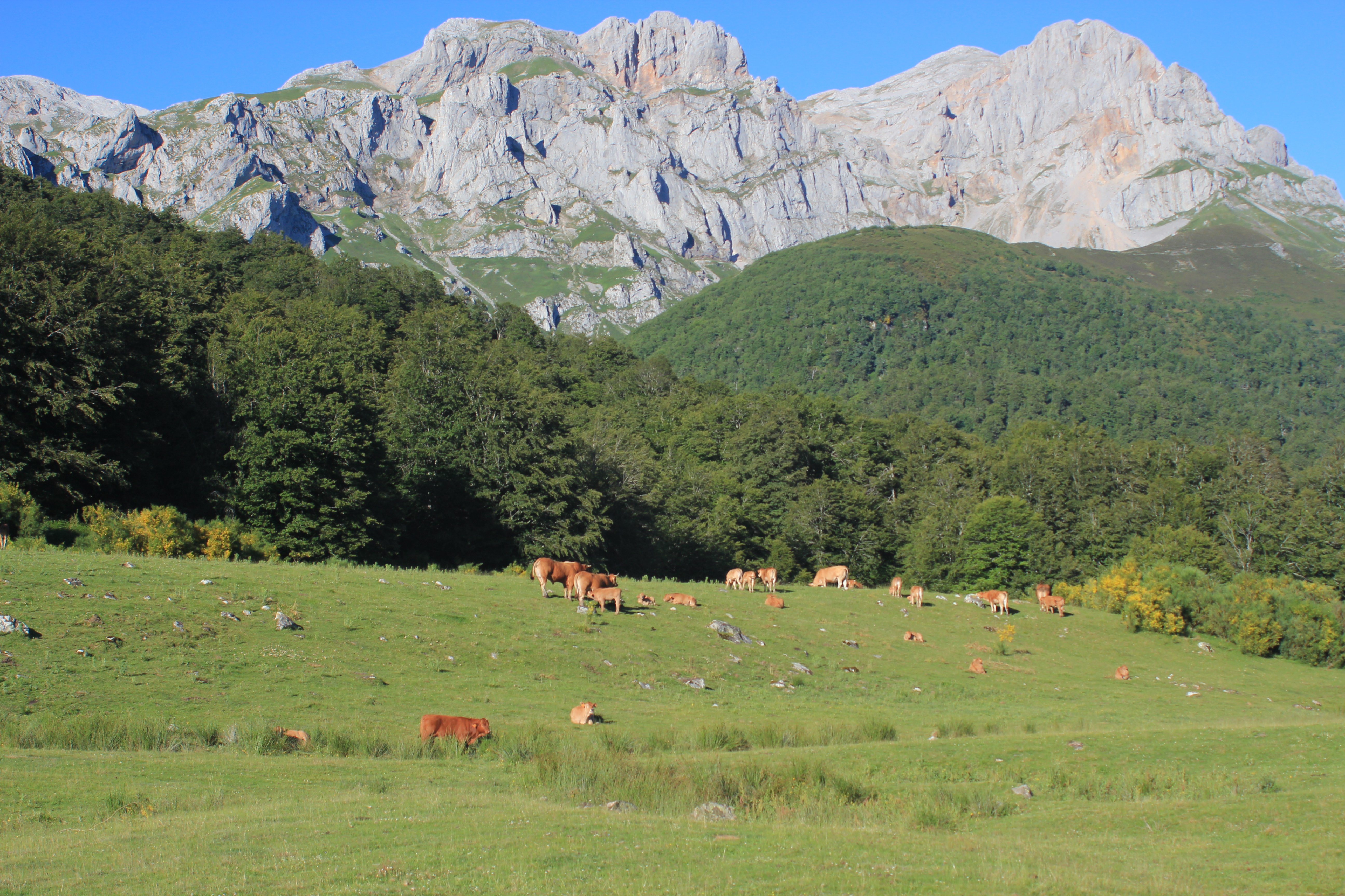
The Picos de Europa socio-ecosystem research platform (LTSER-Picos de Europa) comprises the catchment areas of the Sella (1,284 km², average annual Q 30 m3/s) and Deva-Cares (1,187 km², average annual Q 40 m3/s) rivers that drain the Cantabrian Mountains towards the Cantabrian Sea. The Picos de Europa National Park is located in this area and it was the first National Park declared in Spain (1918). The LTSER-Picos de Europa has a maximum altitude of 2,648 m (Torres Cerredo). The average annual temperature varies between 6ºC (mountainous areas) and 15ºC (coast), while the average annual rainfall varies between 800 mm (Liébana, Cantabria) and 3,000 mm. It is dominated by broadleaf forests >grasslands>shrublands>rocky areas and contains the bio-climatic floors: Hill (0-700 m, crops and eucalyptus), Montane (500-1,100 m, oak and beech) and Subalpine (>1,100 m, birch, mountain pasture and cryosphere). It is a very interesting biogeographical area as it represents the convergence between the Mediterranean and Atlantic biomes. LTSER-Picos de Europa contains 5 SPAs and 9 SACs (Habitats Directive), where 40 habitats and 80 species of Community Importance have been described. The Picos de Europa National Park is practically the only populated National Park in Spain (20 towns; 1,100 inhabitants), although without large urban centres. LTSER-Picos de Europa contains a great deal of reprensentativity of the rural space of the Cantabrian Mountains. Human activities range from the production of hydroelectric energy, to different activities of the agro-livestock sector, tourism and other services. The history of the LTSER-Picos de Europa is very recent, however, many interdisciplinary teams and national and international researches have been investigating in the area for more than half a century. The main objective of the LTSER-Picos de Europa is to improve our knowledge of the effects of global change on mountain socio-ecosystems. Our more specific objectives are: (1) to Identify mountain socio-ecological dynamics and patterns at large temporal and different spatial scales, (2) identify the main factors of global change that govern these dynamics and patterns, (3) determine the main relationships between the different components that make up mountain socio-ecosystems and (4) predict and model the future responses of the studied components under different scenarios of global change.