
abiotic heterogeneity
Type of resources
Available actions
Topics
Keywords
Contact for the resource
Provided by
Years
Formats
Representation types
-
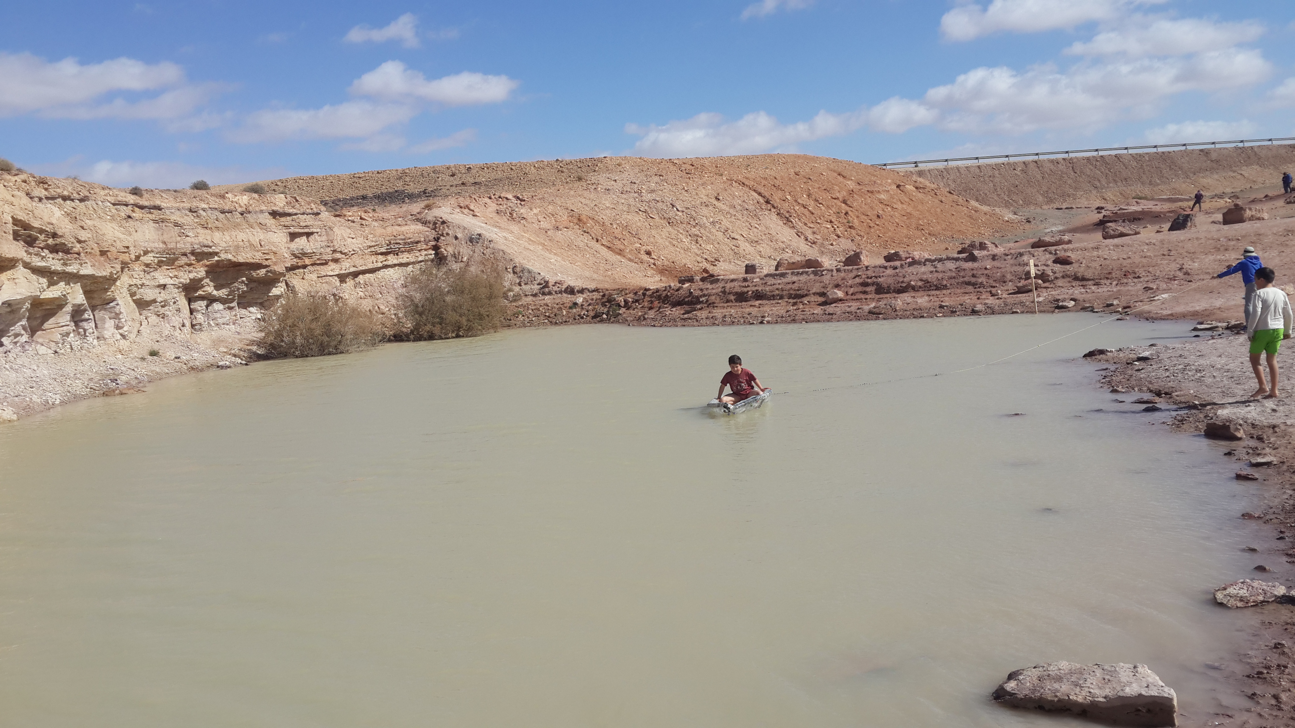
The site is located between two bio -geographical zones arid and hyper-arid, the research is carried out by both sides. The arid side is characterized by remains of terraces from the Nabatean agriculture runoff. The main research topics that being studied in the site are: biodiversity, climate change, runoff hydrology. The arid zone is a geo hydrological ecological system which is depended on a combination of rainfall and runoff that creates water enriched parches that support relatively high biodiversity. The hyper arid zone is runoff depended system the source of runoff are stipe, slope consist on bare bedrock, biological activities are constructed in the dry riverbeds that functions as sinks for the runoff generated from the slopes.
-
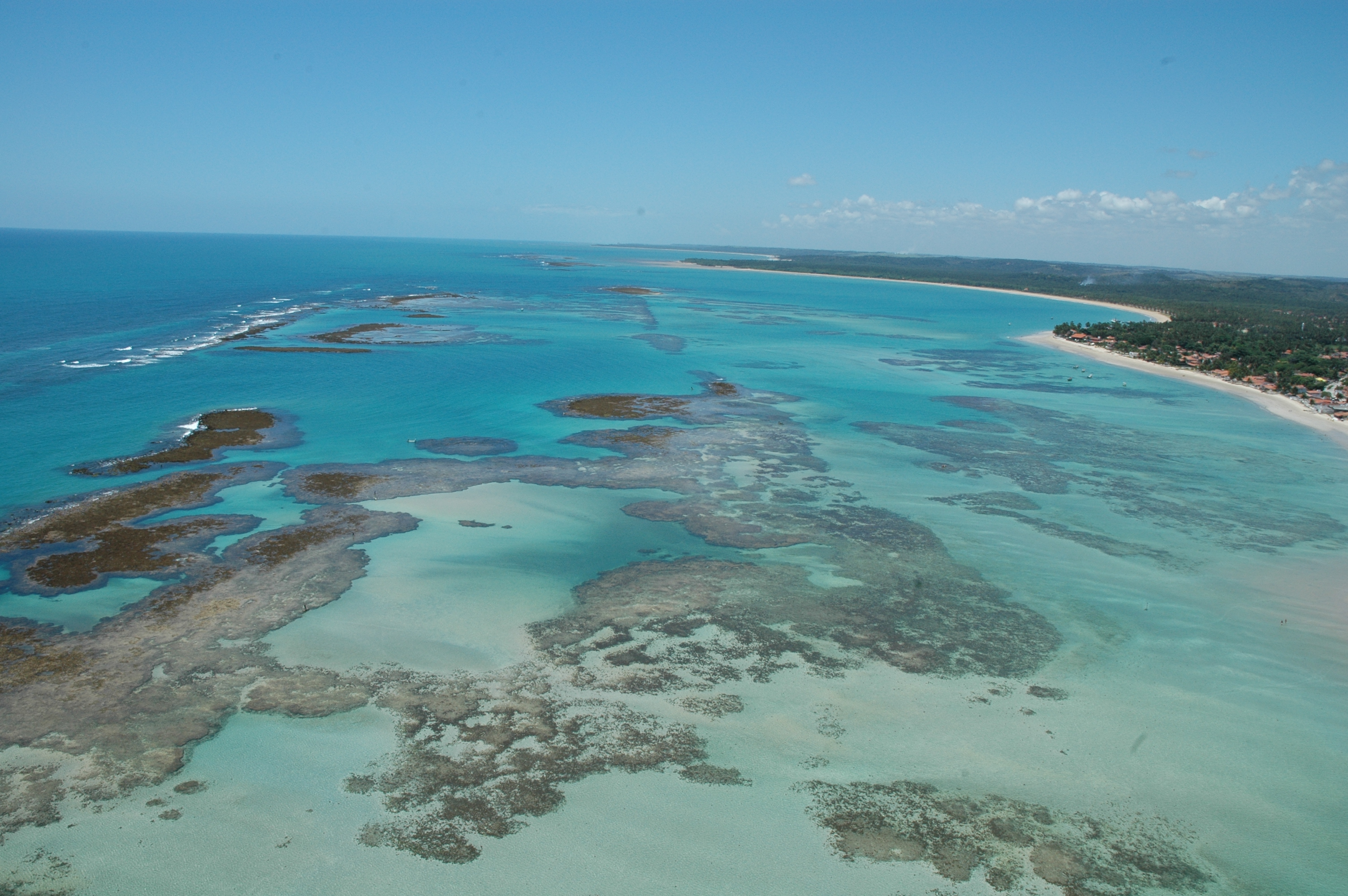
The Site is located on the northeast Brazilian coast, East Brazil LME, and includes the seascape extending from the coast to the continental slope. The coastal area is formed by an ecosystem complex including remnantes of Atlantic forest, mangroves, seagrass beds and coraline reefs. These ecosystems are interconnected along the seascape over the typically carbonatic shelf, with widths around 18 nautical miles. Along the shelf, submerged channels related to continental drainage in glacial periods, and submerged reefs, form habitats responsible for supporting resources exploited by intense fishing activity. The outermost portion of the continental shelf, considered as an area of significant biological and ecological interest (EBSA), is a biodiversity hotspot, home to reef fish spawning aggregations, and higher fish yield associated with evidence of sub-surface upwellings. These seascape support complex ecological processes, subject to intense use, in an area recognized as a priority for conservation. The presence of Marine Protected Areas reflects this characteristic, both for the need to protect these environments, and for the socio-economic importance, with two protected areas for sustainable use (APAs) and one for Integrated Protection (Park), organized in mosaic.
-
Permanent research site Polana Biosphere reserve (Hukavský grúň) site is located in central Slovakia, in the east part of territory of Polana Protected Landscape Area , where forest ecosystems as well as rural cultural landscape of the highest volcanic mountain in Slovakia is protected. The site is situated in 850 m a.s.l with annual mean temperature 5.5 °C and annual precipitation 860 mm. Tree species composition of this site is made up by beech (70 %), norway spruce (19,6 %) and the rest is composited by fir, maple and ash. The age of this forest stand is 90 – 120 years. The research site was established in 1991 and from the beginning research has focused on the individual components of the forest environment and the forest ecosystem (trees including the rhizosphere, soil, air quality), their relationships (the influence of the atmospheric deposition ande on the woods), the cycle of elements and substances (nutrition, litter, biochemical processes), physiological processes, phenology and tree growth , their vitality and ecological stability, as well as practical forestry issues such as natural and artificial regeneration. So there was a very wide range of detection, measurement and evaluation. This area was in 1995 integrated with the ICP Forests system of permanent monitoring areas (PMA). Close to the forest monitoring plot is a series of other 7 permanent research areas (PRA), as a base for comparison close-to-nature mixed forest stand development and stands of individual tree species.
-
studying runoff water harvesting and its affect on the ecosystem and agroforestry
-
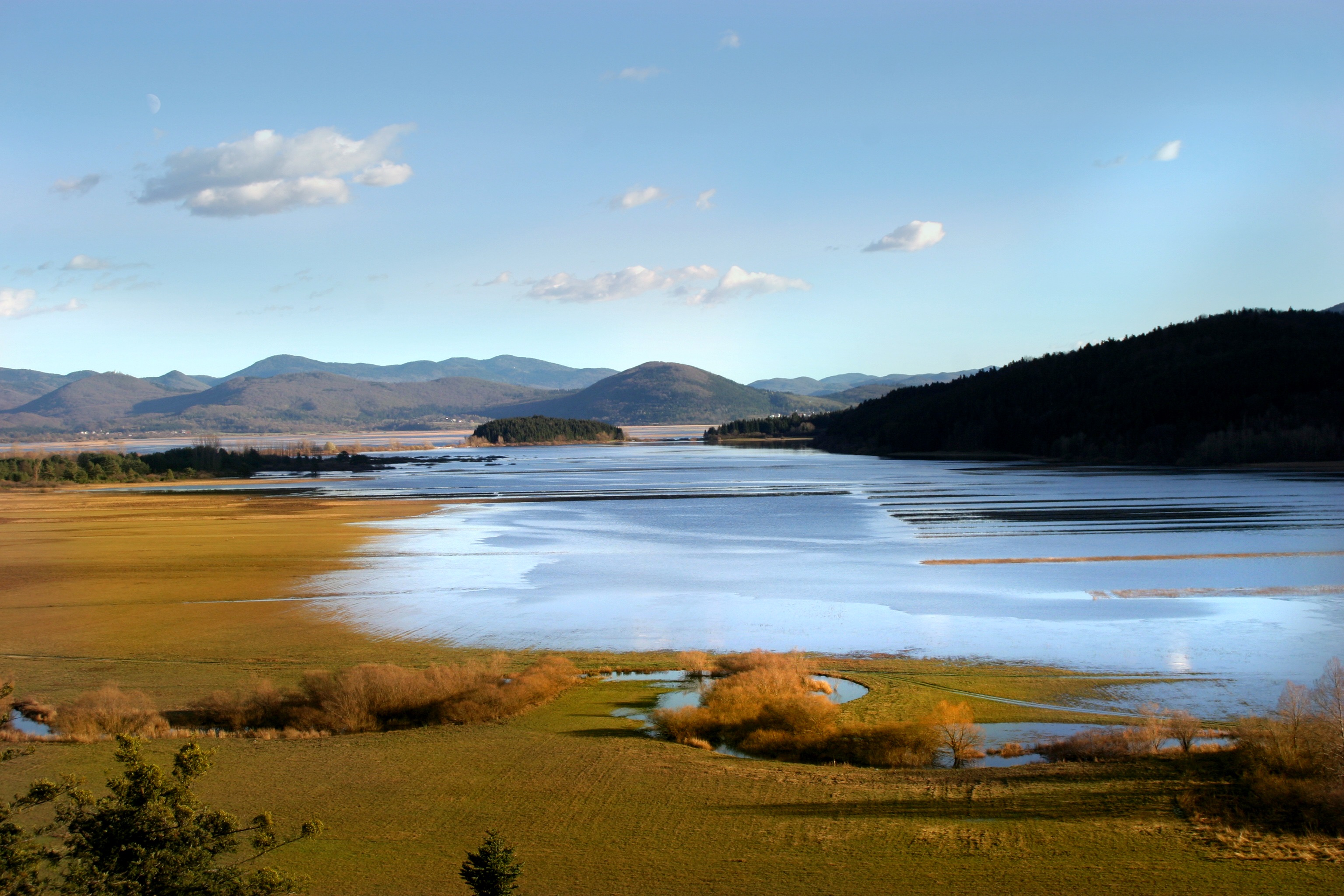
Lake Cerknica is intermittent lake appearing at the bottom of closed depression Cerkniško polje extending on the area of 38 km2. The karst features are associated with carbonate rock, both with limestone and dolomite. About 80 % of inflow consists of karst and only 15% of surface waters. The outflow is completely karstic. In spring and usually late in autumn the lake reaches normal level 550 m a.s.l., covering the area of 26 km2. Polje is flooded for 9 and dry for about 2 months, usually in summer. Lake Cerknica is a highly diverse ecosystem that changes in time and space. Vegetation pattern shows clear zonal distribution that depends on extent and frequency of flooding. The lake supports rich fauna with many endangered species, providing temporary shelters and food for protected large carnivores, such as brown bear, wolf, lynx and numerous species of water birds. In recent decades, flood and drought events have become increasingly irregular altering processes and conditions for many species.
-
High resolution recording of water quality and water hydrology by two types of sensors monitoring the open lake and reed belt sites at Lake Neusiedl: Hydrolab-Multiparameter sensors measuring temperature, oxygen, pH, conductivity, turbidity and chlorophyll-a; PLSC_sensors for water level, water temperature and water conductivity. The on-line recording of these sensors measures at high time resolution of every three minutes. The two types of sensors are located as follows (in alphabetical order): Hydrolab-Multiparameter_Sensor - Neusiedlersee-Steg: N47°46.208’ & E016°45.129’ Hydrolab-Multiparameter_Sensor - Neusiedlersee-Ruster Poschn: N47°46.631’ & E016°45.187’ PLSC_Sensor - Neusiedlersee-Steg: N47°46.208’ & E016°45.129’ PLSC_Sensor - Bootshafen Biologische Station: N47°46.128’ & E016°45.976’
-
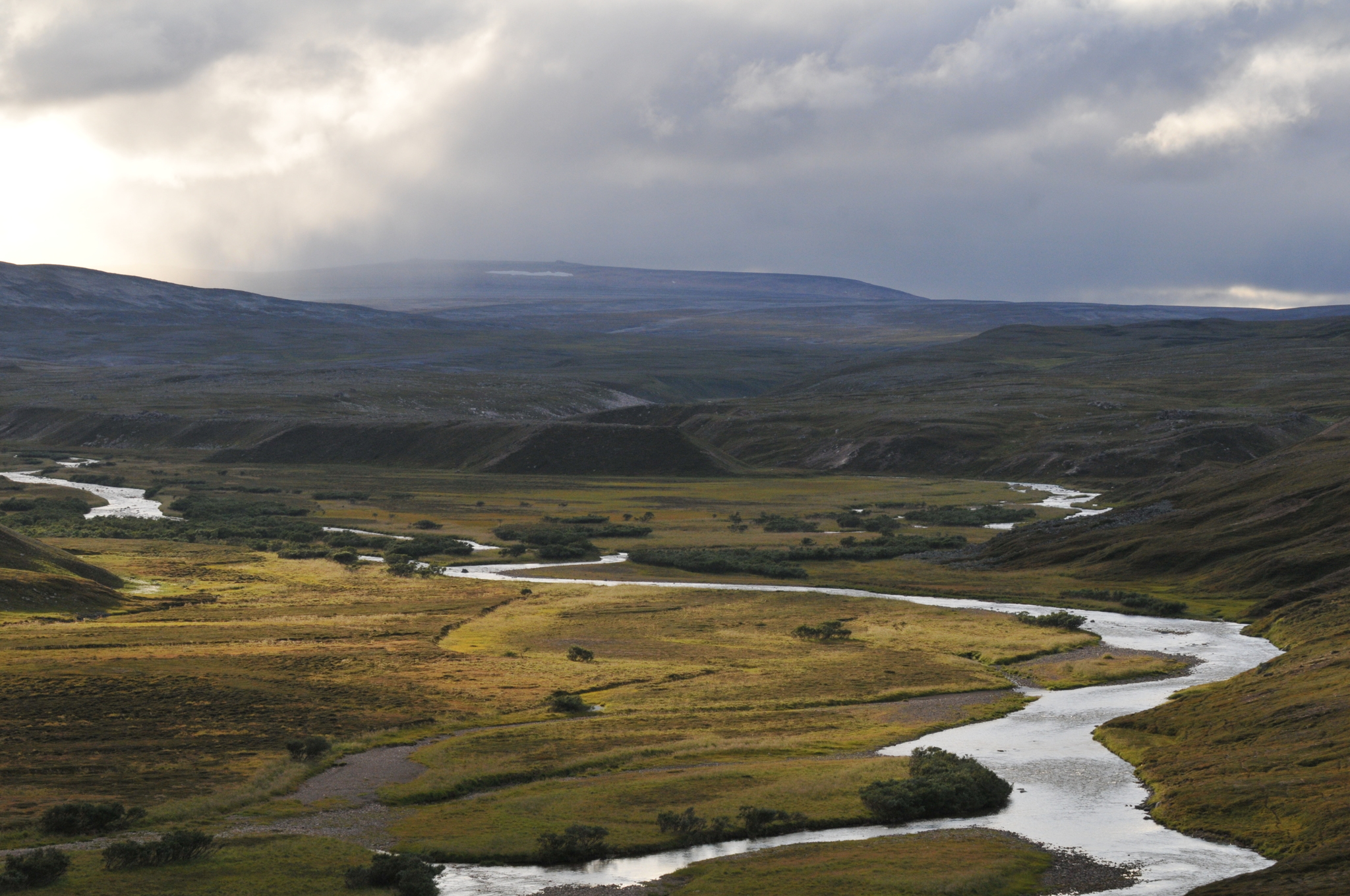
COAT Varanger is a subsite under the COAT platform located mainly on the Varanger penninsula in the low arctic. Long-term monitoring and research on tundra ecosystems are conducted on this site.
-
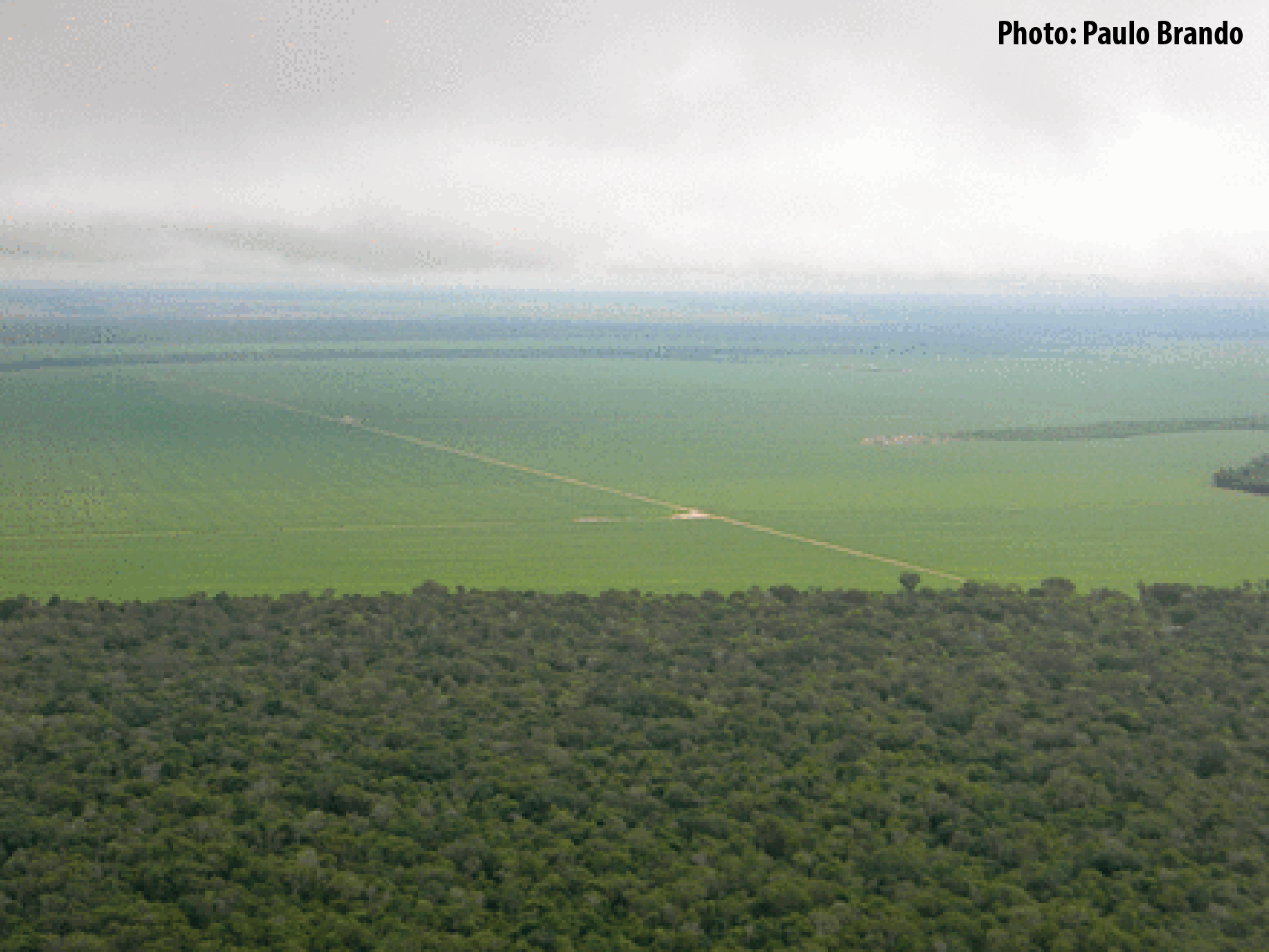
Tanguro Ranch is located in the southern Amazon, the driest portion of the Amazon Basin, and harbors a transitional forest (between Amazon forests and savannas). Tanguro lies on the Amazonian agricultural frontier, where largest rates of deforestation and fire occurred in last decades. The ranch experienced deforestation for cattle pasture in the mid-1980s, followed by a cropland expansion in the early 2000s. Starting in 2010, it has undergone a rapid shift from soybean single cropping to soybean-corn double cropping. The topography, soils, hydrology and farming practices at Tanguro are typical of the southern and eastern Amazonian agricultural frontier, a region that is highly vulnerable to changes in fire regime, climate change, and their interactions. Tanguro ranch represents changes that occur in a much wider area and that will probably occur in other regions of the Amazon Basin in a near future.
-
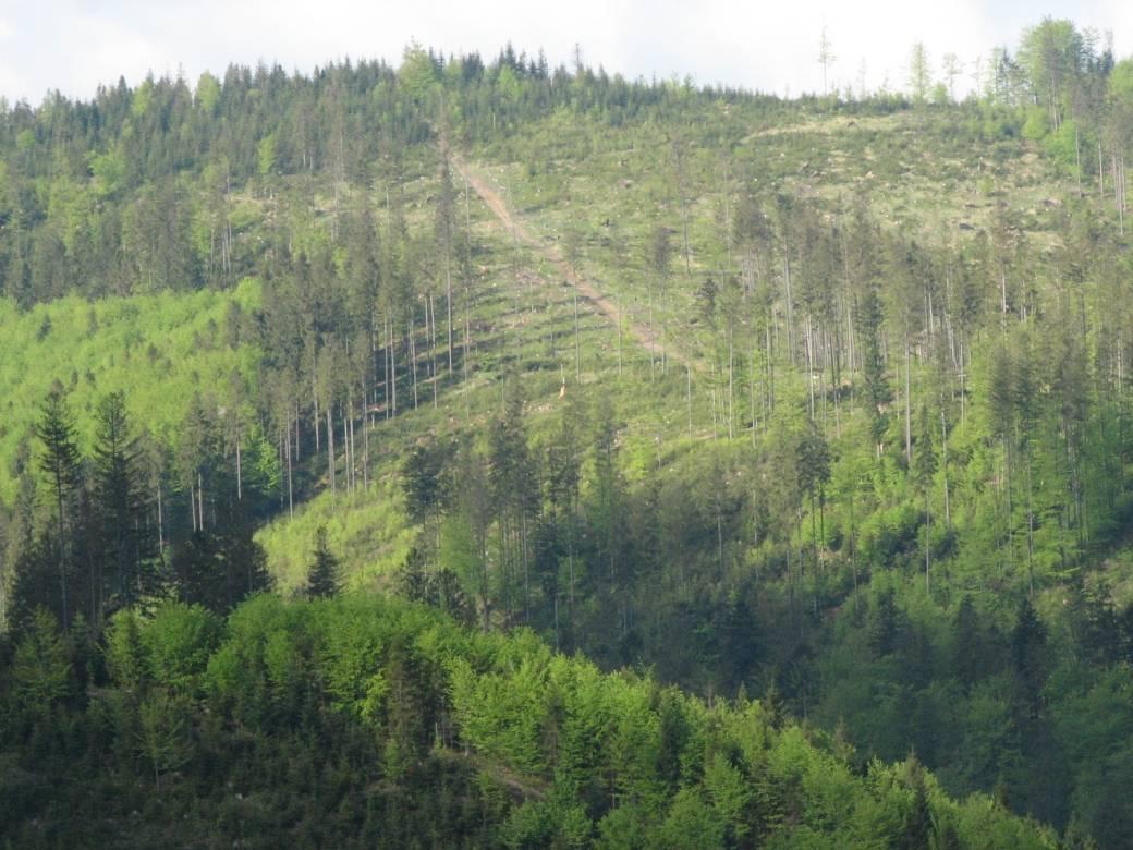
The Brenna monitoring site in the Silesian Beskid (Polish part of the West Carpathians) was established in 1991 and consists of a monitoring station (meteo parameters and air pollution level) at the elevation of 865 m a.s.l. and 7.5 ha and 50 ha catchments at the elevation of 750 m a.s.l under old spruce stand being under reconstruction.The main goals of the monitoring programme is the investigation of: ● Response of spruce stands to air pollution and forest management practice in the mountain area which has been influenced by emissions from the industrial complexes of Silesia and the Czech Republic ● The balance of nutrients in a small mountain catchment. ● Changes in floral characteristics These monitoring activities have been continuing and moreover, the effect of forest management (falling, skidding) on soil (erosion) is monitored. In 2016 the Particulate analyzers (PM10/PM2.5) (The Model 5030 Synchronized Hybrid Ambient Real-time Particulate SHARP Monitor) were installed at the station to measure the inflow of pollutants from industrial regions.Equipment for meteorological measurements is as follows: Barometr LB-716, Thermohigrometer LB-710R, Wind Speed Meter LB-746, Pyranometer PQS1, Thermometer LB-711 (air and soil), Pluviometer RG50A. Additionally, continuous measurements of ozone have been carried out since the nineties (Monitor Thermo Scientific).
-
Děvín is a considerable site of forest and non-forest ecosystems of the warmest part of the Czech Republic. Due to heterogeneous geomorphology, it comprises a range of habitat conditions and vegetation types. Forests cover about 3/4 of the area and they are formed mainly by oak-hornbeam wood, thermophilous oak wood, and ravine wood. The forests of Děvín were strictly managed as a coppice in the past. The oldest records are available from the late 14th century. The cutting period was as short as 7 years in the Middle Age and then gradually increased to 15–25 years during the 17th–19th centuries. A reason of the coppice management was the need of firewood. This probably led to a dominance of the large-leaved lime (Tilia platyphyllos), which stands regular cutting and quickly re-sprouts. The traditional management was abandoned in the 20th century, a nature reserve was declared in 1946, and later even a game preserve was established; the latter, however, was cancelled in the 1990s. The forest has been gradually transformed to a high forest and its age has increased to the today’s average of 70, sometimes over 120 years. The dramatic change in the management has caused a large change in ecological conditions. Light woods, hosting many species occurring in light- and warm-demanding conditions, have shifted to mesic, i.e. moister and nutrient-richer forests than ever before. A marked decrease in diversity in forest understorey has been a consequence. This trend was revealed by a comparison of nearly 200 vegetation plots from 1953–1964 with their 2002–2003 replicates, i.e. after 40 to 50 years. A similar comparison is available for soils with 34 repeated pedological profiles. The aim of the present management is to restore coppices with partial preservation of some stands in a non-intervention regime. A set of 80 permanent plots has been established in 2008 in order to monitor the consequent environmental and vegetation changes, as well as diversity of invertebrates, with a monitoring period of 5–10 years.