
acid neutralising capacity
Type of resources
Available actions
Topics
Keywords
Contact for the resource
Provided by
Years
Formats
Representation types
-
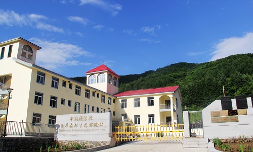
Cele station has a geographic coordinate of 80°43′45″E, 37°00′57″N with altitude of 1318 m a.s.l., and covers 130 ha. The distance from station to Cele county, Hotan, Urumqi and Beijing is approximately 7.5, 100, 1500 and 4500 km, respectively.The Cele Desert Research Station of Chinese Academy of Sciences is located in Cele county at the southern rim of Taklimakan desert. In early 1980s, the distance from the Cele county to the forefront of aklimakan desert was only 1.5 km. In order to cope with the severe desertification threat to the city, Xinjiang Autonomous Region government organized the onsite meeting and decided to establish the research station.he climate is continental, with cold winters and hot dry summers. Mean annual temperature is 11.9 ◦C, the desert is hyper arid with mean annual precipitation of 35.1 mm and potential evaporation rate of 2595.3 mm. The snowmelt on Kunlun mountain is a predominant water supply source for this area. Additionally, sand storm disasters are very common occurring on an average of 20 days a year while lowing sand and suspended dust occurs around 240 days a year. These situations have resulted in a fragile ecosystem in the region. The Gobi and desert ccount for 95% of the total area. The coverage of natural vegetation, which is dominated by perennial desert plants, is less than 15%.
-
Runoff and runoff chemistry at LTER Zöbelboden, Austria
-
The Bohemian Forest in Central Europe is among the most acidified lake districts in the world. Deposition of sulphur and nitrogen compounds in the area rapidly increased between 1950 and 1980, and reached a maximum in mid the 1980s. Owing to long-term occasional hydrobiological research and palaeolimnological studies, we are able to document the significant changes in the lake water chemistry and biodiversity (in particular the conspicuous reduction in crustacean and/or insect species in some lakes, as well as the extinction of fish). During the 1990s, acidic deposition decreased substantially, and its current levels are comparable to the early 20th century for SO42– and NH4+, and to the mid 1960s for NO3–. The decline in acidic deposition has resulted in a partial recovery of the Bohemian Forest lakes, as well as in an improvement of the Norway spruce physiology in their catchments. Therefore, the Bohemian Forest lakes represent excellent LTER sites. Available historical data (biota since 1871) and regular monitoring (biota and chemistry since 1984) provide a valuable background for long-term ecological research of the catchment–lake ecosystems that currently focuses on (i) chemical reversal and biological recovery of the lakes, (ii) acidification effects on in-lake nutrient cycling, (iii) climatic effects on water chemistry, and (iv) catchment processes, including soil biogeochemistry and acidification impacts on vegetation (mountain spruce forests). Two of the lakes, the most acidified Čertovo Lake and the mesotrophic (phosphorus rich) Plešné Lake, have been selected for detail mass-budget studies since 1998. Hydrology, water and precipitation chemistry, soil and sediment biochemistry, litter composition, and climatic variables have been regularly monitored with the aim to evaluate cycling of nutrients (C, N, P, Si) and ecologically important metals (Al, Fe) within the catchment–lake ecosystems.
-
Hailun Agricultural Ecological Station located in Hailun city, Heilongjiang province, was established in 1978, briefly named Hailun Agro-ecosystem Station. The main research fields at that time were the optimal management of agriculture and advanced technology utilization in agricultural production. Chinese ecosystem research network(CERN) established in 1988 selected Hailun station as one of its components. The objective of Hailun station was to study the agro-ecosystem and sustainable development of agriculture in black soil zone in Northease China. Also, Hailun station was considered as one of components, when national field research net was built in 2005.
-
Lake Paione Superiore is a high altitude Alpine lake, located at 2269 m a.s.l. in the Bognanco Valley, Province of Verbania, Piedmont Region, Italy. It has a surface area of 0.68 ha and a maximum depth of 11.5 m. It is included in the monitoring sites of the UN-ECE Program ICP WATERS (International Cooperative Programme on Assessment and Monitoring of Acidification of Rivers and Lakes) funded in Italy by Ministry of the Environment and for which the CNR Water Research Institute (CNR-IRSA) is the National Focal Centre for Italy. The lake has been studied since the late 1970s in the framework of research on the effect of acid deposition on chemistry and biology of sensitive lakes. At present meteorological data are collected continuously by an automatic weather station (AWS) located on the shore of the lake. Chemical data are available since 1978 and are still collected on a regular basis (annual or biennial frequency): pH, conductivity, alkalinity, dissolved oxygen, major anions (sulphate, nitrate, chloride) and cations (calcium, magnesium, sodium, potassium), reactive and total phosphorus, reactive silica, total nitrogen, dissolved organic carbon, main trace elements (included heavy metals). Three samples are collected on the water column at the deepest point of the lake. Winter or spring samplings are performed occasionally. Available biological data include phytoplankton, zoo plankton and benthos taxonomic composition, population dynamics of the main species and, limited to 2000-2001, bacteria, epilithic diatoms, and paleolimnological data.
-
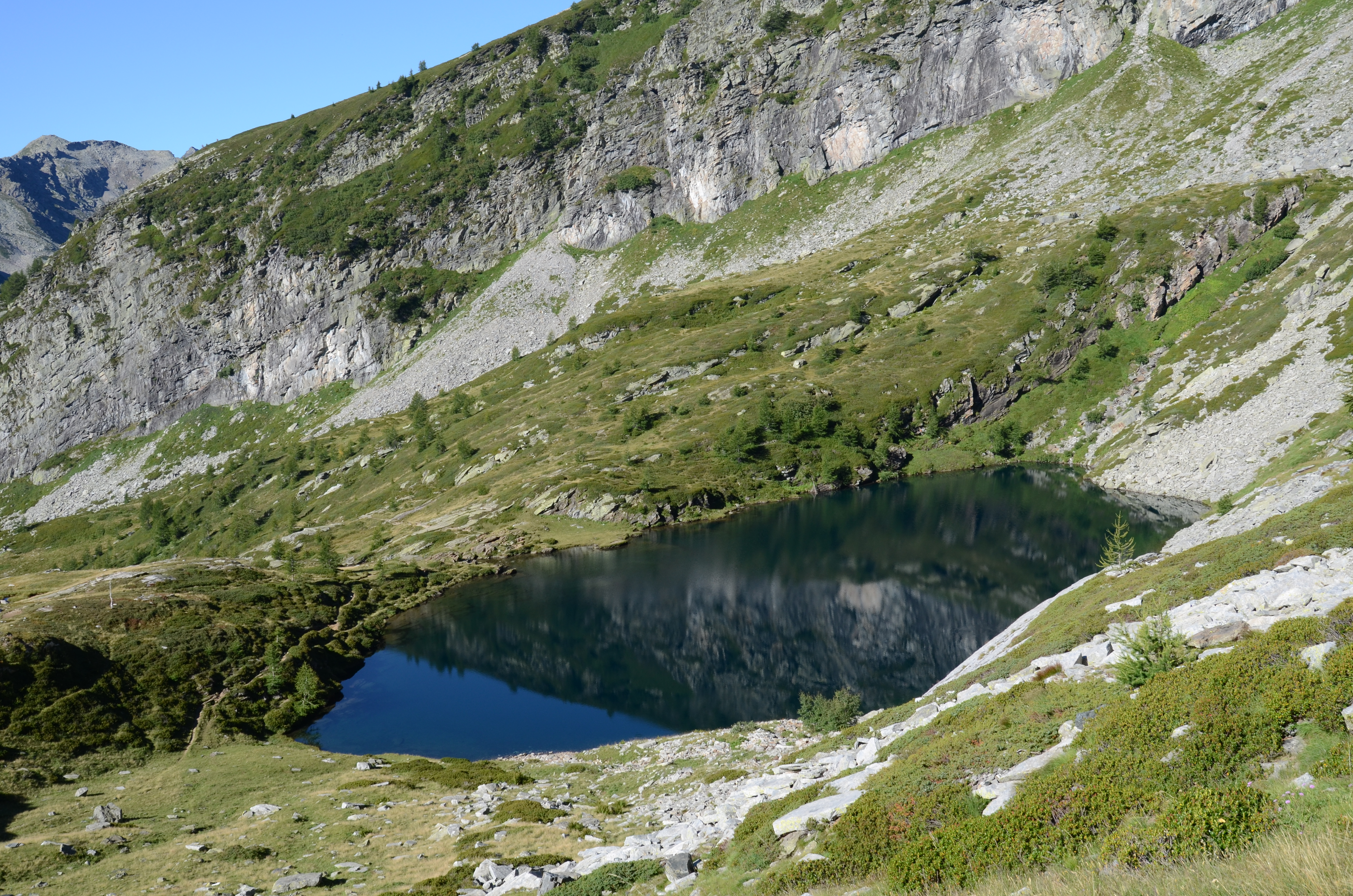
Lake Paione Inferiore is a high altitude Alpine lake, located at 2002 m a.s.l. in the Bognanco Valley, Province of Verbania, Piedmont Region, Italy. It has a surface area of 0.86 ha and a maximum depth of 13.5 m. It is included in the monitoring sites of the UN-ECE Program ICP WATERS (International Cooperative Programme on Assessment and Monitoring of Acidification of Rivers and Lakes) funded in Italy by Ministry of the Environment and for which the CNR Water Research Institute (CNR-IRSA) is the National Focal Centre for Italy. The lake has been studied since the late 1970s in the framework of research on the effect of acid deposition on chemistry and biology of sensitive lakes. At present meteorological data are collected continuously by an automatic weather station (AWS) located on the shore of the close lake Paione Superiore. Chemical data are available since 1978 and are still collected on a regular basis (annual or biennial frequency): pH, conductivity, alkalinity, dissolved oxygen, major anions (sulphate, nitrate, chloride) and cations (calcium, magnesium, sodium, potassium), reactive and total phosphorus, reactive silica, total nitrogen, dissolved organic carbon, main trace elements (included heavy metals). Three samples are collected on the water column at the deepest point of the lake. Winter or spring samplings are performed occasionally. Available biological data include phytoplankton, zoo plankton and benthos taxonomic composition, population dynamics of the main species and, limited to 2000-2001, bacteria, epilithic diatoms, and paleolimnological data.
-
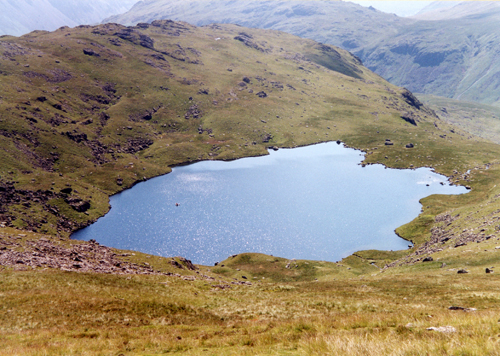
UK ECN and UK UWMN site. Scoat Tarn in the English Lake District is a typical mountain corrie lake, being small and deep with an area of 5.2 ha and a maximum depth of 20 m. The lake lies in a west facing valley at an altitude of 602 m, and drains into Wastwater via the Nether Beck. The catchment comprises a small corrie (95 ha) with steeply sloping walls and three summits in excess of 825 m. The bedrock is Ordivician tuff (undifferentiated) of the Borrowdale Volcanic series and the local soils are mainly shallow, peaty rankers. The eastern slopes are mainly of rock and boulders while to the north are less steep and covered in rough grass and Sphagnum moss. Land use is confined to low intensity sheep grazing. Scoat Tarn is classified as having high acid deposition.
-
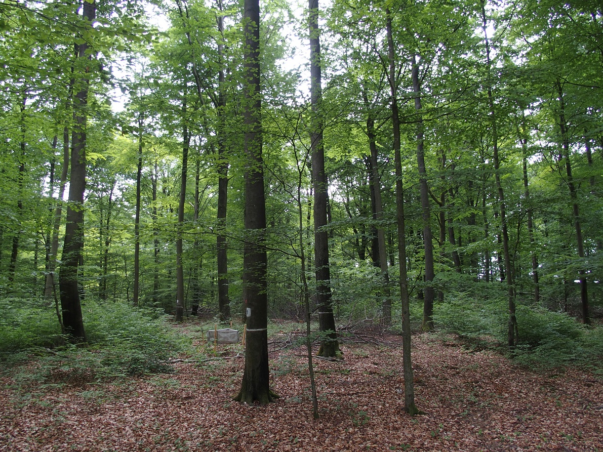
ICP forest monitoring plots: 0.5 ha of fenced stand + 20 m buffer area. Managment, data collection and reserch activities carried on by catholic university of Louvain (UCL)
-
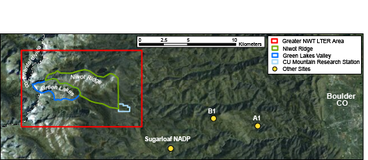
The Niwot Ridge Long Term Ecological Research (LTER) site was established in 1980 with support from the National Science Foundation. The topography, climate and biota of the research site are representative of alpine ecosystems in the southern Rocky Mountains, including extensive expanses of alpine tundra and subalpine coniferous forests, as well as a cirque glacier (Arikaree Glacier), a variety of glacial landforms, lakes and moraines, cirques, talus slopes, patterned ground, and permafrost. The LTER site includes Niwot Ridge, the southern-adjacent Green Lakes Valley, and the University of Colorado’s Mountain Research Station (MRS). Niwot Ridge is part of the Roosevelt National Forest and has been designated a United Nations Educational, Scientific and Cultural Organization (UNESCO) Biosphere Reserve and an Experimental Ecology Reserve (USDA Forest Service). The Green Lakes Valley is a part of the City of Boulder Watershed. The MRS is an interdisciplinary facility devoted to the advancement of the study of mountain ecosystems, providing research and educational opportunities for scientists, students, and the general public.
-
Qingyuan Forest CERN was founded in 2003 in montane regions of eastern Liaoning Province, Northeast China (124º54'E, 41º51'N, 500-1100 m a.s.l.). The climate is continental monsoon type with a strong monsoon windy spring, a warm and humid summer, and a dry and cold winter. There is 1350 ha of experimental forests, 80% of which is mixed broadleaved secondary forests and 20% is Korean pine plantations and Larch plantations. In the study area, natural secondary forests dominated by Fraxinus rhynchophylla Hance, Acer mono Maxim., and Quercus mongolica Fisch., etc. have gradually regenerated from the primary mixed broad-leaf Korean pine forests in the early 1950s, and patches of larch plantations have partially replaced secondary forests in the 1960s to meet the increasing timber demands in Northeast China. This typical secondary forest ecosystem is therefore a result of both the secondary forests and the plantations and plays a critical role in carbon sink, conservations of biodiversity and water resource, and protection for Northeast plains & cities and so on. However, the functions of secondary forest ecosystems are quite different from the ones of primary forests. So, we do the basic researches for restoration or improvement of the secondary forest ecosystems by comparing with primary forests. Three research topics are focused on 1) structure, function and regulation of secondary forest ecosystems, 2) main ecological processes under disturbances in secondary forest ecosystems, and 3) degradation and restoration mechanisms of secondary forest ecosystems. Especially we are now interested in the quantifying the forest gap and stand structure with LiDAR, determining the relationships between stand structure and function, and indicating the restoration mechanisms of water conservation functions for secondary forest ecosystems. Furthermore, there is long-term monitoring of water, soil, atmosphere and biology in strict accordance with the request of the Chinese Ecosystem Research Network (CERN).