
air specific humidity
Type of resources
Available actions
Topics
Keywords
Contact for the resource
Provided by
Years
Formats
Representation types
-
Cap Prud'homme (CAP) is located on the coast of the Antractic Ice sheet (Dumont d'Urville station). Mass balance is measured alo,g 3 different stake networks at the camp and over 150 km inland. Meteorological information are recorded at 2 stations. Dynamics of the ice is measured on the Astrolabe glacier. CAP is a part of the French Glacier Observatory GLACIOCLIM/CRYOBS-CLIM.
-
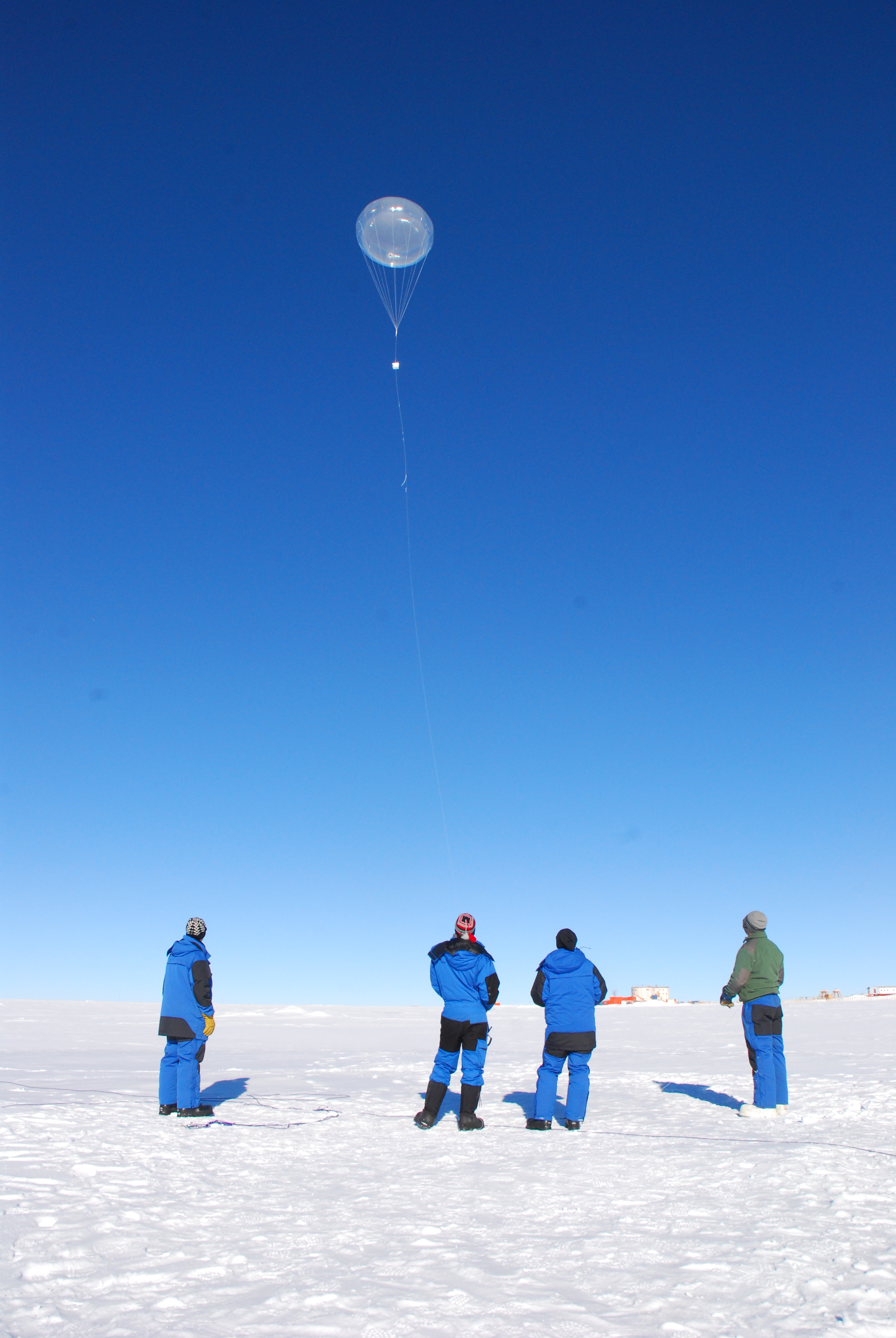
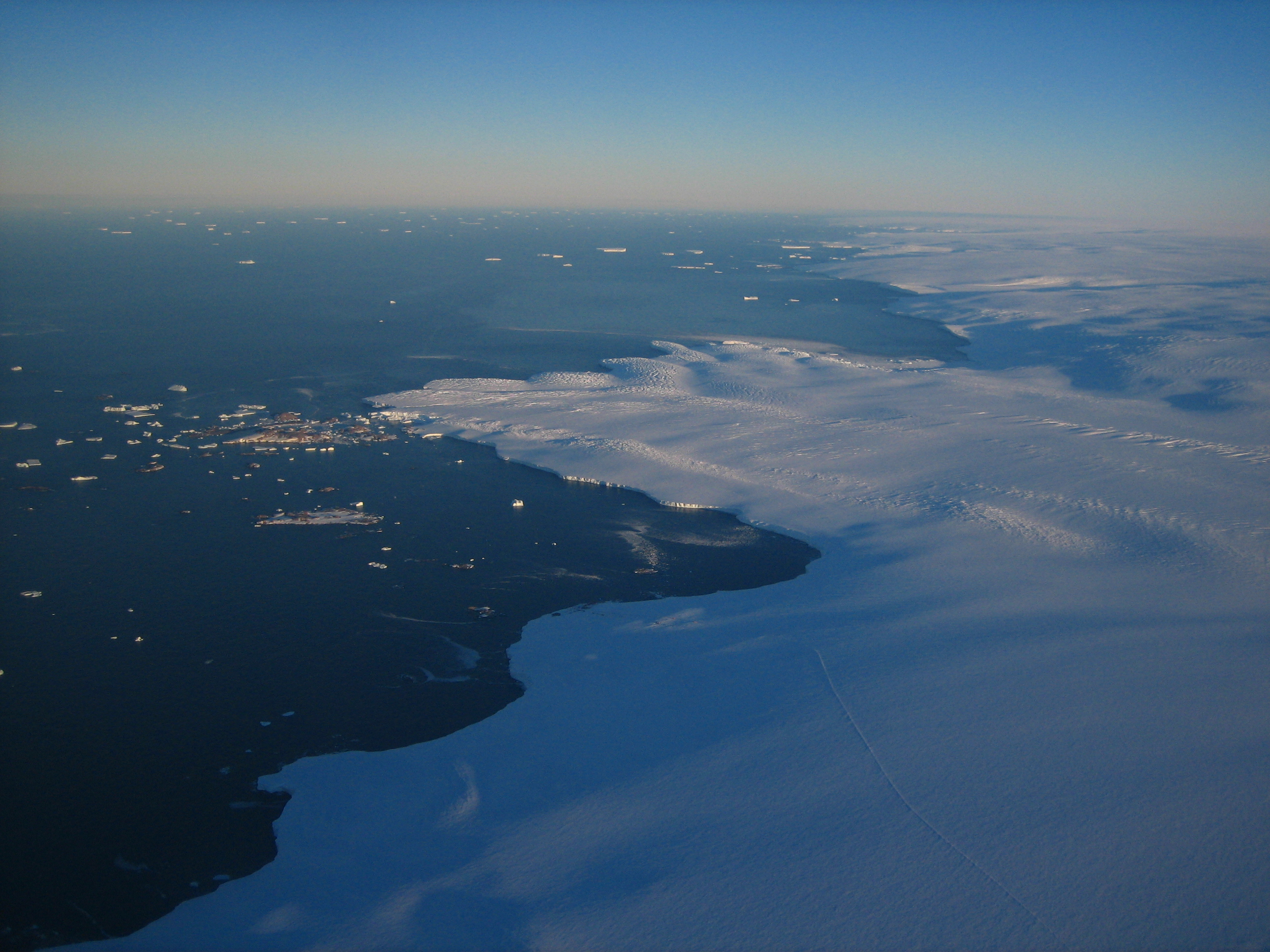
Concordia is a joint French-Italian research facility opened in 2005 on the Antarctic Plateau, Antarctica (-75.1, 123.33), managed together by PNRA (Italian National Antarctic Programme) and IPEV (Institut Polaire Francais Paul Emile Victor). It is built at 3,233 m above sea level on the third highest summit of Antarctica: Dome C.
-
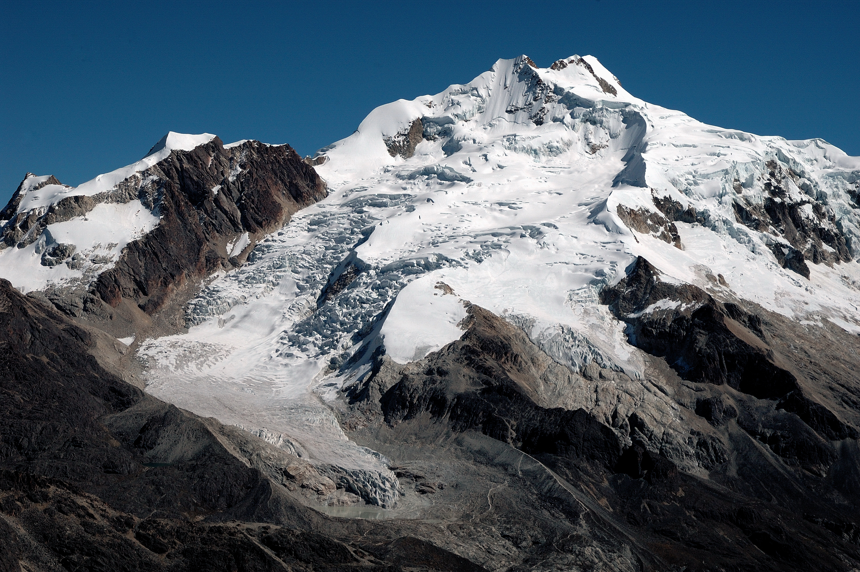
Zongo Glacier is located in the Huayna Potosi region (Cordillera Real, Bolivia) 30 km north of La Paz city, between the dry Altiplano plateau in the west and the wet Amazonian basin in the east, under outer tropics meteorological conditions (strong seasonality in precipitation, low seasonality in temperature).
-
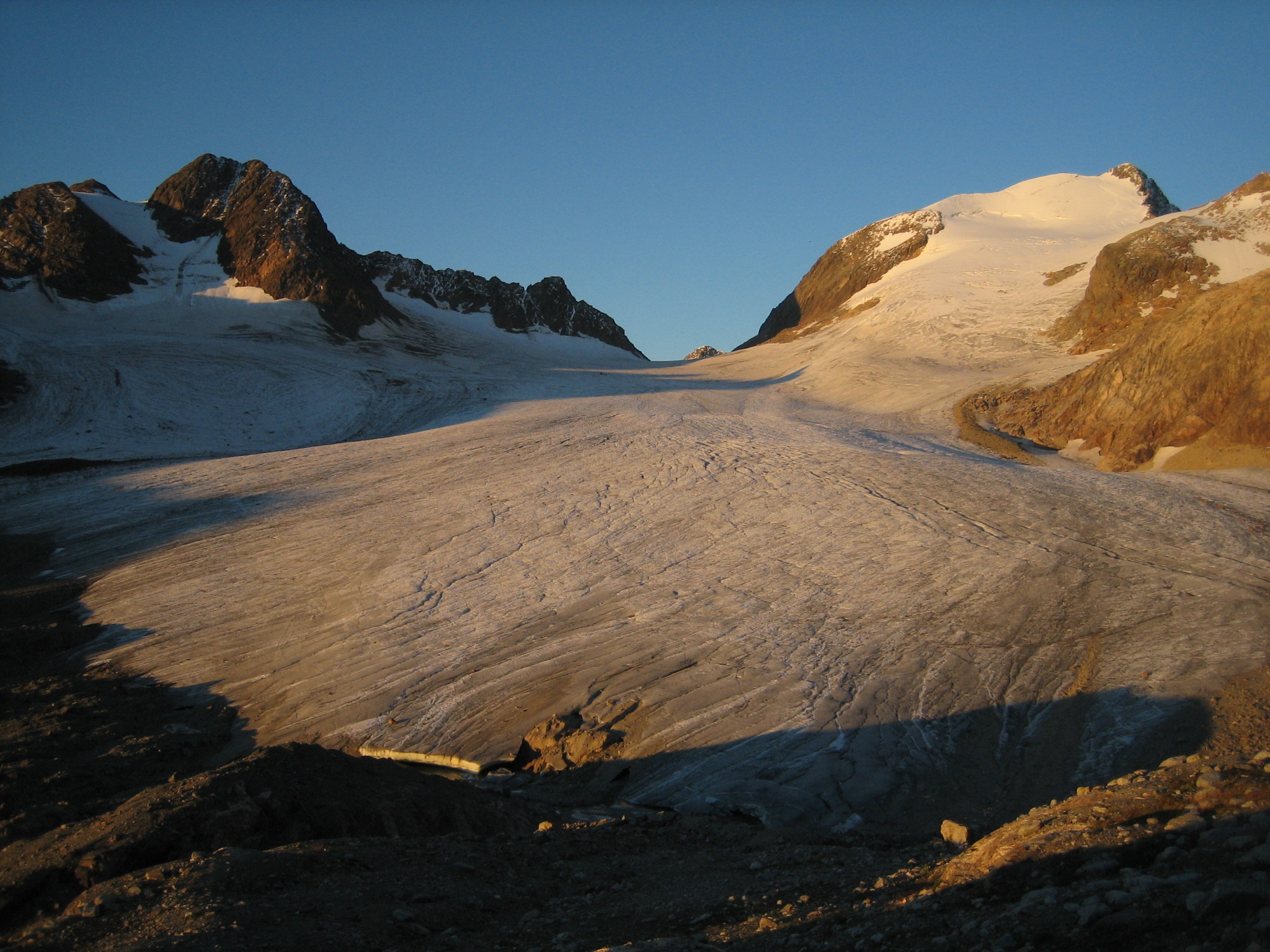
Saint-Sorlin glacier (SSO) is located in the Arvan valley, between 2700 and 3400 m altitude. The glacier is situated in the Grandes Rousses massif, and one of the glaciers with longest records of glacier mass balance worldwide. Data series are continuous and cover few decades (more than 50 years of mass balance measurements).This site is also characterized by the complete glaciological parameters performed annually to complete annual and seasonnal mass balance : ice velocity, ice thickness variation, snout position.In addition, meteorological observations complete the data base. 1 weather station, running since 2005, is located on the moraine, close to the snout of the glacier. SSO is a part of the French Glacier Observatory GLACIOCLIM/CRYOBS-CLIM.
-
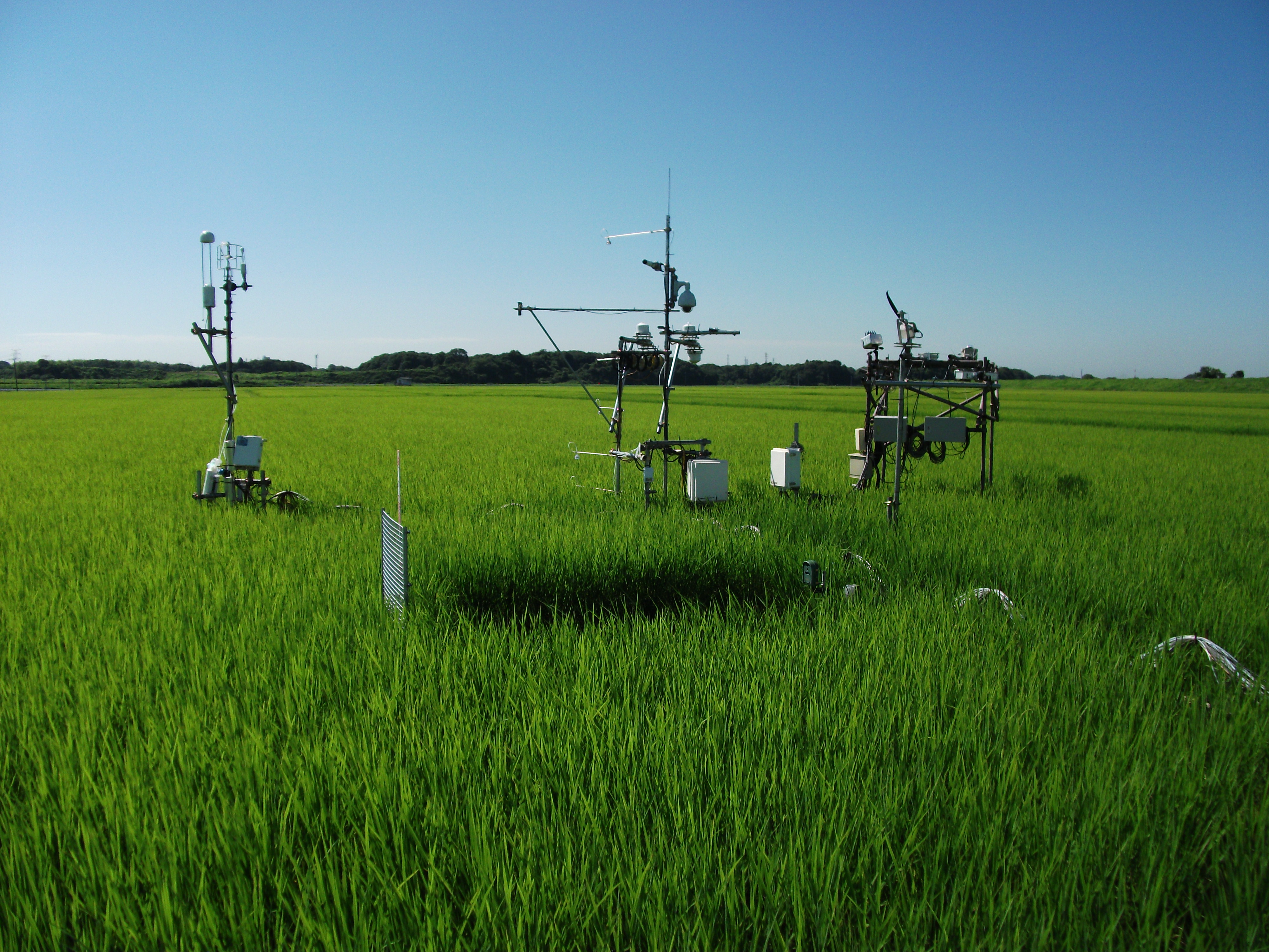
The Mase rice paddy site is a flux station in the AsiaFlux micrometeorological tower network. Located in a regularly cultivated rice paddy area of the Kanto plain in Japan, the site was established in 1999. The initial motivation was to quantify the energy and carbon balance in the rice paddy (ca, 54 a) where the tower was situated. Because of the accessibility and line-power availability, the site has involved many researchers and students from universities and institutes, broadening its target to studies on satellite and field remote sensing, ecosystem modelling, and nutrient cycling.
-
It is located in the region of the Grand Causses, south of the Massif Central. The karstic aquifer of Durzon represents a surface of 100 km² which feeds the spring of Durzon. This spring supplies the drinking water of the Aveyron part of Larzac. The observatory has a set of sites dedicated to gravimetric, inclinometric and hydro-geodesic observations, as well as a flow tower for evapotranspiration measurements.
-
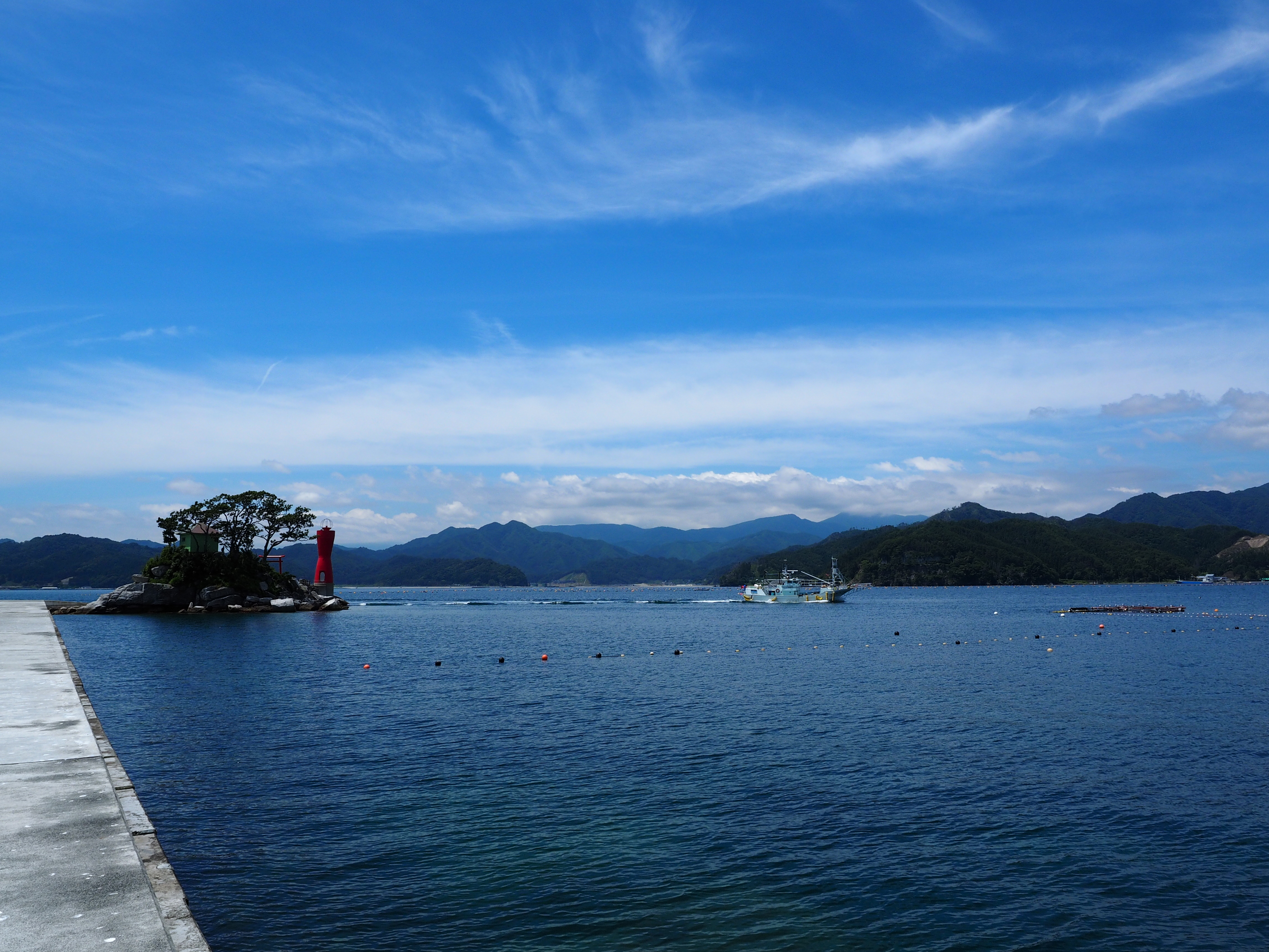
Otsuchi bay is one of the bays on the Sanriku ria coast of northern Japan opening into the western North Pacific Ocean, which was heavily impacted by the mega-earthquake and following massive tsunami occurred on March 11, 2011.
-
This site is located on the territory of National Park “Rila”, Bulgaria. Parangalitsa has been a reserve since 1933. It is situated on part of the southwestern slopes of Rila mountain, covering 1,509 hectares. It contains some of the oldest pine tree forests in Europe with an average age of over 200 years. The site is a part of the network of bioecological stations of Forest Research Institute – BAS and research is focused on highly productive coniferous forests with unique biomass. In the main experimental plots, long-term complex studies were conducted during the period 1979 - 1998, a large-scale database was created and a number of significant scientific results were obtained. In the period 2000 - 2018, separate targeted studies were carried out - focused on some ecosystem processes, which allows the analysis and evaluation of the functioning of ecosystems to be don
-
The total NPHK is currently (since 2020) about 12,000 ha, but the eLTER site corresponds to the former perimeter of the NPHK and represents an urbanised protected area of about 60km2 (or 6,000ha) located in the Province of Limburg in the East of Belgium. The NPHK (inaugurated in 2006 and extended from 6000ha to its current 12000ha in 2020), located in a former coal mining area is surrounded by 10 municipalities with more than 200,000 inhabitants, equivalent to a population density of 450/km2 . The park covers a rich variety of habitats, including heathlands, deciduous forest, coniferous forest and fens and evidently the corresponding diversity of fauna and flora. Several research groups from universities and institutes are monitoring and measuring abiotic and biotic parameters throughout the different ecosystems. Research on ecosystem services are also playing a major role, including tourism and mobility.
-
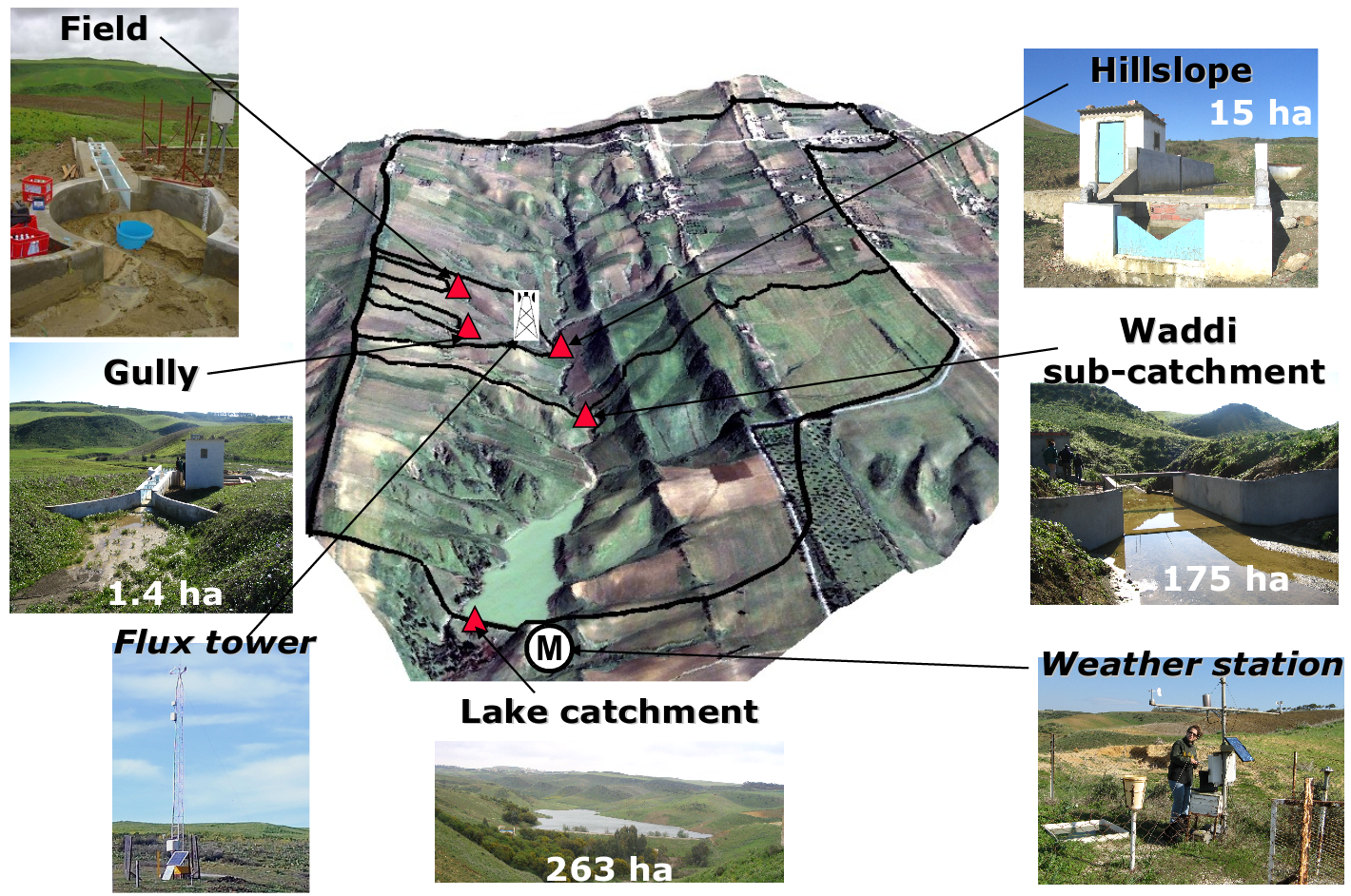
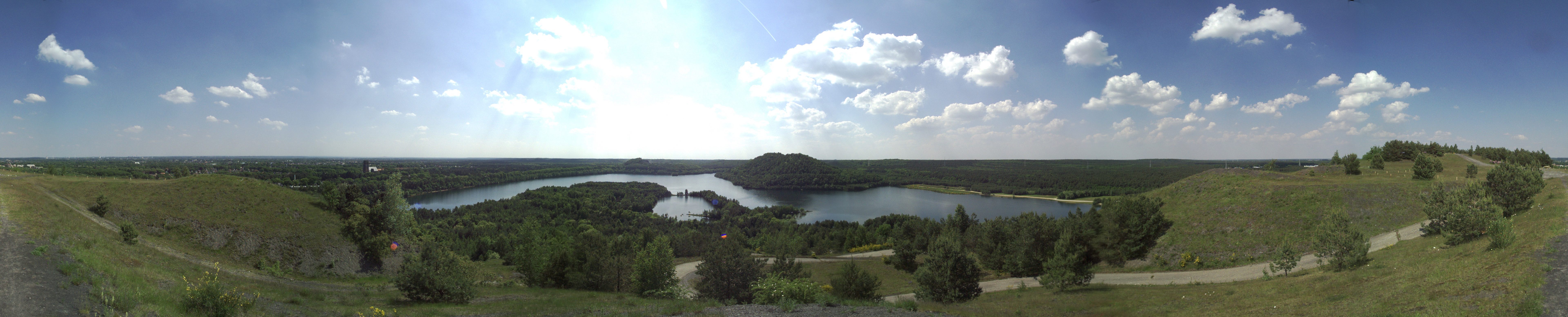
Small agricultural catchment (263 ha) in a Mediterranean environment with 20 years of data: impact of global change (climate and anthropogenic activities as agricultural practices) on water and erosion balance, fluxes and quality. Soils: Calcic Cambisols (63.5%), Regosols (25.5%), Eutric Regosols (9.6%) and Chromic Vertisols (1.4%). Main cultures: cereals and leguminous. Continuous automatic measurements at nested scales from plot to catchment outlet (surface runoff, shallow groundwaters, surface-atmosphere fluxes) and continuous monitoring of anthropogenic activities . More information available on http://www.obs-omere.org. Kamech experimental catchment belongs to the French SOERE-RBV Network.