
air vapor pressure deficit
Type of resources
Available actions
Topics
Keywords
Contact for the resource
Provided by
Years
Formats
Representation types
-
This is a Sphagnum dominated bog, which is part of a mire complex.
-
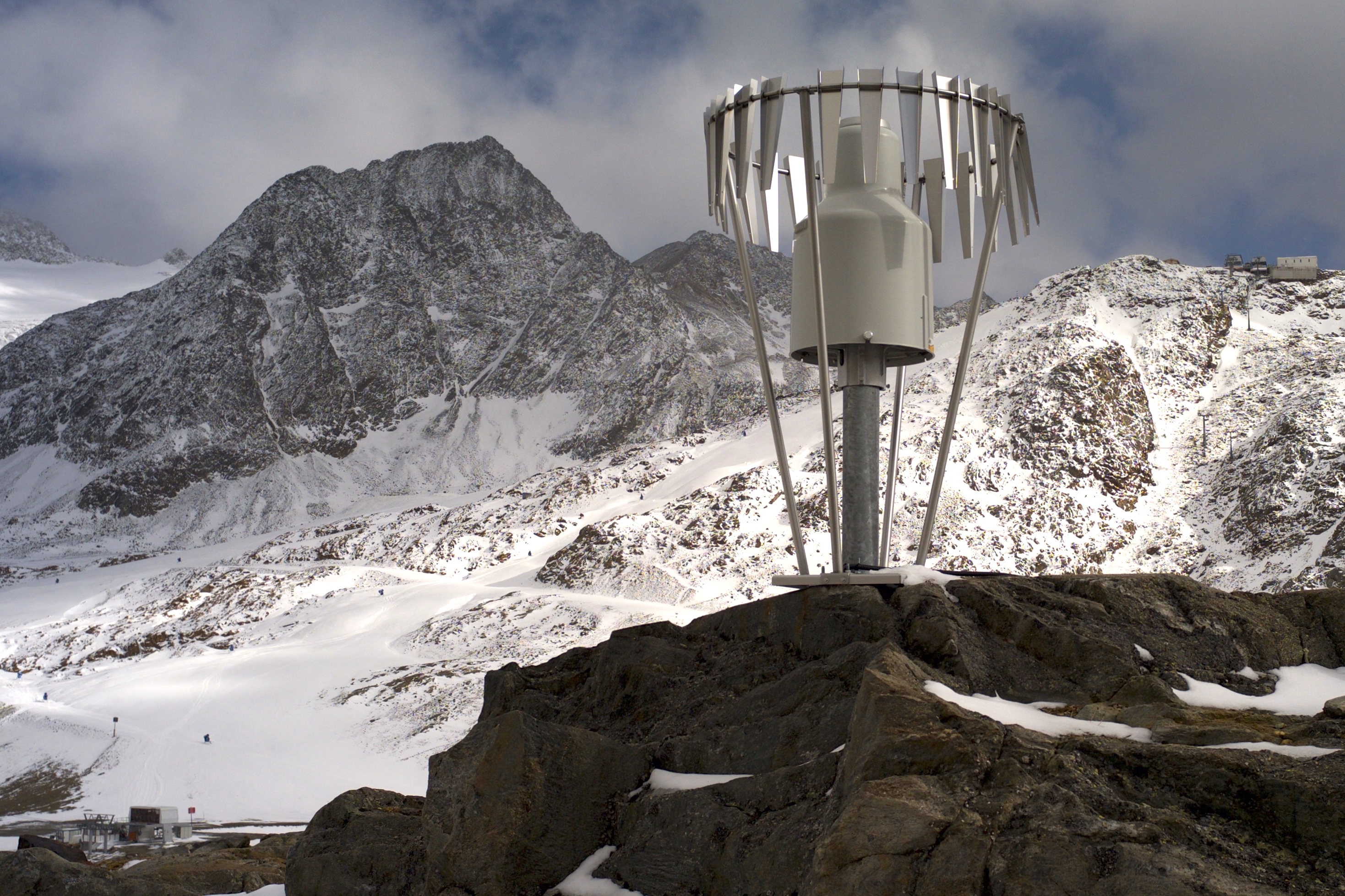
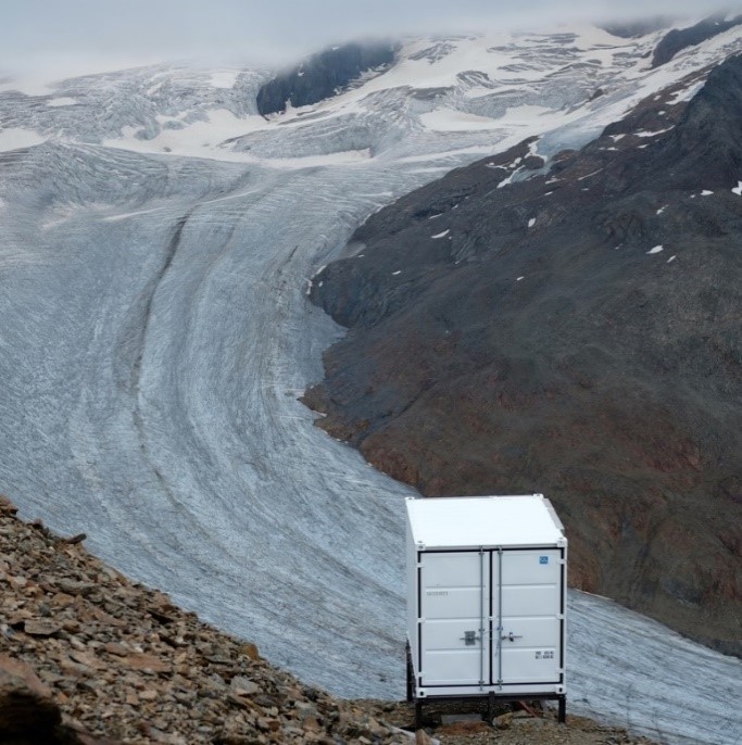
In the Rofental (Ötztal Alps) a consortium of the three institutions, and open to research partners worldwide, concentrates on studying and monitoring cryospheric, atmospheric and hydrological processes and changes with particular attention to the complex topography and climate settings of the Alpine terrain. First documents from glaciers in the Rofental, Ötztal Alps, date back as far as 1601 and regular observations and systematic studies had begun more than 150 years ago. First geodetic maps where generated in the late 19th century, first rain gauges were mounted in 1929 and glacier mass balance time series of Hintereis-, Vernagt- and Kesselwandferner are among the longest uninterrupted world-wide, building a basis for regional hydrological studies, for glacier-climate and ice dynamic research, and for estimating the world wide glacier’s contribution to sea level rise. By 2014, networks of stakes and pits for mass balance monitoring are maintained at Hochjoch-, Hintereis-, Kesselwand- and Vernagtferner by the consortium members. Runoff gauges at Vernagtferner and in Vent (operated by the Hydrological Office of Tyrol) and a network of rain gauges in the Rofental basin are the basis for high mountain hydrological studies. A varying number of automatic weather stations on and in the surroundings of the glaciers are operated by the Rofental consortium. The glaciers in the Rofental are frequently used as a test site for process studies, model development and evaluations and for new remote sensing or ground based methods in glaciological research. A series of airborne LIDAR derived high resolution DTMs of Hintereisferner and its surroundings are available since 2001. They are subject of ongoing evaluations and method comparison studies as well as for monitoring and studying periglacial morphodynamics. The generated data are available from the consortium partners, glaciological key results are annually reported to the World Glacier Monitoring Service (WGMS). A research station on Hintereisferner (with observer status in the Horizon 2020 INTERACT network) and one at Vernagtbach serve as logistic bases for fieldwork. In recent studies, socio-ecological research aspects – e.g. in relation with the use of water for energy production and tourism – comprise the natural scientific investigations.
-
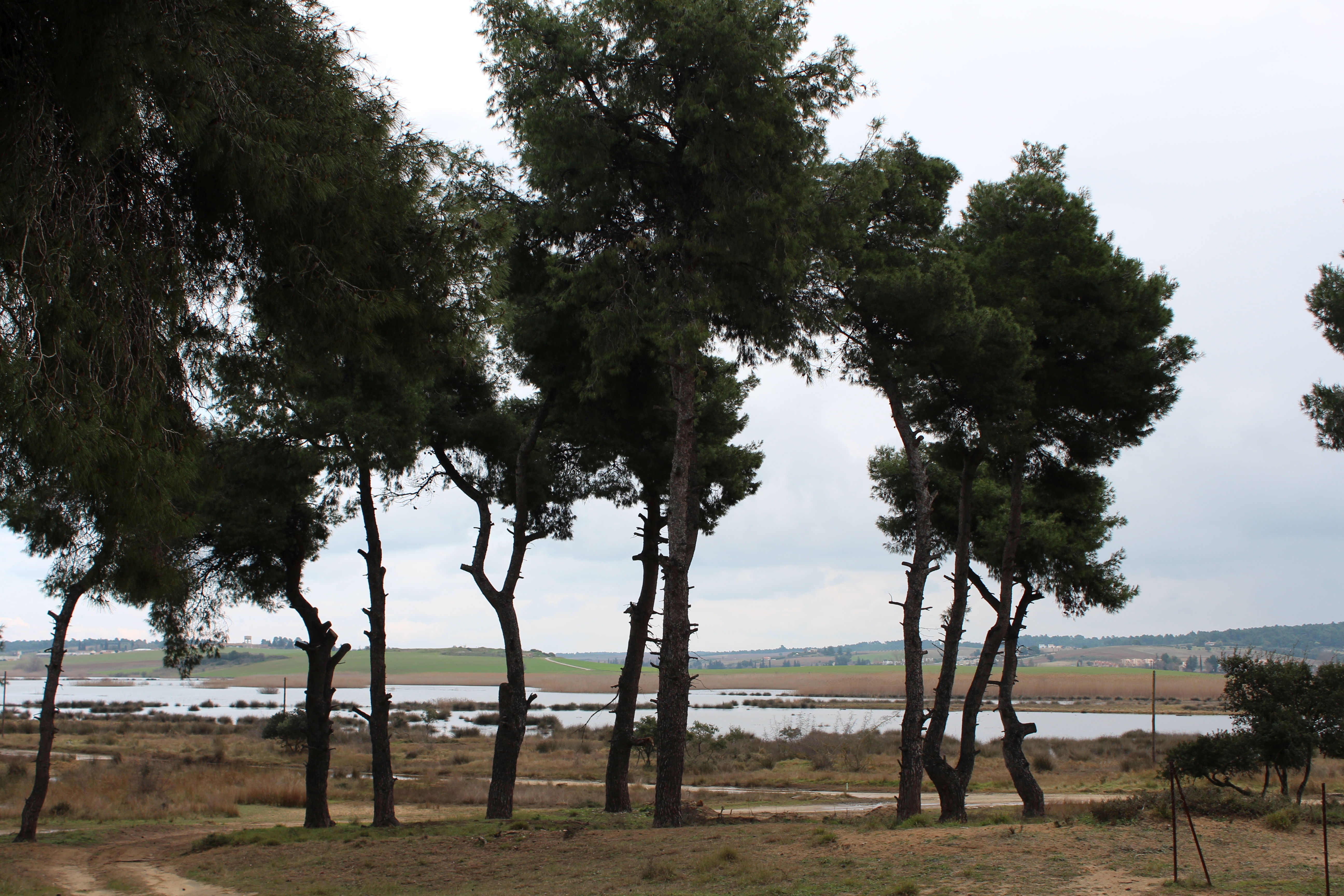
The Sani Environmental Observatory (S.E.O.) is located within a mature, near-coastal Aleppo pine (Pinus halepensis L.) ecosystem at the peninsula of Kassandra, in Chalkidiki, Greece. It is part of the Stavronikita forest, which comprises approximately 300 ha of land covered mainly by forests and to a lesser extend by shrubs and pastures. The Observatory aims primarily at the assessment of the carbon and water balance of this typical low-elevation forest ecosystem to the ongoing climatic shift. Such ecosystems may be prone to the intensified heat and drought events, as well as to the associated insects’ and pathogens’ outbreaks, which are increasingly occurring at the Mediterranean region and particularly at its eastern part. Although Aleppo pines, as well as other Mediterranean pines, are generally adapted to the region’s xerothermic conditions, the in-depth understanding of their ecophysiological and growth responses will allow us to predict the potential of such ecosystems to adapt to climate change. SEO also serves to assess the carbon stocks and fluxes and the contribution of these natural, old-growth ecosystems to carbon sequestration and, thus, to climate change mitigation. S.E.O. is developed by the Forest Research Institute (Lab of Forest Ecophysiology) of the Hellenic Agricultural Organization Dimitra with the support of Sani Resort SA, the owner of the studied forest ecosystem, presenting a nice example of collaboration between the research community and the private sector. Given that SEO is located at a region of high touristic and aesthetic value, close to a wetland and the sea, the Observatory also plans actions to familiarize people with environmental monitoring and the multiple functions and services of the studied Mediterranean ecosystem.
-
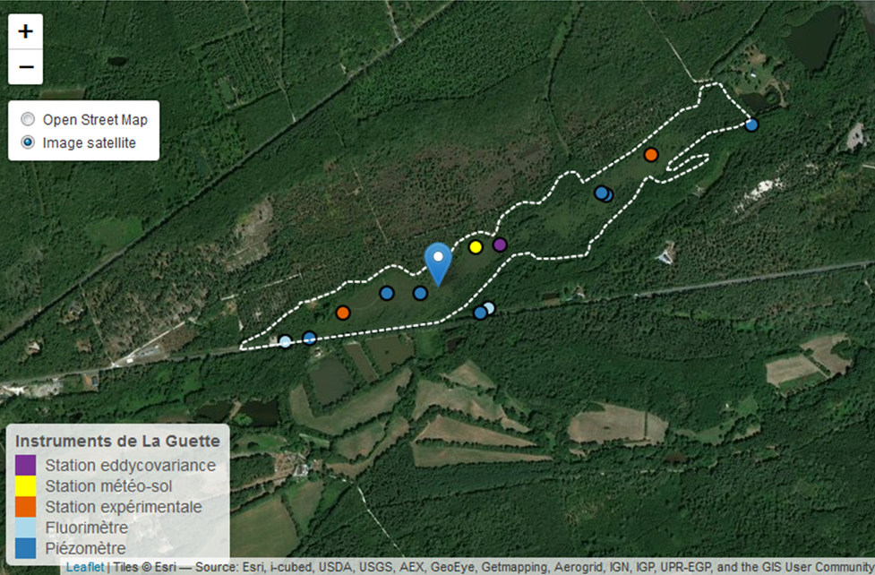
This is a peatland located in Sologne, 80 km south of Orléans. La Guette peatland is one of the four sites of the SNO Tourbières (CNRS). All the sites of the SNO Tourbières are part of OZCAR (French Observatory on the critical zone). The site was hydrologicaly disturbed. Restoration works took place in 2014. A labeling procedure has began to become associated site of ICOS.
-
The SAEON Maputaland Coastal Plain site, Umhlabuyalingana Local Municipality, is a Long term hydro-ecological research platform focused on understanding the relative impacts of climate and land use land cover change on ecosystems services This is a groundwater driven system (sandy unconsolidated aquifer), forming part of the Zululand Aquifer Strategic Groundwater Source Area. There are no surface rivers importing water into the system hence is is dependent on local rainfall for recharge, making it sensitive to changes in rainfall patterns. The site incorporates lake Sibaya, South Africa's largest freshwater lake, which falls within the iSimangaliso Wetland Park, World heritage site and is a RAMSAR site. The region is typified by impoverished and vulnerable communities , with few sources of income. SAEON has instrumented the ground water catchment and its boundaries with raingauges, weather stations, surface renewal systems and an eddy covariance tower. We are also monitoring ground water levels in a number of established monitoring wells. Using a social ecological systems approached, and focused on co-learning, we have developed strong relations with three local communities within the area. The intention is to attract collaborators wishing to co locate instruments as well as perform multidisciplinary work or simply collaborate. We welcome diverse fields of expertise from earth systems science, biodiversity to social and economics sciences.
-

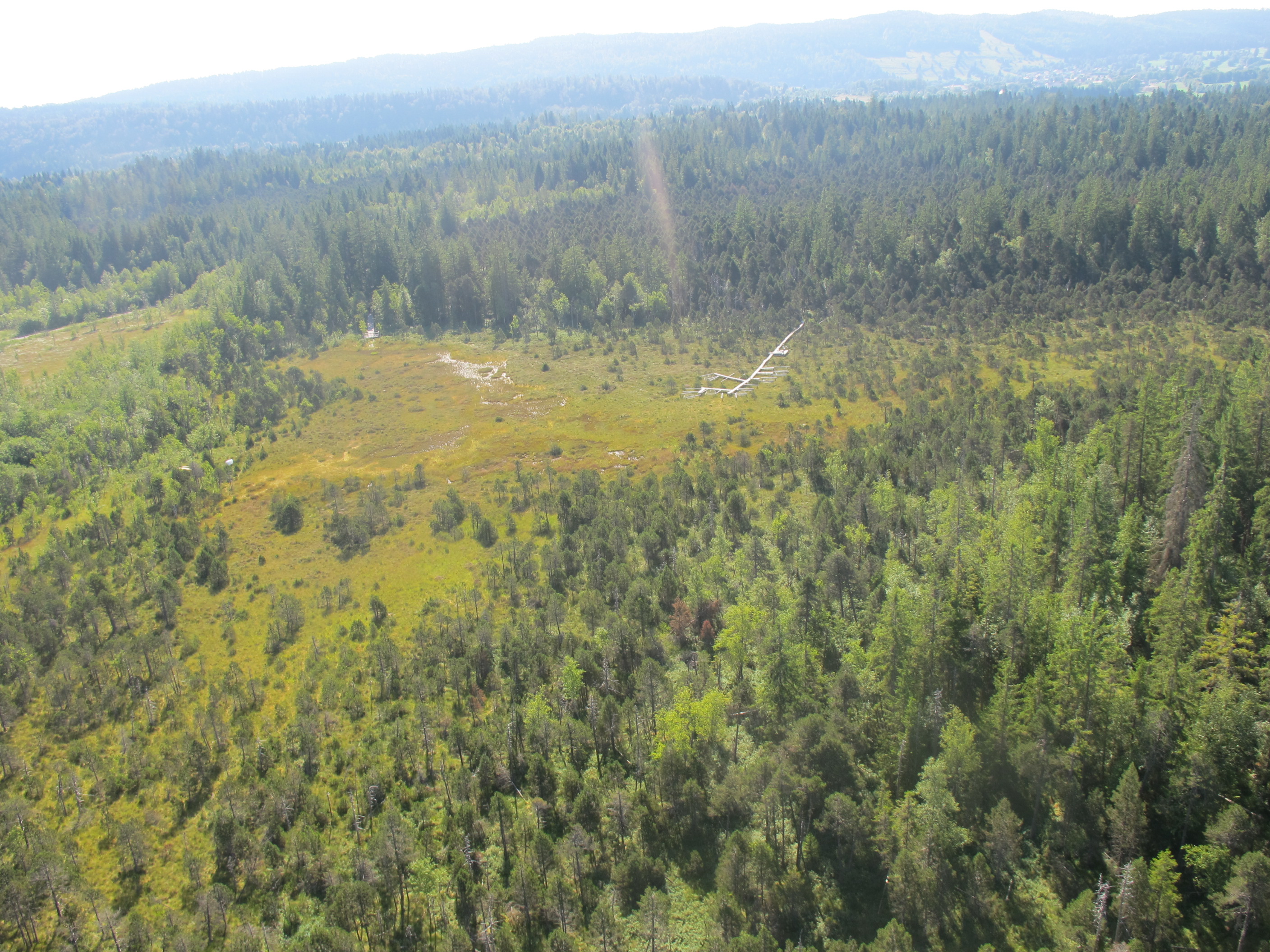
The Pürgschachen Moor is located on the bottom of the Styrian Enns valley, about 1.5 km southwest of the village Ardning in the district of Liezen at an altitude of 632 m a.s.l. It is a pine peat bog with a present extent of about 62 ha. Thus, it is the biggest (to a large part) intact valley peat bog of Austria with a closed peat moss cover and a good example of the formerly widely distributed peatlands of inner-alpine valleys. The peat bog site is property of the Benedictine monastery Admont and is leased to the Moorschutzverein Pürgschachen for an indefinite period of time. An EU Life-project were conducted in the years 1995 to 1998. Since 1991, the peat bog is part of the international and intergovernmental treaty of the Ramsar Convention, constituting a convention on wetlands for the conservation and wise use of wetlands and their resources. As a part of the network of nature protection areas Natura 2000 the site is protected as European nature reserve and mentioned as Important Bird Area. Genesis of such valley floor bogs is owed to the incurrence of postglacial lakes on impermeable loamy clay. The open water surfaces silt up due to the sedimentation of dead plant material. Therefore, peat bogs with a peat depth up to 6 meters could evolve from these terrestrialisation mires in the course of time. Mean average temperature of Admont is 6.6°C, annual precipitation is 1400 mm (1971-2000). The typical vegetation of the peat bog is constituted of the three associations of plants Pino mugo-Sphagnetum magellanici (pine peat bog association), Sphagnetum magellanici (coloured bog moss association), and Caricetum limosae (bog sedge association), depending on the prevailing hydrological (local) site conditions. The peat material of the peat bog can be separated into three different peat layers: Muddy-peaty deposits, Carex-rich Sphagnum-Eriophorum-peat, and Ericaceous-poor Sphagnum-Eriophorum-peat. The focus of our research at the study area Pürgschachen Moor is the investigation of carbon fluxes and a full carbon balance measured by eddy covariance technique. Based on the sampling of undisturbed peat cores potential gas releases measured in the laboratory can be compared with the data measured in field. The examination of peat properties, water table measurements, vegetation surveys, and climate data are further important variables. The Pürgschachen Moor is the first peat bog in the Alpine region getting investigated in detail regarding its carbon budget and is supposed to provide extensive information for the assessment and differentiation of alpine peat bogs.
-
Umbrella site of Rofental - Austria, Obergurgl - Austria & GLORIA Master Site Schrankogel (AT-SCH), Stubaier Alpen - Austria
-
The site Bily Kriz (Bílý Kříž) is located in Moravian-Silesian Beskids Mountains. Ecosystem type: Managed secondary pure Norway spruce stand. Prevailing species: Norway spruce (Picea abies [L.] Karst.) Height of the stand: 17 m (2016) Understory: Vaccinium myrtillus L. Year of plantation: 1981 by 4 years old seedlings
-
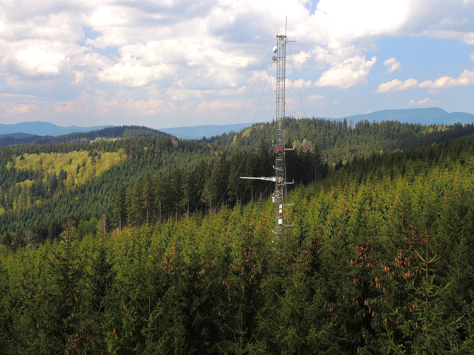
The site is located next to Wettingen in the canton of Aargau, within a natural, mixed forest stand which mainly consists of 150 year-old beech (Fagus sylvatica) and 120-170 year-old spruce (Picea abies) trees. Among others, the site is equipped with two meteorological measurement stations; one is located within the forest stand, the second is co-located in the nearby open-field, allowing to measure the forest stand effect on micro-climate. The following parameters are being measured since 2013: Soil solution chemistry (lysimeters), TREENET, atmospheric deposition (throughfall and bulk deposition), circular vegetation plots, crown condition assessment, diameter and height measurements, foliar analyses, leaf area index (LAI), litterfall, manual circumference band measurements, Ozone visible injury assessment, permanent vegetation quadrats, phenological observations, sapflow measurements, soil matrix chemistry, tree core sampling, automated point dendrometer measurements, automatic circumference band measurements.
-
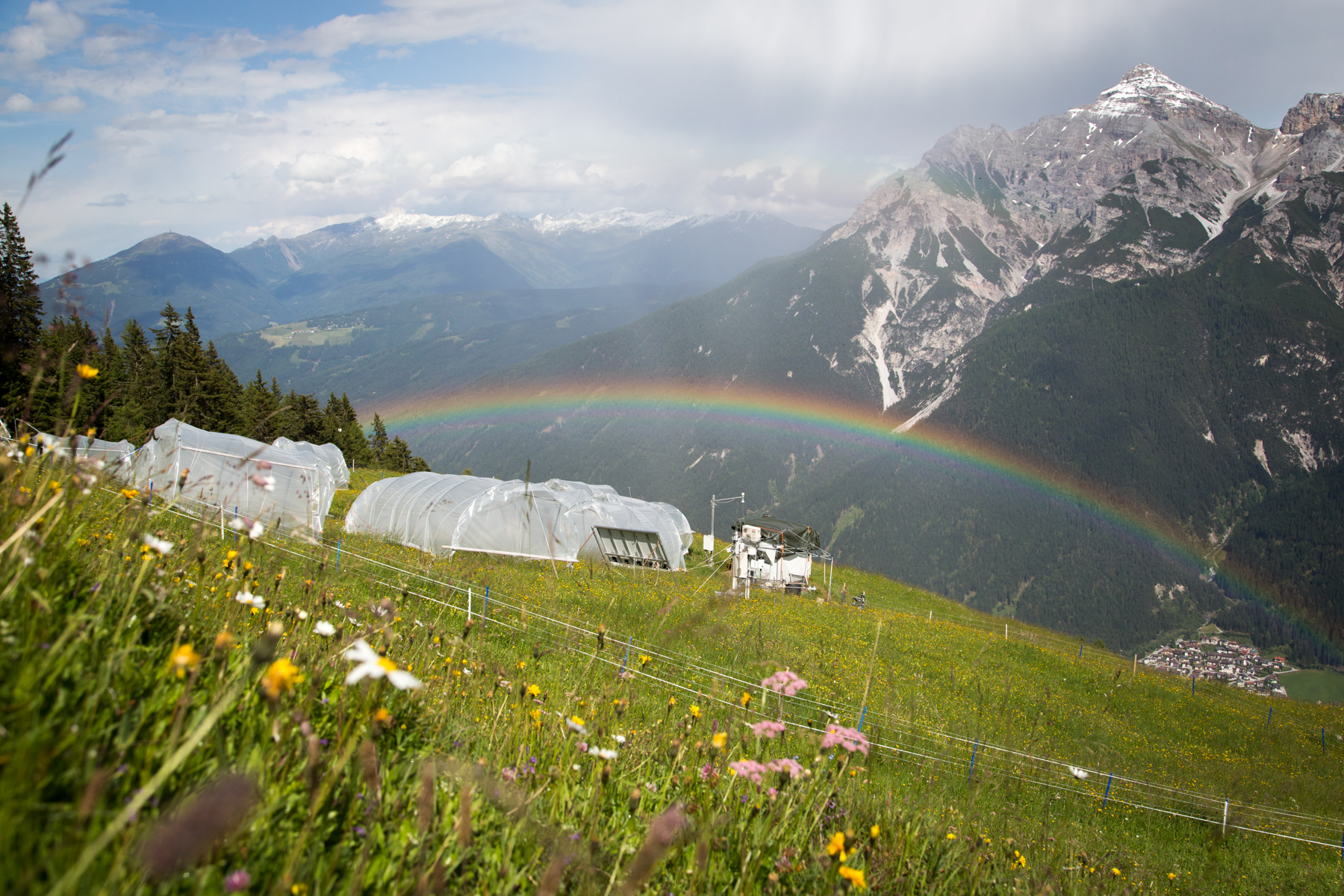
'Tyrolean Mountain Grassland and -Forest' currently consits of 'Stubai - combination of Neustift meadows and Kaserstattalm' (DEIMS.iD: https://deims.org/324f92a3-5940-4790-9738-5aa21992511c). Additional forested research locations may be added in the future.