
air water vapour concentration
Type of resources
Available actions
Topics
Keywords
Contact for the resource
Provided by
Years
Formats
Representation types
-
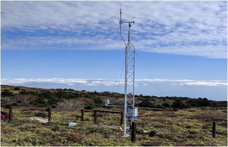
Mt Halla San is in Jeju Island, the only volcanic subtropical island, in South Korea. Every year the island is hit by several typhoons. It has shaped unique environmental characteristics and biodiversity. In addition the mountain is one of the most popular vacation sites with growing ecological concern.
-
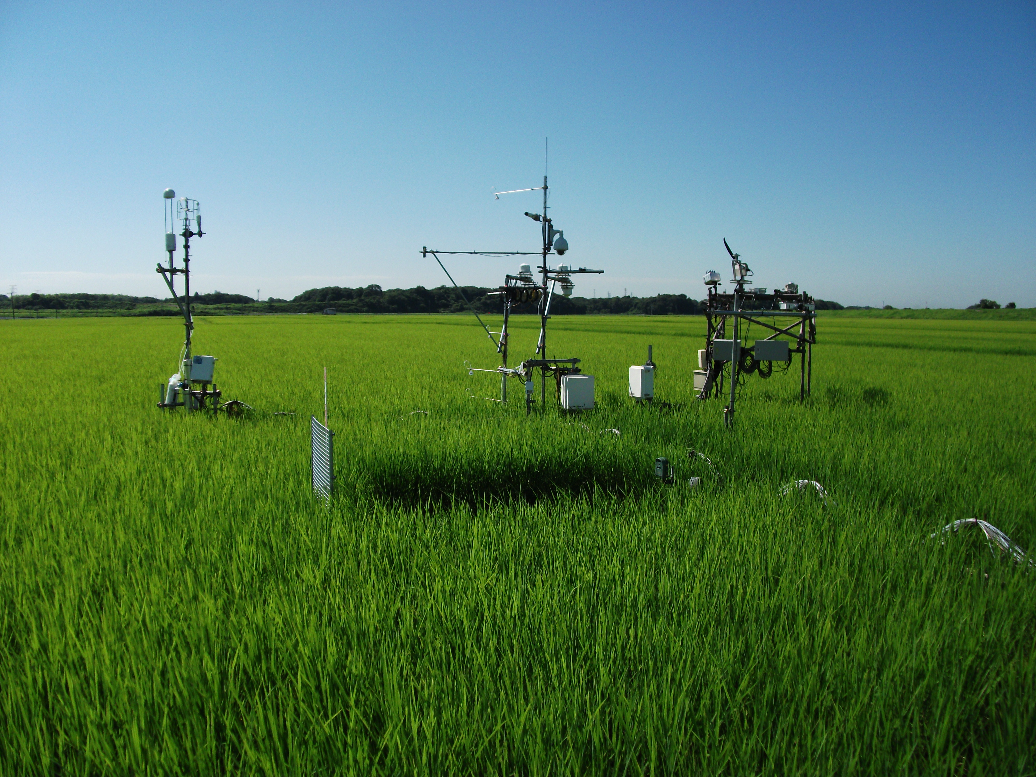
The Mase rice paddy site is a flux station in the AsiaFlux micrometeorological tower network. Located in a regularly cultivated rice paddy area of the Kanto plain in Japan, the site was established in 1999. The initial motivation was to quantify the energy and carbon balance in the rice paddy (ca, 54 a) where the tower was situated. Because of the accessibility and line-power availability, the site has involved many researchers and students from universities and institutes, broadening its target to studies on satellite and field remote sensing, ecosystem modelling, and nutrient cycling.
-
The site Mondsee is part of the European Level II Forest Monitoring System in the frame of the International Co-operative Programme on Assessment and Monitoring of Air Pollution Effects on Forests (ICP Forests). This site is one out of 16 Austrian Level II sites; it was established in 1995 and is, since 2006, part of the LTER Austria network. The site is situated about 25 km east of the city of Salzburg at 850 m a.s.l., in a mixed about 25 year old spruce broadleaved forest.
-
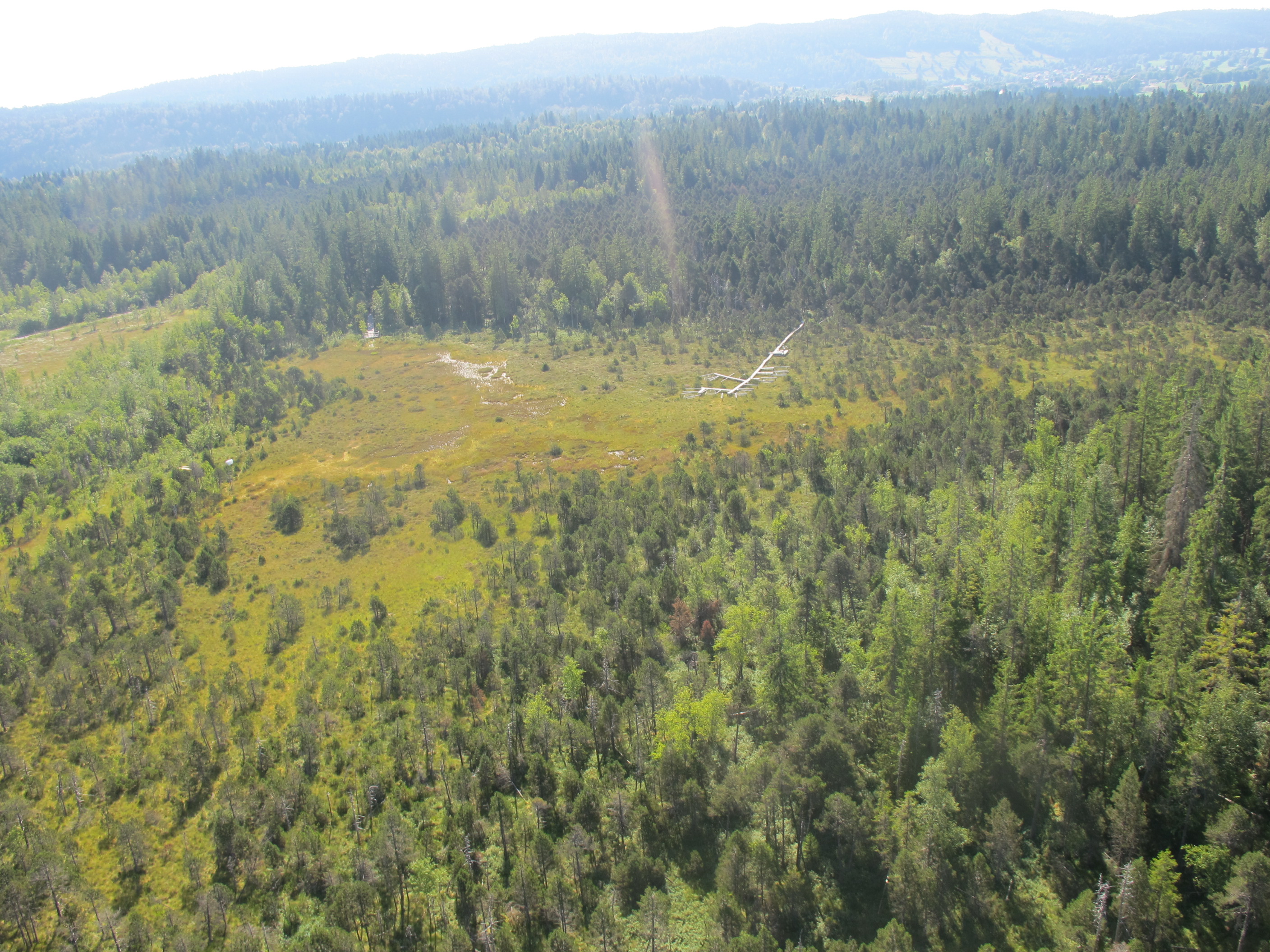
This site experienced peat extraction. It contains Sphagnum plots and Vaccinium oxycoccos, but the peatland is dominated by graminoids forming tussocks.
-
The site is a cropland with a 4-year rotation. Fluxes of CO2 and water vapour are measured by an eddy covariance system. Research activities are carried out by the university of Liège (GxABT).
-
This is a Sphagnum dominated bog, which is part of a mire complex.
-
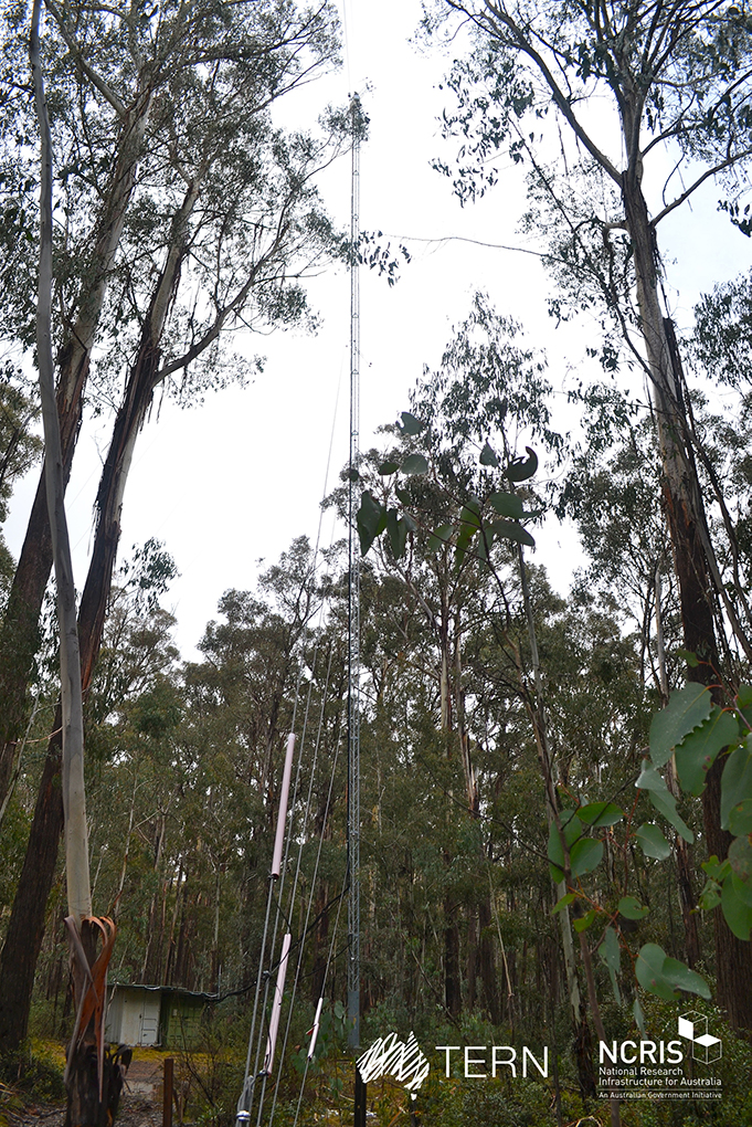
The Tumbarumba Wet Eucalypt SuperSite is a member of the Australian SuperSite Network (SuperSites, http://www.supersites.net.au/), a facility within the Australian Terrestrial Ecosystem Network (TERN, http://www.tern.org.au/). The Tumbarumba Wet Eucalypt SuperSite is located in the Bago State Forest in New South Wales on the western edge of the Snowy Mountains. Key research objectives include: • How does airflow, terrain and forest structure affect the way the ecosystem takes up and releases carbon and uses water? • How can measures of carbon pools, stocks and turnover rates, atmospheric fluxes, be used to improve the surface–vegetation–atmospheric–transfer (SVAT) models? • What effects does vegetation have on the lower atmosphere, including the exchange of heat and the production of particles and chemical species that contribute to the formation of aerosols? We acknowledge and honour all traditional owners past and present of this area, including the Wiradjuri and Ngarigo people, who lived and continue to live on this land.
-
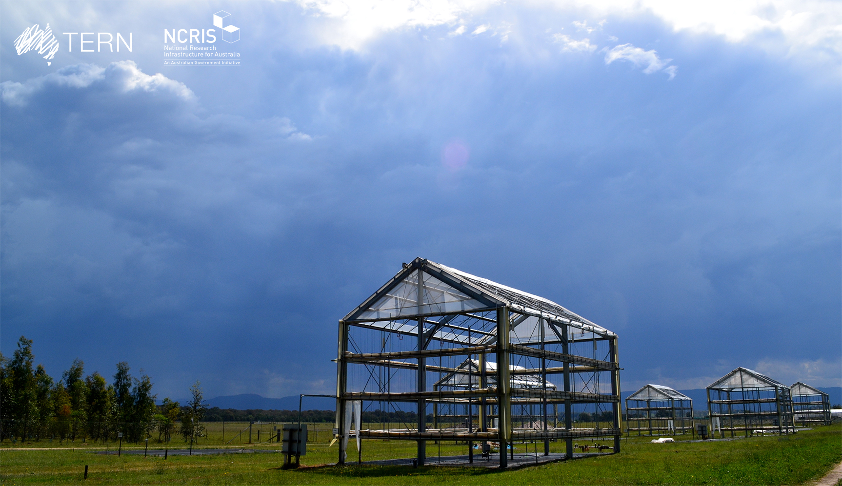
The Cumberland Plain SuperSite is a member of the Australian SuperSite Network (SuperSites, http://www.supersites.net.au/), a facility within the Australian Terrestrial Ecosystem Network (TERN, http://www.tern.org.au/). Cumberland Plain SuperSite is located in remnant Eucalyptus woodland in the Cumberland Plain, at the University of Western Sydney's Hawkesbury campus in Richmond, New South Wales. Associated research extends into the Blue Mountains ecoregion. These sclerophyll woodlands occur on nutrient-poor alluvium deposited by the Nepean River from sandstone and shale bedrock in the Blue Mountains. Despite this they support high regional biodiversity and endemic biota. Cumberland Plain woodland is a critically endangered ecological community found only in the Sydney Basin Bioregion. It faces major pressures including invasive weeds, altered fire regimes, Western Sydney’s urban development, conversion to agriculture, and extreme climate events. The vegetation structure and species composition in the core 1 ha consists of a mix of Eucalyptus moluccana, Eucalyptus fibrosa and Melaleuca decora in the overstorey and Bursaria spinosa dominating the understorey. The traditional custodians are the Darug peoples, and we invite all interested parties to work with us and share their stories. Key research objectives include: • What are the processes controlling biogeochemical fluxes and the impacts of extreme climate events and climate change on biodiversity, conservation management and restoration of remnant Eucalyptus woodland and pastures of Western Sydney.
-
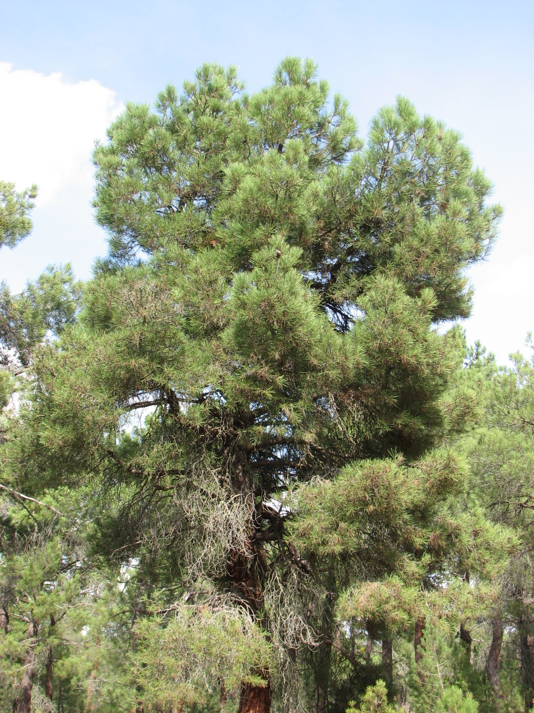
The Intensive Monitoring of Forest Ecosystems (ICP-Forests Level II network) consists currently in 14 monitoring plots representing important Spanish Forest Ecosystems distributed throughout the Spanish mainland showing the most common forest situations of each country and representing rare or endemic situations. The plot 37 Ppr represents a Pinus pinaster forest located in the Castilian region. It is a 41 to 60 years old monoespecific regular forest. The tree layer covers one third of the plot area. Climatic gradient is Supramediterranean. The plot is located on siliceous sands. The soil is poor.
-
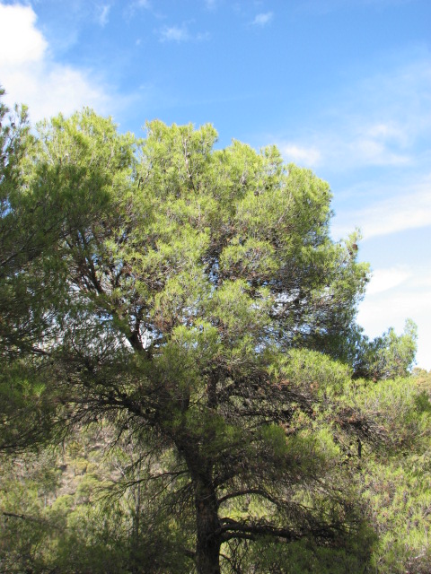
The Intensive Monitoring of Forest Ecosystems (ICP-Forests Level II network) consists currently in 14 monitoring plots representing important Spanish Forest Ecosystems distributed throughout the Spanish mainland showing the most common forest situations of each country and representing rare or endemic situations. The Plot 25 Ph represents a Pinus halepensis pine forest located in the East of the Iberian peninsula. It is a mature monoespecific regular forest. Climatic gradient is Mesomediterranean. The soil is calcareous, shallow and extremely rocky.