
altitudinal gradient
Type of resources
Available actions
Topics
Keywords
Contact for the resource
Provided by
Years
Formats
Representation types
-
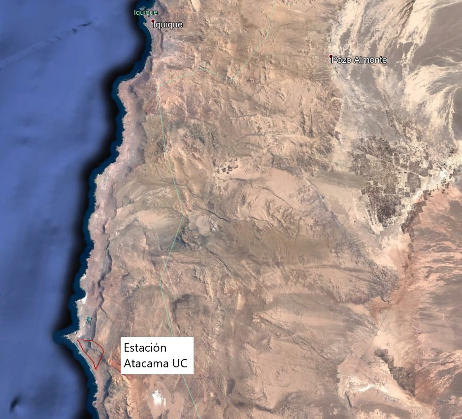
The Alto Patache fog oasis is located in northern Chile, 70 km south of Iquique, Tarapacá Region. This Oasis is located along the Coastal Range of Norte Grande, in the Atacama Desert, known for its remarkable aridity. The influence of coastal fog allows the development of a specially adapted vegetation, which provides habitat suitable for animal species.
-
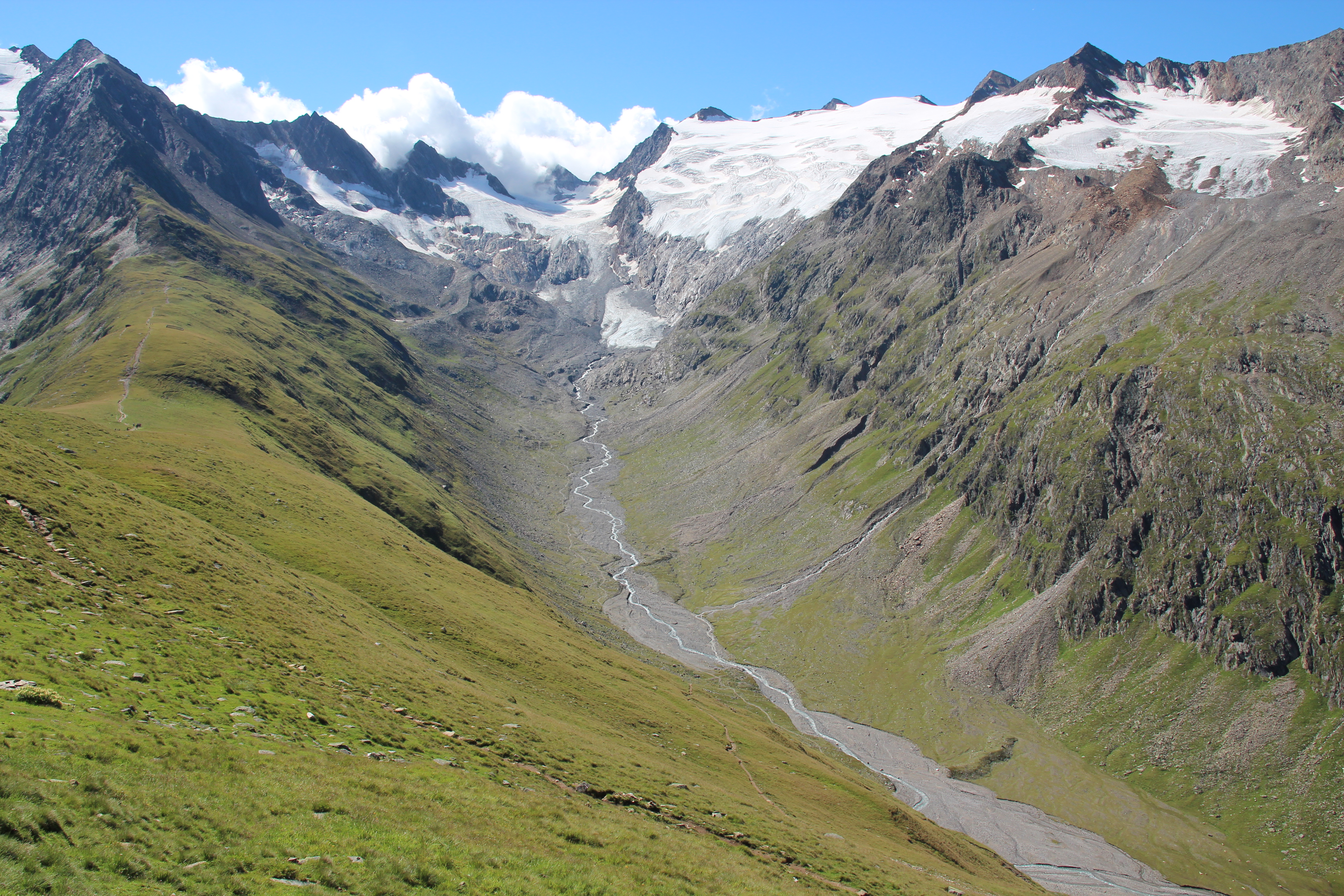
Obergurgl lies about 1930 m a.s.l., very much at the head of the Ötz-valley (municipality of Sölden) in the central Alps. The research areas of the LTER site Obergurgl are located at the slopes, glacier valleys and glaciers south and south-west of Obergurgl. A variety of logger stations (mostly wheather stations) are installed at different locations at the site, some of them measuring since 1953. Various research project, most of them performed by researchers of the University of Innsbruck, are carried out in this area. Habitat types are alpine grassland, alpine forests, pasture and dwarf shrub heath, glacier forelands and glaciers. The LTER site Obergurgl is managed by the Alpine Research Centre Obergurgl (http://www.uibk.ac.at/afo/), a branch office of the University of Innsbruck (http://www.uibk.ac.at/). The Alpine Research Centre Obergurgl is located at the edge of the village Obergurgl. It is consolidated with the University Centre Obergurgl (http://www.uz-obergurgl.at/), a congress centre and hotel with up to 100 beds. Indoor infrastructure are a lecture hall, a seminar room, a small laboratory and small libraries.
-
None
-
Landslides (translational and rotational slides, debris flows, rock avalanches, rock falls, etc.) rank among the most common natural hazards in Lower Austria. As these processes often inherit sporadic phases of activity, it is essential to generate specific long-term measurement series, enabling the analysis of surface and sub-surface dynamics in connection with potential triggering factors. Therefore, in 2014 the project “NoeSLIDE – Monitoring diverse types of landslides in Lower Austria” was initiated. Three subsites are summarized under the parent site "LTER NoeSLIDE".where various types of landslide processes, Hofermühle (complex earth slide - earth flow), Gresten (Salcher landslide) and Brandstatt are monitored with "classic" as well as novel approaches. This includes surface and subsurface monitoring systems. The main research aims comprise implementation of long-term monitoring systems (10+ years) for continuous observation of gravitational mass movements, testing of novel and innovative methods on multiple locations and data availability in a WebGIS application for simple online analyses for authorized users.
-
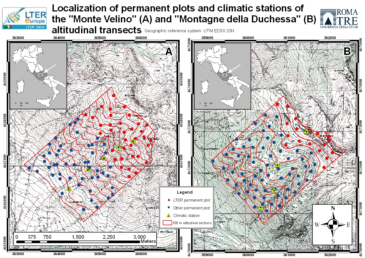
The site includes a large mountainous area in the Central Apennines, almost in the centre of the Italian peninsula and about 70 km west of Rome. It represents an “orographic island” in the Central Mediterranean basin, along the Apennines mountain range. Since 1993, the vegetation has been surveyed at six permanent high elevation plots (Mount Sevice research station, Mount Velino, 2125-2225 m a.s.l.) and (since 2005) at an additional 55 plots along two elevation transects (SW slope of Mount Velino and Mount Morrone), including primary and secondary grasslands, beech forests and alpine tundra. Since 2014, micro-climate data (GLORIA method) have been continuously recorded at the high elevation plots. Vegetation is surveyed yearly in the 6 high elevation plots (each 100 m2 in size) grouped in two cluster-plots (each of 3 plots). Structure and composition changes are studied in two ecologically opposite primary plant communities, both above the timberline: snow-bed grassland and alpine tundra, both characterized by extreme below zero temperatures all year round and frozen soil for 8 months per year, but with very different snow cover duration. Based on the first 30 years of observation, a clear trend toward a decrease of snow dependant species and a parallel increase in drought- and stress-tolerant species has been recognized, linked to a general process of climate change, more accelerated in Southern Europe.
-
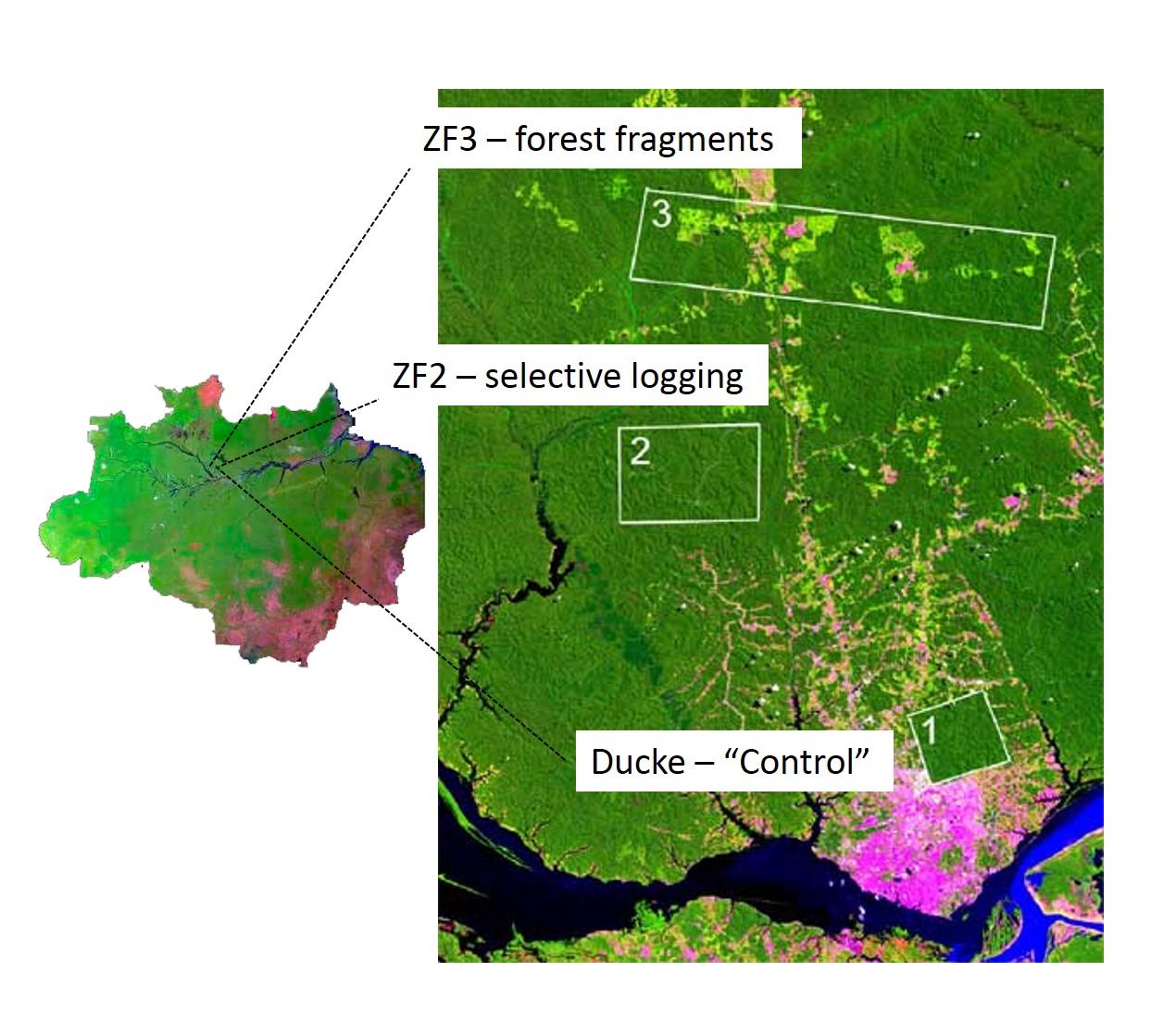
The LTER IAFA site has been running since 1999 and was the first long-term ecological research site in the Amazon. It is situated north of Manaus, central Amazon and includes three sub-sites, with undisturbed terra-firme forest (Reserva Ducke), selective logging (ZF-2 Forest Management Station), and forest fragmentation (Biological Dynamics of forest fragments – BDFFP sites) spread over around 30 x 30 km landscape. Both logging and fragmentation were carried out as controlled experiments to test their effects on biodiversity and ecosystem processes, and thus to outline recommendations for management. The 3 research areas together have 156 permanent monitoring plots, both terrestrial and aquatic, as well as grids of trails for large-scale process monitoring. The information produced has been stored on a public website (https://ppbio.inpa.gov.br/repositorio/dados) where anyone can search data and metadata about the research, as well as the list of publications and all the educational material ( books, identification guides, training course materials) for download.
-
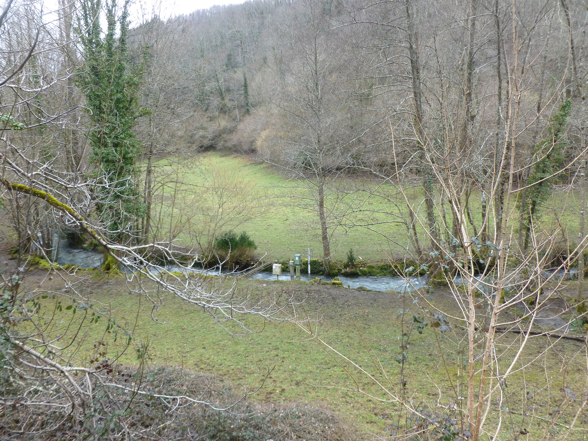
The Baget catchment is managed by the Laboratory of Functional Ecology and Environment (EcoLab), a joint Research Unit between the Institute of Ecology and Environment (INEE) of CNRS, the National Polytechnic Institute of Toulouse and the University Toulouse III-Paul Sabatier, in collaboration with BRGM (Occitania regional agency), the laboratory Geosciences and Environment Toulouse (GET) and the Station of Theoretical and Experimental Ecology (SETE) in Moulis (Ariège, France). The Baget catchment (Pyrénées, Ariège, France) is a mountain ecosystem of middle altitude (Alt.= 1000 m) receiving around 1000mm of precipitation per year. Located close to Balagué village at 10 km West from Saint-Girons, the Baget catchment (13.25 km2) is drained by a karstic network which supplied the surface runoff of Lachein stream (specific discharge: 36 l.s-1.km-2). It is a tributary of the Lez which joins the Salat River, right tributary of the Garonne River. From 1968, this experimental site was intensively equipped by the CNRS underground Laboratory of Moulis (today SETE). The device is composed of one main weir at the outlet, 3 full excess controls, 3 piezometers of which one inside the abyss, and one subterranean loss. This karstic watershed has been surveyed since 1968 for some hydro-climatic parameters, particularly air temperature, precipitations and stream discharge at the outlet. Some geochemical parameters (pCO2, chemical and isotopic compositions of waters) and some hydro-biological and ecological data (invertebrates, particularly Crustacea) have been surveyed for periods during the last 40 years by the CNRS underground Laboratory of Moulis. Since 2011, Baget catchment belongs to the French Network of Catchments (RBV) and it is included in the certified National Observatory Service SNO Karst. Then, new parameters are measured twice a month or with higher frequencies during some flood events (major cations and anions, alkalinity, pH, conductivity, dissolved organic carbon, total suspended matter, H, O, C isotopes…). Since 2014, a multi-parameter probe has been installed with different sensors to measure continuously water level, pH, conductivity, turbidity, dissolved oxygen, nitrate and chloride. These continuous measurements are calibrated twice a month with laboratory analyses. The water discharge is measured by BRGM-Occitania because the Baget karst is part of the French patrimonial network of ground-waters and it belongs to the piezometric network managed by BRGM. The Baget catchment is very sensitive to limit conditions of surface drainage and to land covers. It offers the possibility to develop an eco-systemic survey, which integrates the hydrology, the geochemistry and the ecology of a mountain ecosystem in the SW of France. In this region, climate and land use changes will have significant impacts on biodiversity, ecosystem functioning and biogeochemical cycles for the next decades The Baget catchment is an international field site of the Critical Zone Exploration Network CZEN (http://www.czen.org/content/aurade-experimental-catchment) and it is one of the sites of the French SNO-KARST (Service National d'Observation) labellised by INSU-CNRS. It belongs to the French Research Infrastructure OZCAR and it is also a site of the French LTSER ZA PYGAR "Zone Atelier Pyrénées-Garonne".
-
The Climate-Ecological Observatory for Arctic Tundra (COAT) platform covers two sites in the Norwegian terrestrial arctic - low-arctic Varanger Peninsula and high-arctic Svalbard. Long-term monitoring and research on tundra ecosystems are conducted on these sites.
-
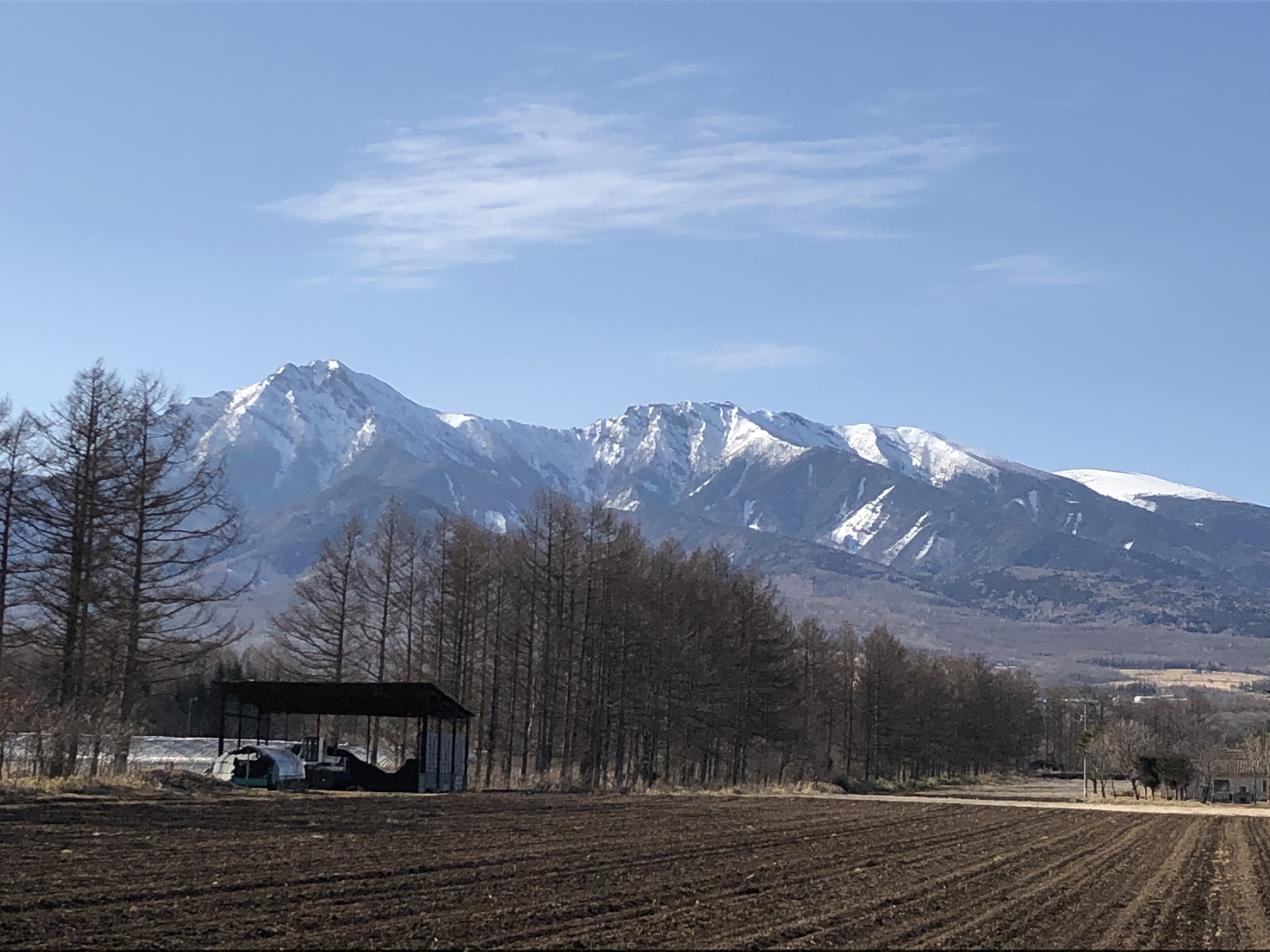
The Yatsugatake-Kawakami Forest of Mountain Science Center, University of Tsukuba, consists of three forest areas: the Yatsugatake Forest (80 ha) located in Minamimaki, Nagano Prefecture, Japan, the "Megumi-no-Mori" (14 ha) on the campus where the administration building is located, and the Kawakami Forest (189 ha) located in Kawakami, Nagano Prefecture, Japan. The Yatsugatake Forest is 1400-1450 m above sea level, and the Megumi-no-Mori is 1350 m above sea level. The forest is characterized by gentle slopes without remarkably topographic change and a mosaic of secondary deciduous broad-leaved forest dominated by oak (Quercus crispula) and Asian black birch (Betula davurica), and intermediate moor characterized by thatch herb (Moliniopsis japonica) and Japanese alder (Alnus japonica). Rare plants such as primrose (Primula sieboldii) and drosera (Drosera rotundifolia) are also found here. Black soil is distributed throughout the Yatsugatake Forest and Megumi-no-Mori. The Kawakami Forest is located between 1360 and 1700 m above sea level. 70% of the forest area is planted with Japanese larch (Larix kaempferi). The rest is a secondary deciduous broadleaf forest dominated by oak and birch. Some of the forests are dominated by a beech (Fagus crenata) stand, a natural Sawara cypress (Chamaecyparis pisifera) stand, and spruce (Picea alcokiana) stand. The forest is covered with brown and black soils, and the topography of the forest is more varied than that of the Yatsugatake Forest, including ridges and valleys. In the Kawakami Forest, an ecological survey of forest mammals is also being conducted. At these three forests, education and research are conducted on ecological surveys of trees, rare plants, and wildlife (population dynamics and conservation ecology), forest meteorological observations, and artificial forest management and operation.
-
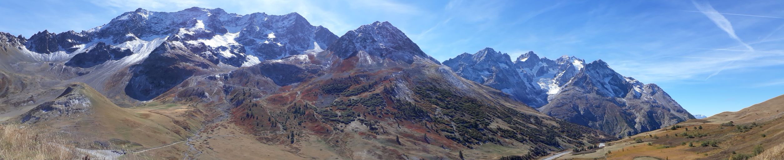
The Lautaret-Oisans platform focuses on the study of socio-ecosystems and the critical zone of the alpine mountains. The research and observation sites are focused on three sub-systems: little-engineered high mountains; alpine pastures; and lakes, rivers and watershed heads. The platform is built around the Lautaret-Roche-Noire site (https://deims.org/8574370e-934e-418a-af63-e15f4cbc5084) and Lautaret Garden infrastructures.