
ammonium nitrate concentration
Type of resources
Available actions
Topics
Keywords
Contact for the resource
Provided by
Years
Formats
Representation types
-
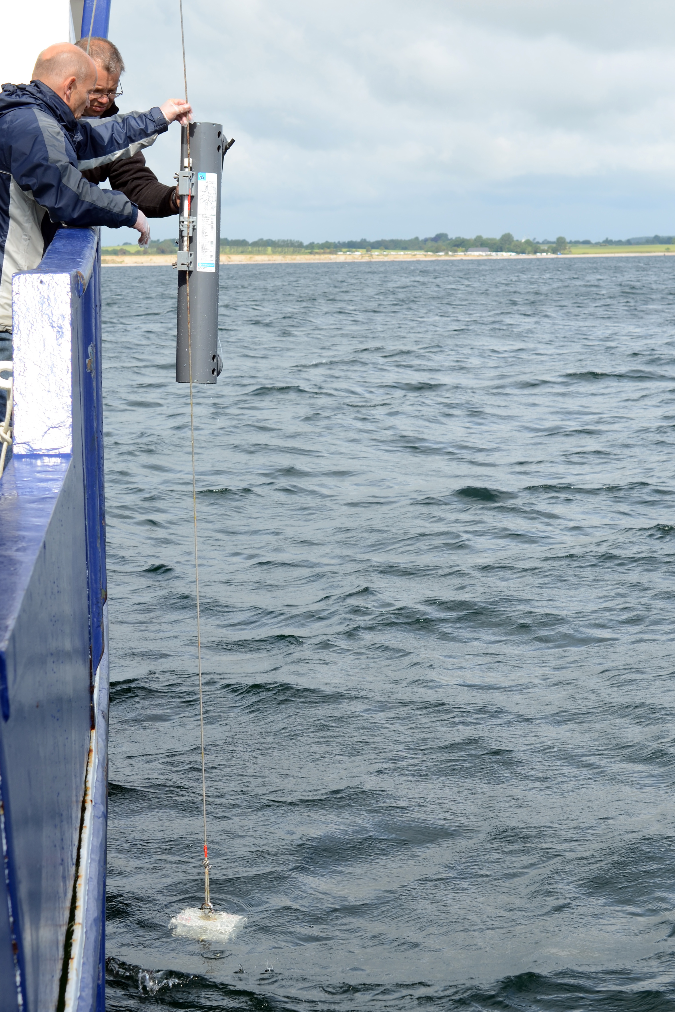
The site of the Boknis Eck Time Series (BE) is located at the entrance of the Eckernförde Bay (54°31.2' N, 10°02.5' E) in the southwestern Baltic Sea. It has a water depth of 28 m with muddy sediments. Riverine inputs into the Eckernförde Bay are negligible and thus the overall hydrographic setting at BE is dominated by the regular inflow of North Sea water through the Kattegat and the Great Belt. Seasonal stratification occurs usually from mid-March until mid-September and causes pronounced hypoxia which sporadically become anoxic.
-
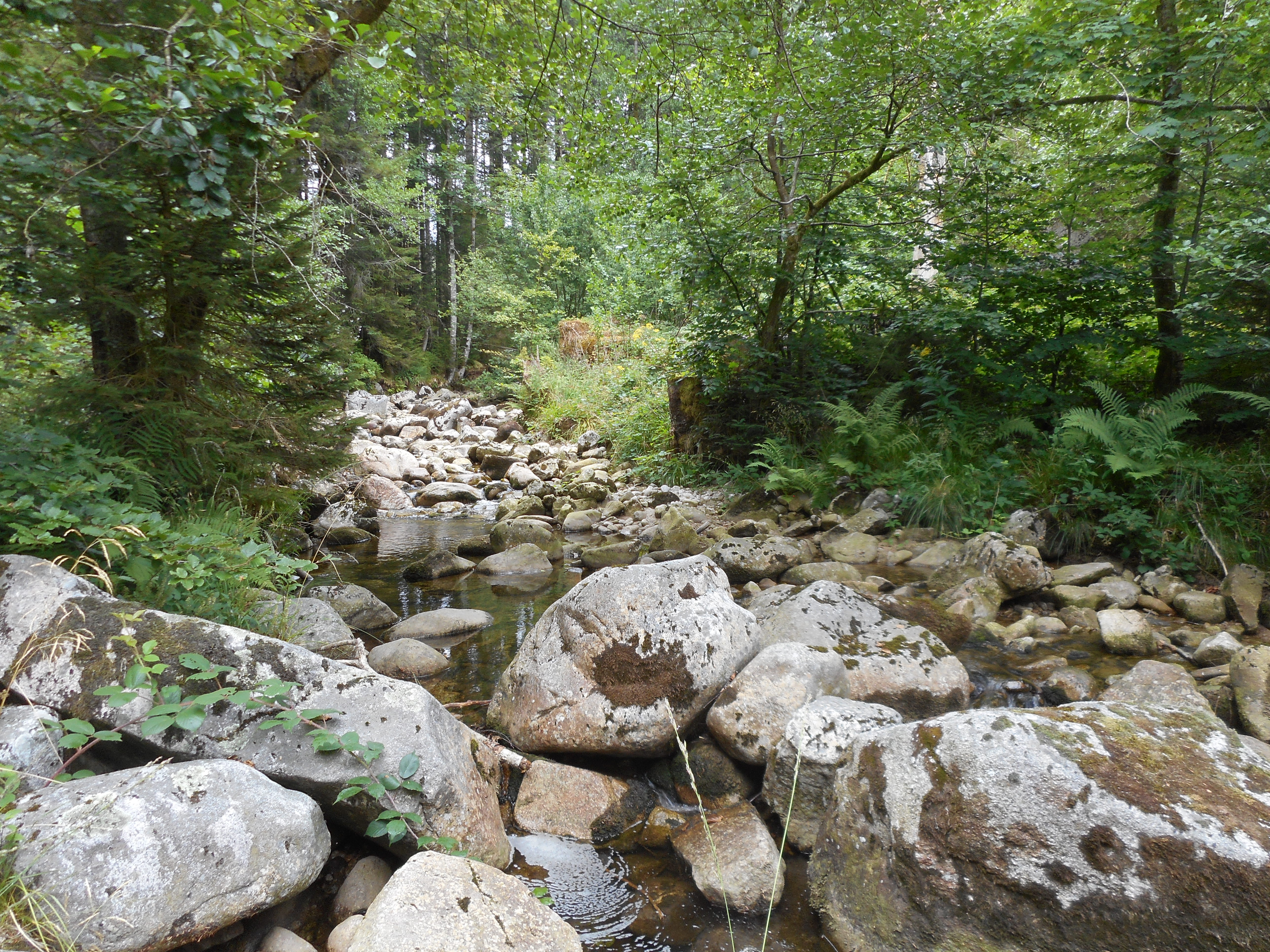
The observatory consists of 16 headstreams (15 in the Moselle River watershed, 1 in the Rhône River watershed), draining forest (mixed coniferous, beech) watersheds on sandstone and granites at very different altitudes.
-
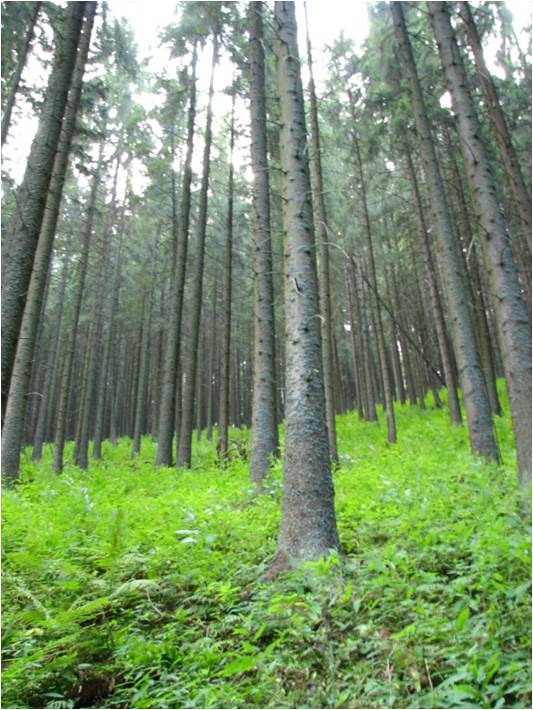
In 1998 a permanent plot (50 x 50 m) was established on the slope of the Nosal Mountain at the height of 970 m asl in 120 year old spruce stand, where in the 120-year-old spruce stand bulk deposition, throughfall and soil solution are collected. The investigations of health status of trees and floral characteristic have been carried out since 2001. The analyses are carried out in a certified laboratory of the Institute for Ecology of Industrial Areas, Katowice (Certificate No AB 325). The basic meteo data are taken from the monitoring station located at Kuźnice (about 1 kn from the plot).
-
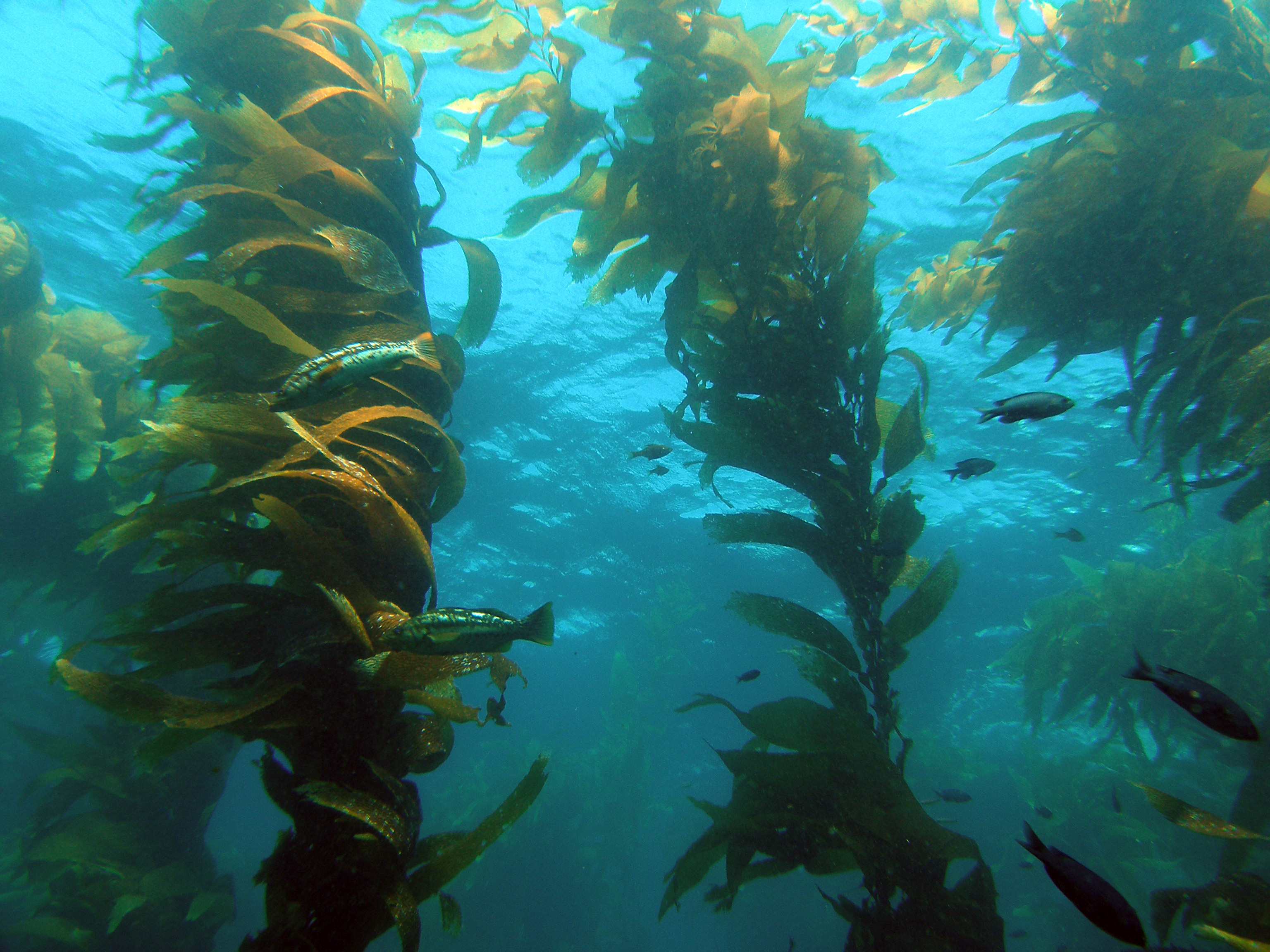
The Santa Barbara Coastal Long Term Ecological Research (SBC LTER) site is an interdisciplinary program established in 2000 to understand the ecology of coastal kelp forest ecosystems. Our research is focused on the nearshore waters of southern California, where ocean currents and climate are highly variable with season and longer-term cycles, including the El Niño-Southern Oscillation and the Pacific Decadal Oscillation. SBC’s principal study domain is a 10,000 square kilometer area of the northern portion of the Southern California Bight that includes the Santa Barbara Channel and the steep coastal watersheds, small estuaries and sandy beaches that border the Channel.
-
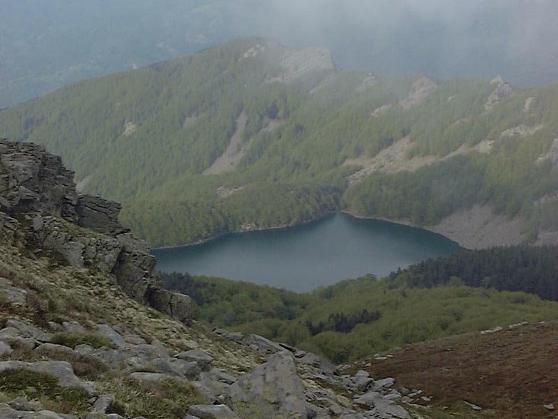
Lake Santo Parmense is an oligotrophic dimictic lake of glacial-tectonic origin located in the Tuscan-Emilian Apennines National Park at an altitude of 1507 m a.s.l. It is the largest and deepest natural water body in the Northern Apennines, with a surface of 8.2 ha and maximum depth of 22.5 m. The period of ice cover usually lasts from November to May. It was naturally fishless, but underwent regular fish stocking since the beginning of the 20th century. There is a hut (Rifugio CAI Mariotti) on the shore of the lake, including a restaurant, dormitories and meeting room, 220 V power supply (open in summer and on request in other times too). It can also be reached by a chair lift. A small boat is permanently stationed at the lake for sampling operations. Limnological research on the lake started in the 1950s and continued until nowadays, although with several discontinuities. Research topics that have been addressed over the years at the lake include phytoplankton and zooplankton ecology and phenology, predation/competition interactions and energy fluxes through pelagic food web, evolution of trophic state, sensitivity to acidification and climate change.
-
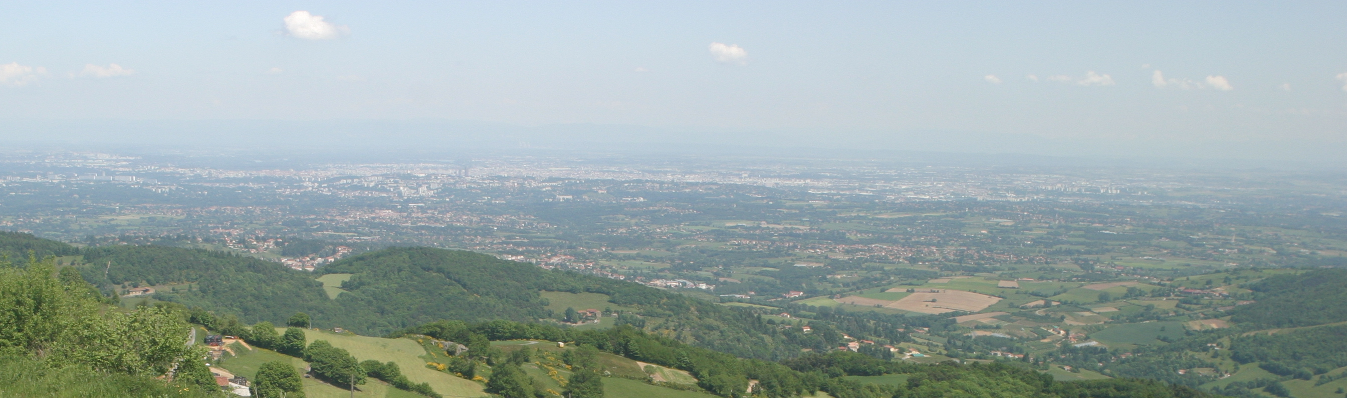
The Yzeron catchment (150 km2) is located to the south-west of Lyon city, France. It forms part of the Observatoire de Terrain en Hydrologie Urbaine (OTHU, 2011) long term observatory. It is representative of French periurban areas and is characterised by a marked topography. The outlet reaches the Rhône river at the elevation of 162 meters and the highest point culminates at 917 m above see level. The slope map calculated from a 25 m resolution Digital Elevation Model (DEM), derived from IGN BDTopo® shows that more than 50% of the catchment has slopes larger than 10%. The geology is contrasted with crystalline formations (granite, gneiss ) in the western part of the catchment and more alluvial and glaciar formations in the eastern part. The land use is heterogeneous. The upstream and western part of the basin is limited by a range of hills covered with forests. The intermediate part is mainly covered with grassland and cultivated lands, mixed with urban nucleus. Thin green corridors remain along rivers, covered with deciduous trees. The downstream part is mainly covered with densely urbanized areas. A fast progression of urbanisation is observed since the eighties. The area is prone to sharp Mediterranean-type flood events due to its steep topography in the upstream part and limited soil water storage capacity overall. The water coming from combined sewer overflow devices is rich of sediments and pollutions, causing quality problems in the rivers, especially during summer storms, where most of the water reaching the river comes from urbanised areas via SODs. Increased erosion of the river banks has also been evidenced with impact on the ecosystems. The catchment is instrumented since 1997 in particular in two sub-catchments with different land uses (Mercier: agriculture and forest) and Chaudanne (agriculture and urban) with rainfall and discharge data. Some information about physico-chemical characteristics are also available.
-
None
-
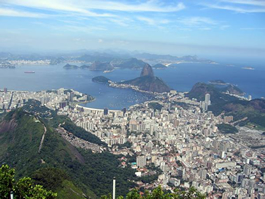
Guanabara Bay (GB) is the second largest bay in the coast of Brazil (384 km2) (22o41 to 22o56 S ; 43o02 to 43o18 W). In its surroundings live 16 million inhabitants (6 million in Rio de Janeiro city). This system experiences steep spatial gradient from the entrance to inner bay. GB receives high load of nutrients and organic material from riverine sources and from domestic and industrial sewage inputs. As a consequence, this system is characterized as a high eutrophicate and polluted one. In spite of its poor environmental status, GB still presents many living resources who use the bay as a refuge, feeding and nursery grounds, with some of those species having commercial interest. An important characteristic of GB is the influence of South Atlantic Central Water, a deep, cold and rich nutrient water, that enters the bay during the Cabo Frio upwelling period. This phenomenon permits to maintain the bay at a relative good health level in its central part, in contrast with the marginal areas highly polluted. Although encroached on by urban expansion, the inner east margins of Guanabara Bay is still bordered by a 90 km2 fringing mangrove system, of which 43 km2 is an environmental protection area, Guapimirim.
-
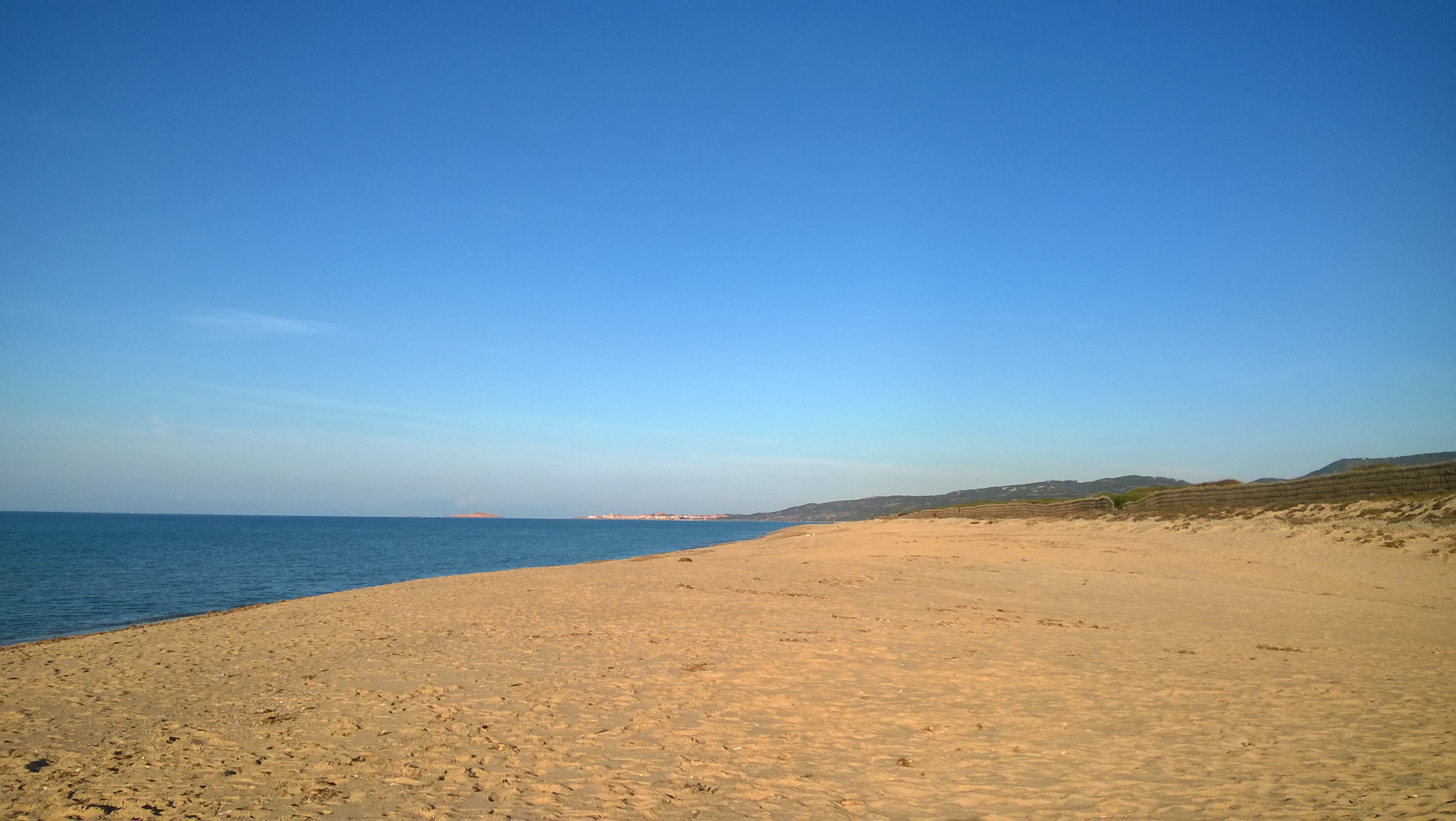
The Asinara Gulf covers approximately 500 km2 and is the second largest bay in Sardinia. The Gulf is limited by Asinara Island (National Park) in the west side and by Castelsardo town in the east side. The average depth of the gulf is approximately 35-40 m and only 35% of the gulf bottom has a depth exceeding 50 m. The predominant winds are from the I and IV quadrant. The marine area of the gulf has been affected since the ‘70s by different human impacts, especially by those connected to the industrial centre of Porto Torres. The main urban centre along the gulf coast is Porto Torres, with an important industrial, commercial and passenger harbour. A long-term series of data is available since 1997 and derives from high-frequency measurements and samplings to assess environmental and biological parameters. In particular the data concern the main trophic descriptors (Secchi depth, temperature, pH, conductivity, dissolved oxygen and saturation, alkalinity, NH4-N, NO2-N, NO3-N, total nitrogen, soluble reactive phosphorus, total phosphorus, dissolved silica) and phytoplankton abundances, as chlorophyll a, cell densities and biomass, class and species composition. Data collection started in 1997 and continued, with few gaps of various sizes of time, up to 2007. The data collection resumed in 2007 only seasonally.
-
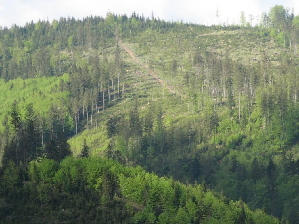
The Brenna monitoring site in the Silesian Beskid (Polish part of the West Carpathians) was established in 1991 and consists of a monitoring station (meteo parameters and air pollution level) at the elevation of 865 m a.s.l. and 7.5 ha and 50 ha catchments at the elevation of 750 m a.s.l under old spruce stand being under reconstruction.The main goals of the monitoring programme is the investigation of: ● Response of spruce stands to air pollution and forest management practice in the mountain area which has been influenced by emissions from the industrial complexes of Silesia and the Czech Republic ● The balance of nutrients in a small mountain catchment. ● Changes in floral characteristics These monitoring activities have been continuing and moreover, the effect of forest management (falling, skidding) on soil (erosion) is monitored. In 2016 the Particulate analyzers (PM10/PM2.5) (The Model 5030 Synchronized Hybrid Ambient Real-time Particulate SHARP Monitor) were installed at the station to measure the inflow of pollutants from industrial regions.Equipment for meteorological measurements is as follows: Barometr LB-716, Thermohigrometer LB-710R, Wind Speed Meter LB-746, Pyranometer PQS1, Thermometer LB-711 (air and soil), Pluviometer RG50A. Additionally, continuous measurements of ozone have been carried out since the nineties (Monitor Thermo Scientific).