
ammonium nitrogen content
Type of resources
Available actions
Topics
Keywords
Contact for the resource
Provided by
Years
Formats
Representation types
-
The study of the physical–chemical parameters in the Mar Piccolo of Taranto, begun since the first years of the last century. In these selected studies physical–chemical characterization of marine water and sediments were carried out in the first and second inlet of the basin. In marine water, temperature, salinity, dissolved oxygen, ammonia, nitrites, nitrates, and orthophosphates were determined. In sediments physical–chemical parameters included: water content, organic matter, total nitrogen and total phosphorous, pH, red-ox potential and grain size classification. Moreover, different micropollutants were also evaluated: heavy metals (Hg, Cd, Pb, Cr, Cu, Ni, Zn, Al V and Fe) and Arsenic, polycyclic aromatic hydrocarbons (PAHs), polychlorobiphenyls (PCBs), organochlorinated pesticides and organotin compounds. These studies demonstrate the important role of water monitoring studies in the semi-enclosed basin of the Mar Piccolo with lagoon features, characterized also by mussel farming activities. Moreover, in addition to the trophic conditions of the area, data obtained from sediments characterization allow us to evaluate the possible contaminants transfer along the food chain, in order to protect human health by consumption of seafood products
-
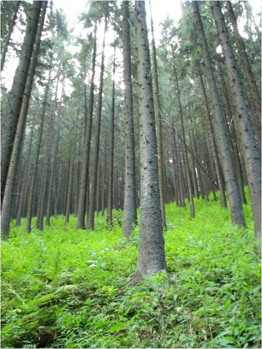
In 1998 a permanent plot (50 x 50 m) was established on the slope of the Nosal Mountain at the height of 970 m asl in 120 year old spruce stand, where in the 120-year-old spruce stand bulk deposition, throughfall and soil solution are collected. The investigations of health status of trees and floral characteristic have been carried out since 2001. The analyses are carried out in a certified laboratory of the Institute for Ecology of Industrial Areas, Katowice (Certificate No AB 325). The basic meteo data are taken from the monitoring station located at Kuźnice (about 1 kn from the plot).
-
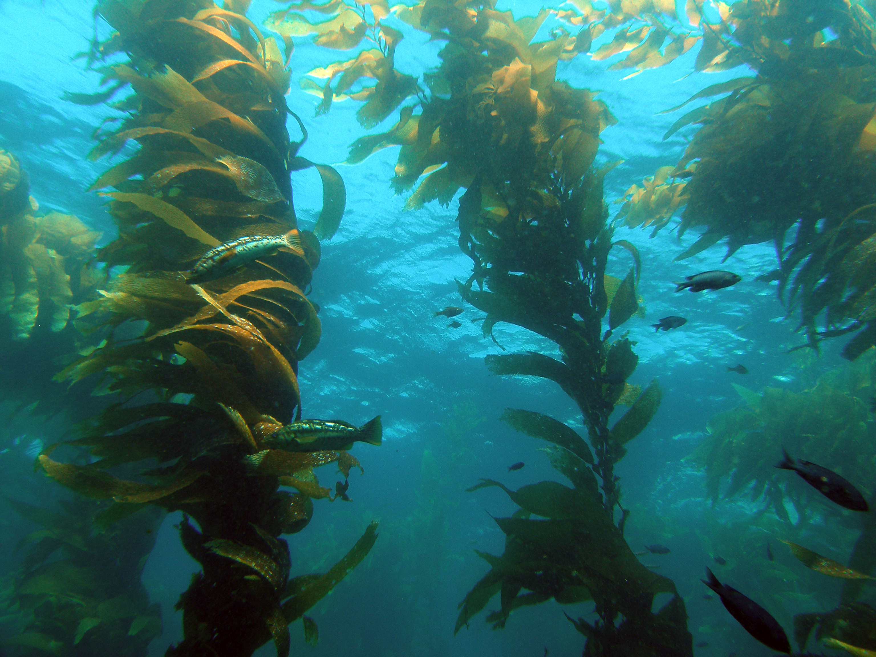
The Santa Barbara Coastal Long Term Ecological Research (SBC LTER) site is an interdisciplinary program established in 2000 to understand the ecology of coastal kelp forest ecosystems. Our research is focused on the nearshore waters of southern California, where ocean currents and climate are highly variable with season and longer-term cycles, including the El Niño-Southern Oscillation and the Pacific Decadal Oscillation. SBC’s principal study domain is a 10,000 square kilometer area of the northern portion of the Southern California Bight that includes the Santa Barbara Channel and the steep coastal watersheds, small estuaries and sandy beaches that border the Channel.
-
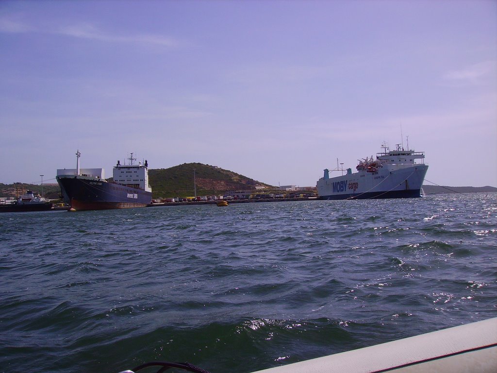
The Gulf of Olbia is situated on the eastern coast of Sardinia. Morphologically, it is a typical ria, long 5 km, wide 2 km and with a total area of 600 ha, a mean depth of 5 m and a maximum depth of 10 m. The gulf receives a freshwater flow from the Padrongianus River in its southern part. The town of Olbia, located in the inner part of the Gulf, is one of the most important passenger harbors in the Mediterranean (about 4 million passengers per year) with in addition a commercial and an industrial harbor. It is also the largest mussel- and clam-farming area in Sardinia (5000 t yr−1). Mussel and clam farming is strongly affected by the presence of toxic algae. Since the early 1990s, the Gulf of Olbia has been monitored with respect to its trophic state and phytoplankton abundance and composition, in particular, the presence of toxic or harmful species of genus Alexandrium (Dinophyceae). However, the first data were collected in 1987, in connection with a discoloration event due to phytoplankton and with an extensive fish death. A long-term series of data is available and derives from high-frequency measurements and samplings to assess environmental and biological parameters. In particular the data concern the main trophic descriptors (Secchi depth, temperature, pH, conductivity, dissolved oxygen and saturation, alkalinity, NH4-N, NO2-N, NO3-N, total nitrogen, soluble reactive phosphorus, total phosphorus, dissolved silica) and phytoplankton abundances, as chlorophyll a, cell densities and biomass, class and species composition. Data collection started in 1992 for only phytoplankton data, then, other environmental variables are added in 1996, with some time gaps of various sizes up to 2008. The collection of only phytoplankton data has continued without interruption since 2008.
-
None
-
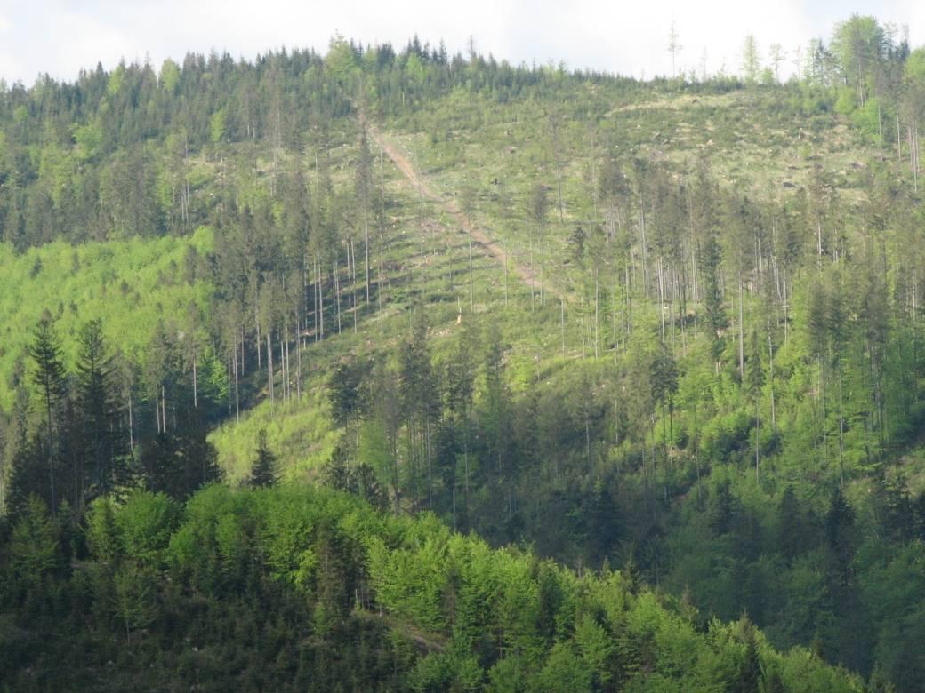
The Brenna monitoring site in the Silesian Beskid (Polish part of the West Carpathians) was established in 1991 and consists of a monitoring station (meteo parameters and air pollution level) at the elevation of 865 m a.s.l. and 7.5 ha and 50 ha catchments at the elevation of 750 m a.s.l under old spruce stand being under reconstruction.The main goals of the monitoring programme is the investigation of: ● Response of spruce stands to air pollution and forest management practice in the mountain area which has been influenced by emissions from the industrial complexes of Silesia and the Czech Republic ● The balance of nutrients in a small mountain catchment. ● Changes in floral characteristics These monitoring activities have been continuing and moreover, the effect of forest management (falling, skidding) on soil (erosion) is monitored. In 2016 the Particulate analyzers (PM10/PM2.5) (The Model 5030 Synchronized Hybrid Ambient Real-time Particulate SHARP Monitor) were installed at the station to measure the inflow of pollutants from industrial regions.Equipment for meteorological measurements is as follows: Barometr LB-716, Thermohigrometer LB-710R, Wind Speed Meter LB-746, Pyranometer PQS1, Thermometer LB-711 (air and soil), Pluviometer RG50A. Additionally, continuous measurements of ozone have been carried out since the nineties (Monitor Thermo Scientific).
-
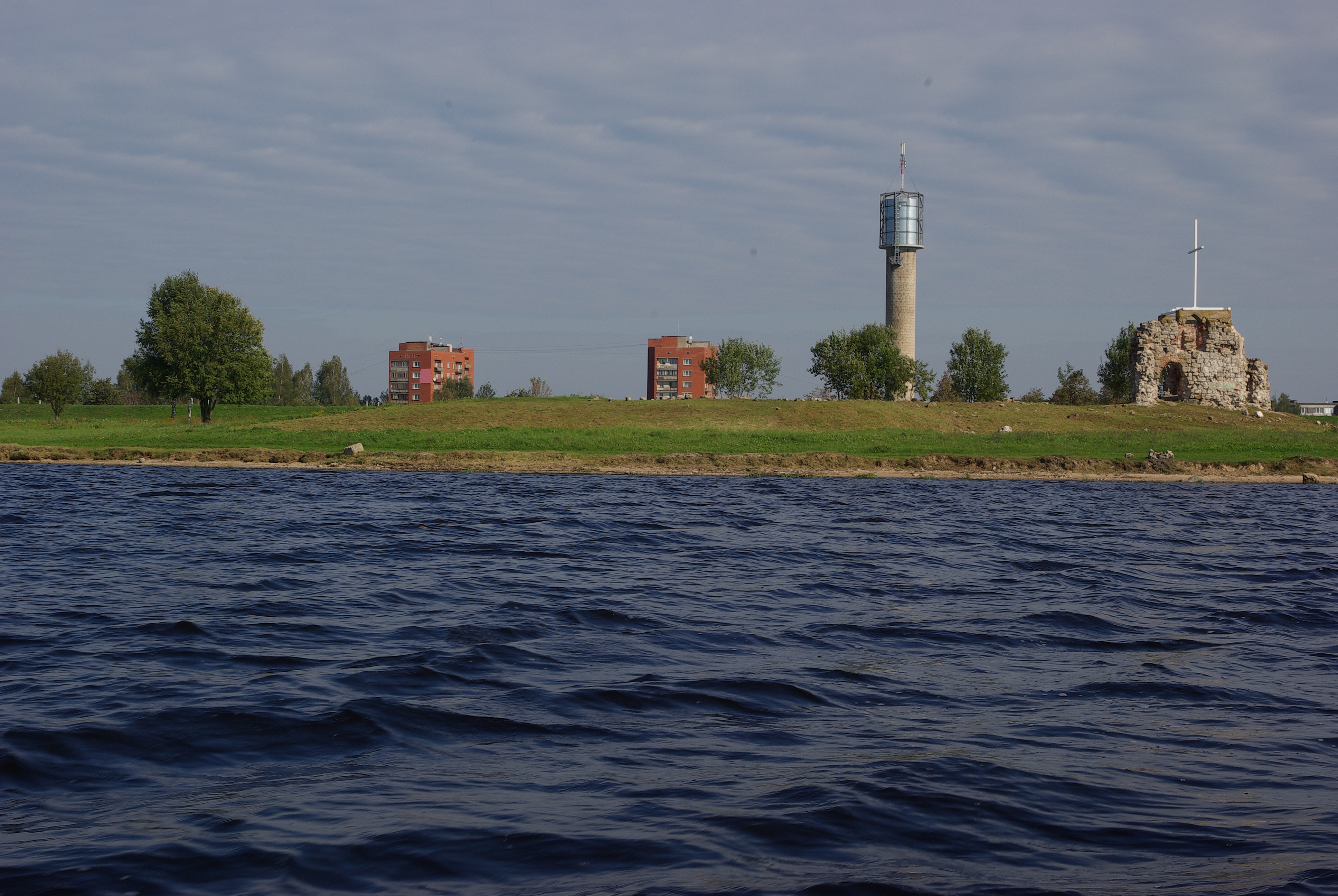
Reservoir of Riga Hydropower station (Riga Hydroelectric Power Plant). The Riga Hydroelectric Power Plant was put into operation in 1974. In order to build Riga HES, a dam was constructed across the Daugava River through the middle of Doles Sala, half of which has since been flooded to make room for Riga Reservoir. Along with Doles Sala, there have been several other smaller islands drowned in order to fill the reservoir. The dam was built in the late 1970s.
-
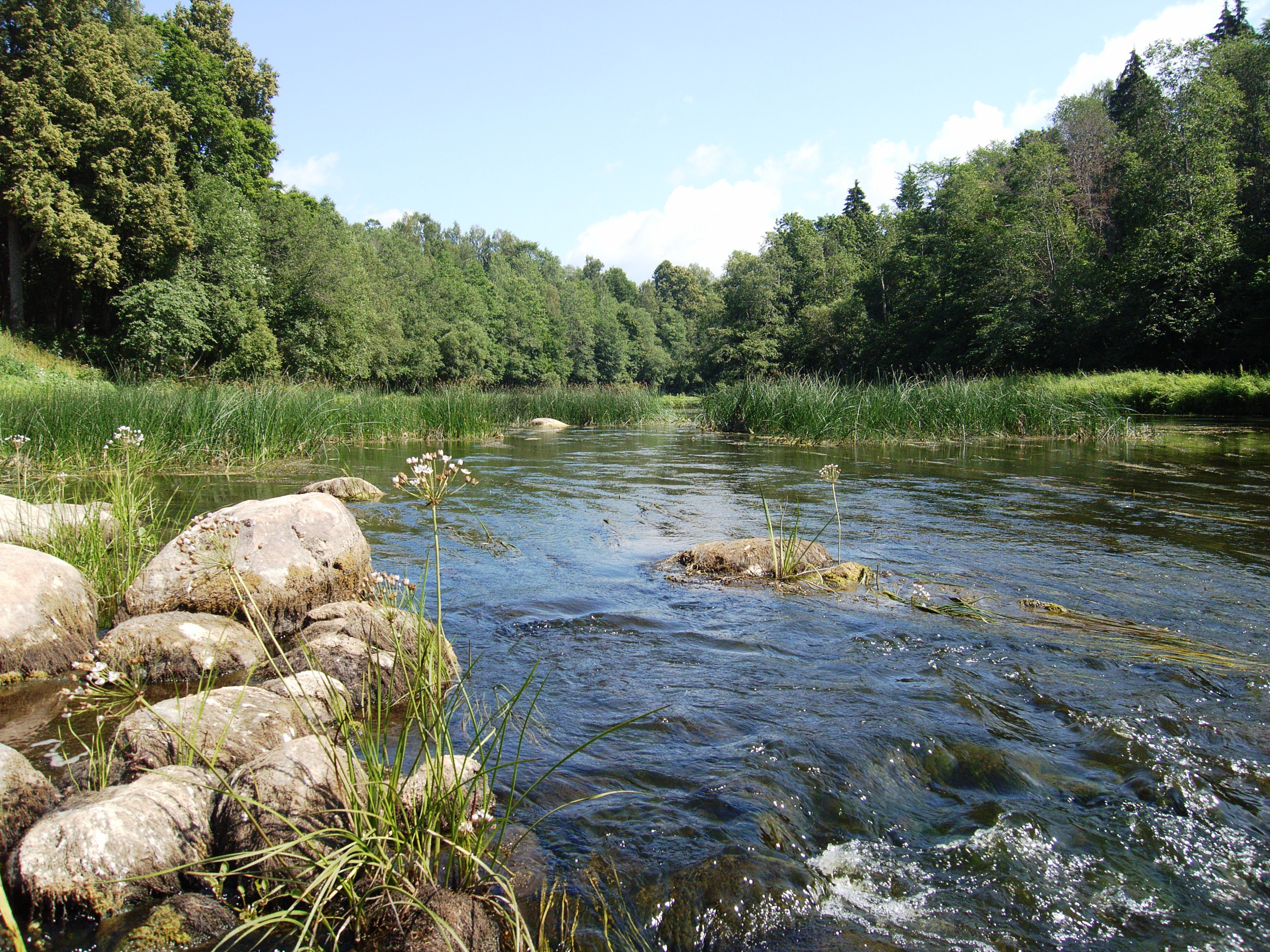
Salaca is a river in northern Latvia, Vidzeme. Salaca is anthropogenically little affected river that is situated in the North Vidzeme Biosphere Reserve, Latvia. n Salaca's drainage basin natural territories are dominating: forests (56,17%), bogs (3,77%) and waterbodies (1,88%). Arable lands are 37,5%, and urban territories 1,88% from the drainage area. It is 90 km long and flows from Lake Burtnieks to the Gulf of Riga. The river flows through three towns, Mazsalaca, Staicele and Salacgrīva. The riverbanks feature Devonian red sandstone cliffs, and many caves and rapids as well. Salaca is internationally recognized river with high biodiversity.It is he most important salmon river in Latvia.
-
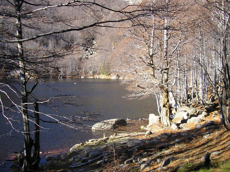
Lake Scuro Parmense is an oligotrophic dimictic lake of glacial origin located in the Tuscan Emilian Apennines National Park at an altitude of 1527 m a.s.l. It has a surface area of 1.2 ha, and maximum depth reaches 10.4 m. The lake often undergoes strong seasonal fluctuations in water level. The period of ice cover usually lasts from November to May. Although naturally fishless, fish has occasionally been released in the lake over the years. A small boat is stationed near the lake for sampling operations. Limnological studies on this lake started in 1986 and continued until nowadays, although with discontinuity. Research topics that have been addressed over the years at the lake include phytoplankton and zooplankton ecology and phenology, predation/competition interactions and energy fluxes through pelagic food web, evolution of trophic state, sensitivity to acidification and climate change.
-
The Słowiński National Park monitoring was established in 1993 and consists of a monitoring station, where the measuring equipment is located, i.e., Wind Speed Meter (Young) pyranometer (LiCo) hygrometers, etc., permanent plots in the 90-year-old spruce and pine stands where bulk deposition, throughfall and soil solution are collected on the monthly basis. The investigations of health status of trees and floral characteristic have been carried out since 1994. The analyses are carried out in a certified laboratory of the Institute for Ecology of Industrial Areas, Katowice (Certificate No AB 325).