
atmosphere stability
Type of resources
Available actions
Topics
Keywords
Contact for the resource
Provided by
Years
Formats
Representation types
-
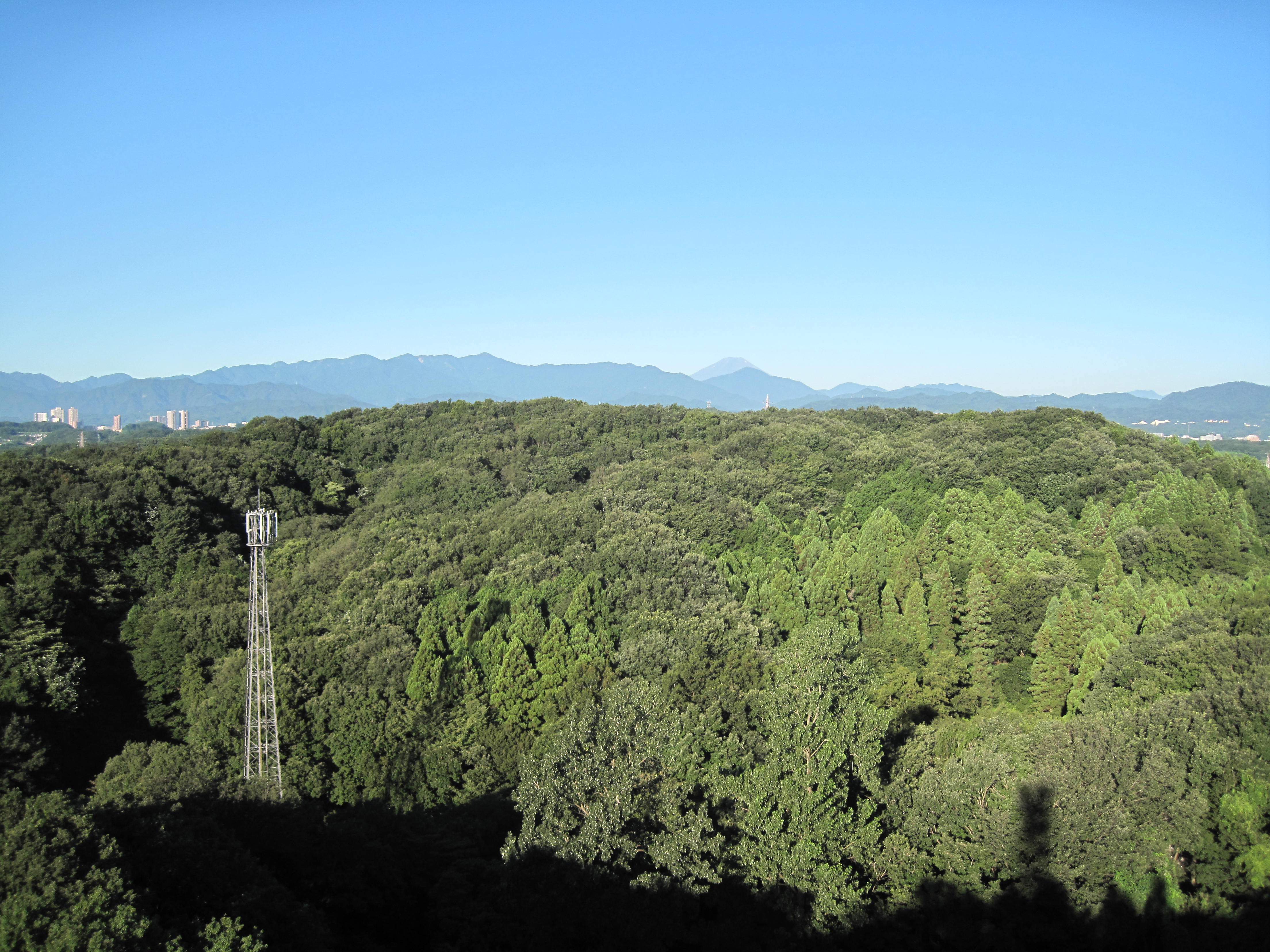
Suburban Tokyo
-
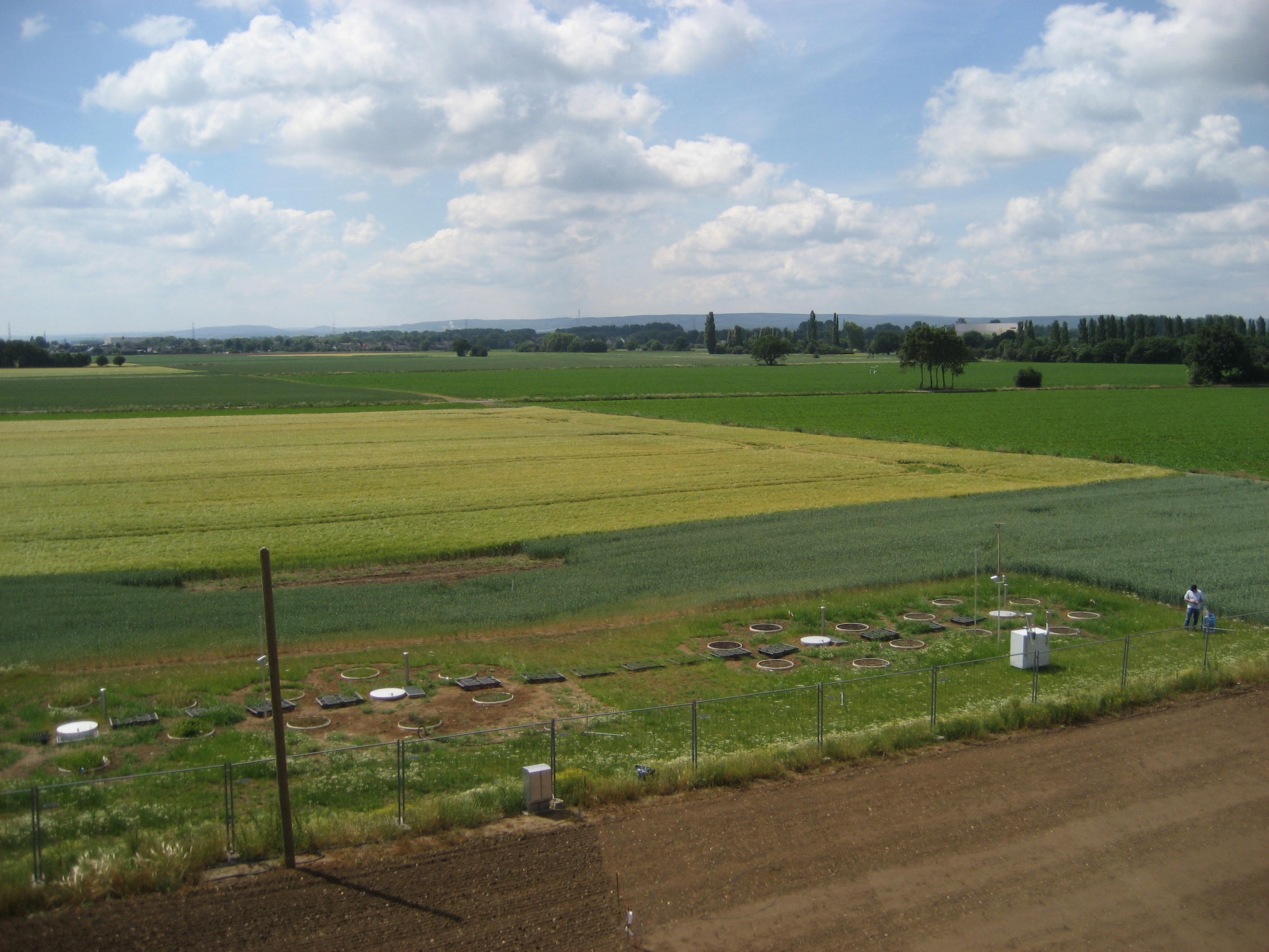
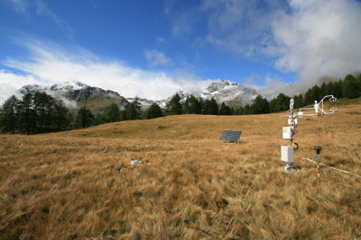
The Selhausen site represents the heterogeneous agricultural rural area of the lower Rhine valley. The climate is temperate maritime with a mean annual temperature of 10°C and annual precipitation of 700 mm for the period from 1961 to 2014 (meteorological tower, Forschungszentrum Jülich). The most important crops in the region of Selhausen are sugar beet (beta vulgaris), winter wheat (triticumavesticum), winter barley (hordeum vulgare), maize (zea mays) and rape seed (brassica napus). Only parts of the region are managed as grasslands. The underlying Quaternary sediments are mostly fluvial deposits covered with loess. Major soil types are luvisols and gleyed cambisols, partly with large contents of gravel. The land surface is generally flat with slopes up to 4° in the area of a former channel of the Rur River system. From 2007 to 2010 a first long-term eddy covariance study was conducted within the Selhausen region (measurements can be found at the European fluxes database cluster, ID: DE-Seh). In spring 2011 a new station (50.865°N, 6.447°E, 203m a.s.l.) was equipped with a CSAT3 sonic anemometer and LI7500 gas analyzer. Besides flux measurements and typical climate parameters (radiation, air temperature, air humidity, soil moisture, soil temperature etc.), also the phenological development of the crops and farming activities were recorded. The station fits now the standards of a Level-1 site for the European project ICOS (Integrated Carbon Observation System). As a pan-European long-term research infrastructure ICOS aims at providing harmonized and high-precision scientific data on carbon cycle and greenhouse gas budget and perturbations.
-
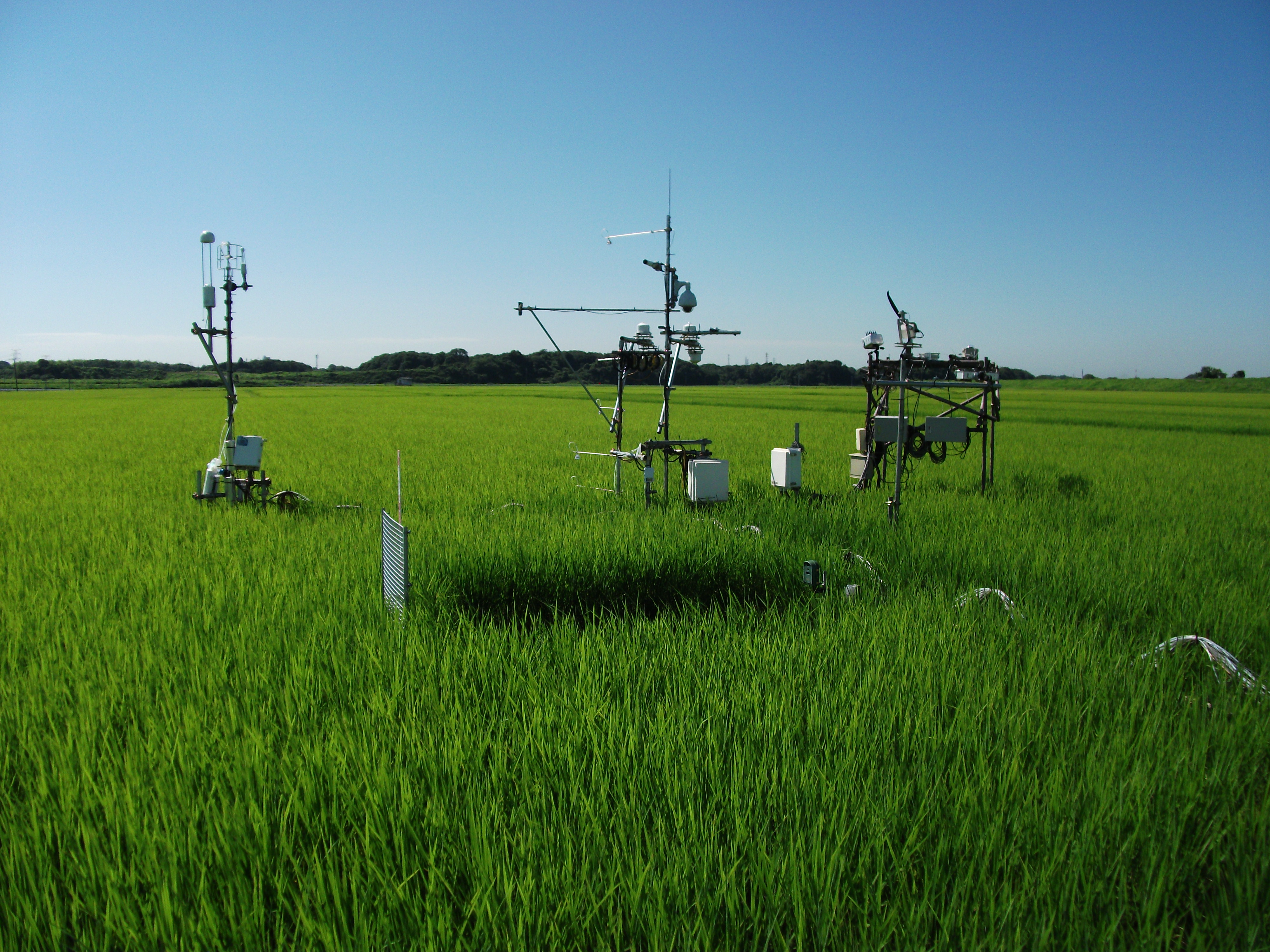
The Mase rice paddy site is a flux station in the AsiaFlux micrometeorological tower network. Located in a regularly cultivated rice paddy area of the Kanto plain in Japan, the site was established in 1999. The initial motivation was to quantify the energy and carbon balance in the rice paddy (ca, 54 a) where the tower was situated. Because of the accessibility and line-power availability, the site has involved many researchers and students from universities and institutes, broadening its target to studies on satellite and field remote sensing, ecosystem modelling, and nutrient cycling.
-
The station has a arid moderate climate, with a annual temperature of 11.2 ℃ but higher in summer and lower in winter relative to areas with the same latitude. Due to dramatic temperature fluctuation in spring and autumn, frozen damage resulted from low temperature in spring and early cooling in autumn often occurs. The annual mean precipitation is as low as 45.7 mm, thus rivers are charged mainly by precipitation in mountains and snowmelt. Frozen-free day, sunshine duration and annual mean wind velocity are, respectively, 207 d, 2940 h and 2.4 m/s. Disaster weather includes dust storm in spring, hail and accidentally continuous high temperature in summer.Aksu station (E80°51′, N40°37′, 1028 m a.s.l.), found in 1982 and affiliated with Xinjiang Institute of Ecology and Geography, was listed in the top-5 stations for irrigation experiment in Xinjiang and became a member of special environment and disaster detection network, CAS in 2002. After development of years, it entered National Field Station Network and Chinese Ecosystem Research Network (CERN) in 2005. The station is located in the source area of Tarim River where its three headstreams (i.e., Aksu, Yeerqiang and Hetian River) converge, and the vastest oasis develops in Tarim Basin under the hyperarid environments. This area is typical of Tarim Basin for dramatic watercourse meandering and great agro-water consumption, thus forming a ideal experimental field for monitoring and researching water, salt and nutrient processes in oasis cropland system, as well as for exploring sustainable oasis agriculture, theory and technologic demonstration of water-saving irrigation.
-
The Słowiński National Park monitoring was established in 1993 and consists of a monitoring station, where the measuring equipment is located, i.e., Wind Speed Meter (Young) pyranometer (LiCo) hygrometers, etc., permanent plots in the 90-year-old spruce and pine stands where bulk deposition, throughfall and soil solution are collected on the monthly basis. The investigations of health status of trees and floral characteristic have been carried out since 1994. The analyses are carried out in a certified laboratory of the Institute for Ecology of Industrial Areas, Katowice (Certificate No AB 325).
-

Tronchaney, Conca di Torgnon, (Torgnon, Aosta), + 388330 + 5075950; Aosta Valley
-
Tellinod, Conca di Torgnon, (Torgnon, Aosta), +389680 +5077920; Valle d'Aosta region
-
Kuršių nerija, the Curonian Spit, is a narrow strip of sand stretching 98 kilometres along the Baltic Sea in western Lithuania. The Curonian Spit is a unique and vulnerable, sandy and wooded cultural landscape on a coastal spit which features small Curonian lagoon settlements. The Spit was formed by the sea, wind and human activity and continues to be shaped by them. Rich with an abundance of unique natural and cultural features, it has retained its social and cultural importance. Local communities adapted to the changes in the natural environment in order to survive. This interaction between humans and nature shaped the Curonian Spit cultural landscape. The history of the Curonian Spit is dramatic: 5,000 years ago, a narrow peninsula (98 km in length and 0.4-3.8 km in width), the Great Dune Ridge separating the Baltic Sea from the Curonian Lagoon, was formed on moraine islands from sand transported by currents, and later covered by forest. After intensive logging in the 17th and 18th centuries, the dunes began moving towards the Curonian Lagoon, burying the oldest settlements. At the turn of the 19th century, it became evident that human habitation would no longer be possible in the area without immediate action. Dune stabilisation work began, and has continued ever since. By the end of the 19th century, a protective dune ridge was formed along the seashore to prevent inland sand migration, and the Great Dune Ridge was reinforced using trees and brushwood hedges. Currently, forests and sands dominate the Curonian Spit. Urbanised areas (eight small settlements) cover just about 6% of the land. One part of the 50 kilometres long Curonian Spit belongs to the Republic of Lithuania. The other to the Russian Federation. With its still drifting sand dunes, the sea side forests cherishing the hundred-years-old pine trees, dunes covered by a mountain pines’ carpet planted by hand, white sand beaches and the old fishermen villages.
-
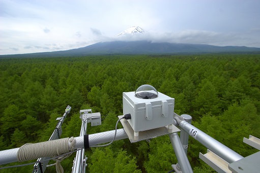
The Fuji Hokuroku Flux Observation Site (FHK) (35° 26'N, 138° 45'E, 1100m above sea level) is located in a mature larch forest of 55-60 years old at the foothills of Mt. Fuji. The micrometeorological, meteorological and biomass measurements were started in 2006. Active studies are now conducted for technological development of various gas flux measurement methods, including other greenhouse gases such as methane. The site is also used for ground measurement to validate satellite remote sensing data, various training programs, and joint investigations with Asian researchers.
-
The site Bily Kriz (Bílý Kříž) is located in Moravian-Silesian Beskids Mountains. Ecosystem type: Managed secondary pure Norway spruce stand. Prevailing species: Norway spruce (Picea abies [L.] Karst.) Height of the stand: 17 m (2016) Understory: Vaccinium myrtillus L. Year of plantation: 1981 by 4 years old seedlings