
atmospheric pressure
Type of resources
Available actions
Topics
Keywords
Contact for the resource
Provided by
Years
Formats
Representation types
-
Daily predictions based on meteorological forecast model - NetCDF.
-
Atmospheric pressure of meteorological Station Rudolfshütte
-
Surface atmospheric pressure data of Blaseneck, Oberkainz, Schröckalm, Kölblwiese, Weidendom and Gscheidegg.
-
The data are for Braila Islands SI000726: Gropeni (2008-2013); Stancuta - Stancuta Meteo Station (2010-2013); Variable list is including: a) biogeochemistry data: NH4N, NO3N, NO2N, NKJ, Ntot, O2D,PO4P, Ptot b) physico-chemical data: COND (water), COND (soil), ALK, pH (water), Temp (water),Temp (soil) c) meteorological parameters: Temp (air), atm, WND, Rad, HH air, PAR - PAR Lite Radiometer um/sm2, NRS - Net Radiometer Short Wave mV, NRL - Net Radiometer Long Wave mV, UVB, UVA, WL - piezometric water level for Stancuta meteo station, HH soil, Temp soil
-
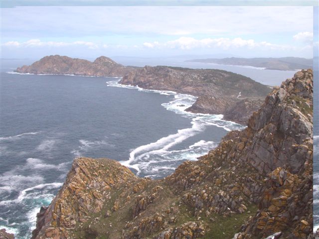
The Atlantic Islands of Galicia were declared a national park in 2002 in order to protect one of the best examples of Atlantic Ocean-associated ecosystems. Although on land there are highly valuable and exceptional ecosystems relating to cliffs, dunes and scrub, it is the marine setting that hosts the greatest biodiversity. Situated off the Rías Baixas (Lower Estuaries), the archipelagos Cíes, Ons, Sálvora and Cortegada, create a natural barrier to the ocean, thereby accentuating the rías’ estuary influence. The terrain features dune systems, cliffs with gorse and heather scrub, while the marine environment hosts a rocky seabed with large communities of brown algae (Sacorhiza polyschides and Laminaria spp.), which are home to a great variety of living things. The marine currents deposit sand in the most sheltered parts, and together with the important Mäerl beds consisting of the remains of calcareous algae, create a shifting substrate to which living things must adapt.
-
It contains monthly weather data. The information has been obtained from meteorological stations located in Sierra Nevada and surroundings
-
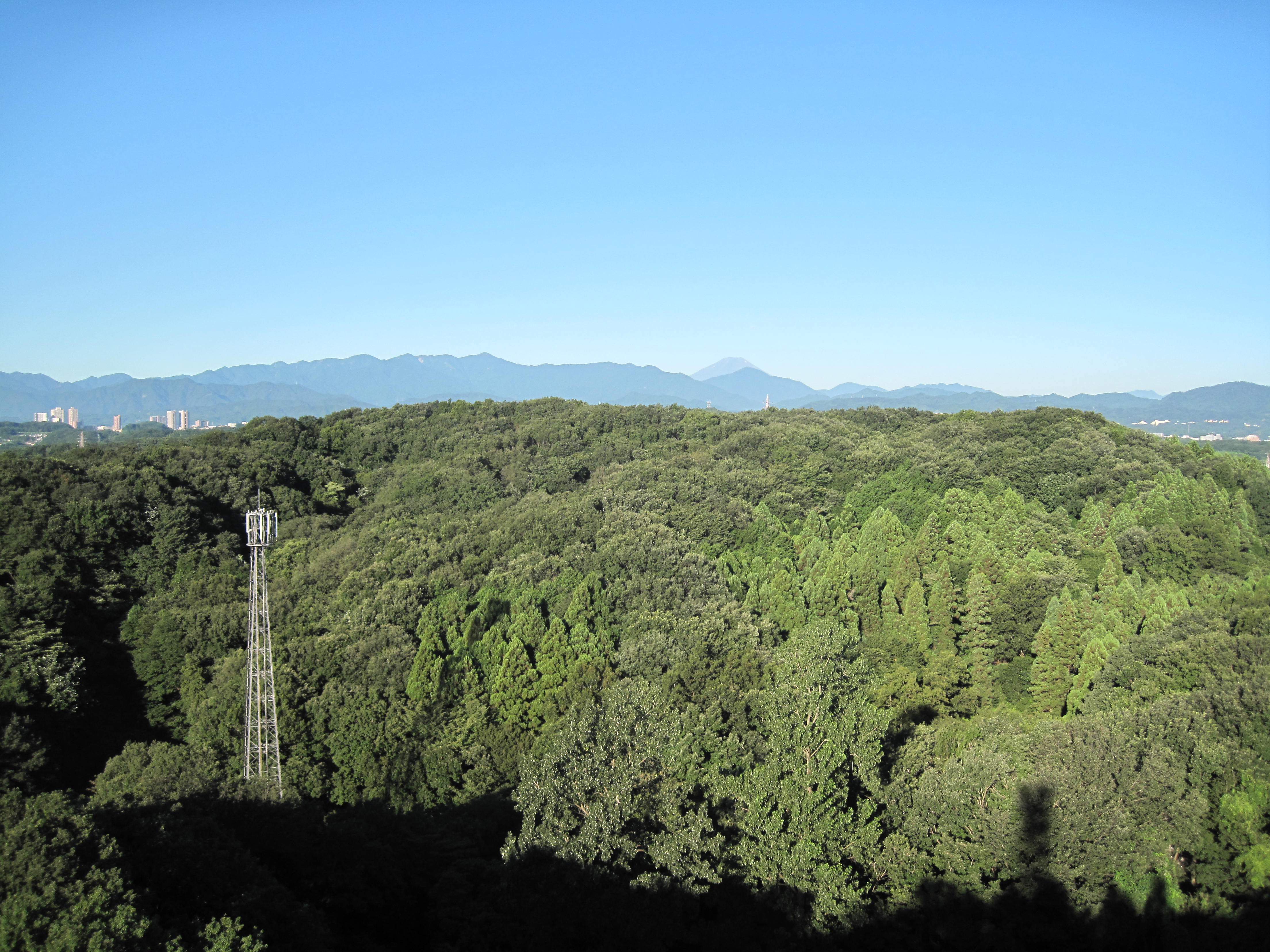
Suburban Tokyo
-
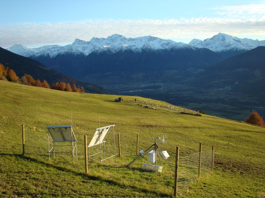
Muntatschinig (Monteschino) is a 25m x 15m grassland site (managed meadow) on 1480m. The site was first established in 2008 as a weather station and is still the most extensive of the four sites. In 2010 the University of Innsbruck installed an eddy covariance station. Nine automatic lysimeters were added to measure evapotranspiration and water use efficiency. Since 2012 a rain-out shelter system has been used for simulating spring and summer droughts. This site is one of the sites along the elevation transect used for grassland transplantation experiments.
-
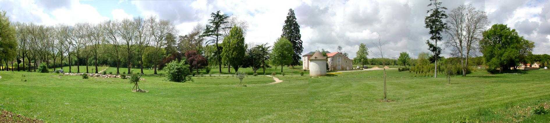
Located 2 km east of the Science Campus of the University of Poitiers, the Hydrogeological Experimental Site (HES) occupies an area of 12 hectares on land belonging to the University. From the geologic viewpoint the SEH occupies the north flank of the “Seuil du Poitou”, a huge Mesozoic carbonate plateau marking the transition between the Aquitaine and Paris sedimentary basins. The studies conducted at the SEH focus mainly on the Dogger Aquifer. The experimental layout now comprises 35 boreholes, including two vertical and two inclined cored holes.
-
The Mediterranean and coastal site of Port-Miou is a wide regional carbonate aquifer, with a catchment area around 400 km², in south of France (Provence, France). It extends mainly over natural land, in the vicinity of one of the main city of France (Marseille), facing recent urban expansion and future groundwater resources management issues. Top of the recharge area culminates at 1100 m asl, and the main outlets are submarine springs. Karst features are observed in surface (polje, intermittent rivers, sinkholes, karren, caves) and underground. Many karst networks have been explored in the unsaturated zone of the aquifer, but also in the saturated zone below the sea level. Karst features and conduits drive the groundwater flows to the main outlets. The Port-Miou submarine springs outflow from huge flooded karst conduits, explored by cave diving over several kilometers inland, and to -235 m deep. Groundwater is brackish, polluted by seawater intrusion. The Port-Miou observation site includes flow rate, salinity and temperature monitoring at the main brackish spring, in an in-situ underground laboratory located 500 m inland from the seashore, directly in the main karst conduit. Rainfall is also recording in the catchment area, and rain water samples are collected for water isotopes observation.