
available phosphorus
Type of resources
Available actions
Topics
Keywords
Contact for the resource
Provided by
Years
Formats
Representation types
-
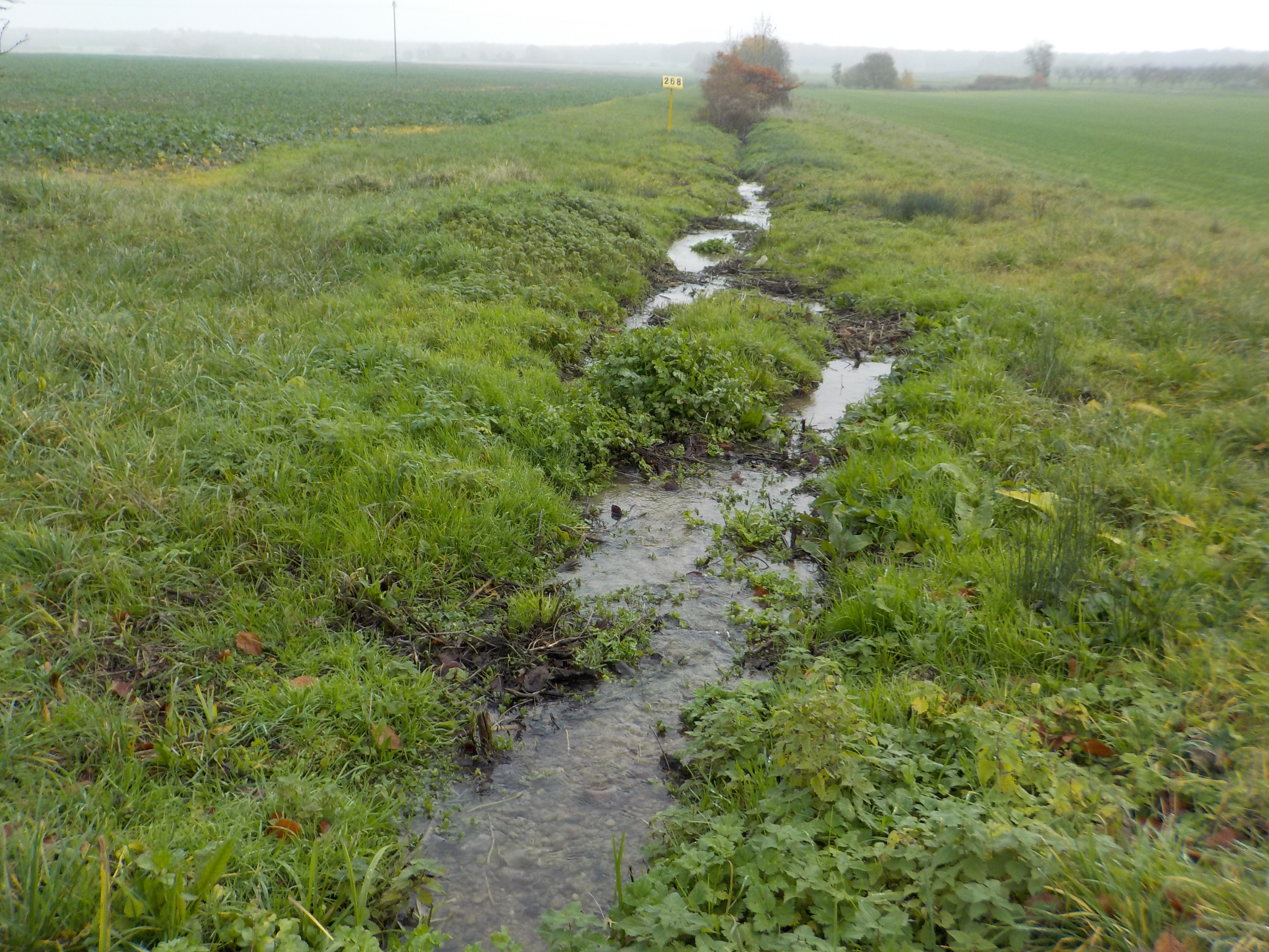
The state forest of La Reine is a humid forest of about 5000 ha located in the south of the plain of Woëvre and at the foot of the Meuse hills in France. Numerous ponds and puddles are scattered throughout the forest and it is crossed by many small, more or less natural streams. Upstream of the forest, these waterways are impacted by human activities (large-scale farming, housing without collective sanitation in particular). Since 2019, the Moselle Basin Workshop Zone has been working on the implementation of a workshop site to understand the bio-hydrogeological functioning of three of these streams, particularly in terms of natural purification. Sampling campaigns are regularly organized in the streams and in ponds.
-
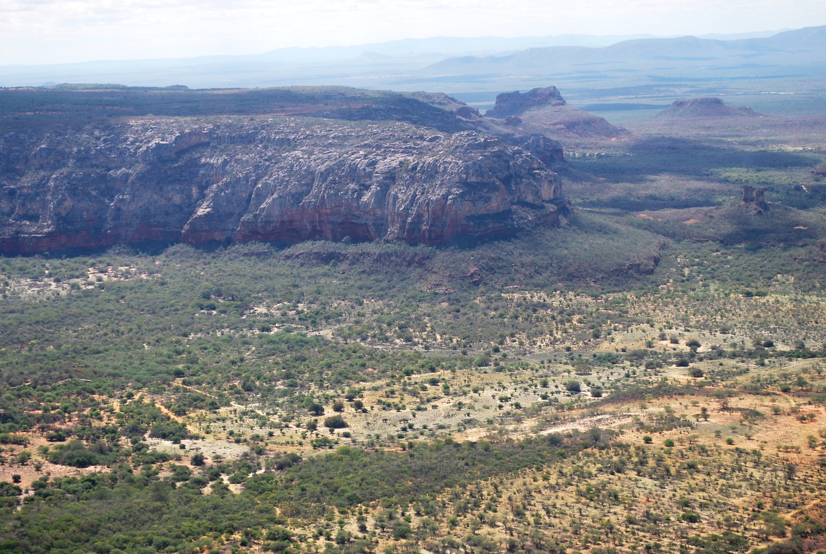
The present proposal aims to assess how human disturbance and changes in rainfall regime affect the Caatinga ecosystem’s biota at different levels of biological organization (i.e, from populations to ecosystem level), by correlating these aspects with the theoretical reference shown in macro trends already documented in the tropics. The project will be developed in Catimbau National Park, a polygon of approximately 63,000 ha, and one of the most important protected areas in the Caatinga. The Park presents vocation for ecological studies of long-term and thus to become an LTER site due to a series of reasons: (1) it has a biological, archaeological and landscape heritage of inestimable value, (2) it shelters areas with different historical land use and anthropic disturbance on the vegetation of Caatinga, (3) there are already in place several research initiatives and training of human resources, and (4) in term of unit management aspects, logistics and infrastructure are favorable for long-term initiatives. Furthermore, the implementation and achievement of this project’s objectives are centered on: (1) establishment of a set of 30 permanent plots, (2) periodic multi-taxa inventories, (3) continuous monitoring of environmental and anthropogenic variables (4) consolidation of biological, land usage and environmental data on the basis of GIS type and (5) dissemination / transfer of information through a wide range of instruments.This proposal will be implemented by a network composed of 23 researchers supported by a number of undergraduate / graduate students, all from six national institutions and three other overseas. The main core of the graduate programs are Plant Biology, Biology Animal and Fungal Biology, all at the Federal University of Pernambuco (UFPE). In summary, the "LTER Catimbau National Park" is an important proposal and has the ability to expand knowledge about how dry biota respond to land use changes and precipitation, with all the implications that these answers may have for the management of biodiversity and the achievement of sustainable development in semi-arid regions.
-
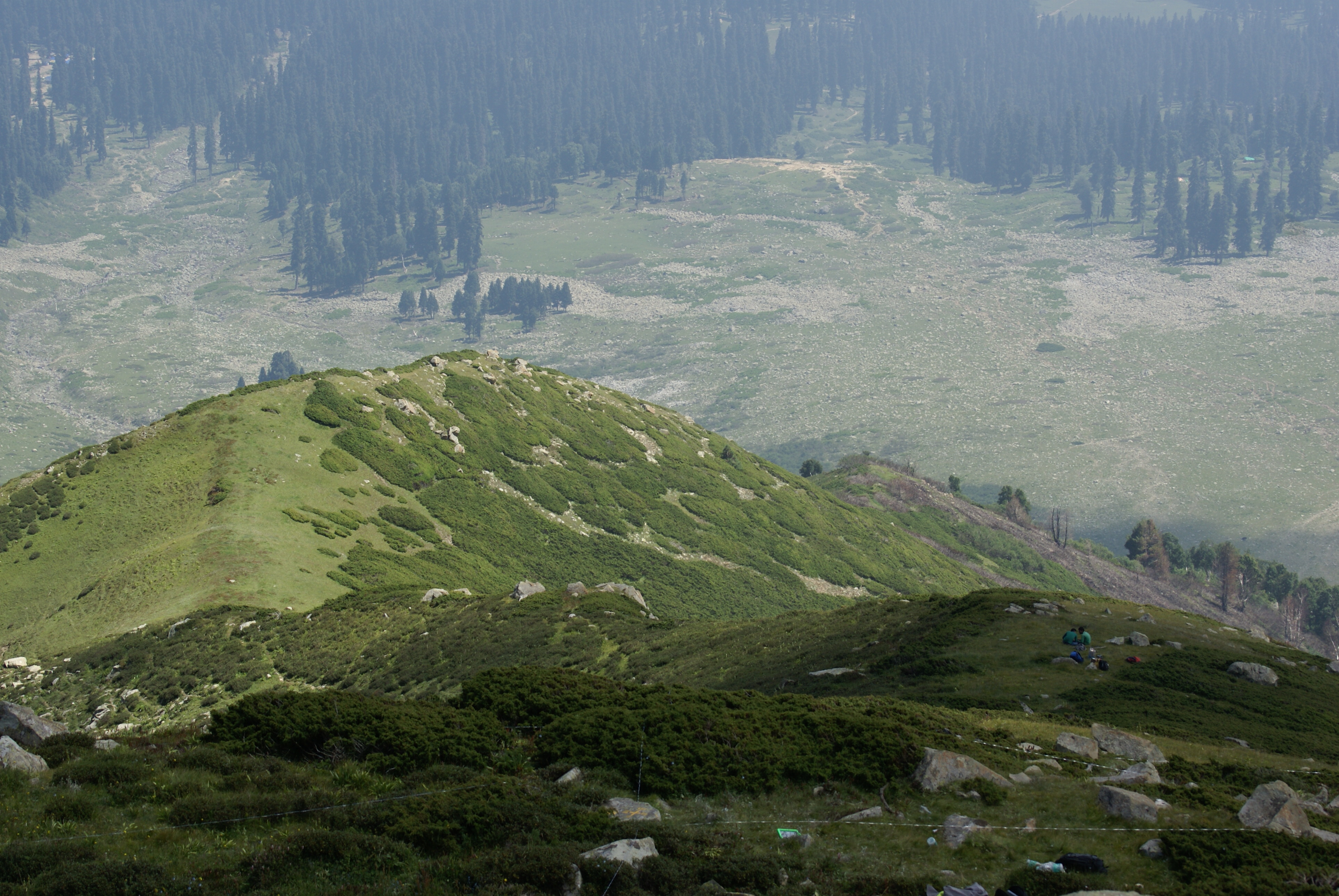
Dynamics of alpine tree line has been reported from several mountain ranges in Europe, in North America, New Zealand as well as in the Alps (Grabherr et al. 1994). This led to the formation of the GLORIA (Global Observation Research Initiative in Alpine Environments) project, dedicated to initiate a global indicator network towards research on the effects of climate change through an international co-operation. Indian part of Himalaya was not having any site towards this mission till 2013. Therefore, based on some Indian studies which also indicated this trend in more pronounced manner, the need of having Indian network was felt. It was in this context as a part of network project across the Indian Himalayan states under the banner of HIMADRI (Himalayan Alpine Dynamics Research Initiative) a long-term monitoring site was established in Kashmir Himalaya at Gulmarg, a famous hill resort. This particular work plan (TeaComposition initiative) is conducted at this selected HIMADRI site. Gulmarg lies on the north east side of the Pir Panjal Range and is about 60 kms west of Srinagar city. It encompasses the upper catchment area of Ferozpur Nullah and the forests that surround the Gulmarg meadow. The vegetation in Gulmarg mainly comprises of coniferous temperate mountain forests of Blue Pine (Pinus Wallichiana), sub-alpine forests of Silver Fir (Abies pindrow) and Himalayan Birch (Betula utilis), followed by alpine scrub and meadows.
-
Hailun Agricultural Ecological Station located in Hailun city, Heilongjiang province, was established in 1978, briefly named Hailun Agro-ecosystem Station. The main research fields at that time were the optimal management of agriculture and advanced technology utilization in agricultural production. Chinese ecosystem research network(CERN) established in 1988 selected Hailun station as one of its components. The objective of Hailun station was to study the agro-ecosystem and sustainable development of agriculture in black soil zone in Northease China. Also, Hailun station was considered as one of components, when national field research net was built in 2005.
-
Děvín is a considerable site of forest and non-forest ecosystems of the warmest part of the Czech Republic. Due to heterogeneous geomorphology, it comprises a range of habitat conditions and vegetation types. Forests cover about 3/4 of the area and they are formed mainly by oak-hornbeam wood, thermophilous oak wood, and ravine wood. The forests of Děvín were strictly managed as a coppice in the past. The oldest records are available from the late 14th century. The cutting period was as short as 7 years in the Middle Age and then gradually increased to 15–25 years during the 17th–19th centuries. A reason of the coppice management was the need of firewood. This probably led to a dominance of the large-leaved lime (Tilia platyphyllos), which stands regular cutting and quickly re-sprouts. The traditional management was abandoned in the 20th century, a nature reserve was declared in 1946, and later even a game preserve was established; the latter, however, was cancelled in the 1990s. The forest has been gradually transformed to a high forest and its age has increased to the today’s average of 70, sometimes over 120 years. The dramatic change in the management has caused a large change in ecological conditions. Light woods, hosting many species occurring in light- and warm-demanding conditions, have shifted to mesic, i.e. moister and nutrient-richer forests than ever before. A marked decrease in diversity in forest understorey has been a consequence. This trend was revealed by a comparison of nearly 200 vegetation plots from 1953–1964 with their 2002–2003 replicates, i.e. after 40 to 50 years. A similar comparison is available for soils with 34 repeated pedological profiles. The aim of the present management is to restore coppices with partial preservation of some stands in a non-intervention regime. A set of 80 permanent plots has been established in 2008 in order to monitor the consequent environmental and vegetation changes, as well as diversity of invertebrates, with a monitoring period of 5–10 years.
-
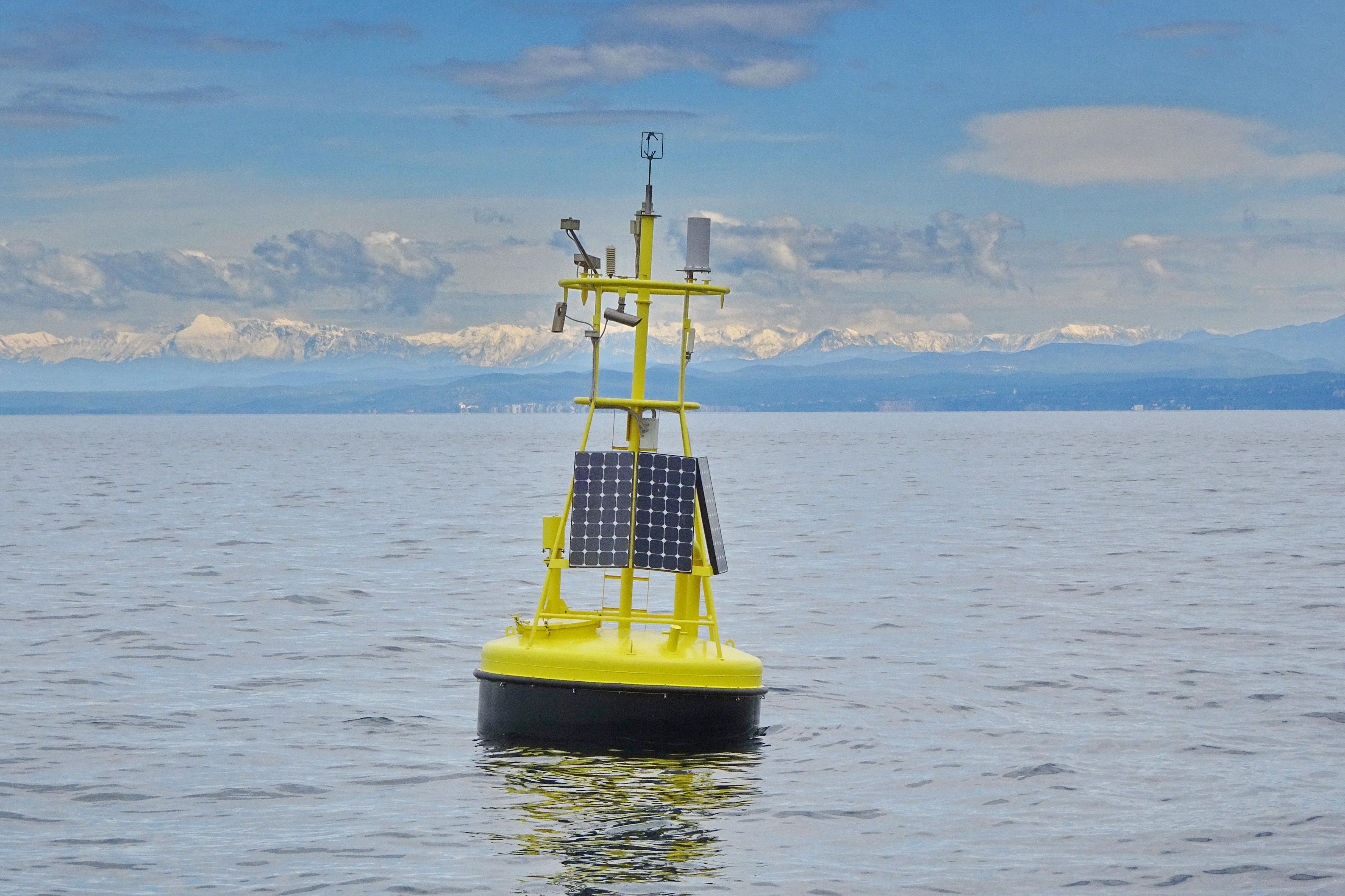
The separation line of the semi-enclosed northern basin from the rest of the Adriatic Sea is conventionally defined at the 100 m isobath, at about 43°20’N, from where the bottom depth moderately decreases up to the northern coast reaching the smallest average depth in the northernmost protrusion of the basin, the Gulf of Trieste (surface area 600 km2, volume 9.5 km3, maximal depth approx. 25 m). The oceanographic properties of Gulf of Trieste are affected by water mass exchange with the northern Adriatic at the open western boundary, by local meteorological conditions that induce a pronounced seasonal cycle of seawater temperature (6 - 28 oC) and by the largest freshwater input, the Soča (Isonzo) River. The latter enters the Gulf on the shallower northern coastline with an average flow of 123 m3 s-1 and represents the major source of land-borne nutrients in this coastal zone, in particular of nitrate, whereas inputs along the south-eastern coast are comparatively small (contributing less than 10% to the freshwater balance in the Gulf). The circulation pattern is variable, however the prevailing ENE wind is the most efficient for the water exchange, especially during winter. These physical features, in addition to freshwater inputs, are ultimately reflected in the distribution of nutrients and in the seasonal and inter-annual variability of plankton communities, primary production but also in events of hypoxia/anoxia and mucous macroaggregates, which have characterised the whole northern Adriatic basin in the recent past. The waters of the Gulf of Trieste have been monitored for several physical-chemical and biological variables since 70s’ but the longest and most continuous data set of biological variables is represented by the phytoplankton time series, which started in 1990 when the national monitoring programme has become operational (set by Slovenian Environmental Agency). From 2007 onwards, the monitoring programme complies with the regulations of the EU Water Framework Directive (2000/60/EC).
-
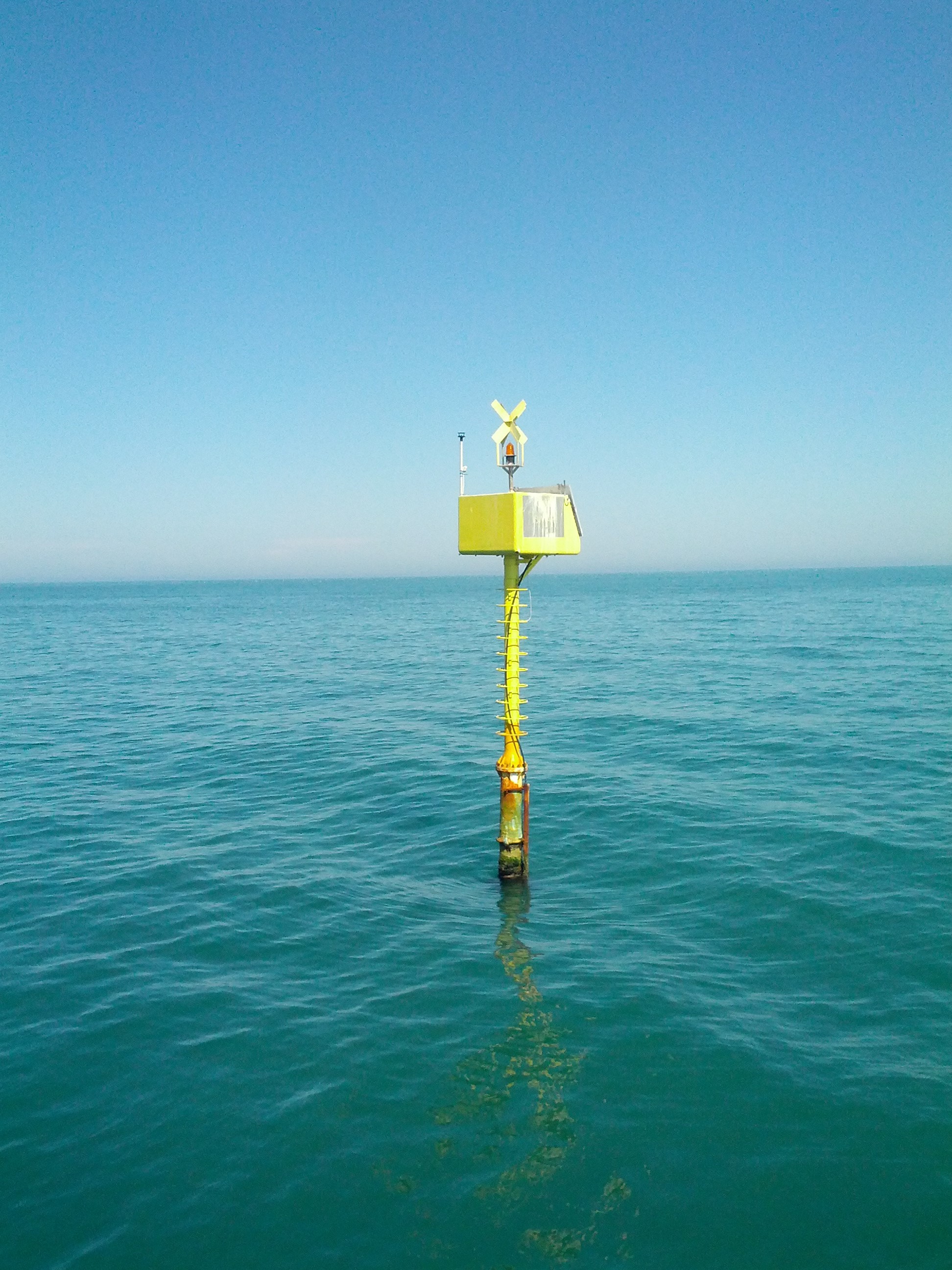
The Transetto Senigallia-Susak is a transect of sampling stations located in the Northern Adriatic Sea. The IRBIM-CNR in Ancona and the Politechnical University of Marche collects from the end of years 80s physical, chemical and biological data. This is an excellent observing site to analyze the characteristics of water masses entering and leaving the North Adriatic Sea and their possible modification. In the site is also located the TeleSenigallia pylon.
-
The Rutzendorf Experimental Station is an agricultural research site of the University of Natural Resources and Live Sciences Vienna (BOKU), belonging to the Landwirtschaftliche Versuchswirtschaften GmbH. It is representative for the productive soils managed as arable land in the Marchfeld area (Lower Austria). The soil is described as a silty loamy Calcaric Phaeozem (WRB), a Chernozem according to Austrian soil classification. Management on the farm is without livestock, no organic fertilizers are applied. The farm was converted to organic farming in the production year 2002/03. The 8-year crop rotation comprises luzerne (2 yrs), winter wheat*, grain maize, spring barley*, field peas*, winter wheat, winter rye. Cover crop mixtures are grown where indicated in the crop rotation with an asteric. Current research questions include to study (i) the long-term sustainability and productivity of the stockless organic arable system compared to a livestock-keeping system, (ii) the mitigation of climate change effects on the soil-plant system by reducing soil cultivation intensity, and (iii) the development of biodiversity following the conversion to organic farming and enhancement of landscape elements. Regularly meteorological data, crop yields and quality, physical, chemical and biological soil traits, weed species and diaspores, springtails, wild bees and other animal species are assessed. Studies have been conducted as research projects financed nationally and by the European Union, e.g. in two EIP projects.
-
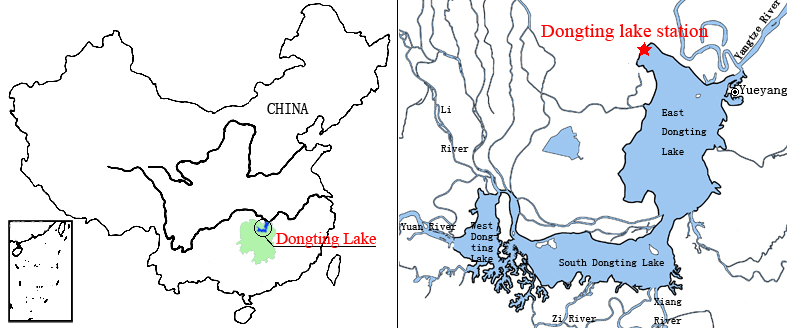
Dongting Lake Station (29º30'N, 112º48'E) located in East Dongting Lake in Yueyang City, Hunan Province. The station has good geographical advantage, convenient transportation, for about 180 kilometers from Changsha, the capital of Hunan Province. Dongting Lake located in the northeast of Hunan Province, the south shore of Jing River (in the middle of the Yangtze River) is the second largest freshwater lake of China.
-
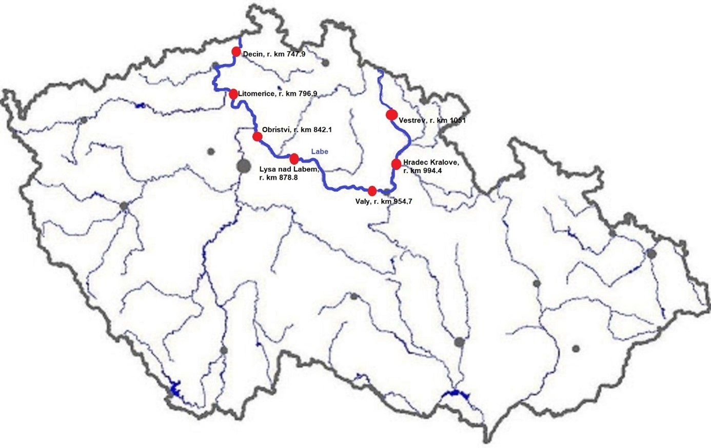
The Elbe River is one of the major rivers in Central Europe. It springs at an altitude of about 1,400 meters in the Giant Mountains in the north of the Czech Republic. It flows through eastern, middle, and northern Bohemia, and its catchment area includes most of Bohemia. The Elbe traverses the northeastern part of Germany and flows into the North Sea. The total river length is 1,094 km. In the Czech Republic, the monitored river length is 371 km and the catchment area includes 49,933 km2. The average flow at the Czech-German borders is 311 m3 s-1. Many weirs dam the watercourse of Elbe River in the Czech Republic. This artificial intervention is crucial for the characteristics of the riverbed, its width, depth, and bottom substrate. The width of the riverbed in the monitored area ranges from approx. 10 m on the upper course to approx. 150 m on the lower course and river sections above the weirs. The depth of the river varies from 0.5 m in the upper parts and below the weirs to more than 5 m in the lower course and above the weirs. The bottom substrate varies from the stony, gravelly, and sandy fractions in shallow and fast-running sections to muddy/silty fractions in slow-running sections above the weirs. The main tributaries of the Elbe in Bohemia are Metuje, Orlice, Jizera, Ploučnice, Vltava, Ohře and Bílina rivers. The catchment area is densely populated. The river is exposed to various sources of pollution (organic, agricultural, and industrial) and hydromorphological pressures (straightening, shortening, regulation of meanders, and fragmentation of river continuity). There are seven permanent monitoring sites on the Elbe River in the Czech Republic: Děčín (river kilometer 747.9), Litoměřice (796.9), Obříství (842.1), Lysá nad Labem (878.8), Valy (954.7), Hradec Králové (994.4) and Vestřev (1051). The Elbe basin long term environmental research has been organised by the Ministry of Environment of the Czech Republic and cooperation institutions since 1993. More than 600 physicochemical parameters, including sensory properties of water, are regularly monitored in at least nine different types of matrices (water, sediment, periphyton, floats, sedimentable floats, benthos, fish tissues, fish fry, and Dreissena polymorpha tissue) and using passive samplers. Among the main monitored characteristics belong balances of macroelements (carbon, nitrogen, oxygen, phosphorus), concentrations of inorganic salts, heavy metals and various organic pollutants such as pesticides, personal care products (including drugs) and other anthropogenic substances in the environment. Characteristics such as abundance and species composition are regularly monitored in fish, macrophytes, macrozoobenthos, phytobenthos and plankton.