
bacillariophyceae species richness
Type of resources
Available actions
Topics
Keywords
Contact for the resource
Provided by
Years
Formats
Representation types
-
Helgoland Roads summary The Helgoland Roads time-series, located at the island of Helgoland in the German Bight, approximately 60 km off the German mainland (54°11'N 7°54'E), is one of the richest temporal marine datasets available. The time-series was initiated in 1962 at the Helgoland Roads site, which is located between the main island of Helgoland and a small sandy outcrop, the so-called 'dune'. The location near Helgoland is of particular interest because the site is essentially in a transitional zone between coastal and oceanic conditions, which is seen most clearly in the salinity patterns at Helgoland Roads. Initially, the sampling frequency was thrice weekly, but this was increased to daily in the early 1970s. Since then, the high sampling frequency has provided a unique opportunity to study long-term trends in abiotic and biotic parameters, but also ecological phenomena, such as seasonal interactions between different foodweb components, niche properties, and the dynamics and timing of the spring bloom (Grüner et al. 2011; Mieruch et al. 2010; Tian et al. 2008; Wiltshire et al. 2015; Wiltshire et al. 2010). The measured parameters comprise phytoplankton, temperature, salinity, and nutrient analyses. Inorganic nutrients. The taxon list now contains over 350 entities (with 230 distinct species). Both the phytoplankton and chemical dataseries are fully quality-controlled, based on original data sheets and metadata (Wiltshire and Dürselen, 2004; Raabe and Wiltshire, 2009). The phytoplankton time-series is augmented by the biological parameters zooplankton, rocky shore macroalgae, macro-zoobenthos, and bacteria, providing a unique opportunity to investigate longterm changes at an ecosystem scale. Some historic data sets are also available and have been archived in the online repository Pangaea, alongside all core phytoplankton and environmental data sets for Helgoland Roads (Kraberg et al. 2015). Analyses by Wiltshire et al. (2010) have demonstrated the statistical significance of these changes, with temperature since 1962 amounting to 1.7°C (Wiltshire et al., 2010). In tandem with the increases in temperature and salinity, nutrient dynamics at Helgoland Roads have also changed considerably, with phosphate concentrations having declined significantly since 1962. Long-term trends are also seen in the biota, with Diatoms in particular having exhibited an increase in abundance, with a concomitant increase in positive trend for total Dinoflagellates (see also (Wiltshire et al. 2008)). This was not a gradual change, but a rapid shift from negative to positive anomalies around 1998. The exact causes for this are still under investigation. Breaking this down to monthly trends, the swing seems to be largely driven by shifts in autumn and winter. There was also a significant shift in seasonal densities of individual Diatom species (Guinardia delicatula, Paralia sulcata) and in the numbers of large Diatoms (e.g. Cocinodiscus wailesii), which are difficult for copepods to graze. The large Diatom Mediopyxis helysia has recently been observed for the first time and now occurs almost throughout the year, with an intensive bloom in spring 2010 (Kraberg et al. 2012). Generally speaking, the spring Diatom bloom now appears to start later, if the preceding autumn was very warm (Wiltshire and Manly, 2004). It is worth noting that species introductions are also occurring in the zooplankton, with the ctenophore Mnemiopsis leidyi being the most obvious new species (Boersma et al. 2007). References Boersma M, Malzahn AM, Greve W, Javidpour J (2007) The first occurrence of the ctenophore Mnemiopsis leidyi in the North Sea Helgoland Marine Research Grüner N, Gebühr C, Boersma M, Feudel U, Wiltshire KH, Freund JA (2011) Reconstructin g the realized niche of phytopankton species from environmental data: fitness versus abundance approach Limnology and Oceanography methods 9:432-442 Kraberg A, Carstens K, Tilly K, Wiltshire KH (2012) The diatom Mediopyxis helysia at Helgoland Roads: a success story? Helgoland Marine Research 66:463-468 Kraberg AC, Rodriguez N, Salewski CR (2015) Historical phytoplankton data from Helgoland Roads: Can they be linked to modern time series data? Journal of Sea Research 101:51-58 Mieruch S, Freund JA, Feudel U, Boersma M, Janisch S, Wiltshire KH (2010) A new method for describing phytoplankton blooms: Examples from Helgoland Journal of Marine Systems 79:36-43 Tian Y, Kidokoro H, Watanabe T, Iguchi N (2008) The late 1980s regime shift in the ecosystem of Tsushima warm current in the Japan/ East Sea: Evidence from historical data and possible mechanisms Progress in Oceanography 77:127-145 Wiltshire KH, Boersma M, Carstens K, Kraberg AC, Peters S, Scharfe M (2015) Control of phytoplankton in a shelf sea: Determination of the main drivers based on the Helgoland Roads Time Series Journal of Sea Research 105:42-52 Wiltshire KH et al. (2010) Helgoland Roads: 45 years of change in the North Sea Estuaries and Coasts DOI 10.1007/s12237-009-9228-y Wiltshire KH et al. (2008) Resilience of North Sea phytoplankton spring bloom dynamics: An analysis of long-term data at Helgoland Roads Limnology and Oceanography 53:1294-1302
-
The Gulf of Olbia is situated on the eastern coast of Sardinia. Morphologically, it is a typical ria, long 5 km, wide 2 km and with a total area of 600 ha, a mean depth of 5 m and a maximum depth of 10 m. The gulf receives a freshwater flow from the Padrongianus River in its southern part. The town of Olbia, located in the inner part of the Gulf, is one of the most important passenger harbors in the Mediterranean (about 4 million passengers per year) with in addition a commercial and an industrial harbor. It is also the largest mussel- and clam-farming area in Sardinia (5000 t yr−1). Mussel and clam farming is strongly affected by the presence of toxic algae. Since the early 1990s, the Gulf of Olbia has been monitored with respect to its trophic state and phytoplankton abundance and composition, in particular, the presence of toxic or harmful species of genus Alexandrium (Dinophyceae). However, the first data were collected in 1987, in connection with a discoloration event due to phytoplankton and with an extensive fish death. A long-term series of data is available and derives from high-frequency measurements and samplings to assess environmental and biological parameters. In particular the data concern the main trophic descriptors (Secchi depth, temperature, pH, conductivity, dissolved oxygen and saturation, alkalinity, NH4-N, NO2-N, NO3-N, total nitrogen, soluble reactive phosphorus, total phosphorus, dissolved silica) and phytoplankton abundances, as chlorophyll a, cell densities and biomass, class and species composition. Data collection started in 1992 for only phytoplankton data, then, other environmental variables are added in 1996, with some time gaps of various sizes up to 2008. The collection of only phytoplankton data has continued without interruption since 2008.
-
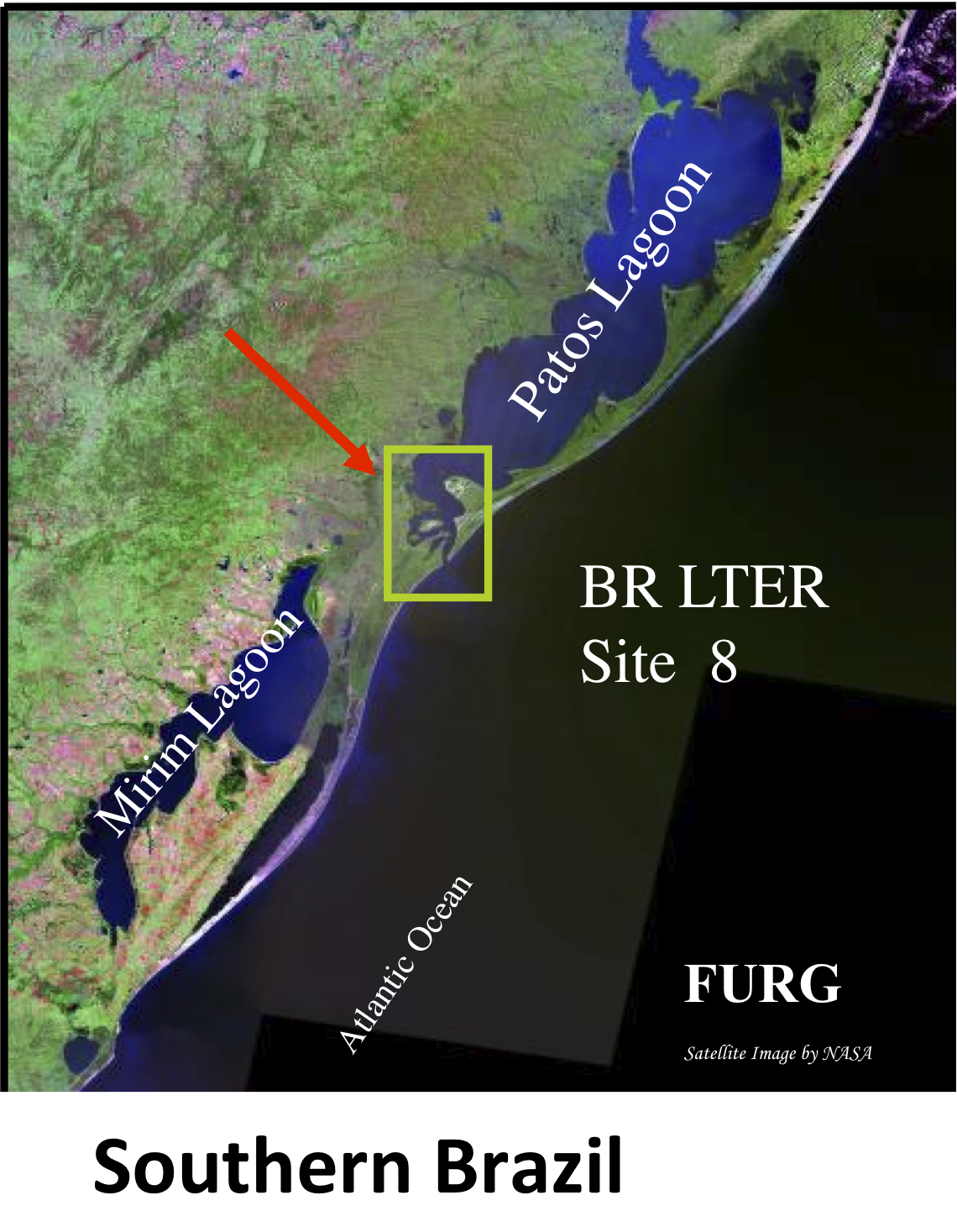
Patos Lagoon is the largest (1,036,000 ha) choked lagoon in the world, extending from the city of Porto Alegre (30º30’ S) to Rio Grande (32º12’ S) in southern Brazil, at the Atlantic coast of South America. In the southern reaches, the Patos Lagoon Estuary and Adjacent Coast (PLEA) present high biological productivity and at the same time provide significant ecosystem services including artisanal and industrial fisheries, an industrial conglomerate and is home to an important maritime port. The hydrology and biology of the ecosystem has been studied since the nineteenth century and the site has been included in the framework of the Brazilian Long Term Ecological Research in 1998. Systematic analysis has been conducted of abiotic and biotic information unraveling the functioning of the ecosystem and their organisms from phytoplankton to marine mammals. Climatic events and human activities both affect the ecology of the highly dynamic PLEA. This shallow warm temperate estuary is river dominated, and freshwater discharge peaks are strongly associated with El Niño Southern Oscillation - ENSO episodes. Rainfall increases significantly during El Niño periods, while low discharge occurs during La Niña when drought conditions are observed. These phenomena influence salinity, physico-chemical water characteristics and sediment dynamics in the estuary, which in turn influence the biota. Long-term continuous studies (more than 25 years) have demonstrated that significant changes of phytoplankton, zooplankton, macrobenthic fauna and flora, crustaceans, fish and marine mammals in these coastal ecosystems are induced by natural impacts and human-related factors. Moreover, freshwater water discharge to the Atlantic Ocean has an overriding influence on ecological processes in the adjacent coastal region and vice-versa fishing activities on the coastal region influence the ecology of the estuary. These conclusions were only possible due to long-term continuous studies conducted in the Patos Lagoon estuary and adjacent coastal region, making this dataset the most comprehensive in South America.
-
The Asinara Gulf covers approximately 500 km2 and is the second largest bay in Sardinia. The Gulf is limited by Asinara Island (National Park) in the west side and by Castelsardo town in the east side. The average depth of the gulf is approximately 35-40 m and only 35% of the gulf bottom has a depth exceeding 50 m. The predominant winds are from the I and IV quadrant. The marine area of the gulf has been affected since the ‘70s by different human impacts, especially by those connected to the industrial centre of Porto Torres. The main urban centre along the gulf coast is Porto Torres, with an important industrial, commercial and passenger harbour. A long-term series of data is available since 1997 and derives from high-frequency measurements and samplings to assess environmental and biological parameters. In particular the data concern the main trophic descriptors (Secchi depth, temperature, pH, conductivity, dissolved oxygen and saturation, alkalinity, NH4-N, NO2-N, NO3-N, total nitrogen, soluble reactive phosphorus, total phosphorus, dissolved silica) and phytoplankton abundances, as chlorophyll a, cell densities and biomass, class and species composition. Data collection started in 1997 and continued, with few gaps of various sizes of time, up to 2007. The data collection resumed in 2007 only seasonally.
-
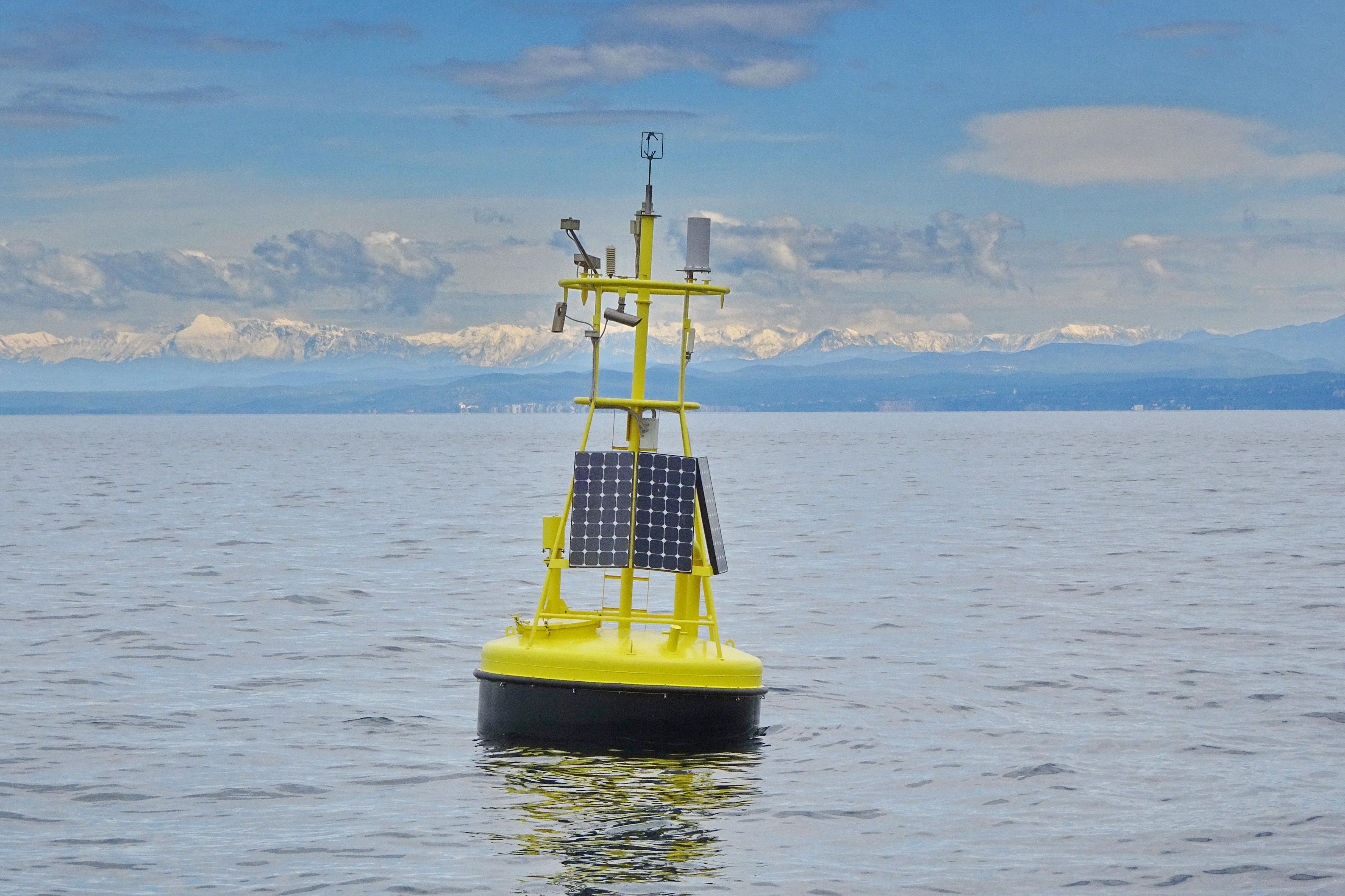
The separation line of the semi-enclosed northern basin from the rest of the Adriatic Sea is conventionally defined at the 100 m isobath, at about 43°20’N, from where the bottom depth moderately decreases up to the northern coast reaching the smallest average depth in the northernmost protrusion of the basin, the Gulf of Trieste (surface area 600 km2, volume 9.5 km3, maximal depth approx. 25 m). The oceanographic properties of Gulf of Trieste are affected by water mass exchange with the northern Adriatic at the open western boundary, by local meteorological conditions that induce a pronounced seasonal cycle of seawater temperature (6 - 28 oC) and by the largest freshwater input, the Soča (Isonzo) River. The latter enters the Gulf on the shallower northern coastline with an average flow of 123 m3 s-1 and represents the major source of land-borne nutrients in this coastal zone, in particular of nitrate, whereas inputs along the south-eastern coast are comparatively small (contributing less than 10% to the freshwater balance in the Gulf). The circulation pattern is variable, however the prevailing ENE wind is the most efficient for the water exchange, especially during winter. These physical features, in addition to freshwater inputs, are ultimately reflected in the distribution of nutrients and in the seasonal and inter-annual variability of plankton communities, primary production but also in events of hypoxia/anoxia and mucous macroaggregates, which have characterised the whole northern Adriatic basin in the recent past. The waters of the Gulf of Trieste have been monitored for several physical-chemical and biological variables since 70s’ but the longest and most continuous data set of biological variables is represented by the phytoplankton time series, which started in 1990 when the national monitoring programme has become operational (set by Slovenian Environmental Agency). From 2007 onwards, the monitoring programme complies with the regulations of the EU Water Framework Directive (2000/60/EC).
-
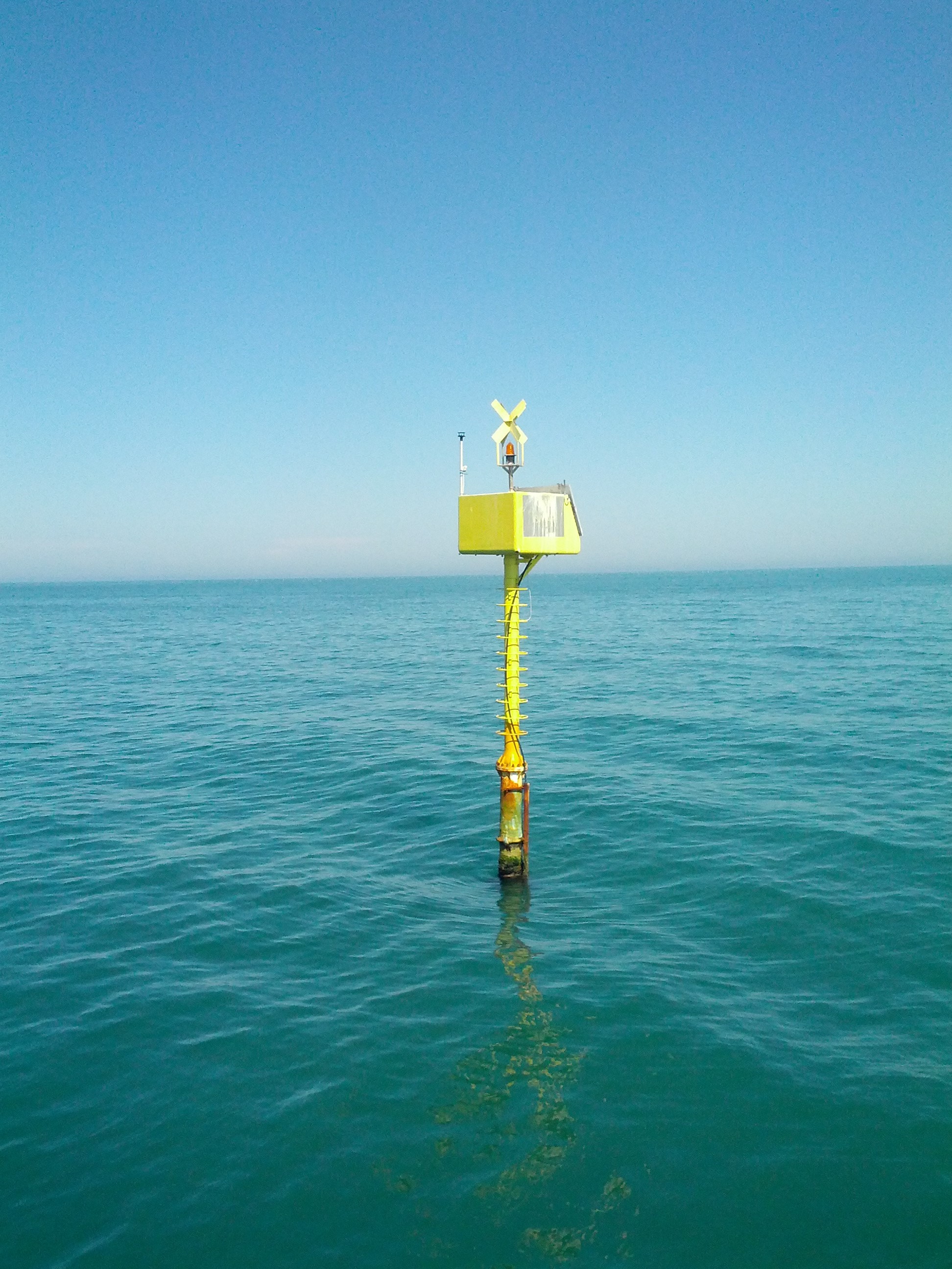
The Transetto Senigallia-Susak is a transect of sampling stations located in the Northern Adriatic Sea. The IRBIM-CNR in Ancona and the Politechnical University of Marche collects from the end of years 80s physical, chemical and biological data. This is an excellent observing site to analyze the characteristics of water masses entering and leaving the North Adriatic Sea and their possible modification. In the site is also located the TeleSenigallia pylon.
-
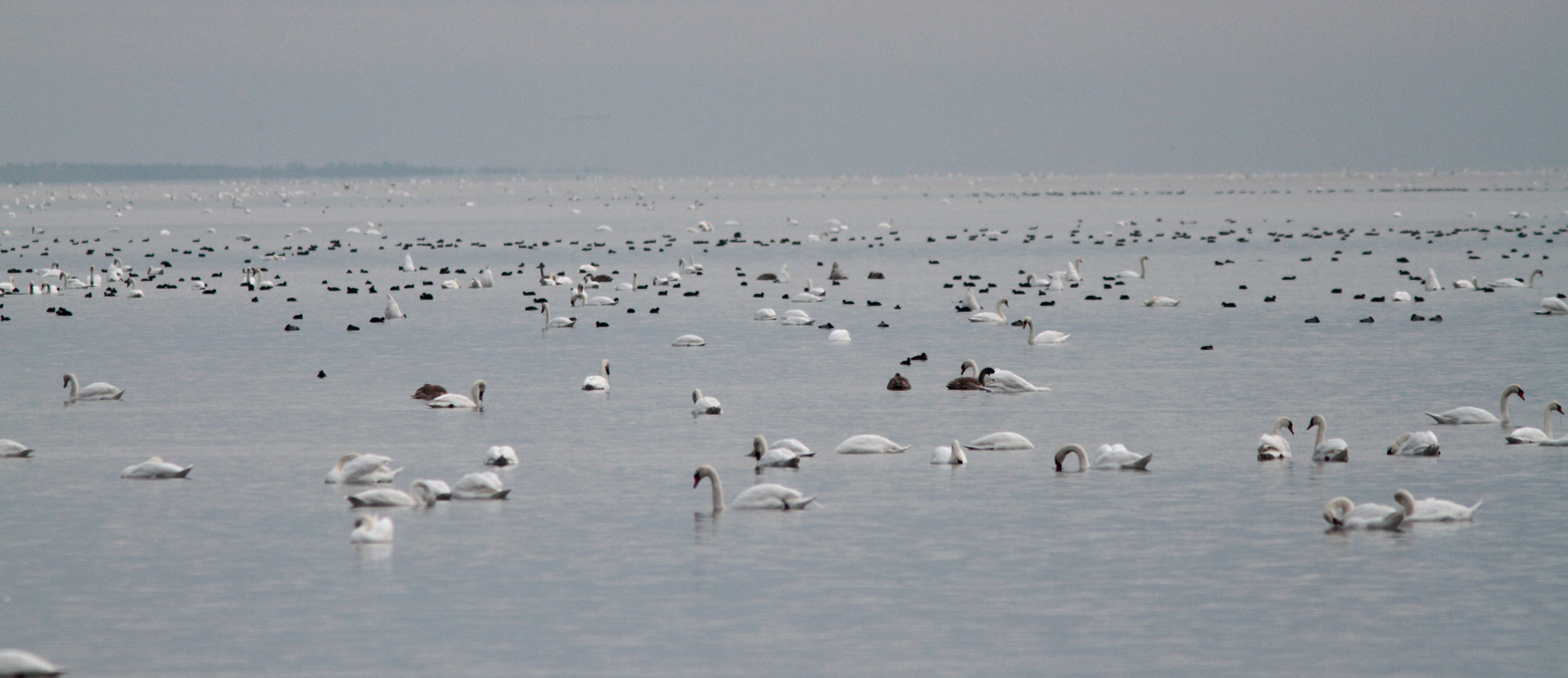
Curonian lagoon biosphere polygon is a part of ecologic and specialized monitoring system for biological diversity and NATURA2000.
-
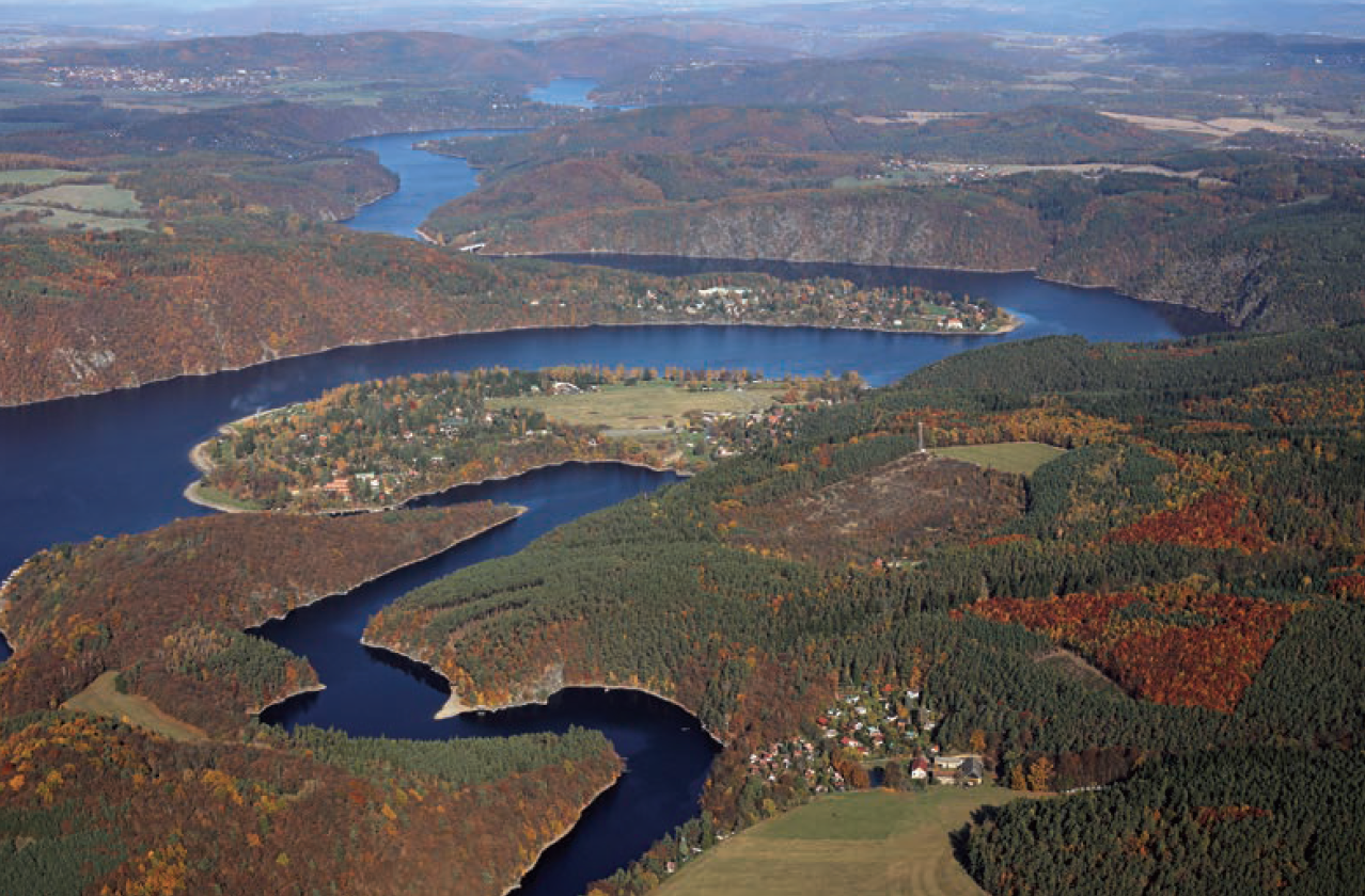
The Slapy reservoir is a part of the Vltava Cascade, a system of nine reservoirs together retaining 1.4 billion m3 of water. The dam of the Slapy reservoir was constructed at the 91.7 km of the Vltava River in 1949–1954 and the reservoir impounded in 1955. The dam is 60 m high and 260 m long. Reservoir volume is 270×106 m3. Just below the Slapy dam, there is the end of impoundment of the small Štěchovice reservoir (built earlier in 1938–1944). Only several small brooks enter the impoundment of the Slapy reservoir, the mean yearly flow through the Slapy reservoir is 83.8 m3 s-1 and the mean hydraulic retention time is 38.5 days. A large Lipno reservoir in the upper part of the Vltava River was built in 1952–1959. In 1961, another part of the Vltava Cascade, large Orlík reservoir was built above the Slapy reservoir and later several small reservoirs. The total catchment area of the Slapy reservoir is 12 968 km2. The Slapy reservoir is a canyon shaped water body mostly with steep banks. An electric power station, working in peak hours (morning and evening), is located in the dam. As a consequence, periodic seiches occurred, water level fluctuates, and a littoral zone with aquatic plants is not developed. The reservoir is intensely used for recreation and locally as a drinking water source. Regular investigations include major physical and chemical characteristics and pelagic biota (bacteria, protists, phytoplankton and zooplankton). The sampling point is located 8.8 km downstream of the dam in a lacustrine zone of the reservoir. Long-term research in the reservoir already yielded valuable results explaining long-term effects of anthropogenic and land use changes in the catchment, such as the construction of the upstream reservoir, agricultural practice (e.g. drainage, changes in arable land area and fertilization rate), wastewater treatment, road de-icing etc., on water chemistry and biology.
-
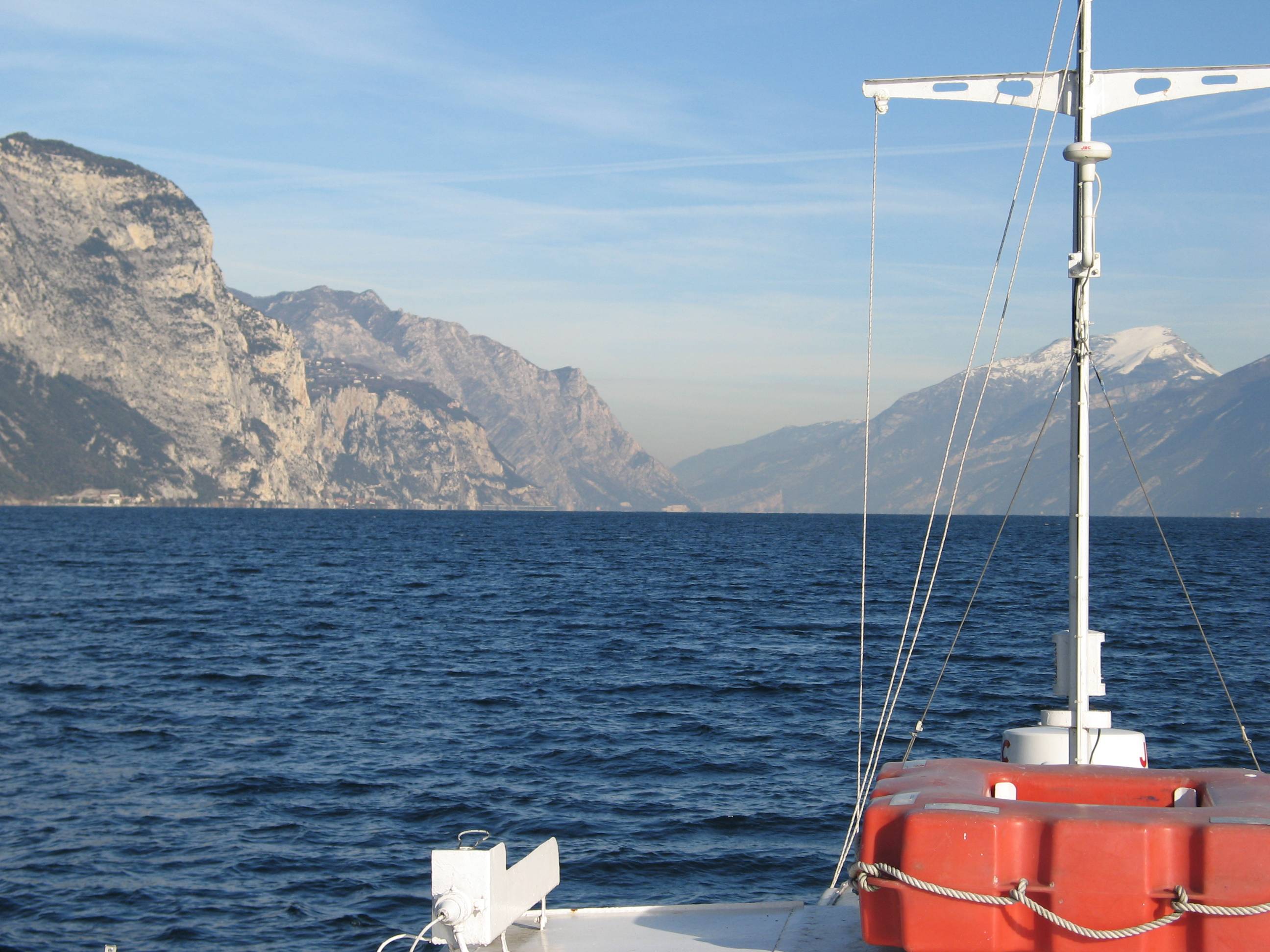
Lake Garda has the largest volume (49 billions of cubic meters) and the most extensive area (368 km2) of Italian lakes. Along with lakes Orta, Maggiore, Lugano, Como, Iseo and Idro, it forms part of the group of deep lakes located south of the Alps in one of the most densely populated and highly productive area of Italy. With a total volume of over 124 billions of cubic meters, these lakes constitute one of the largest freshwater supplies in Europe. Their waters are used for agriculture, industry, fishery and drinking. Moreover, they are an important resource for recreation and tourism thanks to both attractive landscape and water quality. In Lake Garda, sporadic studies were carried out irregularly by various Institutions up to the end of the 1980s. Since the beginning of the 1990s, continuous monthly samplings and measurements were carried out by the Department of Biology of the Padova University (Responsible, Nico Salmaso), with the collaboration of ARPAV. Since 2005 the whole limnological research is performed by the Limnological research group of the Agrarian Institute of S. Michele all’Adige – E. Mach Foundation (S. Michele all’Adige, Trento; coordinator, Nico Salmaso). Since the 1970s, Lake Garda showed an increase in the trophic status, with mean annual concentrations of total phosphorus in the whole water column increasing from ca. 10 µg P/L to 20 µg P/L. In the last 4-5 years of observations, TP showed a stabilisation of the concentrations, around 18 µg P/L. At the community level, annual phytoplankton cycles underwent a unidirectional and slow shift mainly due to changes in the species more affected by the nutrient enrichment of the lake. After a first and long period of dominance by conjugatophytes (Mougeotia) and diatoms (Fragilaria), phytoplankton biomass in recent years was sustained by cyanobacteria (Planktothrix). Other important modifications in the development of phytoplankton were superimposed on this pattern due to the effects of annual climate fluctuations principally mediated by the deep mixing events at spring overturn. Main specific research objectives in this LTER station include: -Changes in the physical, chemical and biological variables at different temporal scales, from months to decades and centuries (paleoecology). Update of the time series of hydrological, climatological and limnological data, whith special attention to lake evolution and effects on biotic communities in relation to ongoing climatic changes. Definition of predictive models. - Identification of the environmental and biotic mechanisms favouring the development of cyanobacteria (including the recent appearence of blooms and new species). Identification of the factors selecting for the development of toxic strains, the production and concentrations of epato- and neurotoxins, and their impact on trophic webs and water usability. The limnological field facilities of the limnological research group include 2 rubber dinghies, 2 multi-parameter probes, a fluoroprobe, a FlowTracker Handheld ADV Sonntek, underwater Quantum sensors, a Kajak corer and an Eckman dredge for sediment sampling. The unit also has several laboratories. These include the hydrobiology and microscopy laboratory, equipped for analyses of basic limnological variables (photosynthetic pigments, dry weight, dissolved oxygen, water turbidity, macrophytes) and of phytoplankton, picoplankton and periphyton samples (microscopes, invertoscopes, fluorescent microscopy, image analysis). The analytical and environmental chemistry laboratory is equipped for analysis of the major ions and nutrients (phosphorus, nitrogen and silica), as well as organic molecules (with focus on cyanotoxins) by means of spectrophotometry, ion chromatography and Liquid Chromatography-Mass Spectrometry (LC-MS). We have access to genetic laboratories equipped with the principal analytical tools, i.e. PCR, electrophoresis, and sequencing. The data collected at monthly frequency since 1991 includes water temperature and oxygen. Phytoplankton was collected since 1993, while complete data recording (including chemistry and zooplankton) begun in 1995.
-
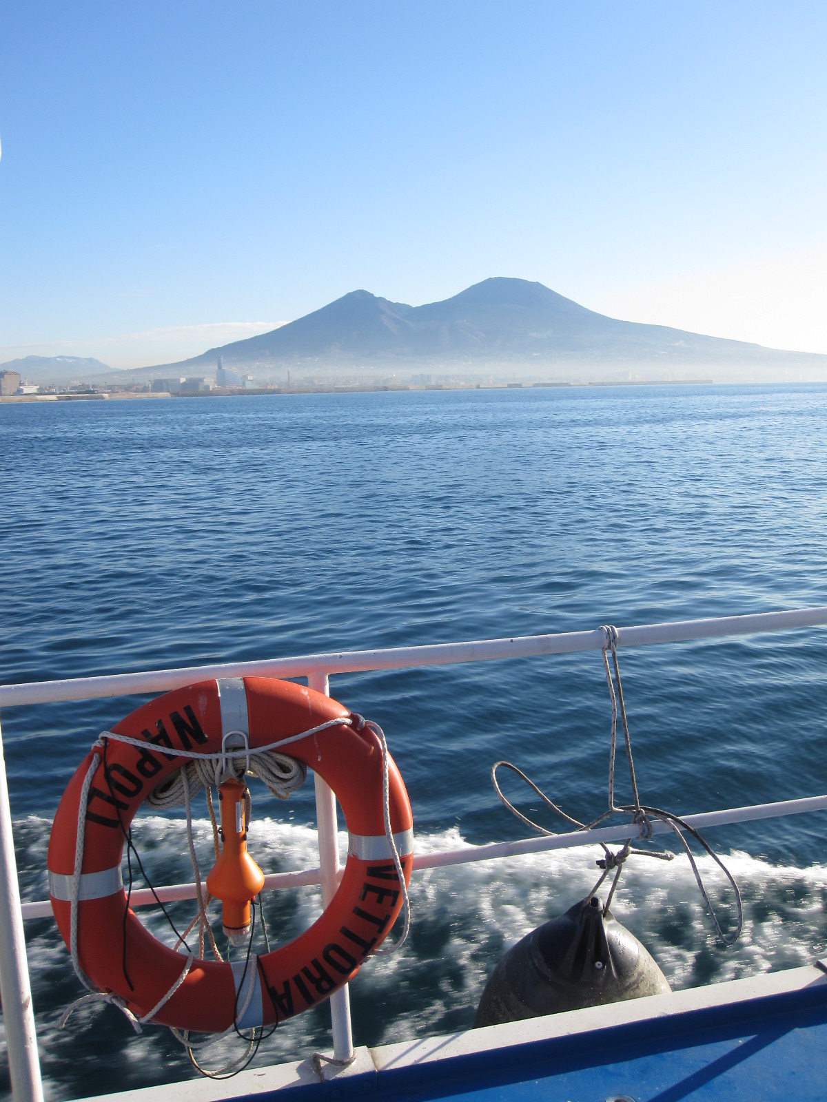
The Gulf of Naples has an extension of ca 870 kmq and an average depth of 170 m. The coastal area, which is inhabited since pre-Roman age, is densely populated and small factories are actively growing. In the Gulf, polluted areas (Sarno river mouth, harbours) coexist with pristine areas, including some Protected Marine Areas. Research on marine organisms has started before since the beginning of 1800, but first ecological studies date back to the 70ies of the last century. The long-term monitoring station (LTER-MC, 40°49’N, 14°15’E) is located 2 nm off Naples city (depth ca 75 m) at the boundary between eutrophied coastal waters and oligotrophic Tyrrhenian waters. Larger areas of the Gulf have been sampled occasionally in several cruises. The MC data set represents one of the few plankton time series available in the Mediterranean Sea, and it is certainly one of the longest.