
bacteria abundance
Type of resources
Available actions
Topics
Keywords
Contact for the resource
Provided by
Years
Formats
Representation types
-
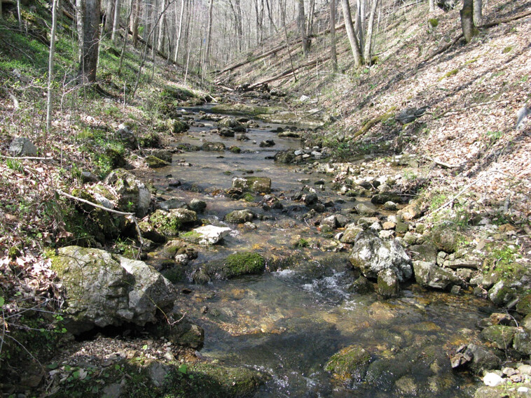
Walker Branch is a core wadeable stream site located in the deciduous forest of the Oak Ridge Reservation in eastern Tennessee. This site is part of NEON's Appalachians and Cumberland Plateau Domain 7. Remote sensing surveys of this site collect lidar, spectrometer and high resolution RGB camera data. This site has one meteorological station located in the riparian area. The met station is outfitted with a subset of the same sensors used at terrestrial sites. Measurements include wind speed and direction, air temperature, barometric pressure, relative humidity, shortwave radiation, and PAR. This site has one upstream sensor station and one downstream sensor station. Measurements include PAR, temperature, water quality [specific conductivity, chlorophyll a, dissolved oxygen content, pH, turbidity, and fluorescent dissolved organic matter (only downstream)], and nitrate is measured at the downstream station. Three groundwater wells throughout the site collect specific conductivity, water tempertaure, and elevation of groundwater. Field ecologists collect the following types of observational data at this site: aquatic organisms (Aquatic Microbes (surface water),macroinvertebrates microalgae, plants and macroalgae, zooplankton. Biogeochemical data on plants,sediment water and particulates.As well as physical aquatic data on bathymetric maps, stage,secchi depth and depth profiles, and riparian assessment.Total data products planned for this site: 78
-
In order to evaluate fecal pollution and environmental status Vibrio, E. coli and coliforms abundance from water, sediments and mussels in the Mar Piccolo of Taranto was assessed
-
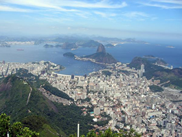
Guanabara Bay (GB) is the second largest bay in the coast of Brazil (384 km2) (22o41 to 22o56 S ; 43o02 to 43o18 W). In its surroundings live 16 million inhabitants (6 million in Rio de Janeiro city). This system experiences steep spatial gradient from the entrance to inner bay. GB receives high load of nutrients and organic material from riverine sources and from domestic and industrial sewage inputs. As a consequence, this system is characterized as a high eutrophicate and polluted one. In spite of its poor environmental status, GB still presents many living resources who use the bay as a refuge, feeding and nursery grounds, with some of those species having commercial interest. An important characteristic of GB is the influence of South Atlantic Central Water, a deep, cold and rich nutrient water, that enters the bay during the Cabo Frio upwelling period. This phenomenon permits to maintain the bay at a relative good health level in its central part, in contrast with the marginal areas highly polluted. Although encroached on by urban expansion, the inner east margins of Guanabara Bay is still bordered by a 90 km2 fringing mangrove system, of which 43 km2 is an environmental protection area, Guapimirim.
-
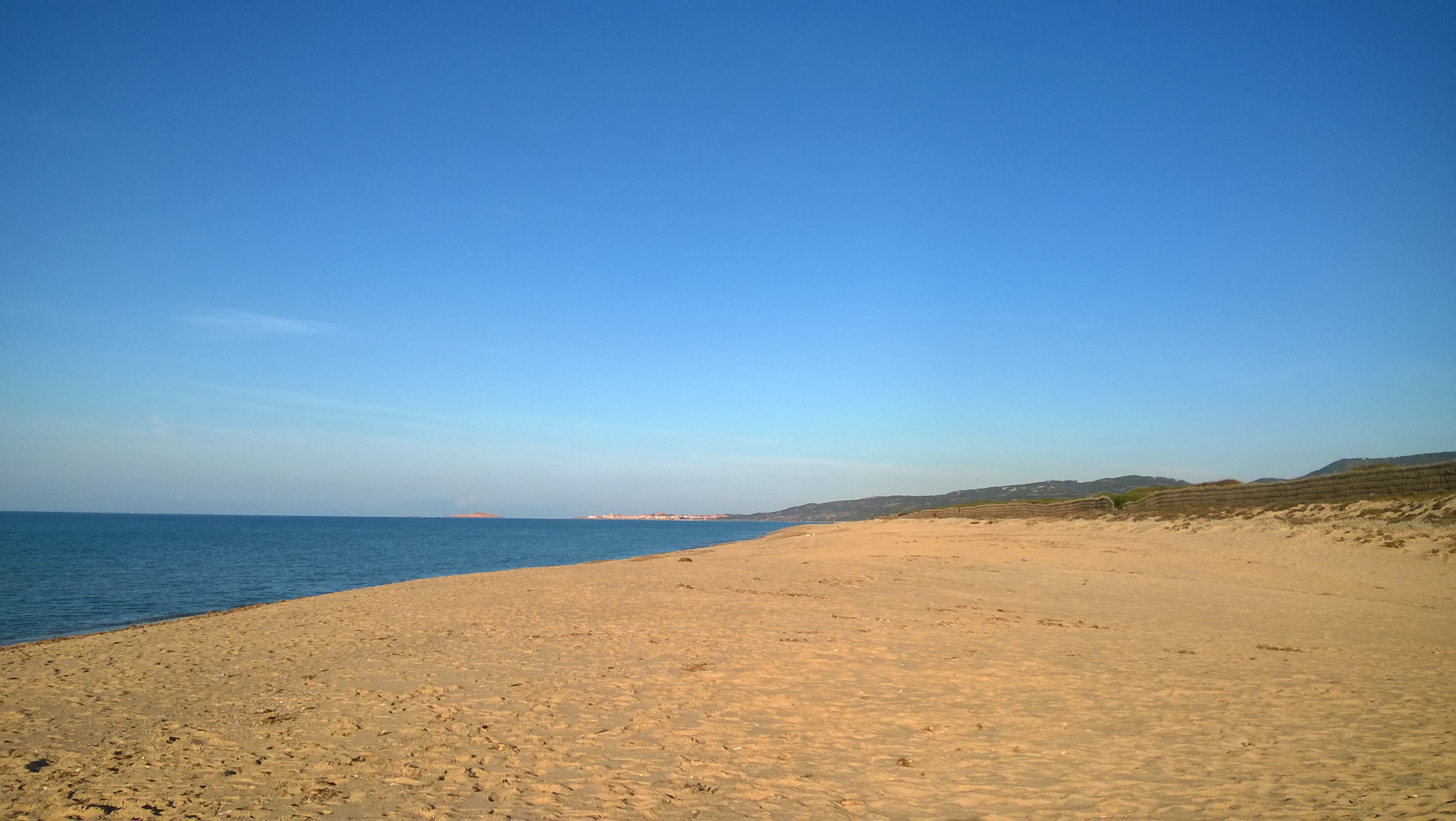
The Asinara Gulf covers approximately 500 km2 and is the second largest bay in Sardinia. The Gulf is limited by Asinara Island (National Park) in the west side and by Castelsardo town in the east side. The average depth of the gulf is approximately 35-40 m and only 35% of the gulf bottom has a depth exceeding 50 m. The predominant winds are from the I and IV quadrant. The marine area of the gulf has been affected since the ‘70s by different human impacts, especially by those connected to the industrial centre of Porto Torres. The main urban centre along the gulf coast is Porto Torres, with an important industrial, commercial and passenger harbour. A long-term series of data is available since 1997 and derives from high-frequency measurements and samplings to assess environmental and biological parameters. In particular the data concern the main trophic descriptors (Secchi depth, temperature, pH, conductivity, dissolved oxygen and saturation, alkalinity, NH4-N, NO2-N, NO3-N, total nitrogen, soluble reactive phosphorus, total phosphorus, dissolved silica) and phytoplankton abundances, as chlorophyll a, cell densities and biomass, class and species composition. Data collection started in 1997 and continued, with few gaps of various sizes of time, up to 2007. The data collection resumed in 2007 only seasonally.
-
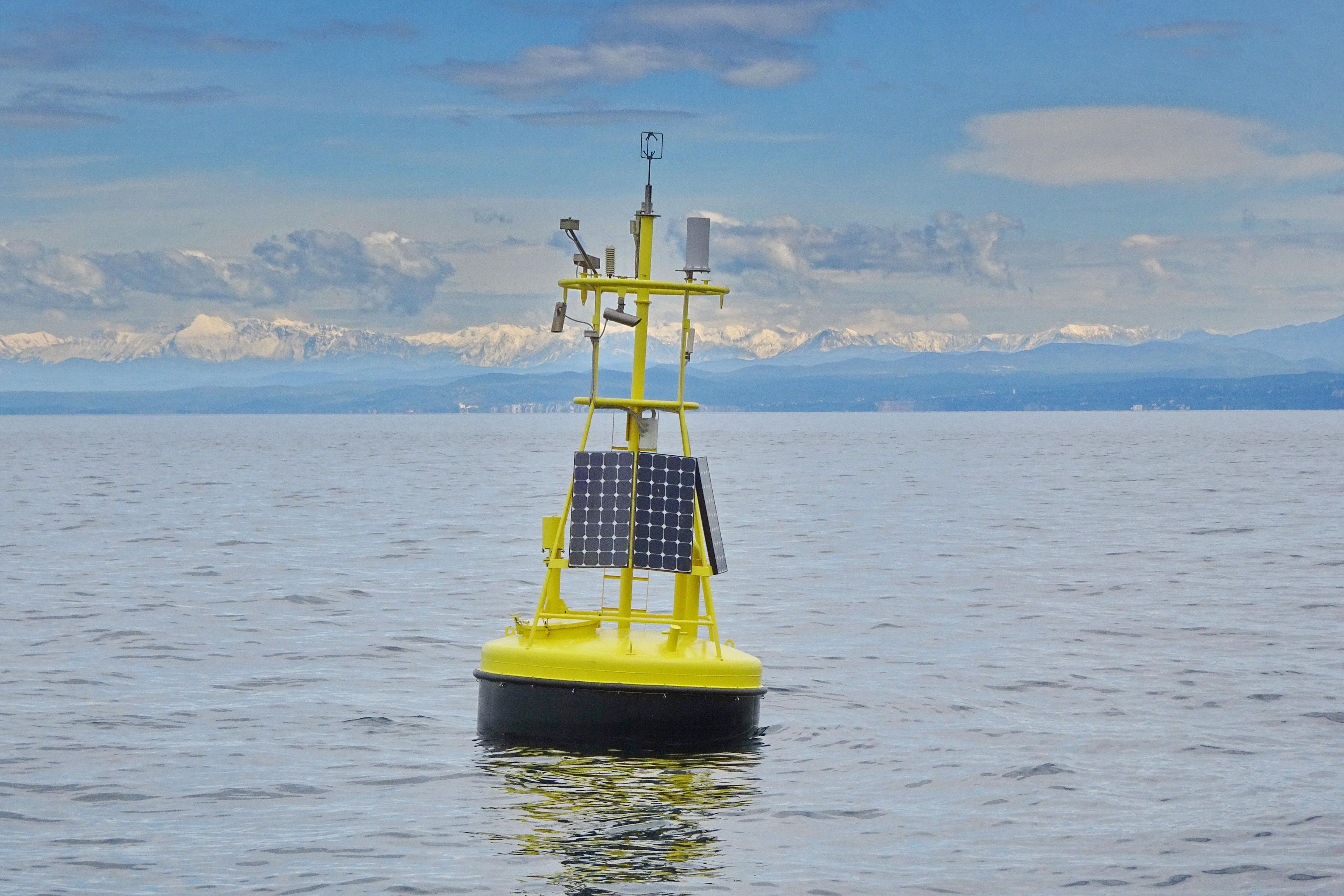
The separation line of the semi-enclosed northern basin from the rest of the Adriatic Sea is conventionally defined at the 100 m isobath, at about 43°20’N, from where the bottom depth moderately decreases up to the northern coast reaching the smallest average depth in the northernmost protrusion of the basin, the Gulf of Trieste (surface area 600 km2, volume 9.5 km3, maximal depth approx. 25 m). The oceanographic properties of Gulf of Trieste are affected by water mass exchange with the northern Adriatic at the open western boundary, by local meteorological conditions that induce a pronounced seasonal cycle of seawater temperature (6 - 28 oC) and by the largest freshwater input, the Soča (Isonzo) River. The latter enters the Gulf on the shallower northern coastline with an average flow of 123 m3 s-1 and represents the major source of land-borne nutrients in this coastal zone, in particular of nitrate, whereas inputs along the south-eastern coast are comparatively small (contributing less than 10% to the freshwater balance in the Gulf). The circulation pattern is variable, however the prevailing ENE wind is the most efficient for the water exchange, especially during winter. These physical features, in addition to freshwater inputs, are ultimately reflected in the distribution of nutrients and in the seasonal and inter-annual variability of plankton communities, primary production but also in events of hypoxia/anoxia and mucous macroaggregates, which have characterised the whole northern Adriatic basin in the recent past. The waters of the Gulf of Trieste have been monitored for several physical-chemical and biological variables since 70s’ but the longest and most continuous data set of biological variables is represented by the phytoplankton time series, which started in 1990 when the national monitoring programme has become operational (set by Slovenian Environmental Agency). From 2007 onwards, the monitoring programme complies with the regulations of the EU Water Framework Directive (2000/60/EC).
-
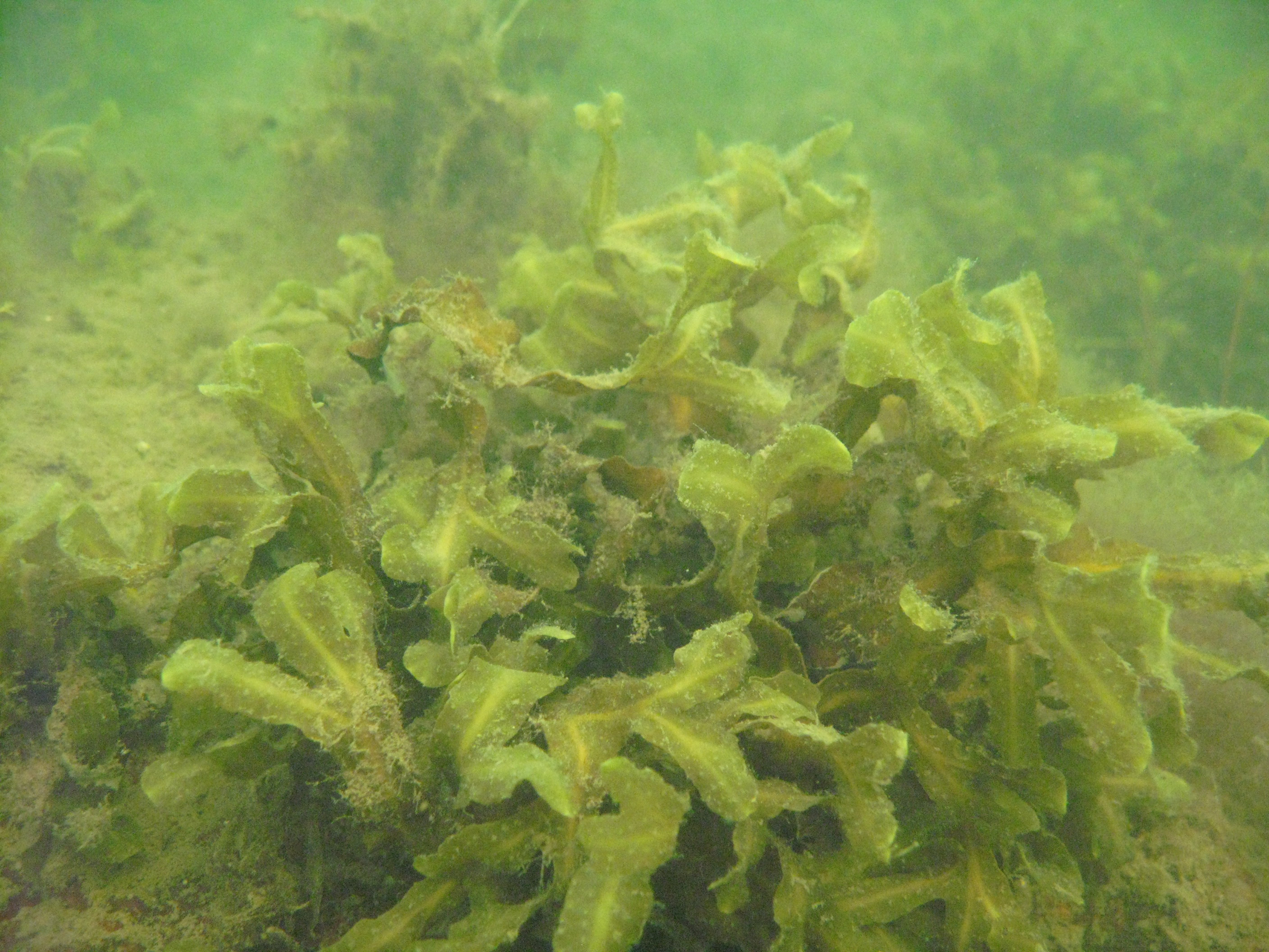
Western part of the Gulf of Riga (the Baltic Sea) littoral and sublitoral zone. The marine site is located on the west coast of the Gulf, in the Engure Nature protected area. The monitoring activities are based on three transects which represent an open area of very similar substrate type. These transects are located on the tip of Mersrags, 2.5 km northwards from the port of Mersrags. Long-term studies of the Gulf of Riga coastal zone communities and macrophytes as the key component of littoral zone under natural and anthropogenic impact and possible threats to the littoral zone biological resources. The SCUBA diving is used in marine site assessment.
-
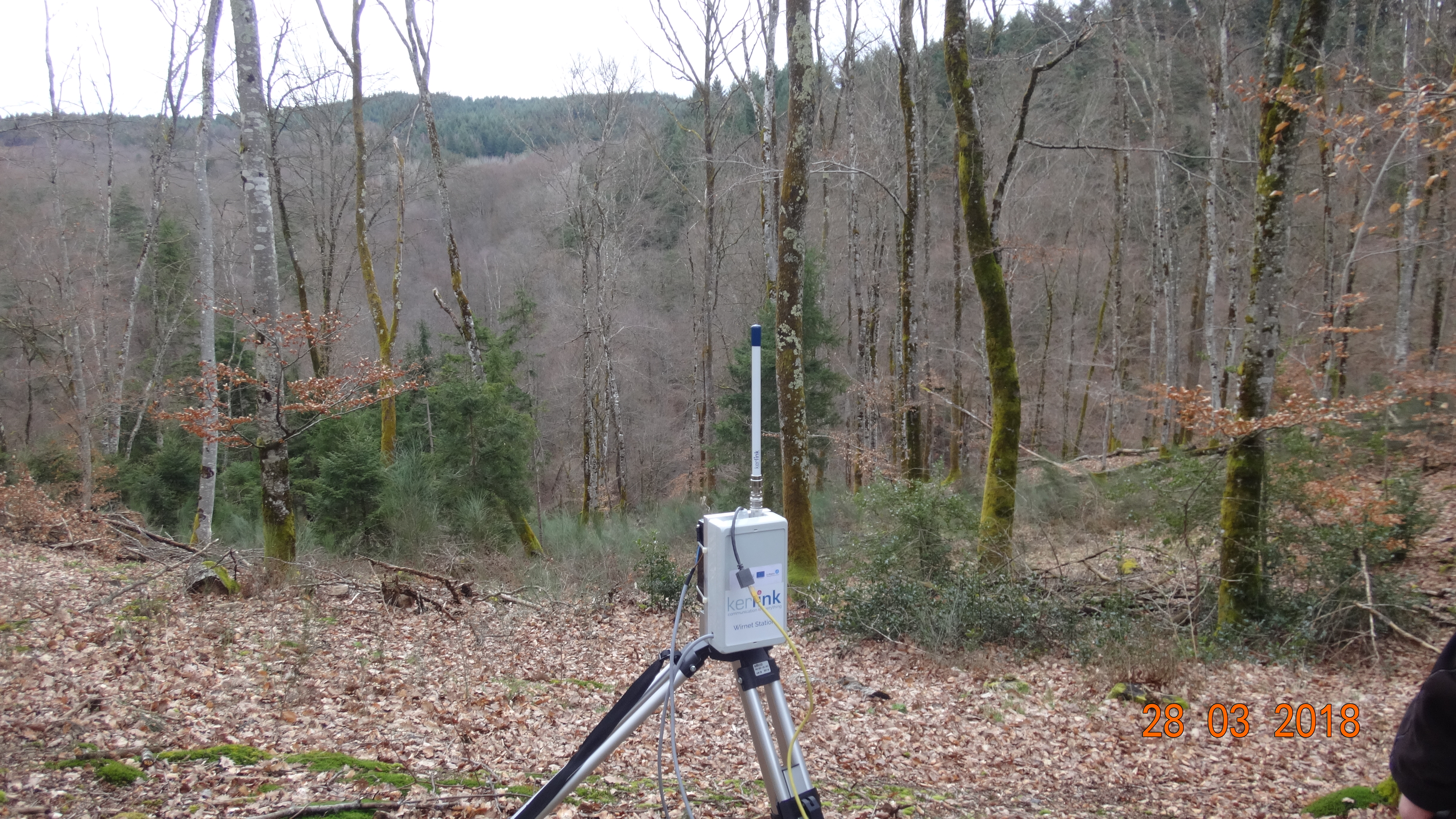
The LTSER Zone Atelier Territoires Uranifères belongs to LTER-France network and is located in center of France. ZATU’s goal is to develop a multidisciplinary approach confronting the views of biologists, chemists, geographers , ecologists, geologists, physicians , physicists, sociologists on life in environments characterized by chronic natural or enhanced natural radiation . The ZA research program is built around three main themes centered on human and social sciences, radiochemistry , and biology. The ZA provides a framework for interaction between these research areas and therefore offers opportunities for developing truly interdisciplinary projects with a systemic approach. Indeed , interactions and strong feedback exist between living systems, human beings and the long-term future of radionuclides. Human acts on his environment through mining, large-scale development, and post-mining management), creating new life habitats and impacting the long term fake of radionuclides (management of water flows , introduction of radioactive material confinement cover , ...). Similarly, the presence of radioactivity impacts the relationship of man to his environment in terms of understanding risk and implementing prevention process. Finally, if the radioactivity affects living systems, living systems can also act on the fate of radionuclides. For instance, bacteria can induce change in speciation.
-
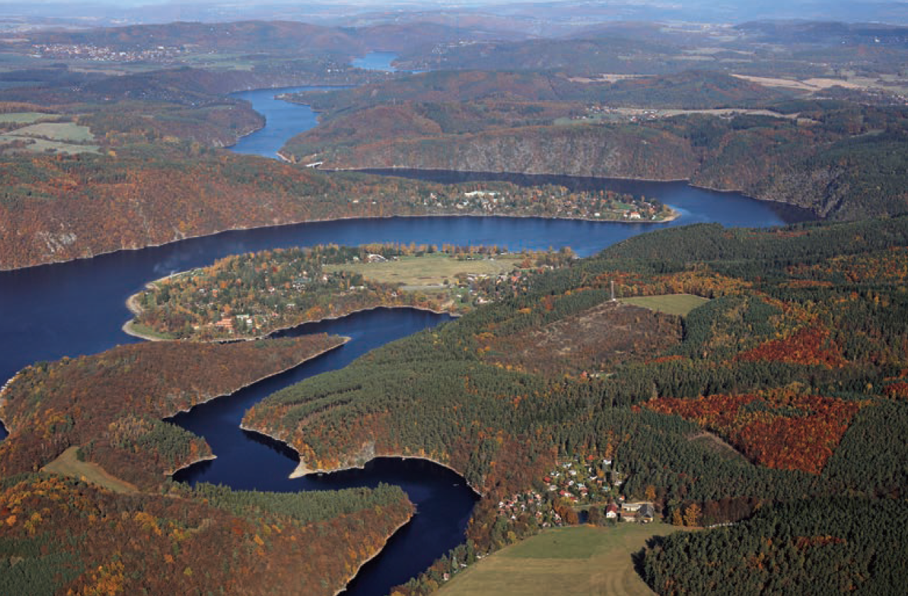
The Slapy reservoir is a part of the Vltava Cascade, a system of nine reservoirs together retaining 1.4 billion m3 of water. The dam of the Slapy reservoir was constructed at the 91.7 km of the Vltava River in 1949–1954 and the reservoir impounded in 1955. The dam is 60 m high and 260 m long. Reservoir volume is 270×106 m3. Just below the Slapy dam, there is the end of impoundment of the small Štěchovice reservoir (built earlier in 1938–1944). Only several small brooks enter the impoundment of the Slapy reservoir, the mean yearly flow through the Slapy reservoir is 83.8 m3 s-1 and the mean hydraulic retention time is 38.5 days. A large Lipno reservoir in the upper part of the Vltava River was built in 1952–1959. In 1961, another part of the Vltava Cascade, large Orlík reservoir was built above the Slapy reservoir and later several small reservoirs. The total catchment area of the Slapy reservoir is 12 968 km2. The Slapy reservoir is a canyon shaped water body mostly with steep banks. An electric power station, working in peak hours (morning and evening), is located in the dam. As a consequence, periodic seiches occurred, water level fluctuates, and a littoral zone with aquatic plants is not developed. The reservoir is intensely used for recreation and locally as a drinking water source. Regular investigations include major physical and chemical characteristics and pelagic biota (bacteria, protists, phytoplankton and zooplankton). The sampling point is located 8.8 km downstream of the dam in a lacustrine zone of the reservoir. Long-term research in the reservoir already yielded valuable results explaining long-term effects of anthropogenic and land use changes in the catchment, such as the construction of the upstream reservoir, agricultural practice (e.g. drainage, changes in arable land area and fertilization rate), wastewater treatment, road de-icing etc., on water chemistry and biology.
-
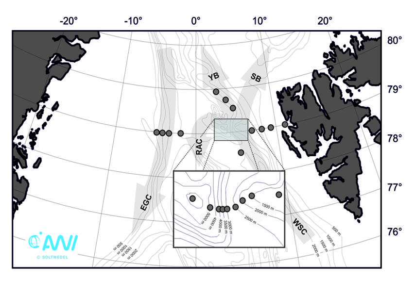
HAUSGARTEN comprises 21 permanent stations covering a depth range of 300 to 5.500 m water depth. Repeated water and sediment sampling and the deployment of moorings and different free-falling systems, which act as observation platforms, has taken place since the establishment of the observatory in 1999.
-
Socio-ecological interactions in ecosystems of mid-altitude mountains The LTSER Zone Atelier Arc Jurassien belongs to LTER-France network and is located in eastern France.The LTSER site Jurassian Arc (ZAAJ stands for Zone atelier Arc jurassien, in French) is designed to promote long-term interdisciplinary research into the environment and ecosystems in relation to society issues. It federates a network of research partnerships around interactions between the environment, society and the dynamics of moutain socio-ecological systems.ZAAJ helps to capitalise on field data and to analyze and promote the results from long-term observation schemes at the interface between ecology, the environment and society. Benefiting of more than 25 years of experience on the issue, accredited by the CNRS Ecology and Environment Institute (INEE) in 2013, ZAAJ is a cluster of five research units totalling 40 researchers.