
below ground autotrophic respiration
Type of resources
Available actions
Topics
Keywords
Contact for the resource
Provided by
Years
Formats
Representation types
-
Boreal forest consisting of Betula and Acer species.
-
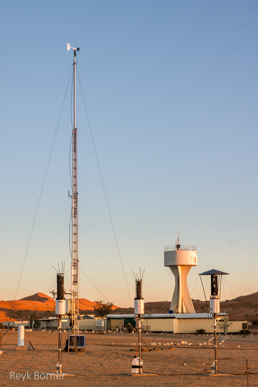
Gobabeb is a Research Centre with accommodation, conference, laboratory and teaching facilities in Namibia's Namib-Naukluft National Park, about 65km from the coast on the northern bank of the ephemeral Kuiseb River. It is located at a point where three main habitats meet (ephemeral river, gravel plain and the Namib erg) and lies within the inland edge of the fog zone. It is the designated monitoring and research centre for the Namib Sand Sea World Heritage Site.
-
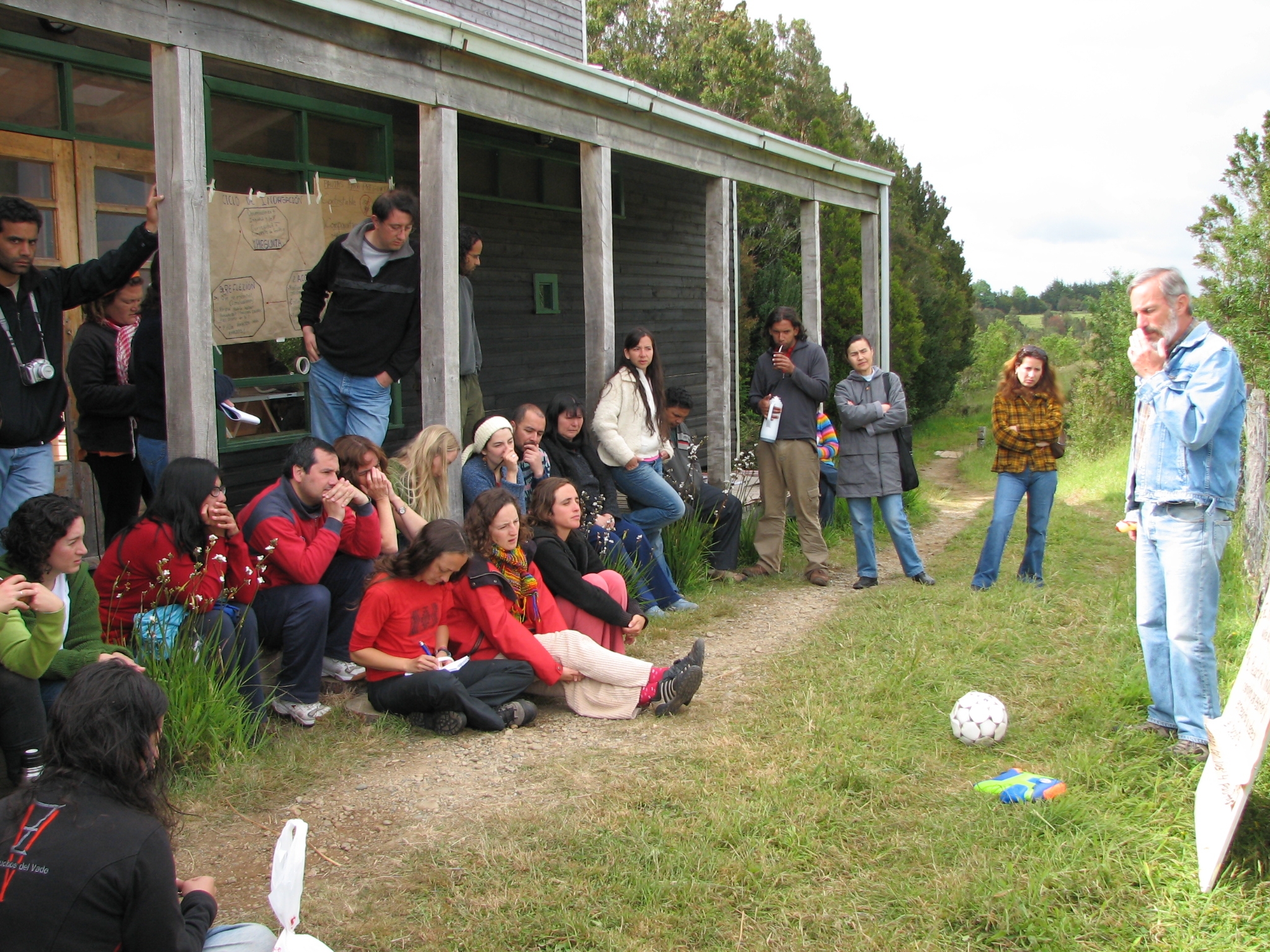
Senda Darwin Biological Station is located along Route 5 south, at a distance of 14 kilometers from the city of Ancud, in the north of Chiloe Island. It aims to facilitate scientific research, environmental education and the application of knowledge for temperate forests conservation.
-
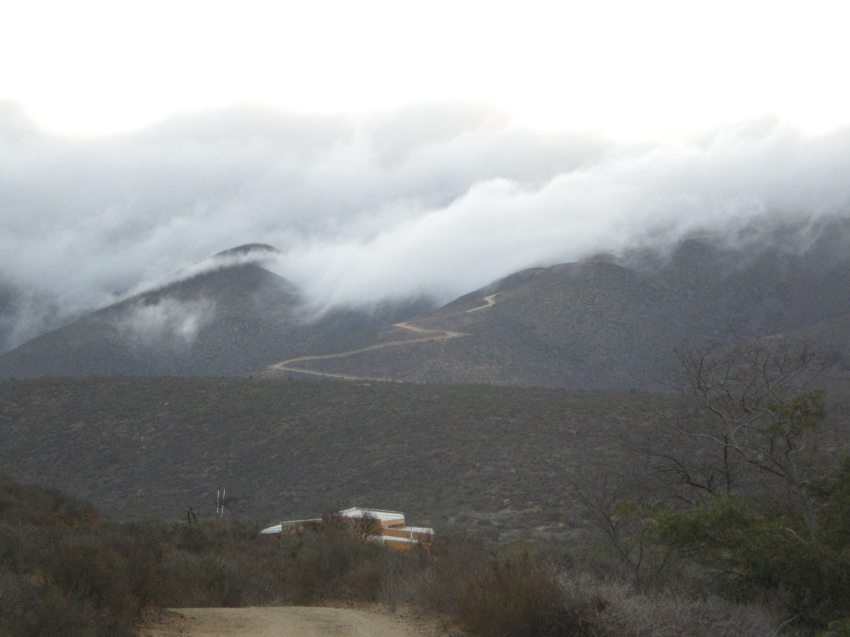
The Fray Jorge experimental site is located inside the Fray Jorge National Park, in the Region of Coquimbo. Its characteristic vegetation is Mediterranean and at the top of the coastal range exists evergreen temperate forests (cloud forests). The climate is Mediterranean with coastal influence.
-
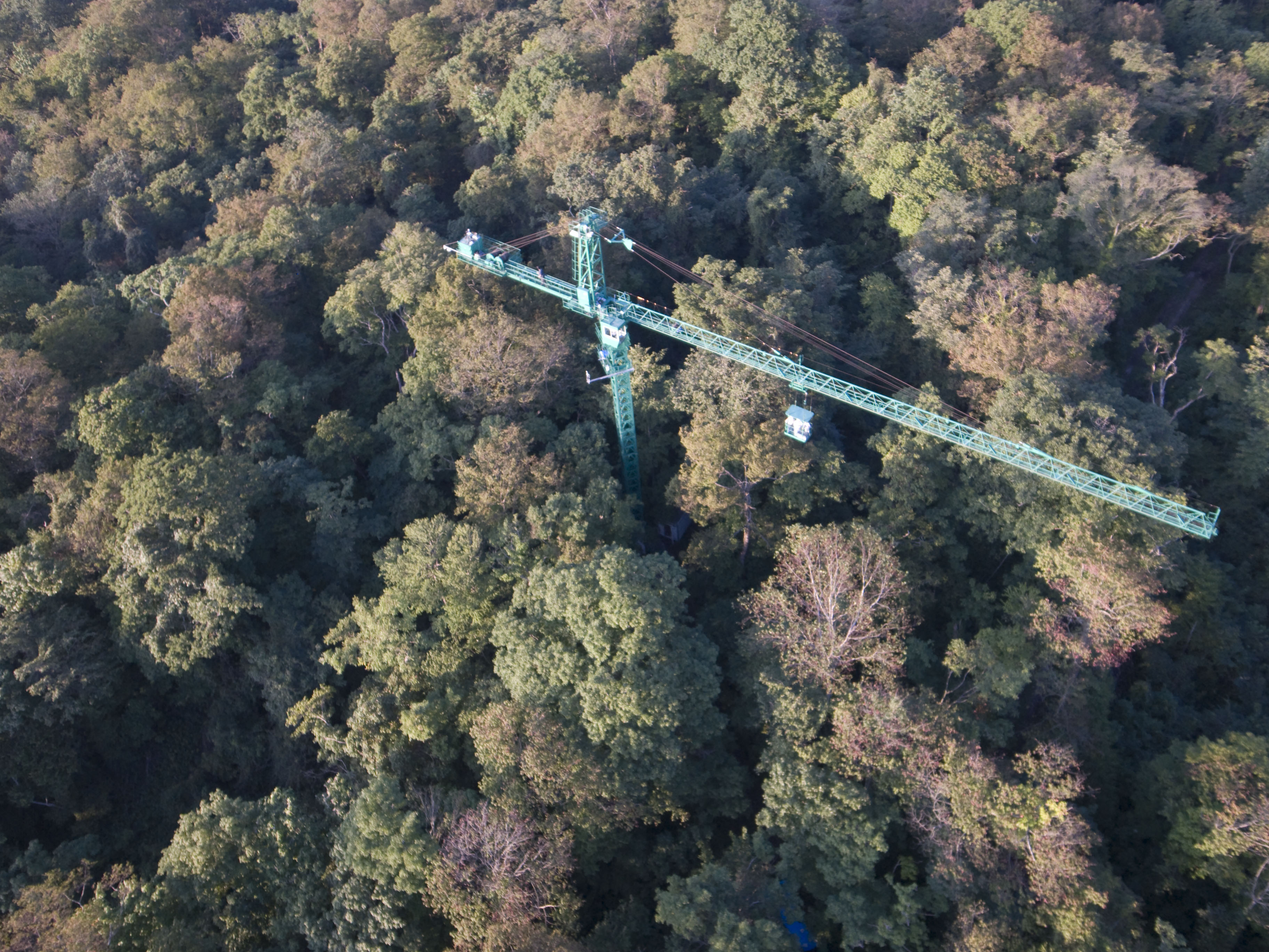
The Lehrforst Rosalia (Rosalia University forest) is about 1000 ha, covered with all major tree species and forest types in Austria (Norway spruce, Fir, Larch, Scots pine, Beech, Oak, etc). The forest area is located in the Rosalia Mountains near the Lower Austria/Burgenland border. The Demonstration Forest (950 ha) was set up in 1972 with an agreement between the Austrian Federal Forests (Österreichische Bundesforste, ÖBf, https://www.bundesforste.at/english.html) and BOKU. Nevertheless, the University is active in this area since 1875; considerable documentation regarding forest description and planning was elaborated by that time. It is located on the western slope of the mountainous ridge called „Rosaliengebirge“ in the southeastern part of Lower Austria (LAT 47°42’N, LON 16°17’ E). Elevation is between 300 and 720 m a.s.l, annual mean temperature of 6.5 deg C and 800 mm annual precipitation. The forest is mainly composed of beech associations (Fagetums) , peripheral also spruce-fir-beech forest association (Abieti-Fagetum). The Key task of the Forest Demonstration Centre ist supporting the educational and research work of the University of Natural Resources and Life Sciences. Accordingly, accommodation, work and teaching facilities are provided. The research focus lies on following areas: · Collection and hold ready of area-based and environmental Data · Establishing and monitoring of sample plots especially for beech growth and treatment related questions · Characterization of local and microclimate · Environmental impacts to forest ecosystems · Monitoring and modelling of small forested watersheds Essential research and educational infrastructure are: · 4 Weather monitoring stations · 2 scaffolding towers for measuring (35m) with instrument cabin · 4 Measuring weirs for runoff monitoring (Watershed 230 ha) · radio linked data collection and on-line hosting · Surveying and Mapping equipments (terrestric and GPS) · Long-term experiment simulating drying and rewetting of forest soils (DRAIN Station) · IT-Room with different Software-packages (GIS, Planning Tools etc.) · Laboratories and work rooms · Lecture Rooms · Accommodation for > 40 people The available data range from base data (GIS-Data), meterological and hydrological time series (since 1990), inventory data of growing stock, data of different plots to measuring data related to numerous projects.
-
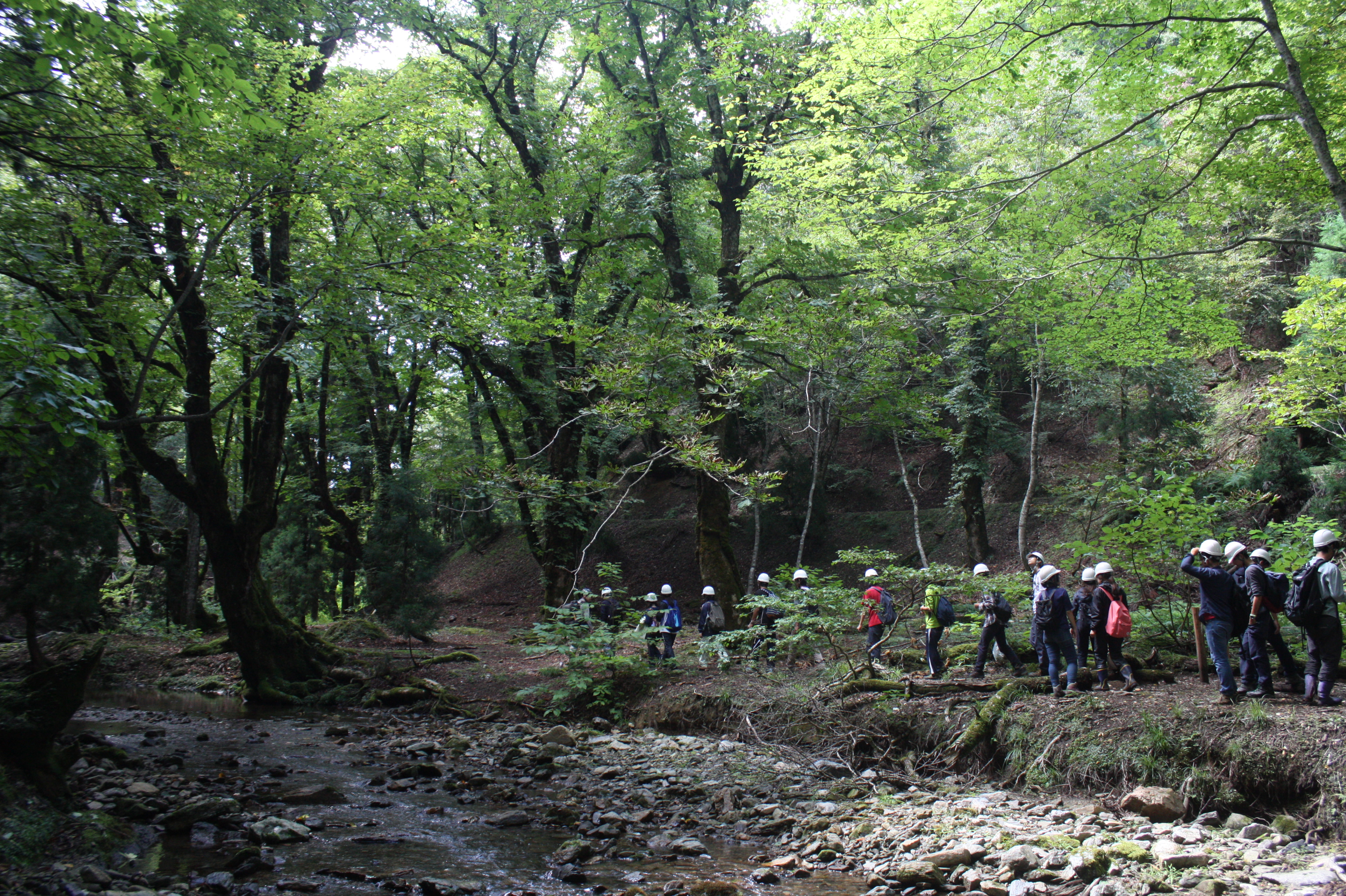
Ashiu Forest Research Station is located in the northeastern border part of Kyoto Prefecture in main island Honshu and stretches 6km east to west and 7km north to south in a rectangular shape. The area is characterized by high relief with altitudes ranging from 355 to 959 m above the sea level and encompasses the headwater zones of Yura River flowing into Wakasa bay, the Sea of Japan. This region is situated in the transition part between cool temperate forests and warm temperate forests. There is a heavy snowfall ranging from 1 to 3m in winter seasons. More than half of Ashiu Forest Research Station is covered with old-growth forests. In cool temperate forests above 600m altitude, the main species are beech (Fagus crenata), Japanese ceder (Cryptomeria japonica), deciduous oak (Quercus crispula). In warm temperate forests under 600m altitude, evergreen and deciduous oaks (Quercus salicina and Quercus sessilifolia) can be seen. There are two noteworthy characteristics in Ashiu Forest Research Station. Firstly, its high biodiversity. Since the establishment of the Research Station in 1921, new plant or vertebrate species/ varieties have been found. 801 woody, herbaceous and fern species have been recorded (Yasuda and Nagamasu 1995). Nationally protected species such as Japanese serow (Capricornis crispus) and Giant Saramander (Andrias japonicas) can be seen. Secondly, Ashiu Forest Research Station has been used not only for research and education but also for ecotourism by local stakeholders for more than 20 years, which has great opportunities for inter- and transdisciplinary studies.
-
Nature reserve, Natura 2000, Protected coniferous blueberry forest, catchment, IM site, Podzol soil.
-
Tomakomai Experimental Forest (TOEF) was established in 1904, as a field of research and education about forest science. The forest covers 2,715ha of lowland area near the Tomakomai city, and it has been used as a study site in various field of research and education for many years.
-
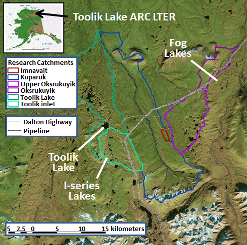
The Arctic LTER research site is in the foothills region of the North Slope of Alaska and includes the entire Toolik Lake watershed and the adjacent watershed of the upper Kuparuk River, down to the confluence of these two watersheds. This area is typical of the northern foothills of the Brooks Range, with continuous permafrost, no trees, a complete snow cover for 7 to 9 months, winter ice cover on lakes, streams, and ocean, and cessation of river flow during the winter. Tussock tundra is the dominant vegetation type but there are extensive areas of drier heath tundra on ridge tops and other well-drained sites as well as areas of river-bottom willow communities. The North Slope is divided into the Coastal Plain (6,000 km2), the Foothills (95,000 km2), and the Mountains (40,000 km2).
-
Qianyanzhou Agricultural Experimental Station of Red Soil and Hilly Land, was founded as a pilot experimental site for ecological recovery in South China In 1983. In 1985, it was selected as an Integrated Development Demonstration Base of Mountain-Lake-River Project of Jiangxi Province. In 1992, as an international experiment station, it was nominated by MAB as a training center of UND Jiangxi Project. Qianyanzhou Station became a member of CERN in 1991 and a member of ChinaFLUX in 2002.