
biotic diversity
Type of resources
Available actions
Topics
Keywords
Contact for the resource
Provided by
Years
Formats
Representation types
-
Long-term (2005-2019) monitoring data of epiphytic lichens of the LTER station Zöbelboden, Austria. The data contains lichen species frequencies per host tree.
-
Data on pollen is very valuable for many scientific questions relating to climate change, ecology and allergology. This data is analysed according to European standards by analysts at the Medical University of Vienna. At the Biologische Station Neusiedler See, a so-called pollen trap is used, which is positioned on the roof of the station and is maintained on a weekly basis. Air is sucked in and pollen particles adhere to a rotating adhesive film, allowing not only the detection of certain pollens, but also their temporal classification. This makes this method suitable for determining the pollen count and pollen forecasting.
-
The present database contains observations for 21 parameters of abiotic, phyto and zooplankton data collected in the Northern Adriatic Sea region (Italy). It relies on a Comma Separated Values file and it is composed by 108687 records. Due to its long temporal coverage, it is classifiable as Long Term Ecological data. Due to the long temporal coverage, the great part of parameters changed collection and analysis method in time. These variations are reported in the database. A long term database can be useful for multiple purposes. This database has been released under a research project focused on Open Science principles application to marine ecology.
-
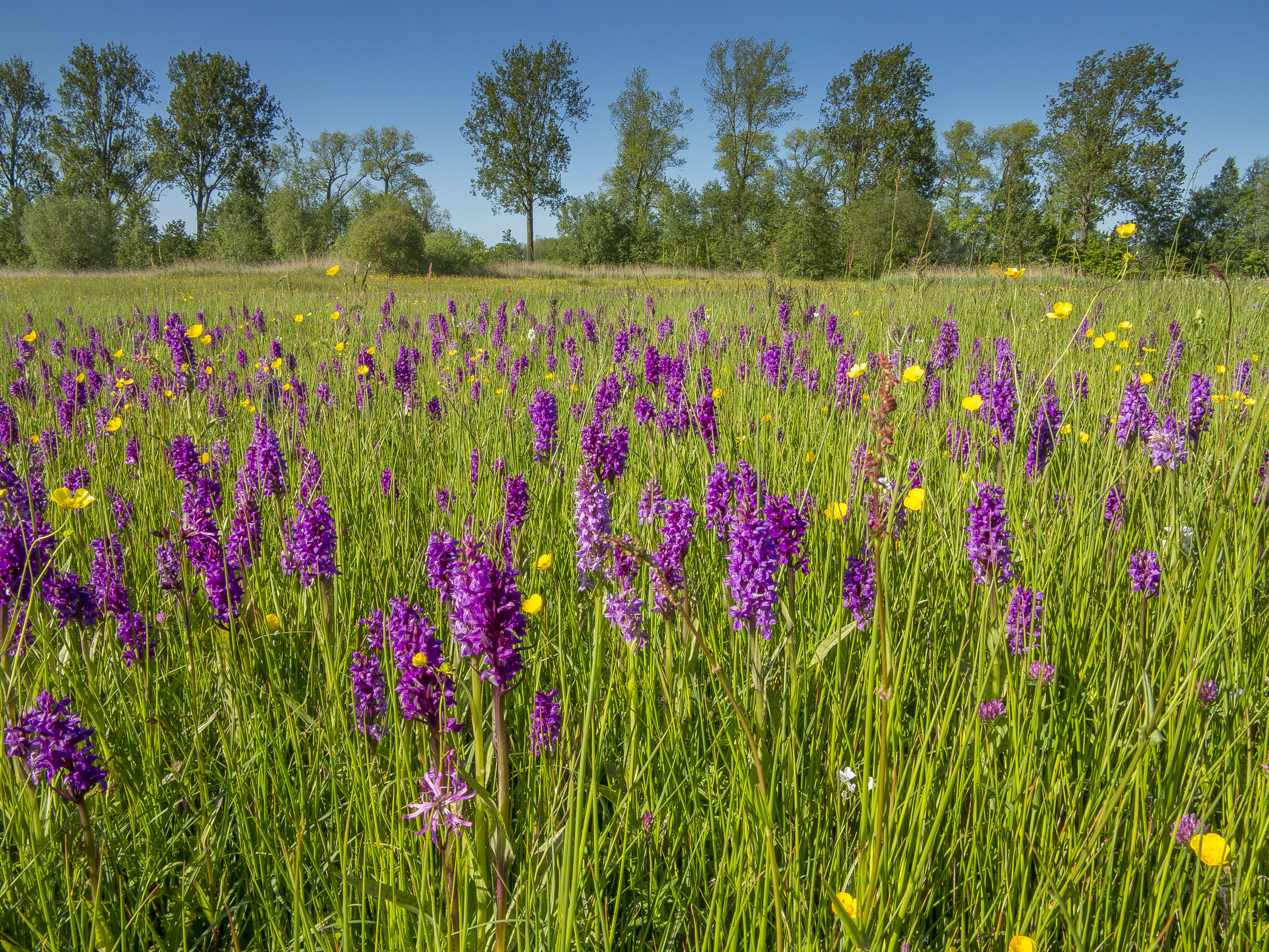
Fen meadow and transition mire nature reserve
-
None
-
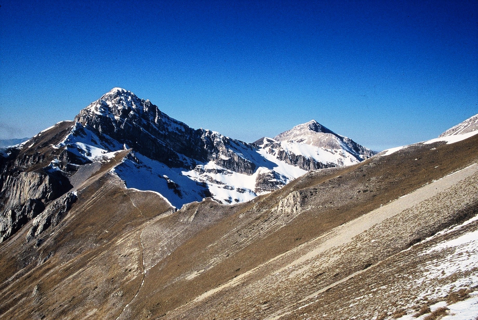
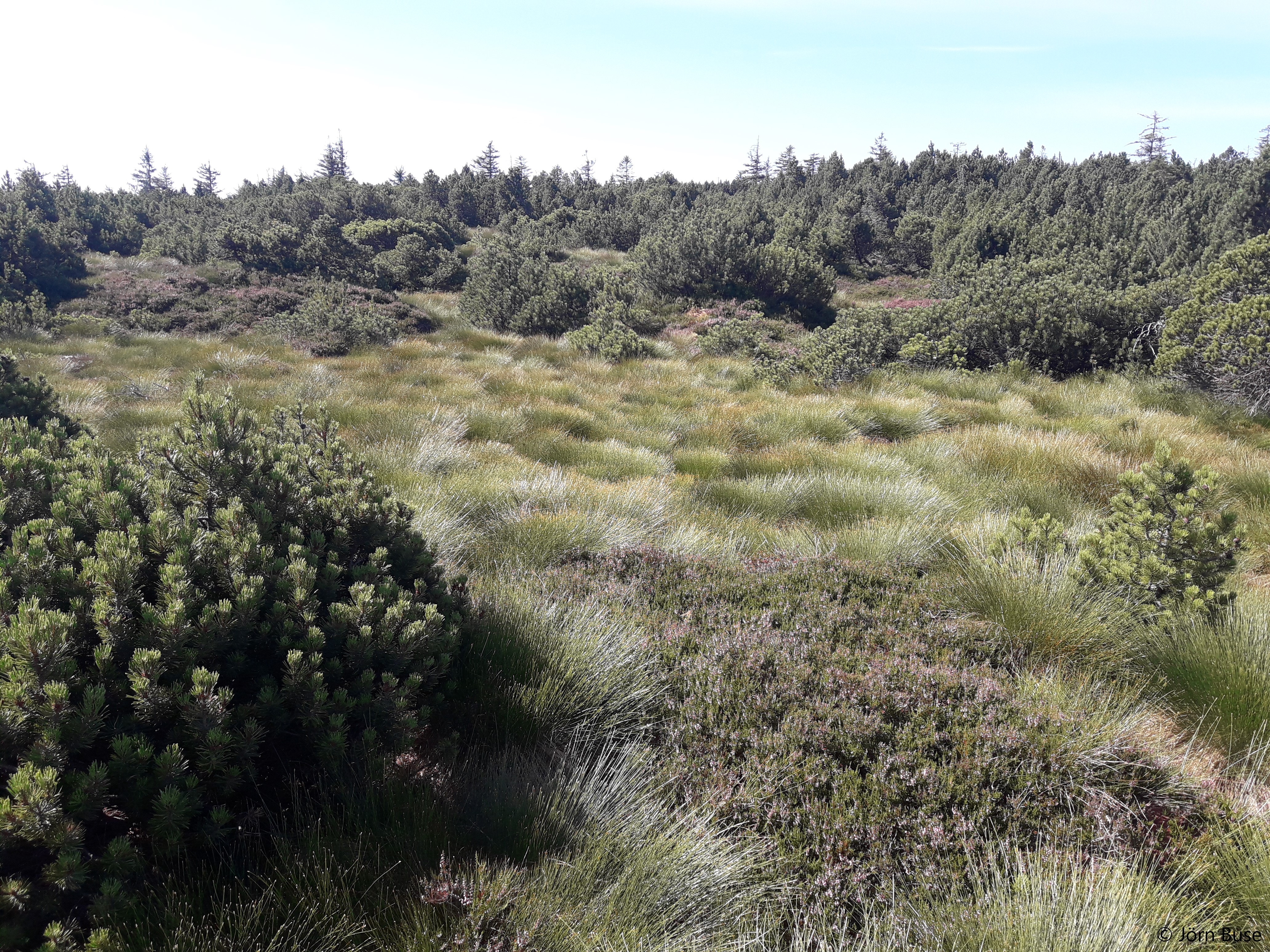
The site consists of high elevation vegetation in central Mediterranean basin, along the Apennines mountain range: xerophitic primary grassland (Pediculari elegantis-Seslerietum tenuifoliae) and mesophitic primary grassland (Luzulo italiacae-Festucetum macratherae), with important resident and migratory bird communities. Six plots, each one 100 m2 large, grouped in two cluster-plots including each one three plots, representative of a larger area of 0,5 km2 ca., ranging from 2100 to 2300 m a.s.l. (alpic and Mediterranean high-mountain belts.
-
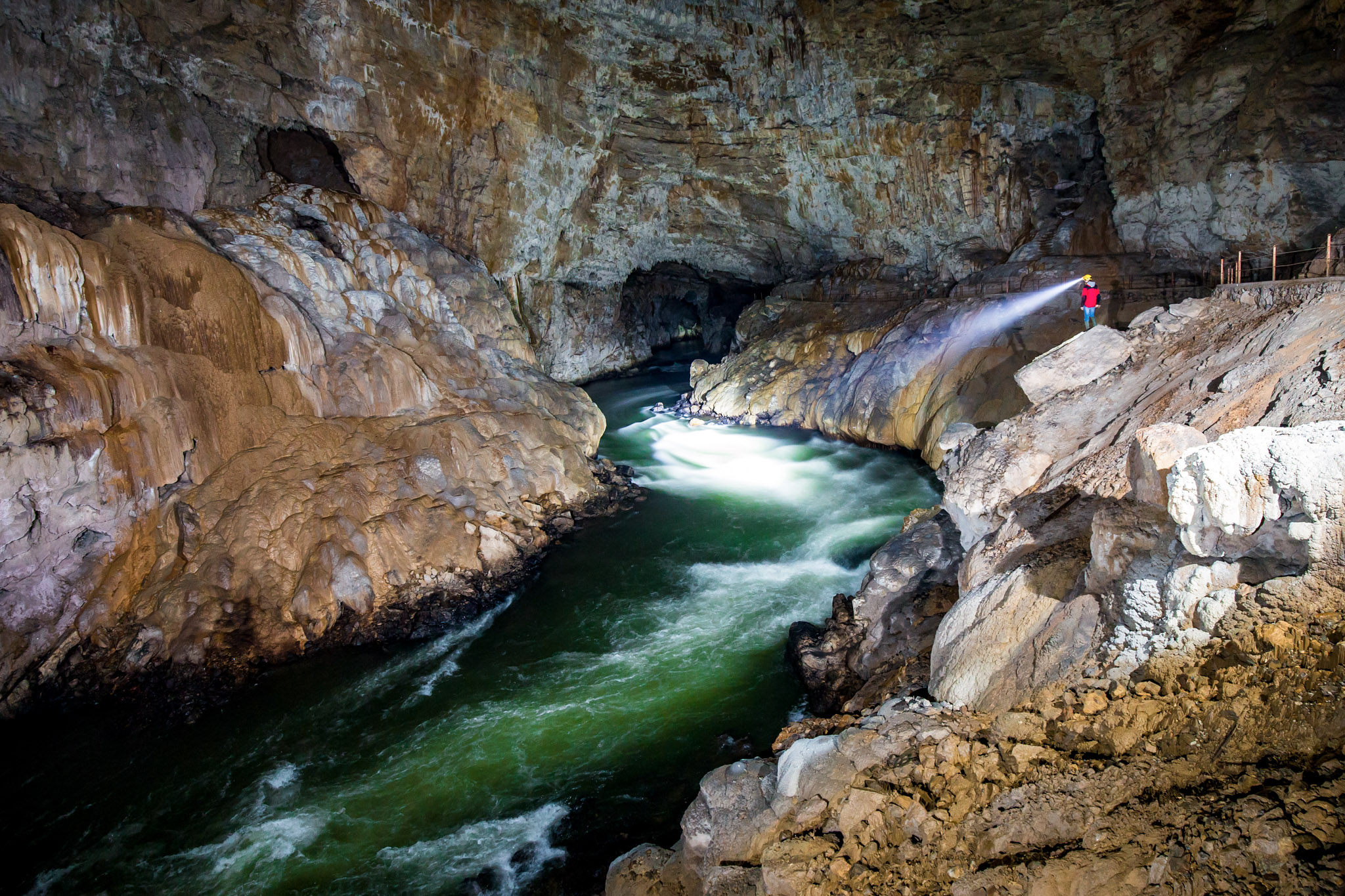
Postojnska jama is a part of the Postojna-Planina cave system (PPCS), the most biologically diverse cave in the world. Postojnska jama is a locus typicus of at least 37 animals, among them also cave beetle Leptodirus hochenwarti, the first recognized cave adapted animal. PPCS consisting of 17 and 6 km of passages, respectively, connected by 2 km of flooded corridors, the PPCS has more known species of stygobionts than any other cave or other subterranean site. The sinking river in the main passages is inhabited by a rich assortment of stygobionts, stygophiles, and accidental surface species. Both streams drain a catchment area of over 800 km2. Above the cave passages is the rich epikarst community. Among the 48 stygobionts is the European cave salamander Proteus anguinus anguinus. Both the snail (8 species) and crustacean (16 species) faunas are rich. The marine origin of some of the stygobiotic species is evident in the hydrozoan Velkovrhia enigmatica and the cirolanid isopod Monolistra racovitzae racovitzae. Three species of the amphipod genus Niphargus as well as populations of Asellus aquaticus were isolated in the cave at different times. The Postojna-Planina Cave is one of the best-studied caves in the world, and parts of it have been heavily visited by tourists since 1818. There are currently installed underground meteorological stations, and sites are defined for permanent water and biodiversity monitoring with the respect to human impact.
-
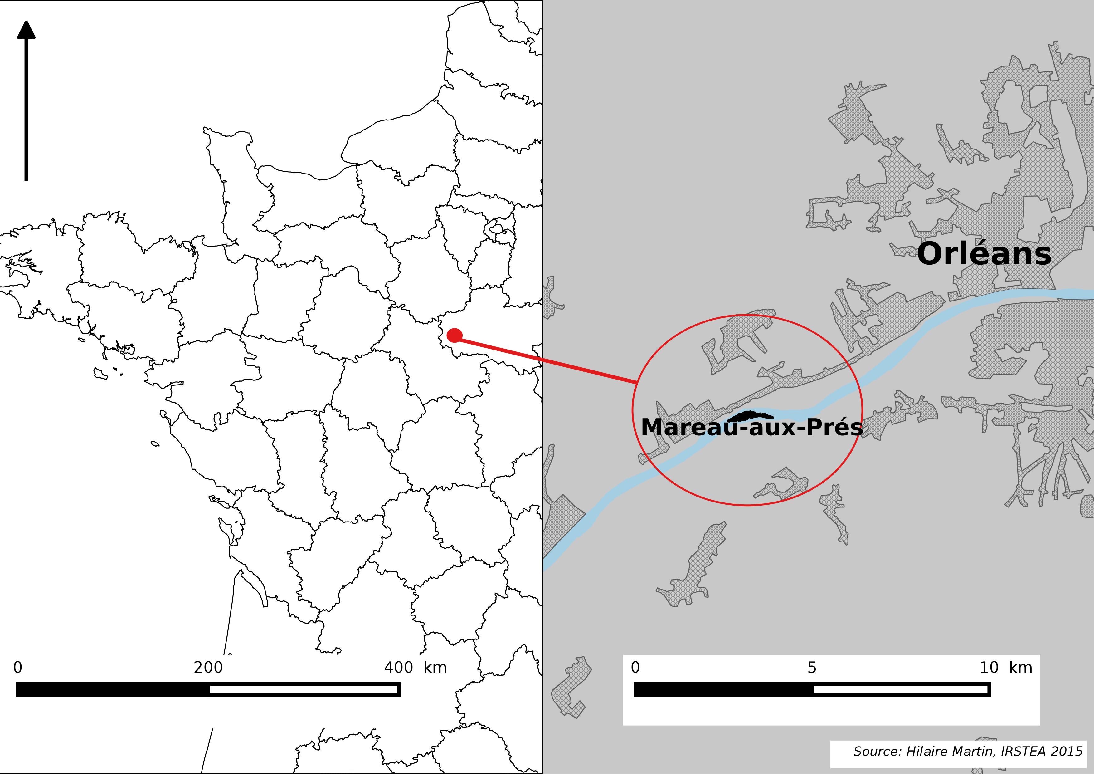
The Mareau-aux-Prés islands, along the Loire river, are characterized by a multiple channel pattern, where natural limestone riffles influence the morphology and spatial distribution of vegetated islands, secondary channels and alluvial bars. Within these islands, in september 2012, fluvial management operations (FMO) were launched. The vegetation of the central sandy-gravelly bar (3 ha area) was uprooted and the bar level lowered in order to maintain the flow capacity of the river. A new sandy-gravelly bar appeared in spring 2013, ideal field support for studying long-term ecological issues. A multidisciplinary research program (‘BioMareau’ project) is currently being conducted from 2012 to 2019, focusing on biodiversity recolonization and on interactions and feedbacks between biotic and abiotic compartments.
-
LTER plot Thermophilous forests includes five regions and sixteen localities in Central Bohemia and Southern Moravia, where ecosystems of thermophilous forests, including adjacent natural treeless vegetation, have been studied for a long time. The monitoring is run jointly by the Institute of Botany of the Czech Academy of Sciences (coordination R. Hédl) and the Silva Tarouca Research Institute for Landscape and Ornamental Gardening (coordination D. Adam). The main focus is on the plant community, including trees and herbs, which are monitored by using sets of permanent plots, or as continuous forest stands. Data are collected at the level of individuals (plants), plant communities (species composition and biodiversity) and ecosystem (soil, canopy, microclimate and other variables). The backbone of the monitoring system consists of nearly 500 long-term monitoring plots. These are supplemented by several dozens of short-term monitoring plots, and historical plots resurveyed only once after several decades. The monitored forest stands share similar natural conditions and management history. They cover a wide range of thermophilous forest communities, mainly thermophilous oak-hornbeam forests, various types of oak and ravine forests, occasionally beech forests and the adjacent open habitats (rocky steppes). The dominant type of management was coppicing in most sites, mainly as coppices-with-standards. The historical management was abandoned during the 19th and early 20th centuries, and the monitored ecosystems were managed with a decreasing intensity in about the past half a century. Some of the localities or their parts are subject of non-intervention regime at present. This has affected the age of the forest stands, which has increased by several times. Today, many stands are 100+ years old. All monitored localities are parts of conservation areas, often multiple combinations - national nature reserves (NNR), national nature monuments (NNM), nature reserves (NR), national park (NP), protected landscape area (PLA), EU Site of Community Importance (SCI). The main strategy of the nature conservation is the management reduction at most sites. In several cases, however, restoration of the traditional ways of forest management has been introduced in the past years. The Thermophilous forests site consists of the following five areas and sixteen localities: 1. Křivoklátsko Protected Landscape Area Monitoring of the dynamics of tree communities (including 3D scanning), vegetation including the communities of vascular plants, fungi, saproxylic beetles and soil processes. Data are available from 1976, 1999, 2004 and annually since 2004 (localities Velká Pleš and Týřov), or since 1993 (locality Červený kříž) - Velká Pleš: 10 ha of continuous forest stand monitoring, 400 microplots (20 x 20 cm) and monitoring of game impact on rocky steppes (pleše = balds). - Týřov: 400 microplots (20 x 20 cm) in xerothermic treeless habitats and in enclosures. - Červený kříž: focus on the impact of game on the diversity of plant communities. 2. Český kras Protected Landscape Area Monitoring of the dynamics of plant communities, soil and tree overstory in five-year intervals, using a network of 190 permanent plots. Microclimatic measurements in part of the plots. Data from 2005, 2009, 2014, 2019. Focus on the tree dynamics at one locality (Doutnáč). Part of the area left for spontaneous development, part subject of the traditional management restoration. Additionally, 57 historical vegetation plots resurveyed after 50 years. - Karlštejn NNR: three localities Prostřední vrch, Vysoká stráň and Doutnáč; collective area 166 ha. - Koda NNR: three localities Tobolský vrch, Za lípou and Kodská stěna, collective area 95 ha. 3. Podyjí National Park Monitoring of the dynamics of several forest ecosystem components, focusing on natural processes and the restoration of traditional management forms. Continuously measured tree stands, yearly monitoring of plant communities, invertebrates, bryophytes, snails, fungi and soil variables by using a network of plots. Data available from 2010 and 2014-onwards. A network of 50 permanent plots with five-year monitoring interval was established in 2018. - Four localities in the eastern part of the national park: Lipina, Šobes, Popice and Hnanice, collective area 309 ha. 4. Pálava Protected Landscape Area Monitoring of the dynamics of plant communities, soil and tree overstory in five-year intervals, using a network of 160 monitoring plots. Microclimatic measurements in part of the plots. Monitoring of spider, beetle and ant communities in addition to that. Data available from 2008-onwards. Next to it, about 230 historical vegetation plots resurveyed after 50-60 years, and a detailed research on the management history. - Děvín NNR: 380 ha, 85 permanent plots and about 180 resurveyed historical plots. - Milovický les: 2051 ha, 75 permanent plots a 46 resurveyed historical plots. 5. Dúbrava Monitoring of the dynamics of plant communities, soil and tree overstory in five-year intervals, using a network of 75 monitoring plots. Data from 2011, 2012 and 2017. In addition to that, 56 historical vegetation plots resurveyed after 50 years, covering a larger area. Detailed research on the management history and a paleoecological research covering the entire Holocene. - Hodonínská Dúbrava: 4820 ha, 75 permanent plots and 56 resurveyed historical plots.
-
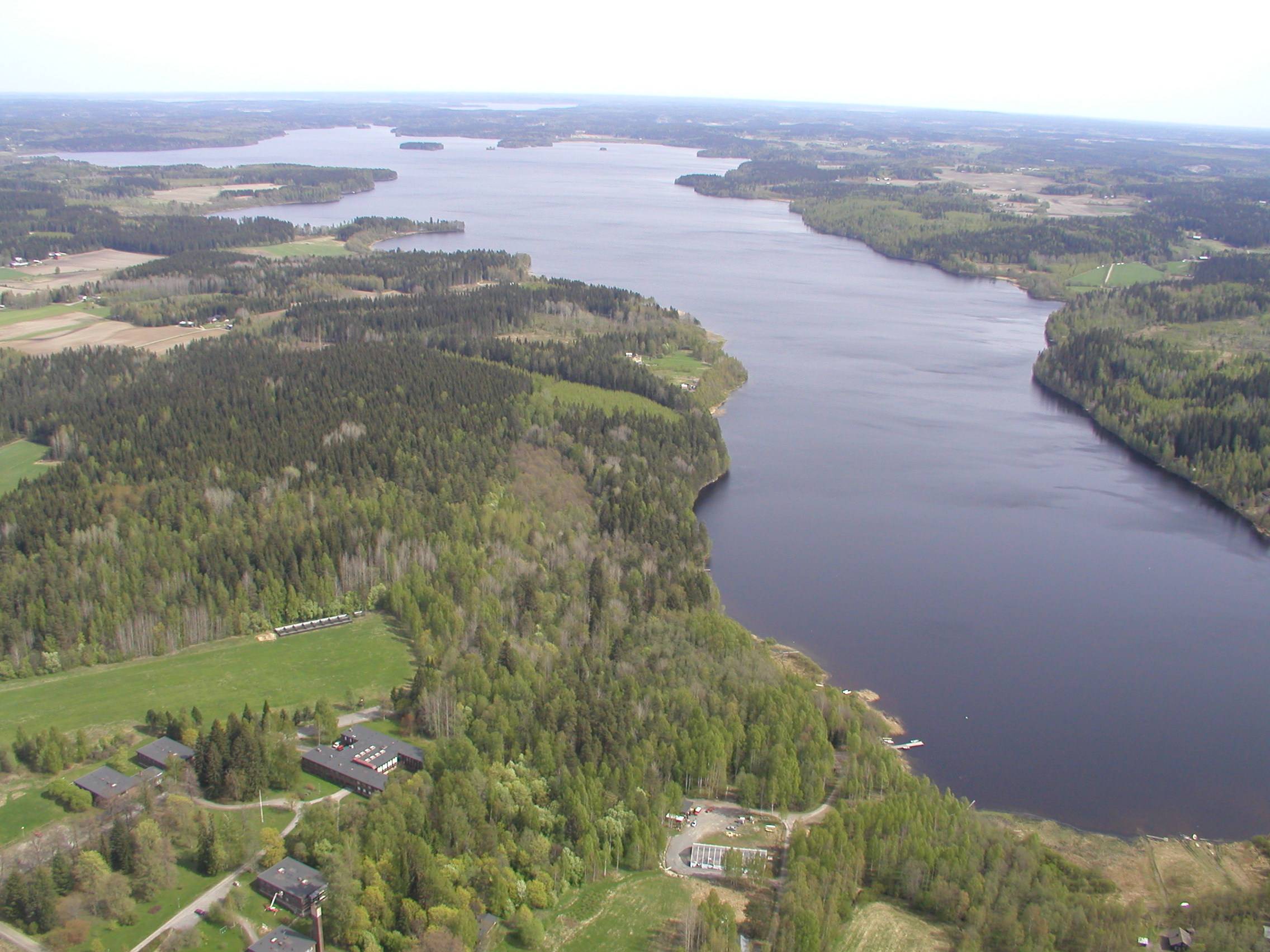
The Lammi LTER area is located 130 km north of Helsinki, 35 km east of the city of Hämeenlinna and 40 km west of the city of Lahti in uplands between two major river basins, i.e. rivers Kokemäenjoki and Kymijoki. The Lammi LTER area consists of several core sites/areas from which the Evo Forest and Lake Area (EVO) is the largest one and has a special value in terms of long term ecological studies. Another important study area is Lake Pääjärvi and its surroundings. The EVO area is among the largest coniferous forest areas in southern Finland. Lake Pääjärvi and its surroundings have been studied since early 1960s as a result of the establishment of the Lammi Biological Station in 1953 by the University of Helsinki.