
bryophytes cover
Type of resources
Available actions
Topics
Keywords
Contact for the resource
Provided by
Years
Formats
Representation types
-
Studies on ecological successions have a long tradition and strongly contributed to the understanding of community assembly, niche theory and ecosystem structure and functionality. Reports on ecological successions are however mostly restricted to one or two taxonomical groups, neglecting the mutual influences and dependencies between multiple taxonomic groups that are the building blocks of multidiverse communities. We introduce the Alpine research platform Ödenwinkel to promote observational and experimental research on the emergence of multidiversity and ecosystem complexity. We established n = 140 permanent plots along the successional gradient of the forefield of the Ödenwinkelkees glacier at the end of Stubachvalley in the Hohe Tauern range (National Park Hohe Tauern, Land Salzburg, Austria). In summer 2019 we completed a first full inventory of biotic and abiotic characteristics of these plots covering the diversity and composition of vascular plants, bryophytes, arthropods and other animals, bacteria and fungi as well as some geomorphologic properties. In this paper we introduce the design of the research platform and show first results on the diversity and composition of vascular plants along the successional gradient. The Ödenwinkel platform will be available as long-term ecological research site where researchers from various disciplines can contribute to accumulate knowledge on ecological successions and on how interactions between various taxonomical groups structure ecological complexity in this alpine environment.
-
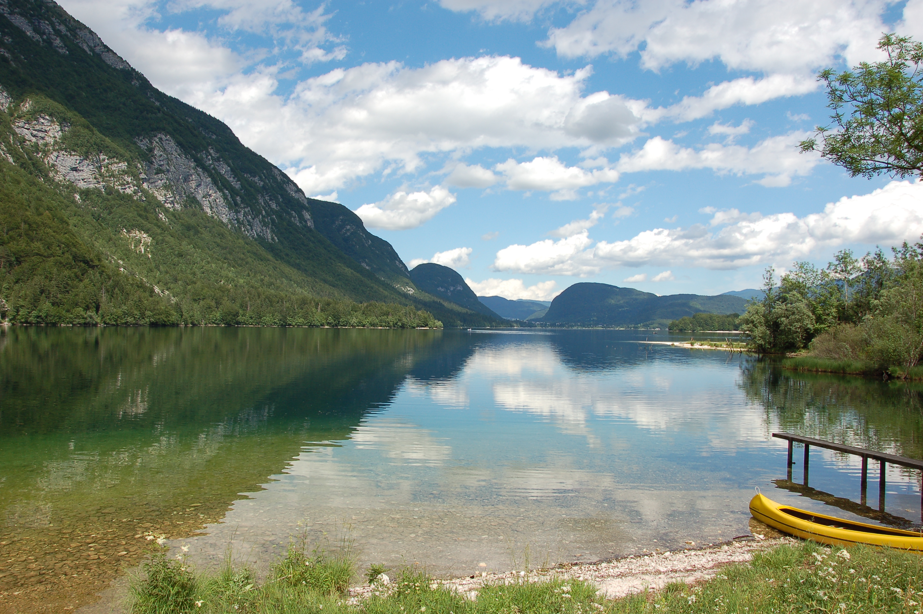
Lake Bohinj is of tectonic-glacial origin and was transformed by the Bohinj glacier. Its surface area is 3.28 km 2 , its volumeWeather conditions and chlorophyll concentrations determine long-term macrophyte community dynamics of Lake...92.5 × 10 6 m 3 and its maximum depth 45 m. It is located at an altitude of 525 m a.s.l. and issurrounded by mountains that are up to 2000 m high. Lake Bohinj is conditioned by the main inflow from River Savica and by several karst springs from the base of Mount Komarča and has a single outflow, River Sava Bohinjka. The residence time of the water in Lake Bohinj is about 4 months, which means that the total volume of the water in Lake Bohinj changes three times a year. The surrounding watershed comprises around 94.3 km2 and is mostly uninhabited, with a large portion extending above the tree line; therefore, the input of nutrients into Lake Bohinj is moderate. This watershed receives about 3300 mm of rainfall a year. Long-term temper-atures show a tendency to a rise. In winter, usually in January, the surface water cools and the lake can be frozen over. From 1961 to 1990, Lake Bohinj was frozen over for a mean of > 50 days/year, while in the decade from 1991 to 2000, the mean number of days with ice cover was reduced to 31 days/year. Since 1990, the lake did not freeze completely in individual years. The majority of the lake catchment area consists of carbon-ate rock, and therefore, the main lake sediment fraction is carbonate, while quartz and feldspar represent a minor part.
-
The Climate-Ecological Observatory for Arctic Tundra (COAT) platform covers two sites in the Norwegian terrestrial arctic - low-arctic Varanger Peninsula and high-arctic Svalbard. Long-term monitoring and research on tundra ecosystems are conducted on these sites.
-
The Aelmoeseneie Forest is a 28.5 ha mixed deciduous forest in the community of Gontrode, just southeast of Ghent. The largest part of the forest is ‘ancient forest’, i.e. it is permanently forested since before 1775, while the forest is surrounded by agricultural land (mostly pastures). The soil consists of a silt loam to loam soil (Planosol), overlaying a mosaic of tertiary clayey and sandy deposits with high base saturation starting at 50 cm depth. Forest management is designed to obtain a more natural tree species composition and to conserve biodiversity. More info can be found at www.aelmoeseneiebos.ugent.be.
-
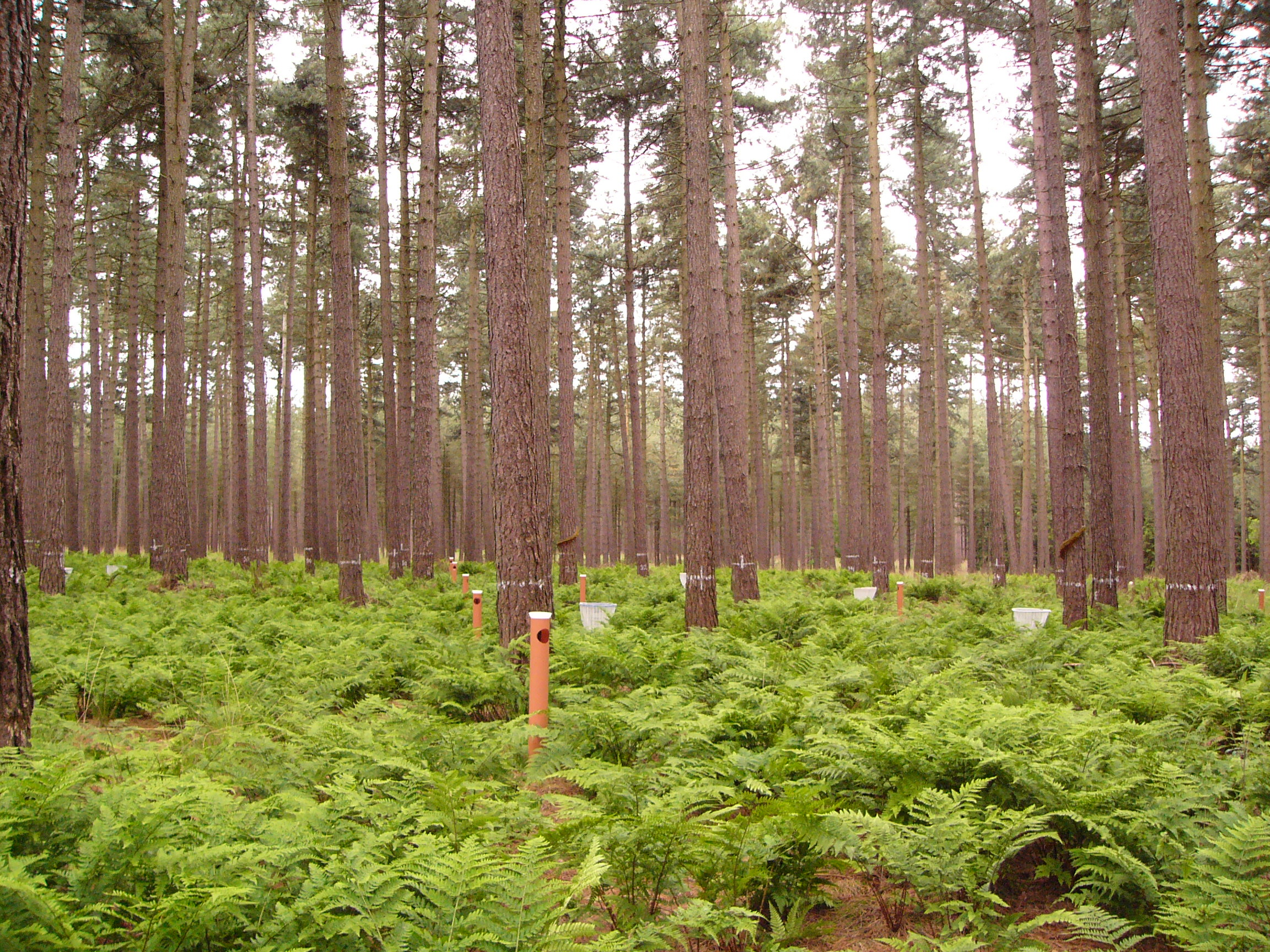
This LTER-site corresponds with a 0.25 ha intensive forest monitoring plot (ICP Forests Level II) including a 0.25 ha buffer zone. The site is located in a homogeneous stand of Corsican pine (Pinus nigra ssp. laricio var. Corsicana Loud.) planted in 1930 on former heathland and is part of Gewestbos Ravels, a landscape (about 1000 ha) with deciduous and coniferous forests, heathland, bogs and pastures in the northern part of the Campine ecoregion of Flanders. The terrain is gently sloping (1-2 %) and the soil is a well-drained sandy soil (Endogleyic Folic Brunic Albic Arenosol (Dystric)). Ground vegetation is dominated by ferns (Dryopteris dilatata and D. carthusiana) and Vaccinium myrtillus. After a storm in February 2007 felled several trees an understorey of Betula pubescens started to develop. Intensive monitoring was started in 1987 with the main objective to study the effects of air pollution on biogeochemical cycling and forest performance (growth, vitality). This yielded a number of long-term data series including on atmospheric deposition, air quality, soil and soil solution chemistry, tree mineral nutrition, ground vegetation and growth. Monitoring will be continued in the future as a statutory task of INBO.
-
Large forest area, ancient woodland of beech forests, just south of Brussels. In this forest, numerous research activities covering silviculture, forest history, biodiversity inventories, geomorphology, recreation etc... have taken place. Therefore, the complete forest is proposed as an LTSER-platform. Within the forest, two active long-term ecological monitoring programmes are present: - one ICP Forests Level II intensive forest monitoring plot (permanent sampling since 1987) - strict forest reserve monitoring programme on an area of 100 ha (periodic sampling of 15 ha since 1986, extended to 100 ha in 2000) On July 7th 2017, the strict forest reserve 'Joseph Zwaenepoel', together with 4 other unmanaged reserves in the forest, was added to the UNESCO Natural Heritage Site ' Primeval Beech Forests of the Carpathians and Other Regions of Europe' (http://whc.unesco.org/en/list/1133). Besides these, a large number of former research projects, PhD research and a detailed management follow-up make the Sonian Forest one of the best mapped and documented forests in Belgium / Europe.
-
The site Klausen-Leopoldsdorf is part of the European Level II Forest Monitoring System in the frame of the International Co-operative Programme on Assessment and Monitoring of Air Pollution Effects on Forests (ICP Forests). The site was established in 1995 and is, since 2006, part of the LTER Austria network. It is situated in a homogenous 80 years-old managed beech stand about 20km west of Vienna. The LTER-CWN research area in Klausenleopoldsdorf is divided into 3 subplots: a measuring weir, a dendrometer/sapflow measuring facility and GHG-chambers for measuring the fluxes of CO2 and other relevant GHG´s. All 3 subplots were installed in 2019 to collect high-resolution data. The measuring weir is located at about 475m a.s.l and the other subplots (denrometer/sapflow, GHG measuring chambers) are located at about 510m a.s.l. The observed catchment of the measuring weir has an area of 46 hectares. The dominating soil types in the catchment are Planosoils and Stagnosols. The subplots are situated in the near vicinity of the ICP-forest plot.
-

The Cairngorms National Park is one of 15 National Parks in the UK (one of two in Scotland) and is Britain's largest National Park (4,528 km2). It is the location for some of the most spectacular landscapes in Britain and is home to an incredible diversity of wildlife and plants. http://cairngorms.co.uk/the-park/facts-figures/ The aims of the National Park are: • To conserve and enhance the natural and cultural heritage of the area; • To promote sustainable use of the natural resources of the area; • To promote understanding and enjoyment (including enjoyment in the form of recreation) of the special qualities of the area by the public; • To promote sustainable economic and social development of the area’s communities. Cairngorms National Park, seven broad habitats can be identified: • Enclosed farmlands • Woodlands • Open waters (rivers, lochs, wetlands and floodplains) • Mountains • Moorland • Semi-natural grasslands • Urban • Population of c17,500 • 25.8% of population over 60 (higher than Scottish average) • Average health index in top 25% of Scotland (based on deprivation indices) • Extensive core paths network • 55 Munros including 5 summits over 4000 feet • 3 ski centres • National Cycle Network Route 7 • 1 Long Distance Route (Speyside Way) • Relatively low atmospheric pollution • Annual precipitation over 2250mm on summits and under 900mm in straths • Average annual snow cover 200 days on summits and 50 days on low-ground • Prevailing winds from south-west
-

Monitoring stations in Aukštaitija NP started functioning in 1993. Aukstaitija station (LT01) was founded in strict reserve zone of Aukstaitija national park in Ažvinčių old forest, Versminis river closed basin. The area of the basin is 101.5 ha. The lowest place is at 159.5 m, the highest - 188.6 m above sea level. Geographical co-ordinates of the basin are: longitude - 26*03*20* - 26*04*50*, latitude - 55*26*00* - 55*26*53*. The climate is characterised as average cold with high humidity and abundant precipitation. The average air temperature is 5.8 C, average precipitation - 682 mm. Length of vegetation period - 189 days. Side glavioacvalic accumulation forms with sand, gravel and stones are typical for river basin and in the western part of the basin, with the decrease of surface altitude transfers into fliuvioglacial terrace delta plain with fine sand, and at the source- into marsh accumulation forms with organic sediments. At the eastern side of the basin, which has higher altitudes, the typical for this basin glavioacvalic accumulation forms transfer into gravel sand. Carbonates start foaming at 45 cm depth (Gulbinas et al., 1996). The saturation of the river water with the oxygen is very weak. The average yearly oxygen concentration equals to 2.9 mg/l (minimal allowable concentration – 6 mg/l). The pH value of the water fluctuates from 7.10-7.75 mg/l, which indicates the alkalisation of the water. Concentration of hydro-carbonate ions varies in the intervals of 148-224 mg/l. Concentrations of sulphates and chlorides are very small. Calcium and magnesium ions are dominating in the media of cations. Concentration of natrium ions is insignificant – 2 mg/l 9DLK=120 mg/l), concentration of kalium ions reaches only tenths of mg/l (DLK=50 mg/l). According to the size of mineralisation the river water could be described as having average mineralisation levels. Concentrations of nitrogen materials (ammonium nitrogen, nitrates) are small, compared to maximum allowable concentrations (DLK) set for surface waters. Concentrations of phosphates are small. Silicium concentrations fluctuate from 2 mg/l to 9 mg/l (Čeponienė, 1997). Main ecosystems Coniferous multi-layered forest stands are prevailing in the basin, which are mainly pine trees with a mixture of spruce. Those stands usually have a second and third tree layer with abundant under layer vegetation. Spruce stands are also of complicated structure. The second and third spruce layer with abundant under layer vegetation are common. Remarkable amounts of territory are occupied by mixed conifer-deciduous or mixed conifer forests. Pure birch stands in more wet habitats in the vicinity of Versminis river source can also be found. According to the forest stand age they are old pure overmature or with accompanying forest stands of several age classes. It is mainly multi-aged and multi-layered over mature pine and spruce stands. In addition The study was based on monitoring data on crown defoliation of more than 3000 Scots pine (Pinus sylvestris L.) trees from 20 permanent observation stands (POS) annually obtained between 1994 and 2009 in Aukstaitija national park (ANP), located in the eastern part of Lithuania (Fig. 1). Over 16yr period mean values of crown defoliation of every sample pine stand were computed annually. Therefore the total number of treatments made N=320. These stands were classified according to stand maturity: 4 sapling stands (45 to 50 years – Table 1, section “Stand maturity”, group 1), 5 middle aged stands (61 – 80 years – group 2), 4 premature stands (81-100 years – group 3), 3 mature stands (101-120 years – group 4) and 4 over mature stands (> 121 years – group 5). Main characteristics of the considered stands are compiled in table 1. All stands represent the prevailing in Lithuania Pinetum vaccinio-myrtilosum forest type.
-
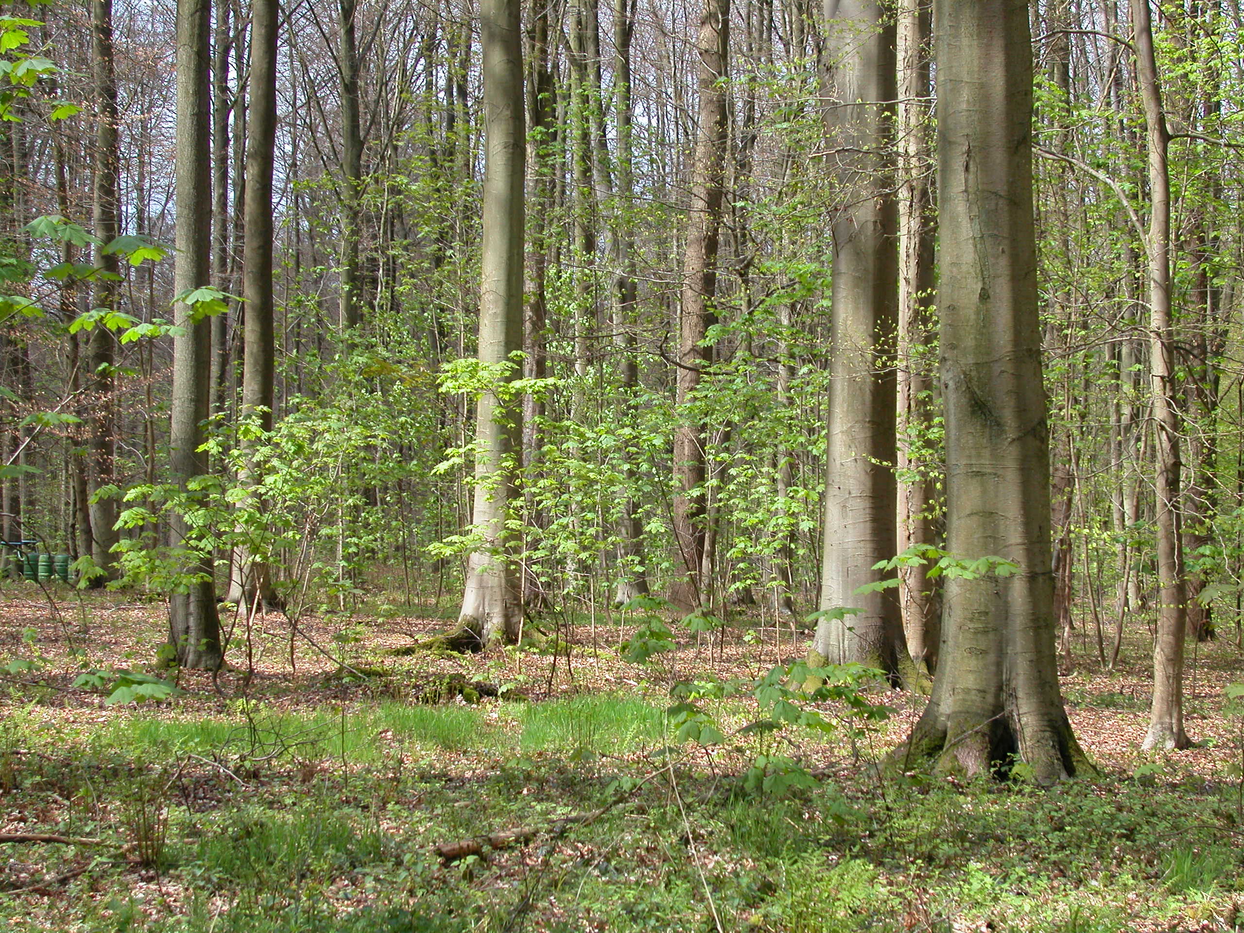
Beech forest in the Central italian Apennines