
bryophytes presence
Type of resources
Available actions
Topics
Keywords
Contact for the resource
Provided by
Years
Formats
Representation types
-
The restoration sites are located in abandoned arable land and clear-cut tree plantations mostly, but not entirely within LTER Fulophaza that is a high diversity site, both in terms of habitats and species, in the Kiskunság Sand Ridge. It uses some of the central facilities of the KISKUN LTER, such as the meteorological station and the field research station with accommodation opportunities, and a couple of long term monitoring sites and field experiments.
-
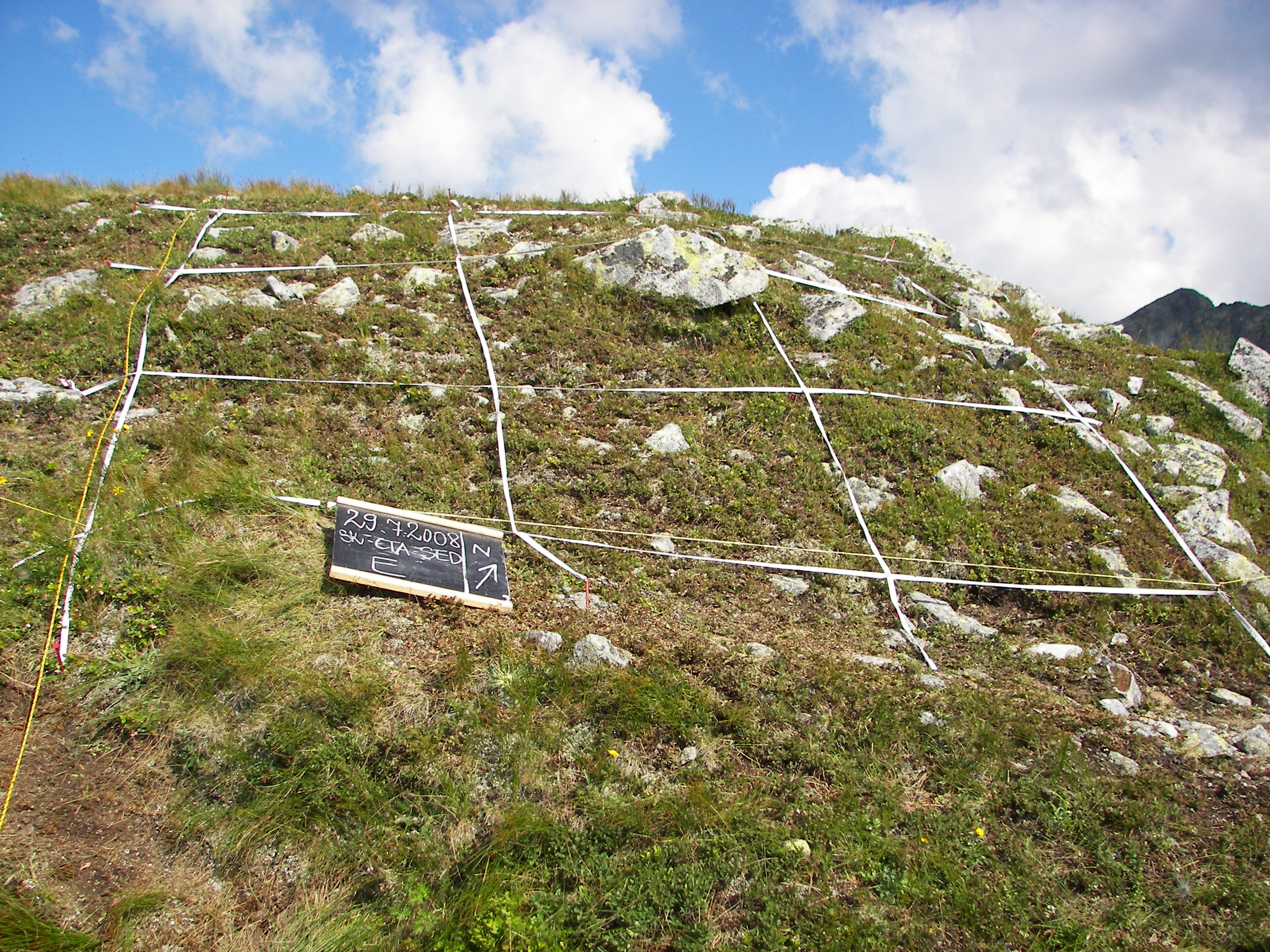
The Site was established in 2001 as a part of research initiative GLORIA (Global Observation Research Initiative in Alpine Environments) and as a long-term observation network for the comparative study of climate change impacts on mountain biota respecting the multi-summit sampling design. The Site is situated in the Tatra National Park and consists of four summits occurring in the alpine belt: Krížna peak (1,918.6 m a.s.l.), Veľká kopa peak (2,052.4 m a.s.l.), Sedielková kopa peak (2,061.3 m a.s.l.) and Summit – Krátka peak (2,374.5 m a.s.l.). The re-investigation of site take place every 7 years and the data are compared with other GLORIA research sites within the world-wide network.The first took place in within the 5th RTD framework programme of the EU, the second in 2008 and the next in 2015.
-
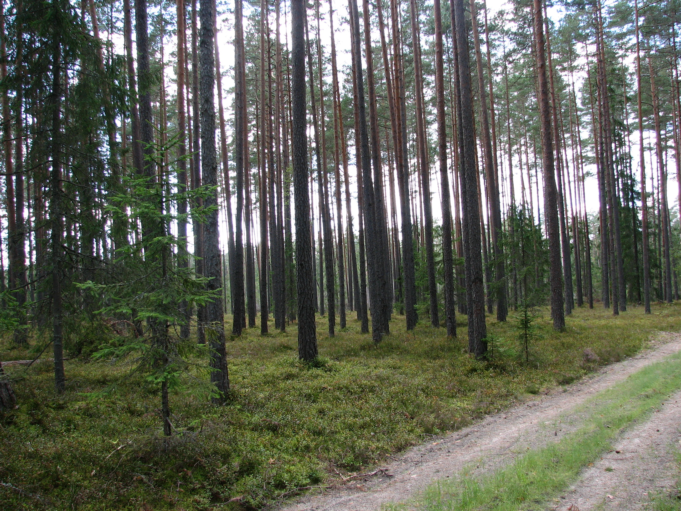
Three Scots pine (Pinus sylvestris) forest sites (30-40 year old, 50-70 year-old, and 150-200 year-old)on sandy podzolic soils in the central part of the North Vidzeme Biosphere Reserve.
-
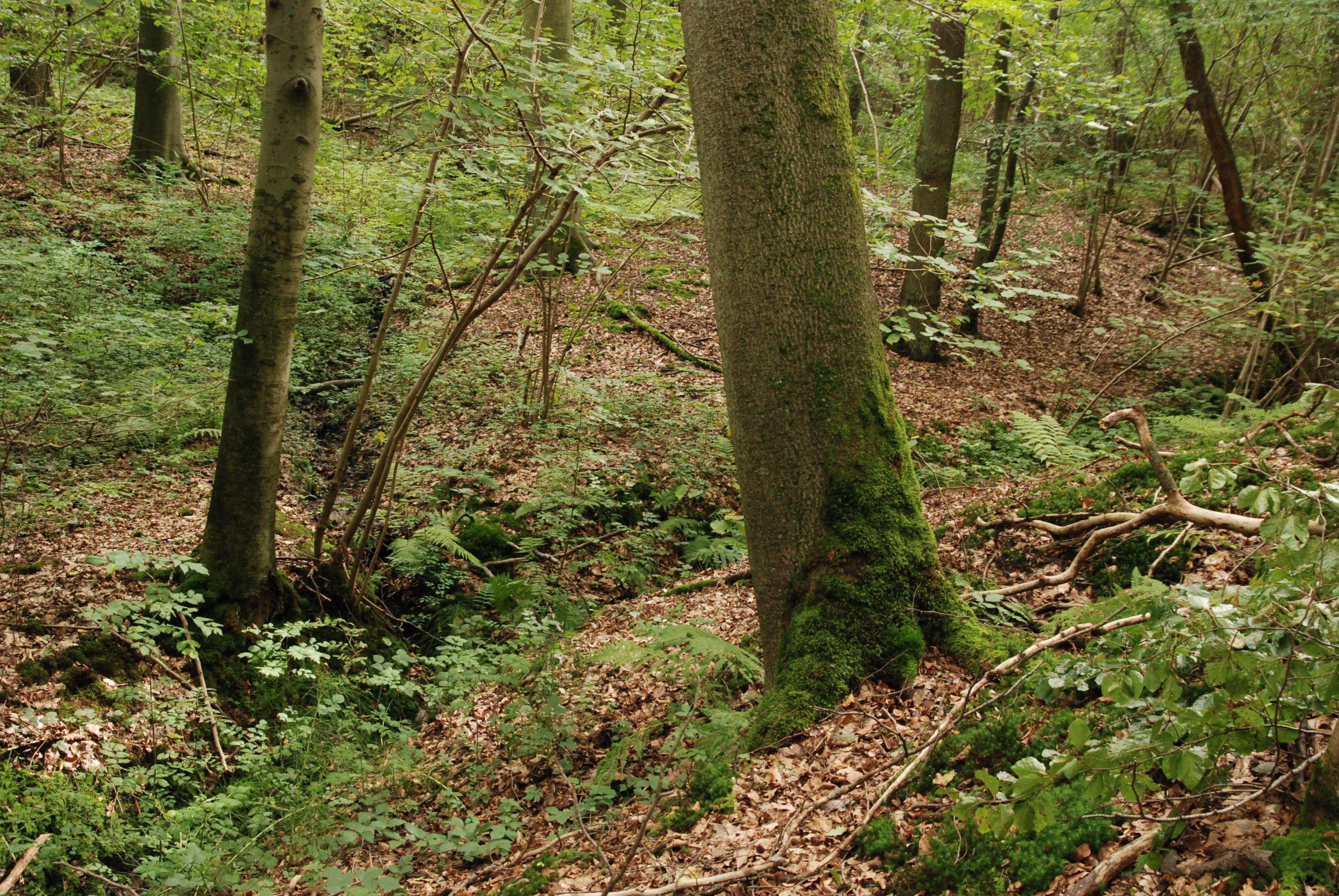
The Nature Reserve Rode Forest and Laan Valley is a diverse site, covering a small rivulet valley (river Laan) with grasslands and marches, and the adjacent plateau forest of Rodebos. The forest on the plateau consists of acidophylous oak-beech forests. The slope forest habitats are influenced by an aquifer that feeds slope sources. Hydrochemically, the water of this aquifer can be characterized as acid and nutrient poor. The slope displays an acid tolerant vegetation with Sphagnum as well as a more neutrophilic Querceto-Carpinetum. Lower on the slope, also base-rich sources are present, resulting in neutrophylous spring and alluvial forest. The research in this LTER-site focuses primarely on ecohydrology of this forest ecosystem, and forest dynamics in two sampling areas (resp. 1ha and 0.5 ha) within the unmanaged strict reserve area in the northern part of the reserve (23 ha). consists of a valley part, a slope part and a plateau part.
-
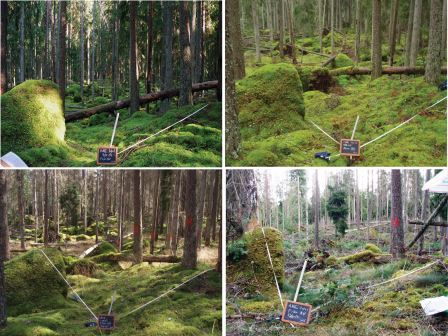
Resurvey data of vascular plants, epiphytic lichens and bryophytes at LTER Zöbelboden, Austria. First records started in 1993 and all permanent plots are being resurveyed on a regular basis every couple of years. Permanent plots for forest understorey are 10x10 m; epiphytic lichens and bryophytes are recorded on tree trunks (with some bryophytes plots on the forest floor)
-
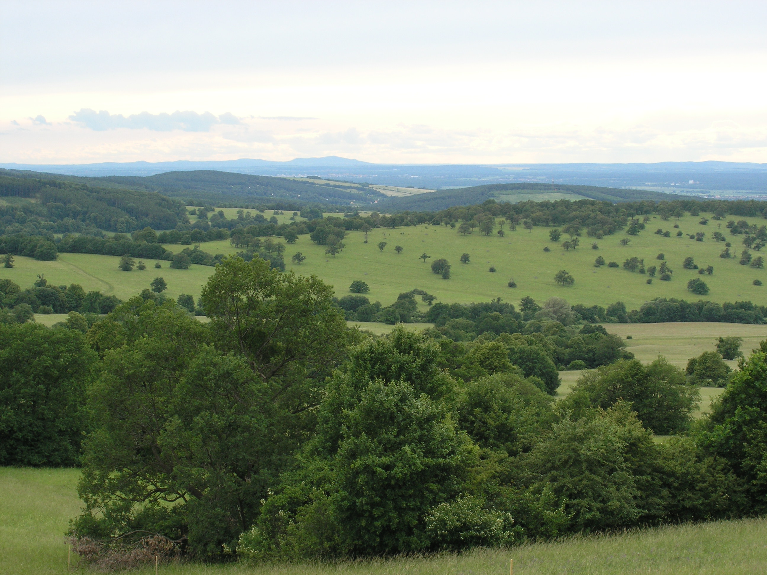
The White Carpathian (Bílé Karpaty) Mts. are important especially for their vast species-rich meadows with many rare and endangered species, often having here very large populations or remarkably isolated occurrences distant from the centres of their natural ranges. Čertoryje Nature Reserve and its buffer zone, which form the majority of the LTER site, is the largest area of this precious habitat in the White Carpathians. Meadows which were not fertilized (or even ploughed up) under socialist agriculture in the second half of the 20th century are the most valuable. These meadows are usually situated on steep slopes which were hardly accessible to the machinery and were thus often totally abandoned and gradually overgrew with expansive grasses and scrub. Their current biological diversity therefore needs resumption of the former extensive management (scrub elimination and subsequent regular mowing without fertilization). These resoration activities started here in the mid 1980s. A fine-scale monitoring of vegetation succession after management restoration at one of these plots is a component of the long-term research here since 1989. The opposite extreme of socialist agricultural management of species-rich meadows was their conversion to arable land. These fields have been gradually re-grassed since 1989. Restoration of the former species-richness is however very slow (or even impossible) and needs special restoration measures. Hence another objective of the local long-term research is the succession on re-grassed arable fields. Spatially detailed observations take place on the eastern slope of the Výzkum hill and are aimed to find out an optimalized economic method of restoring a species-rich meadow (four variants are tested). Except vegetation succession, also the development of several soil fauna coenoses (Testacea, Nematoda, Oribatida, Collembola, Enchytraeidae, Lumbricidae, Oniscidea, Diplopoda, Chilopoda, Opiliones, and Carabidae) has been studied here since 2000. Since 2009, also succession in a broader landscape context is studied, taking into account restored grasslands in a major part of the whole White Carpathian Mountains. More than one tenth of the localities from this landscape study takes place directly in the LTER site, representing about 100 hectares regrassed by a regional species-rich seed mix since 2000 and 30 hectares regrassed by a commercial clover-grass seed mix in the late nineties. The research is focused on both plants (mainly vascular plants, additionally also bryophytes) and animals (Auchenorrhyncha, Heteroptera, Lepidoptera: Hesperioidea, selected phytophagous Coleoptera).
-
Nature reserve, Natura 2000, Protected coniferous blueberry forest, catchment, IM site, Podzol soil.
-
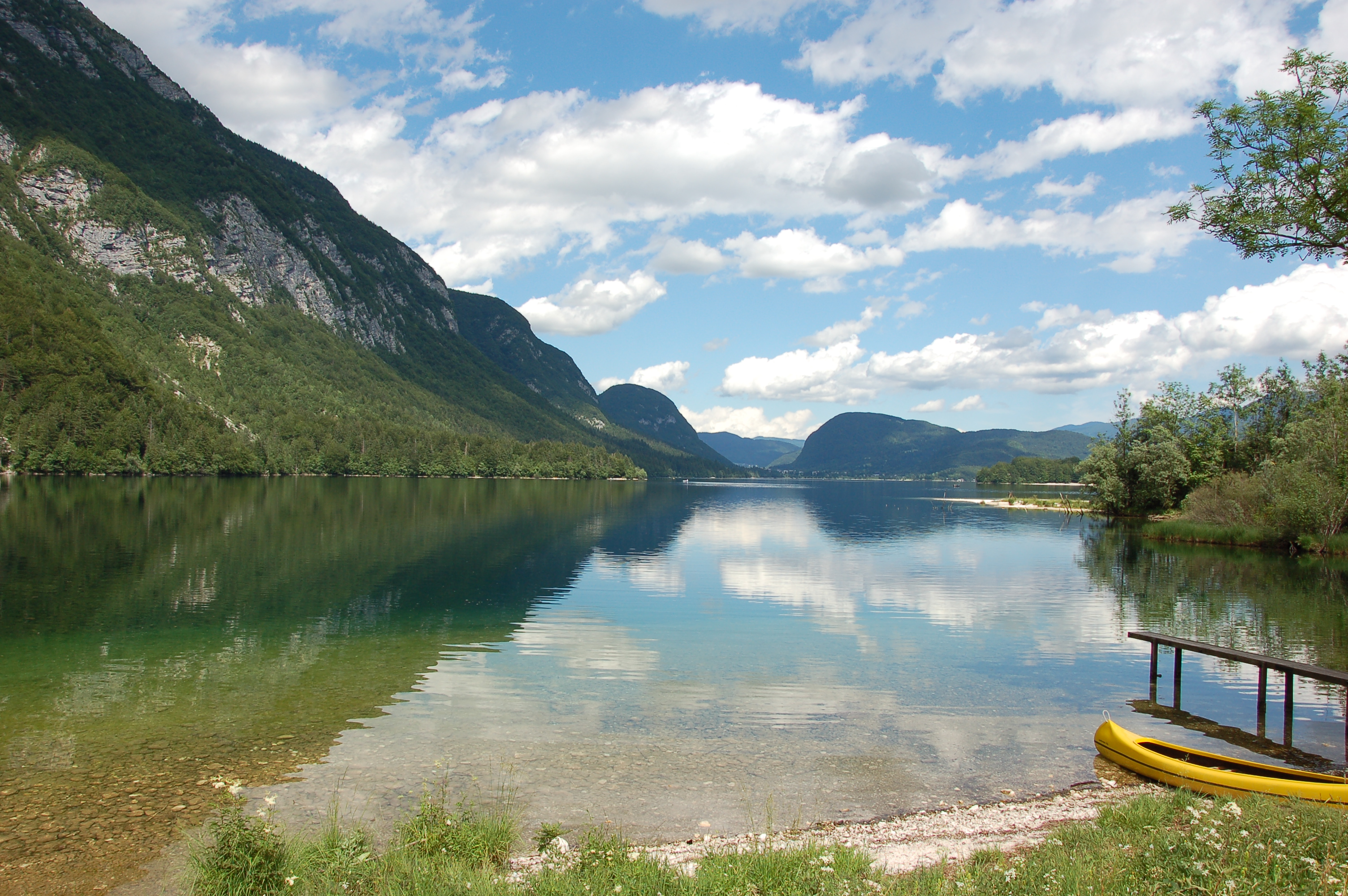
Lake Bohinj is of tectonic-glacial origin and was transformed by the Bohinj glacier. Its surface area is 3.28 km 2 , its volumeWeather conditions and chlorophyll concentrations determine long-term macrophyte community dynamics of Lake...92.5 × 10 6 m 3 and its maximum depth 45 m. It is located at an altitude of 525 m a.s.l. and issurrounded by mountains that are up to 2000 m high. Lake Bohinj is conditioned by the main inflow from River Savica and by several karst springs from the base of Mount Komarča and has a single outflow, River Sava Bohinjka. The residence time of the water in Lake Bohinj is about 4 months, which means that the total volume of the water in Lake Bohinj changes three times a year. The surrounding watershed comprises around 94.3 km2 and is mostly uninhabited, with a large portion extending above the tree line; therefore, the input of nutrients into Lake Bohinj is moderate. This watershed receives about 3300 mm of rainfall a year. Long-term temper-atures show a tendency to a rise. In winter, usually in January, the surface water cools and the lake can be frozen over. From 1961 to 1990, Lake Bohinj was frozen over for a mean of > 50 days/year, while in the decade from 1991 to 2000, the mean number of days with ice cover was reduced to 31 days/year. Since 1990, the lake did not freeze completely in individual years. The majority of the lake catchment area consists of carbon-ate rock, and therefore, the main lake sediment fraction is carbonate, while quartz and feldspar represent a minor part.
-
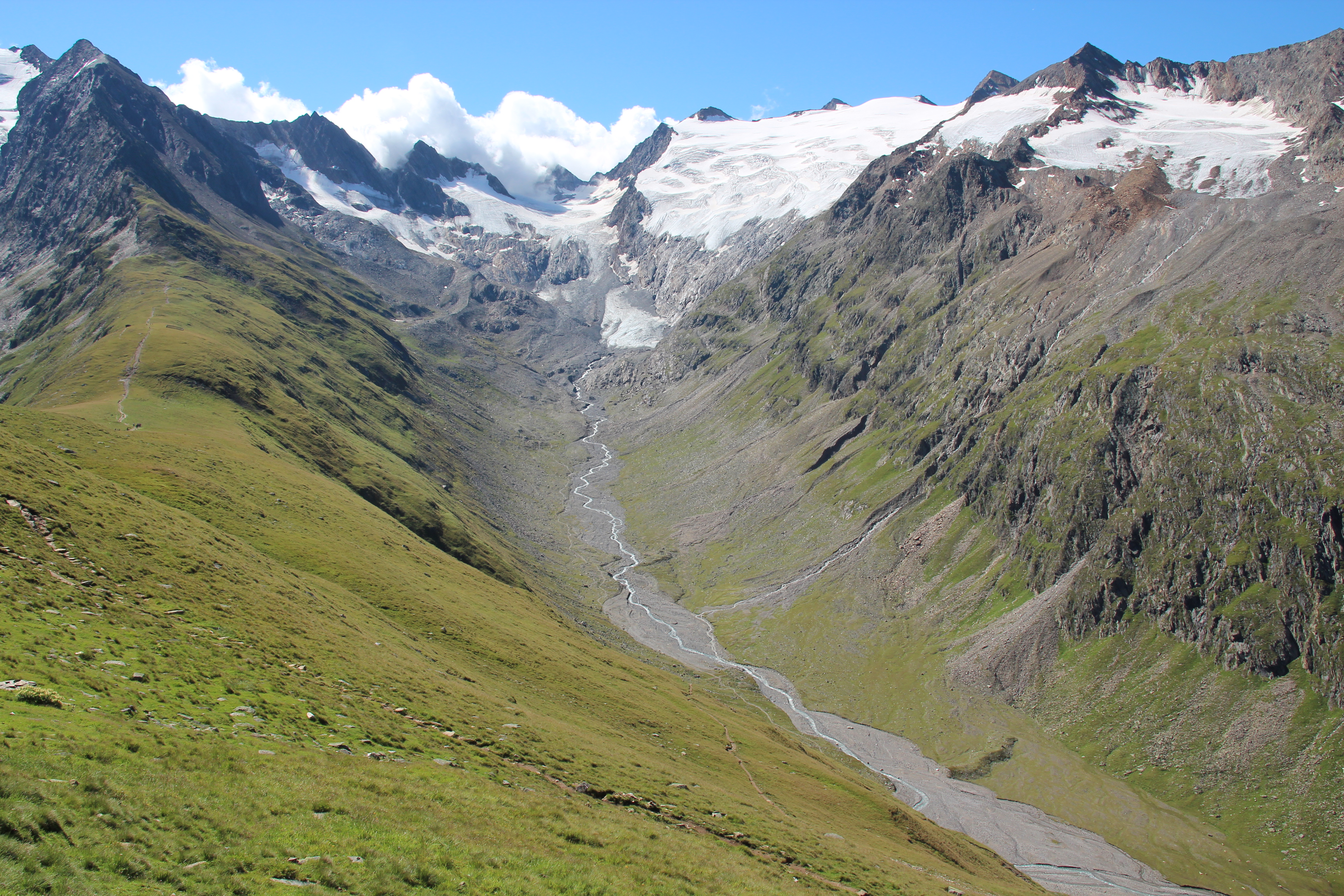
Obergurgl lies about 1930 m a.s.l., very much at the head of the Ötz-valley (municipality of Sölden) in the central Alps. The research areas of the LTER site Obergurgl are located at the slopes, glacier valleys and glaciers south and south-west of Obergurgl. A variety of logger stations (mostly wheather stations) are installed at different locations at the site, some of them measuring since 1953. Various research project, most of them performed by researchers of the University of Innsbruck, are carried out in this area. Habitat types are alpine grassland, alpine forests, pasture and dwarf shrub heath, glacier forelands and glaciers. The LTER site Obergurgl is managed by the Alpine Research Centre Obergurgl (http://www.uibk.ac.at/afo/), a branch office of the University of Innsbruck (http://www.uibk.ac.at/). The Alpine Research Centre Obergurgl is located at the edge of the village Obergurgl. It is consolidated with the University Centre Obergurgl (http://www.uz-obergurgl.at/), a congress centre and hotel with up to 100 beds. Indoor infrastructure are a lecture hall, a seminar room, a small laboratory and small libraries.
-
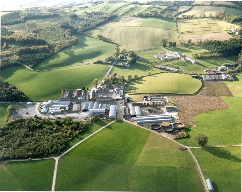
UK ECN site. A lowland grassland site situated at the Agri-Food and Biosciences Institute, Co. Down, Northern Ireland and representative of grassland in much of the north-western United Kingdom. There are several long-term field experiments ongoing on the site. A large part of the site is estate woodland (Hillsborough Forest) consisting of mature mixed woodland and conifer plantation. Many of the vegetation plots are located within this forested area, as are sections of the butterfly, carabid beetle, spider and bird transects. The Hillsborough premises had formerly been the home of Marquis of Downshire and then during the 1st world war had been used for cropping by local farmers. When the war ended agric commodities prices collapsed and large portions of the farm became derelict with rough grazing let out by public auction on a conacre basis from 1922-1926. The research station at Hillsborough was originally established in 1926 and incorporated by the Agricultural Research Station Act N.I. 1927. By 1931 263 acres was actively farmed.In 2006 the Agricultural Research Institute was amalgamated to form what is now called AGRI Food and Biosciences Institute.