
buffer capacity
Type of resources
Available actions
Topics
Keywords
Contact for the resource
Provided by
Years
Formats
Representation types
-
Plynlimon is at the headwaters of the Rivers Severn and Wye. The infrastructure at Plynlimon consists of 10 instrumented research catchments representing different land use options on the same geological parent material. It is the UK’s Critical Zone Observatory, part of the EU and global network of CZOs and is an ExpeER site. The infrastructure records high temporal resolution river flow and meteorological data (40 year data record) and stream water and precipitation chemistry for cations, anions, trace metals, nutrients, pH and alkalinity (30 year data record) and some data for suspended sediment. The site has an extensive spatial data library including topography, digital terrain model (DTM), soils, geology and vegetation/land-use available, open access, through the Environmental Information Data Centre (https://catalogue.ceh.ac.uk/documents/91961a0f-3158-4d00-984d-91eb1e03e8bd). Sub sites in the catchments represent a range of upland management types: mature/clear cut/replanted conifer forest; acid grassland; eroding peatland; improved grassland.Samples analysed for a wide range of major, minor and trace components. Bulk precipitation and cloudwater chemistry is also measured at one location.
-
The LTSER Zone Atelier Bassin de la Moselle belongs to LTER-France network and is located in eastern France, Lorraine / Moselle. The ZAM acquires knowledge for better controls the impact of human activities on the quality of the water resources in Lorraine County (France), in the watershed of the Moselle River.
-
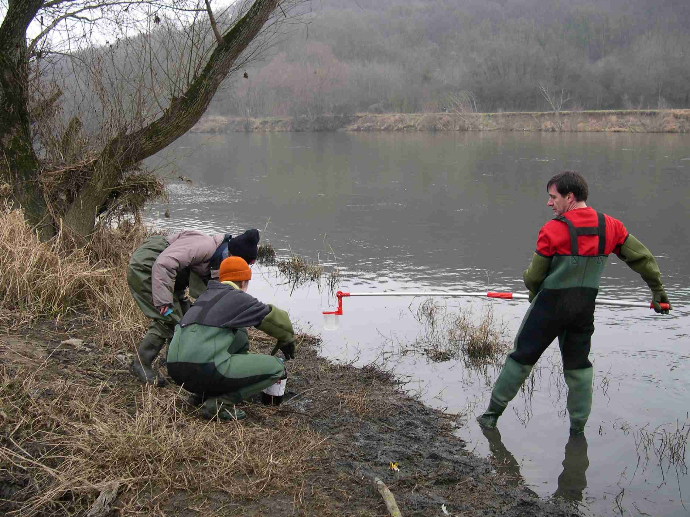
The Baget catchment is managed by the Laboratory of Functional Ecology and Environment (EcoLab), a joint Research Unit between the Institute of Ecology and Environment (INEE) of CNRS, the National Polytechnic Institute of Toulouse and the University Toulouse III-Paul Sabatier, in collaboration with BRGM (Occitania regional agency), the laboratory Geosciences and Environment Toulouse (GET) and the Station of Theoretical and Experimental Ecology (SETE) in Moulis (Ariège, France). The Baget catchment (Pyrénées, Ariège, France) is a mountain ecosystem of middle altitude (Alt.= 1000 m) receiving around 1000mm of precipitation per year. Located close to Balagué village at 10 km West from Saint-Girons, the Baget catchment (13.25 km2) is drained by a karstic network which supplied the surface runoff of Lachein stream (specific discharge: 36 l.s-1.km-2). It is a tributary of the Lez which joins the Salat River, right tributary of the Garonne River. From 1968, this experimental site was intensively equipped by the CNRS underground Laboratory of Moulis (today SETE). The device is composed of one main weir at the outlet, 3 full excess controls, 3 piezometers of which one inside the abyss, and one subterranean loss. This karstic watershed has been surveyed since 1968 for some hydro-climatic parameters, particularly air temperature, precipitations and stream discharge at the outlet. Some geochemical parameters (pCO2, chemical and isotopic compositions of waters) and some hydro-biological and ecological data (invertebrates, particularly Crustacea) have been surveyed for periods during the last 40 years by the CNRS underground Laboratory of Moulis. Since 2011, Baget catchment belongs to the French Network of Catchments (RBV) and it is included in the certified National Observatory Service SNO Karst. Then, new parameters are measured twice a month or with higher frequencies during some flood events (major cations and anions, alkalinity, pH, conductivity, dissolved organic carbon, total suspended matter, H, O, C isotopes…). Since 2014, a multi-parameter probe has been installed with different sensors to measure continuously water level, pH, conductivity, turbidity, dissolved oxygen, nitrate and chloride. These continuous measurements are calibrated twice a month with laboratory analyses. The water discharge is measured by BRGM-Occitania because the Baget karst is part of the French patrimonial network of ground-waters and it belongs to the piezometric network managed by BRGM. The Baget catchment is very sensitive to limit conditions of surface drainage and to land covers. It offers the possibility to develop an eco-systemic survey, which integrates the hydrology, the geochemistry and the ecology of a mountain ecosystem in the SW of France. In this region, climate and land use changes will have significant impacts on biodiversity, ecosystem functioning and biogeochemical cycles for the next decades The Baget catchment is an international field site of the Critical Zone Exploration Network CZEN (http://www.czen.org/content/aurade-experimental-catchment) and it is one of the sites of the French SNO-KARST (Service National d'Observation) labellised by INSU-CNRS. It belongs to the French Research Infrastructure OZCAR and it is also a site of the French LTSER ZA PYGAR "Zone Atelier Pyrénées-Garonne".
-
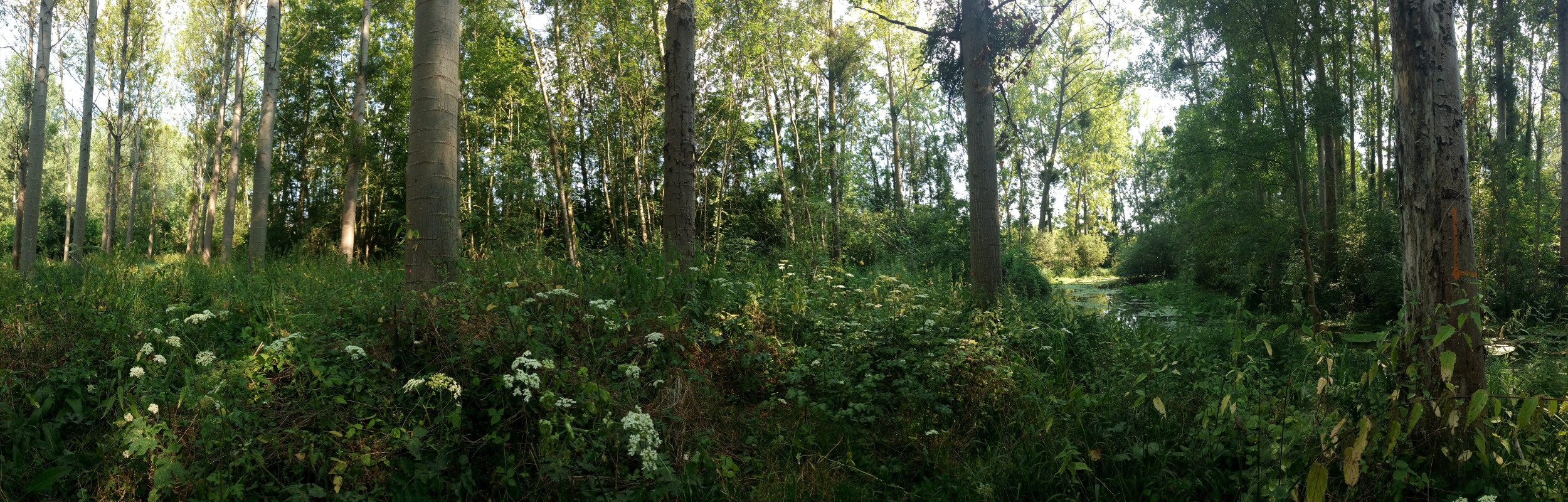
The Bassée floodplain is a large area in the Seine river basin (~ 50 km long and 5-10 km wide). Series of hydrological installations (dikes, channelization, damming, drainage, sand and gravel pits) have considerably reduced the flooding in the plain which nervertheless remains an important resource in the Seine river basin for freshwater and biodiversity. The level of anthropization increases from upstream to downstream. Projects for new hydrological installation (damming, channelization) still exist, which supports a high monitoring activity in this area.
-
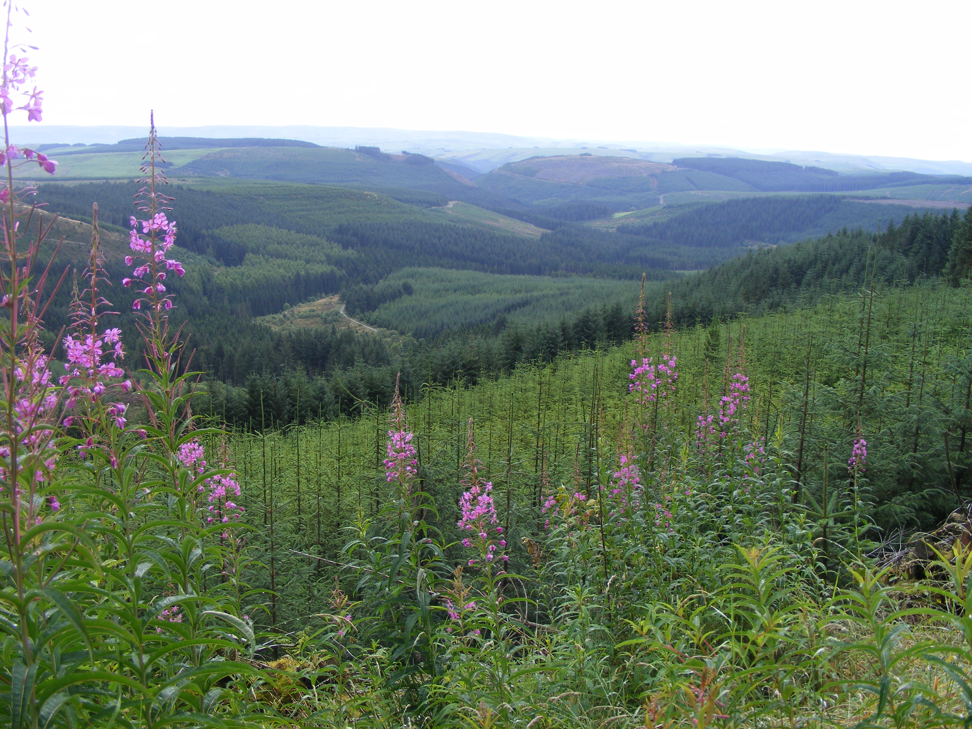
Oulanka Research Station is part of the Infrastructure Platform and is situated in Kuusamo as a regional unit of the University of Oulu. The station is located in the Oulanka river valley within the Oulanka National Park (66°22'N, 29°19'E). The area lies within the boreal coniferous forest-zone (Taiga), where Norway spruce and Scots pine prevail. In the Oulanka river valley there are, also many alluvial meadows, stream mouths and crags supporting luxurious plant communities. The bedrock is calcium-rich in places. Bogs, fens and marshes as well as numerous springs, ponds and lakes, brooks and rivers characterize the landscapes. All these factors together create a diverse and exceptional rich environment with rich flora and fauna.In terms of temperature Oulanka has a continental climate. The coldest and warmest ever measured temperatures are -48.0°C and 32.1°C. The difference between the mean temperature of coldest (January, -15°C) and the warmest (July, 15°C) month is 30°C. The mean temperature for the whole year is c. -0.5°C (1967-2009).
-
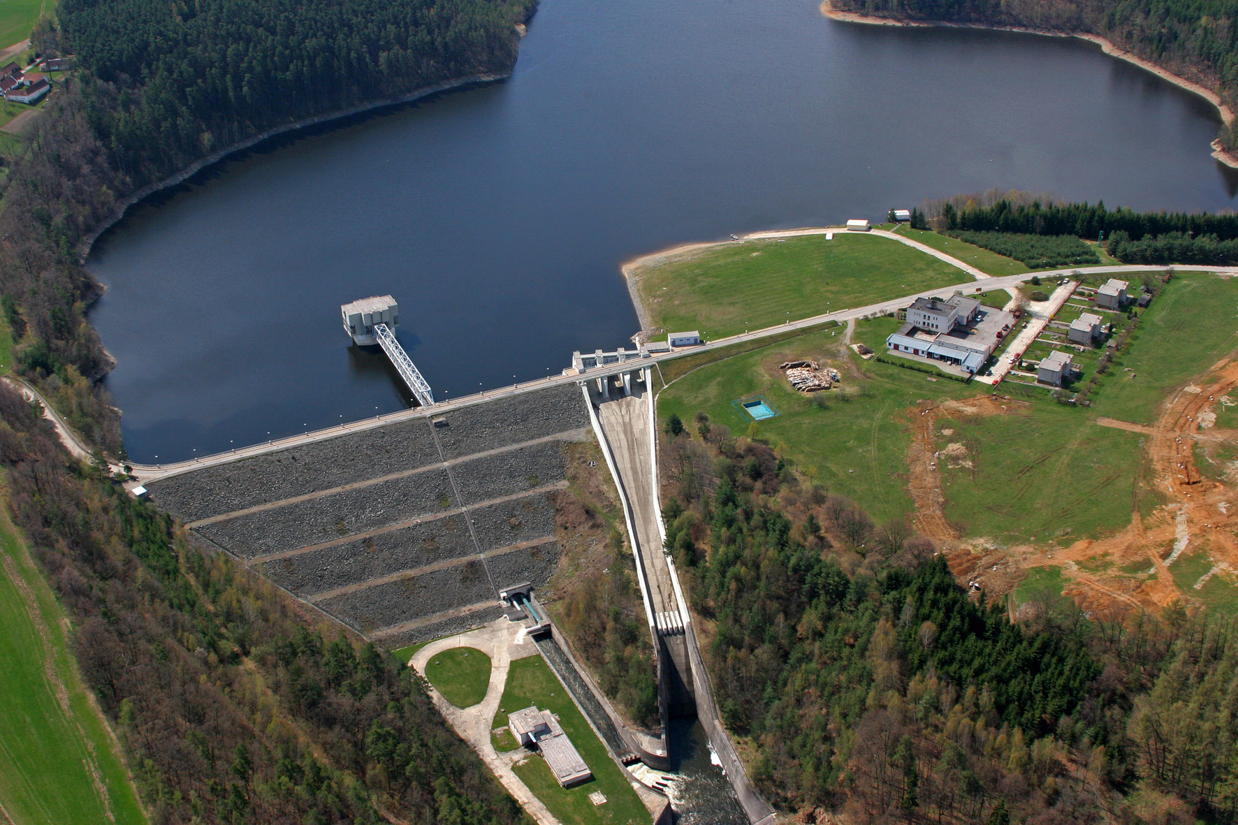
The Římov Reservoir was constructed in 1971–1978 at 21.85 km of the Malše River (tributary of the Vltava River), downstream its confluence with the Černá stream. The reservoir serves as an important drinking water supply for South Bohemia and helps to maintain a minimum flow downstream. The dam is 47 m high and 290 m long. Reservoir volume is 34.3×10⁶ m3, the catchment area is 489 km2.Mean annual flow is 4,3 m3 s-1 and mean theoretical water retention time 92 days. The Římov Reservoir is a canyon-shaped impoundment with steep banks, the „tower“ for drinking water input is at 5 m distance from the dam. Being a drinking water source, Římov Reservoir is protected and no other uses are allowed. Regular investigations of the Římov reservoir in its lacustrine part started in 1979 and have continued at three-week intrevals up to now. Since 1997, the Římov reservoir has been a part of the Czech LTER network. The parameters studied include physical, chemical and biological data on pelagic organisms like bacteria, protists, phytoplankton and zooplankton. Once per year, the abundance and species composition of fish is investigated. Besides regular monitoring, a lot of extensive studies were done of pelagic organisms, their diversity, interactions and functions as well as chemical processes in water and sediment, both in the lacustrine part and in the canyon-shaped riverine part near the inflow. Such intense studies were possible due to the vicinity of well equipped labs in České Budějovice and the construction of a field station at the dam (in 1994).
-
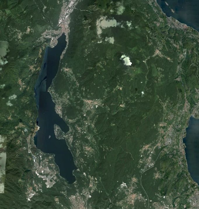
Lake Orta is a deep subalpine lake, located in Northern Italy, at a mean altitude of 290 m a.s.l. Its perimeter is 33,8 km, surface area 18,14 km2, volume 1,29 km3. Lake Orta has a maximum depth of 143 m and a mean depth of 71 m. Lake Orta is well known for being polluted by industrial discharges (copper sulphate and ammonia) since the late 1920: as a consequence, the pH of the lake water dropped down till 4 and the food web was almost completely destroyed, except for some few, strongly adapted species. The pollution stopped around mid 1980s and a liming intervention was carried out in 1989-1990, to neutralize the acidic waters of the lake. The recovery was very fast, new species started to colonise the lake just after the liming. The lake, however, is still at risk, due to the large amount of heavy metals stored in the sediments.
-
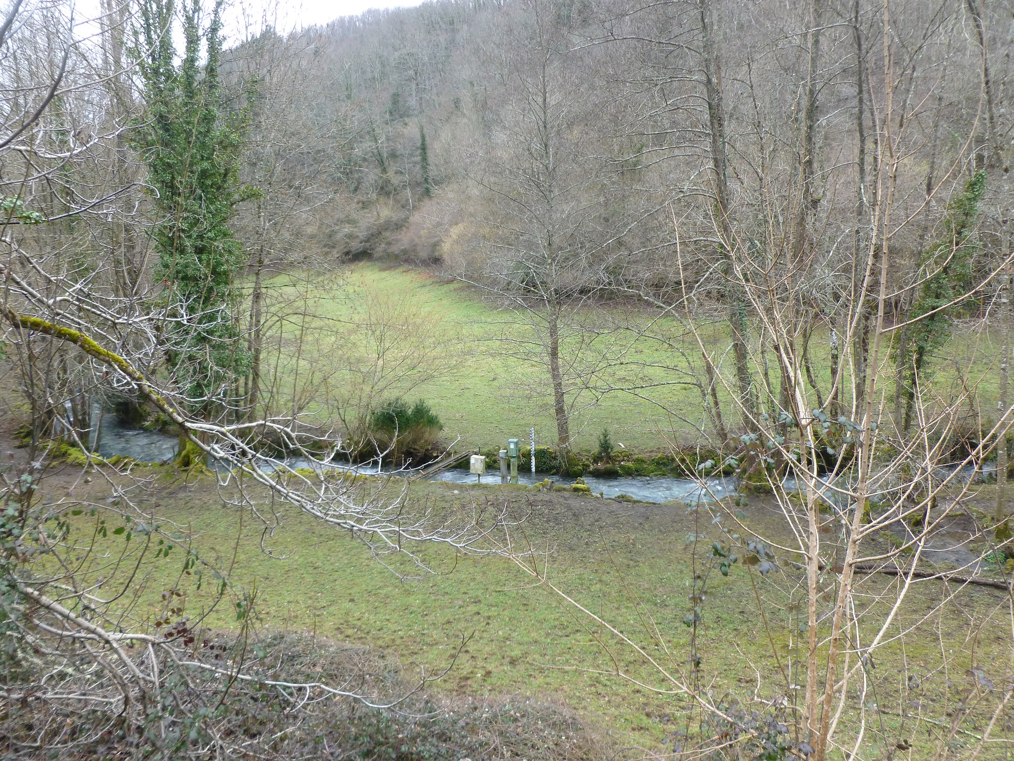
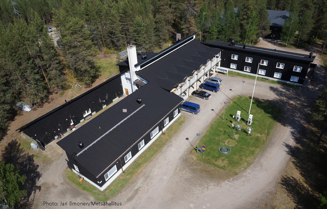
The site Klausen-Leopoldsdorf is part of the European Level II Forest Monitoring System in the frame of the International Co-operative Programme on Assessment and Monitoring of Air Pollution Effects on Forests (ICP Forests). The site was established in 1995 and is, since 2006, part of the LTER Austria network. It is situated in a homogenous 80 years-old managed beech stand about 20km west of Vienna. The LTER-CWN research area in Klausenleopoldsdorf is divided into 3 subplots: a measuring weir, a dendrometer/sapflow measuring facility and GHG-chambers for measuring the fluxes of CO2 and other relevant GHG´s. All 3 subplots were installed in 2019 to collect high-resolution data. The measuring weir is located at about 475m a.s.l and the other subplots (denrometer/sapflow, GHG measuring chambers) are located at about 510m a.s.l. The observed catchment of the measuring weir has an area of 46 hectares. The dominating soil types in the catchment are Planosoils and Stagnosols. The subplots are situated in the near vicinity of the ICP-forest plot.
-

The ZA PYGAR covers the whole Garonne river basin up to the upper part of the Gironde estuary (La Reole station). Within this territory, research is structured around 4 main sites: the Pyrénées mountains, covering the upstream part of the Garonne river basin (PYRénées site), the farmland of the foothills of the Pyrénées (Vallées et Coteaux de Gascogne site), the Garonne river (Axe Fluvial Garonne site) and the basin of two tributaries of the Garonne river in the Massif Central moutains (Aveyron-Viaur site).
-
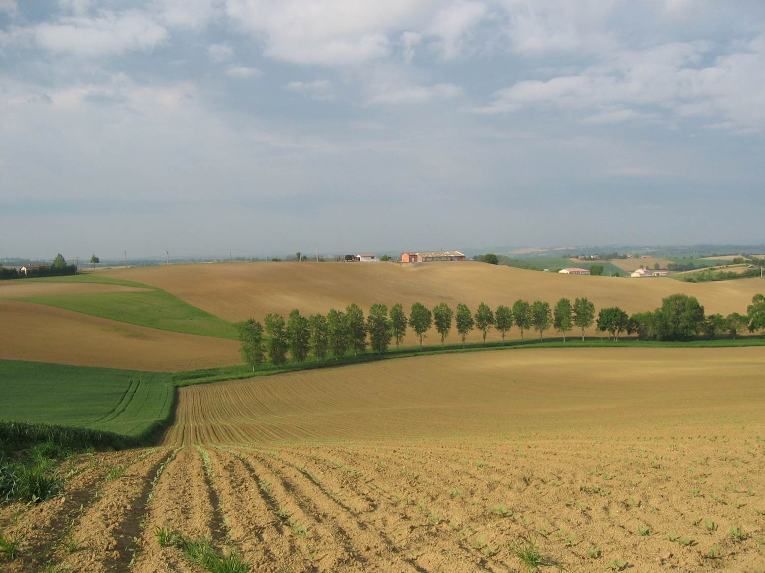
Small agricultural catchment (320 ha) with 30 years of data to study impact of climate change and agricultural practices on soil erosion, weathering rate and river fluxes. Continuous measurements with sensor: river discharge, Temperature, pH, conductivity, turbidity, dissolved oxygen, nitrate Weekly samples and high resolution sampling during storm runoff: major cations and anions, alkalinity, pH, dissolved silica, conductivity, total suspended solids, stable isotopes (13C of DIC, 2H and 18O of H2O, 15N of nitrates), heavy metals, some pesticide molecules Climatological station, rain collector for precipitation chemistry, soil solution station with lysimetric plate at different depths. Continuous measurement since 2004 of CO2, N2O, water vapor, energy exchange in the soil-vegetation-atmosphere continuum thanks to Eddycovariance and closed chamber methodologies (see OZCAR-RI Regional Spatial Observatory in the South West France contribution) Collaboration with the Aurade farmer association for fertilizer and pesticide inputs, cultivation, agricultural practices... Aurade experimental catchment and flux site are an international field site of the Critical Zone Exploration Network CZEN and of ICOS network, a field site of the French Research Infrastructure OZCAR and it is also a site of the French LTSER ZA PYGAR "Zone Atelier Pyrénées-Garonne". and a regional Platform of Research and Innovation-Midi Pyrénées.