
canopy gap area
Type of resources
Available actions
Topics
Keywords
Contact for the resource
Provided by
Years
Formats
Representation types
-
evergreen broad-leaved forest The mature and old-growth forests dominated by Distylium racemosum, Quercus acuta, Q. salicina, Percea thunbergii and other species. In total, more than 50 tree species are found in the 4-ha plot.
-
The Victorian Tall Eucalypt Forest Plot Network is located in the Central Highlands of Victoria, Australia and its research infrastructure is comprised of stratified 1-ha long-term plots within 3-ha monitoring sites. Between 2012 and 2018 the Victorian Tall Eucalypt Forest Plot Network was a member of the Long Term Ecological Research Network (LTERN), Australia, a facility of the Australian Government's Terrestrial Ecosystem Research Network (TERN).
-
The mature and old-growth forests dominated by Quercus serrata, Fagus Japonica, F. crenata and other species. In total, more than 60 tree species are found in the 6-ha plot.
-
Permanent research site Polana Biosphere reserve (Hukavský grúň) site is located in central Slovakia, in the east part of territory of Polana Protected Landscape Area , where forest ecosystems as well as rural cultural landscape of the highest volcanic mountain in Slovakia is protected. The site is situated in 850 m a.s.l with annual mean temperature 5.5 °C and annual precipitation 860 mm. Tree species composition of this site is made up by beech (70 %), norway spruce (19,6 %) and the rest is composited by fir, maple and ash. The age of this forest stand is 90 – 120 years. The research site was established in 1991 and from the beginning research has focused on the individual components of the forest environment and the forest ecosystem (trees including the rhizosphere, soil, air quality), their relationships (the influence of the atmospheric deposition ande on the woods), the cycle of elements and substances (nutrition, litter, biochemical processes), physiological processes, phenology and tree growth , their vitality and ecological stability, as well as practical forestry issues such as natural and artificial regeneration. So there was a very wide range of detection, measurement and evaluation. This area was in 1995 integrated with the ICP Forests system of permanent monitoring areas (PMA). Close to the forest monitoring plot is a series of other 7 permanent research areas (PRA), as a base for comparison close-to-nature mixed forest stand development and stands of individual tree species.
-
The Nanangroe Plantation Plot Network is located in the southwest slopes of NSW west of Lake Burrinjuck and includes four exotic Pine Plantations (Nanangroe, Cotway, East Bungongo and Bungongo), as well as private properties adjacent to those plantations. Its research infrastructure is comprised of an array of stratified 2-ha long-term plots. Temporal visits occur annually / biennially (rotating sampling program). Between 2012 and 2018 the Nanangroe Plantation Plot Network was a member of Long Term Ecological Research Network (LTERN), Australia, a facility of the Australian Government's Terrestrial Ecosystem Research Network (TERN)).
-
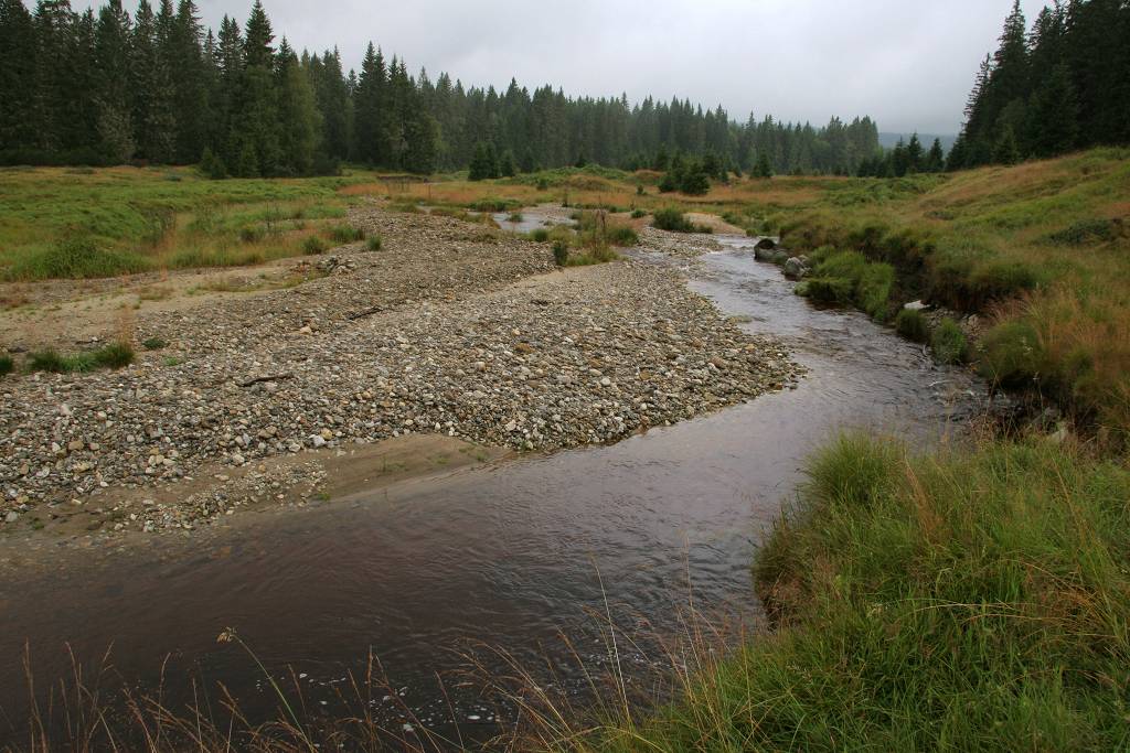
Site consists of a large set of mountain spruce forest monitoring plots (388) that have been monitored since 2008. The main focus of monitoring is the effect of cessation or reduction of forest management on vegetation dynamics and the recovery of forest from windthrow and/or bark beetle-induced die off. Each plot of the monitoring network (500 m2) is studied using the Field-Map technology and the following characteristics are measured: plot characteristics, location and characteristics of all trees (living, dead), stumps and dead wood, numbers and quantitative / qualitative characteristics of natural regeneration and plant community composition. The type of forests include Calamagrostis spruce forests (L9.1), Bog and waterlogged spruce forests (L9.2), and Athyrium spruce forests (L9.3).
-
The Forest of Meerdaal is situated on the Belgian loess belt about 25 km south-east of Brussels. It is an ancient woodland site, previously managed as coppice with standards, well known history (up to the middle ages). It is managed as multifunctional forest containing strict forest reserves with dense sampling grid (measured every decade). its proximity to the university make it an ideal research subject. Over the years many different studies have been conducted and documented.
-
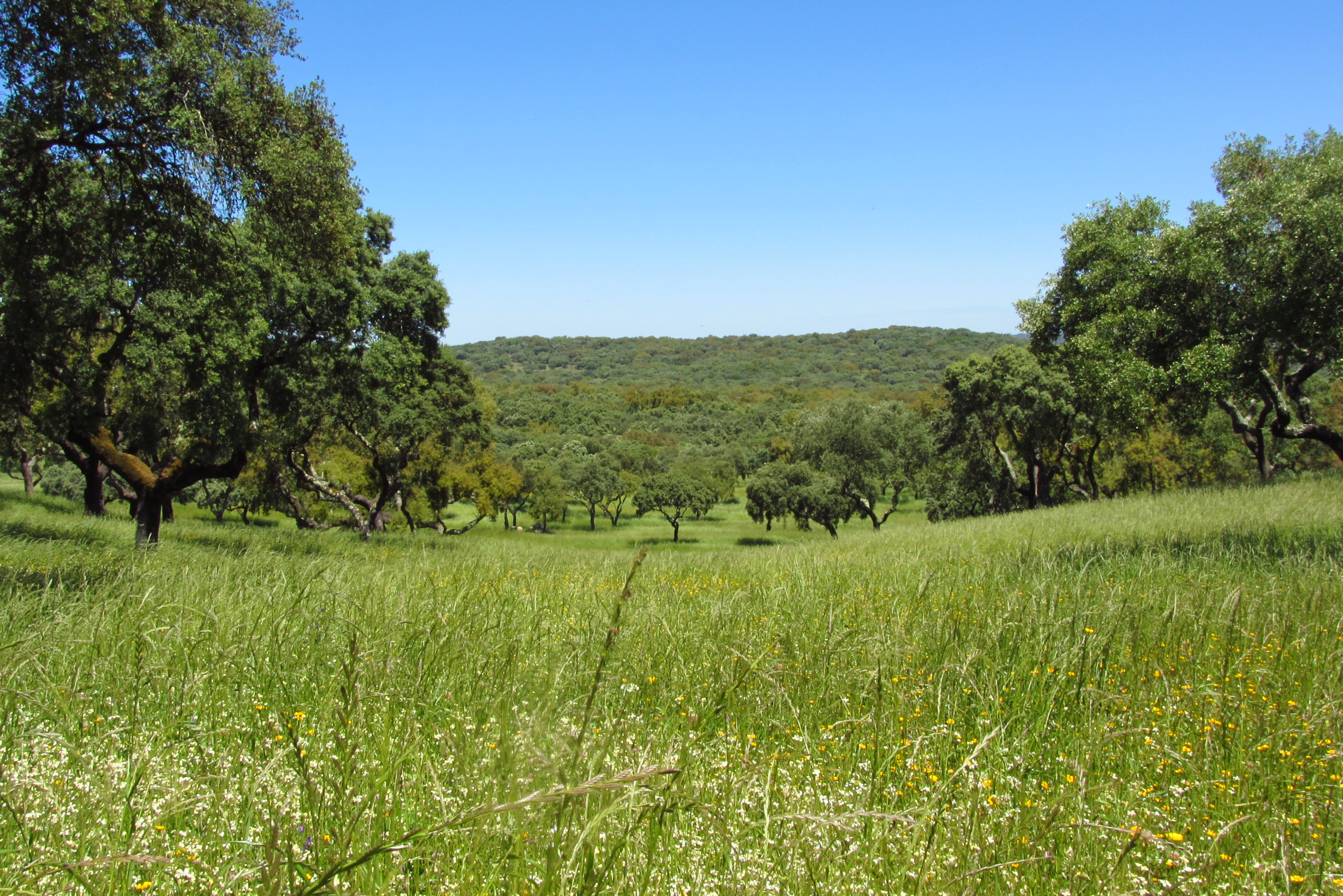
Montados (or dehesas in Spanish) are traditional agro-forestry systems with a savanna type structure, characteristic of the Mediterranean Basin. In Portugal, Montados are mainly distributed in the southern half of the country where the climate is Mediterranean. Annual average precipitation is 600 mm and mean annual temperature is 15ºC, although there is a large variation within the area of distribution of this system. Cork oaks (Quercus suber) and holm oaks (Q. rotundifolia) are the dominant trees, forming pure or mixed stands, with holm oak being dominant in drier regions. Montados with natural or semi-natural pasture and extensive grazing are listed under the EU Habitats Directive (habitat 6310), and are key habitats of Special Areas of Conservation (Habitats Directive) and of Special Protection Areas (Birds Directive), which are part of the Natura 2000 network. Their multifunctional management promotes structural diversity at the stand and landscape level, which combined to a large distribution area and spatial continuity results in high-levels of biodiversity. They are also High Natural Value farmlands that simultaneously fulfill the three criteria considered for their delimitation by the European Commission, since they are dominantly related to a high proportion of semi-natural vegetation, to a mosaic of low intensity agriculture and natural and structural elements and to the presence of rare species (e.g. Lynx pardinus and Aquila pennata). Cork is the most important forest product from Montado systems, with Portugal producing 54% of the world cork. In addition to cork (harvested every 9-12 years), animal production in pastures also provide a source of income. The regulation of water and nutrient cycles and of soil erosion, as well as carbon sequestration are important regulating services to be managed in Montados. From a cultural and recreational perspective, Montados are valued for the landscape aesthetics, natural values and cultural heritage. Strategic actions have been put in place to conciliate human use and biodiversity conservation, such as the publication of national regulations that legally protect the cork and holm oaks. But the most significant one might be forest certification, which has been promoting practices of responsible forest management in more than 70,000 ha of Montado, around 30% of the total certified Portuguese forest area.
-
The Šumava Biosphere Reserve, which includes the Šumava National Park, was established as a Czech LTSER platform in 2008. Its territory covers most of the Czech part of the Bohemian Forest (Šumava in Czech, Böhmerwald in German) along the historical border of Bohemia with Bavaria (Germany) and Austria. The Bohemian Forest creates the most extensive forest landscape in Central Europe, where primeval mountain forest remnants, glacial lakes, peat bogs, and mountain secondary grasslands are home to various communities of vegetation and animal species. The centre of this region is preserved as the Šumava National Park (680 km2). Human colonisation and exploitation of the Bohemian Forest has a long history accelerated during the Middle Age and caused gradual changes in land use. Deforestation and agriculture as well as local population peaked before the beginning of the last century (before the World War I), while after the World War II came to a significant reduction of the settlement. In consequence of historical and economical changes in the region, dramatic land use changes, such as land abandonment or boom of tourism, have largely affected regional development in the recent past. Due to the serious changes in settlement and land use, this region is worth to study also socio-economic issues, e.g., land abandonment and secondary succession, current changes in farming, sustainable forest management, tourist and transport pressure (parking, biking and skiing facilities), etc. In particular, developers’ plans for new downhill-skiing areas or large-scale die out of mountain spruce forests may be considered as serious social-economic conflicts. The Bavarian Forest National Park (242 km2) is the nearest partner of the Šumava NP. More and more research and monitoring projects are operated transboundary following the natural distribution of biotopes as well as natural migration of wild animals in the region of both NPs. The main focus of long-term research and monitoring is on ecosystem processes such is natural regeneration of mountain forests after wind storm disturbances and spruce bark beetle outbreaks, as well as on changes of water regime and species diversity in response to climatic changes. Changes in ecosystem services and better awareness of the National parks for public are the most discussed topics of currently emerging socio-economical studies. Common Czech-Bavarian LTSER platform Silva Gabreta has been initiated. A name was adopted from the peer-reviewed journal Silva Gabreta (silvagabreta.npsumava.cz) published by the Šumava NP since 1996, which is a joint publication base for regional studies (mostly in English, partly in Czech or German with English summary).
-
The Lehrforst Rosalia (Rosalia University forest) is about 1000 ha, covered with all major tree species and forest types in Austria (Norway spruce, Fir, Larch, Scots pine, Beech, Oak, etc). The forest area is located in the Rosalia Mountains near the Lower Austria/Burgenland border. The Demonstration Forest (950 ha) was set up in 1972 with an agreement between the Austrian Federal Forests (Österreichische Bundesforste, ÖBf, https://www.bundesforste.at/english.html) and BOKU. Nevertheless, the University is active in this area since 1875; considerable documentation regarding forest description and planning was elaborated by that time. It is located on the western slope of the mountainous ridge called „Rosaliengebirge“ in the southeastern part of Lower Austria (LAT 47°42’N, LON 16°17’ E). Elevation is between 300 and 720 m a.s.l, annual mean temperature of 6.5 deg C and 800 mm annual precipitation. The forest is mainly composed of beech associations (Fagetums) , peripheral also spruce-fir-beech forest association (Abieti-Fagetum). The Key task of the Forest Demonstration Centre ist supporting the educational and research work of the University of Natural Resources and Life Sciences. Accordingly, accommodation, work and teaching facilities are provided. The research focus lies on following areas: · Collection and hold ready of area-based and environmental Data · Establishing and monitoring of sample plots especially for beech growth and treatment related questions · Characterization of local and microclimate · Environmental impacts to forest ecosystems · Monitoring and modelling of small forested watersheds Essential research and educational infrastructure are: · 4 Weather monitoring stations · 2 scaffolding towers for measuring (35m) with instrument cabin · 4 Measuring weirs for runoff monitoring (Watershed 230 ha) · radio linked data collection and on-line hosting · Surveying and Mapping equipments (terrestric and GPS) · Long-term experiment simulating drying and rewetting of forest soils (DRAIN Station) · IT-Room with different Software-packages (GIS, Planning Tools etc.) · Laboratories and work rooms · Lecture Rooms · Accommodation for > 40 people The available data range from base data (GIS-Data), meterological and hydrological time series (since 1990), inventory data of growing stock, data of different plots to measuring data related to numerous projects.