
canopy structure
Type of resources
Available actions
Topics
Keywords
Contact for the resource
Provided by
Years
Formats
Representation types
-
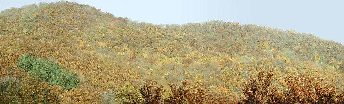
Central Europe maintains a considerable diversity of dry-mesic oak forests as the main representatives of zonal forest vegetation types in Hungary, covering the major part of foothills of the middle-range mountain, Inner Western Carpathians. The 669 m high, Triassic limestone hill called ‘Vár-hegy’ belongs to the Bükk Mountains. The annual mean temperature is about 8◦C and the annual precipitation is about 650 mm. The core area of the reserve (94 ha) is covered mainly by close-to-nature. long untouched oak dominated forests stands: Pannonic woods with Quercus petraea and Carpinus betulus; Pannonian-Balkanic Turkey oak-sessile oak forests; Pannonian woods with Quercus pubescens. It has been set aside for preservation in 1991, though several previous conservation acts had already secured almost spontaneous natural development of the stands. Most of the area was cut around 1880, however, several over-mature trees were retained. The intensive use in the previous centuries and during the world wars left a sessile oak dominated, 120-130-year-old, mostly coppice forest. The abandonment and the precedent severe oak decline contributed to generate a more diverse forest composition and structure developing towards a mixed forest with pronounced ‘old-growth’ characteristics.
-
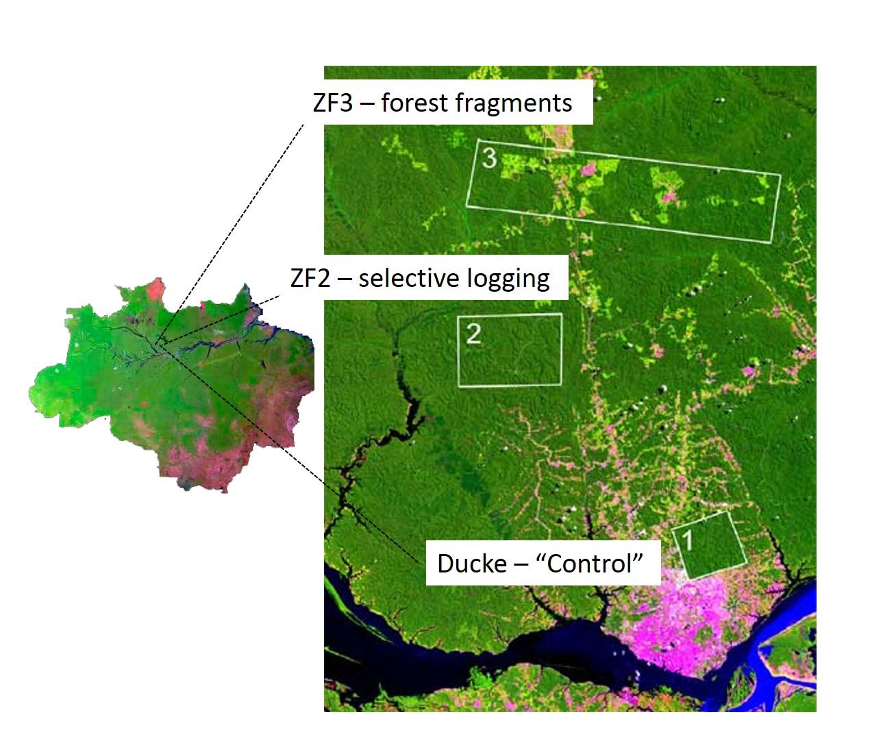
The LTER IAFA site has been running since 1999 and was the first long-term ecological research site in the Amazon. It is situated north of Manaus, central Amazon and includes three sub-sites, with undisturbed terra-firme forest (Reserva Ducke), selective logging (ZF-2 Forest Management Station), and forest fragmentation (Biological Dynamics of forest fragments – BDFFP sites) spread over around 30 x 30 km landscape. Both logging and fragmentation were carried out as controlled experiments to test their effects on biodiversity and ecosystem processes, and thus to outline recommendations for management. The 3 research areas together have 156 permanent monitoring plots, both terrestrial and aquatic, as well as grids of trails for large-scale process monitoring. The information produced has been stored on a public website (https://ppbio.inpa.gov.br/repositorio/dados) where anyone can search data and metadata about the research, as well as the list of publications and all the educational material ( books, identification guides, training course materials) for download.
-
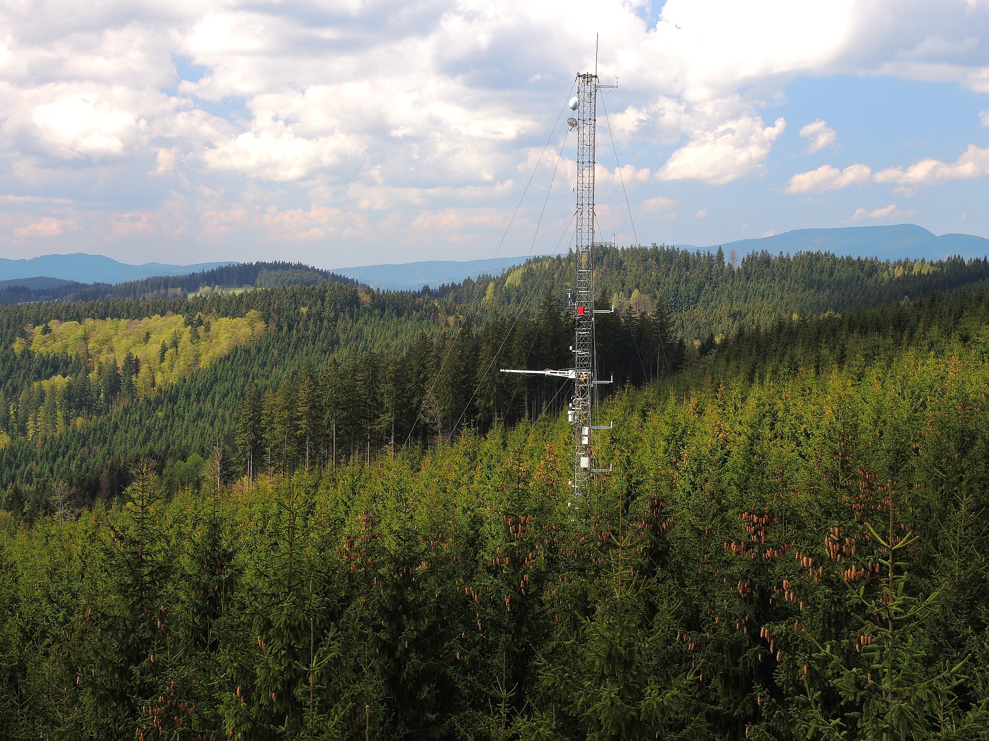
The LWF research programme provides, on the one hand, long-term data series from the last 20 years, together with a scientific interpretation to national and international policy makers. On the other hand, the available data and latest LWF infrastructure provide an attractive scientific platform for collaboration with both national and international partners. The site is located close to the city of Davos in the canton of Graubuenden, within a natural, coniferous forest stand which mainly consists of 200-390 year-old spruce (Picea abies) trees. Among others, the site is equipped with two meteorological measurement stations; one is located within the forest stand, the second is co-located in the nearby open-field, allowing to measure the forest stand effect on micro-climate. The following parameters are being measured (starting-end year): Atmospheric deposition (throughfall and bulk deposition) (2009-today), Circular vegetation plots (2008-today), Crown Condition Assessment (2006-today), Diameter and Height measurements (2004-today), EC-5 soil water content measurement (2008-today), EC-5 soil water content measurement (2008-today), Foliar analyses (2007-today), Leaf area index (LAI) (2008-today), Litterfall (2009-today), Manual circumference band measurement (2006-today), Matric potential (manual suction cups) (2009-today), O3 Injuries (2009-today), Ozone visible injury assessment (2009-today), Permanent vegetation quadrats (2008-today), Phenological observations (2009-today), Sapflow measurements (1998-today), Soil matrix chemistry (2007-today), Soil solution chemistry (lysimeters) (2010-today), Tree core sampling (), automated point dendrometer measurements (1998-today), automatic circumference band measurement (2006-today), Deadwood sampling (2009-today).
-
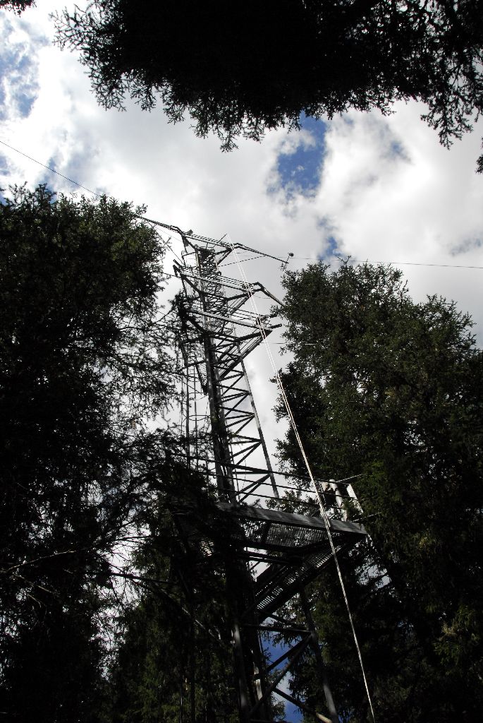
The site Bily Kriz (Bílý Kříž) is located in Moravian-Silesian Beskids Mountains. Ecosystem type: Managed secondary pure Norway spruce stand. Prevailing species: Norway spruce (Picea abies [L.] Karst.) Height of the stand: 17 m (2016) Understory: Vaccinium myrtillus L. Year of plantation: 1981 by 4 years old seedlings
-
The site is located next to Wettingen in the canton of Aargau, within a natural, mixed forest stand which mainly consists of 150 year-old beech (Fagus sylvatica) and 120-170 year-old spruce (Picea abies) trees. Among others, the site is equipped with two meteorological measurement stations; one is located within the forest stand, the second is co-located in the nearby open-field, allowing to measure the forest stand effect on micro-climate. The following parameters are being measured since 2013: Soil solution chemistry (lysimeters), TREENET, atmospheric deposition (throughfall and bulk deposition), circular vegetation plots, crown condition assessment, diameter and height measurements, foliar analyses, leaf area index (LAI), litterfall, manual circumference band measurements, Ozone visible injury assessment, permanent vegetation quadrats, phenological observations, sapflow measurements, soil matrix chemistry, tree core sampling, automated point dendrometer measurements, automatic circumference band measurements.
-
'Tyrolean Mountain Grassland and -Forest' currently consits of 'Stubai - combination of Neustift meadows and Kaserstattalm' (DEIMS.iD: https://deims.org/324f92a3-5940-4790-9738-5aa21992511c). Additional forested research locations may be added in the future.
-
Hainich is a large deciduous forest area in Thuringia and is situated in central Germany not far from the town of Eisenach with the famous Wartburg Castle. With a total area of ca. 16.000 hectares (13.000 hectares of which is forest), Hainich is the largest continuos area of deciduous forest in Germany. On the 31.12.1997 the southern part of Hainich, with an area of 7.500 hectares, was declared Germany’s 13th National Park. Since then it has been seen as a place of relaxation close to nature that is open to sustainable tourism. The area has gone through an amazing development which is quite unique. Since 2011 Hainich is part of UNESCO World Heritage Site "Primeval Beech Forests of the Carpathians and the Ancient Beech Forests of Germany".
-
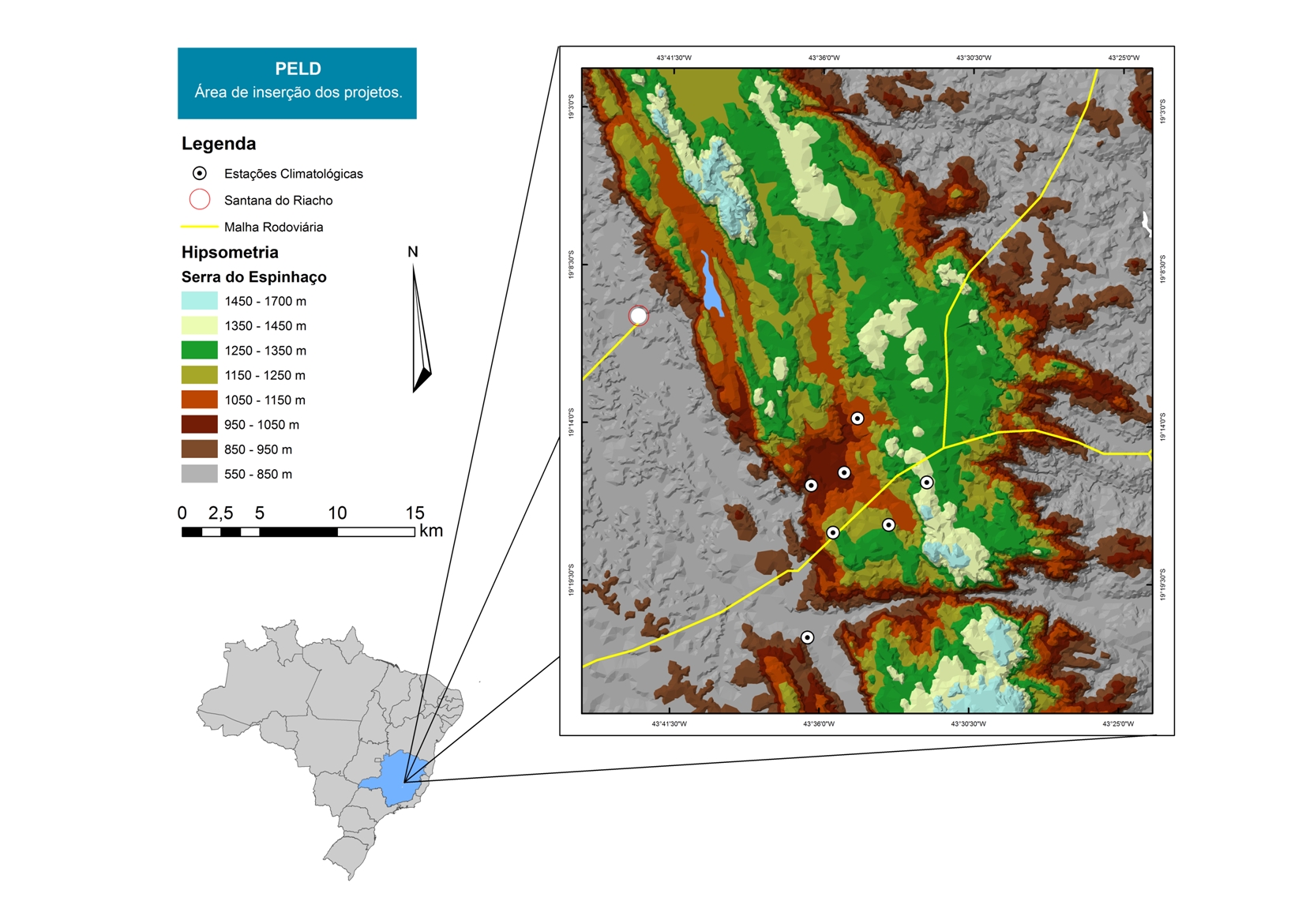
For over 20 years as a team of Long Term Sites in Serra do Cipó PELD-CRSC has been working to answer crucial questions of evolutionary ecology and provide a basis for understanding the spatio-temporal ecosystem functioning and it is future challenges with changes in climate and land use.
-

Berchtesgaden National Park was established in 1978 and is the only German national park located at the Alps. It comprises three major valleys and covers an elevantional range from 600 to 2700 m. Ecosystems include montane mixed forest and subalpine coniferous forest, alpine grasslands, pastures and rocky habitats. The Department for Research and Monitoring is linked to the Techincal University of Munich. It conducts monitoring on climate, hydrology, ecosystem dynamics and biodiversity. Main research topics include drivers of natural ecosystem dynamics, human impacts on ecosystems and climate change effects on ecosystems.
-

Monitoring stations in Aukštaitija NP started functioning in 1993. Aukstaitija station (LT01) was founded in strict reserve zone of Aukstaitija national park in Ažvinčių old forest, Versminis river closed basin. The area of the basin is 101.5 ha. The lowest place is at 159.5 m, the highest - 188.6 m above sea level. Geographical co-ordinates of the basin are: longitude - 26*03*20* - 26*04*50*, latitude - 55*26*00* - 55*26*53*. The climate is characterised as average cold with high humidity and abundant precipitation. The average air temperature is 5.8 C, average precipitation - 682 mm. Length of vegetation period - 189 days. Side glavioacvalic accumulation forms with sand, gravel and stones are typical for river basin and in the western part of the basin, with the decrease of surface altitude transfers into fliuvioglacial terrace delta plain with fine sand, and at the source- into marsh accumulation forms with organic sediments. At the eastern side of the basin, which has higher altitudes, the typical for this basin glavioacvalic accumulation forms transfer into gravel sand. Carbonates start foaming at 45 cm depth (Gulbinas et al., 1996). The saturation of the river water with the oxygen is very weak. The average yearly oxygen concentration equals to 2.9 mg/l (minimal allowable concentration – 6 mg/l). The pH value of the water fluctuates from 7.10-7.75 mg/l, which indicates the alkalisation of the water. Concentration of hydro-carbonate ions varies in the intervals of 148-224 mg/l. Concentrations of sulphates and chlorides are very small. Calcium and magnesium ions are dominating in the media of cations. Concentration of natrium ions is insignificant – 2 mg/l 9DLK=120 mg/l), concentration of kalium ions reaches only tenths of mg/l (DLK=50 mg/l). According to the size of mineralisation the river water could be described as having average mineralisation levels. Concentrations of nitrogen materials (ammonium nitrogen, nitrates) are small, compared to maximum allowable concentrations (DLK) set for surface waters. Concentrations of phosphates are small. Silicium concentrations fluctuate from 2 mg/l to 9 mg/l (Čeponienė, 1997). Main ecosystems Coniferous multi-layered forest stands are prevailing in the basin, which are mainly pine trees with a mixture of spruce. Those stands usually have a second and third tree layer with abundant under layer vegetation. Spruce stands are also of complicated structure. The second and third spruce layer with abundant under layer vegetation are common. Remarkable amounts of territory are occupied by mixed conifer-deciduous or mixed conifer forests. Pure birch stands in more wet habitats in the vicinity of Versminis river source can also be found. According to the forest stand age they are old pure overmature or with accompanying forest stands of several age classes. It is mainly multi-aged and multi-layered over mature pine and spruce stands. In addition The study was based on monitoring data on crown defoliation of more than 3000 Scots pine (Pinus sylvestris L.) trees from 20 permanent observation stands (POS) annually obtained between 1994 and 2009 in Aukstaitija national park (ANP), located in the eastern part of Lithuania (Fig. 1). Over 16yr period mean values of crown defoliation of every sample pine stand were computed annually. Therefore the total number of treatments made N=320. These stands were classified according to stand maturity: 4 sapling stands (45 to 50 years – Table 1, section “Stand maturity”, group 1), 5 middle aged stands (61 – 80 years – group 2), 4 premature stands (81-100 years – group 3), 3 mature stands (101-120 years – group 4) and 4 over mature stands (> 121 years – group 5). Main characteristics of the considered stands are compiled in table 1. All stands represent the prevailing in Lithuania Pinetum vaccinio-myrtilosum forest type.