
carbon dioxide flux per soil horizon
Type of resources
Available actions
Topics
Keywords
Contact for the resource
Provided by
Years
Formats
Representation types
-
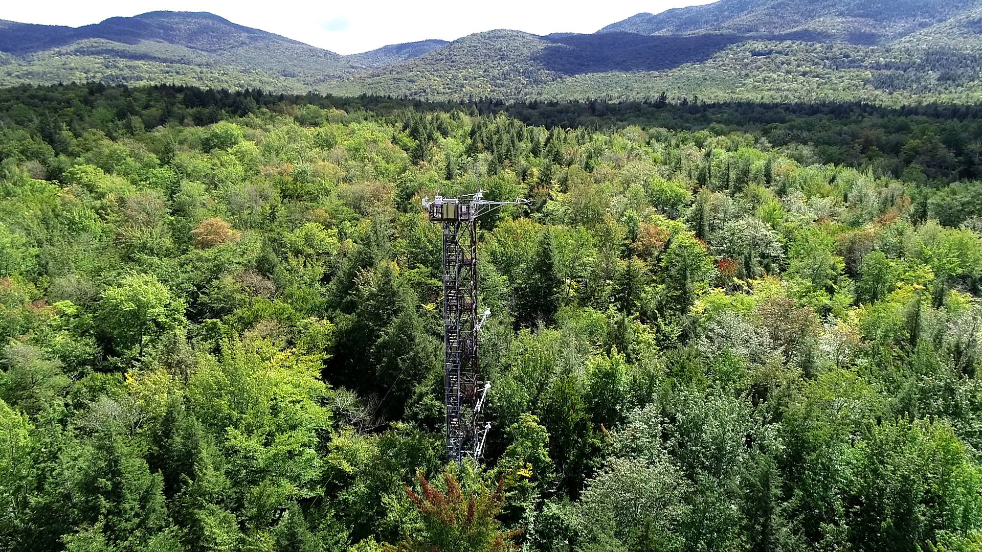
The Bartlett Experimental Forest is relocateable site in Domain 01 Northeast and the site is part of NEON's sampling design. The site is located in New Hampshire. BART extends from the village of Bartlett in the Saco River valley at 680 ft to about 3,000 ft at its upper reaches. Aspects across the forest are primarily north and east. This particular site was chosen because it represented conditions (soils, elevation, climate, tree species composition) typical of many forested areas throughout New England and northern New York. An actively managed forest: manged protions (30% reflect a range of forest patch sizes and structural distrubutions. Sampling area is 15.66 km^2. . Airborne remote sensing surveys of this field site collect collect lidar, spectrometer and high-resolution RGB camera data. The flux/meterological tower at this site is 116’ with 6 measurement levels. The tower top extends above the vegetation canopy to allow sensors mounted at the top and along the tower to capture the full profile of atmospheric conditions from the top of the vegetation canopy to the ground. The tower collects physical and chemical properties of atmosphere-related processes, such as humidity, wind, and net ecosystem gas exchange. Precipitation data are collected by a tipping bucket at the top of the tower and a series of throughfalls located in the soil array. This site has five soil plots placed in an array within the airshed of the flux tower. Field ecologists collect the following types of observational data at this site: Terrestrial organisms (birds, ground beetles, mosquitoes, plants, small mammals, soil microbes, ticks), Biogeochemical data, and and soil data. Total data products collected at this site is 116.
-
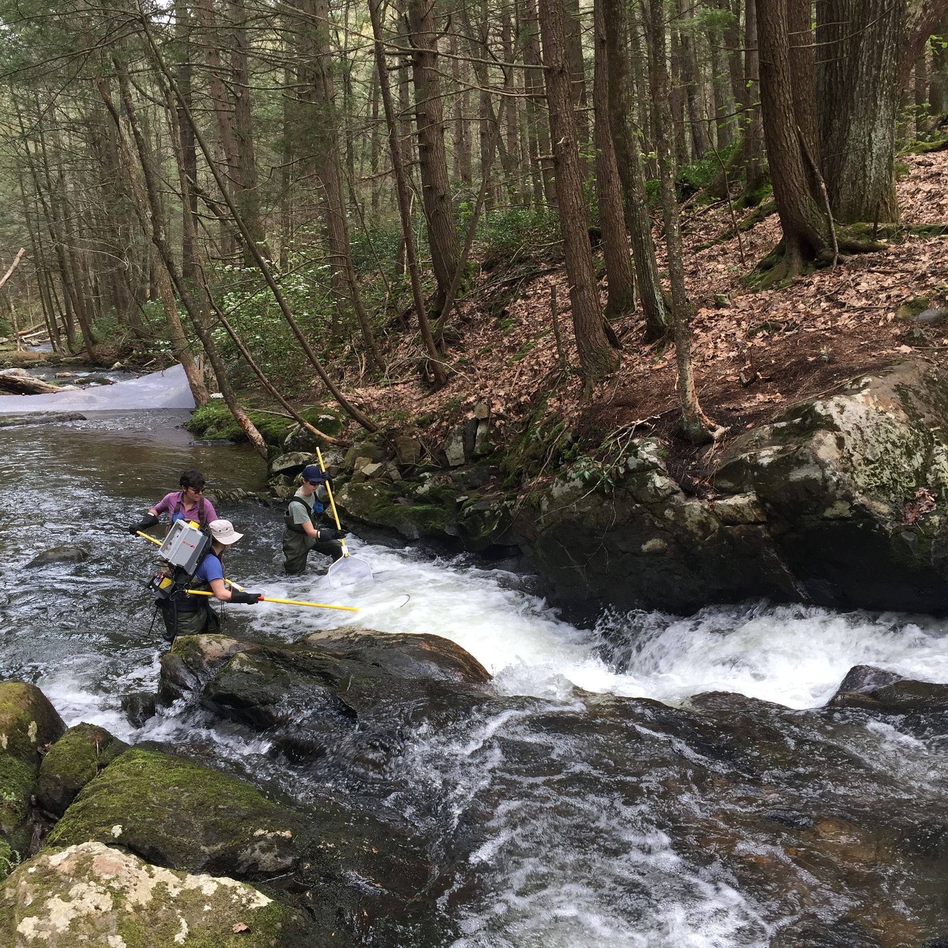
The Lower Hop Brook is a core aquatic site in Domain 01 Northeast in Massachusetts. HOPB site is a 3rd-4th order wadeable stream that flows into the Quabbin Reservoir in central Massachusetts. The section of stream selected by NEON flows from Shutesbury Road to the inlet of reservoir. Several beaver dams and ponds characterize the area upstream of Shutesbury Road. The Lower Hop Brook site is a clear-water, moderate gradient stream with gradient increasing as the stream approaches the reservoir. Minimal beaver activity (dams, ponds) is anticipated in the upper portions of the reach during the life of the NEON project. Large debris dams characterize the reach downstream. Substrate ranges from sand to cobbles, boulders, and finally bedrock outcrops downstream. The stream canopy is predominantly a mixed deciduous, northern hardwood forest with beech trees near the stream. Total data products collected at this site 78.
-
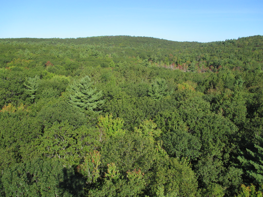
Harvard Forest is a core site in Domain 01: Northeast. Located 73 miles from Boston in Petersham, Massachusetts The Harvard Forest site is spread across 49 km2 of land and is the core NEON site for the Northeast region. Representative habitats at Harvard Forest include northern, transition, and central forests; marshes, swamps, and conifer-dominated bogs; and forest plantations. NEON's meteorological/flux tower and tower sampling plots are located on land owned by Harvard Forest - Harvard University, LTER an forest with a rich history of scientific research. The distributed sampling plots are located along the edge of the Quabbin reservoir which is managed by the Massachusetts Department of Conservation and Recreation, Division of Water Supply Protection. For access to the area along the Quabbin, visitors must be accompanied by a NEON project employee. Total data products collected at this site is 119.
-
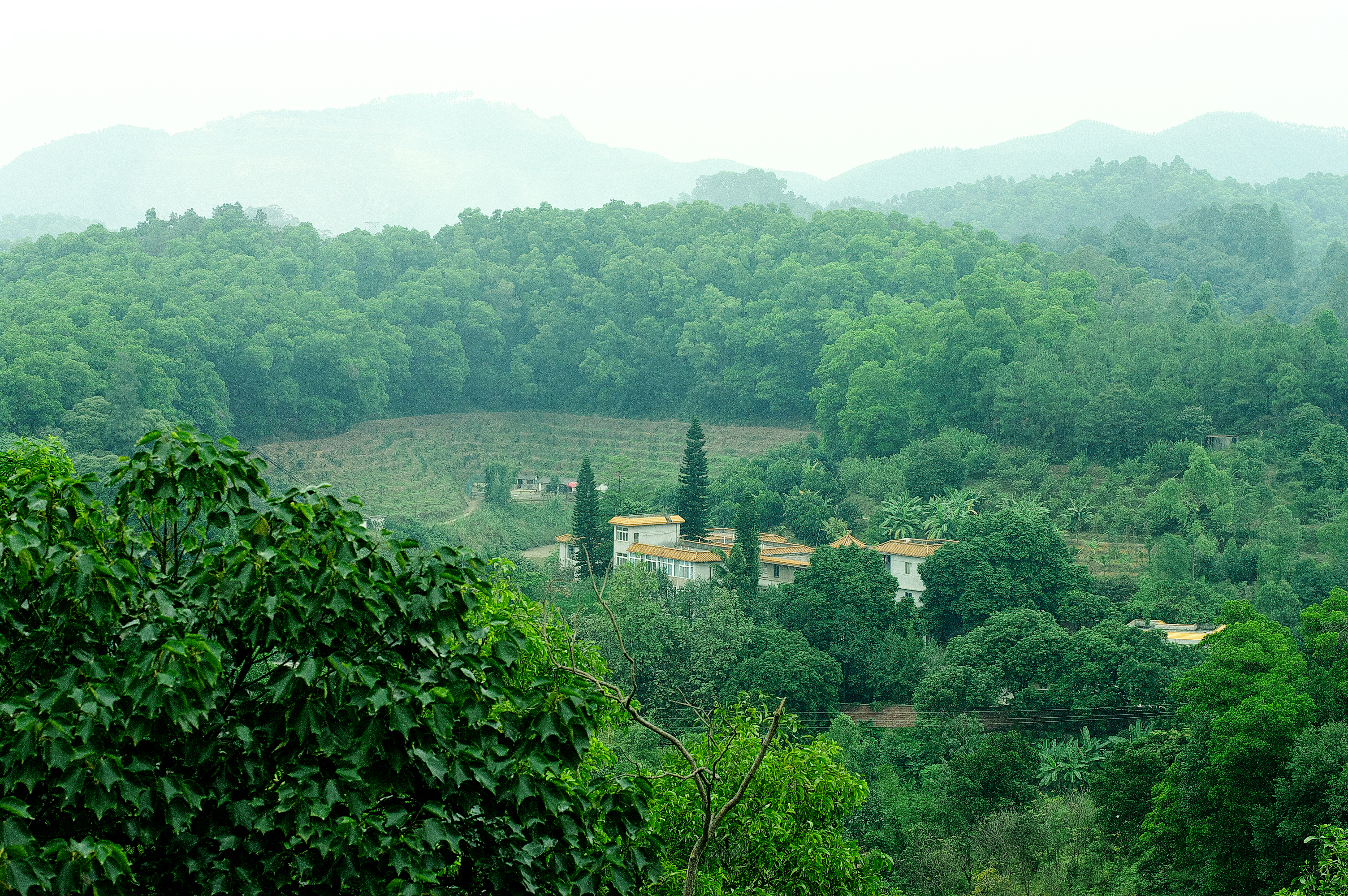
Heshan station (112 °54' E, 22 °41' N) is located in Heshan County, Guangdong Province, China. It is one of the core stations of the Chinese Ecological Research Network (CERN) of the Chinese Academy of Sciences (CAS.). The station was co-established by South China Institute of Botany (Renamed as South China Botanical Garden in 2002), CAS and Heshan Institute of Forest Science in 1984 based on the experience and knowledge of previous studies in a degraded costal ecosystem. Natural Conditions:The station is located in the central part of Guangdong Province with a typical climate of south subtropical monsoon. The soil is laterite. The mean annual temperature is 21.7 C, the mean rainfall is 1700 mm, and the mean evaporation is 1600 mm. The region is a hilly agricultural zone with 78.6% of hilly land, 17.1% of farming land and 4.3% of water body. The zonal vegetation is evergreen broad-leaved forest of typical subtropics. Research Areas:The research areas of the station include but not limited to the followings: 1) Study on canopy water flux of Acacia mangiun forest in the hilly lands of South China by applying sap flow technique; 2) Ecosystem carbon cycling; 3) Conservation genetics of cryptocarya chinensis population in lower subtropical fragmented forest; 4) N2O emission from main types of agricultural and forest lands in tropical and lower subtropical region of China; 5) comparative study on restoration progress between degraded tropical and subtropical ecosystems; 6) effects of landfills on soil biota and water quality; 7) impacts of forest composition on restoration progress; 8) mechanisms of adaptation of invasive species; 9) effects of girdling and defoliation on plant resource use efficiency and soil processes (root exudation, soil respiration and soil biota); 10) confounding effects of manure application on eucalyptus forest and on NEP (Net Ecosystem productivity); 11) nematodes as bio-indicators of different ecosystems.
-
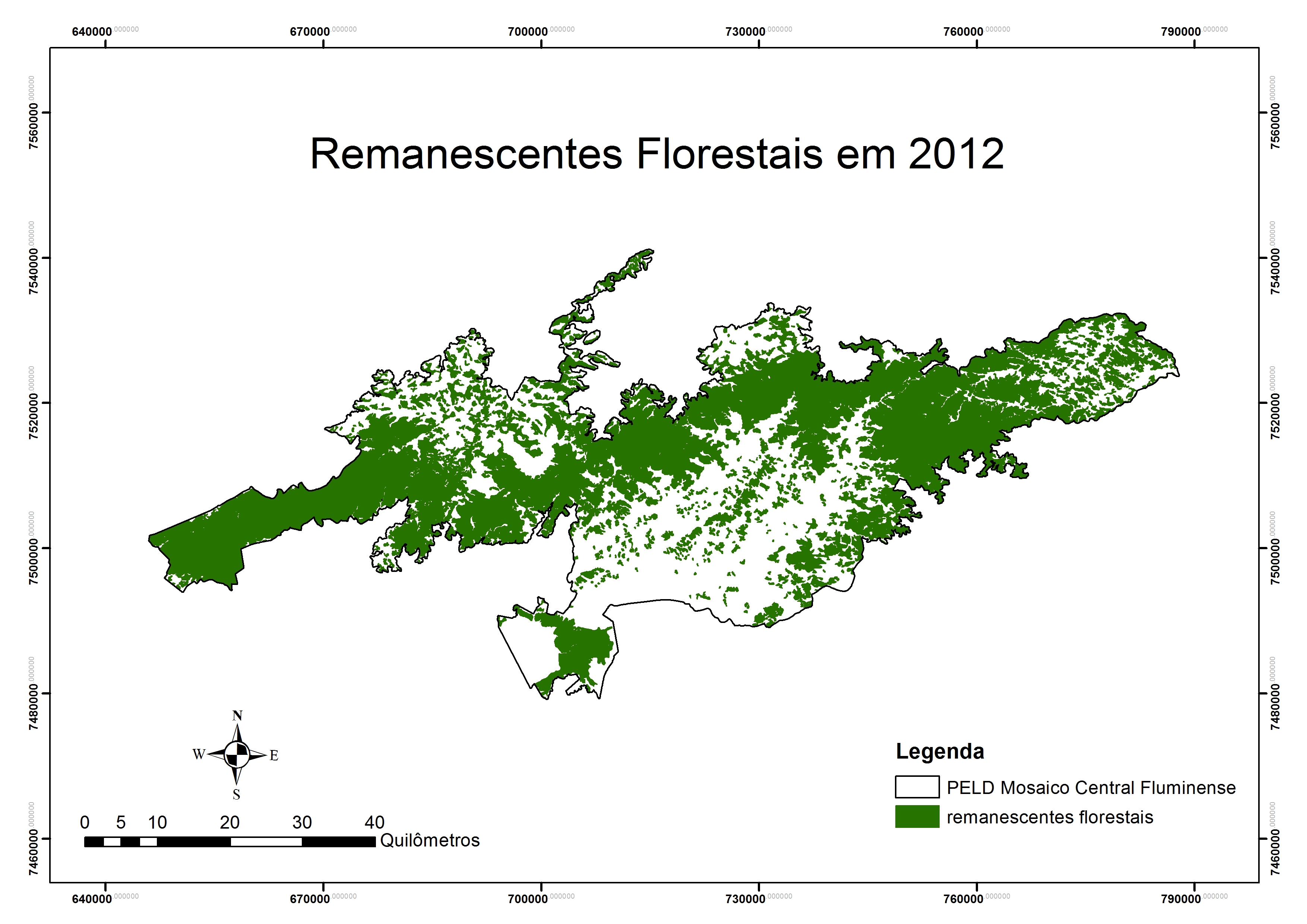
Covers an elevational gradient from 0 to 2,200 m in the Serra dos Órgãos mountain range, with high elevation grasslands (campos de altitude), cloud and lowland rainforests in the Atlantic Forest biome. In the lowlands it includes fragmented landscapes due to deforestation occurred in the last 500 years, with a variety of land uses in the matrix were fragments are inserted. Long term studies and monitoring actions focus on the effects two main factors: effects of climate change and land use. Presents high species richness, embracing a National Park (Parque Nacional da Serra dos Órgãos), a state park (Parque Estadual dos Três Picos), a private reserve (Reserva Ecológica Guapiaçu), and other federal and state protected areas.
-
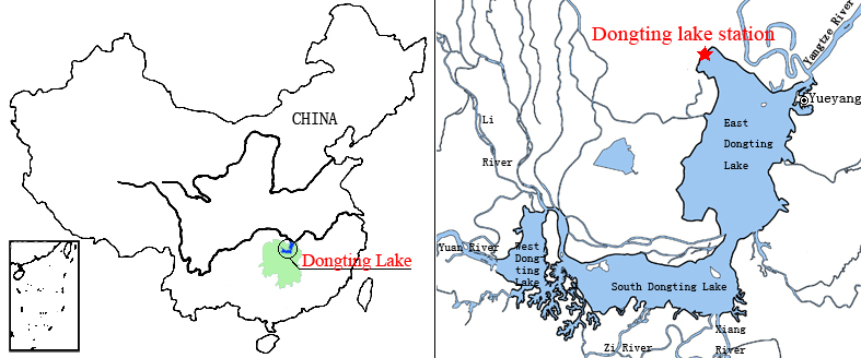
Dongting Lake Station (29º30'N, 112º48'E) located in East Dongting Lake in Yueyang City, Hunan Province. The station has good geographical advantage, convenient transportation, for about 180 kilometers from Changsha, the capital of Hunan Province. Dongting Lake located in the northeast of Hunan Province, the south shore of Jing River (in the middle of the Yangtze River) is the second largest freshwater lake of China.
-
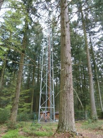
The site is a mixed mature forest composed mainly of Fagus Sylvatica, Pseudotsuga menziesii and Picea abies. The soil (100-150 cm deep) is a silty and stony soil with B structural horizon composed by schist and phyllades. Fluxes of CO2 and water vapour and micrometeorological measurements are performed above the forest by an eddy-covariance system installed on a tower since 1996. During the successive measurement years, several complementary campaigns have been organised : forest inventory, automatic soil respiration measurements, advection, ecosystem water budget, diffusion of CO2 and stable isotopes in soil, volatile organic compounds fluxes, soil carbon content inventory, monthly evolution of nitrogen deposition... Research activities are carried out by the University of Liège (GxABT) and the Université catholique de Louvain (UCL) within the ICOS infrastructure.
-
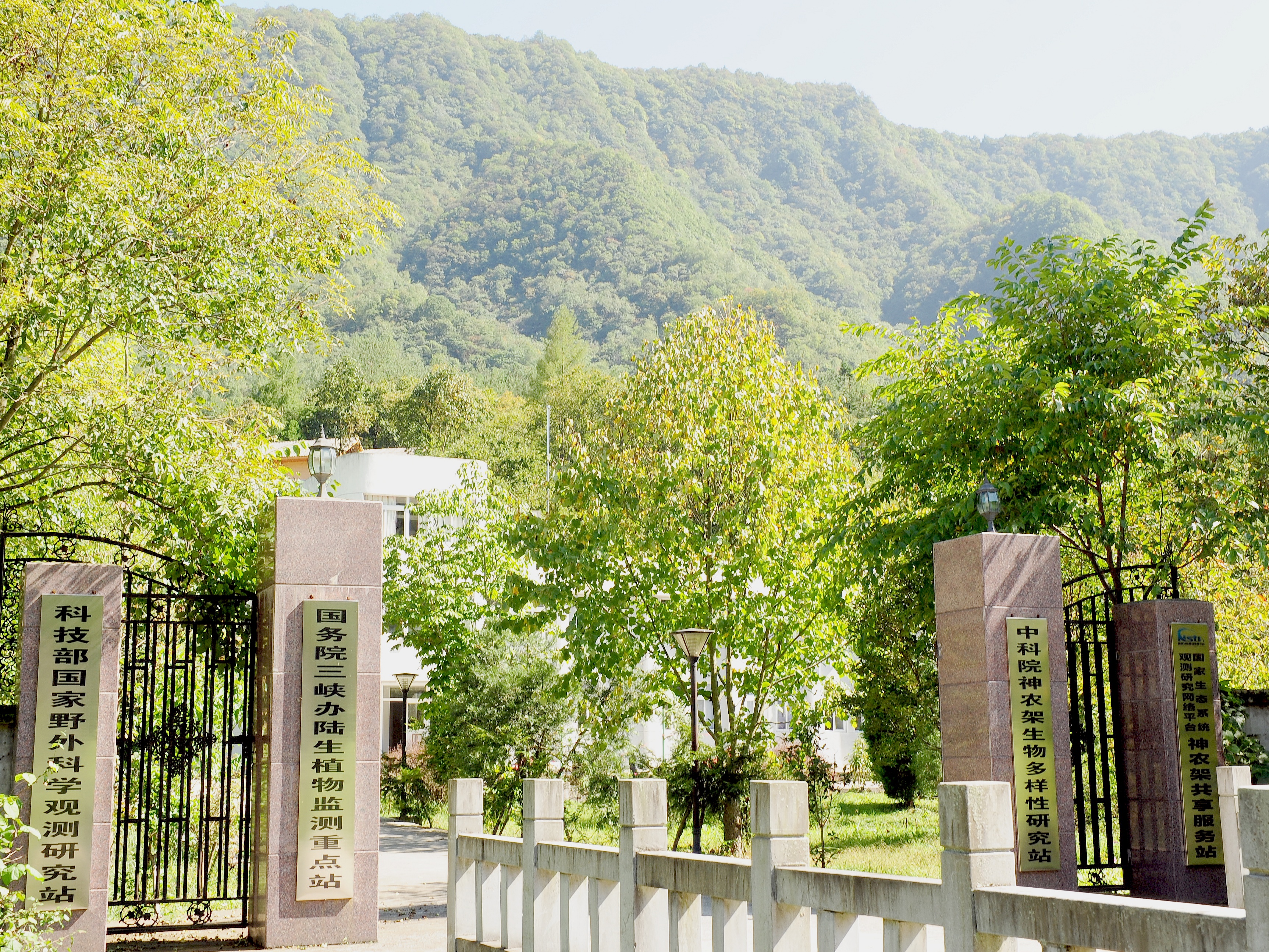
Shennongjia Station is located in Xingshan County, Hubei Province, China. It is located in the southern slope of Mount Shennongjia. The altitude is 1290m above sea level. The typical forest types are the northern subtropical mixed evergreen and deciduous broadleaved forest. Shennongjia Station was established in 1994, it became a station of National Field Research Station network running by the Ministry of Science and Technology of the People’s Republic of China in 2005, and became a member of Chinese Ecosystem Research Network (CERN), CAS in 2008.
-

The LTSER Zone Atelier Environnementale Urbaine belongs to LTER-France network and is located in eastern France.The Zone Atelier Environnementale Urbaine ZAEU was created in 2010. It focuses on urban area and urban socioecosystem research questions. The main objective is to define how to facilite an harmonious development according to the city needs without badly impacting the natural system around. The Eurometropole of Strasbourg is a close partner of the ZAEU: local authorities participate to the research experimentations and observation campains. Six working groups are dealing with natural systems in order to better understand the urban ecosystem (biodiversity, hydrology, air and climate, urban metabolism) and the socio system (social and economic dimensions of the society and the individuals, groups behavior and values, politics strategies). In the working groups, we study issues like hydrological system processes in the urban area, population health, energy consomption and production at the city scale, pollutions and contaminations of the various spheres, refusal management with regards to the context of global changes, sustainable development and transitions (economy, ecology, energy).
-

The study plot was established by the Institute of Forest Ecology (Mendel University in Brno) in 1968, namely in connection with the UNESCO International Biological Programme (IBP) and the UNESCO programme "Man and the Biosphere" (MAB). The study plot is carried out in the natural forest region 30 – Drahanská Vrchovina upland (Drahanský bioregion, 1.52) about 1 km west of the village of Němčice in the Czech Republic on the modal oligotrophic Cambisol (KAmd´) of a fir-beech forest vegetation zone (4 FVZ) with forest type 5S1 – Abieto-Fagetum mesotrophicum with Oxalis acetosella (4AB3 – Fageta quercino abietina, union Luzulo-Fagion, association Luzulo-Fagetum) at an a altitude of 600–660 m at sites of autochthonous mixed forests. Research is aimed at ecological aspects of the transformation of spruce monocultures and optimation of management procedures at the application of sustainable management in forests. Recently, research is aimed at possibilities of the adaptation of forest stands on effects of an expected climate change. The main oriented research in present is: (i) study of mesoclimate and microclimate, (ii) evaluation of water balance, (iii) phenology of tree species, (iv) study of biogeochemical cycle (carbon, nitrogen, sulphur), (v) study of decomposition and soil processes, and (vi) evaluation of biodiversity.