
carbon to nitrogen ratio
Type of resources
Available actions
Topics
Keywords
Contact for the resource
Provided by
Years
Formats
Representation types
-
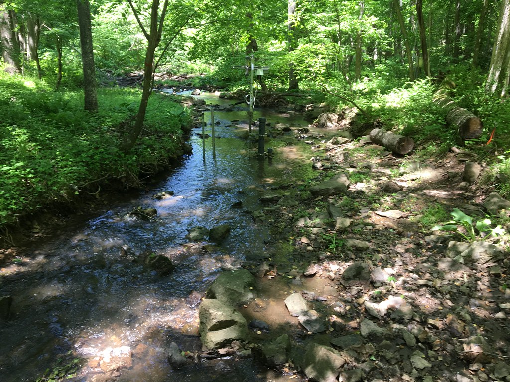
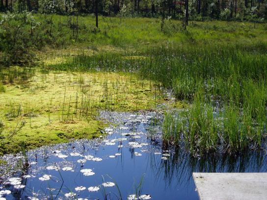
The Posey Creek (POSE) core aquatic site is part of NEON's Mid-Altantic Domain 2 sites. POSEY is a wadeable stream near Front Royal, VA and is located on the Smithsonian Conservation Biology Institute land. It is a shallow stream (<40 cm at average flow) and 3 - 5 m wide (6 meters wide during high flows). This site has one meteorological station located in the riparian area. The met station is outfitted with a subset of the same sensors used at terrestrial sites. Measurements include wind speed and direction, air temperature, barometric pressure, relative humidity, shortwave radiation, and PAR. This site has one upstream sensor station and one downstream sensor station. Measurements include PAR, temperature, water quality [specific conductivity, chlorophyll a, dissolved oxygen content, pH, turbidity, and fluorescent dissolved organic matter (only downstream)], and nitrate is measured at the downstream station. Eight groundwater wells throughout the site collect specific conductivity, water tempertaure, and elevation of groundwater. Field ecologists collect the following types of observational data at this site: aquatic organisms (Aquatic Microbes (surface water), macroinvertebratesmicroalgae, plants and macroalgae, zooplankton. Biogeochemical data on plants,sediment water and particulates. As well as physical aquatic data on bathymetric maps, stage,secchi depth and depth profiles, and riparian assessment. Total data products planned for this site: 78
-
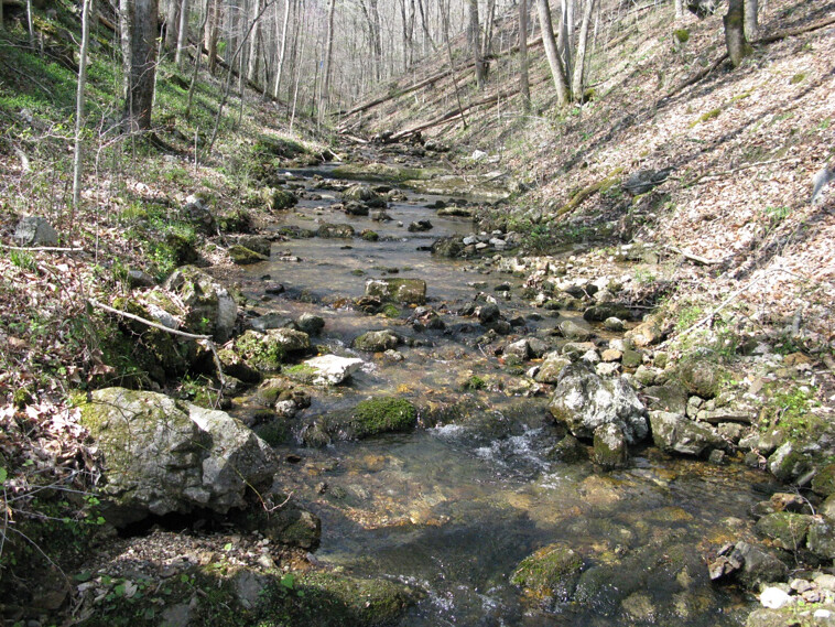
Walker Branch is a core wadeable stream site located in the deciduous forest of the Oak Ridge Reservation in eastern Tennessee. This site is part of NEON's Appalachians and Cumberland Plateau Domain 7. Remote sensing surveys of this site collect lidar, spectrometer and high resolution RGB camera data. This site has one meteorological station located in the riparian area. The met station is outfitted with a subset of the same sensors used at terrestrial sites. Measurements include wind speed and direction, air temperature, barometric pressure, relative humidity, shortwave radiation, and PAR. This site has one upstream sensor station and one downstream sensor station. Measurements include PAR, temperature, water quality [specific conductivity, chlorophyll a, dissolved oxygen content, pH, turbidity, and fluorescent dissolved organic matter (only downstream)], and nitrate is measured at the downstream station. Three groundwater wells throughout the site collect specific conductivity, water tempertaure, and elevation of groundwater. Field ecologists collect the following types of observational data at this site: aquatic organisms (Aquatic Microbes (surface water),macroinvertebrates microalgae, plants and macroalgae, zooplankton. Biogeochemical data on plants,sediment water and particulates.As well as physical aquatic data on bathymetric maps, stage,secchi depth and depth profiles, and riparian assessment.Total data products planned for this site: 78
-
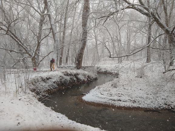
The Lewis Run relocateable aquatic site is a small 2nd order wadeable stream located about 60 miles west of Washington DC in Clarke County, Virginia. The majority of the stream reach flows past and through agricultural lands on the Casey Trees property. This site is one of two aquatic sites found within Domain 02, the Mid-Atlantic. This site has one meteorological station located in the riparian area. The met station is outfitted with a subset of the same sensors used at terrestrial sites. Measurements include wind speed and direction, air temperature, barometric pressure, relative humidity, shortwave radiation, and PAR. This site has one upstream sensor station and one downstream sensor station. Measurements include PAR, temperature, water quality [specific conductivity, chlorophyll a, dissolved oxygen content, pH, turbidity, and fluorescent dissolved organic matter (only downstream)], and nitrate is measured at the downstream station. Eight groundwater wells throughout the site collect specific conductivity, water tempertaure, and elevation of groundwater. Field ecologists collect the following types of observational data at this site: aquatic organisms (Aquatic Microbes (surface water), macroinvertebratesmicroalgae, plants and macroalgae, zooplankton. Biogeochemical data on plants,sediment water and particulates. As well as physical aquatic data on bathymetric maps, stage,secchi depth and depth profiles, and riparian assessment.Total data products planned for this site: 78
-
Data for pH, SO42-, NO3-, NH4+, Cl-, K+, Na+, Ca2+, Mg2+ concentrations of bulk precipitation and throughfall, deposition of major ions and heavy metals (Pb and Cd), rainfall amount, temperature, humidity and some soil properties of the beech and spruce sample plots for 2012 year
-
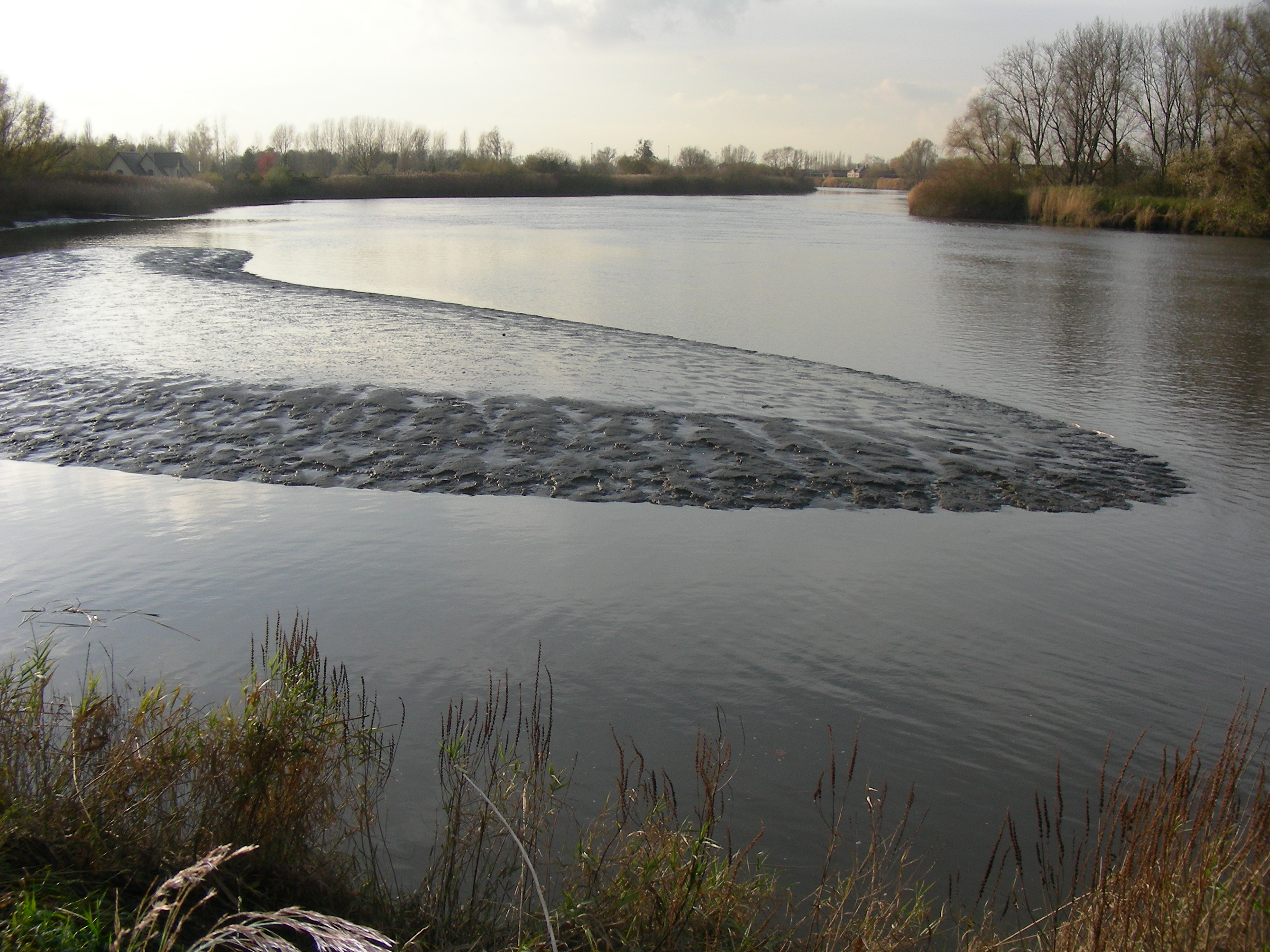
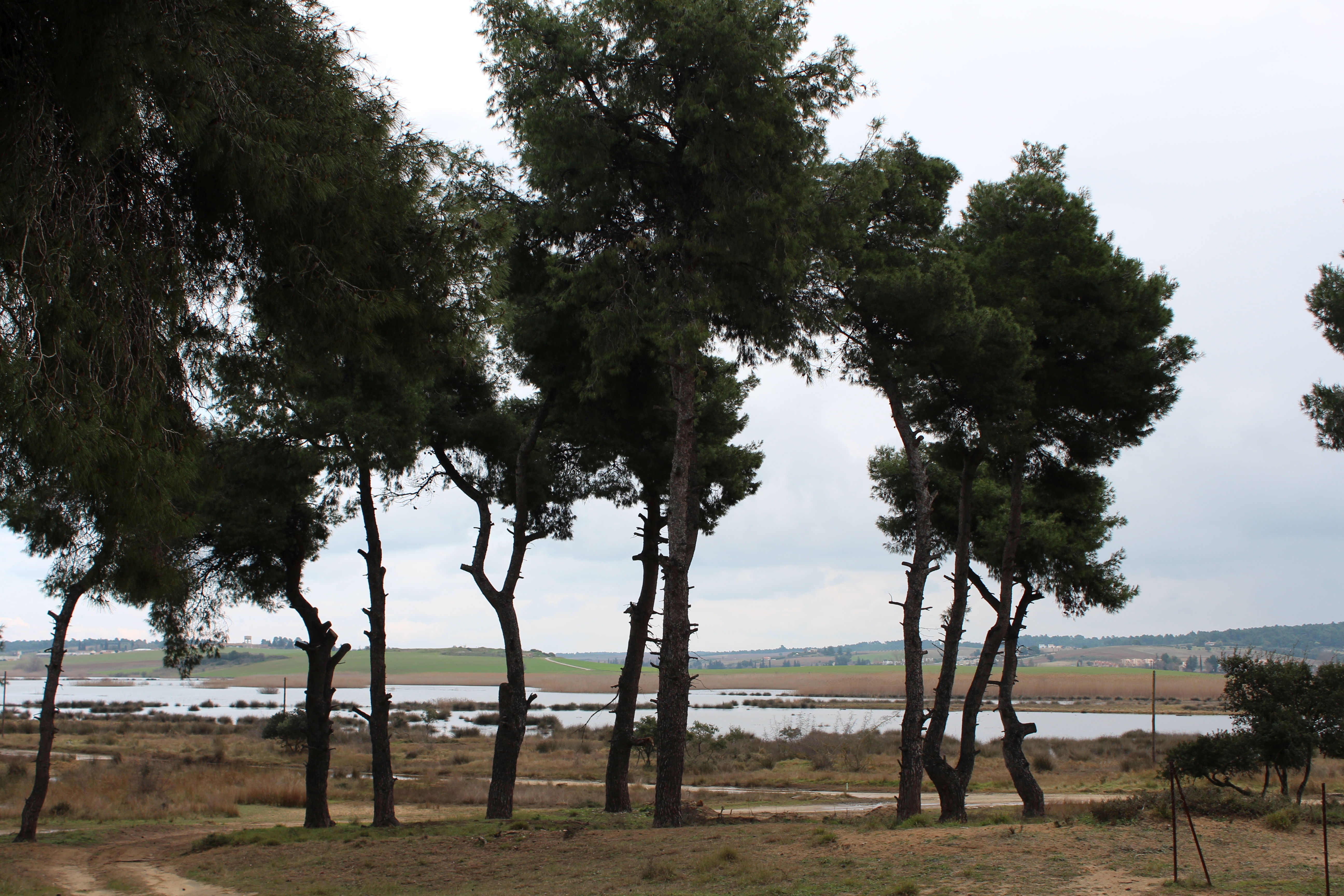
The study site starts at the mouth of the river (Vlissingen, the Netherlands) and extends to Gent, 160 km from the mouth, where tidal influence is stopped by sluices. The tributaries the Durme and the Rupel, with the Nete , Dijle and Zenne are also under tidal influence and are considered part of the estuary. The natural inundated areas around the river and the valleys up to 5m TAW are also part of the study system.
-
The data set provides information about the relationship between abiotic and biotic environments on the ecosystem scale whereas the extensity is correlated by the intensity of effective factors of structural and functional change. Available data comprise element cycling and water relationships on the one hand and the dynamics of effective concentrations mainly in the soil solution. Supplementary data are values for characterizing ecosystem structures and the related element pools as well as climate.
-
Coniferous forests and mire.
-
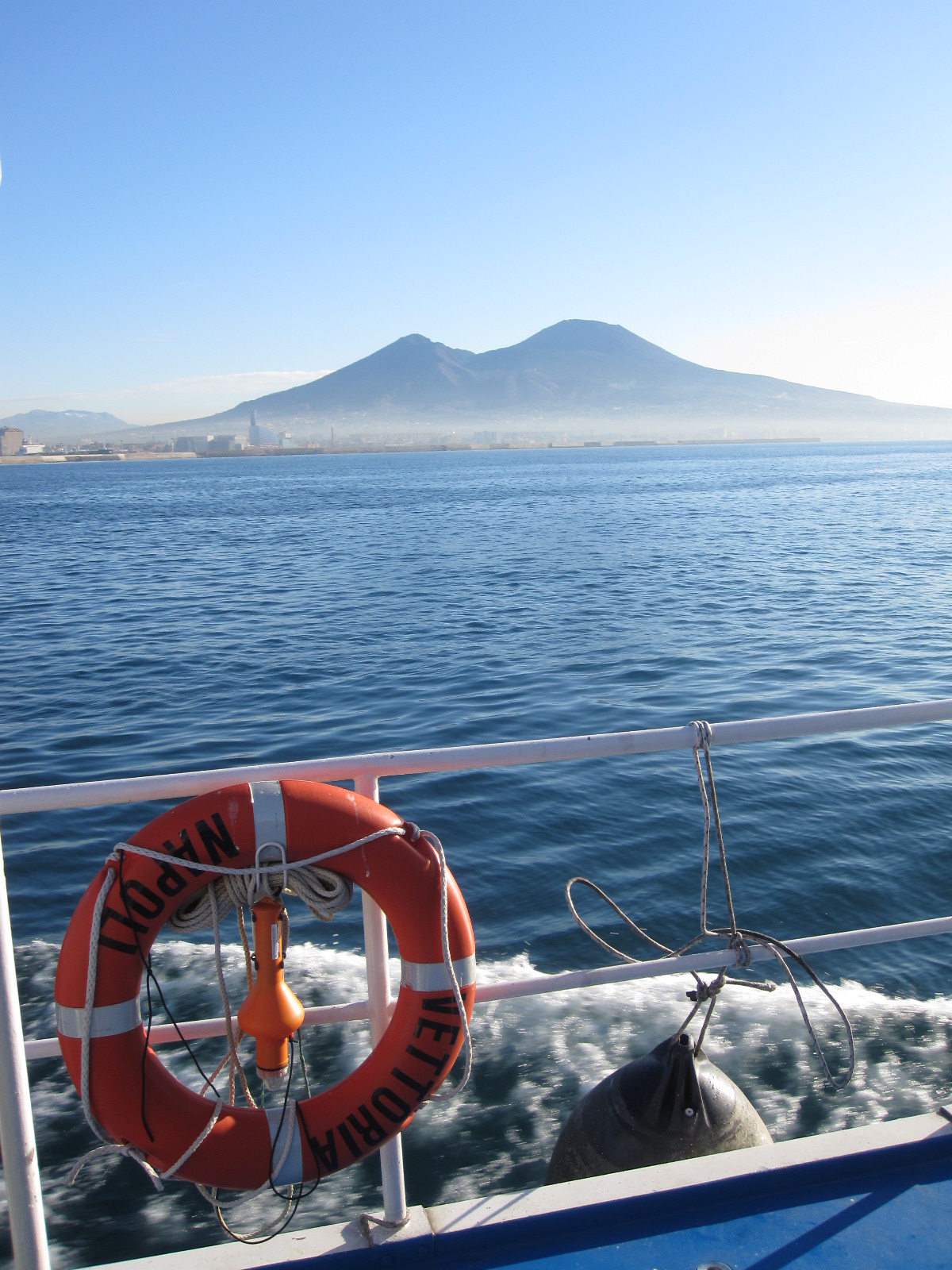
The Gulf of Naples has an extension of ca 870 kmq and an average depth of 170 m. The coastal area, which is inhabited since pre-Roman age, is densely populated and small factories are actively growing. In the Gulf, polluted areas (Sarno river mouth, harbours) coexist with pristine areas, including some Protected Marine Areas. Research on marine organisms has started before since the beginning of 1800, but first ecological studies date back to the 70ies of the last century. The long-term monitoring station (LTER-MC, 40°49’N, 14°15’E) is located 2 nm off Naples city (depth ca 75 m) at the boundary between eutrophied coastal waters and oligotrophic Tyrrhenian waters. Larger areas of the Gulf have been sampled occasionally in several cruises. The MC data set represents one of the few plankton time series available in the Mediterranean Sea, and it is certainly one of the longest.
-
The Sani Environmental Observatory (S.E.O.) is located within a mature, near-coastal Aleppo pine (Pinus halepensis L.) ecosystem at the peninsula of Kassandra, in Chalkidiki, Greece. It is part of the Stavronikita forest, which comprises approximately 300 ha of land covered mainly by forests and to a lesser extend by shrubs and pastures. The Observatory aims primarily at the assessment of the carbon and water balance of this typical low-elevation forest ecosystem to the ongoing climatic shift. Such ecosystems may be prone to the intensified heat and drought events, as well as to the associated insects’ and pathogens’ outbreaks, which are increasingly occurring at the Mediterranean region and particularly at its eastern part. Although Aleppo pines, as well as other Mediterranean pines, are generally adapted to the region’s xerothermic conditions, the in-depth understanding of their ecophysiological and growth responses will allow us to predict the potential of such ecosystems to adapt to climate change. SEO also serves to assess the carbon stocks and fluxes and the contribution of these natural, old-growth ecosystems to carbon sequestration and, thus, to climate change mitigation. S.E.O. is developed by the Forest Research Institute (Lab of Forest Ecophysiology) of the Hellenic Agricultural Organization Dimitra with the support of Sani Resort SA, the owner of the studied forest ecosystem, presenting a nice example of collaboration between the research community and the private sector. Given that SEO is located at a region of high touristic and aesthetic value, close to a wetland and the sea, the Observatory also plans actions to familiarize people with environmental monitoring and the multiple functions and services of the studied Mediterranean ecosystem.
-

The BLE LTER program (https://ble.lternet.edu/) focuses on productivity, trophic relationships, and biogeochemical cycling in the network of lagoons that span Alaska’s northernmost coastline. BLE is examining factors that affect the stability and resilience of microbial and metazoan food webs, including drivers and forms of primary production, in these highly dynamic ecosystems.