
change in population size over time
Type of resources
Available actions
Topics
Keywords
Contact for the resource
Provided by
Years
Formats
Representation types
-
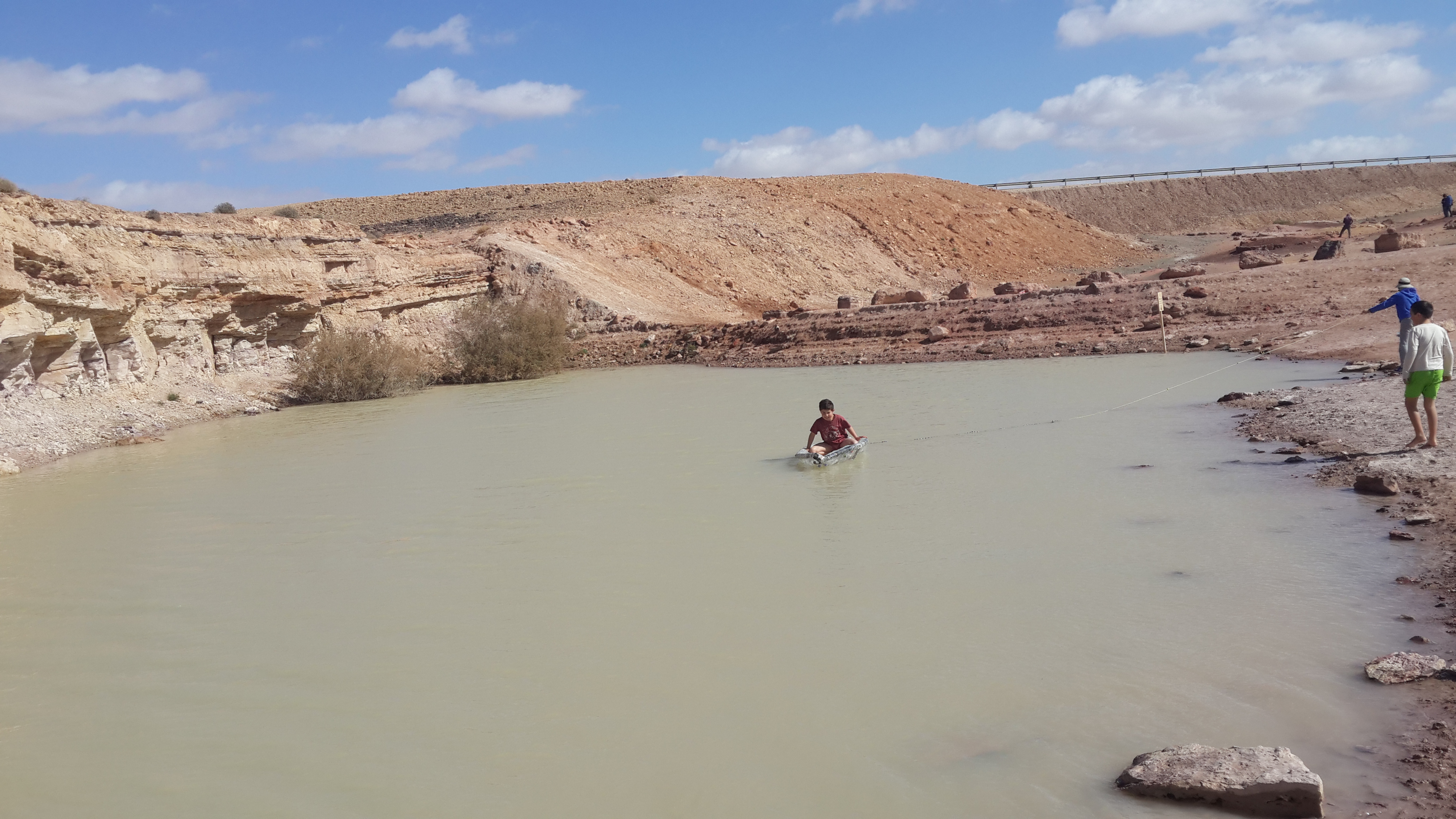
The site is located between two bio -geographical zones arid and hyper-arid, the research is carried out by both sides. The arid side is characterized by remains of terraces from the Nabatean agriculture runoff. The main research topics that being studied in the site are: biodiversity, climate change, runoff hydrology. The arid zone is a geo hydrological ecological system which is depended on a combination of rainfall and runoff that creates water enriched parches that support relatively high biodiversity. The hyper arid zone is runoff depended system the source of runoff are stipe, slope consist on bare bedrock, biological activities are constructed in the dry riverbeds that functions as sinks for the runoff generated from the slopes.
-
The introduction of non-indigenous species (NIS), also known as alien species, is a pressing issue throughout the world nowadays, mostly linked to globalization. Transitional environments are particularly exposed to this threat due to the importation of seafood for either aquaculture or sale. According to the most recent observations, the Mar Piccolo of Taranto hosts 36 NIS positively identified, divided in 13 invertebrates, 15 macroalgae, and 8 planktonic species. This basin ranks third among the Mediterranean hot spots for seaweed introduction, after the Thau Lagoon (southern France) and the Venice Lagoon. Continuous monitoring activities are carried out to early identify new introductions and follow the fate of those already introduced.
-
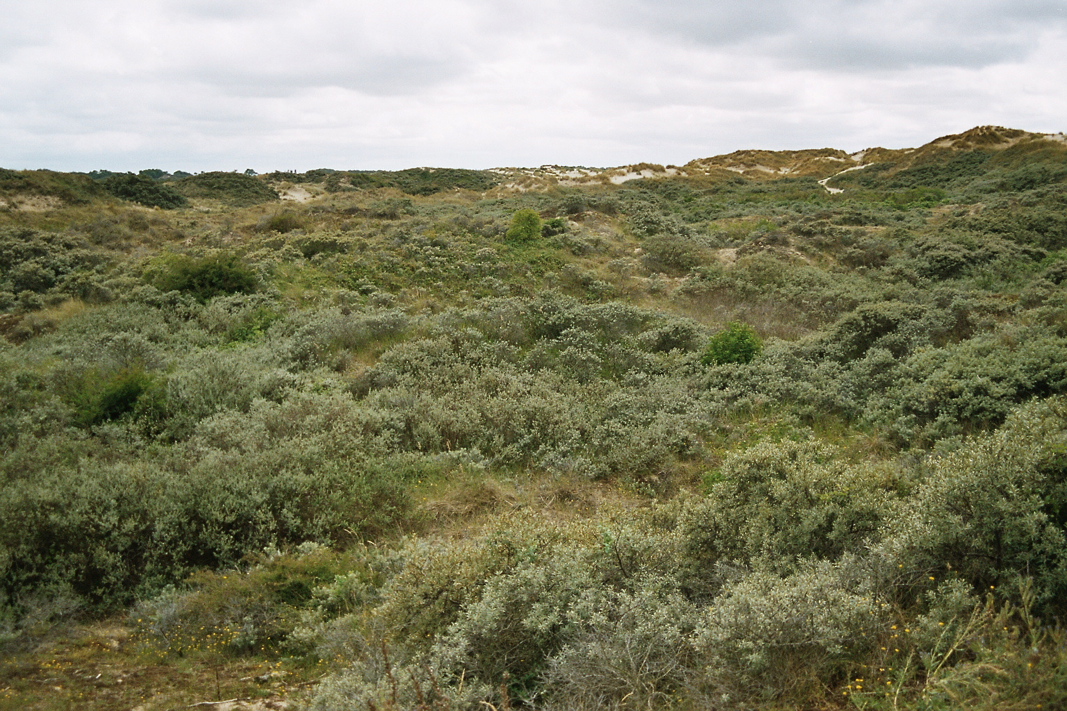
Coastal dune site with complete gradient from beach to coastal woodland, partly grazed - >20 year follow up of vegetation succession
-
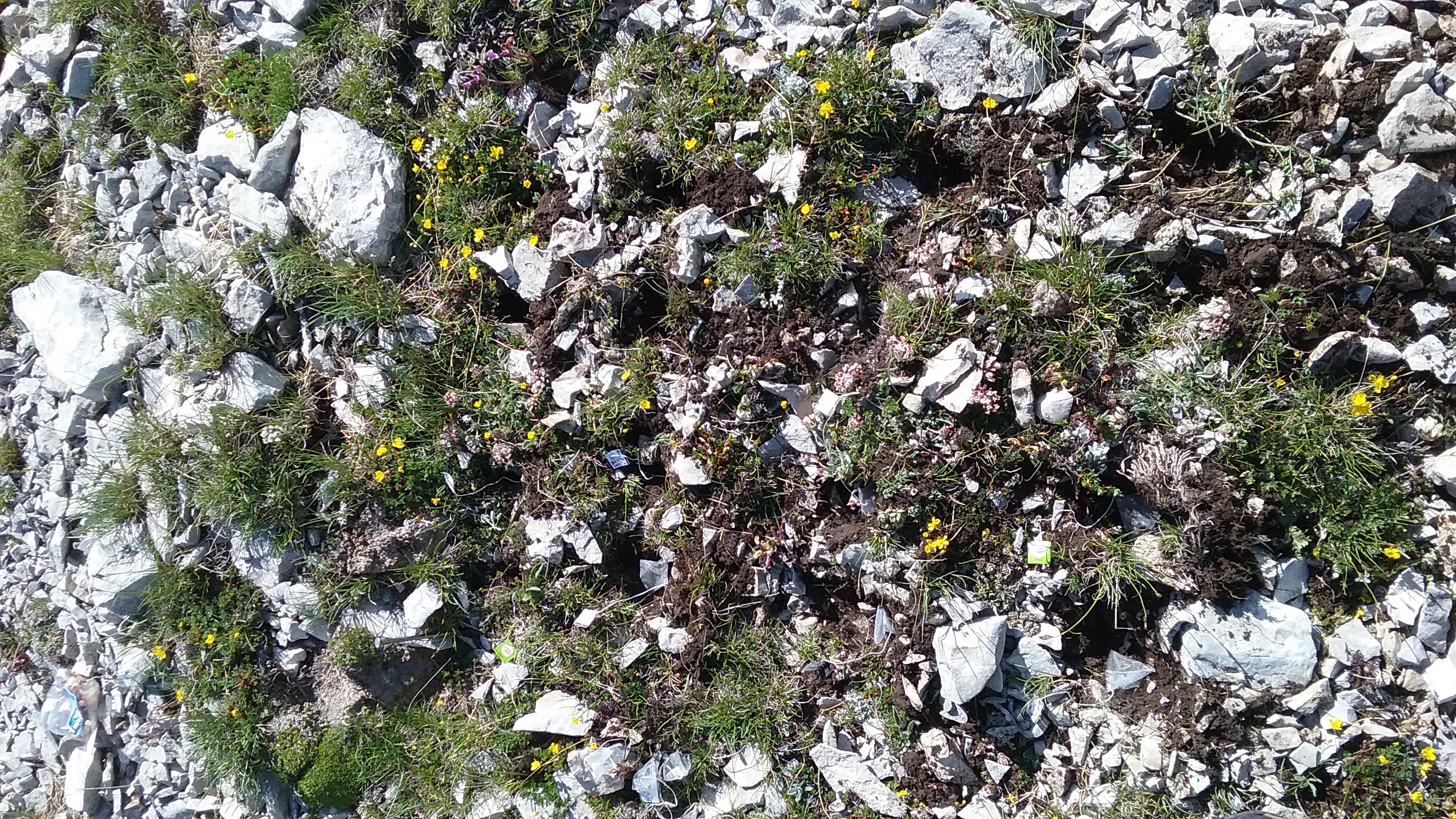
The site consists of “orographic islands” with high elevation vegetation in central Mediterranean basin, along the Apennines mountain range. Majella: 26 plots are in Majella National Park, 15 plots belonging to the world network GLORIA, placed along an elevation gradient between dwarf shrublands and tundra vegetation (2400-2700 m a.s.l.), 6 plots refer to the study of population biology of endangered taxa and other 5 plots, ranging from 2400 to 2600 m a.s.l., refer to soil monitoring. Matese: 10 plots in Matese mountains (1800-2000 m a.s.l.), included into the world network GLORIA, and characterised by high elevation grasslands.
-
Managed realignment in the brackish part of the Scheldt Estuary. Realised since April 2004. A formal sand stock was removed to allow tidal influence.
-
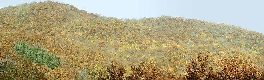
Central Europe maintains a considerable diversity of dry-mesic oak forests as the main representatives of zonal forest vegetation types in Hungary, covering the major part of foothills of the middle-range mountain, Inner Western Carpathians. The 669 m high, Triassic limestone hill called ‘Vár-hegy’ belongs to the Bükk Mountains. The annual mean temperature is about 8◦C and the annual precipitation is about 650 mm. The core area of the reserve (94 ha) is covered mainly by close-to-nature. long untouched oak dominated forests stands: Pannonic woods with Quercus petraea and Carpinus betulus; Pannonian-Balkanic Turkey oak-sessile oak forests; Pannonian woods with Quercus pubescens. It has been set aside for preservation in 1991, though several previous conservation acts had already secured almost spontaneous natural development of the stands. Most of the area was cut around 1880, however, several over-mature trees were retained. The intensive use in the previous centuries and during the world wars left a sessile oak dominated, 120-130-year-old, mostly coppice forest. The abandonment and the precedent severe oak decline contributed to generate a more diverse forest composition and structure developing towards a mixed forest with pronounced ‘old-growth’ characteristics.
-
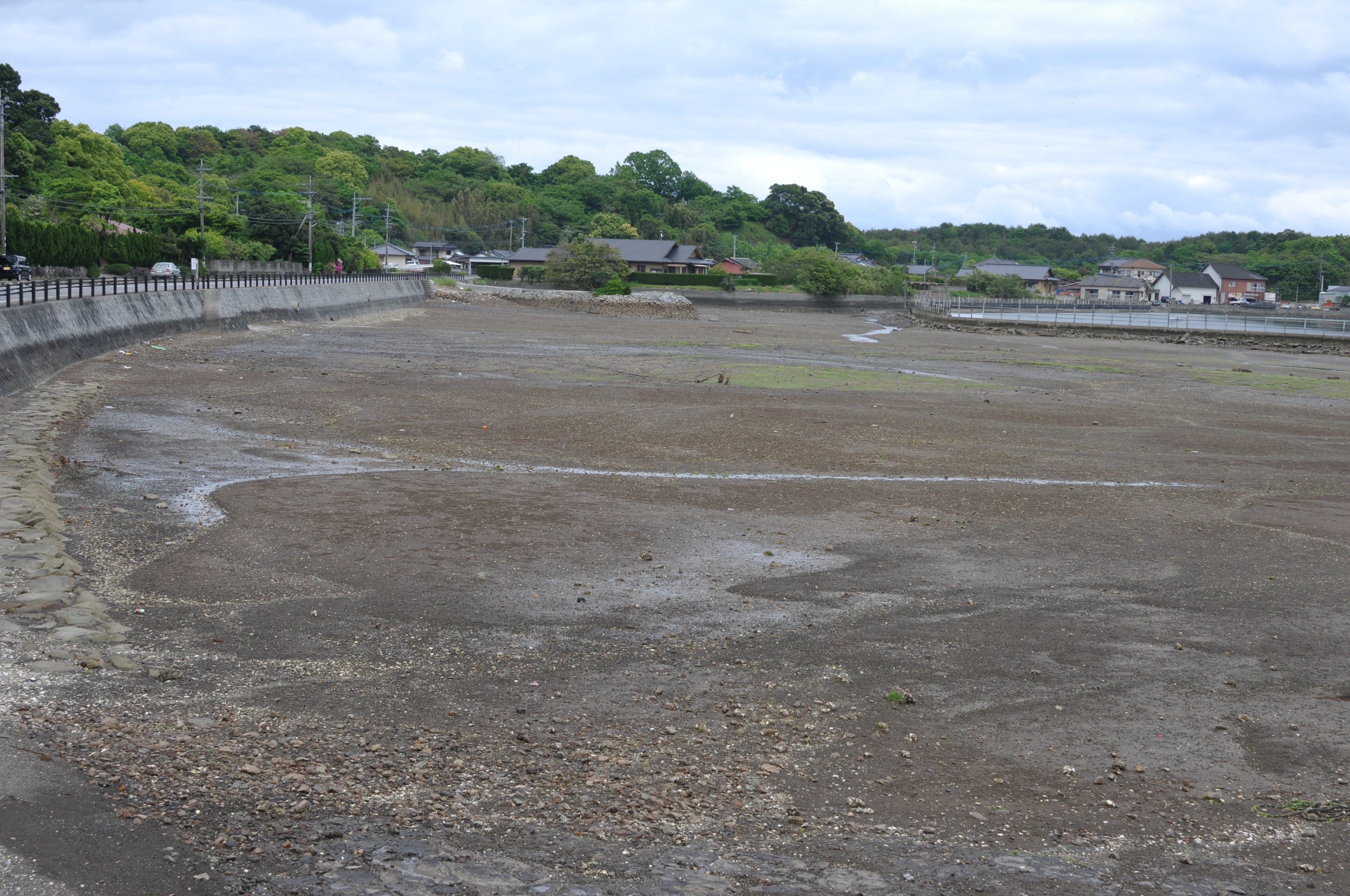
Tidalflats, Rocky shore, Wetlands (containing saltmarshes) in Nagaura Island, Kami-Amakusa, Kumamoto, Japan. It locates in Unzen-Amakusa National Park at west-Kyushu.
-
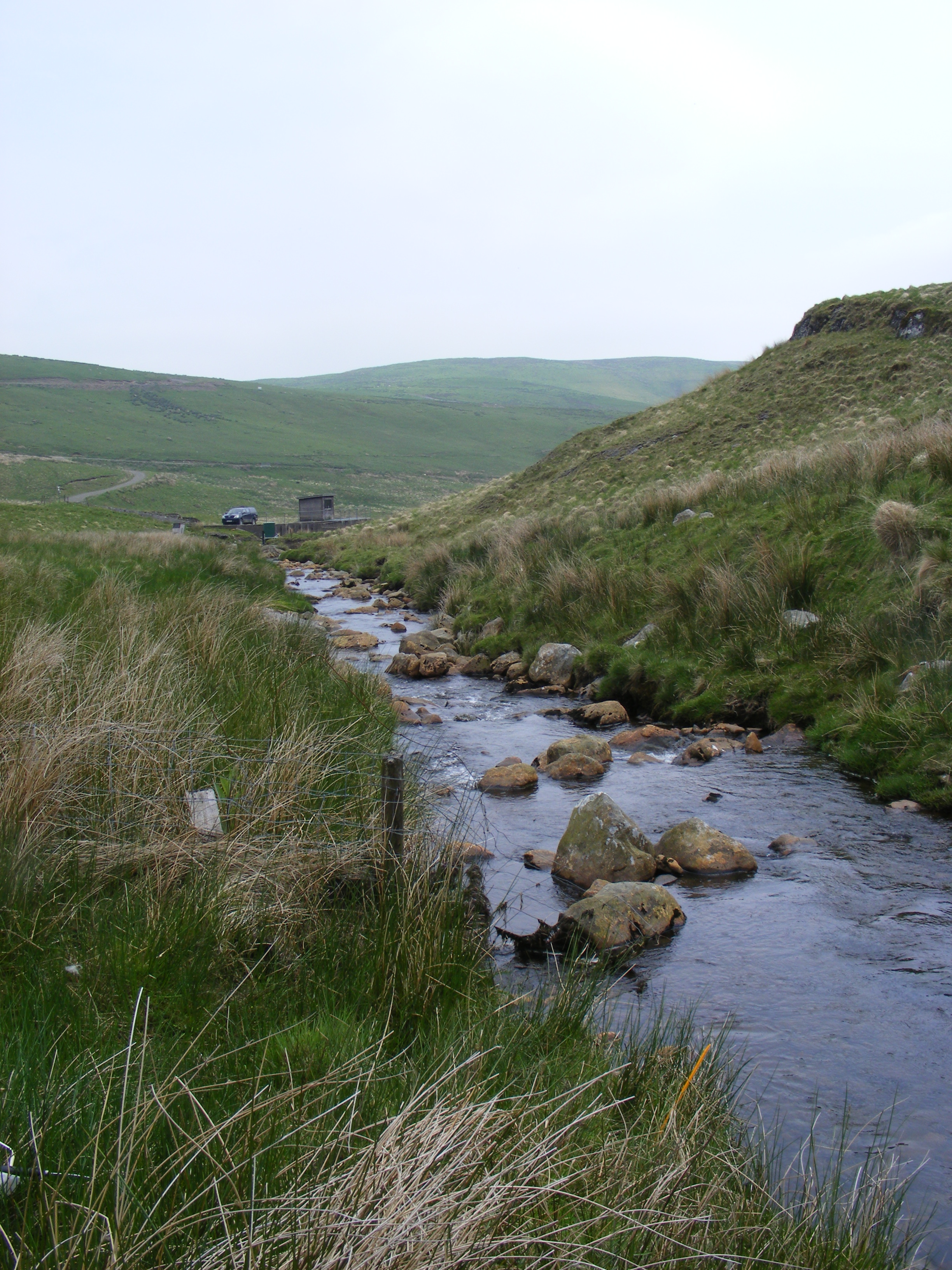
UK Upland Waters Monitoring Network (UK UWMN) site. The Bencrom River lies in the Mourne Mountains of County Down, south-eastern Northern Ireland. The catchment area is 216 ha and rises from 140 m where the river meets the Silent Valley Reservoir to a maximum of 700 m at Slieve Meelbeg. The underlying geology is fine-grained granite with localised superficial boulder clay drift. Soils are dominated by blanket peats which are eroding in the upper part of the catchment. Moorland species characterised by Calluna, Molinia, and Sphagnum mosses, comprise the catchment vegetation, with Pteridium in the lower reaches indicating land-use disturbance in the past. Contemporary land-use and management is confined to low-intensity sheep grazing and infrequent heather burning. The annual rainfall is c. 1800 mm. Note: The area is the size of the catchment.
-
The Neusiedler See - Seewinkel National Park is the first cross-border National Park in Austria and the first Austrian National Park recognised by the IUCN. It covers in total about 90km² on Austrian territory. About 50% of the area (about 4500 ha) is a Nature Reserve Zone, which remains untouched by humans. This zone is dominated by the southernmost Austrian part of the reed belt from Lake Neusiedl. The Conservation Zones are mainly cultural landscapes and require landscape conservation measures and habitat management like pasturing, mowing, cutting reed or water retention. These measures are taken to preserve the cultural landscape and its biodiversity that has developed over centuries. Important habitats like 160 km² of reed belt and around 40 periodically dry soda lakes, as well as sand habitats, dry and wet meadows can be found closely associated with vineyards, cropland, touristic infrastructure and rural settlements. Long-term monitoring programs regarding bird populations, fish ecology or the grazing management enable the cross-border National Park Neusiedler See - Seewinkel to provide biological data from flora and fauna. Furthermore, all soda lakes are monitored frequently regarding salinity, oxygen, temperature, color etc. and biological parameters such as species diversity and quantity of macrozoobenthos. Due to the mosaique of protected and non-protected areas, the boundaries of the National Park area are difficult to define on the shown map.
-
UK Upland Waters Monitoring Network (UK UWMN) site. The Afon Gwy lies to the east of Plynlimon in central Wales and forms part of the headwater system of the River Wye. The catchment area is 389 ha and rises from 380 m at the sampling station to a maximum altitude of 730 m. Catchment soils are dominated by peats and stagnopodsols. The underlying geology is Lower Palaeozoic mudstones, shales and grits of the Gwestyn and Van formations, overlain in places by locally-derived glacial drift. The catchment consists of moorland grasses, notably Molinia and Nardus, with Eriophorum and the moss Racomitrium on areas of wetter land and Pteridium on the lower slopes. The majority of this grassland supports rough grazing for sheep and in summer, on the lower land, cattle. The local area is crossed with tracks used for rally testing, one of which passes through the southern edge of the catchment. Some data are managed by UK ECN Data Centre. Note: The area is the size of the catchment. Note that Afon Gwy is within the Plynlimon Experimental Catchments (see http://data.lter-europe.net/deims/site/EXPEER-UK-02).