
chemical composition
Type of resources
Available actions
Topics
Keywords
Contact for the resource
Provided by
Years
Formats
Representation types
-
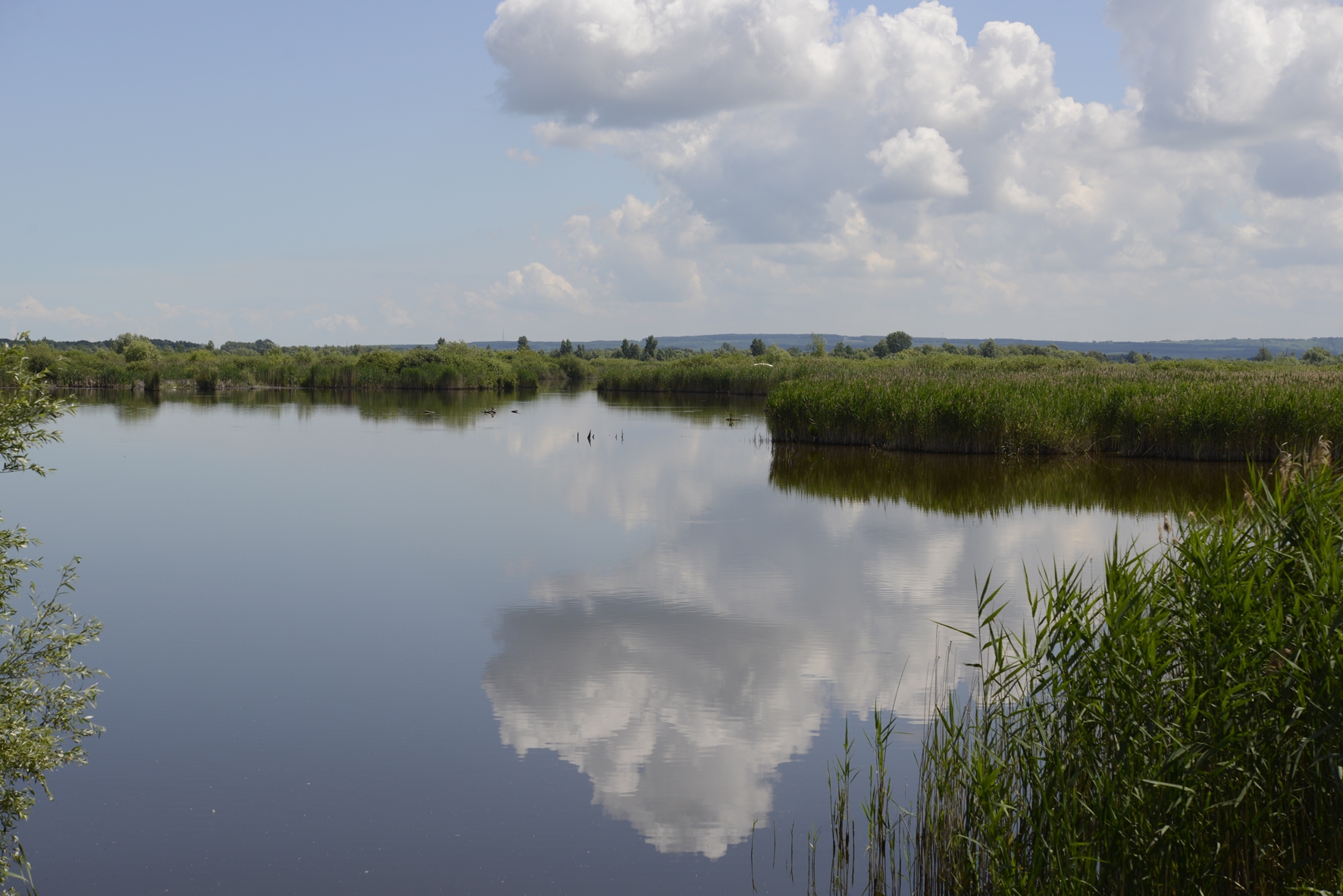
In order to combat the eutrophication of Lake Balaton, the Kis-Balaton Water Protection System (KBWPS) was initiated in the early 1980s. Originally, the KBWPS consisted of an 18 km2 shallow (less than 1.3 m) artificial lake system (Lake Hídvégi) and a 16 km2 wetland, which were constructed on the site of the former Kis-Balaton wetland in the mid-1980s. Later, the wetland part of the KBWPS was significantly enlarged (over 50 km2). Lake Hídvégi was designed to retain nutrients and provide ideal conditions for algae growth, while the wetland component of the KBWPS prevented these algae from entering Lake Balaton. Regular limnological, ornithological, ichthyological and plant ecological measurements are carried out in both Lake Hídvég and the wetland part of the KBWPS.
-
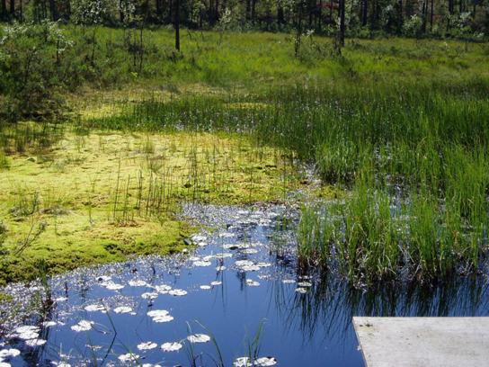
Coniferous forests and mire.
-
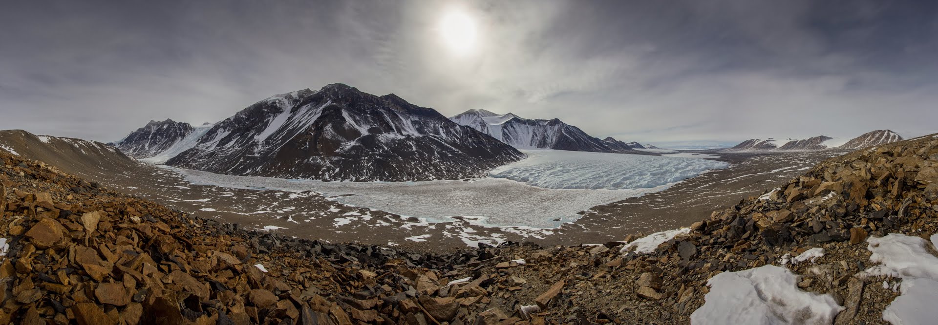
The McMurdo Dry Valleys (MDVs) (78°S, 162°E) represent the largest (4500 km^2) ice-free area on the Antarctic continent. The MDV landscape is a mosaic of glaciers, soil and exposed bedrock, and stream channels that connect glaciers to closed-basin, permanently ice-covered lakes on the valley floors. Mean annual air temperatures are cold (ranging from -15 to -30°C on the valley floors), and precipitation is low (~50 mm annual water equivalent as snow). Summer air temperatures typically hover around freezing and winter air temperatures are commonly < -40°C. While the water columns of the lakes are liquid and biologically active year round, glacial meltwater streams flow and soils thaw only during the austral summer. There are no vascular plants, but microbial mats are abundant in lakes and streams. Mat organisms are transported by wind onto glacier and lake ice surfaces where they actively metabolize in liquid water pockets (cryoconites) that form during the summer months. In the streams, which desiccate for ~10 months each year, cyanobacterial mats host extensive diatom and soil invertebrate communities. Lakes provide a habitat for diverse phototrophic and heterotrophic plankton communities that are adapted to annual light-dark cycles and temperatures near 0°C. Soils are inhabited by nematodes, rotifers, and tardigrades, all of which are metabolically active during summer. The McMurdo Dry Valleys LTER (MCM) began studying this cold desert ecosystem in 1993 and showed that its biocomplexity is inextricably linked to past and present climate drivers. In the fifth iteration of the MCM LTER program, we are working to determine how the MDVs respond to amplified landscape connectivity resulting from contemporary climate variation.
-
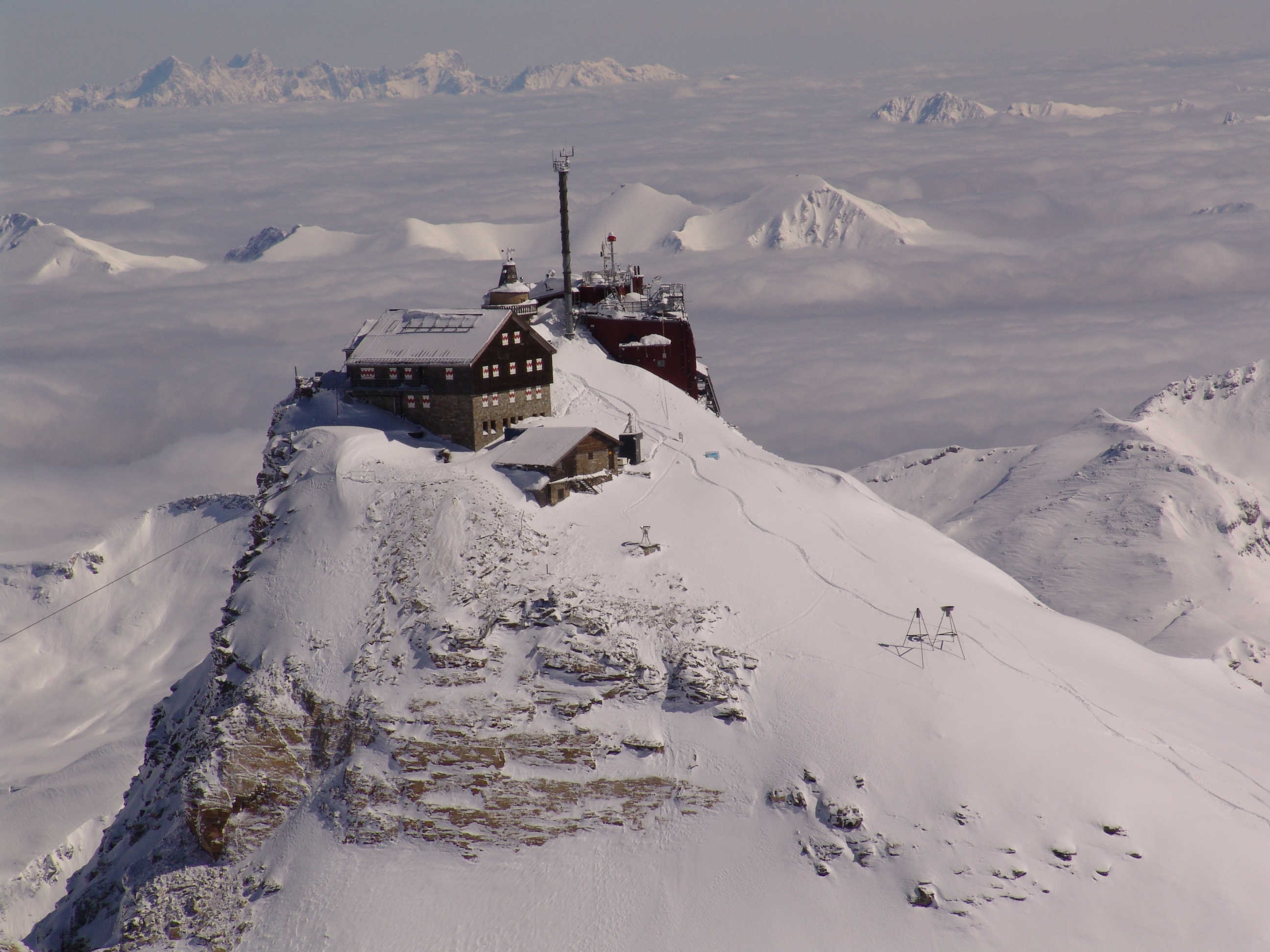
The Sonnblick Observatory is located in the Austrian Central Alps at an elevation of 3100 m a.s.l. It is situated at the alpine main divide, which is a clear climatological border. It also lies in the “Nationalpark Hohe Tauern” which covers 1856 km2 of the Austrian Alps. Research of the Sonnblick Observatory is currently formulated in the research programme ENVISON. It covers three main topics (the atmosphere, the cryosphere, and the biosphere) in an extensive monitoring programme and with many research projects.The Sonnblick Observatory is outstanding with respect to its long-term climate observations and studies on glacier changes. Thus, the impact of Climate Change on the cryosphere is a major research topic at the Sonnblick Observatory. Since 1886, the observatory is also involved in many international projects on atmospheric chemistry and atmospheric physics. The research is described on www.sonnblick.net. The Sonnblick Observatory cooperates with several Austrian and international universities/research institutions. Within the frame of the GAW-DACH cooperation, Sonnblick has a special partnership with the observatories Jungfraujoch (in Switzerland), Zugspitze and Hohenpeissenberg (both Germany) for common research on atmospheric processes and Climate Change. The Sonnblick observatory ist part of the BSRN-Network, LTER Austria, ACTRIS, etc. Data are available via the SBO Data Portal. In the frame of eLTER the SBO will be part of the eLTSER Cluster NPHT.
-
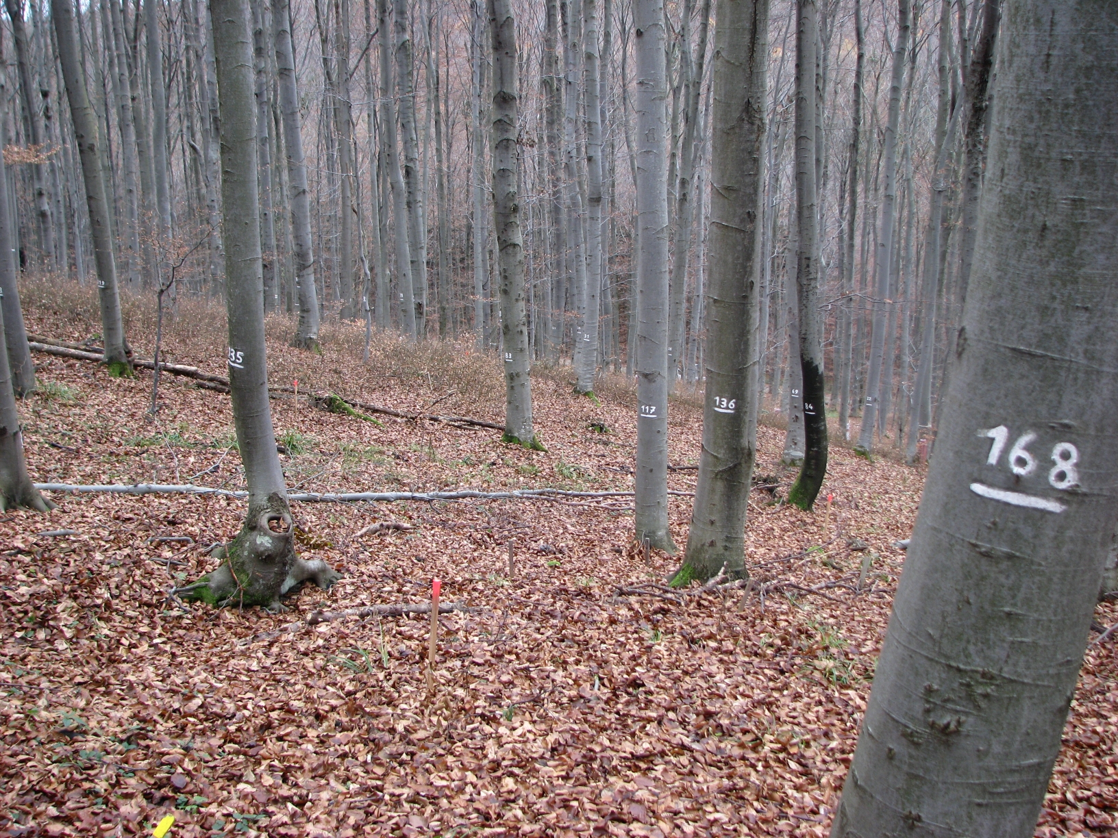
The site Klausen-Leopoldsdorf is part of the European Level II Forest Monitoring System in the frame of the International Co-operative Programme on Assessment and Monitoring of Air Pollution Effects on Forests (ICP Forests). The site was established in 1995 and is, since 2006, part of the LTER Austria network. It is situated in a homogenous 80 years-old managed beech stand about 20km west of Vienna. The LTER-CWN research area in Klausenleopoldsdorf is divided into 3 subplots: a measuring weir, a dendrometer/sapflow measuring facility and GHG-chambers for measuring the fluxes of CO2 and other relevant GHG´s. All 3 subplots were installed in 2019 to collect high-resolution data. The measuring weir is located at about 475m a.s.l and the other subplots (denrometer/sapflow, GHG measuring chambers) are located at about 510m a.s.l. The observed catchment of the measuring weir has an area of 46 hectares. The dominating soil types in the catchment are Planosoils and Stagnosols. The subplots are situated in the near vicinity of the ICP-forest plot.
-
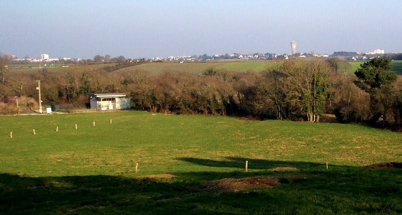
The Ploemeur-Guidel observatory (Britanny, France) is focusing on surface-depth relationships in a fractured crystalline geological context and oceanic climate. It is built on 2 sub-sites, one highly anthropized, the other in natural state. In Ploemeur, groundwater has been pumped since 1991, supplying more than 1 million m3 of clean drinking water annual at a sustainable rate. Such high productivity is explained the specific fractured network in granite and micaschists, draining deep geological layers (~400 m). Extracted water quality is very good, with limited nitrate concentration, in a region that has been strongly affected by widespread pollution. Guidel site is in a similar, but natural context. Deep iron-rich groundwater is upflowing, creating surface and deep groundwater-dependent ecosystems, and feeding a classified coastal wetland. Both sites have a very dense equipment to study rapid to long-term surface-depth exchanges: a flux tower, unsaturated zone monitoring, a network of ~50 shallow (<10m) and deep boreholes (>80m), hydrochemical, temperature and deformation. An well-characterized fractured experimental site offers the possibility to conduct experiments to test innovative instruments and develop new methodologies
-

The ZA PYGAR covers the whole Garonne river basin up to the upper part of the Gironde estuary (La Reole station). Within this territory, research is structured around 4 main sites: the Pyrénées mountains, covering the upstream part of the Garonne river basin (PYRénées site), the farmland of the foothills of the Pyrénées (Vallées et Coteaux de Gascogne site), the Garonne river (Axe Fluvial Garonne site) and the basin of two tributaries of the Garonne river in the Massif Central moutains (Aveyron-Viaur site).
-
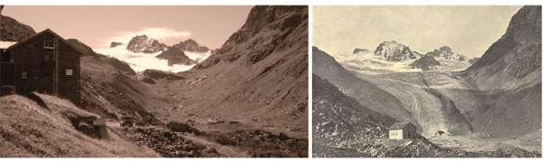
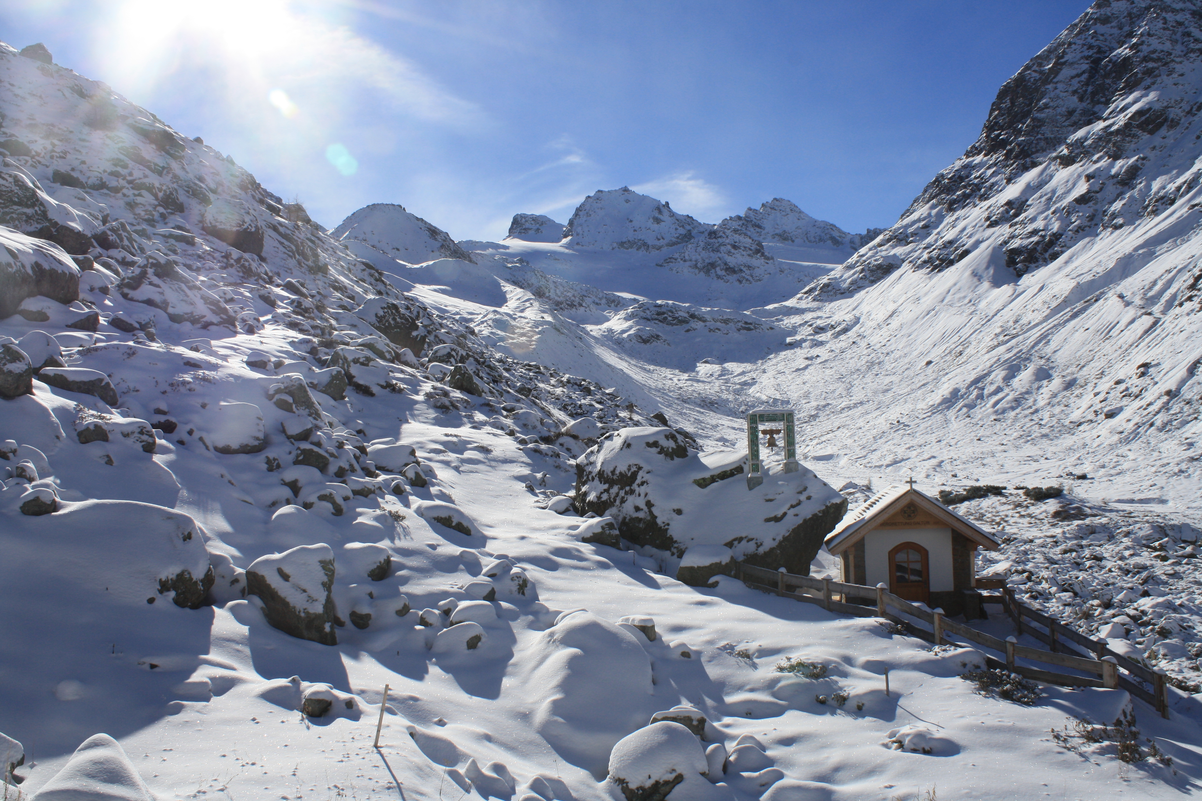
The site is located at the main Alpine ridge in Silvretta group right at the border between Austria and Switzerland. Jamtalferner glacier and it's forefield is subject to scientific reseach for more than 100 years. Current monitoring includes climate, hydrology, glacier mass balance, permafrost, paleoglaciology, society and biotic succession in the periglacial area. In addition to that, several short time research projects are carried out, e.g. concerning glacier albedo. The site inlcudes the are from the highest peaks at 3384 m a.s.l. and the valley further down to the communities of Galtür and Ischgl (1263 m a.s.l.). More information can be found at the website of the environmental education program Jamtal www.umweltbildung-jamtal.info.
-
The LTSER platform Oberes Paznaun includes the communities of Ischgl and Galtür (225 km²), and covers an elevation range from 1263 to 3384 m.a.sl.. The village of Galtür is one of the highest permanently inhabited places in the Alps. Fluchthorn, the highest peak of the largely glacier-covered Silvretta, was taken down by about 30m in 2023, when a major rock fall occurred as a result of reducing permafrost. Both the effects of climate and those of land use change affect the very sensitive livelihoods in the are, exposed as they are to natural hazards, such as avalanches, rock fall and floods. The region was economically weak until winter tourism boomed from the 1970s. Skiing as dominant source of income now has an impact on land use as well as on social and economic structures in the region. Management issues arise from the high number of incoming tourists. Local stakeholder networks involved in spatial planning and hazard management are also part of the LTSER Platform. The local Alpinarium museum is dedicated to presenting the livelihoods of mountain communities and acts as a local hub for linking science and society. Apart from the long-term monitoring of the environmental parameters, initiated in 1895 with glacier length changes, the socio-economic research in the Paznaun area dates back to the 1960s. Socio-economic and socio-ecological research in the region focuses on the multiple feedbacks between environmental and socio-economic changes in the region. The avalanche disaster of Ischgl and Galtür in 1999 affected disaster management and related structures in many ways, not only for the region, but for all of Austria, for instance leading to the foundation of crisis intervention teams. The question of how to deal with impacts of climate change, for example on hydrology and water management, is part of research projects in the area connecting stakeholders and scientists. The overarching aim of the platform Oberes Paznaun is linking up geosphere, atmosphere, hydrosphere and biosphere research with local political and administrative processes for sustainable development in a warming future.
-

The Cairngorms National Park is one of 15 National Parks in the UK (one of two in Scotland) and is Britain's largest National Park (4,528 km2). It is the location for some of the most spectacular landscapes in Britain and is home to an incredible diversity of wildlife and plants. http://cairngorms.co.uk/the-park/facts-figures/ The aims of the National Park are: • To conserve and enhance the natural and cultural heritage of the area; • To promote sustainable use of the natural resources of the area; • To promote understanding and enjoyment (including enjoyment in the form of recreation) of the special qualities of the area by the public; • To promote sustainable economic and social development of the area’s communities. Cairngorms National Park, seven broad habitats can be identified: • Enclosed farmlands • Woodlands • Open waters (rivers, lochs, wetlands and floodplains) • Mountains • Moorland • Semi-natural grasslands • Urban • Population of c17,500 • 25.8% of population over 60 (higher than Scottish average) • Average health index in top 25% of Scotland (based on deprivation indices) • Extensive core paths network • 55 Munros including 5 summits over 4000 feet • 3 ski centres • National Cycle Network Route 7 • 1 Long Distance Route (Speyside Way) • Relatively low atmospheric pollution • Annual precipitation over 2250mm on summits and under 900mm in straths • Average annual snow cover 200 days on summits and 50 days on low-ground • Prevailing winds from south-west