
chemical composition of water
Type of resources
Available actions
Topics
Keywords
Contact for the resource
Provided by
Years
Formats
Representation types
-
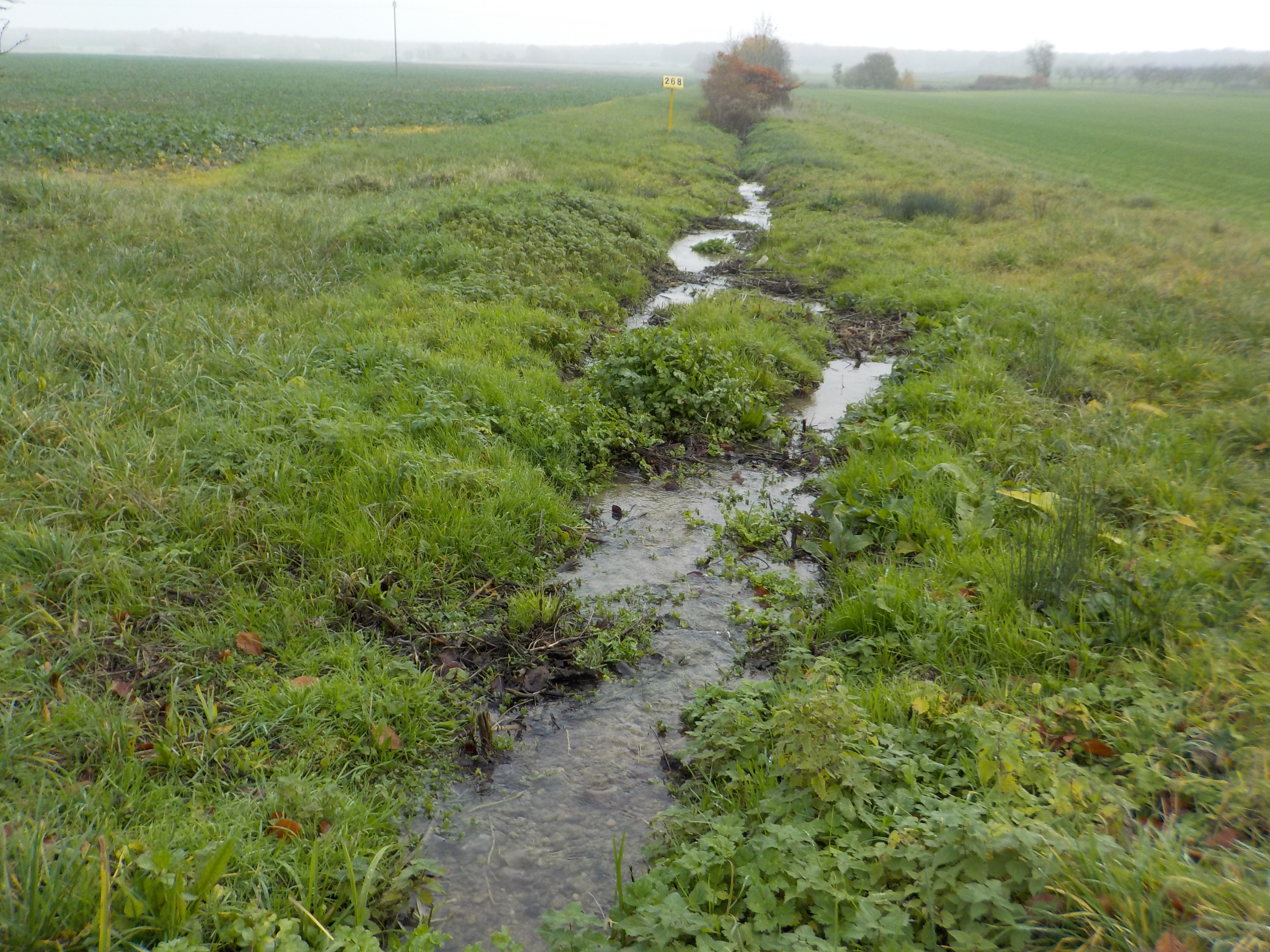
The state forest of La Reine is a humid forest of about 5000 ha located in the south of the plain of Woëvre and at the foot of the Meuse hills in France. Numerous ponds and puddles are scattered throughout the forest and it is crossed by many small, more or less natural streams. Upstream of the forest, these waterways are impacted by human activities (large-scale farming, housing without collective sanitation in particular). Since 2019, the Moselle Basin Workshop Zone has been working on the implementation of a workshop site to understand the bio-hydrogeological functioning of three of these streams, particularly in terms of natural purification. Sampling campaigns are regularly organized in the streams and in ponds.
-
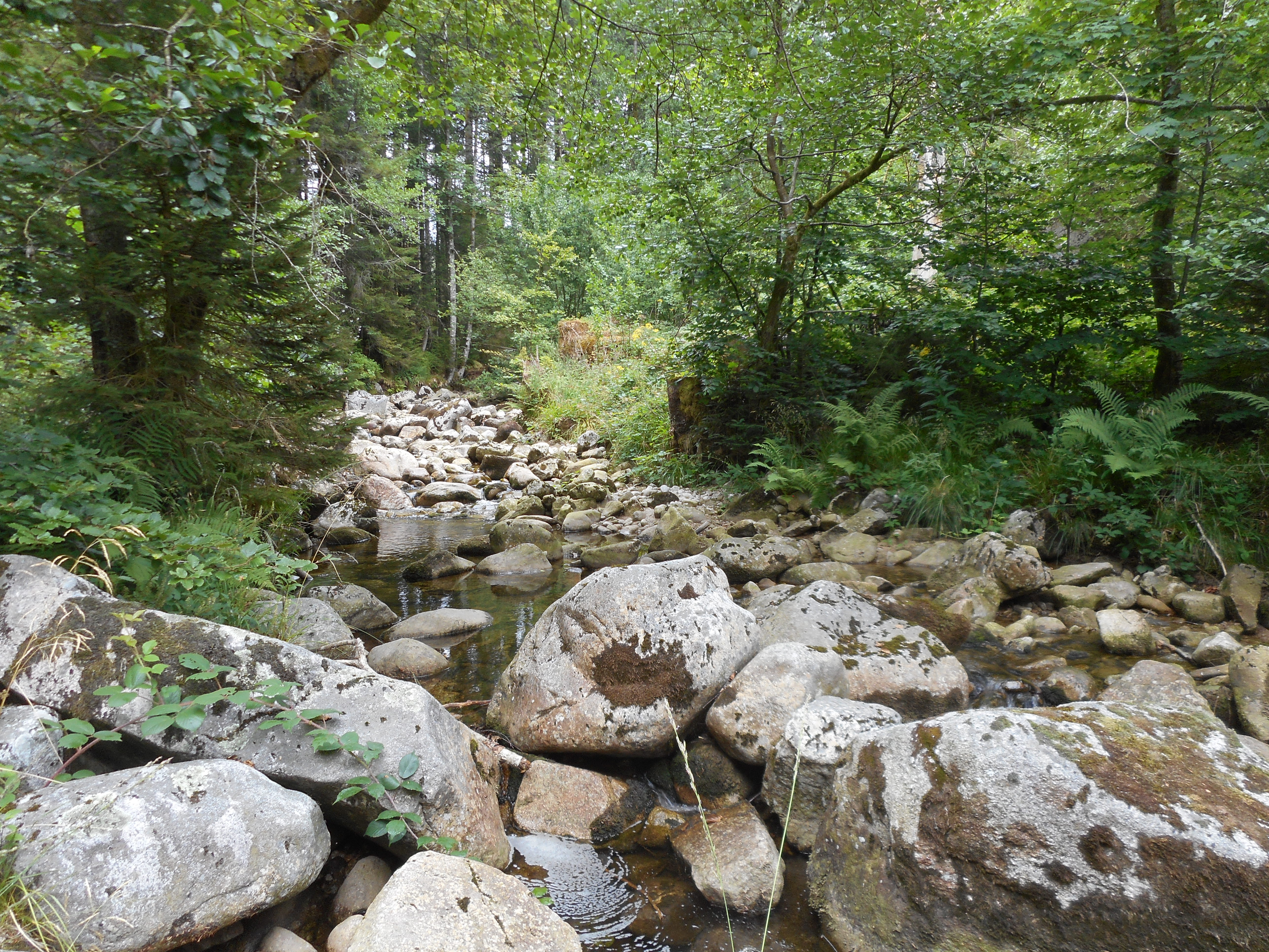
The observatory consists of 16 headstreams (15 in the Moselle River watershed, 1 in the Rhône River watershed), draining forest (mixed coniferous, beech) watersheds on sandstone and granites at very different altitudes.
-
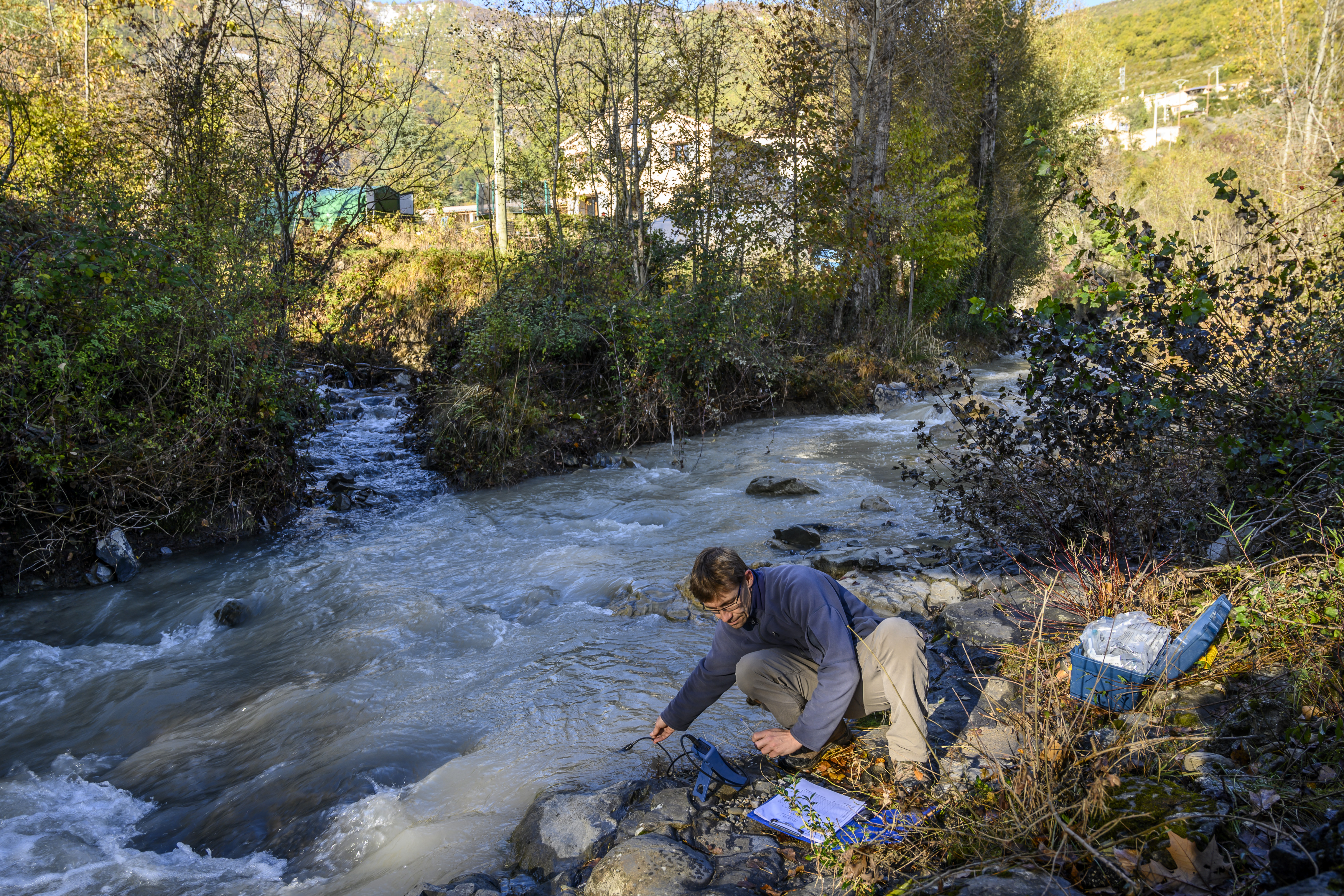
The Galabre site is part of Draix-Bleone observatory, located in the French South Alps, upstream of Digne, on the right side of the Bleone river. The hydrosedimentary station of La Robine-sur-Galabre was created in 2008 to measure water of sediment fluxes from the Galabre catchment, 20 km2. This catchment integrates a diversity of lithologies and land use that are characteristic of the Pre-Alps. The climate is mountainous and Mediterranean. The site is characterized by intense erosion and intermittent sediment fluxes. The variables that are monitored on the long-term include rainfall and meteorology, high-frequency water discharge and suspended sediment concentration (10 minutes), some physico-chemical properties of stream water and sediments.
-
UK Upland Waters Monitoring Network (UK UWMN) site. Loch Coire Fionnaraich has a catchment of 550 ha, with a range of elevation from 236 m at the outflow to 933 m at the summit of Maol Chean-dearg. Whilst a band of Cambrian basal quartzite and "Pipe Rock" crosses beneath the northern side of the loch, the catchment geology is mostly made up of Torridonian sandstones from the Applecross and Aultbea groups. Catchment soils consist of peats and peaty podsols alongside extensive areas of exposed rock. Vegetation is dominated by Molinia and Calluna and the catchment is treeless. The surrounding moorland is managed for red deer and low numbers of feral goats are also present. A popular hiking path passes along the western shore of the loch. There are a number of very small lochans and pools on the catchment's northern boundary and one more in the north-west.
-
UK Upland Waters Monitoring Network (UK UWMN) site. Named Lochan a' Cheaird on historic maps, Loch Tinker lies at 418 m altitude and drains an adjacent catchment to the east of Loch Chon in the Trossachs region of central Scotland. The loch receives drainage from seepage through the catchment blanket peats and from the steep slopes to the south and east, although the main stream in this area is naturally captured just a few metres downstream of the loch outflow. The loch drains to the north east via the Allt Glasahoile which falls steeply to Loch Katrine. The loch (surface area 11.1 ha) has an irregular shoreline and the generally shallow (mean depth 3.5 m) bathymetry includes two distinct sub-basins reaching a maximum depth of 9.8 m. Three small islands are located towards the southern end of the loch. Some data managed by UK ECN Data Centre. Note: The area is the size of the catchment.
-
UK Upland Waters Monitoring Network (UK UWMN) site. Loch Chon is a relatively large (surface area 105.7 ha) lake lying at an altitude of 92 m in the Trossachs region of central Scotland. The loch is fed by several small streams and drains to the south via Loch Ard and the River Forth. The loch has two main basins, with the deepest area (25 m) represented by a trench near the western shore. The bathymetry was first surveyed by Murray and Pullar in 1910. Some data managed by UK ECN Data Centre. Note: The area is the size of the catchment. The lake area is 106 ha
-
UK Upland Waters Monitoring Network (UK UWMN) site. The site lies at 298 m altitude in the Galloway region of south-west Scotland. The loch is 12.7 ha in area and receives drainage from minor streams and catchment blanket peats. The outflow drains to the south-west into the Glenhead Burn and Loch Trool. The loch bathymetry indicates a single deep basin (maximum depth 13.5 m) offset to the south with slopes rising gently away from the southern shore. An island is located just off the western shore some 250 m from the outflow. Some data are managed by UK ECN Data Centre. Note: The area is the size of the catchment.
-
UK Upland Waters Monitoring Network (UK UWMN) site. Blue Lough is a small (1.9 ha) circular lake lying at 340 m altitude. The lough has no discrete inflow and drains through a Sphagnum bog to a tributary of the Annalong River. The bathymetry reveals a shallow concentric basin offset to the east, with a maximum depth of 5 m. Blue Lough is situated in a col between the Silent Valley and Annalong Valley in the Mourne Mountains of south-eastern Northern Ireland, very close to Bencrom River. The catchment is small (48 ha), but is steep and rugged, reaching a maximum altitude of 703 m. The solid geology of the catchment consists of granite which is exposed as bare rock and scree on the steep backwall and is covered with thin and often eroded blanket peat, peaty podsols and peaty gleys in the less steep areas. Bare rock, scree and eroded peat characterise the catchment, but elsewhere the vegetation is dominated by Calluna which in places is mature and in others has been intensively burnt. Land-use and management is restricted to low-intensity sheep grazing and occasional heather burning. Annual rainfall is c. 1600 mm. Some data are managed by UK ECN Data Centre. Note: The area is the size of the catchment.
-
UK Upland Waters Monitoring Network (UK UWMN) site. Loch Grannoch is a large (surface area 111.4 ha), elongated lake which lies at 214 m altitude. Small streams feed the loch along its eastern and western shores, the principal of which is the Cuttimore Burn. It drains to the north into the River Dee via the Pullaugh Burn. The loch bathymetry was first surveyed by Murray and Pullar in 1910 and was updated by a subsequent survey by the Palaeoecology Research Unit of University College London. The major basin is offset to the south of the loch and reaches a maximum depth of 20.5 m. Some data are managed by UK ECN Data Centre. Note: The area is the size of the catchment.
-
UK Upland Waters Monitoring Network (UK UWMN) site. Llyn Cwm Mynach lies at 287 m altitude. The lake consists of two distinct basins; the southern section comprises a shallow limb separated from the deeper northern section by an old and broken stone causeway. The maximum depth of 11 m occurs in the northern basin in a localised hollow. Discrete drainage to the lake is by three small inflows and it is drained to the south-east by a small stream which flows to the Mawddach estuary. At some stage in the past a wooden weir (now derelict) was constructed at the outflow, presumably to raise the level of the southern section of the lake. Some data are managed by UK ECN Data Centre. Note: The area is the size of the catchment.