
chemical parameter
Type of resources
Available actions
Topics
Keywords
Contact for the resource
Provided by
Years
Formats
Representation types
-
Analysis of a set of water samples were taken from several sites in the Jamtal in July and September 2021. Water pH, electrical conductivity, alkalinity, major ions (Ca, Mg, K, Na, SO4, Cl HCO3), and major nutrients (NO3-N, NH4N, total N, PO4, total P, SiO2) were analyzed. At the same time samples for the analysis of epilithic and epiphytica diatoms, used as bioindicators of the overall ecological quality of the streams and springs were collected.
-
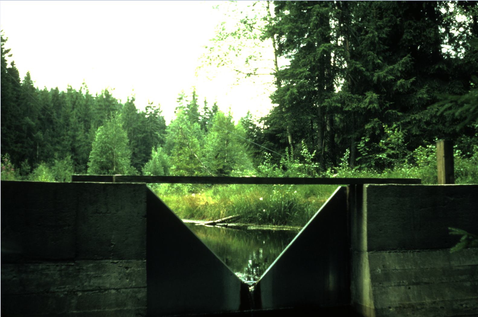
Catchment stream monitoring of water chemistry. Forested catchment on acid-sensitives soils, 200-300 masl
-
Research Site located inside the Paneveggio-Pale di S. Martino Provincial Park mainly formed by pure Norway spruce stands. In the upper part of this forest Norway spruce is mixed with Swiss stone pine and larch.
-
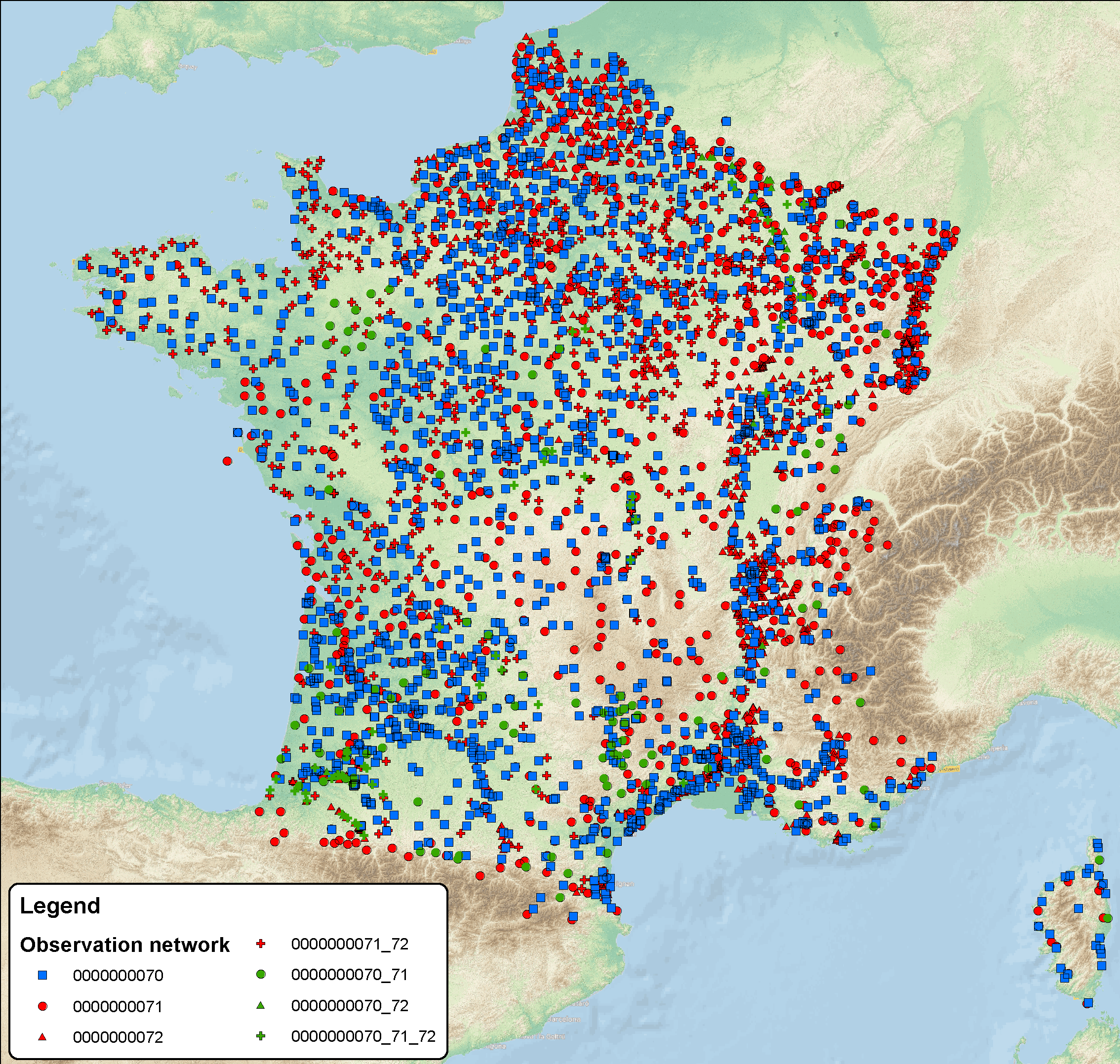
ROSES is the groundwater observatory network at national scale (France); it's based on 78 000 monitoring water points (4600 observatory boreholes and 75 000 qualitometers (wells, borholes, springs); some stations concern both measurements, quality and groundwater level). Some water points belong to water framework directive (WFD) such as groundwater level data network 0000000070, quality monitoring network 0000000071 and quality operational network 0000000072, and several other regional networks operated by various actors. Available data: More than 15 million piezometric levels, more than 78 million analyses (in situ parameters, major ions, traces, organic compound (pesticides, pharmaceutical substances, ...)) Monitoring frequencies for the chemical data are different in fonction of the pressure on the ressource (monthly to yearly). Regarding groundwater level, for the WFD observatory boreholes network, the frequency is on the hour base; in the database, daily data are only available. All ROSES' data are available on the ADES database ( www.ades.eaufrance.fr)
-
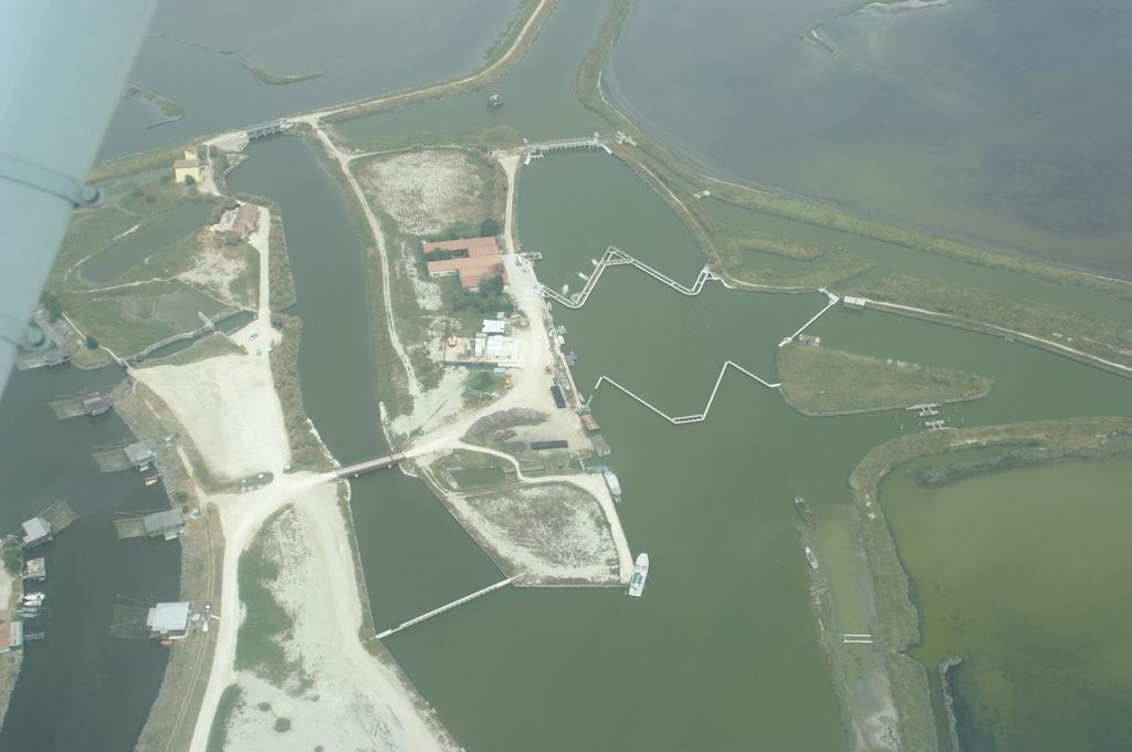
IT07-001-M (Sacca di Goro), IT07-002-M (Valli di Comacchio) The Sacca di Goro is a shallow-water embayment of the Po River Delta approximately triangular in shape with a surface area of 26 Km2, an average depth of 1.5 m, and it is connected to the sea by two mouths about 0.9 Km wide each. The lagoon is characterized by a clear zonation with the low energy eastern area separated from two higher energy zones, the western area influenced by freshwater inflow from the Po di Volano and the central area influenced by the sea The eastern zone is very shallow (maximum depth 1 m) and accounts for one half of the total surface area and one quarter of the water volume. The lagoon is surrounded by embankments. The main freshwater inputs are the Po di Volano River, the Canal Bianco and Giralda, which have approximately the same discharge rates. Freshwater inlets are also located along the Po di Goro River and are regulated by sluices. There are no direct estimates of the freshwater input from the Po di Goro, which is usually assumed to be equivalent to that of the Po di Volano. The freshwater system is mostly located in a subsident area and is regulated by a system of pumping stations (scooping plants). The fresh water or hydraulic residence time oscillates monthly between 2.5 and 122 days with a mean value of 24.5 days, whereas the water exchange time ranges from 2 to 4 days. The tidal amplitude is ca 80 cm. The bottom of the lagoon is flat and the sediment is alluvial mud with high clay and silt content in the northern and central zones. Sand is more abundant near the southern shoreline, whilst sandy mud occurs in the eastern area. The Valli di Comacchio are a large (115 km2) complex of shallow-water (with depth ranging from 0.5-1.5 m) brackish lagoons located in the southernmost part of the Po River deltaic area (Figure 1). The Valli are, nowadays, constituted by three main basins, i.e. Valle Magnavacca, Valle Fossa di Porto and Valle Campo. This semi-enclosed lagoonal complex is almost completely surrounded by earthen dikes, and separated by the sea by the highly anthropogenically impacted, 2.5 km-wide Spina spit. The Valli are connected with the Adriatic Sea by three marine channels, Portocanale, Logonovo and Gobbino, but since the latter is impounded, major water exchange with the sea occurs only through the firsts two channels. The former receives also nutrient-enriched continental water from Valle Fattibello. Water exchange with the sea is both tidal and man-regulated. Moreover, from February to May, large amounts of freshwater are conveyed through the Reno river through two dams in the southermost parts of Valle Magnavacca and Valle Fossa di Porto. Due to the shallowness of the basins and their limited water renewal, salinity (annual range: 24-38 psu) is mostly influenced by meteorological events, such as evaporation and occasional heavy rainstorms. The bottoms of the Valli are typically muddy, but sparsely vegetated meadows of the seagrass Ruppia cirrhosa occur in the southern parts of the Valli Magnavacca and Fossa di Porto. These meadows are the remnants of the larger macrophytic coverage that characterized the bottom of the Valli in the early 1970s
-
na
-
The Valli di Comacchio are a large (115 km2) complex of shallow-water (with depth ranging from 0.5-1.5 m) brackish lagoons located in the southernmost part of the Po River deltaic area (Figure 1). The Valli are, nowadays, constituted by three main basins, i.e. Valle Magnavacca, Valle Fossa di Porto and Valle Campo. This semi-enclosed lagoonal complex is almost completely surrounded by earthen dikes, and separated by the sea by the highly anthropogenically impacted, 2.5 km-wide Spina spit. The Valli are connected with the Adriatic Sea by three marine channels, Portocanale, Logonovo and Gobbino, but since the latter is impounded, major water exchange with the sea occurs only through the firsts two channels. The former receives also nutrient-enriched continental water from Valle Fattibello. Water exchange with the sea is both tidal and man-regulated. Moreover, from February to May, large amounts of freshwater are conveyed through the Reno river through two dams in the southermost parts of Valle Magnavacca and Valle Fossa di Porto. Due to the shallowness of the basins and their limited water renewal, salinity (annual range: 24-38 psu) is mostly influenced by meteorological events, such as evaporation and occasional heavy rainstorms. The bottoms of the Valli are typically muddy, but sparsely vegetated meadows of the seagrass Ruppia cirrhosa occur in the southern parts of the Valli Magnavacca and Fossa di Porto. These meadows are the remnants of the larger macrophytic coverage that characterized the bottom of the Valli in the early 1970s
-
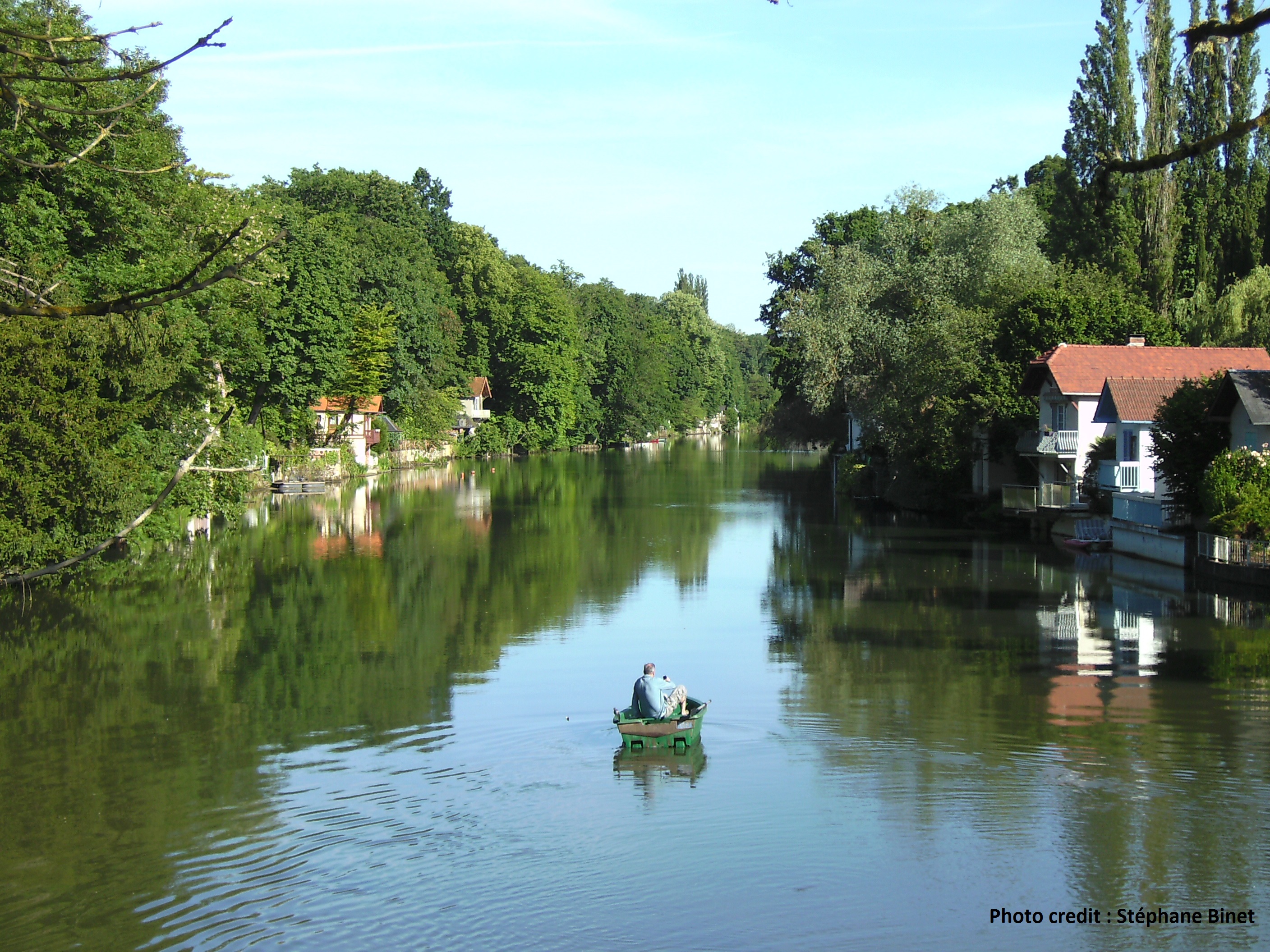
The Val d’Orléans is a vast depression in the Loire River main flow, 37 km long and from 4 to 7 km wide. This is a saturated karst aquifer, hosted within a carbonate lacustrine deposit called the Beauce limestone with a high porosity overlain by the Quaternary alluvia of the Loire River. The Loire River feeds more than 80% of the water hosted in the carbonate karst aquifer (11.5 m3/s during low water periods). Water outflows toward several resurgences of the Loiret River through a saturated karst networks.
-
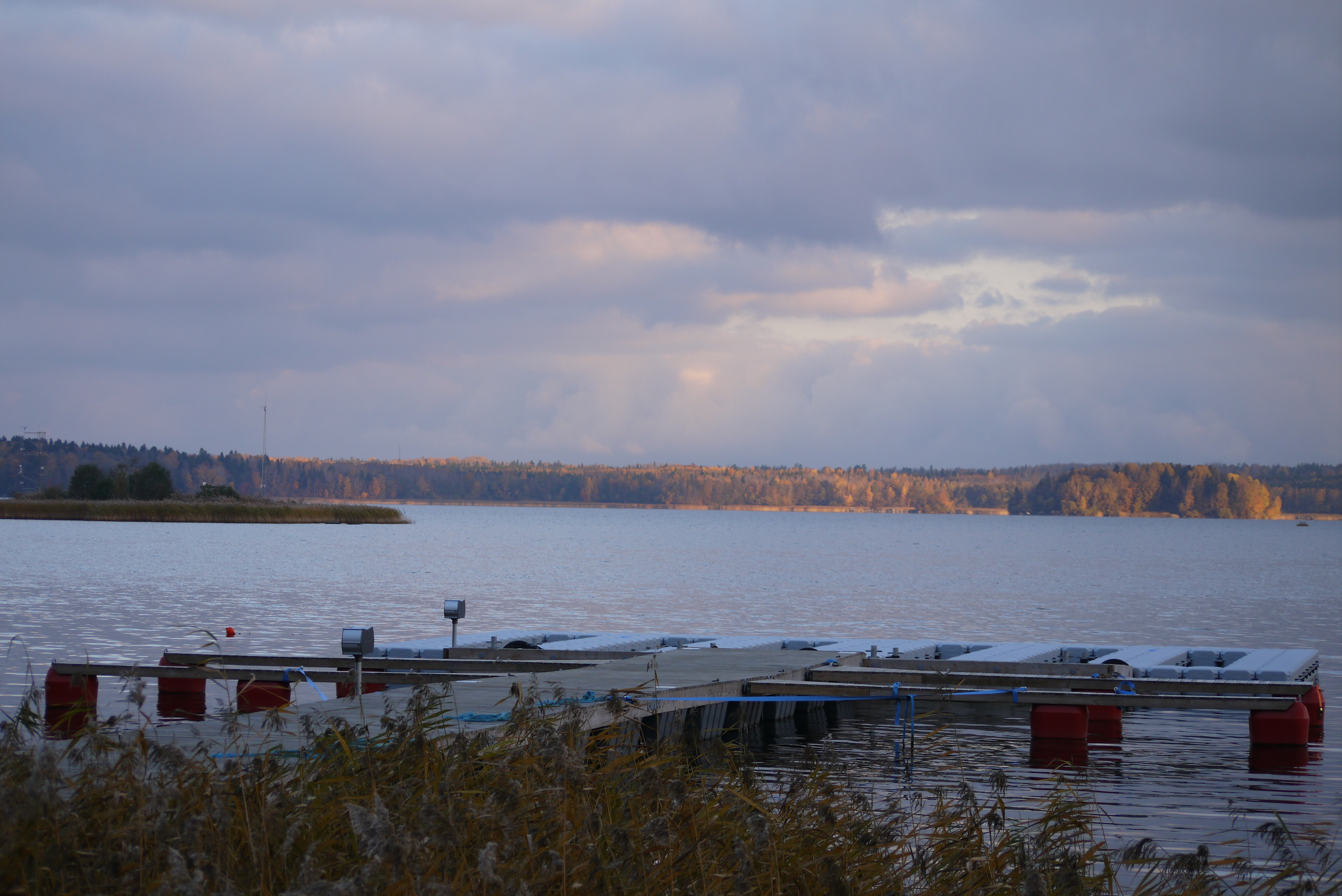
The Erken station and lake is located in the Uppland area in east-central Sweden surrounded by a hemi-boreal landscape. The bedrock consists mainly of gneiss and granites overlayed by glacial and postglacial clay deposits. The extensive environmental monitoring program for Lake Erken includes both manual and high-frequency automatic measurements. The program includes one of the longest available measurements series of water temperature and water chemistry as well as plankton community analyses, including sampling stations in the lake as well as all in- and outlets. More recently, greenhouse gas flux measurements also became part of the monitoring programme. The field station was founded 1946 and belongs to Uppsala University. It is running all year round with a staff of about ten people. The station is also part of the Swedish Infrastructure for Ecosystem Science (SITES).
-
The Sacca di Goro is a shallow-water embayment of the Po River Delta approximately triangular in shape with a surface area of 26 Km2, an average depth of 1.5 m, and it is connected to the sea by two mouths about 0.9 Km wide each. The lagoon is characterized by a clear zonation with the low energy eastern area separated from two higher energy zones, the western area influenced by freshwater inflow from the Po di Volano and the central area influenced by the sea The eastern zone is very shallow (maximum depth 1 m) and accounts for one half of the total surface area and one quarter of the water volume. The lagoon is surrounded by embankments. The main freshwater inputs are the Po di Volano River, the Canal Bianco and Giralda, which have approximately the same discharge rates. Freshwater inlets are also located along the Po di Goro River and are regulated by sluices. There are no direct estimates of the freshwater input from the Po di Goro, which is usually assumed to be equivalent to that of the Po di Volano. The freshwater system is mostly located in a subsident area and is regulated by a system of pumping stations (scooping plants). The fresh water or hydraulic residence time oscillates monthly between 2.5 and 122 days with a mean value of 24.5 days, whereas the water exchange time ranges from 2 to 4 days. The tidal amplitude is ca 80 cm. The bottom of the lagoon is flat and the sediment is alluvial mud with high clay and silt content in the northern and central zones. Sand is more abundant near the southern shoreline, whilst sandy mud occurs in the eastern area.