
chlorophyll a content in water
Type of resources
Available actions
Topics
Keywords
Contact for the resource
Provided by
Years
Formats
Representation types
-
High resolution recording of water quality and water hydrology by two types of sensors monitoring the open lake and reed belt sites at Lake Neusiedl: Hydrolab-Multiparameter sensors measuring temperature, oxygen, pH, conductivity, turbidity and chlorophyll-a; PLSC_sensors for water level, water temperature and water conductivity. The on-line recording of these sensors measures at high time resolution of every three minutes. The two types of sensors are located as follows (in alphabetical order): Hydrolab-Multiparameter_Sensor - Neusiedlersee-Steg: N47°46.208’ & E016°45.129’ Hydrolab-Multiparameter_Sensor - Neusiedlersee-Ruster Poschn: N47°46.631’ & E016°45.187’ PLSC_Sensor - Neusiedlersee-Steg: N47°46.208’ & E016°45.129’ PLSC_Sensor - Bootshafen Biologische Station: N47°46.128’ & E016°45.976’
-
Measurements of chlorophyll-a are part of lake monitoring, which is usually carried out by monthly sampling at many regular lake sites (5 to 17 sites depending on the intensity of the measurements over the years). The integrated sample represents the whole water column of this polymictic shallow lake with a mean lake depth of 1.2m. The photometric measurement satisfies the analytical standards of Ö-Norm in Austria.
-
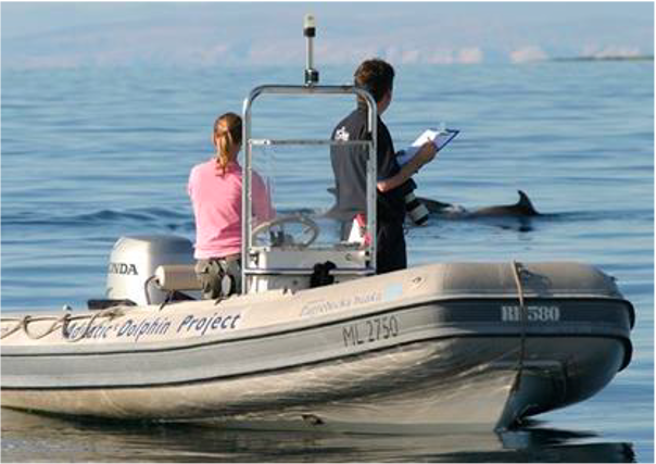
Large marine site located in the Kvarnerić area, around the sheltered coast and waters of the eastern part of the Lošinj and Cres archipelago. It is one of the most important feeding and breeding areas for bottlenose dolphins (Tursiops truncatus) in the Eastern Adriatic. Lithostratigraphic units represented on the coast are dolomites and post sedimentary diagenetic breccia (upper albian, lower cenomanian - K16, K12), rudist limestones (cenomanianmaastricht - K21-6). Soils on the coast are rockyground, anthropogenic soil on karst. The area was created after the transgression of the sea after the last glaciation; marine shelf; highly indented coastline. In July 2006 of preventive protection of a part of the Kvarnerić region for 3 years as a Special Marine Reserve (Cres-Lošinj Special Marine Reserve – CLSMR has been declared.
-
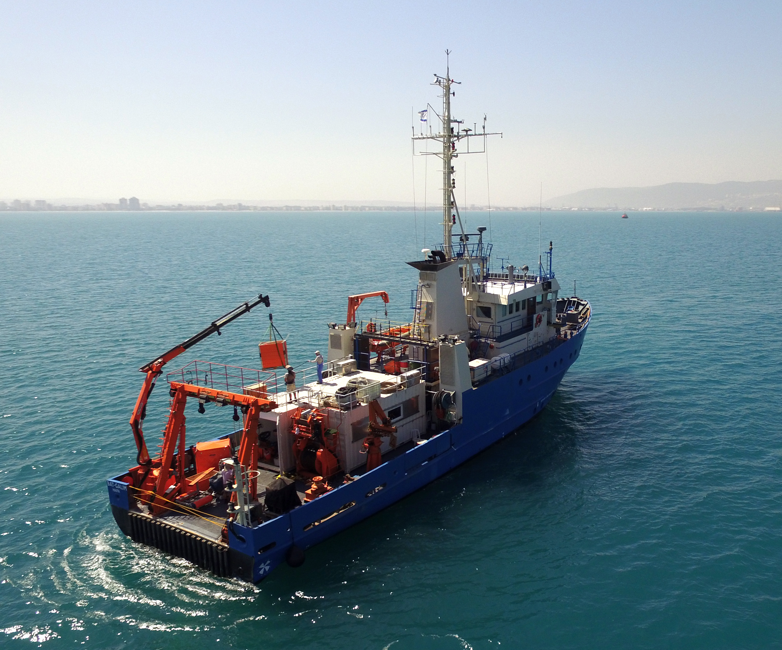
The National Institute of Oceanography (IOLR) is located in Haifa (Tel Shikmona) on the shores of the Mediterranean Sea. The institute engages in research and development in marine sciences and provides information and professional advice to the government and the public sector in the context of the sustainable utilization and conservation of Israel’s marine and coastal resources. The oceanographic studies at the institute are engaged in research, monitoring, and collecting environmental data in the Mediterranean Sea, and in studying natural and unnatural processes. The research topics at the institute include subjects such as; flow and mixing processes; oceanographic models; material cycles; sediment transportation and geological processes; the structure of the seabed; physiology, immunology, and ecology of marine organisms and the populations’ dynamics; the biological diversity in offshore waters and deep seas; effects of human activity on the open sea and coastal environment. IOLR operates advanced instruments and national infrastructures for marine research and monitoring, such as; the national research vessel “Bat Galim”, small ships, and autonomous underwater gliders. A variety of mapping, sampling, data collection, and independent systems are placed at sea for continuous monitoring of environmental variables. In addition, ecological monitoring (community structure, biological diversity, etc.) is carried out in several habitats at a monthly to yearly frequency as follows: • Seasonal ecological monitoring of the Benthos community of the vegetation tables in four sites from north to south since 2009 (also includes a monthly sampling of the water - chlorophyll, nutrients, alkalinity, DIC, temp., pH). • Seasonal ecological monitoring of the benthos community (fish, and biotic cover) of the shallow reefs in the Shekmona/Rash Carmel area. • Annual ecological monitoring of the mesophotic reefs (90-100 meters) at the top of Carmel and the shallow reef. • Monthly zooplankton monitoring at the Hadera station • Monitoring the fish society and the invertebrate community in sandy bottoms • Deep sea monitoring IOLR operates the National Marine Information Center - ISRAMAR, which collects, records, and distributes data and information regarding Israel’s marine environment.
-
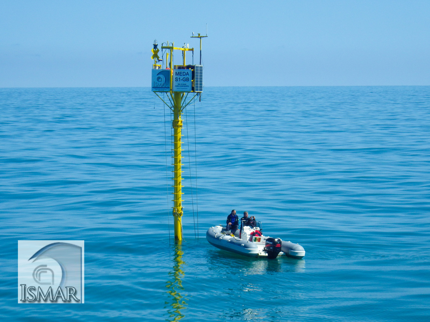
The site is equipped with two fixed stations: a meteo-oceanographic buoy (E1 buoy) and an elastic beacon equipped with meteo-oceanographic sensors (S1-GB beacon). The fixed stations were deployed in the framework of a multidisciplinary research project that uses automated stations to study the marine environment, in cooperation between the Insitute of Marine Science (ISMAR) in Bologna (CNR) and other public and governmental Research Institutes. The S1 buoy was installed in 2004 at the Po river Delta and recently (2015) implemented being now an elastic beacon. The E1 buoy is off the coast of Rimini town measuring in near real-time meteo and physico-chemical oceanographic parameters at different depths in the water column. It records every 5-10-15-30 minutes atmospheric pressure, air temperature, relative humidity, wind speed , wind gust, wind direction, net solar radiation, water temperature, salinity, dissolved oxygen, fluorescence, turbidity, speed and direction of the currents, height, direction and period of the wawes . The data are transmitted via GSM and downloaded (on average every 2-4 hours) at the Data Center of the Institute of ISMAR in Bologna. Data are daily validated and analysed, in order to be used for different studies.
-
The separation line of the semi-enclosed northern basin from the rest of the Adriatic Sea is conventionally defined at the 100 m isobath, at about 43°20’N, from where the bottom depth moderately decreases up to the northern coast reaching the smallest average depth in the northernmost protrusion of the basin, the Gulf of Trieste (surface area 600 km2, volume 9.5 km3, maximal depth approx. 25 m). The oceanographic properties of Gulf of Trieste are affected by water mass exchange with the northern Adriatic at the open western boundary, by local meteorological conditions that induce a pronounced seasonal cycle of seawater temperature (6 - 28 oC) and by the largest freshwater input, the Soča (Isonzo) River. The latter enters the Gulf on the shallower northern coastline with an average flow of 123 m3 s-1 and represents the major source of land-borne nutrients in this coastal zone, in particular of nitrate, whereas inputs along the south-eastern coast are comparatively small (contributing less than 10% to the freshwater balance in the Gulf). The circulation pattern is variable, however the prevailing ENE wind is the most efficient for the water exchange, especially during winter. These physical features, in addition to freshwater inputs, are ultimately reflected in the distribution of nutrients and in the seasonal and inter-annual variability of plankton communities, primary production but also in events of hypoxia/anoxia and mucous macroaggregates, which have characterised the whole northern Adriatic basin in the recent past. The waters of the Gulf of Trieste have been monitored for several physical-chemical and biological variables since 70s’ but the longest and most continuous data set of biological variables is represented by the phytoplankton time series, which started in 1990 when the national monitoring programme has become operational (set by Slovenian Environmental Agency). From 2007 onwards, the monitoring programme complies with the regulations of the EU Water Framework Directive (2000/60/EC).
-
Processing of time series of satellite and airborne images, with different spatial and spectral resolution, in order to derive water quality maps based on physically based algorithms parametrised with specific optical properties of lake Garda. Generation of spatial and temporal information of different water quality parameters of surface water column and coastal zone. Dedicated actives of calibration and validation of satellite images, algorithms and products.
-
The study site starts at the mouth of the river (Vlissingen, the Netherlands) and extends to Gent, 160 km from the mouth, where tidal influence is stopped by sluices. The tributaries the Durme and the Rupel, with the Nete , Dijle and Zenne are also under tidal influence and are considered part of the estuary. The natural inundated areas around the river and the valleys up to 5m TAW are also part of the study system.
-
Lake Stechlin is a a deep clear-water lake located in a nature reserve approximately 80 km north of Berlin, Germany (53°10°N, 13°02° E), at 59 m elevation.The lake basin was formed during the last continental glaciation some 12,000 years ago and today is situated at the transition between temperate/maritime and temperate-continental climates.The drainage basin is almost completely covered by forest (95%), with the exception of the area of a former nuclear power plant and a small village, which diverts its wastewater into a different drainage basin. The shoreline of Lake Stechlin is largely undeveloped with no notable infrastructure. The seepage lake is essentially fed by precipitation and groundwater, resulting in a theoretical water retention time of greater than 40 years.
-
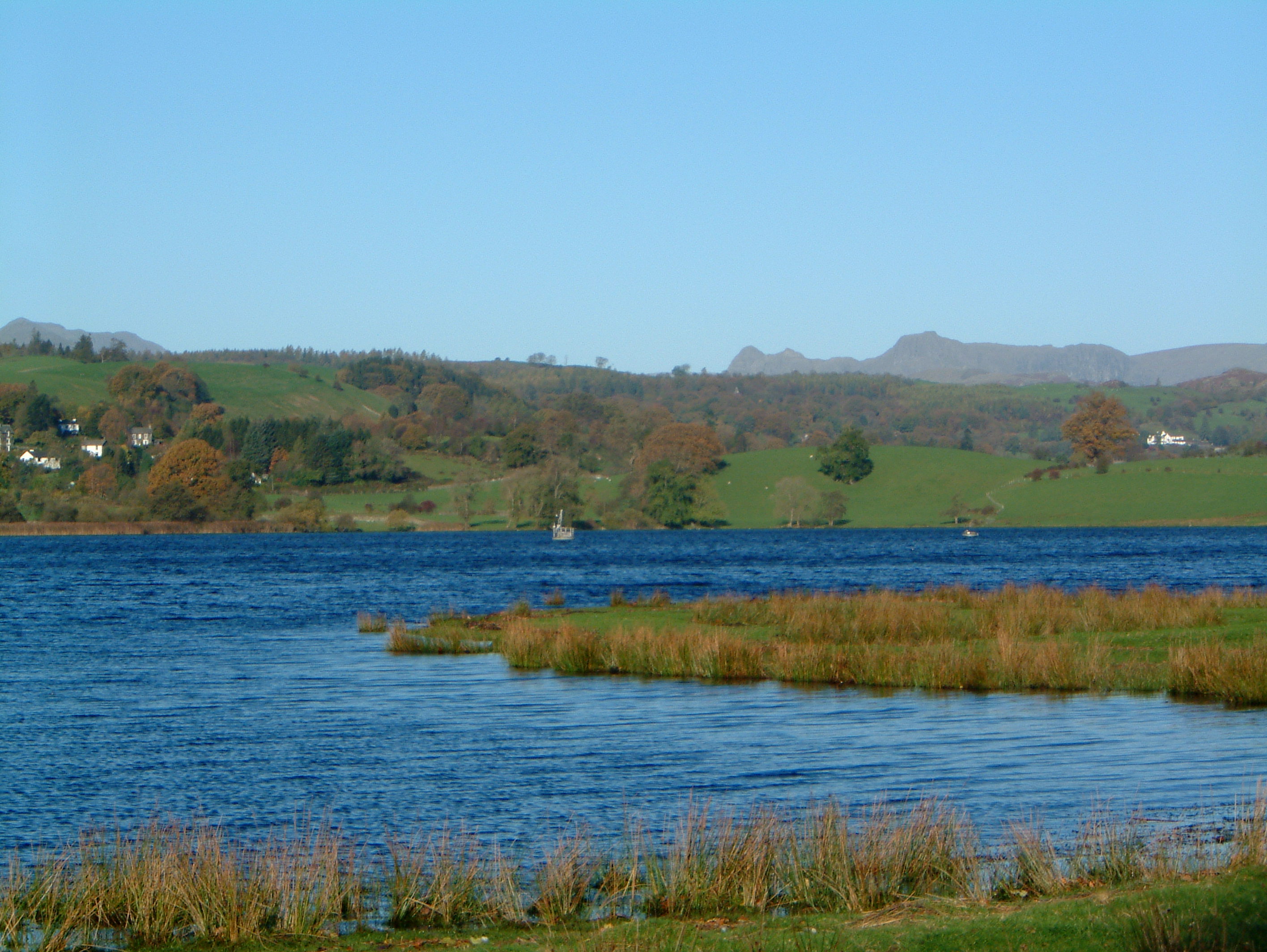
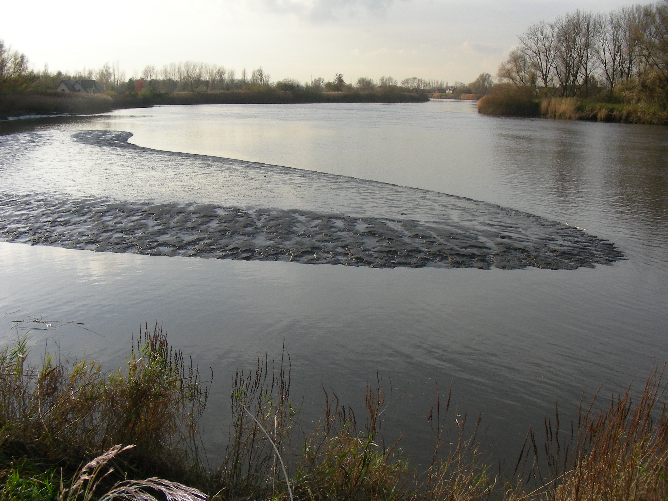
UK ECN Site. Esthwaite Water is a natural lake situated in a glacial valley and is generally agreed to be the most productive or eutrophic lake in the English Lake District. It lies approximately 65 m above sea level and has an area of 1 km2 and a maximum depth of 15.5 m. The average retention time is 90 days. The catchment area is 17.1 km 2 and the hills are composed geologically of Bannisdale slates and grits. The surrounding land is used chiefly for agricultural purposes and forestry. The lake is a grade 1 Site of Special Scientific Interest and has been a designated "Ramsar" site since November 1991. The diverse aquatic invertebrate fauna includes a number of species with restricted distributions in Britain, one of which is the flatworm, Bdellocephala punctata. The slender naiad, Najas flexilis, which is listed as Nationally Scarce, has been found in Esthwaite Tarn. Artificial enrichment of the lake occurs by input from the Hawkshead Sewage Treatment Works (which has operated a continuous programme of phosphate stripping since 1989) and originally from effluents from the fish farm which used to be situated towards the south of the lake. The lake undergoes summer stratification with oxygen depletion regularly below 7 m and sometimes as shallow as 5 m. The phytoplankton tends to be dominated by diatoms in spring and by cyanobacteria for much of the summer.