
community composition
Type of resources
Available actions
Topics
Keywords
Contact for the resource
Provided by
Years
Formats
Representation types
-
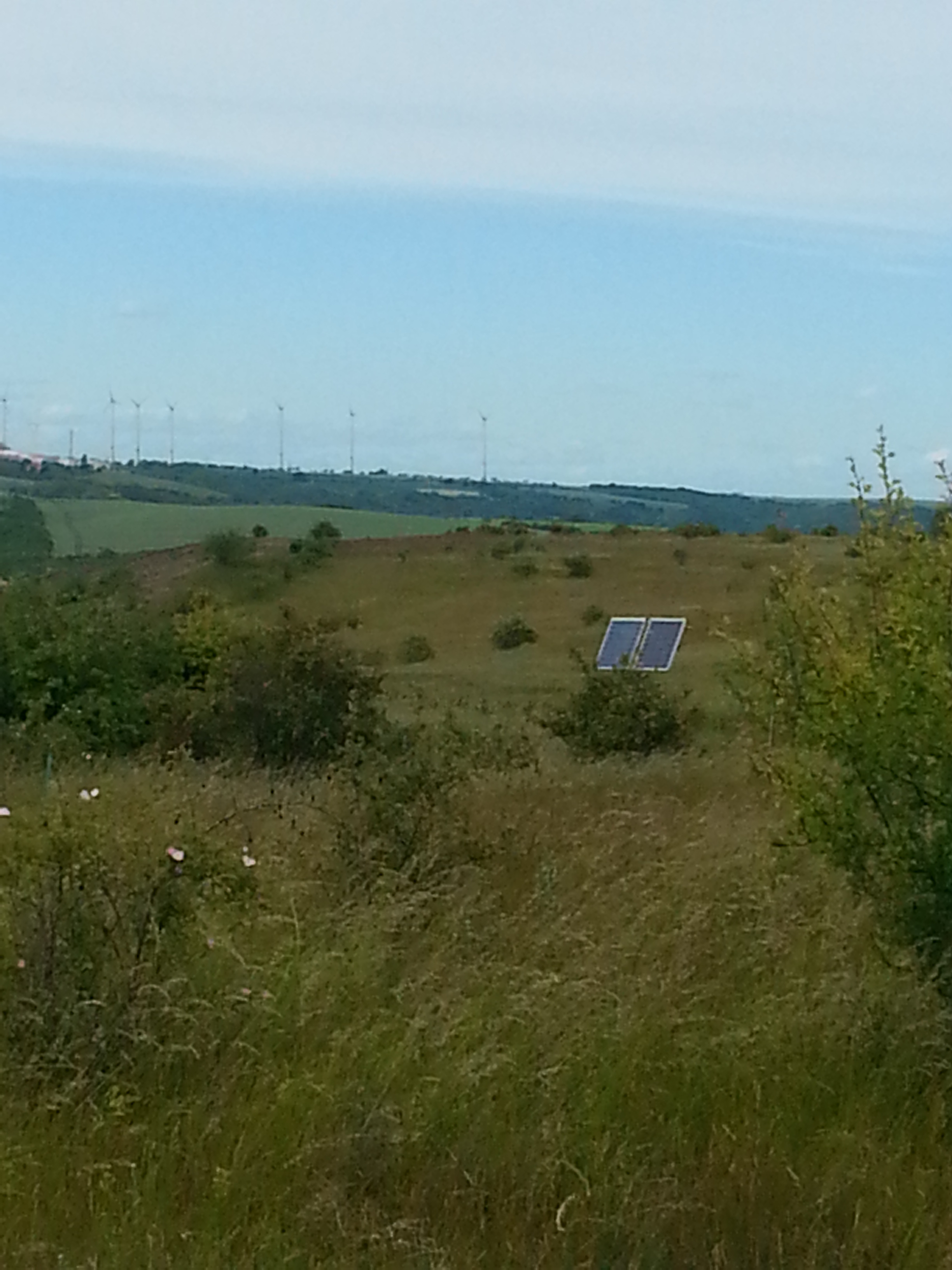
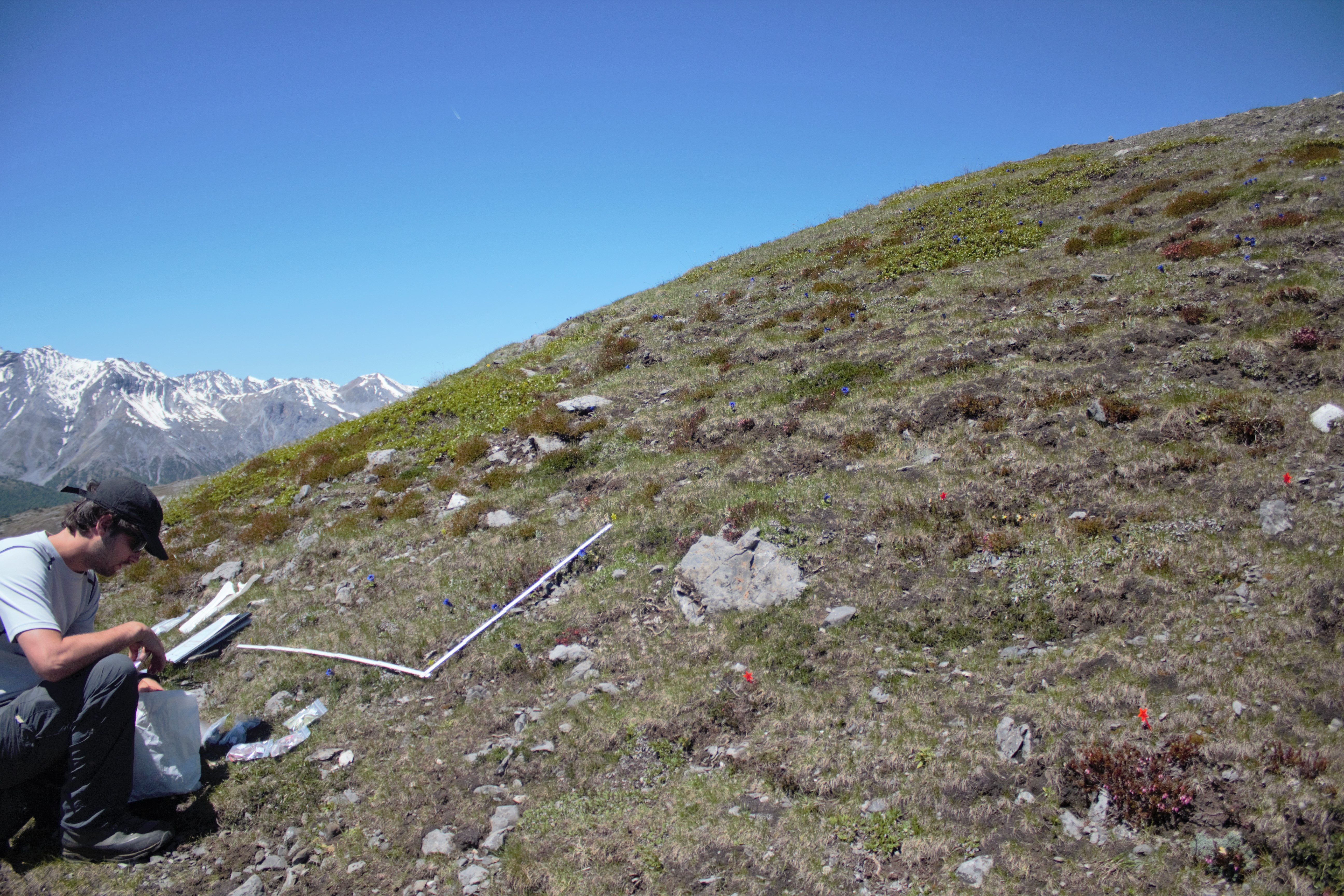
The site is located within a protected area near Halle and due to the rain shadow of the Harz mountains the annual precipitation in this area is low (497 mm). The climate is subcontinental with relative high mean yearly temperatures (average 9.1 °C). The area is characterized by a distinct topography with a complex mosaic of soils. On rhyolithic bedrocks rankers are dominating while brown soils and tschernosemic soils occur in the valleys between the hills. This mosaic leads to a considerable variation of soil properties (soil pH varies between 4.6-7.4). On the small rhyolitic bedrocks a mosaic of dry grassland communities occurs correlated with depth of the soil layer, soil pH and exposition. Four plant communities are dominating :Brachypodietum pinnati (soil-pH: 7.4), Euphorbio-Callunetum (4.8), Festucetum rupicolae (5.8), Thymo-Festucetum (4.6). On top of the hills and on the southern slopes, the shallow soils do not allow the establishment of shrubs and trees. Part of the area was irregularly grazed by sheep. Areas with deeper soils were used as arable fields. In 1990 the grazing regime was partially reduced and the arable fields were transformed into grassland, which is mown once per year.
-
This dataset presents relative abundance data of subfossil diatoms obtained from sediment cores retrieved from six lakes at Sierra Nevada Mountains (Granada, Spain) during 2008 and 2011. The files show data over the past 180 years approximately. Sediment cores were taken from the deepest part of the lake by a slide-hammer gravity corer (Aquatic Research Instruments, USA), with a 6.9 cm inner diameter during the summer of 2011, except for Río Seco Lake core which was sampled in 2008. The cores were sectioned on-site into 0.25 cm thick layers for the upper sections of the cores and into 0.5 cm intervals for the remainder of the cores, except for Río Seco Lake core which was sectioned at 0.5 cm contiguous intervals for the entire core length. Sediment cores were dated using gamma spectrometry (DSPec, Ortec®) techniques by measuring activities of radioisotopes (210Pb, 214Bi and 137Cs) and sediment ages were estimated from unsupported 210Pb activities using the constant rate of supply (CRS) model. Diatom samples were processed by digesting sediment samples with a 50:50 mixture solution of H2SO4 and HNO3 and mounted onto slides with Naphrax®. For each sample, a minimum of 300 diatom valves were counted using a Leica microscope fitted with a 100× fluotar objective (N.A. = 1.4) and using differential interference contrast optics under oil-immersion at 1000× magnification. Diatoms were identified to the species level or lower using a selection of taxonomic sources and diatom counts were expressed as a percent abundance relative to the total number of diatom valves counted in each sedimentary interval.
-
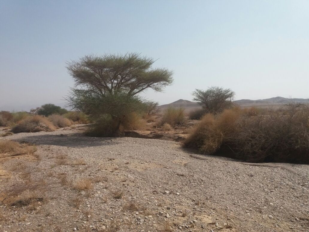
A very extreme desert located with in a part of the rift vally
-
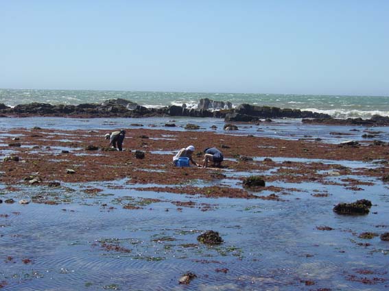
Choshi JaLTER site locate along the Pacific coast of Chiba Prefecture, Central Honshu. The coastal site consists of various types of habitats, including algal and seagrass beds, rocky intertidal and subtidal bottoms, boulder shore and high energy sandy beach. This site locates the region where the warm Kuroshio and the cold Oyashio meet, and is characterized by the co-occurrence of warm-water and cold-water derived marine organisms.
-
In the Central Alps the treeline is formed by the European larch (Larix decidua Mill.) and the Swiss pine (Pinus cembra L.), shaping the alpine plant community Larici-Cembretum. Currently, alpine pastures, which are increasingly abandoned in the European Alps, are colonised, after a phase of shrub encroachment, by the European larch, while a Swiss pine forest will establish once the undergrowth becomes too dense for larch trees. Former studies on tree growth rates indicate that the European larch will react positively to increasing temperatures at the treeline and will grow faster in the future. The Swiss pine has in general slower growth rates and will likely be less affected by higher temperatures. Thus, there might be a change from Swiss pine to European larch forests. This change in the dominating tree species might have profound impacts on the soil macro-invertebrate community, particularly due to differing chemical and physical compositions of larch and pine needle litter. To investigate potential effects of this change, we took soil core and litter samples and further installed pitfall traps in pure European larch and Swiss pine forests, as well as in mixed forests. We found no explicit differences in species composition between forests, presumably due to highly variable site and environmental parameters between and within forest types. The larch forests showed the highest number of taxa in general and the highest number of taxa found exclusively in this habitat. The pine forests were inhabited by the highest number of characteristic taxa while mixed forests harboured the most stable and consistent soil macro-invertebrate community.
-
GIS thematic layer of plant communities in the Tatra National Park. Overall, as many 49 non-forest plant communities were identified, in addition to approx. 17 major forest plant communities. Many of them are specific of the Tatras since associated with high sub-alpine and alpine environments.
-
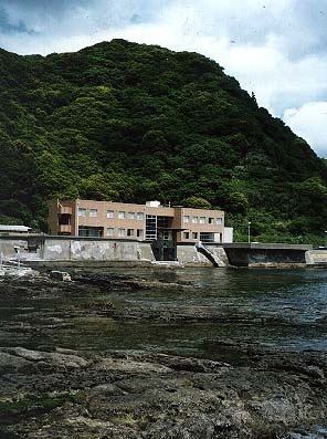
Kominato JaLTER site locate along the Pacific coast of Chiba Prefecture, Central Honshu. Intertidal and subtidal rocky shores in front of Marine Biosystems Research Center, Chiba University are main habitat types of this site, which has been registered for marine protected area for scientific research.
-
lowest GLORIA summit on dolomite in the Swiss Nationa Park region
-
Na região de Santarém, próximo à vila de Alter do Chão (comunidade de São Pedro e áreas próximas existe uma área única de vegetação de savana (enclave de Savana Arborizada e Savana Parque, segundo a classificação do IBGE 2012). Esse enclave de savana faz parte de uma vegetação única, pois está isolada há pelo menos 2000 anos (Sanaiotti et. al, 2002). Dentro dessa matriz, existem fragmentos florestais isolados, mas que são semelhantes às florestas das terras baixas das margens do rio Tapajós, também estabelecidos sobre areias quartzosas. A vegetação de savana ocorrente no município de Santarém (Savanas Florestadas e Arborizadas) é floristicamente mais relacionada com às fitofisionomias de Cerrado do Brasil central que as formações savânicas (Savanas Arborizadas, Savanas Parque e Gramíneo-lenhosa) ocorrentes no estado de Roraima e na Venezuela (Ratter et al. 2002). Inseridos nessas manchas, existem fragmentos florestais com mais de 200 anos de isolamento (Bates, 1892). Todas estas áreas citadas fazem parte da APA municipal de Alter do Chão. Nessa região, foram implantadas parcelas permanentes, sendo 35 destas em áreas de savana e 26 em áreas de floresta sobre areia. Ambos os conjuntos de parcelas somam 4,2 hectares cada. Nessas parcelas foi iniciado o monitoramento de várias espécies, e também conduzidos estudos de curto prazo, principalmente inventários de espécies de alguns grupos da fauna (coleópteros, formigas, lagartos, anuros, pequenos mamíferos, aves etc.). Algumas das questões envolvendo o efeito do fogo sobre a biodiversidade nas savanas foram respondidas (Farias, Lima & Magnusson, 2004; Cintra & Sanaiotti, 2005; Vasconcelos et al., 2008; Fadini & Lima, 2012, entre outros). Apenas um estudo de longo prazo envolvendo a espécie de roedor Nectomys lasiurus (Muridae: Rodentia) foi conduzido até o momento (Magnusson, Layme & Lima, 2010), esse estudo indicou que as flutuações na população estão associadas ao índice de Oscilação Sul e à extensão regional do fogo, mas não diretamente com chuvas locais. Mais ao sul desta região está localizada a FLONA do Tapajós, que compreende cerca de 500.000 hectares, num mosaico de florestas ombrófilas de fisionomias distintas, distribuídas ao longo de uma sequência topográfica típica de florestas amazônicas de terra firme: platôs (áreas localizadas em maiores cotas altitudinais da sequência topográfica), vertentes (zonas de transição) e baixios (menores cotas de altitude, geralmente integradas à rede de drenagem) (MMA, 2004). Estudos de monitoramento de espécies arbóreas, principalmente aquelas de interesse comercial, são conduzidos na FLONA desde 1975 por pesquisadores da Embrapa Amazônia Oriental, sendo estes disseminados em boletins da empresa (p.ex.: Carvalho 1981). Mais tarde, este monitoramento envolveu pesquisadores que hoje compõem o corpo docente da UFOPA, e que mantém unidades amostrais na FLONA (p. ex. Oliveira et al. 2005). Estes estudos concentram-se em espécies de interesse madeireiro e não contemplam a variação ambiental observada na FLONA pois foram essencialmente desenvolvidos em áreas de platô, sob latossolos. A utilidade do monitoramento é também limitada, uma vez que não foram produzidos materiais testemunho de todas as espécies, além do que o desenho experimental não foi replicado. Entre 2010 e 2012, foram implementados cinco módulos do tipo PPBio/RAPELD na FLONA. Os módulos estabelecidos têm forma retangular, com 5 e 1 km de lado, respectivamente. Ao longo dos lados mais longos são estabelecidas cinco parcelas num mesmo sentido (sul-norte ou oeste-leste, de acordo com a disposição do módulo), seguindo curvas de nível, perfazendo o total de 10 parcelas por módulo (cinco em cada um dos lados mais longos). Os lados do módulo são usados como trilhas de deslocamento, e as parcelas contam com largura variável (1 a 40 m), dependendo do critério de inclusão, sendo seu maior eixo de 250 metros. O inventário das espécies de plantas arbóreas e arbustivo/herbáceas não pôde ser conduzido até o presente momento devido a carência de recursos para execução dos protocolos de amostragem. Para o proposito desse PELD, iniciaremos utilizando os módulos localizados nas proximidades dos km 67 e 134 da BR-163. Em relação à fauna, dados sobre a distribuição da ictiofauna de pequenos igarapés de até terceira ordem, por exemplo, colocam a FLONA do Tapajós entre os maiores recordes amazônicos para registros de número de espécies de peixes de pequeno porte por trecho de amostragem pontual a partir do protocolo de coleta PPBio/RAPELD (Silva-Oliveira et al. 2015). Neste estudo, a drenagem presente na área da FLONA foi dividida em 3 sub-bacias para a distribuição das parcelas aquáticas, totalizando 22 unidades de amostragem. A maioria destas parcelas está localizada fora dos módulos PPBio pré-existentes na FLONA, pois os módulos estão localizados em áreas de platô ou com drenagem escassa, e, portanto, carecem de dados estruturantes geralmente levantados nos sítios PPBio como a caracterização: do solo, da estrutura da vegetação e da comunidade de herbáceas. Como tais parcelas estão localizadas em áreas de baixio, são uma excelente oportunidade para integrar este compartimento florestal ao monitoramento da biodiversidade na região. Para isto, propomos a implementação de mais dois módulos, que se sobreponham à sub-bacia da FLONA do Tapajós, onde existe grande influência e atuação comunitária, localizada à margem direita do rio Tapajós entre as bacias de drenagem do igarapé Maguari e a do igarapé Cachoeirinha. Cada módulo deverá compreender 10 parcelas de 1 ha, totalizando 20 parcelas (sendo cinco delas ripárias), e uma área de 20 ha para os estudos no componente florestal ombrófilo de terras baixas do PELD aqui proposto.
-
Abundance (individuals/m2) and biomass (g/m2) of macrozoobenthic taxa from seagrass meadows along the Southern Bulgarian Black Sea coast (Burgas Bay), collected during field surveys of IBER-BAS in 2013-2014 as part of project PERSEUS. Due to the sampling method (hand corer), the dataset represents the infauna associated with the seagrasses. The dataset also contains measurements of several environmental parameters at the stations: sediment grain size (% gravel, sand, and silt/clay); sediment moisture content (%) and total organic matter (% loss on ignition); temperature and salinity of the water.