
concentration of nitrogen in seeds
Type of resources
Available actions
Topics
Keywords
Contact for the resource
Provided by
Years
Formats
Representation types
-
The Experimental Farm Groß Enzersdorf is a research and teaching facility of BOKU University of Natural Resources and Life Sciences, Vienna. It was founded in 1902 as a donation to the university by the Austrian emperor; it is a typical arable farm of 140 ha arable fields in Gross-Enzersdorf, Lower Austria. The farm is run in conventional agriculture, but 26 ha are converted to organic farming since more than 20 years. Another 35 ha acreage in Tulln, Lower Austria, plus 6 ha of experimental garden in the city of Vienna, 21. district, are additionally managed by the farm and available for experiments with arable crops, vegetables and fruit species. The experiments include two long-term field experiments that are descibed individually as related plots. These experiments are focussed on long term effects (i) of crop rotation and fertlization since 1906, and (ii) of soil tillage treatments since 1996. The whole farm beyond can be used for any kind of soil, plant or atmosphere observations in experimental settings, representing a typical Pannonian agricultural environment. It is equipped with complete sets of agricultural machinery for large scale farming operation as well as for small experimental plots. On the farm there is also a weather observation station installed by the Austrian Zentralanstalt für Meteorologie und Geodynamik (ZAMG).
-
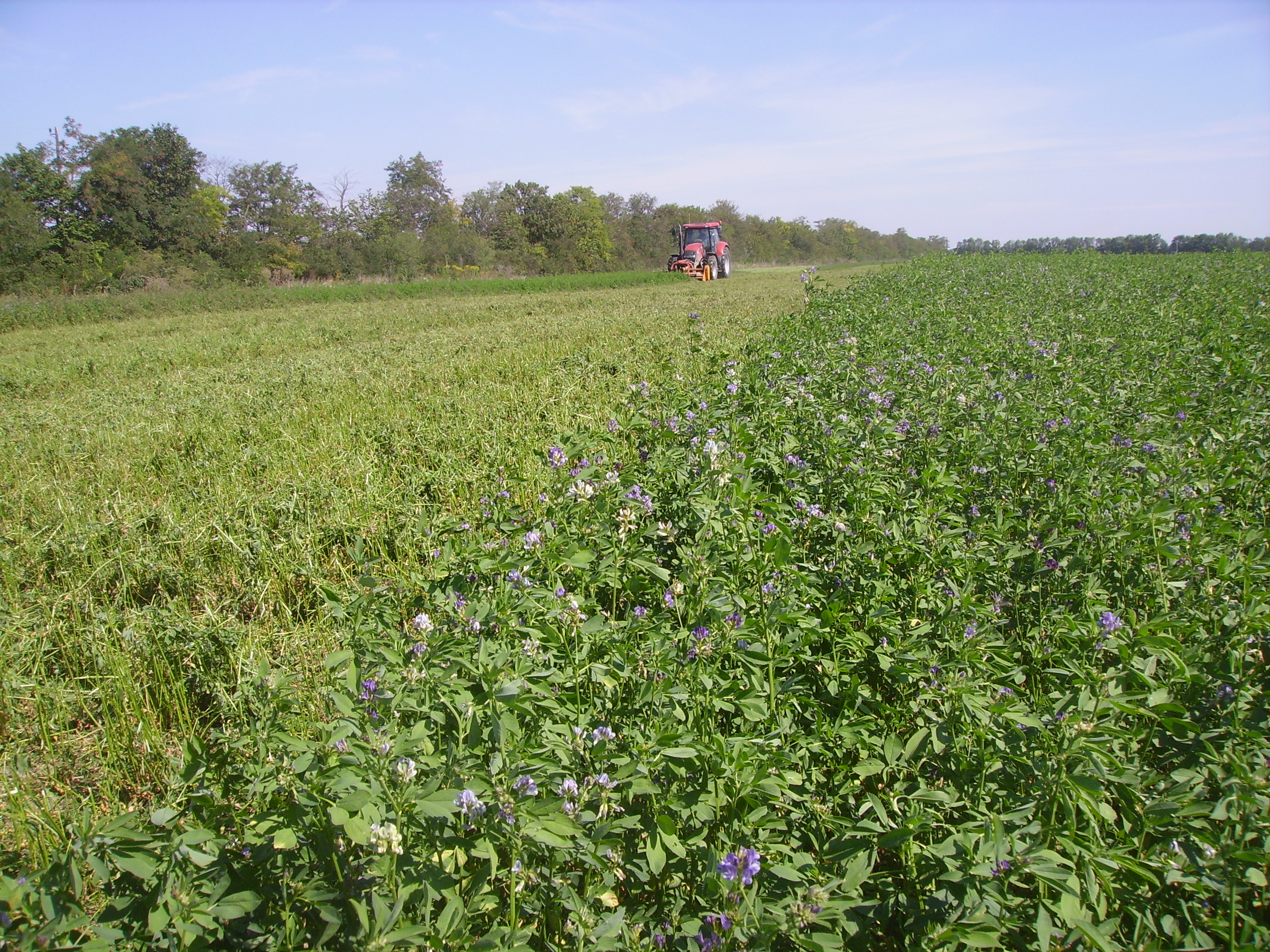
SITES Lönnstorp research station is situated in the Scanian agricultural landscape between Malmö and Lund and has a focus on the design, sustainable development and assessment of arable cropping systems, in conventional and organic farming. The research station is available for research within ecology, agronomy, environmental science, agroecology and other disciplines. SITES Lönnstorp research station have access to 60 hectares of conventional and 18 hectares of organic farm land, mainly cultivated with annual crops, representative for agricultural practise in southern Sweden. The station is also a part of SITES, Swedish Infrastructure for Ecosystem Science. SITES is a nationally co-ordinated infrastructure for terrestrial and limnological field research. In 2016, SAFE (SITES Agroecological Field Experiment) was established at the research station. SAFE make it possible to compare four different agroecosystems, a conventional reference system, an organic system, a perennial system and an agroecological intensified system.
-
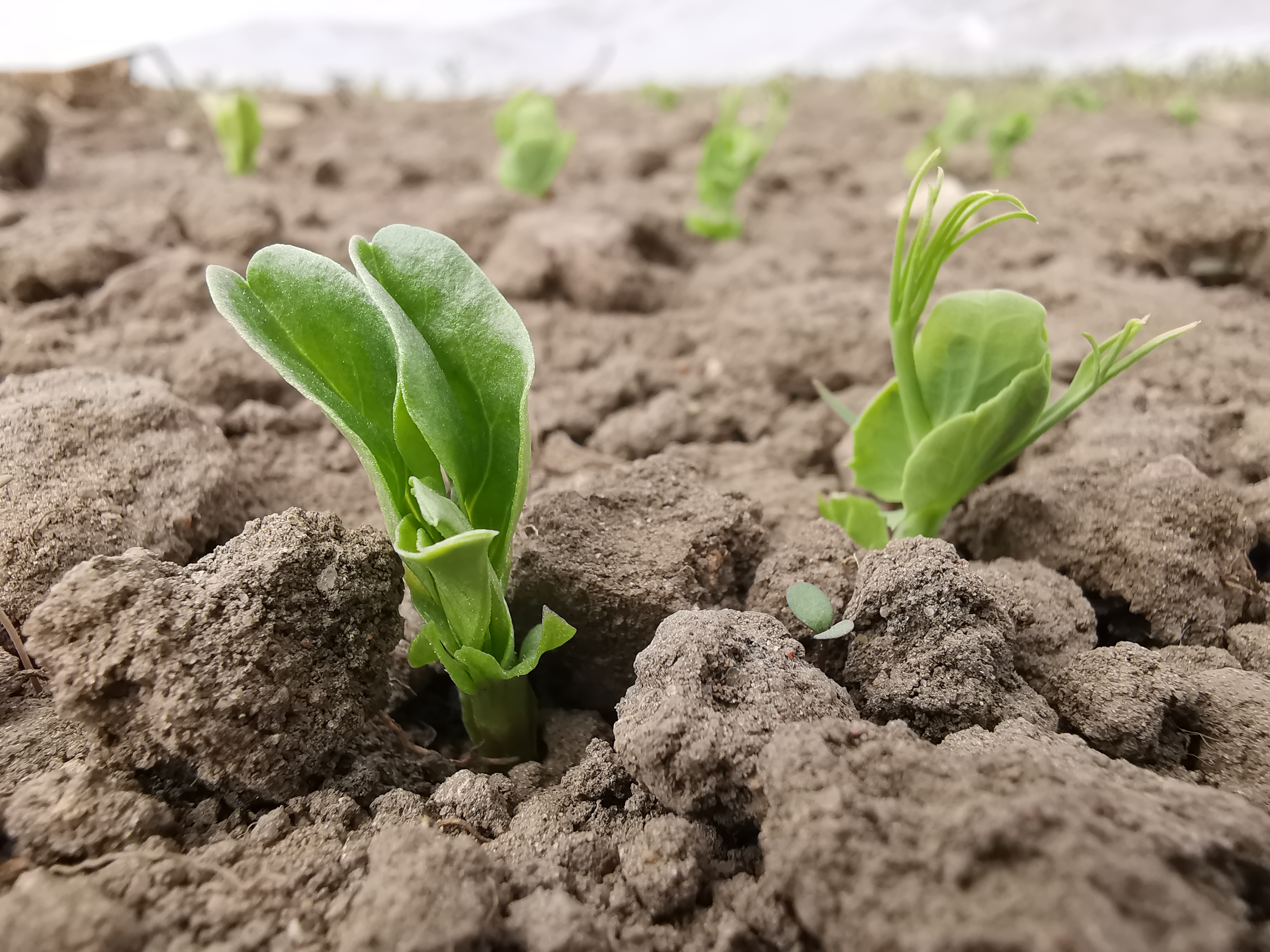
The Rutzendorf Experimental Station is an agricultural research site of the University of Natural Resources and Live Sciences Vienna (BOKU), belonging to the Landwirtschaftliche Versuchswirtschaften GmbH. It is representative for the productive soils managed as arable land in the Marchfeld area (Lower Austria). The soil is described as a silty loamy Calcaric Phaeozem (WRB), a Chernozem according to Austrian soil classification. Management on the farm is without livestock, no organic fertilizers are applied. The farm was converted to organic farming in the production year 2002/03. The 8-year crop rotation comprises luzerne (2 yrs), winter wheat*, grain maize, spring barley*, field peas*, winter wheat, winter rye. Cover crop mixtures are grown where indicated in the crop rotation with an asteric. Current research questions include to study (i) the long-term sustainability and productivity of the stockless organic arable system compared to a livestock-keeping system, (ii) the mitigation of climate change effects on the soil-plant system by reducing soil cultivation intensity, and (iii) the development of biodiversity following the conversion to organic farming and enhancement of landscape elements. Regularly meteorological data, crop yields and quality, physical, chemical and biological soil traits, weed species and diaspores, springtails, wild bees and other animal species are assessed. Studies have been conducted as research projects financed nationally and by the European Union, e.g. in two EIP projects.
-
Qianyanzhou Agricultural Experimental Station of Red Soil and Hilly Land, was founded as a pilot experimental site for ecological recovery in South China In 1983. In 1985, it was selected as an Integrated Development Demonstration Base of Mountain-Lake-River Project of Jiangxi Province. In 1992, as an international experiment station, it was nominated by MAB as a training center of UND Jiangxi Project. Qianyanzhou Station became a member of CERN in 1991 and a member of ChinaFLUX in 2002.
-
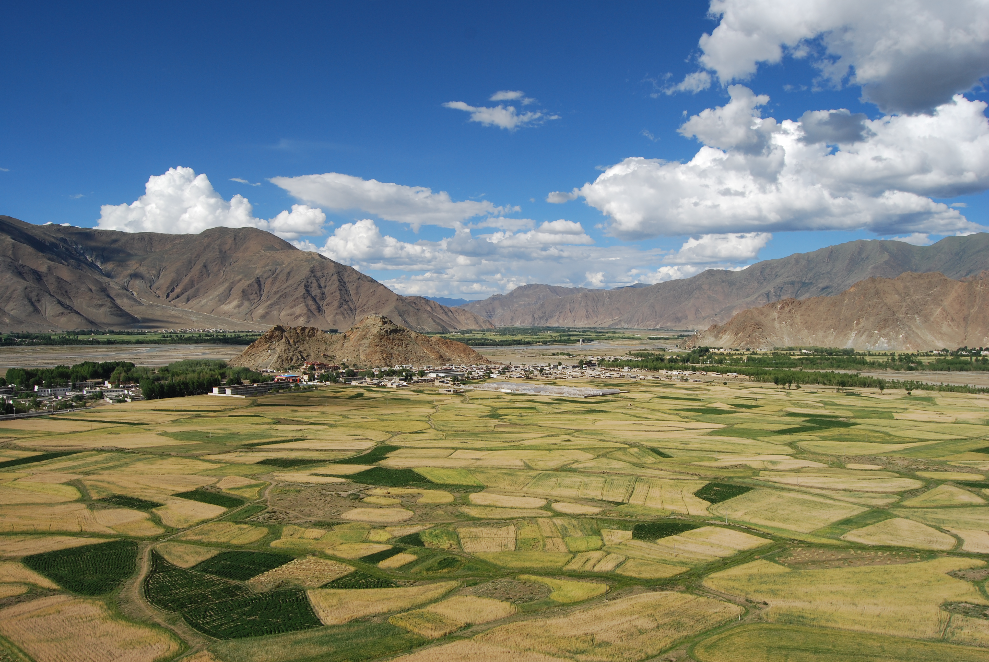
The Lhasa Plateau Ecosystem Research Station is situated at Dagze county, with approximately 3688 m above sea level, Tibet Autonomous Region. It is one of the highest elevation agro-ecological station in World.
-
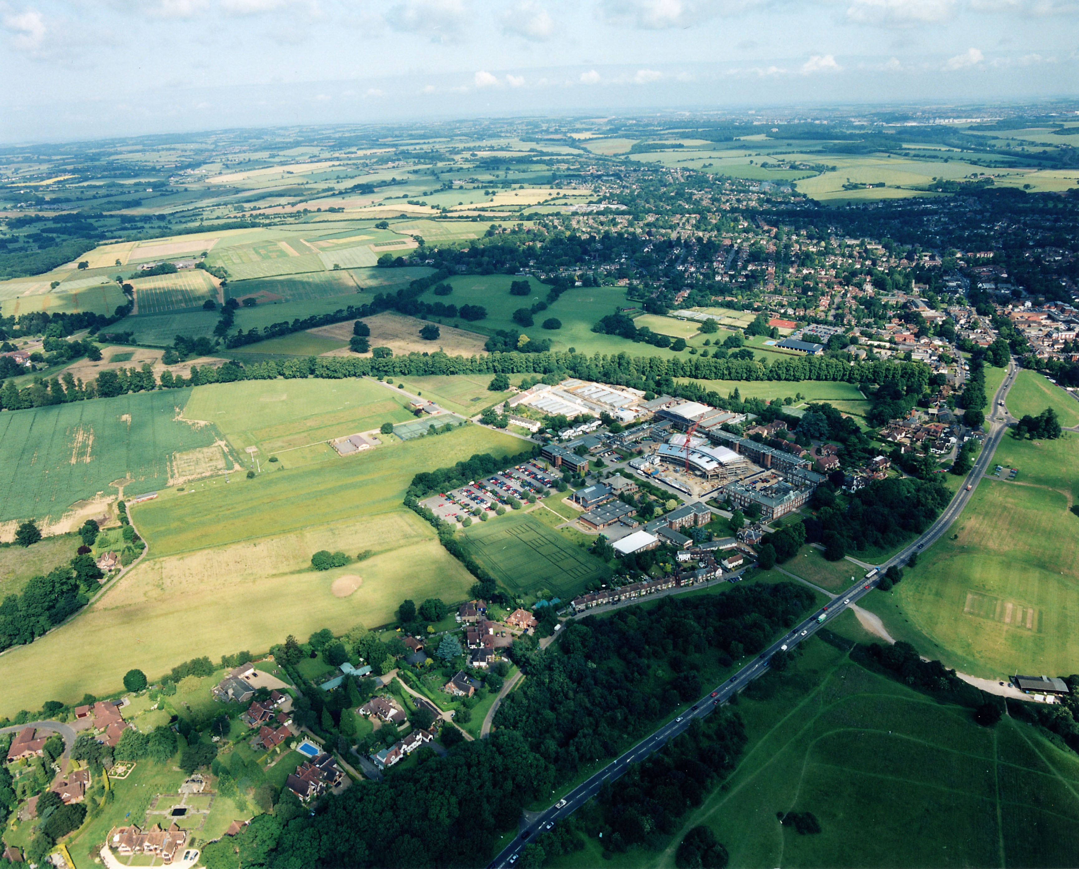
UK ECN site (T06 ROT) is funded through the Rothamsted Long-Term Experiments National Capability (LTE-NCG). Rothamsted is located about 35 km North of London, UK (51° 48’ 34.44” N, 0° 21’ 22.76” W) in the county of Hertfordshire. It covers about 330 ha, all of which is included within the Rothamsted ECN site. The estate contains several ecosystems, including managed arable and grassland fields, naturally regenerated and ancient woodland, the river Ver and more recently energy crops e.g. short rotation coppice willow and miscanthus grass. It is a rural area within an urban landscape, surrounded by the town of Harpenden to three sides and the village of Redbourn on the south-west side. The larger conurbations of Luton, St. Albans and Hemel Hempstead, together with the M1 motorway and London Luton Airport, are within an eight mile radius. The Park Grass Hay Experiment (est. 1856) is the principal target sample site (TSS) for the majority of the ECN protocols at Rothamsted. This experiment is widely acknowledged to be the oldest continuing agro-ecological experiment in the world; it is recognised internationally as an important site for long-term studies on biodiversity and ecology. The experimental plot on Park Grass of most interest to the ECN, in relation to physical and atmospheric inputs is Plot 3, Section d (Plot 3d). This plot receives no inorganic or organic inputs apart from atmospheric deposition.
-
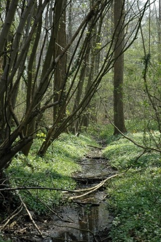
The Aelmoeseneie Forest is a 28.5 ha mixed deciduous forest in the community of Gontrode, just southeast of Ghent. The largest part of the forest is ‘ancient forest’, i.e. it is permanently forested since before 1775, while the forest is surrounded by agricultural land (mostly pastures). The soil consists of a silt loam to loam soil (Planosol), overlaying a mosaic of tertiary clayey and sandy deposits with high base saturation starting at 50 cm depth. Forest management is designed to obtain a more natural tree species composition and to conserve biodiversity. More info can be found at www.aelmoeseneiebos.ugent.be.
-
The LTSER Zone Atelier Plaine & Val de Sèvre belongs to LTER-France network and is located in the Poitou-Charentes Region, Western France (46°11’N, 0°28’W, 43m average altitude). The main interests of this zone lie in its large size and the historical data related to monitoring of land use by the CNRS-CEBC over the past 26 years (1994 onwards). The site is bordered by the town of Niort to the north, and Chizé forest massif to the south. Approximately 28,000 inhabitants live in the area, in c. 40 villages. The study area size is 45,000 ha, of calcareous plains which are subjected to a warm-temperate oceanic climate. With a mean annual precipitation of 840 mm and regular summer dryness, mixed oak forests would be the potentially natural vegetation. Rain is scarce in summer. Woodlands are mostly reduced to small and scattered remnant patches (mean patch size = 1.87 ha) and hedgerows are widespread in some areas especially in the cattle breeding sectors. Woods are composed of medium-sized trees, maple, ash, cherry or oak (Acer, Fraxinus, Prunus cerasus or Quercus), with a strong presence of elm (Ulmus). Some of the main human derived landscape features of this area are a suburban zone in the North including many garden areas, a motorway on a North-South axis carrying heavy road traffic, and an electricity substation creating a concentration of high voltage power lines in some areas. The ZAPVS aims to elaborate an alternative agricultural system to the productivist model, for ensuring the sustainable management of natural resources.
-
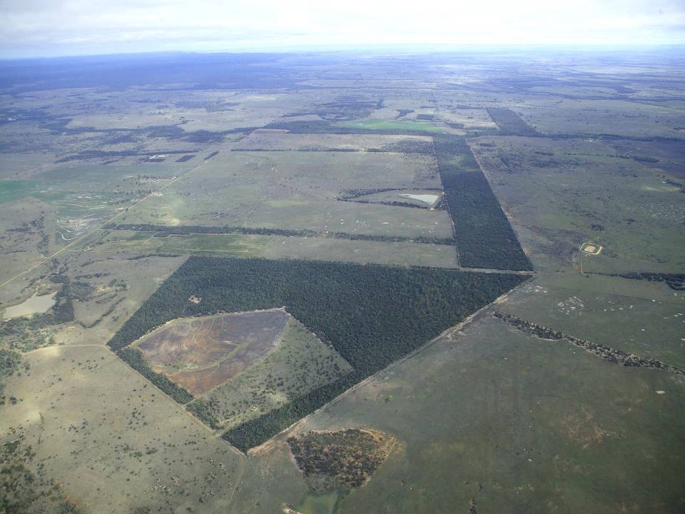
The aim of the Brigalow Catchment Study is to determine the effects of land clearing and land use change on hydrology, water quality, soil fertility and crop and animal productivity in the Brigalow Belt bioregion of central Queensland, Australia
-
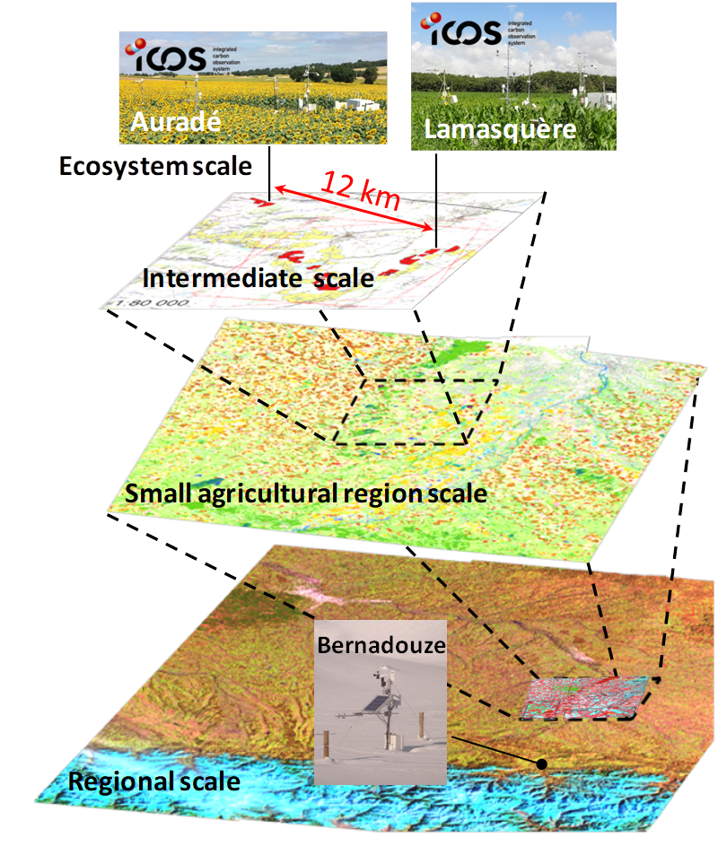
The Regional Spatial Observatory (OSR), labeled in 2007 by the National Institute of Sciences of the univers (INSU), is supported by the Center of Spatial Studies of the BIOSPHERE (CESBIO, OMP). The mission of the OSR aims at documenting on the long term the effects of the climate change and the increasing anthropogenic pressures on the hydrologic and agro-ecologic evolutions in the South-West of France near Toulouse, for various spatial and temporal scales.