
crop growth rate
Type of resources
Available actions
Topics
Keywords
Contact for the resource
Provided by
Years
Formats
Representation types
-
studying runoff water harvesting and its affect on the ecosystem and agroforestry
-
The Lehrforst Rosalia (Rosalia University forest) is about 1000 ha, covered with all major tree species and forest types in Austria (Norway spruce, Fir, Larch, Scots pine, Beech, Oak, etc). The forest area is located in the Rosalia Mountains near the Lower Austria/Burgenland border. The Demonstration Forest (950 ha) was set up in 1972 with an agreement between the Austrian Federal Forests (Österreichische Bundesforste, ÖBf, https://www.bundesforste.at/english.html) and BOKU. Nevertheless, the University is active in this area since 1875; considerable documentation regarding forest description and planning was elaborated by that time. It is located on the western slope of the mountainous ridge called „Rosaliengebirge“ in the southeastern part of Lower Austria (LAT 47°42’N, LON 16°17’ E). Elevation is between 300 and 720 m a.s.l, annual mean temperature of 6.5 deg C and 800 mm annual precipitation. The forest is mainly composed of beech associations (Fagetums) , peripheral also spruce-fir-beech forest association (Abieti-Fagetum). The Key task of the Forest Demonstration Centre ist supporting the educational and research work of the University of Natural Resources and Life Sciences. Accordingly, accommodation, work and teaching facilities are provided. The research focus lies on following areas: · Collection and hold ready of area-based and environmental Data · Establishing and monitoring of sample plots especially for beech growth and treatment related questions · Characterization of local and microclimate · Environmental impacts to forest ecosystems · Monitoring and modelling of small forested watersheds Essential research and educational infrastructure are: · 4 Weather monitoring stations · 2 scaffolding towers for measuring (35m) with instrument cabin · 4 Measuring weirs for runoff monitoring (Watershed 230 ha) · radio linked data collection and on-line hosting · Surveying and Mapping equipments (terrestric and GPS) · Long-term experiment simulating drying and rewetting of forest soils (DRAIN Station) · IT-Room with different Software-packages (GIS, Planning Tools etc.) · Laboratories and work rooms · Lecture Rooms · Accommodation for > 40 people The available data range from base data (GIS-Data), meterological and hydrological time series (since 1990), inventory data of growing stock, data of different plots to measuring data related to numerous projects.
-
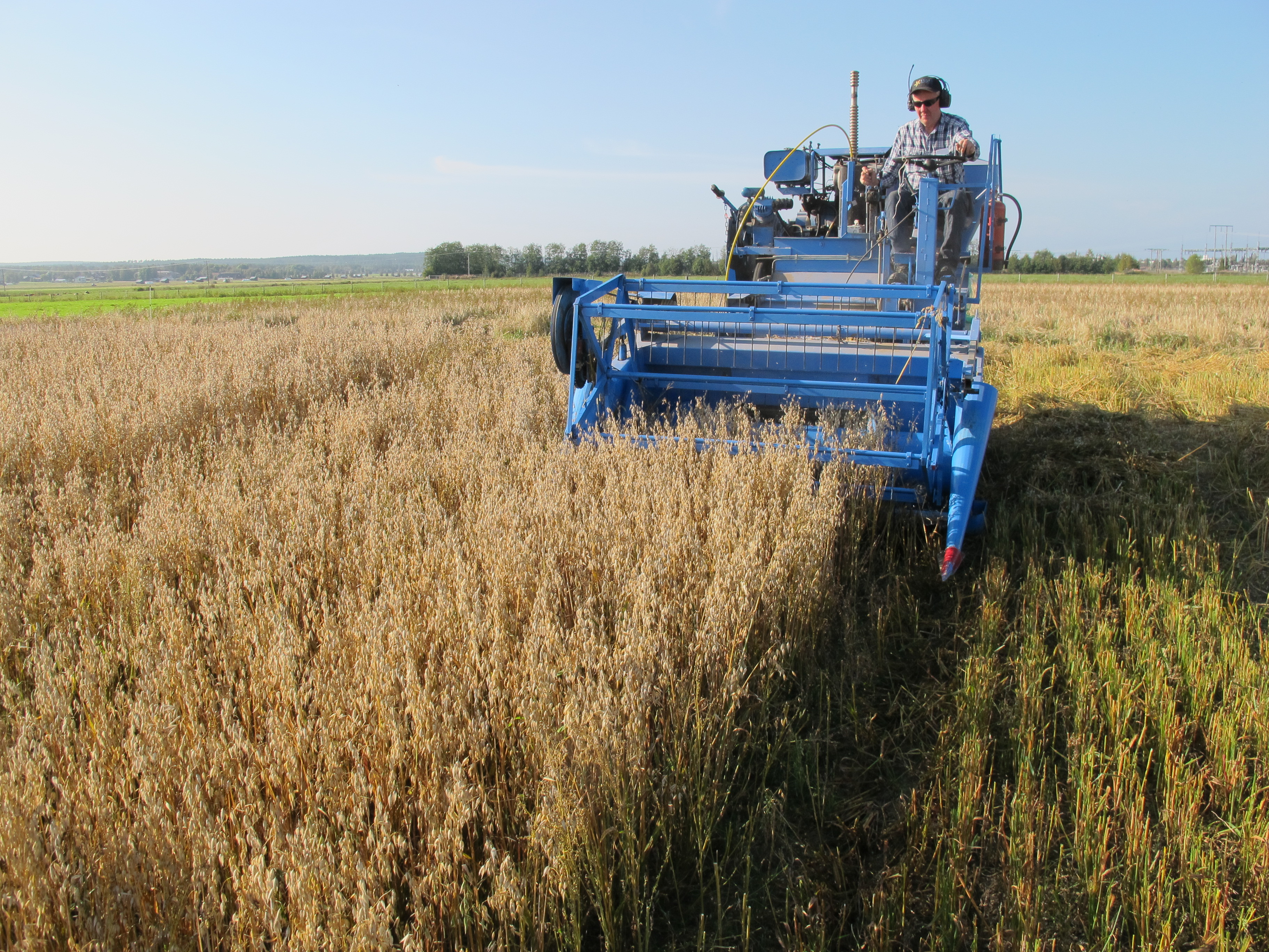
Röbäcksdalen research station was established 1954 and contains a field station and a dairy barn. The field station offers the ability to perform field research in a variety of areas such as agricultural science, biology, agroecology, soil science and environmental science. At the infrastructure it is possible to do research in a variety of areas such as animal science, agricultural science, ecology, phenology, climatology, geochemistry, biology, agroecology, soil science and environmental science. Visitors and users of the infrastructure can get access to the land and a stream collecting drainage and surface runoff-water from the area, animals in the dairy facility, workshop, machines, measuring equipment and techniques, personnel, laboratories and working stations. All data that is gathered within the infrastructure can also be available for the user, most of with is continuously collected data, data from feeding trials, climate data, soil data, data from water samples of runoff-water, data from the catchment area around the station as well as GIS data and data from different long-term-trials. The predominant soil type at the experimental fields is sandy-silt, which is characterized by good water holding capacity and high capillarity, hence the crops seldom suffer from drought here. The humus content is high (3-6%) which means that the soil is not so dense, something that otherwise might be a problem for this soil type. Sandy soil is present in limited areas. We are active in four different locations in northern Sweden. At Röbäcksdalen we manage the station and on the other sites we collaborate with Lantmännen Lantbruk at Lännäs (Västernorrland), Torsta AB at Ås (Jämtland) and Hushållningssällskapet Norrbotten och Västerbotten at Öjebyn (Norrbotten). The dairy barn was built in 2006 and has around 105 dairy cows of the breed Swedish red. The barn can e.g. be used for feed trials and among the equipment are two Greenfeed units that measure greenhouse gases (GHG) produced by the animals. The inclusion of the barn also offers farm scale studies of e.g. production of GHG or N or P flows.
-
Pianosa Island (Long. 10° 04' 44” E and Lat. 42° 35' 07” N) is the fifth, by extension, of the seven islands of the Tuscan Archipelago National Park with a total area of 10.2 km2 and a coastal perimeter of approximately 20 km. The island is almost completely flat, with some small undulations. The highest elevation is 29 m above sea level (a.s.l.), while the average is about 18 m a.s.l. The climate of Pianosa is influenced by its flat morphology that prevents the condensation of moist air, resulting in a mean annual rainfall considerably lower than on the other islands of the Tuscan Archipelago; furthermore, due to the high permeability of the soils, the rain is quickly drained. On the basis of an historical meteorological dataset (1951-2009), mean air temperature is 15.8 °C and mean annual rainfall is 497 mm, ranging between a minimum of 176 mm (1999) and a maximum of 716.2 mm (1984). A clear seasonal precipitation pattern shows a maximum from October to December followed by a decrease with a minimum value in July. The first historical record of Pianosa island dates back to the Roman age, when the Emperor Ottaviano, in the 6-7 A.C., forced the grandson Agrippa Postumo to live on Pianosa island. Following the decadence of the Roman Empire, during the periods of Barbarians’ invasions, the island was abandoned. The name of Pianosa island newly appeared in some documents of the Repubbliche Marinare of Pisa and Genova (XII and XIII century) that reported the remarkable strategic position of the island. The 27th August 1802, Napoleone Bonaparte established that the islands of Elba, Capraia, Pianosa, Palmaiola and Montecristo were united to the territory of the French Republic. Bonaparte visited Pianosa twice and found it the most interesting of the other islands, appreciating its richness of vegetation and animals. In 1858 Pianosa became an Agriculture Penal Colony, where the prisoners were forced to work in the fields. During the ’70s the jail of Pianosa became a maximum security penitentiary. Only in the ’80s, representatives of the Government and members of the civil society started to propose to close the prison and to return Pianosa to the competent civil authority. In view of this, the number of the prisoners was drastically reduced and, consequently, several agriculture activities progressively stopped. In the 1997 the territory of Pianosa was formally included in the National Park of the Tuscan Archipelago and since than it is a site for natural conservation. In 1998 the penitentiary was completely dismissed
-
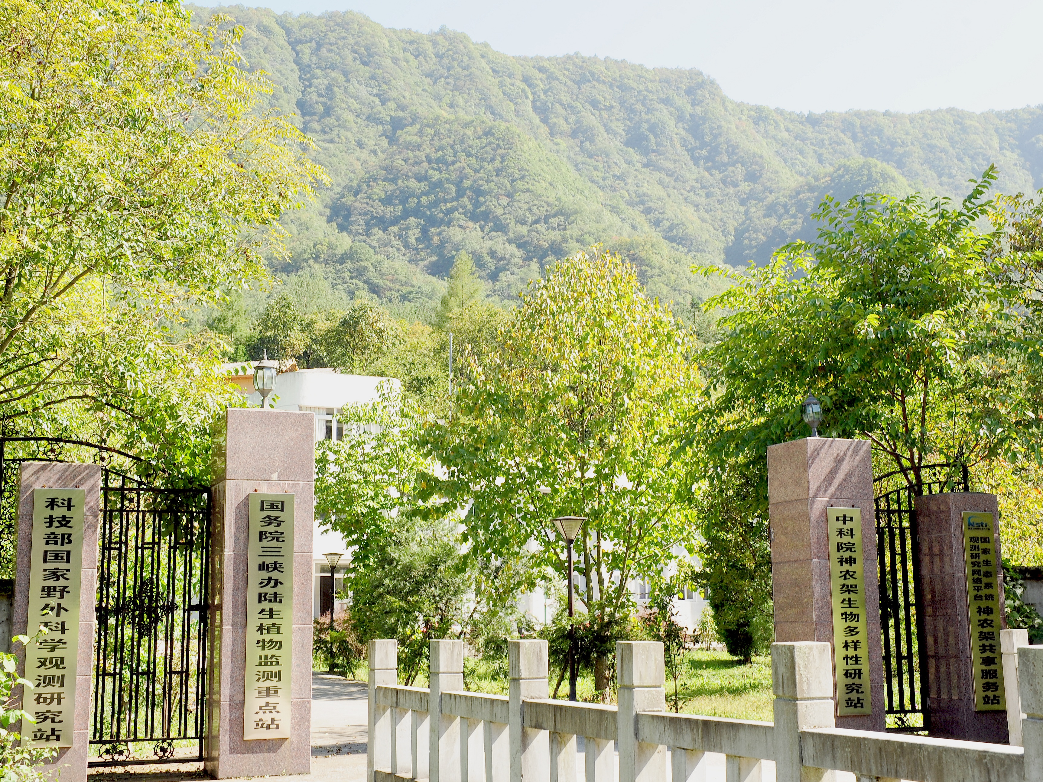
Shennongjia Station is located in Xingshan County, Hubei Province, China. It is located in the southern slope of Mount Shennongjia. The altitude is 1290m above sea level. The typical forest types are the northern subtropical mixed evergreen and deciduous broadleaved forest. Shennongjia Station was established in 1994, it became a station of National Field Research Station network running by the Ministry of Science and Technology of the People’s Republic of China in 2005, and became a member of Chinese Ecosystem Research Network (CERN), CAS in 2008.
-
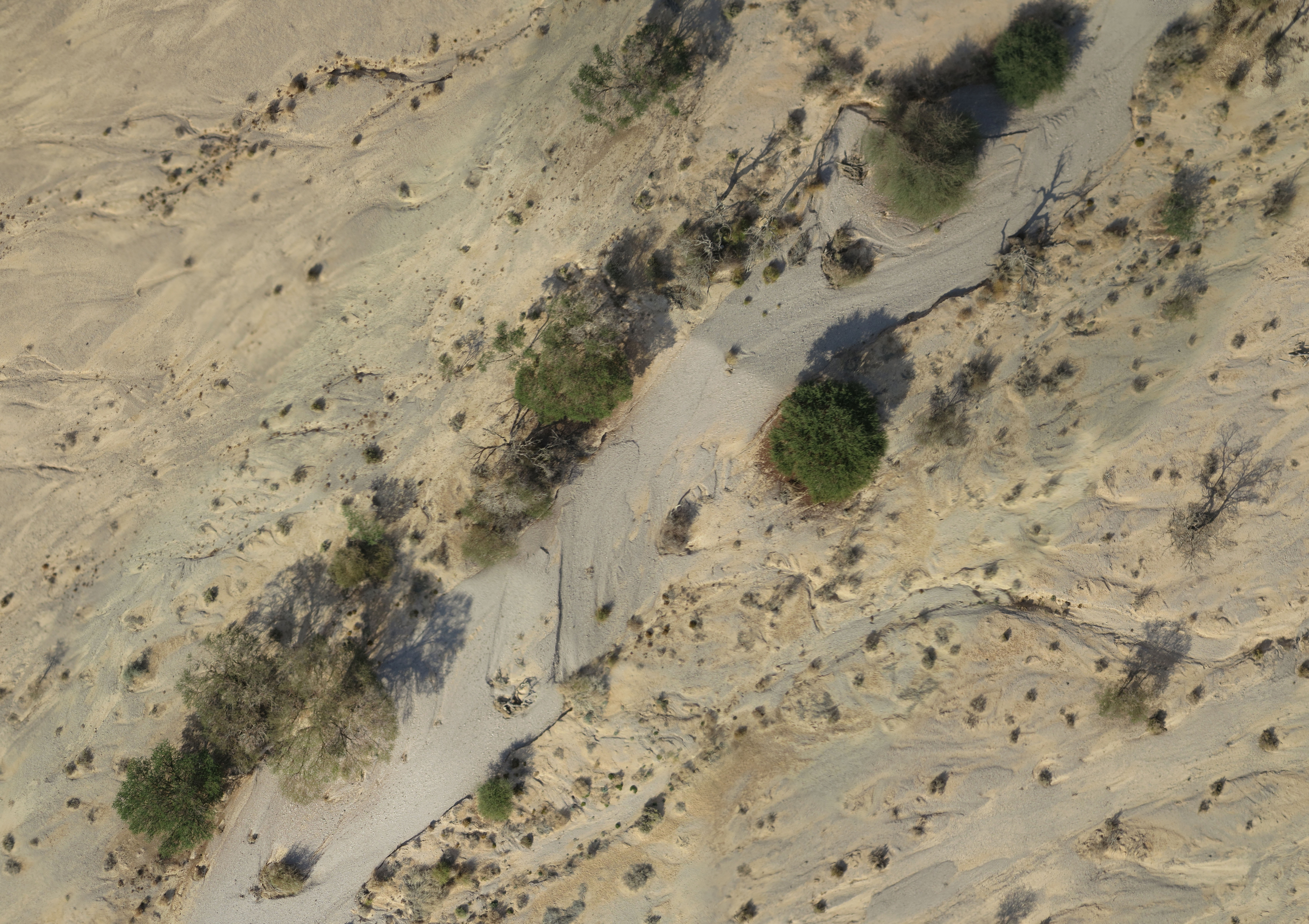
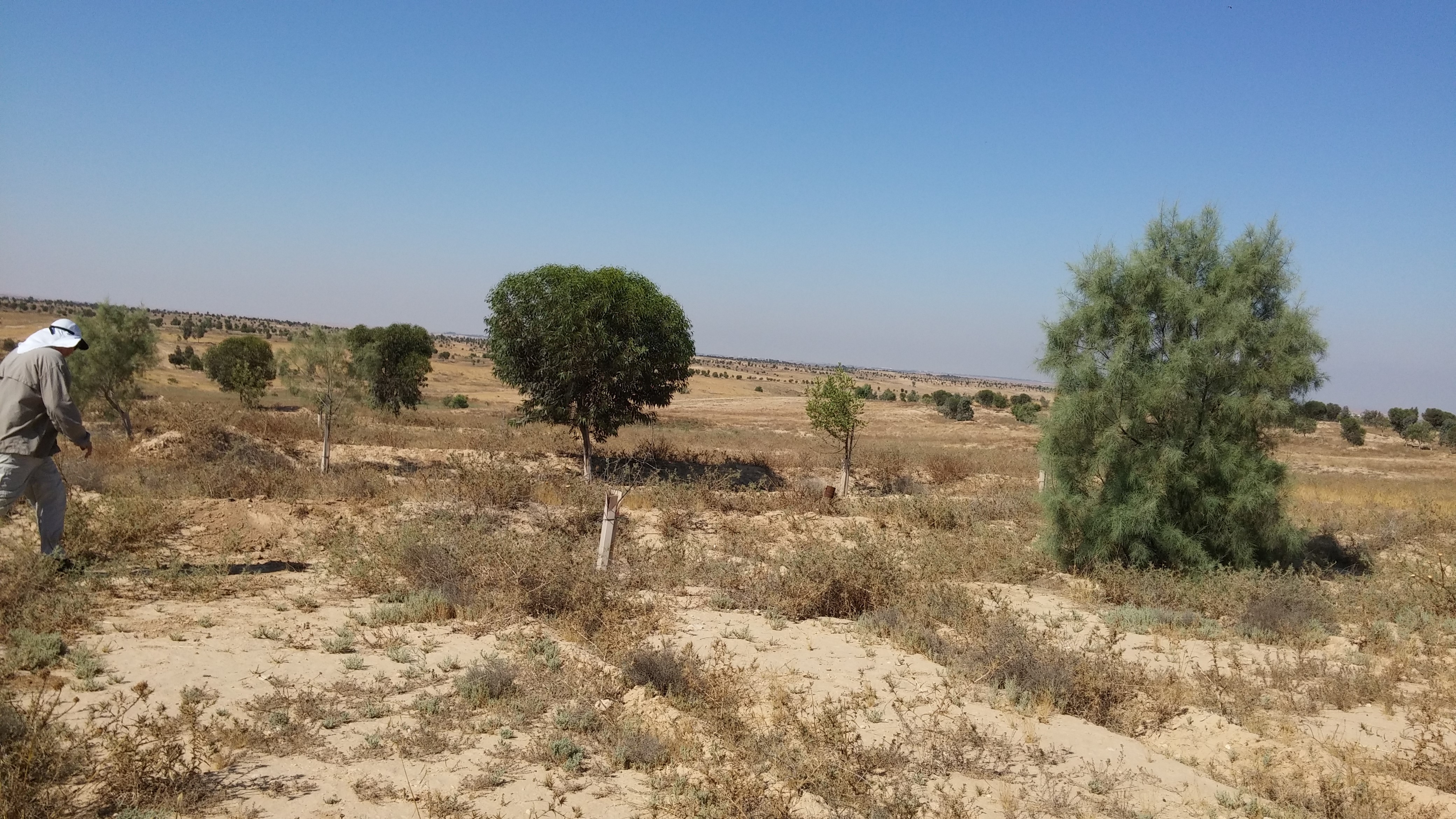
A small watershed that collects floods and run-off. The lowest place is home to a (relativity) dense Acacia savana. The slopes are completely bare. The wadi is covered with alluvium resting on a 6 m layer of red surface of late Pleistocene, which includes silt, clay and fine sand. Rainfall is 30 mm
-
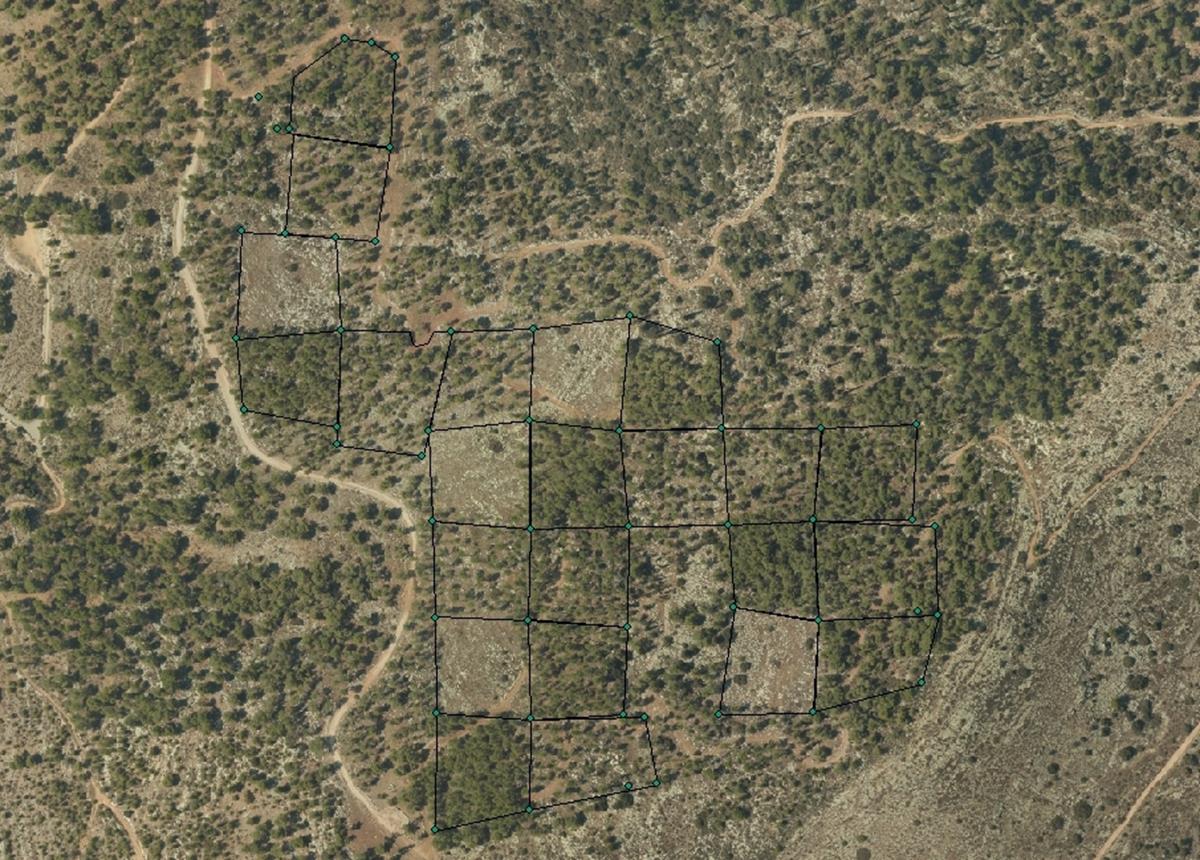
The Kedoshim-forest Long Term Ecological Research (LTER) is an experimental set up established in 2008 in a mature Pinus halepensis forest. This long-term research was designed to address silvicultural issues related to the management of mature, first generation, man-made, pine forest ecosystems in Israel and the design of their next generations as sustainable multiple-use forests. The Kedoshim LTER site is part of the Israeli LTER network - MAARAG. The Kedoshim LTER site provides a comprehensive well designed experimental infrastructure to study long-term effects of silvicultural manipulation (specifically overstory thinning) on vegetation dynamics, forest structure and ecosystem function. Four overstory thinning treatments were applied within 70×70 research plots: 1) clear cut, 2) heavy thinning – 100 tree ha-1 (65% reduction in stem basal area), 3) moderate thinning – 300 tree ha-1 (35% reduction in stem basal area) and, 4) control with no thinning – ca. 500 tree ha-1. Additionally, adjacent non-forested area was assigned as a reference. Climate and microclimate and various aspects of vegetation dynamics, forest function and biodiversity are monitored continuously since the application of thinning treatments.
-
In September 1993, Ramat Hanadiv inaugurated the Long Term Ecological Research (LTER) station as part of the global and Israel LTER network. One of the main areas of activity at the station is a long-term monitoring program. The long-term monitoring program includes continuous monitoring of several parameters and organisms as determined in advance: Gazelles, chukars, passerines, butterflies, herbaceous vegetation, and woody vegetation. A meteorological station has been established in the park to collect climactic data. The information is gathered and stored in a web-based database providing baseline data that can serve in the future as a point of reference. Our aspiration is that the combination of monitoring and management will in the long term enable the conservation and enrichment of the diversity of species, communities, landscapes, and processes of the Mediterranean landscape. In addition to the activities of the LTER station, Ramat Hanadiv is also implementing dozens of studies focusing on a wide range of fields. These studies are carried out by students and researchers from universities throughout Israel. In the Israeli context Ramat Hanadiv is a unique case of a natural area that is actively managed, intensively studied and mapped on all levels. As such, it cam serve as an example of nature conservation and management of Mediterranean ecosystems in Israel.
-
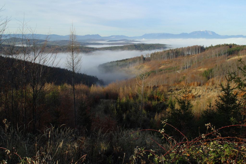
The alpine site is located in East Styria, the current stand is a Norway spruce monoculture. Measurements were begun in 1990. Primary research questions center around the lack of natural regeneration of all tree species and slow stand growth. The site is instrumented with climate stations, on-line measurements of plant-available light and soil temperature measurements. Data from two detailed inventories on tree rejuvenation, humus form distribution and ground vegetation are available as well as soil chemical analyses, LAI measurements and detailed humus form descriptions, litter analyses and litter input measurements. At the site two national and one international project have taken place.
-
A Loess plain is devoted to agro – ecosystem and climate change research. The site is subdivided into permanent plots which are exposed to various manipulations. The manipulations include introducing of various crops and various grazing regime. The manipulation provides data on the effect of management and rainfall regime on agricultural productivity. In addition, the area includes ecological plots to study a natural succession, penology and productivity under various rainfall regimes. The site is also used to study climate change in relation to rainfall and runoff patterns. An important study is the dynamic of geophytes that are important as cultural ecosystem service in the area. A new research direction is to study ecosystem development under various rainfall and runoff patterns.