
crop surface temperature
Type of resources
Available actions
Topics
Keywords
Contact for the resource
Provided by
Years
Formats
Representation types
-
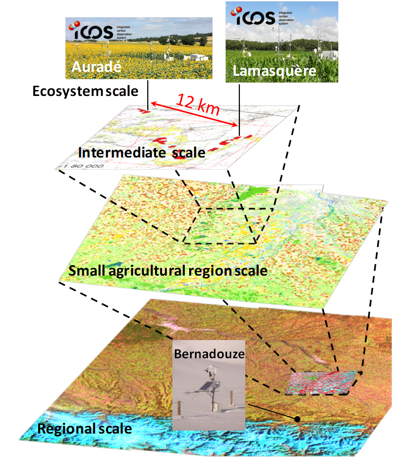
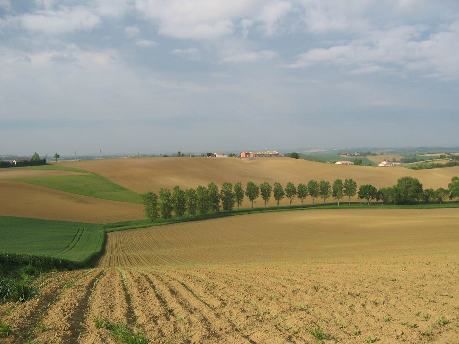
The Regional Spatial Observatory (OSR), labeled in 2007 by the National Institute of Sciences of the univers (INSU), is supported by the Center of Spatial Studies of the BIOSPHERE (CESBIO, OMP). The mission of the OSR aims at documenting on the long term the effects of the climate change and the increasing anthropogenic pressures on the hydrologic and agro-ecologic evolutions in the South-West of France near Toulouse, for various spatial and temporal scales.
-
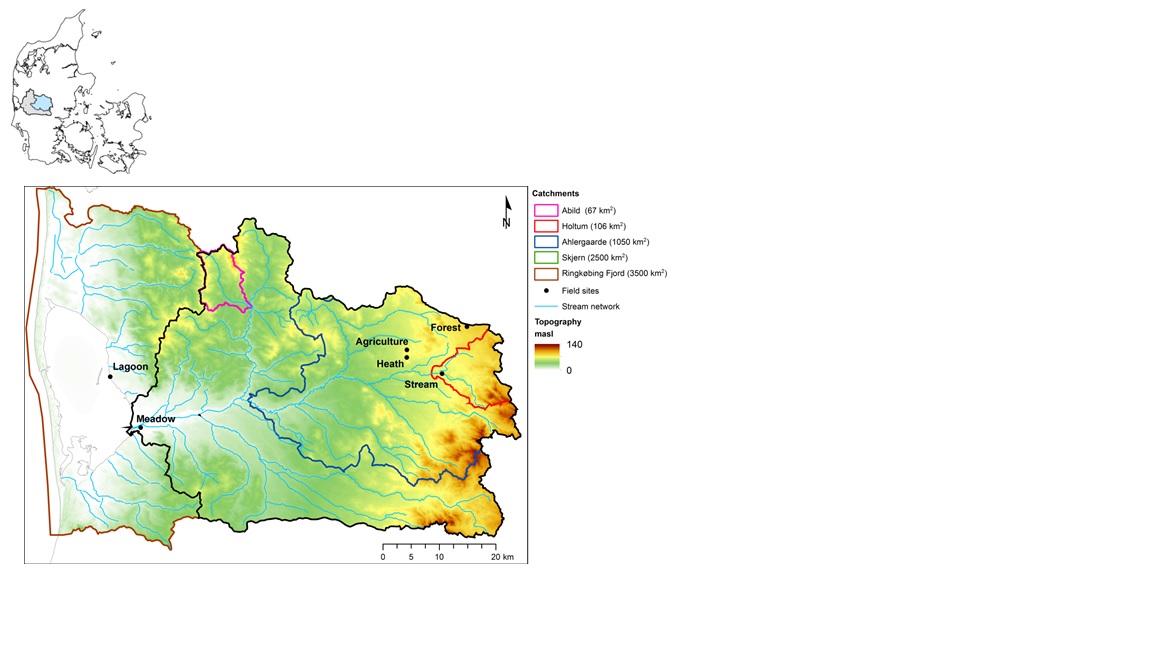
The HOBE experimental catchment is located in the western part of Denmark. The topography of the catchment is relatively flat. The surface elevations in the eastern part of the catchment are about 125 m above sea level at the Jutland ridge and gently decreasing to sea level elevations towards the coast. Alluvial outwash deposits in the form of sand and gravel dominate the central part of the catchment. Towards east, glacial deposits of moraine till are present with a higher content of clay. Also the remnants from the Saale glaciation have higher clay content and the dominant sediment type at these locations is clayey sand. Overall the top sediments are highly permeable with little water retention capability and the stream flow is therefore dominated by groundwater inflow. Based on a classification of the topsoil four soil classes can be identified in the catchment. The by far most dominating soil type is fine/coarse sandy soil. The Quaternary deposits have a thickness less than 50 m in the eastern and central part of the area increasing up to 250 m towards west. The Quaternary deposits are underlain by Miocene sediments in the form of alternating layers of marine, lacustrine and fluvial deposits forming layers of clay, silt, sand and gravel. Further below thick layers of Paleogene clay are found with little permeability and thus acting as a lower impermeable boundary for the aquifer systems. The sand and gravel layers from the Quaternary and Miocene periods form interconnected aquifer systems. The land surface of the catchment is predominantly agriculture and due to the sandy soil characteristics extensive irrigation of the agricultural crops takes place. Based on satellite data the land-use distribution is estimated as follows: grain and corn (55%), grass (30%), forest (7%), heath (5%), urban (2%) and other (1%). The climate of the observatory is of maritime origin and influenced by weather systems coming from the Atlantic Ocean. The weather conditions are variable with frequent precipitation. The prevailing winds from west lead to relatively mild winters and cool summers. The mean annual precipitation is about 1050 mm/year. It varies over the season with highest amounts in the months of October-December and lowest in the months of April-May. The mean annual temperature is 8.20C. The highest mean monthly temperature is in August (16.50C) and the lowest in January (1.40C). Precipitation in the form of snow is highly variable from year to year; in some years, no snowfall occurs and in others, it may stay on the ground for months.
-
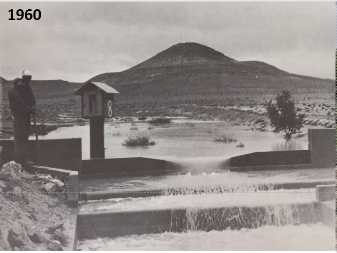
The site established in 1958. We can still find in the site the remains of terraces from the Nabatean agriculture runoff. The main research topics that being studied in the site are: biodiversity, climate change, runoff hydrology
-
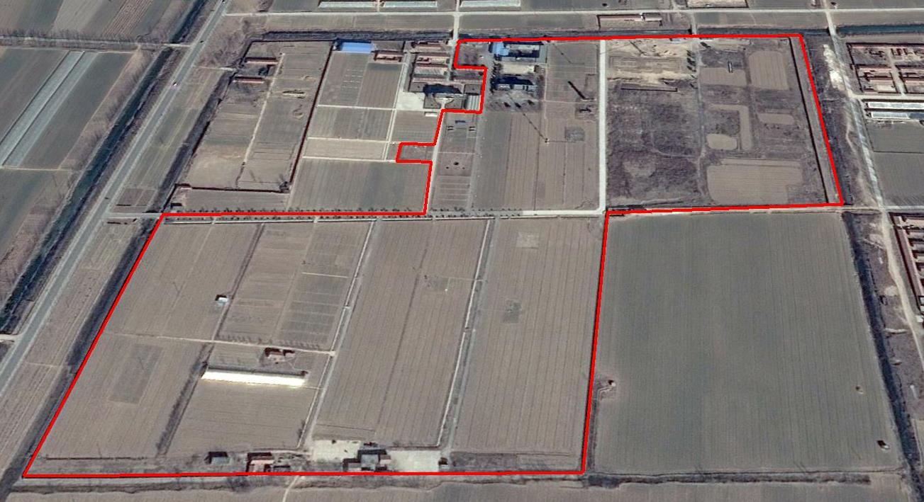
The Yucheng Comprehensive Experiment Station (YCES) of Chinese Academy of Sciences (CAS) is located at the irrigation district of the Yellow River Basin in the Huang-Huai-Hai Plain, also called North China Plain. Physiognomy is characterized as hinterland covered mainly by fluvo-aquic soil (Fluvisol or cambisal) and salinized fluvo-aquic soil in the Yellow River Alluvial Plain. This region is dominated by warm-temperate semi-humid monsoon climate with ample energy and water resources. Historically, natural disasters such as drought, waterlogging, salinization, and wind erosion frequently occurred, resulting in vulnerable ecological environment and low grain production. Integrated improvements and managements were deployed in last several decades, and this region has become suitable for planting winter wheat, corn, cotton, and soybean with high yields in the Huang-Huai-Hai Plain. Research objectives and contents Objectives: regional sustainable agriculture rational utilization of natural resources such as water, land, climate, biomass, etc. Contents: conducting long-term observations and experiments understanding the mechanism of energy transfer and mass cycle in farmlands developing models from point to regional scales improving and developing instruments and measurement methods improving agro-ecosystem managements demonstrating research results and technologies Research achievements: Outstanding research results and massive experiment data have been achieved at the YCES. The achievements cover research fields of farmland evapotranspiration, crop water use, water transfer mechanism, experimental remote sensing techniques, regional agriculture demonstration, and technology transfer. More than 1,000 papers, 15 monograph books, and 5 data sets have been published. A number of awards were granted by national, CAS, and international academic organizations, for example, Agriculture Prize granted by the Third World Academy of Sciences Science and Technology Progress Award by Chinese Academy of Sciences National Top Award of Science and Technology Progress
-
Small agricultural catchment (320 ha) with 30 years of data to study impact of climate change and agricultural practices on soil erosion, weathering rate and river fluxes. Continuous measurements with sensor: river discharge, Temperature, pH, conductivity, turbidity, dissolved oxygen, nitrate Weekly samples and high resolution sampling during storm runoff: major cations and anions, alkalinity, pH, dissolved silica, conductivity, total suspended solids, stable isotopes (13C of DIC, 2H and 18O of H2O, 15N of nitrates), heavy metals, some pesticide molecules Climatological station, rain collector for precipitation chemistry, soil solution station with lysimetric plate at different depths. Continuous measurement since 2004 of CO2, N2O, water vapor, energy exchange in the soil-vegetation-atmosphere continuum thanks to Eddycovariance and closed chamber methodologies (see OZCAR-RI Regional Spatial Observatory in the South West France contribution) Collaboration with the Aurade farmer association for fertilizer and pesticide inputs, cultivation, agricultural practices... Aurade experimental catchment and flux site are an international field site of the Critical Zone Exploration Network CZEN and of ICOS network, a field site of the French Research Infrastructure OZCAR and it is also a site of the French LTSER ZA PYGAR "Zone Atelier Pyrénées-Garonne". and a regional Platform of Research and Innovation-Midi Pyrénées.