
current direction
Type of resources
Available actions
Topics
Keywords
Contact for the resource
Provided by
Years
Formats
Representation types
-
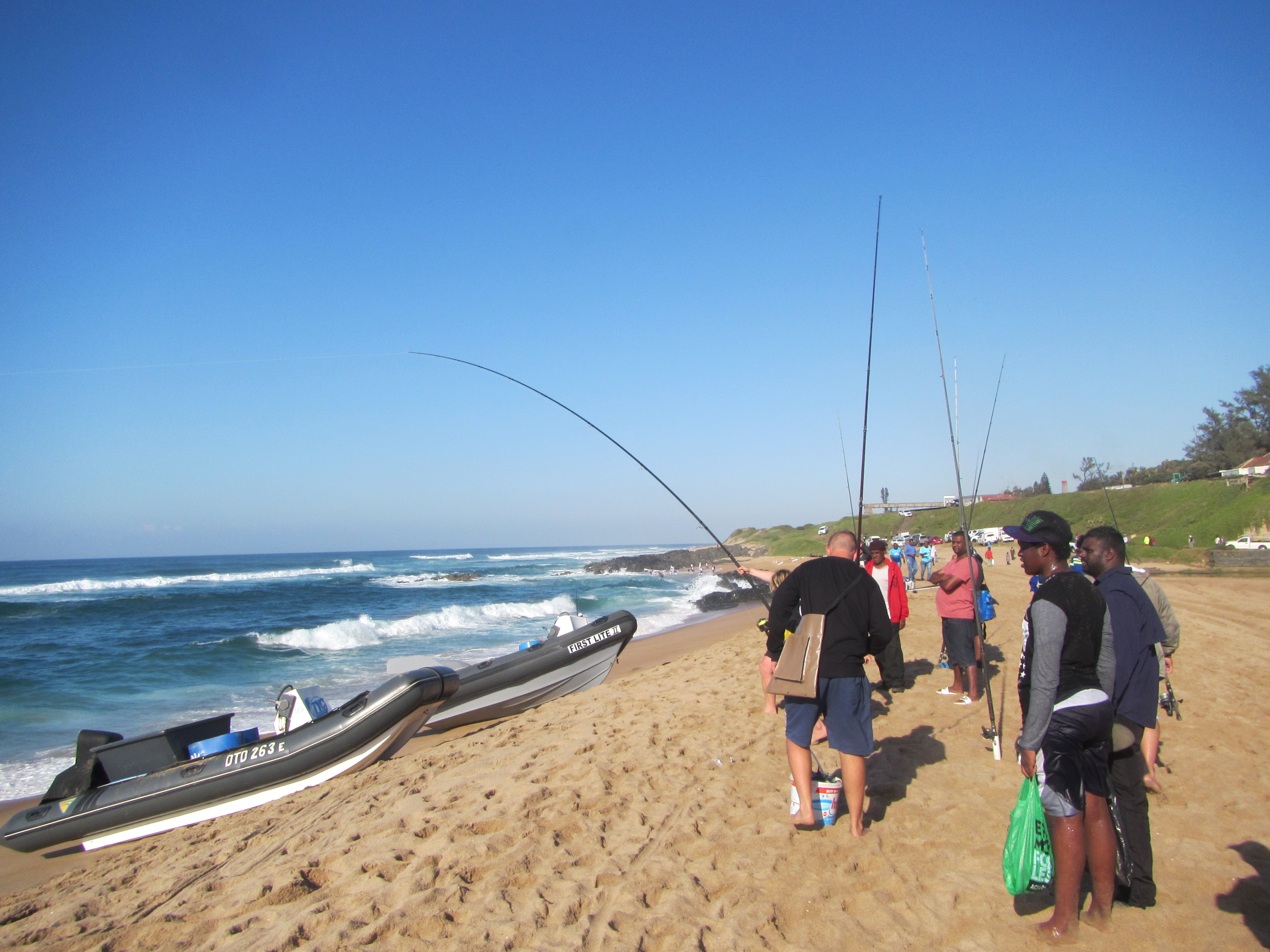
The KwaZulu-Natal Bight Sentinel Site (KZNBSS) is a coastal observatory situated on the subtropical east coast of South Africa. The KZNBSS forms part of distributed network of sentinel sites for LTER coordinated by the Shallow Marine and Coastal Research Infrastructure (SMCRI) initiative of the Department of Science and Innovation of South Africa. The site is in its deployment phase with the first instruments launched in February 2022. The network comprises 6 Underwater Temperature Recorder Arrays (UTR) deployed offshore and 3 shallow UTRs deployed in permanently submerged rocky shore gullies for the facilitation of shallow water temperature observations. The site encompasses a coastal reach of 150 km that includes the uThukela MPA to the northeast. Deployment of additional instruments (2023-2025) near the City of Durban will include an Acoustic Doppler Current Profiler (ADCP) and a METOCEAN Coastal Observation Buoy. A Pelagic Ecosystem LTER Programme will also be established in partnership with regional institutions and existing research projects.
-
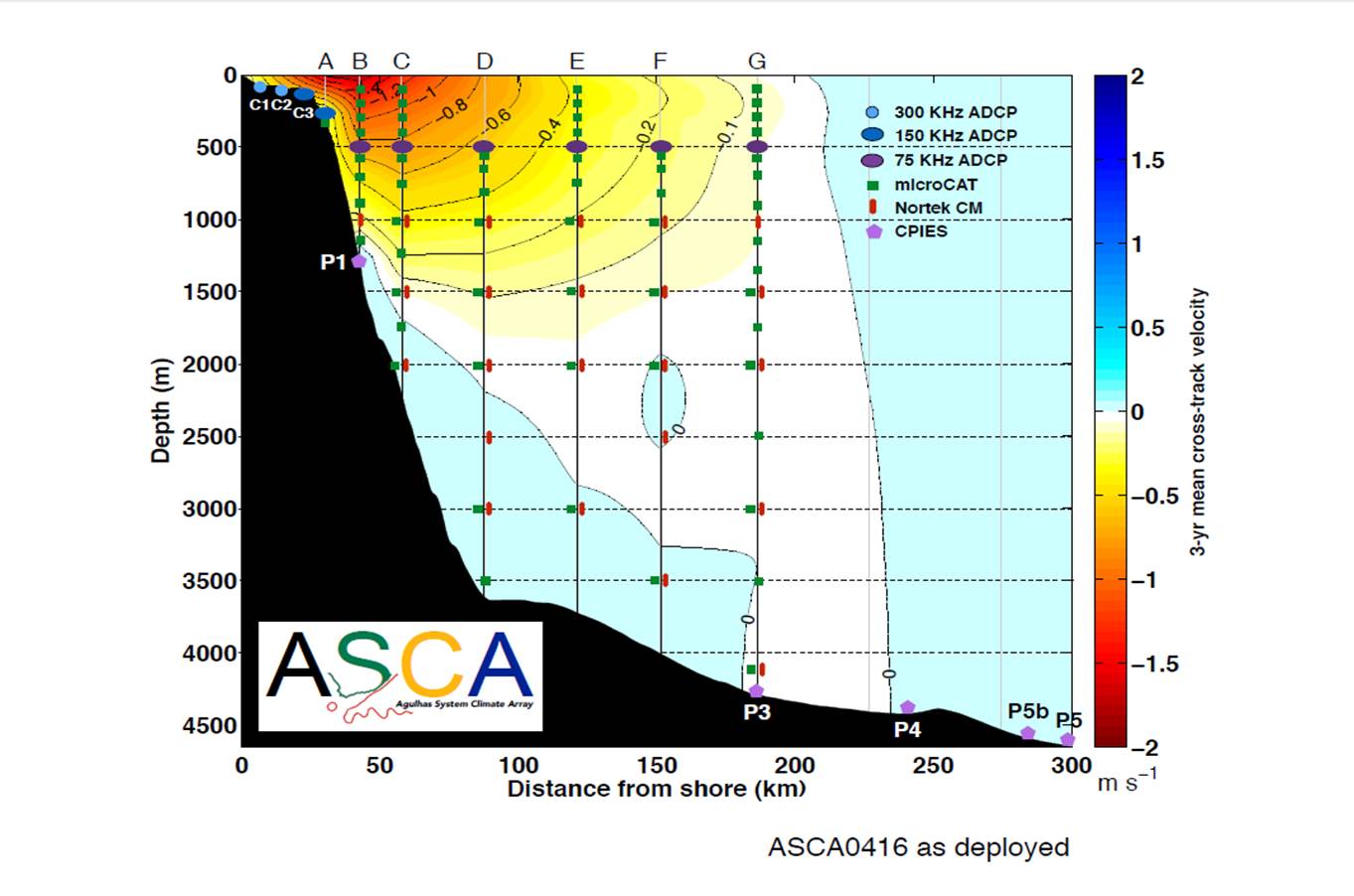
The ASCA shelf and tall moorings extend 200 km offshore of Hamburg just south of East London on the East coast of South Africa, along the decending TOPEX/Jason satellite ground track # 96, through the core of the Agulhas Current, with Current- and Pressure-recording Inverted Echo Sounders (CPIES) measurements extending the array to 300 km offshore. There are two shelf and seven full-depth tall moorings, interspersed with five CPIES, measuring pressure, current velocities, temperatures and salinities.
-
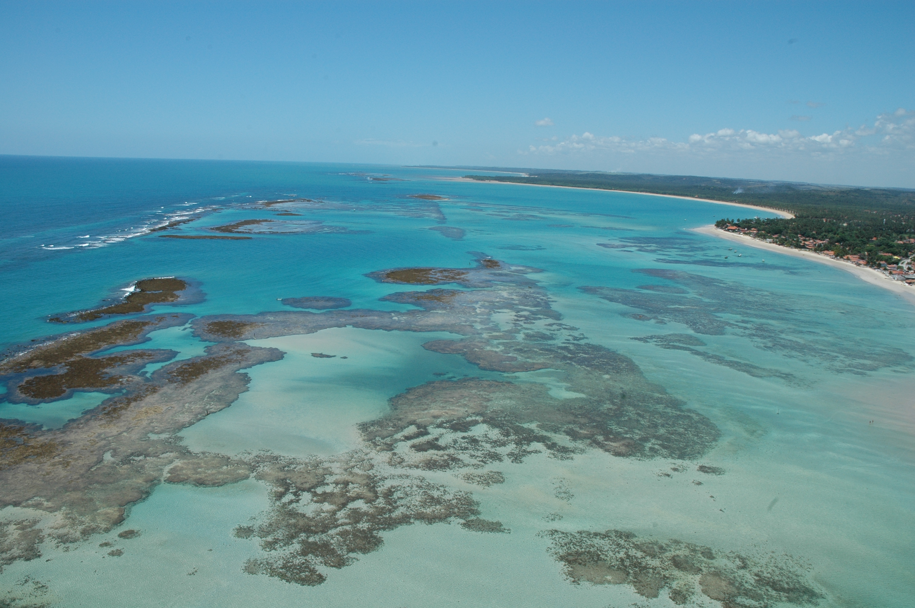
The Site is located on the northeast Brazilian coast, East Brazil LME, and includes the seascape extending from the coast to the continental slope. The coastal area is formed by an ecosystem complex including remnantes of Atlantic forest, mangroves, seagrass beds and coraline reefs. These ecosystems are interconnected along the seascape over the typically carbonatic shelf, with widths around 18 nautical miles. Along the shelf, submerged channels related to continental drainage in glacial periods, and submerged reefs, form habitats responsible for supporting resources exploited by intense fishing activity. The outermost portion of the continental shelf, considered as an area of significant biological and ecological interest (EBSA), is a biodiversity hotspot, home to reef fish spawning aggregations, and higher fish yield associated with evidence of sub-surface upwellings. These seascape support complex ecological processes, subject to intense use, in an area recognized as a priority for conservation. The presence of Marine Protected Areas reflects this characteristic, both for the need to protect these environments, and for the socio-economic importance, with two protected areas for sustainable use (APAs) and one for Integrated Protection (Park), organized in mosaic.
-
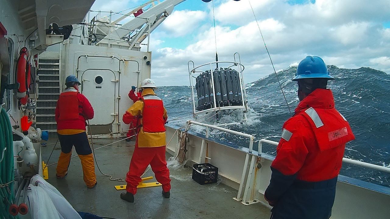
The Northeast US Shelf (NES) ecosystem spans the Middle Atlantic Bight and Gulf of Maine, is a large portion of the NW Atlantic Shelves Province, and is in a coastal biome. The waters over the NES provide an array of ecosystem services including fishing, energy development, shipping, waste disposal, recreation, and conservation. The NES ecosystem, like other productive temperate shelf ecosystems, is characterized by strong seasonality along with high levels of variability in physical forcing at timescales from days to decades, including climate impacts.
-
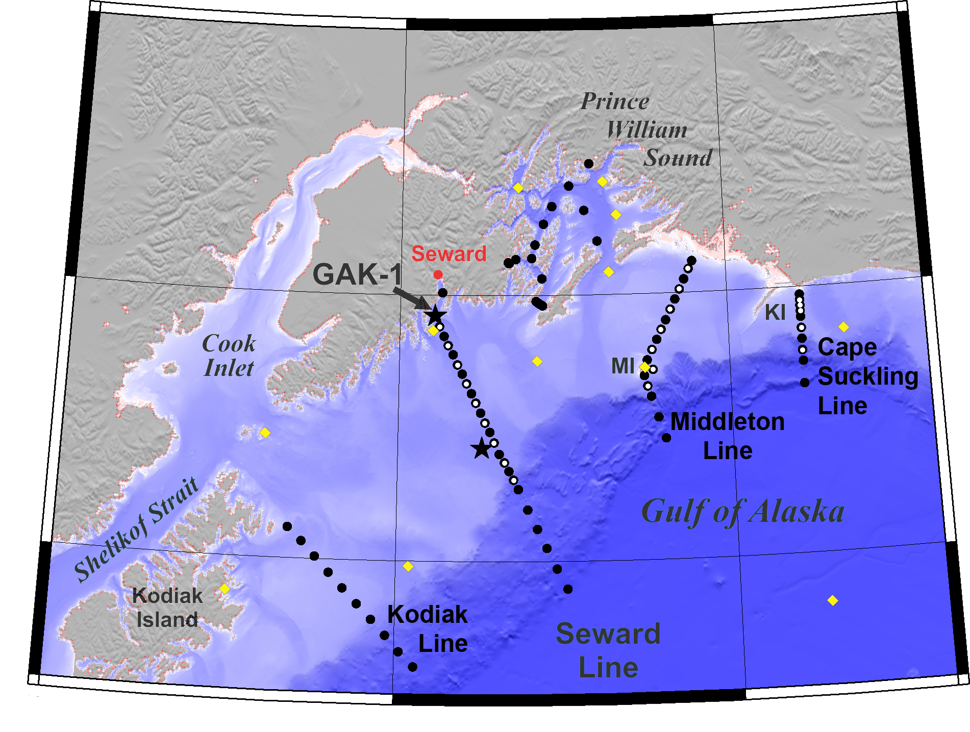
In the NGA study area, the biological community is highly productive. The lower levels of the food chain (phytoplankton and zooplankton) support the iconic fish, crabs, seabirds, and marine mammals of Alaska. Large increases in phytoplankton during the spring and sustained production during the summer support zooplankton that transfer energy up the food chain. Substantial amounts of this organic matter also sink to feed animals on the sea bottom.
-
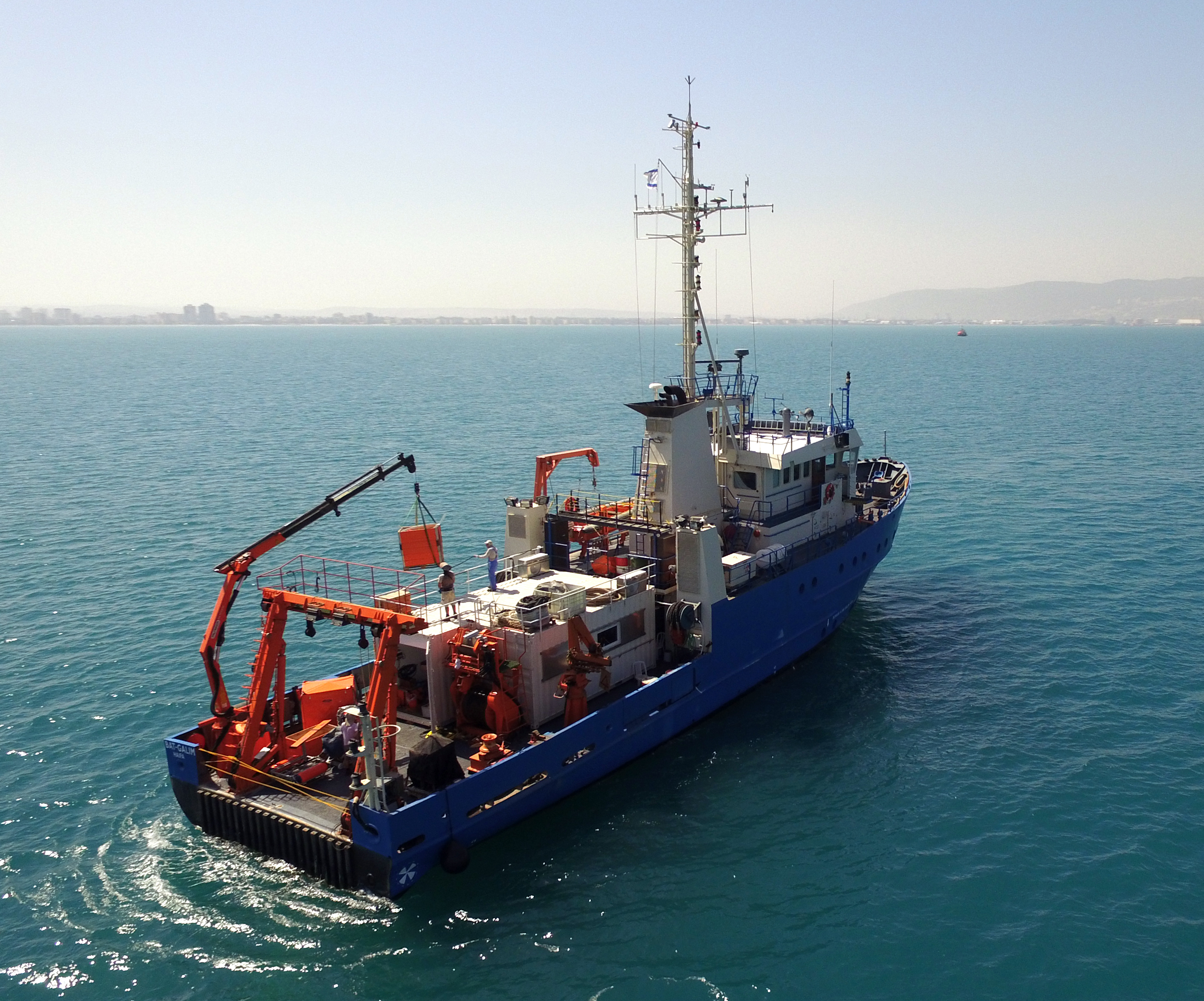
The National Institute of Oceanography (IOLR) is located in Haifa (Tel Shikmona) on the shores of the Mediterranean Sea. The institute engages in research and development in marine sciences and provides information and professional advice to the government and the public sector in the context of the sustainable utilization and conservation of Israel’s marine and coastal resources. The oceanographic studies at the institute are engaged in research, monitoring, and collecting environmental data in the Mediterranean Sea, and in studying natural and unnatural processes. The research topics at the institute include subjects such as; flow and mixing processes; oceanographic models; material cycles; sediment transportation and geological processes; the structure of the seabed; physiology, immunology, and ecology of marine organisms and the populations’ dynamics; the biological diversity in offshore waters and deep seas; effects of human activity on the open sea and coastal environment. IOLR operates advanced instruments and national infrastructures for marine research and monitoring, such as; the national research vessel “Bat Galim”, small ships, and autonomous underwater gliders. A variety of mapping, sampling, data collection, and independent systems are placed at sea for continuous monitoring of environmental variables. In addition, ecological monitoring (community structure, biological diversity, etc.) is carried out in several habitats at a monthly to yearly frequency as follows: • Seasonal ecological monitoring of the Benthos community of the vegetation tables in four sites from north to south since 2009 (also includes a monthly sampling of the water - chlorophyll, nutrients, alkalinity, DIC, temp., pH). • Seasonal ecological monitoring of the benthos community (fish, and biotic cover) of the shallow reefs in the Shekmona/Rash Carmel area. • Annual ecological monitoring of the mesophotic reefs (90-100 meters) at the top of Carmel and the shallow reef. • Monthly zooplankton monitoring at the Hadera station • Monitoring the fish society and the invertebrate community in sandy bottoms • Deep sea monitoring IOLR operates the National Marine Information Center - ISRAMAR, which collects, records, and distributes data and information regarding Israel’s marine environment.
-
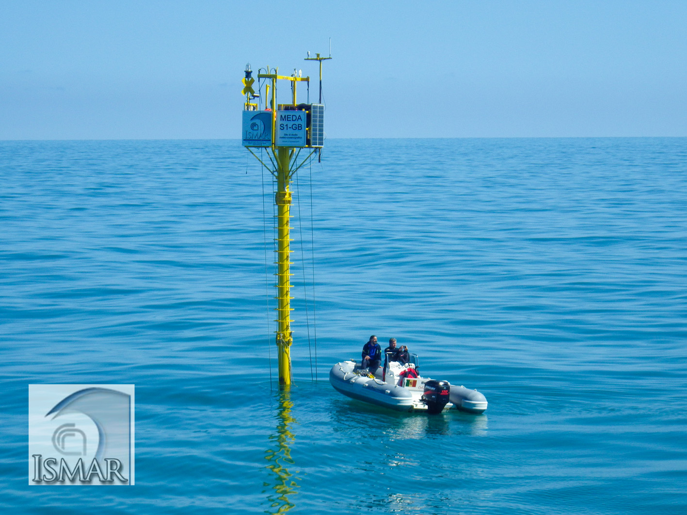
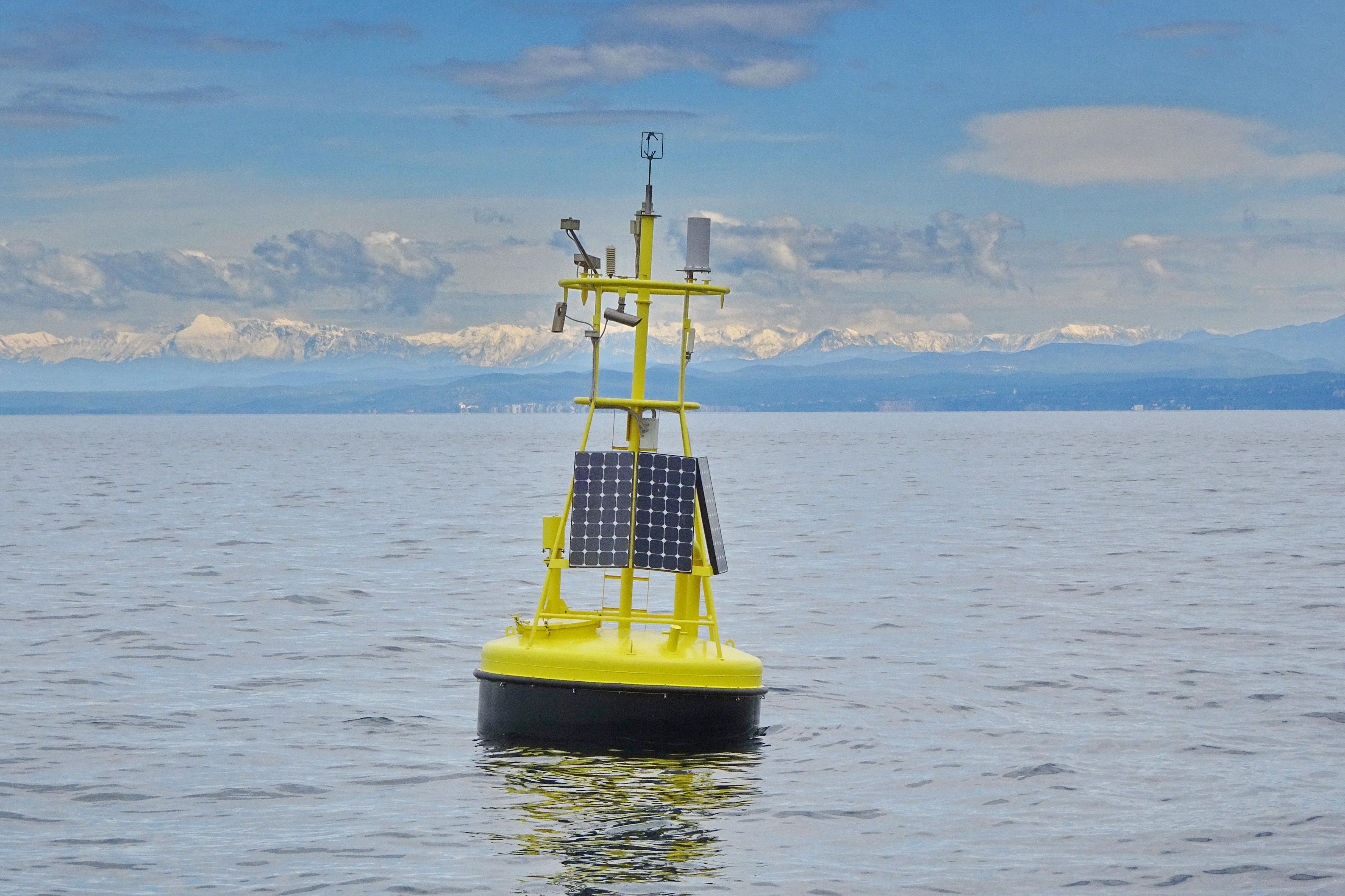
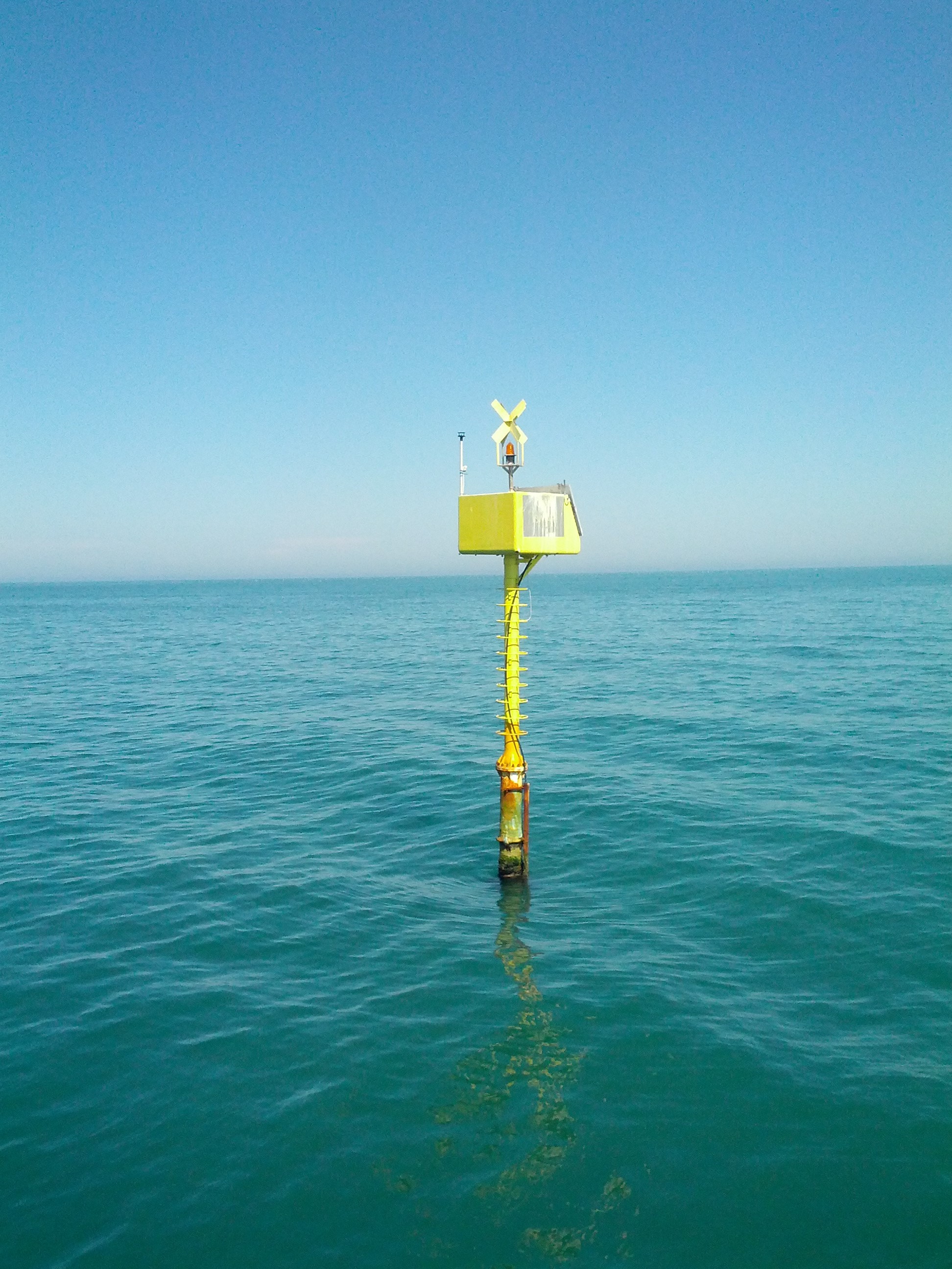
The site is equipped with two fixed stations: a meteo-oceanographic buoy (E1 buoy) and an elastic beacon equipped with meteo-oceanographic sensors (S1-GB beacon). The fixed stations were deployed in the framework of a multidisciplinary research project that uses automated stations to study the marine environment, in cooperation between the Insitute of Marine Science (ISMAR) in Bologna (CNR) and other public and governmental Research Institutes. The S1 buoy was installed in 2004 at the Po river Delta and recently (2015) implemented being now an elastic beacon. The E1 buoy is off the coast of Rimini town measuring in near real-time meteo and physico-chemical oceanographic parameters at different depths in the water column. It records every 5-10-15-30 minutes atmospheric pressure, air temperature, relative humidity, wind speed , wind gust, wind direction, net solar radiation, water temperature, salinity, dissolved oxygen, fluorescence, turbidity, speed and direction of the currents, height, direction and period of the wawes . The data are transmitted via GSM and downloaded (on average every 2-4 hours) at the Data Center of the Institute of ISMAR in Bologna. Data are daily validated and analysed, in order to be used for different studies.
-
The separation line of the semi-enclosed northern basin from the rest of the Adriatic Sea is conventionally defined at the 100 m isobath, at about 43°20’N, from where the bottom depth moderately decreases up to the northern coast reaching the smallest average depth in the northernmost protrusion of the basin, the Gulf of Trieste (surface area 600 km2, volume 9.5 km3, maximal depth approx. 25 m). The oceanographic properties of Gulf of Trieste are affected by water mass exchange with the northern Adriatic at the open western boundary, by local meteorological conditions that induce a pronounced seasonal cycle of seawater temperature (6 - 28 oC) and by the largest freshwater input, the Soča (Isonzo) River. The latter enters the Gulf on the shallower northern coastline with an average flow of 123 m3 s-1 and represents the major source of land-borne nutrients in this coastal zone, in particular of nitrate, whereas inputs along the south-eastern coast are comparatively small (contributing less than 10% to the freshwater balance in the Gulf). The circulation pattern is variable, however the prevailing ENE wind is the most efficient for the water exchange, especially during winter. These physical features, in addition to freshwater inputs, are ultimately reflected in the distribution of nutrients and in the seasonal and inter-annual variability of plankton communities, primary production but also in events of hypoxia/anoxia and mucous macroaggregates, which have characterised the whole northern Adriatic basin in the recent past. The waters of the Gulf of Trieste have been monitored for several physical-chemical and biological variables since 70s’ but the longest and most continuous data set of biological variables is represented by the phytoplankton time series, which started in 1990 when the national monitoring programme has become operational (set by Slovenian Environmental Agency). From 2007 onwards, the monitoring programme complies with the regulations of the EU Water Framework Directive (2000/60/EC).
-
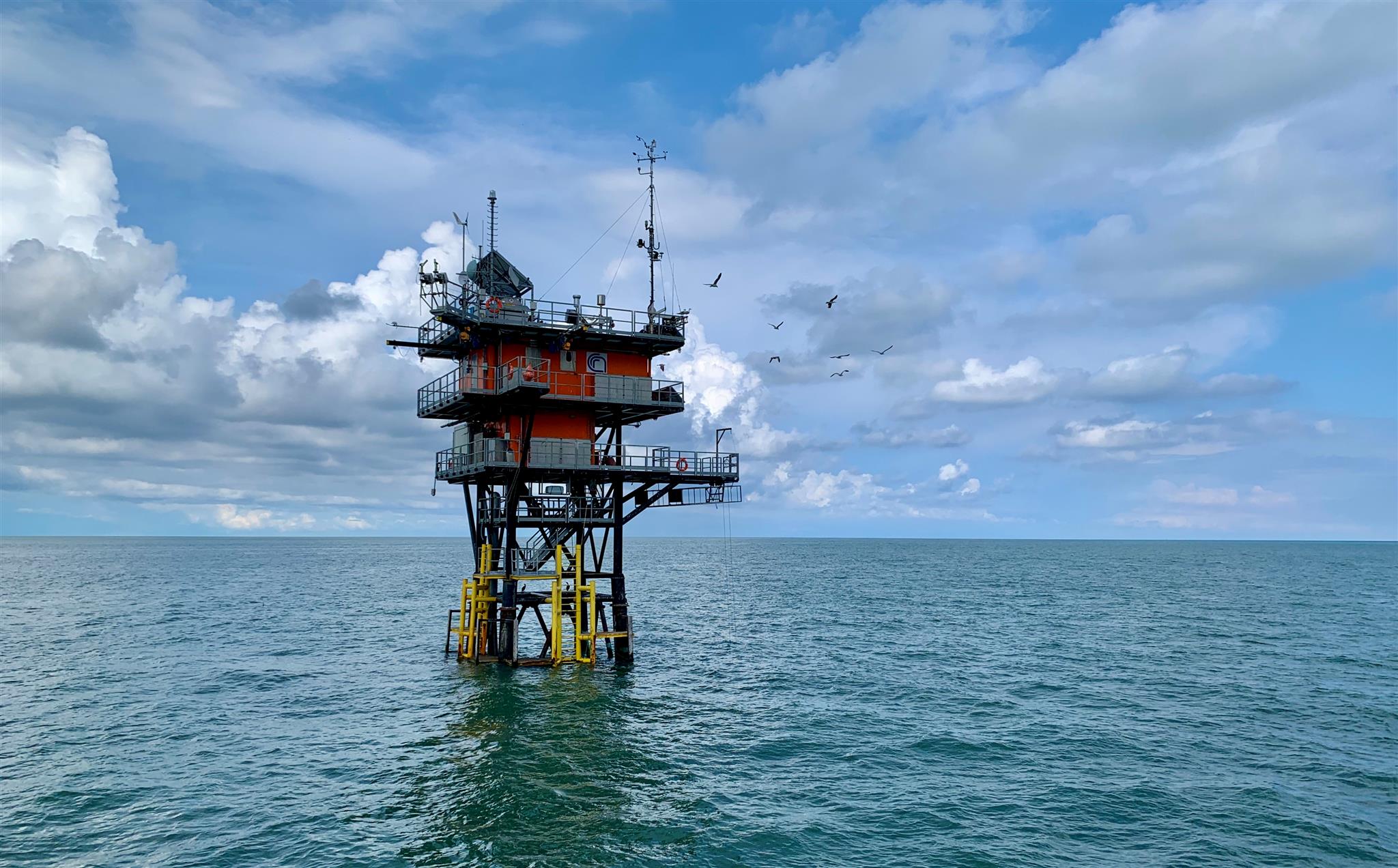
The Transetto Senigallia-Susak is a transect of sampling stations located in the Northern Adriatic Sea. The IRBIM-CNR in Ancona and the Politechnical University of Marche collects from the end of years 80s physical, chemical and biological data. This is an excellent observing site to analyze the characteristics of water masses entering and leaving the North Adriatic Sea and their possible modification. In the site is also located the TeleSenigallia pylon.
-
The Gulf of Venice is a gulf that borders modern-day Italy, Slovenia and Croatia, and is at the north of the Adriatic Sea between the delta of the Po river in northern Italy and the Istria peninsula in Croatia. The site is under a heavy antropic impact (nutrient loads, coastal towns, fishery, tourism maritime routes). In the past eutrophic events struck the ecosystem and, more recently, frequent mucus macro-aggregates extended in the whole basin. Study of long term historical time series of the biotic community in the Gulf of Venice in relation with the biogeochemical cycles and physical properties of sea-water have been conducted since the '70s.