
daylight length
Type of resources
Available actions
Topics
Keywords
Contact for the resource
Provided by
Years
Formats
Representation types
-
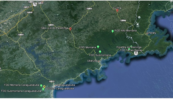
This research site develops long-term ecological studies in experimental units located in Protected Areas along the altitudinal gradient of Atlantic Forest types: Low Altitude Ombrophilous Dense Forest (5 to 50 m above sea level), Submontana Ombrophilous Dense Forest (50 to 500 m above sea level), and Montane Ombrophilous Dense Forest (500 to 1.200 m above sea level). In each altitude, all trees with a DBH ≥ 5,0 cm that fall inside 4 independent 1 hectare permanent plots, divided into a grid of 10 x 10 meter parcels, are being considered. The site extends from 23°15' S a 23° 40 S to 44° 40’ a 45° 40’ W. within areas of the Nucleus Caraguatatuba, Cunha, Picinguaba and Santa Virginia from the Serra do Mar State Park/PESM. The database on composition and structure of the forest will allow a choice of species for more detailed studies on reproduction biology; seed anatomy and reserves; germination; photosynthesis and water use efficiency; nitrogen assimilation, transport and metabolism; plant populations structure and dynamics; techniques; genetic structure of plant populations using molecular markers; determination of forest age by DBH classes and using 14C; determination of annual average growth rates of key species; and phenology. Multivariate analyses has been used to check for functional groups, or groups of species that share a common behavior and ecology. The comparison of different groups along the altitudinal gradient will allow investigation of the effect of altitude in the functioning of these groups. Simultaneously, the inputs of nitrogen through precipitation, biological fixation, and soil mineralization and nitrification are being determined, along with key parameters of N losses through denitrification and export by streams, allowing a preliminary nitrogen mass balance along the altitudinal gradient. Water and carbon balance of the forest will be estimated along with the seasonal variation of this balance through use of micrometeorological towers and Eddy-covariance technique. The photosynthesis/respiration balance of the ecosystem will be used to determine the role of the forest as a sink or source of carbon to the atmosphere. Our final goal is to integrate the results of all activities listed above, scaling-up from individual trees, to families, to functional groups, and finally to phytophysiognomies, allowing us to investigate in detail the structure and the functioning of the forest.
-
Mt Halla San is in Jeju Island, the only volcanic subtropical island, in South Korea. Every year the island is hit by several typhoons. It has shaped unique environmental characteristics and biodiversity. In addition the mountain is one of the most popular vacation sites with growing ecological concern.
-
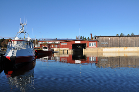
Umeå Marine Sciences Centre produces long term marine time series in the coastal and off-shore environments of the Gulf of Bothnia. The Ore estuary is proposed as the primary study area for the LTER initiative. This is a particularly intensively studied brackish water body with records back to the 1980´s. The estuary is 71.2 km^2 with an average depth of 10 m and maximum depth of 32 m. Salinity is between 1-3 g/kg. The Ore river discharge into the estuary and long term ecological time series i available also from the river. The watershed is dominated by boreal forest and mires.
-
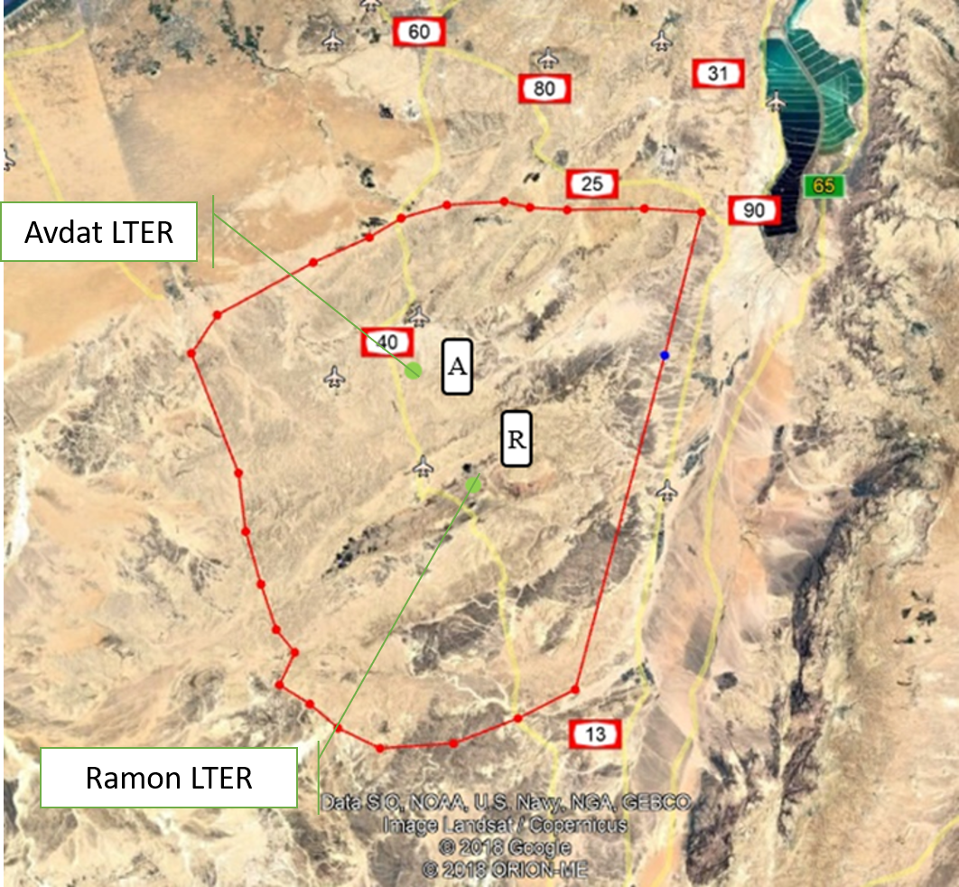
The Negev Highlands (NH) LTSER platform is situated between the Sinai Peninsula to the west and the Arava – Dead Sea depression to the east. This is a rocky terrain, covering an area of 17,000 sq. km with series of ridges at an altitude of 400-1000 m above sea level. As part of the Saharo-Arabian desert belt, the climate across the NH is arid to hyper-arid region: January’s mean daily temperature is 10 °C and July’s mean daily temperature is 25 °C The potential evaporation is approximately 2200 mm/y, and mean annual precipitation is 70–130 mm, with large inter annual variations. The rainy season occurs during the winter months, from November to March. The area is rich with unique natural landscapes. One of the most prominent of these are the Makhteshim, which is the largest erosion craters in the world. In addition to its unique landscapes, it is also a habitat for various species of flora and fauna that are adapted to arid zones and highlands, some of which are endemic to the area. The Negev Highland LTSER platform includes two LTER sites: Avdat Site in the arid zone and Makhtesh Ramon site in the hyper arid zone. Archaeological remains indicate that humans lived in the area for at least 1.4 million years. Today, about 10,000 residents live here, in towns, agricultural communities, small Bedouin tribal villages and tourist-agricultural farms. Most of it is concentrated along the main route (Route No. 40), while much of the area beyond the roads is either designated nature reserves or firing zones. The two main livelihoods in NH today are agriculture - mainly vines and olives, and tourism; Both are greatly affected by climate change. Agriculture relies on desalinated seawater imported into the area. However, it is affected by the climate in several ways: 1) flash floods cause increased soil erosion. 2) Long periods of drought during the winter, cause increased evaporation and therefore large water consumption. This is when the price of water is the main expense of the farmers, and increasing it may make agriculture unprofitable. 3) The uncertainty regarding the amount of precipitation and their timing, characterizes the arid environment. Recent climate changes are increasing this uncertainty and therefore make it very difficult for farmers to plan their land cultivation and expenses. Climatic uncertainty poses a significant challenge also for tourism operators; Jews and Bedouins, as well. This is due to the multiplicity of events of extreme climatic conditions (extreme cold or extreme heat), which repel tourists from reaching the area. And, a multitude of years when there is not enough precipitation to generate the famous spring bloom of the area. For the past 7 years, the NH LTSER's researchers have been working closely with three stakeholder groups in the area: winegrowers in the valleys, the Negev Highlands Tourism Association and Bedouin tourism operators. In Green Transformation we will actively engage with this group, through tow case studies: 1) The Desert Miracle farm - which will serve as a monitoring and dissemination knowledge farm; In a collaboration with the owner of the farm, R and D agriculture in the NH and the Center for Flood Research (DSASC). 2) Tourism in the NH; In collaboration with the NH Tourism Association. Through joint work with these NGOs, we will develop a long-term monitoring program and educational materials. The topics we will deal with: reducing soil erosion and increasing soil moisture, by using appropriate agricultural methods to multiply flash floods, which will be distributed to additional farmers in the area through activities at the monitoring farm. and to tourists through workshops of the Tourism Association. In the case of tourists, the aspect to be monitored is the number of tourists who come to the area in relation to the weather conditions. Together with the Tourist Association we will develop tourist-monitoring system. The high sensitivity of the arid region to climate change and the great exposure of the impact of these changes on animals, plants and humans, invite possible tourist-educational activities aimed at transformation in ways of thinking and behaving. An environmental education program and educational tools will be developed together with the Tourist Association. Their impact will be monitored in collaboration between the NH LTSER platforms researchers and tourism operators.
-
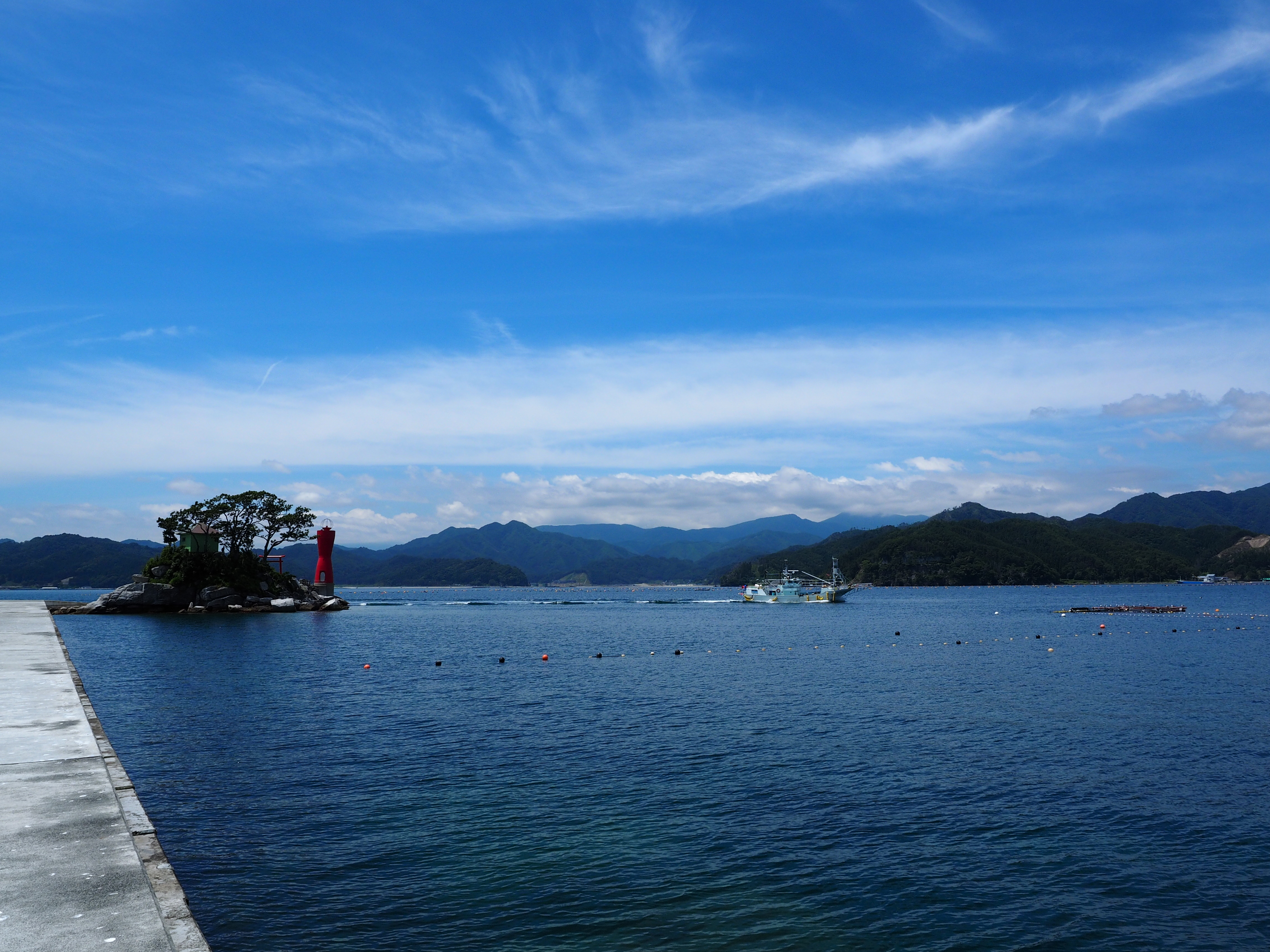
Otsuchi bay is one of the bays on the Sanriku ria coast of northern Japan opening into the western North Pacific Ocean, which was heavily impacted by the mega-earthquake and following massive tsunami occurred on March 11, 2011.
-
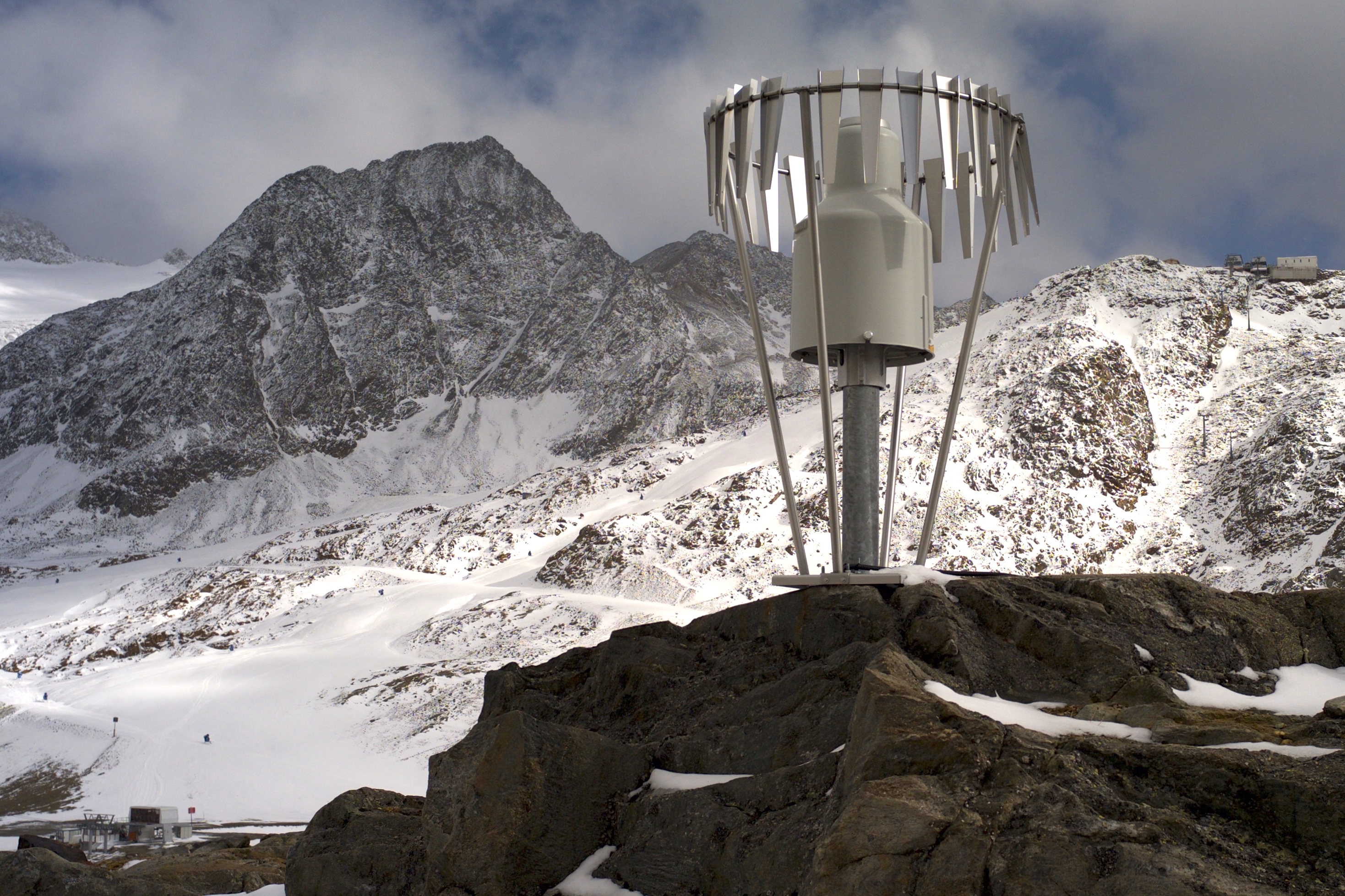
In the Rofental (Ötztal Alps) a consortium of the three institutions, and open to research partners worldwide, concentrates on studying and monitoring cryospheric, atmospheric and hydrological processes and changes with particular attention to the complex topography and climate settings of the Alpine terrain. First documents from glaciers in the Rofental, Ötztal Alps, date back as far as 1601 and regular observations and systematic studies had begun more than 150 years ago. First geodetic maps where generated in the late 19th century, first rain gauges were mounted in 1929 and glacier mass balance time series of Hintereis-, Vernagt- and Kesselwandferner are among the longest uninterrupted world-wide, building a basis for regional hydrological studies, for glacier-climate and ice dynamic research, and for estimating the world wide glacier’s contribution to sea level rise. By 2014, networks of stakes and pits for mass balance monitoring are maintained at Hochjoch-, Hintereis-, Kesselwand- and Vernagtferner by the consortium members. Runoff gauges at Vernagtferner and in Vent (operated by the Hydrological Office of Tyrol) and a network of rain gauges in the Rofental basin are the basis for high mountain hydrological studies. A varying number of automatic weather stations on and in the surroundings of the glaciers are operated by the Rofental consortium. The glaciers in the Rofental are frequently used as a test site for process studies, model development and evaluations and for new remote sensing or ground based methods in glaciological research. A series of airborne LIDAR derived high resolution DTMs of Hintereisferner and its surroundings are available since 2001. They are subject of ongoing evaluations and method comparison studies as well as for monitoring and studying periglacial morphodynamics. The generated data are available from the consortium partners, glaciological key results are annually reported to the World Glacier Monitoring Service (WGMS). A research station on Hintereisferner (with observer status in the Horizon 2020 INTERACT network) and one at Vernagtbach serve as logistic bases for fieldwork. In recent studies, socio-ecological research aspects – e.g. in relation with the use of water for energy production and tourism – comprise the natural scientific investigations.
-
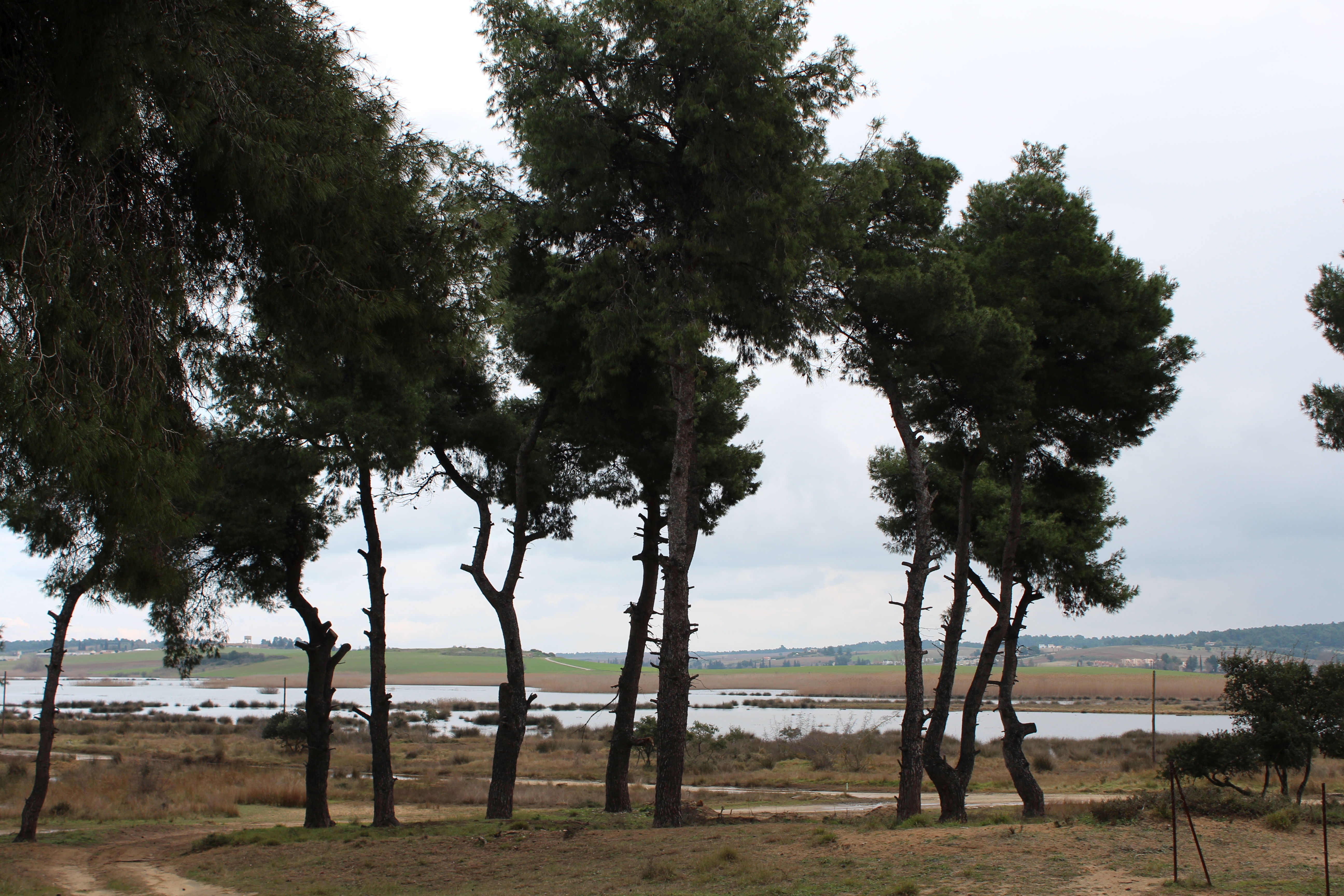
The Sani Environmental Observatory (S.E.O.) is located within a mature, near-coastal Aleppo pine (Pinus halepensis L.) ecosystem at the peninsula of Kassandra, in Chalkidiki, Greece. It is part of the Stavronikita forest, which comprises approximately 300 ha of land covered mainly by forests and to a lesser extend by shrubs and pastures. The Observatory aims primarily at the assessment of the carbon and water balance of this typical low-elevation forest ecosystem to the ongoing climatic shift. Such ecosystems may be prone to the intensified heat and drought events, as well as to the associated insects’ and pathogens’ outbreaks, which are increasingly occurring at the Mediterranean region and particularly at its eastern part. Although Aleppo pines, as well as other Mediterranean pines, are generally adapted to the region’s xerothermic conditions, the in-depth understanding of their ecophysiological and growth responses will allow us to predict the potential of such ecosystems to adapt to climate change. SEO also serves to assess the carbon stocks and fluxes and the contribution of these natural, old-growth ecosystems to carbon sequestration and, thus, to climate change mitigation. S.E.O. is developed by the Forest Research Institute (Lab of Forest Ecophysiology) of the Hellenic Agricultural Organization Dimitra with the support of Sani Resort SA, the owner of the studied forest ecosystem, presenting a nice example of collaboration between the research community and the private sector. Given that SEO is located at a region of high touristic and aesthetic value, close to a wetland and the sea, the Observatory also plans actions to familiarize people with environmental monitoring and the multiple functions and services of the studied Mediterranean ecosystem.
-
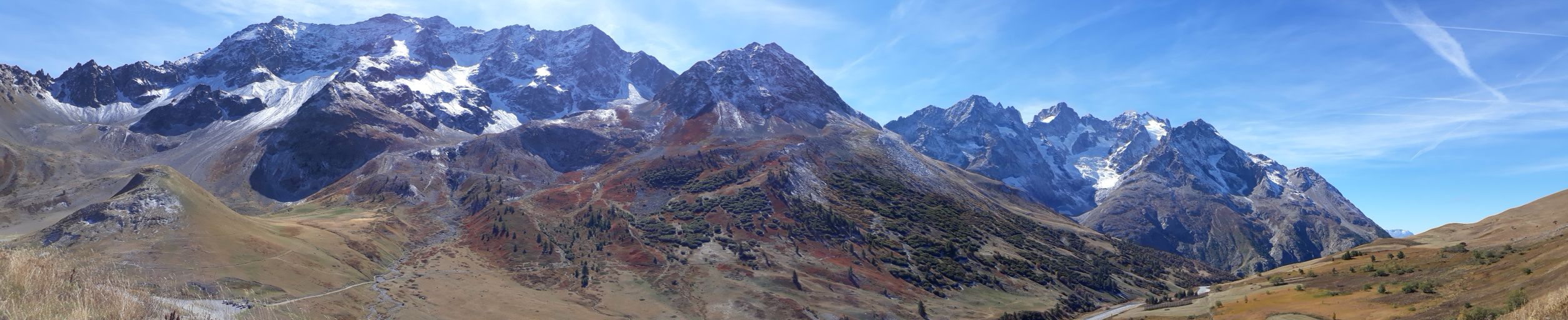
The Lautaret-Oisans platform focuses on the study of socio-ecosystems and the critical zone of the alpine mountains. The research and observation sites are focused on three sub-systems: little-engineered high mountains; alpine pastures; and lakes, rivers and watershed heads. The platform is built around the Lautaret-Roche-Noire site (https://deims.org/8574370e-934e-418a-af63-e15f4cbc5084) and Lautaret Garden infrastructures.
-

Tronchaney, Conca di Torgnon, (Torgnon, Aosta), + 388330 + 5075950; Aosta Valley
-
Tellinod, Conca di Torgnon, (Torgnon, Aosta), +389680 +5077920; Valle d'Aosta region