
deadwood volume
Type of resources
Available actions
Topics
Keywords
Contact for the resource
Provided by
Years
Formats
Representation types
-
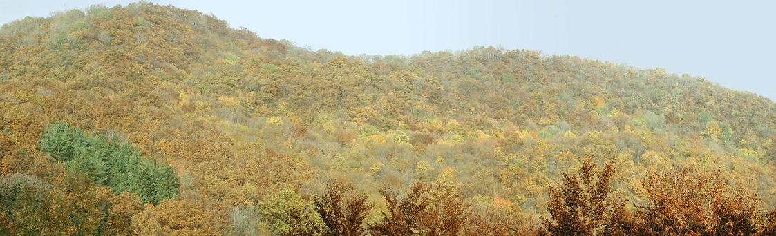
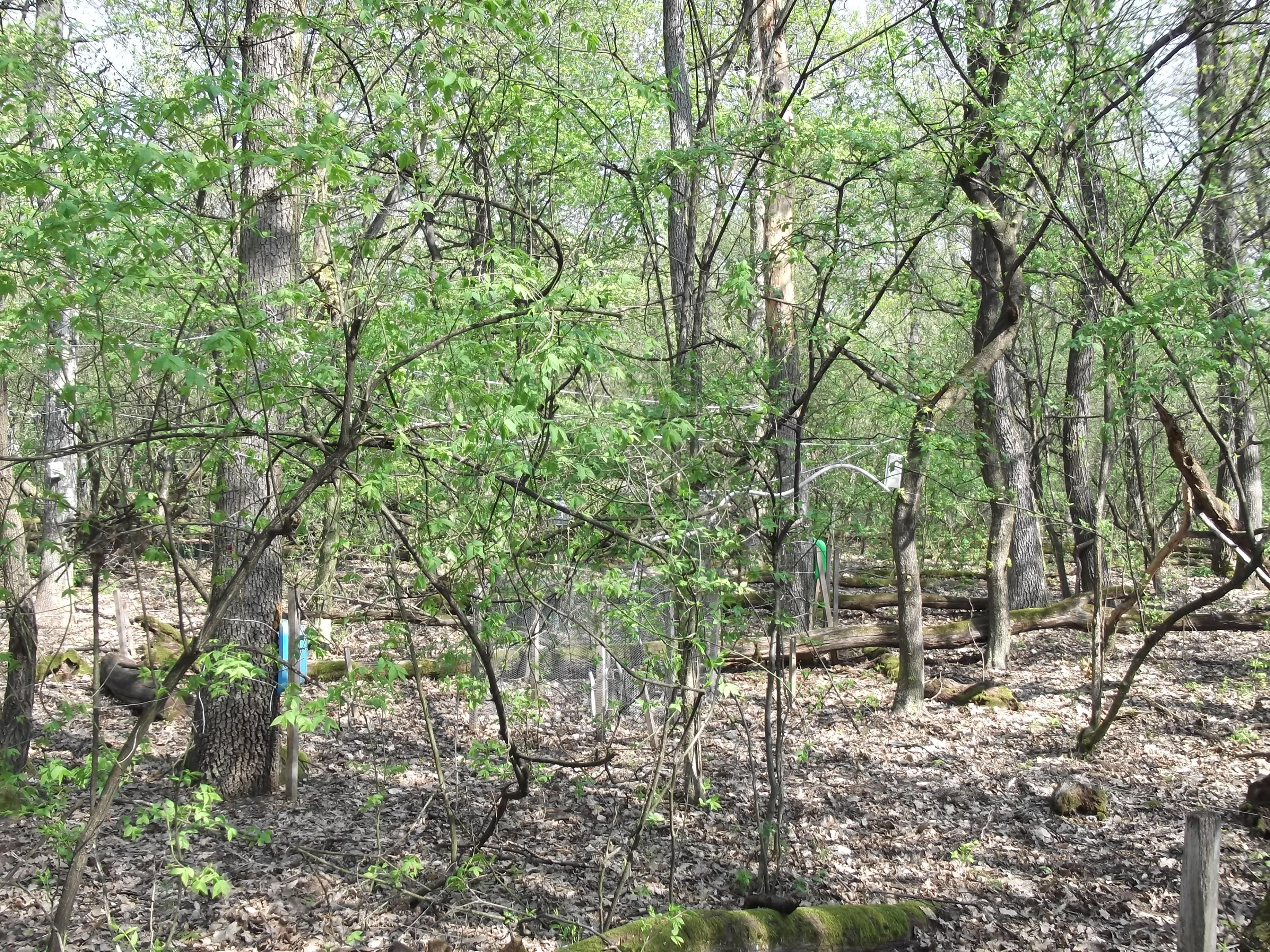
Central Europe maintains a considerable diversity of dry-mesic oak forests as the main representatives of zonal forest vegetation types in Hungary, covering the major part of foothills of the middle-range mountain, Inner Western Carpathians. The 669 m high, Triassic limestone hill called ‘Vár-hegy’ belongs to the Bükk Mountains. The annual mean temperature is about 8◦C and the annual precipitation is about 650 mm. The core area of the reserve (94 ha) is covered mainly by close-to-nature. long untouched oak dominated forests stands: Pannonic woods with Quercus petraea and Carpinus betulus; Pannonian-Balkanic Turkey oak-sessile oak forests; Pannonian woods with Quercus pubescens. It has been set aside for preservation in 1991, though several previous conservation acts had already secured almost spontaneous natural development of the stands. Most of the area was cut around 1880, however, several over-mature trees were retained. The intensive use in the previous centuries and during the world wars left a sessile oak dominated, 120-130-year-old, mostly coppice forest. The abandonment and the precedent severe oak decline contributed to generate a more diverse forest composition and structure developing towards a mixed forest with pronounced ‘old-growth’ characteristics.
-
None
-
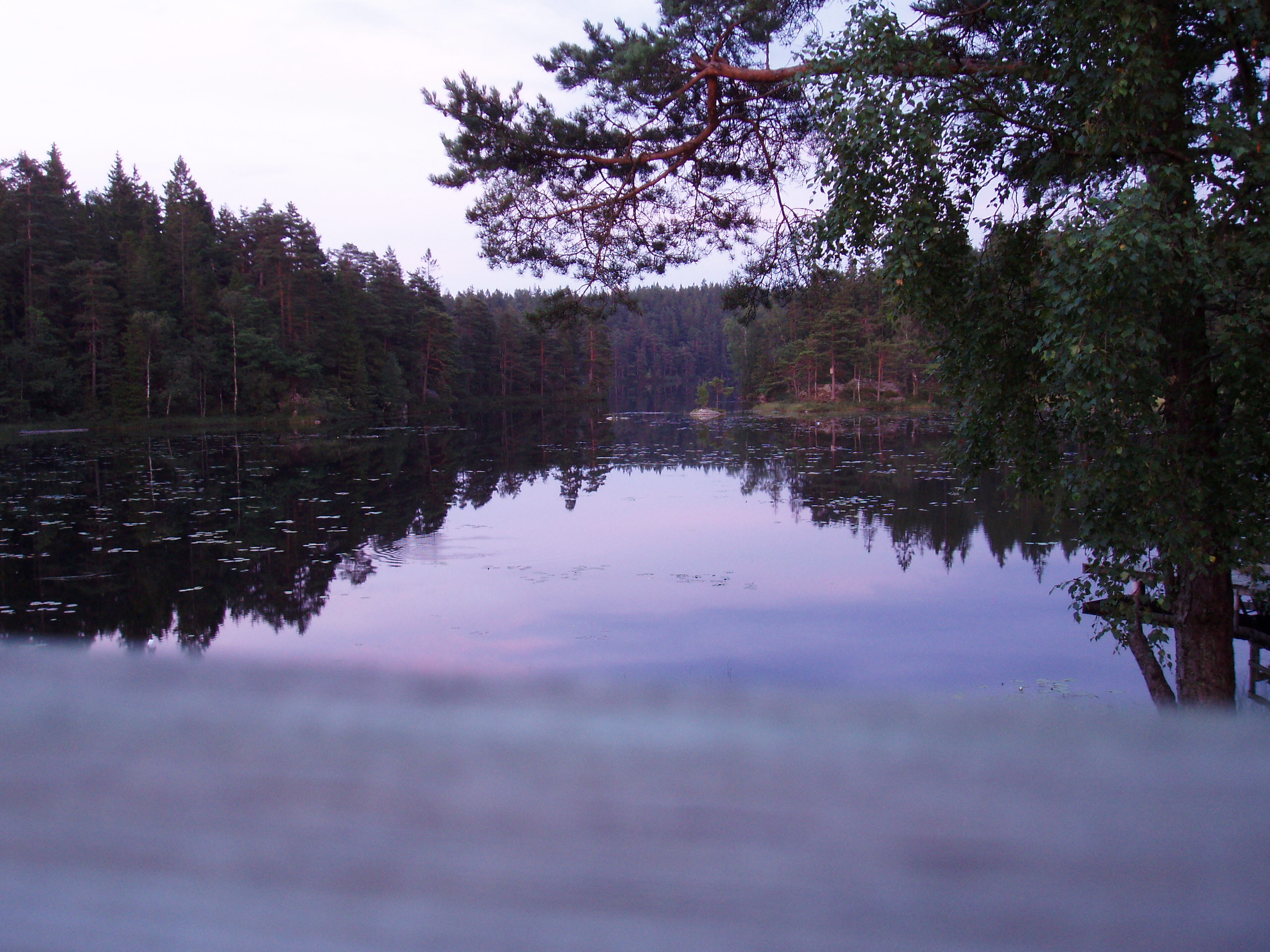
The lake Gårdsjön catchment is 2.1 km2 and includes 5 lakes and a number of headwater streams. It is located 50 km north of Göteborg. The whole area has been intensively studied for the last 30 years by scientists from IVL and from other institutes from Sweden and from abroad. Since 1979 several both national and international projects have been carried out. Smaller sub-catchments were used for experiments ranging from clear cutting, liming, fertilisation, sulphur addition and a combination of these treatments. In 1989 two large manipulation experiments were initiated. In the “Roof” experiment catchment G1 was covered by a transparent plastic roof and for 10 years the polluted precipitation was substituted with clean artificial precipitation sprinkled under the roof in a de-acidification experiment. The adjacent catchment G2 has been fertilised with NH4NO3 since 1991 to study several aspects (soil, water, vegetation) transition from N limited to N saturated conditions. Research at Gårdsjön resulted in three books and a large number of publications, covering different environmental problems, a range of pollutants, aquatic and terrestrial parts of the catchment, soils, vegetation and organisms. The site has served as an educational centre with countless visitors both from Sweden and abroad.
-
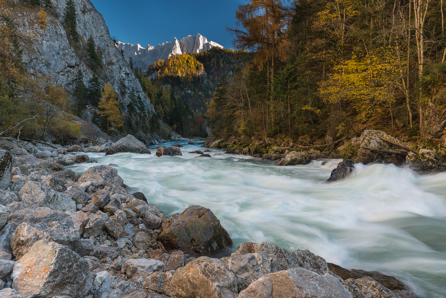
The Gesäuse Nationalpark was founded in 2002 and is located in Styria, in the Center of Austria. It is Austrias third largest National Park with an area of about 120 km² . The Gesäuse is characterized by a mountainous landscape which is cut by the river "Enns". Most parts of the Nationalpark are coverd by mountain forests. Other important habitats are alpine grasland, rock and scree habitats and pastures. The Enns with its alluvial forests and its small islands as well as the numerous freshwater springs represent very special habitats within the mountain ranges. Because of the great range of altitude differences within a small area in the Gesäuse National Park, there is a dense concentration of extremely diverse habitats and, consequently, of species of animals and plants. Furthermore the Gesäuse is known for its exeptional richness in endemic species. 200 years ago, the natural beauty of the Gesäuse region, the contrast between the river Enns and the sheer rock faces of Gesäuse mountains with their diverse habitats and species, already attracted researchers and mountaineers to this area in the heart of Austria. As early as 1958, the Gesäuse and the valley of the river Enns leading out of it were designated as the first conservation area in Styria. Persisting plans for hydroelectric power generation on the Enns eventually led to the creation of a national park. The Gesäuse NP was established on 26 October 2002 and internationally recognized in 2003 by the IUCN as Cat. II protected area (national park). Large areas of the national park are also part of the Natura 2000 network in the sense of the EU Fauna Flora Habitat and Birds Directives. With 11 000 ha, it is the third-largest National park in Austria. It is situated in the Ennstal Alps in the province of Styria, which are part of the Northern Limestone Alps and includes essentially the two mountain ranges of Buchstein and Hochtor. In the north it borders on the Eisenwurzen Nature Park and is only ten kilometres away from Kalkalpen NP in Upper Austria. Currently there are six national parks in Austria, which are recognized by the IUCN as Cat. II national parks. Covering an area of 2 382 km², they make up 2.8 % of the Austrian territory and include some of the ecologically most valuable regions. They are organized under the umbrella of Nationalparks Austria to leverage synergies and to ensure consistent presentation to the general public. The directors of the national parks coordinate and initiate joint activities in cooperation with the Federal Ministry of Agriculture, Forestry, Environment and Water Management and the respective federal provinces. National parks across the world aim to protect areas of outstanding natural beauty, rich diversity of plants and animals, rare or endangered species and special natural phenomena. The label is designed to prevent technical development and economic exploitation and to safeguard natural dynamics. Humans are invited to participate as quiet observers. As internationally recognized IUCN Cat.II protected areas, all national parks in Austria are committed to four basic tasks: -- conservation and protection of biodiversity; -- recreation and nature experience; -- education about nature and the environment; -- research. Research in the Gesäuse NP concentrates in implementing its core tasks of protecting habitats and species. Most of it is therefore research into applied conservation, with basic research taking second place. Applied conservation research includes documenting habitats and species in the national park, basic research includes long-term research and monitoring of changes in the natural landscape. In the Gesäuse NP the focus is on dynamic habitats like avalanche chutes, windthrow areas, scree gullies or gravel banks in the river. Initial results underline the special significance of these ecosystems shaped by extreme weather for biodiversity in the national park. In terms of long-term research, over the last seven years the Gesäuse NP has established a network of permanent monitoring sites in diverse habitats (springs, running waters, forest, high mountain pastures, peaks, etc.). In addition to monitoring the vegetation in these sites, the focus is on identifying various groups of animals as indicator species. These special climate change monitoring projects in the national park include studies of flora and fauna at peaks (GLORIA) and the creation of a network of metereological measuring stations that represents all altitudinal zones and expositions. A project modelling climate and hydrological scenarios is headed by the University of Graz and includes a dozen partners. The national park works closely with universities on numerous projects. Many theses have been written on issues of the Gesäuse. The national park offers the local infrastructure and the universities bring their special know-how to the research in the national park. All research deliverables in the national park are also available online on the dedicated research web page http://www.parcs.at/npg
-
Síkfőkút LTER Europe site is a temperate deciduous forest site, unmanaged since the late 1960ies. It is situated in the Szőllőcske forest reserve area on the southern foothills of Bükk Mountains, NE Hungary. The site is covered by a mature coppice oak forest (105 years old) with Q. petraea and Q. cerris in the upper canopy layer and other woody species occurring in the secondary canopy layer and shrub layers (Acer sp., Cornus sp, Euonymus sp., Crataegus sp.) The site was seriously impacted by oak decline during 1980ies. The soil has been classified as a brown forest soil type according to the Hungarian Soil Classification System which corresponds to Luvisol according to FAO WRB. Long-term data are available on climate, soil variables and forest structural and functional characteristics (for period 1973-2016).
-
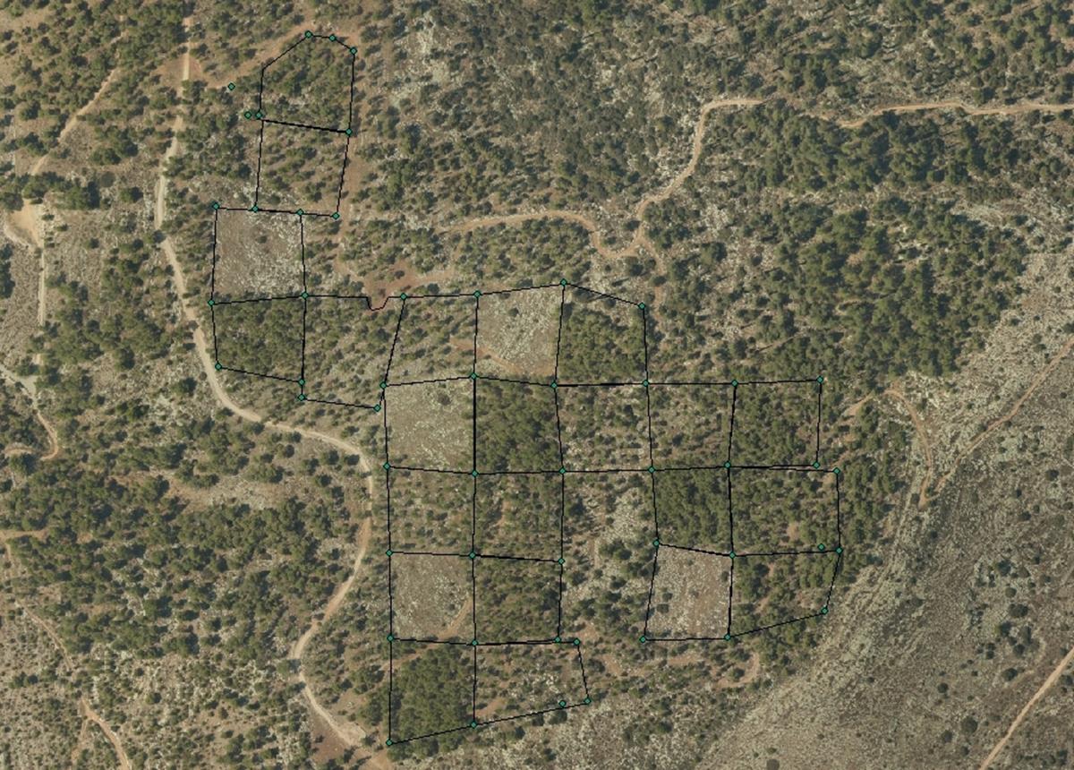
The Kedoshim-forest Long Term Ecological Research (LTER) is an experimental set up established in 2008 in a mature Pinus halepensis forest. This long-term research was designed to address silvicultural issues related to the management of mature, first generation, man-made, pine forest ecosystems in Israel and the design of their next generations as sustainable multiple-use forests. The Kedoshim LTER site is part of the Israeli LTER network - MAARAG. The Kedoshim LTER site provides a comprehensive well designed experimental infrastructure to study long-term effects of silvicultural manipulation (specifically overstory thinning) on vegetation dynamics, forest structure and ecosystem function. Four overstory thinning treatments were applied within 70×70 research plots: 1) clear cut, 2) heavy thinning – 100 tree ha-1 (65% reduction in stem basal area), 3) moderate thinning – 300 tree ha-1 (35% reduction in stem basal area) and, 4) control with no thinning – ca. 500 tree ha-1. Additionally, adjacent non-forested area was assigned as a reference. Climate and microclimate and various aspects of vegetation dynamics, forest function and biodiversity are monitored continuously since the application of thinning treatments.
-
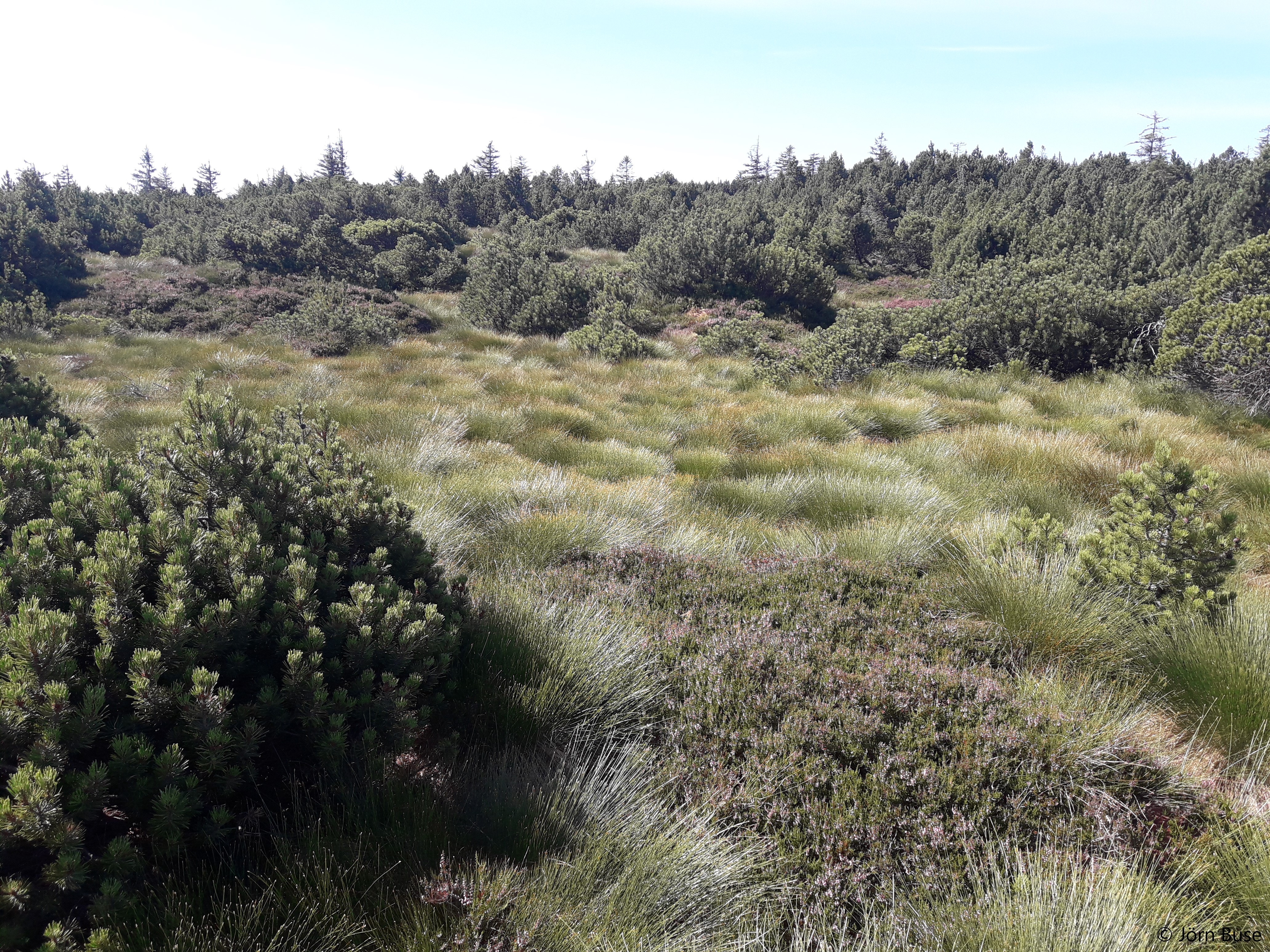
Nature reserve, Natura 2000, protected coniferous blueberry forest.
-
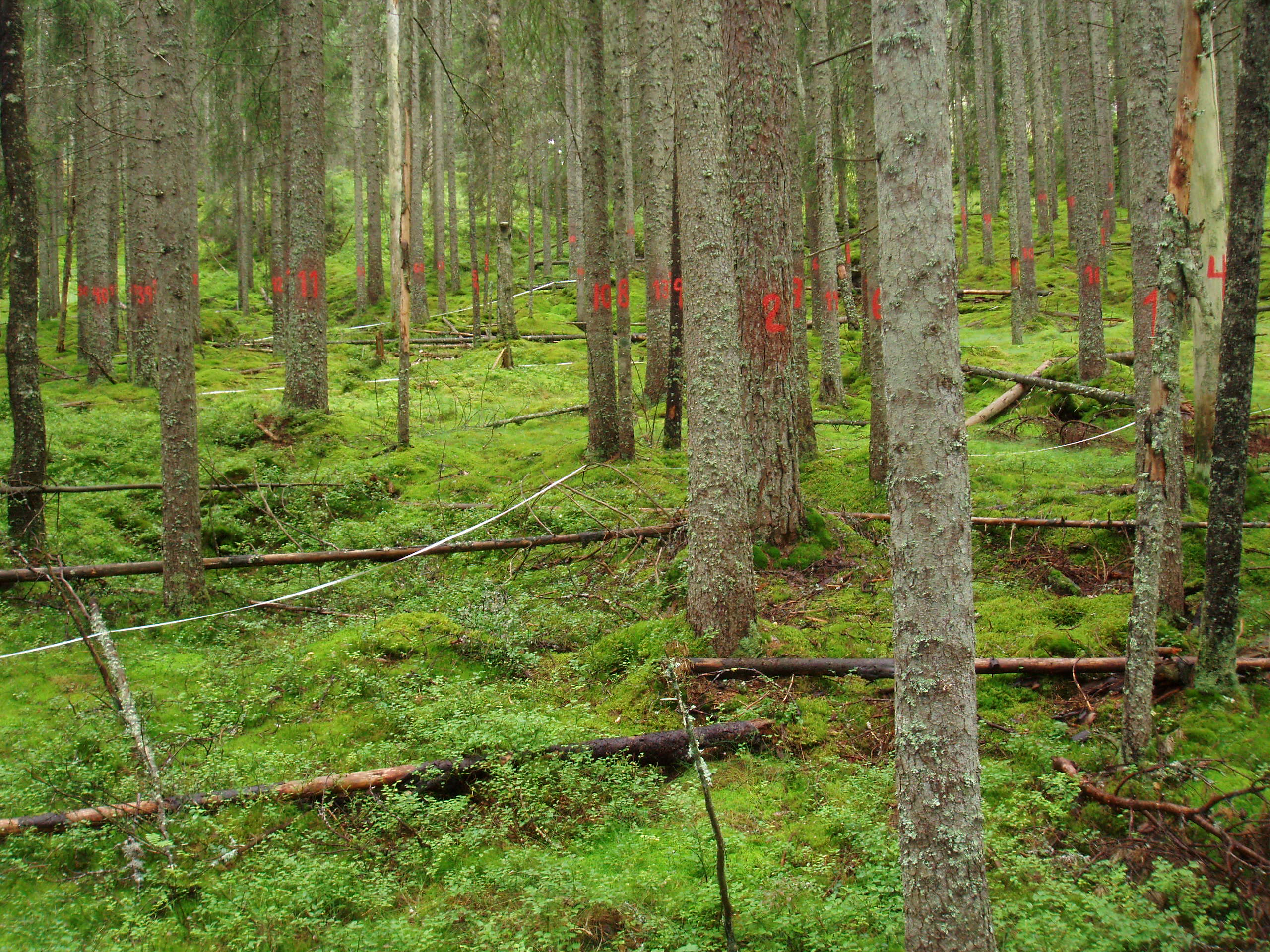
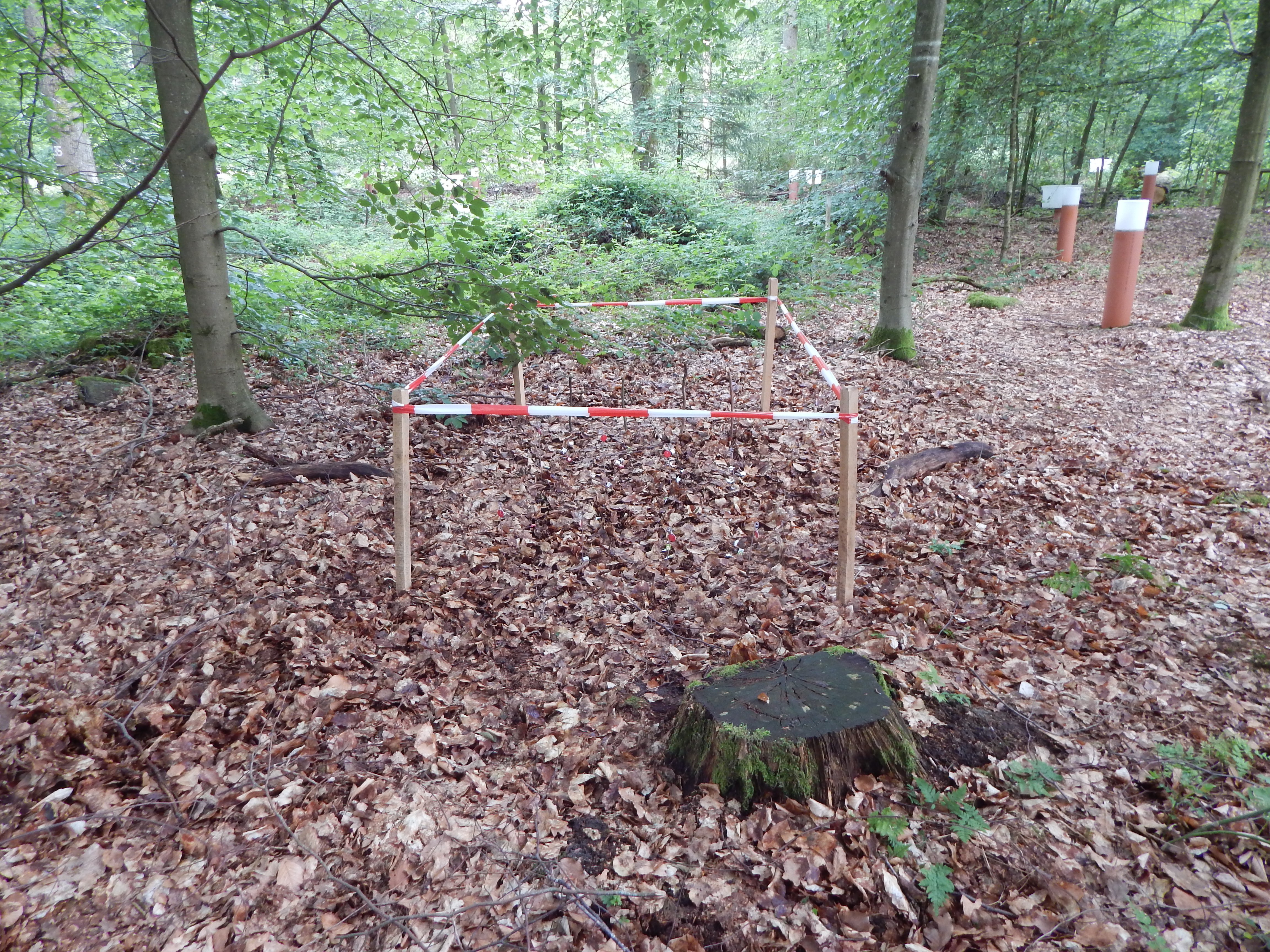
LTER plot Thermophilous forests includes five regions and sixteen localities in Central Bohemia and Southern Moravia, where ecosystems of thermophilous forests, including adjacent natural treeless vegetation, have been studied for a long time. The monitoring is run jointly by the Institute of Botany of the Czech Academy of Sciences (coordination R. Hédl) and the Silva Tarouca Research Institute for Landscape and Ornamental Gardening (coordination D. Adam). The main focus is on the plant community, including trees and herbs, which are monitored by using sets of permanent plots, or as continuous forest stands. Data are collected at the level of individuals (plants), plant communities (species composition and biodiversity) and ecosystem (soil, canopy, microclimate and other variables). The backbone of the monitoring system consists of nearly 500 long-term monitoring plots. These are supplemented by several dozens of short-term monitoring plots, and historical plots resurveyed only once after several decades. The monitored forest stands share similar natural conditions and management history. They cover a wide range of thermophilous forest communities, mainly thermophilous oak-hornbeam forests, various types of oak and ravine forests, occasionally beech forests and the adjacent open habitats (rocky steppes). The dominant type of management was coppicing in most sites, mainly as coppices-with-standards. The historical management was abandoned during the 19th and early 20th centuries, and the monitored ecosystems were managed with a decreasing intensity in about the past half a century. Some of the localities or their parts are subject of non-intervention regime at present. This has affected the age of the forest stands, which has increased by several times. Today, many stands are 100+ years old. All monitored localities are parts of conservation areas, often multiple combinations - national nature reserves (NNR), national nature monuments (NNM), nature reserves (NR), national park (NP), protected landscape area (PLA), EU Site of Community Importance (SCI). The main strategy of the nature conservation is the management reduction at most sites. In several cases, however, restoration of the traditional ways of forest management has been introduced in the past years. The Thermophilous forests site consists of the following five areas and sixteen localities: 1. Křivoklátsko Protected Landscape Area Monitoring of the dynamics of tree communities (including 3D scanning), vegetation including the communities of vascular plants, fungi, saproxylic beetles and soil processes. Data are available from 1976, 1999, 2004 and annually since 2004 (localities Velká Pleš and Týřov), or since 1993 (locality Červený kříž) - Velká Pleš: 10 ha of continuous forest stand monitoring, 400 microplots (20 x 20 cm) and monitoring of game impact on rocky steppes (pleše = balds). - Týřov: 400 microplots (20 x 20 cm) in xerothermic treeless habitats and in enclosures. - Červený kříž: focus on the impact of game on the diversity of plant communities. 2. Český kras Protected Landscape Area Monitoring of the dynamics of plant communities, soil and tree overstory in five-year intervals, using a network of 190 permanent plots. Microclimatic measurements in part of the plots. Data from 2005, 2009, 2014, 2019. Focus on the tree dynamics at one locality (Doutnáč). Part of the area left for spontaneous development, part subject of the traditional management restoration. Additionally, 57 historical vegetation plots resurveyed after 50 years. - Karlštejn NNR: three localities Prostřední vrch, Vysoká stráň and Doutnáč; collective area 166 ha. - Koda NNR: three localities Tobolský vrch, Za lípou and Kodská stěna, collective area 95 ha. 3. Podyjí National Park Monitoring of the dynamics of several forest ecosystem components, focusing on natural processes and the restoration of traditional management forms. Continuously measured tree stands, yearly monitoring of plant communities, invertebrates, bryophytes, snails, fungi and soil variables by using a network of plots. Data available from 2010 and 2014-onwards. A network of 50 permanent plots with five-year monitoring interval was established in 2018. - Four localities in the eastern part of the national park: Lipina, Šobes, Popice and Hnanice, collective area 309 ha. 4. Pálava Protected Landscape Area Monitoring of the dynamics of plant communities, soil and tree overstory in five-year intervals, using a network of 160 monitoring plots. Microclimatic measurements in part of the plots. Monitoring of spider, beetle and ant communities in addition to that. Data available from 2008-onwards. Next to it, about 230 historical vegetation plots resurveyed after 50-60 years, and a detailed research on the management history. - Děvín NNR: 380 ha, 85 permanent plots and about 180 resurveyed historical plots. - Milovický les: 2051 ha, 75 permanent plots a 46 resurveyed historical plots. 5. Dúbrava Monitoring of the dynamics of plant communities, soil and tree overstory in five-year intervals, using a network of 75 monitoring plots. Data from 2011, 2012 and 2017. In addition to that, 56 historical vegetation plots resurveyed after 50 years, covering a larger area. Detailed research on the management history and a paleoecological research covering the entire Holocene. - Hodonínská Dúbrava: 4820 ha, 75 permanent plots and 56 resurveyed historical plots.
-
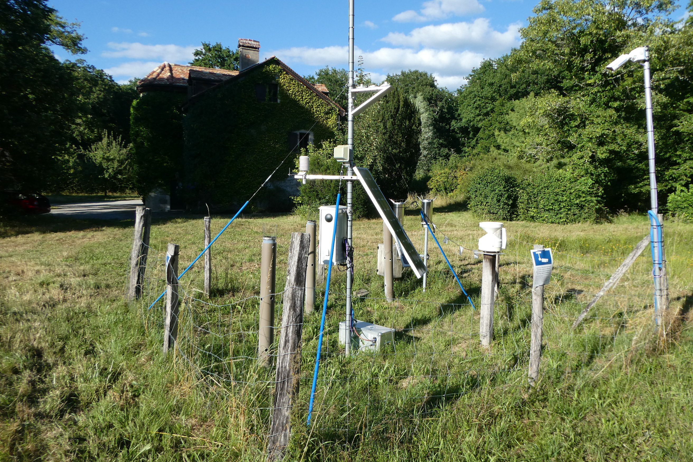
The forest site "Jussy" has been installed in 1995 as part of the Swiss Long-term Forest Ecosystem Research Programme LWF. The programme investigates anthropogenic and natural forces on the long-term health of the forests and the potential risks to humans. For this, a profound understanding of the relationship between processes, causes and effects in the ecosystem are necessary. The objectives of the LWF research programme include (i) early detection and a representative assessment of changes in forest condition, (ii) determination of external influences, both from anthropogenic and natural sources such as element inputs and climate and their effect on the forest ecosystem, (iii) development of indicators to assess the condition of the forest, (iv) integrated risk assessment based on different stress scenarios, and (v) extended platform for internal and external research projects. The LWF research programme provides, on the one hand, long-term data series from the last 20 years, together with a scientific interpretation to national and international policy makers. On the other hand, the available data and latest LWF infrastructure provide an attractive scientific platform for collaboration with both national and international partners. The site is located close to Jussy in the canton of Geneva, within a natural, mixed forest stand which mainly consists of 90 year-old sessile oak (Quercus petrea), 60 year-old aspen (Populus tremula), and 60 year-old European hornbeam (Carpinus betulus) trees. Among others, the site is equipped with two meteorological measurement stations; one is located within the forest stand, the second is co-located in the nearby open-field, allowing to measure the forest stand effect on micro-climate. The following parameters are being measured (starting-end year): Atmospheric deposition (throughfall and bulk deposition) (1997-today), Circular vegetation plots (1995-today), Crown Condition Assessment (1995-today), Deadwood survey (1995, 2005-today), Diameter and Height measurements (2000-today), Foliar analyses (1997-today), Leaf area index (LAI) (1996-today), Lichens (2003-today), Litterfall (1997-1998), Manual circumference band measurement (2001-today), Matric potential (manual suction cups) (1996-today), Meteorological measurements (1997-today), O3 Injuries (2002-today), Ozone visible injury assessment (2002-today), Passive sampling of NH3 (1999-2000), Passive sampling of NO2 (1999-2000), Passive sampling of O3 (2000-today), Permanent vegetation quadrats (1995-today), Phenological observations (1997-today), Soil matrix chemistry (1995-today), Soil morphology (1995-today), Tree core sampling (1916-1998), Tree crown measurements (1995-today), Deadwood sampling (2009-today).
-
Quercus robur and Pinus silvestris forests on glacio-fluvial sediments