
dew point
Type of resources
Available actions
Topics
Keywords
Contact for the resource
Provided by
Years
Formats
Representation types
-
Dew point of meteorological Station Rudolfshütte
-
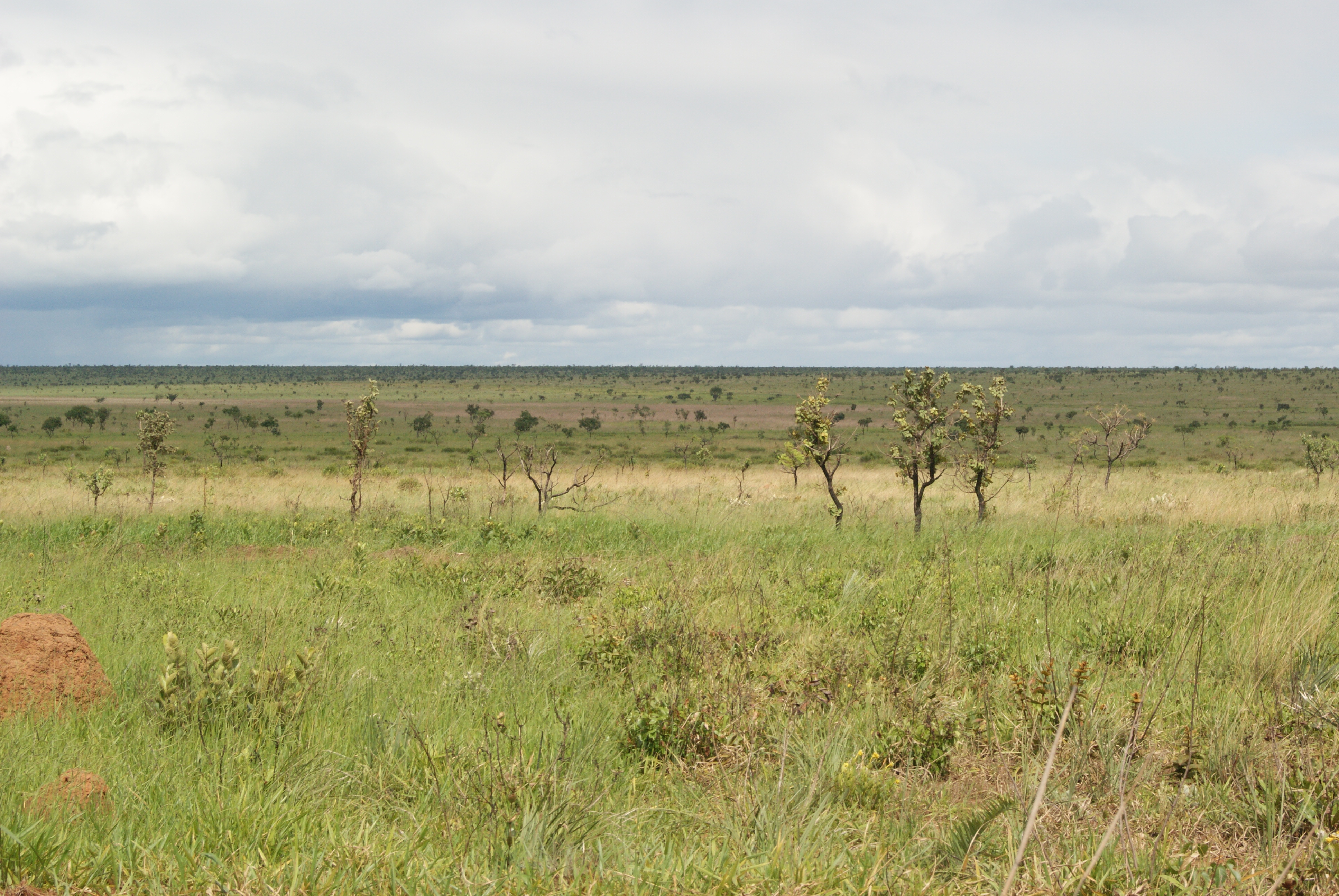
Located in the central Brazilian plateau, the nuclear region of the cerrado biome. The climate is Aw of Koppen (1931), with annual rainfall between 1200 and 2000 mm, concentrated between September and March, and the average annual temperature is 24.6 ° C. In the park dominates the flat relief, with altitudes ranging between 720 and 890 m. The PNE is home to all types of vegetation occurring in the Cerrado, with a predominance of open formations - "campo limpo", "campo sujo" and "campo cerrado" - holding 78.5% of the park area. The PNE is renowned for its wildlife observation easy, especially birds and mammals.
-
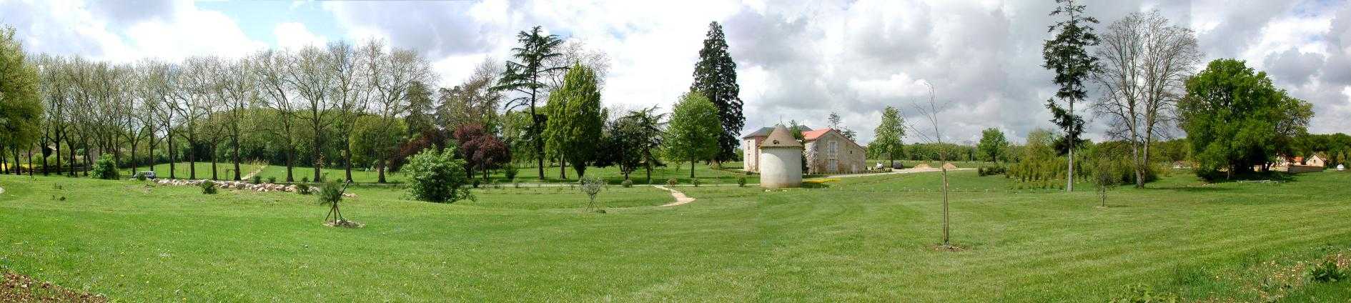
Located 2 km east of the Science Campus of the University of Poitiers, the Hydrogeological Experimental Site (HES) occupies an area of 12 hectares on land belonging to the University. From the geologic viewpoint the SEH occupies the north flank of the “Seuil du Poitou”, a huge Mesozoic carbonate plateau marking the transition between the Aquitaine and Paris sedimentary basins. The studies conducted at the SEH focus mainly on the Dogger Aquifer. The experimental layout now comprises 35 boreholes, including two vertical and two inclined cored holes.
-
Basic meteorologic data from authomatic weather stations (MeteoAutoTDNP_1: GEONICA METEODATA 256 [1992-1999; Currently not in operation], MeteoAutoTDNP_2: METEODATA/HYDRODATA 1256C [2001-]). Values recorded at 10 min intervals and then averaged for daily data (mean or sum).
-
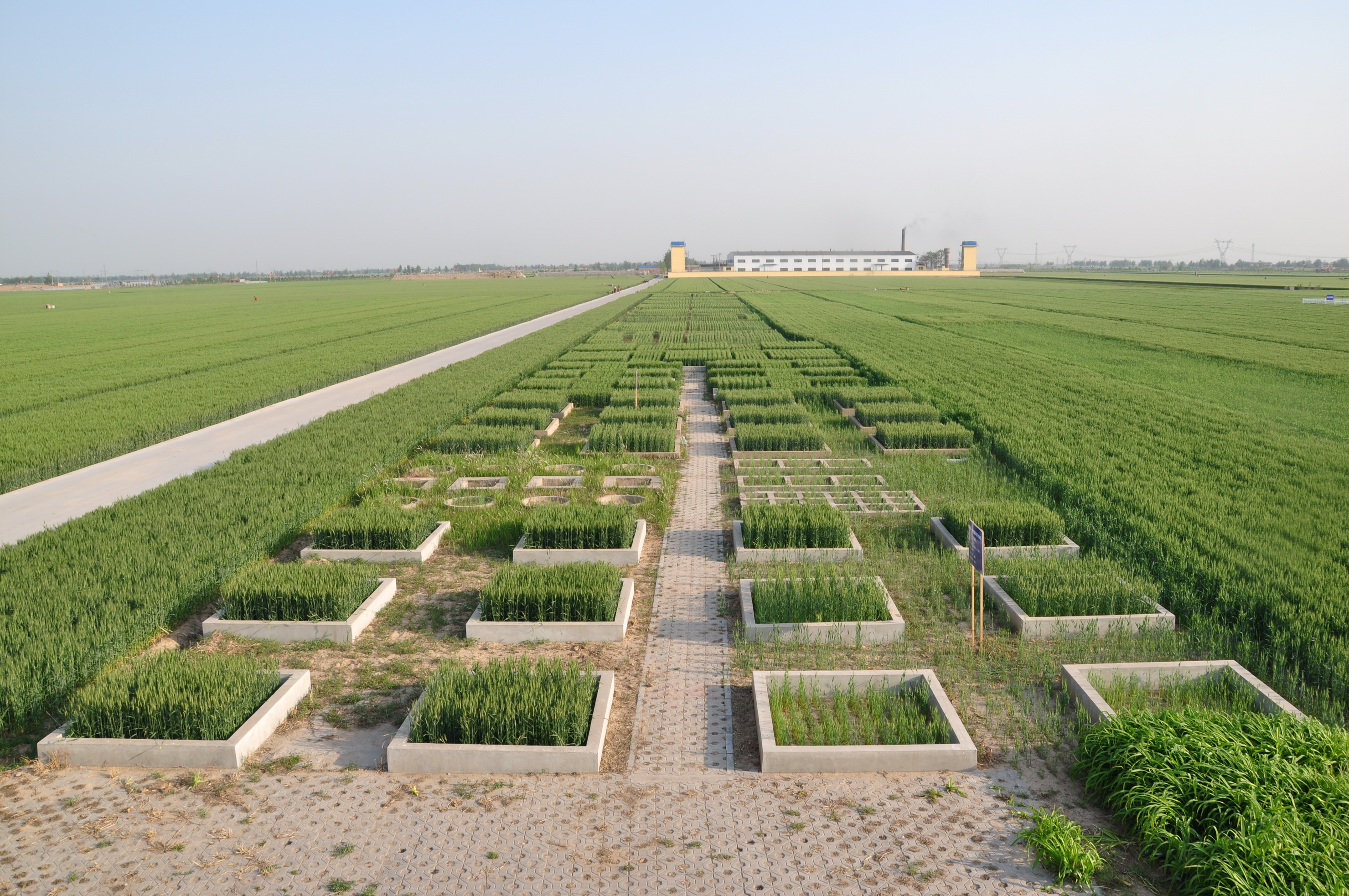
Luancheng station, established in 1981, is one of the field stations of the Chinese Ecosystem Research Network (CERN) and a member of Global Terrestrial Observation System (GTOS). The station is also a demonstration base for modern agricultural technologies in Hebei province. In 2005, the station became one of the stations of the China National Ecosystem Observation and Research Network(CNERN). Luancheng Station is located in Luancheng county of Hebei province (37°53' N, 114°41'E and elevation at 50.1 m), represents the typical high production area in the northern part of the North China Plain. The rapid declining groundwater table has become the main problem that threatens the sustainable agricultural development in this area. The researches conducted at the station focus on the long-term investigations of farmland ecosystem, water and nutrients transfer and regulation mechanisms, modern water-saving technologies, molecular breeding, precision agriculture and regional sustainable agro-ecosystem demonstration models etc.. The station has 28 ha land for field research and provides accommodation for scientists and students to stay. There are laboratories, field research infrastructure and equipments to be used for different experiments.
-
None
-
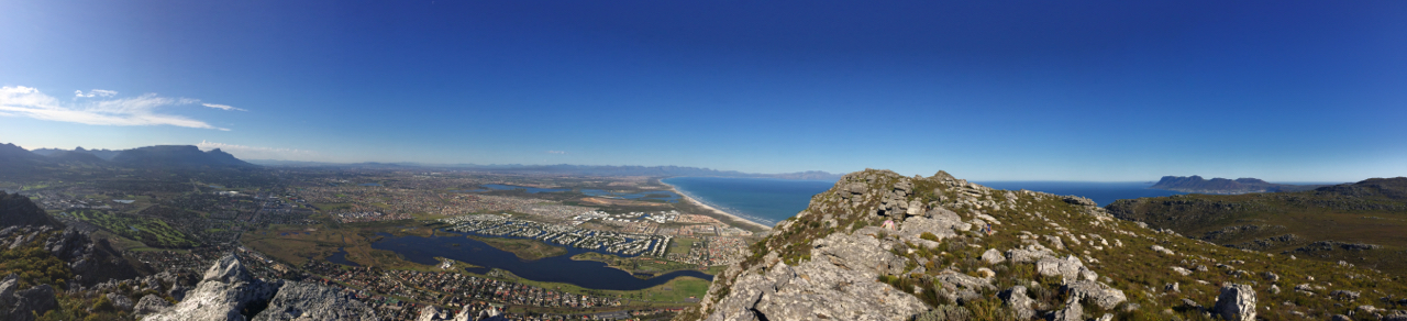
The Table Mountain Chain comprises a network of public and private land within the Cape Peninsula. The land area is approximately 340 km2 and the marine component is approximately 980 km2. The coastline is approximately 130 km. The land area is surrounded by the intensive agriculture and urban development of the City of Cape Town. Because of the proximity of the city the area has a long history of research carried out by universities, research institutions and nature conservation agencies.
-
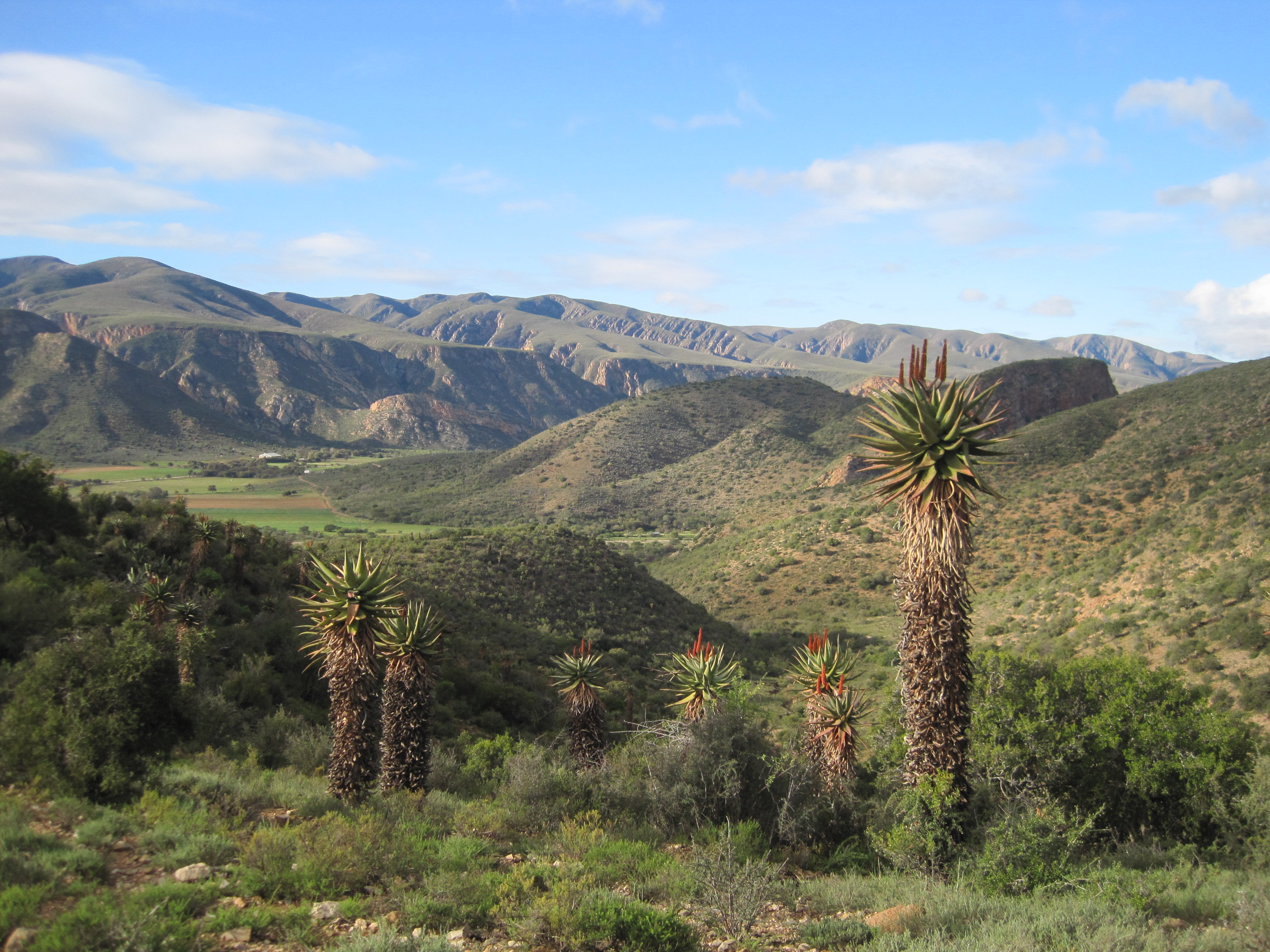
This site covers the catchment area of the Baviaanskloof River and surrounding Baviaanskloof Mega-Reserve area, where ecological, agricultural and social systems are managed collaboratively in order to promote sustainable use of the landscape.
-
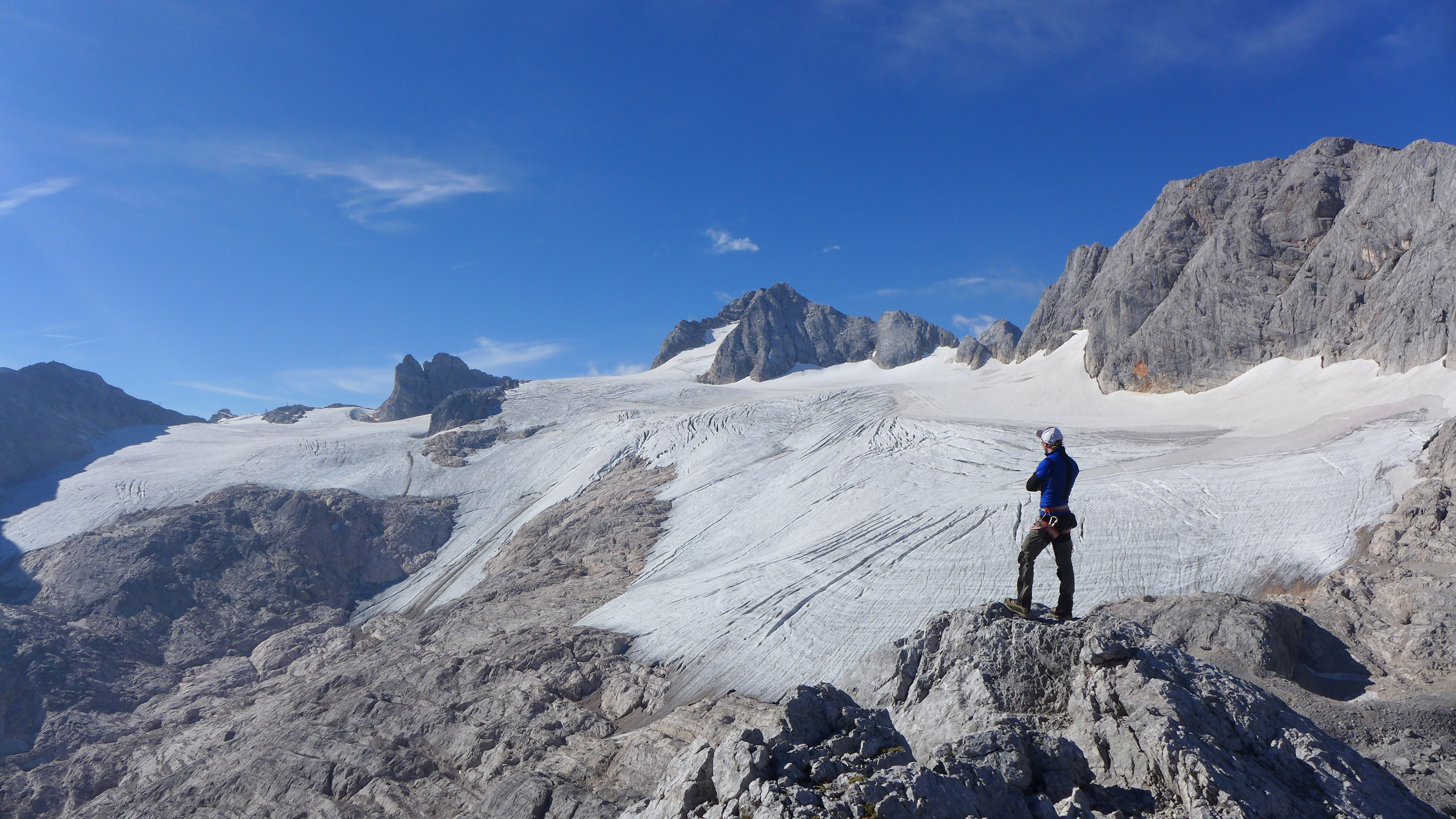
The Hallstätter Glacier is the largest glacier in the northern Limestone Alps. The Hallstätter Glacier is oriented to the northeast and is bordered by Rock walls. The Large plateau above 2550 m.a.s.l. is connected by three short tongues. The largest altitude zone in terms of area is between 2550 m and 2600m. The highest point of the glacier is at 2905 m, the lowest point is on 2240 m. With an area of 2.623 km² (glacier boundary 2020), the glacier lost half of its extent compared to the glacier peak in 1856. In the past 10years, the area has increased by around 13 %.
-
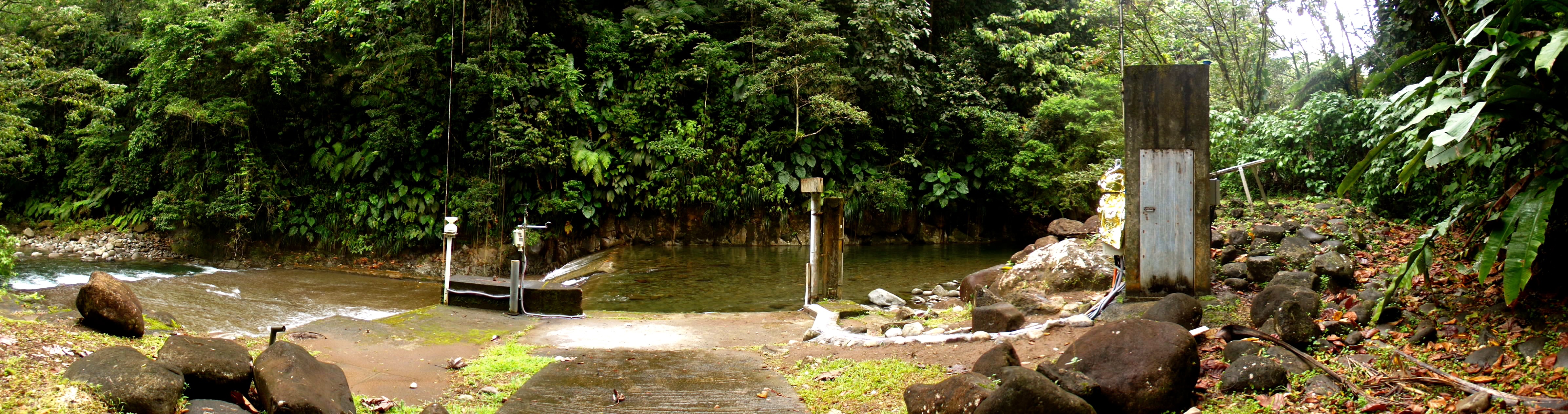
The Capesterre river is located on Basse-Terre Island (Guadeloupe archipelago, lesser Antilles arc). This volcanic island results from the ongoing subduction of the Atlantic plate under the Caribbean plate. Capesterre drains a watershed of 16.4 km2 located on the windward side of the active Soufrière volcano. The Capesterre catchment, mainly composed of lava and pyroclastic flows aged from 600 to 400 ky, is characterized by rather thin soils, typically ranging from 0.5 to 2 meters. Vegetation is dominated by tropical rainforest. The hydrologic regime is torrential: flow rate is characterized by abrupt variations due to tropical rains. Storms and hurricanes are particularly frequent during the rainy season from june to january.