
diffuse radiation intensity
Type of resources
Available actions
Topics
Keywords
Contact for the resource
Provided by
Years
Formats
Representation types
-
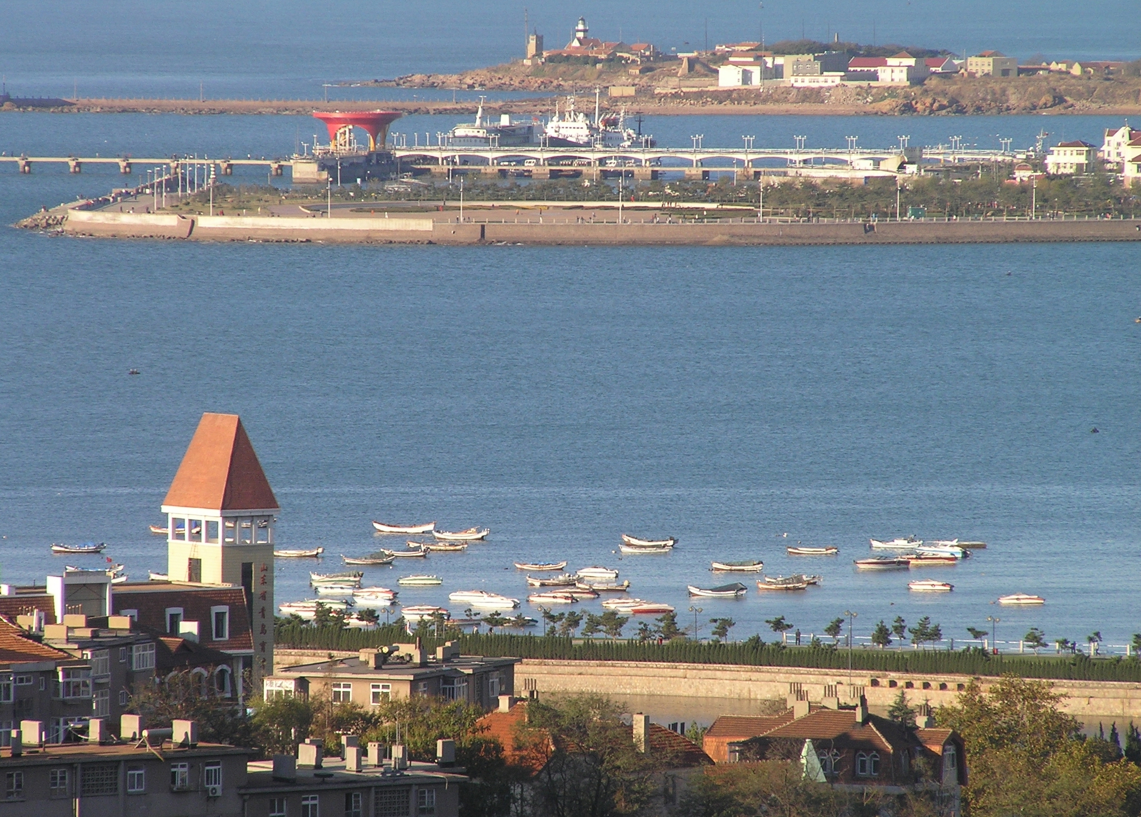
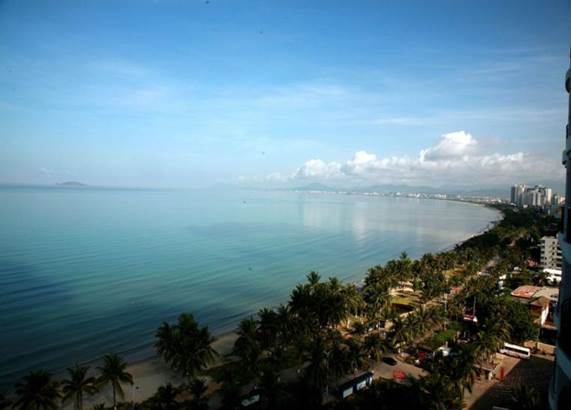
The Jiaozhou Bay, covering an area of 390 km2 between 3538′ and 3618′ N and 12004′ and 12023′ E, surrounded by the Qingdao city. As a semi-enclosed, fan-shaped bay, the narrowest place at the channel connecting with the Yellow Sea, from the Tuan Island to the Xuejia Island, is only 3000 m wide. Its average depth is 6-7 m, with most part of the bayshallower than 5 m, and the tidal zone adds up to 125 km2. The tide of Jiaozhou Bay is regular semidiurnal type. The speed of the flood is greater than that of the ebb, and the duration of the flood is shorter than that of the ebb. There are many peninsulas and islands in the bay, so the circulation inside is complicated. After the residual current analysis, six circulation systems were observed in Jiaozhou Bay. Marine biodiversity and productivity is high in the bay. With the development of Qingao City, the population is increasing quickly around Jiaozhou Bay. Farms, factories, highways, ports, tourism etc. can all affect the environments of the bay. Most of the land-sourced input are from several rivers, such as the Dagu, Haibo, Licun and Nan Jiaolai rivers.
-
It is located in the region of the Grand Causses, south of the Massif Central. The karstic aquifer of Durzon represents a surface of 100 km² which feeds the spring of Durzon. This spring supplies the drinking water of the Aveyron part of Larzac. The observatory has a set of sites dedicated to gravimetric, inclinometric and hydro-geodesic observations, as well as a flow tower for evapotranspiration measurements.
-
The Mullwitzkees is located in the Venediger Group in the core zone of the National Park Hohe Tauern. The upper part of the glacier (outer Mullwitzkees) is oriented to the south.The lower part of the glacier, especially the tongue, is oriented to West-South-West.
-
Obergurgl lies about 1930 m a.s.l., very much at the head of the Ötz-valley (municipality of Sölden) in the central Alps. The research areas of the LTER site Obergurgl are located at the slopes, glacier valleys and glaciers south and south-west of Obergurgl. A variety of logger stations (mostly wheather stations) are installed at different locations at the site, some of them measuring since 1953. Various research project, most of them performed by researchers of the University of Innsbruck, are carried out in this area. Habitat types are alpine grassland, alpine forests, pasture and dwarf shrub heath, glacier forelands and glaciers. The LTER site Obergurgl is managed by the Alpine Research Centre Obergurgl (http://www.uibk.ac.at/afo/), a branch office of the University of Innsbruck (http://www.uibk.ac.at/). The Alpine Research Centre Obergurgl is located at the edge of the village Obergurgl. It is consolidated with the University Centre Obergurgl (http://www.uz-obergurgl.at/), a congress centre and hotel with up to 100 beds. Indoor infrastructure are a lecture hall, a seminar room, a small laboratory and small libraries.
-
The Sany Bay, covering an area of 120 km2 between 109.3333 and 109.5 E and 18.183 and 18.3 N, surrounded by the Sanya city. It is a typical tropical bay in China. Dongmao Island, Ximao Island and Luhuitou, located in the bay mouth, possess mostly coastal coral reefs. The Sanya River, located in the eastern part of the bay, has many kinds of tropical habitats including coral reefs, mangroves, rocky and sandy shores, mudflats, etc. The coral reefs and mangroves have special resource value and ecological benefits and are, therefore very important to the sustainable social and economical development in these tropical coastal areas. Coral reefs and mangrove areas have important relationships to the regulation and optimization of the tropical marine environments.
-
Pianosa Island (Long. 10° 04' 44” E and Lat. 42° 35' 07” N) is the fifth, by extension, of the seven islands of the Tuscan Archipelago National Park with a total area of 10.2 km2 and a coastal perimeter of approximately 20 km. The island is almost completely flat, with some small undulations. The highest elevation is 29 m above sea level (a.s.l.), while the average is about 18 m a.s.l. The climate of Pianosa is influenced by its flat morphology that prevents the condensation of moist air, resulting in a mean annual rainfall considerably lower than on the other islands of the Tuscan Archipelago; furthermore, due to the high permeability of the soils, the rain is quickly drained. On the basis of an historical meteorological dataset (1951-2009), mean air temperature is 15.8 °C and mean annual rainfall is 497 mm, ranging between a minimum of 176 mm (1999) and a maximum of 716.2 mm (1984). A clear seasonal precipitation pattern shows a maximum from October to December followed by a decrease with a minimum value in July. The first historical record of Pianosa island dates back to the Roman age, when the Emperor Ottaviano, in the 6-7 A.C., forced the grandson Agrippa Postumo to live on Pianosa island. Following the decadence of the Roman Empire, during the periods of Barbarians’ invasions, the island was abandoned. The name of Pianosa island newly appeared in some documents of the Repubbliche Marinare of Pisa and Genova (XII and XIII century) that reported the remarkable strategic position of the island. The 27th August 1802, Napoleone Bonaparte established that the islands of Elba, Capraia, Pianosa, Palmaiola and Montecristo were united to the territory of the French Republic. Bonaparte visited Pianosa twice and found it the most interesting of the other islands, appreciating its richness of vegetation and animals. In 1858 Pianosa became an Agriculture Penal Colony, where the prisoners were forced to work in the fields. During the ’70s the jail of Pianosa became a maximum security penitentiary. Only in the ’80s, representatives of the Government and members of the civil society started to propose to close the prison and to return Pianosa to the competent civil authority. In view of this, the number of the prisoners was drastically reduced and, consequently, several agriculture activities progressively stopped. In the 1997 the territory of Pianosa was formally included in the National Park of the Tuscan Archipelago and since than it is a site for natural conservation. In 1998 the penitentiary was completely dismissed
-
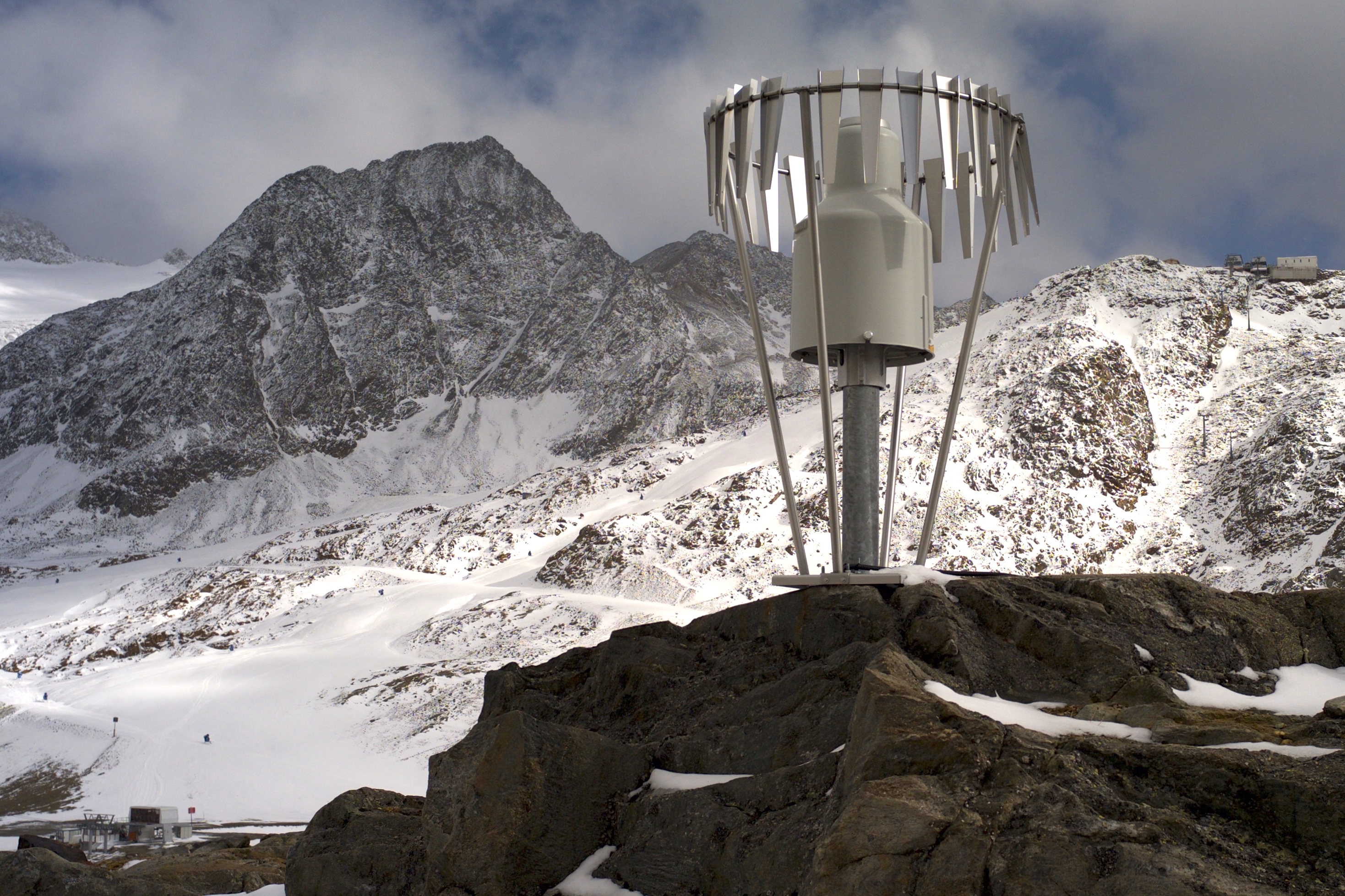
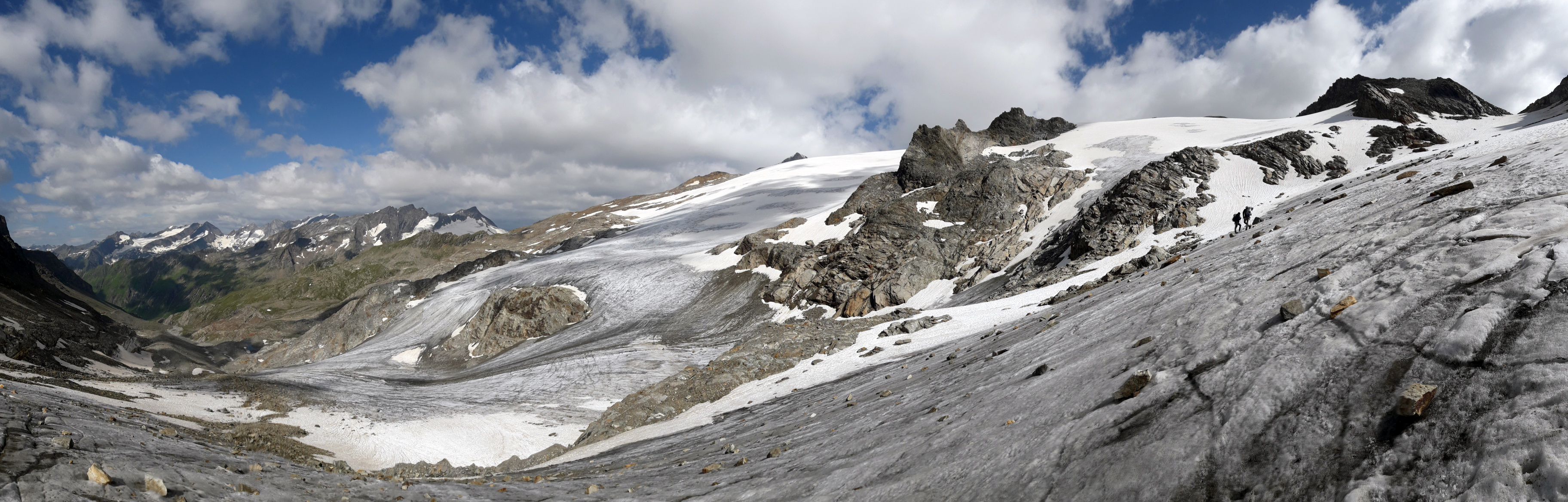
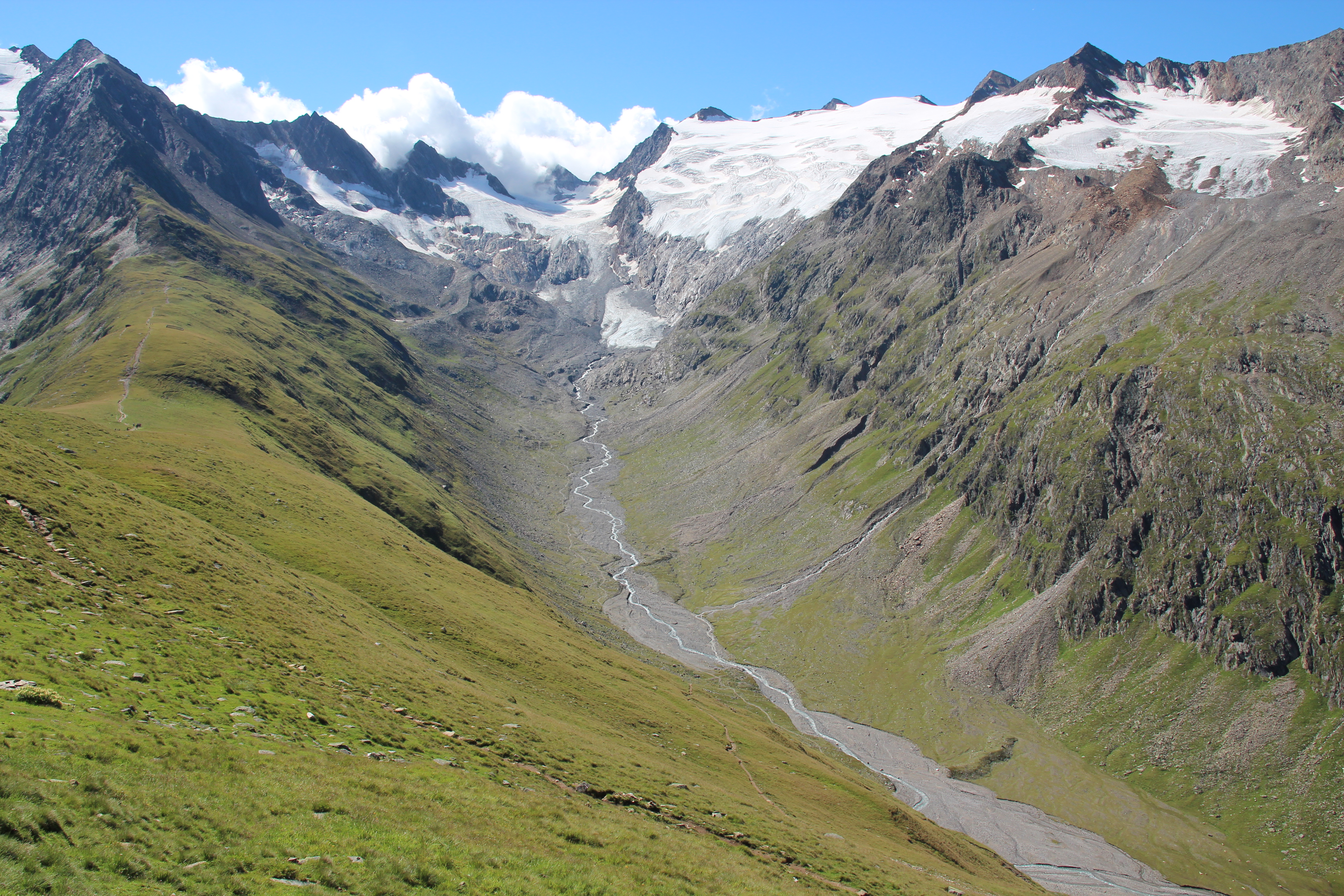
In the Rofental (Ötztal Alps) a consortium of the three institutions, and open to research partners worldwide, concentrates on studying and monitoring cryospheric, atmospheric and hydrological processes and changes with particular attention to the complex topography and climate settings of the Alpine terrain. First documents from glaciers in the Rofental, Ötztal Alps, date back as far as 1601 and regular observations and systematic studies had begun more than 150 years ago. First geodetic maps where generated in the late 19th century, first rain gauges were mounted in 1929 and glacier mass balance time series of Hintereis-, Vernagt- and Kesselwandferner are among the longest uninterrupted world-wide, building a basis for regional hydrological studies, for glacier-climate and ice dynamic research, and for estimating the world wide glacier’s contribution to sea level rise. By 2014, networks of stakes and pits for mass balance monitoring are maintained at Hochjoch-, Hintereis-, Kesselwand- and Vernagtferner by the consortium members. Runoff gauges at Vernagtferner and in Vent (operated by the Hydrological Office of Tyrol) and a network of rain gauges in the Rofental basin are the basis for high mountain hydrological studies. A varying number of automatic weather stations on and in the surroundings of the glaciers are operated by the Rofental consortium. The glaciers in the Rofental are frequently used as a test site for process studies, model development and evaluations and for new remote sensing or ground based methods in glaciological research. A series of airborne LIDAR derived high resolution DTMs of Hintereisferner and its surroundings are available since 2001. They are subject of ongoing evaluations and method comparison studies as well as for monitoring and studying periglacial morphodynamics. The generated data are available from the consortium partners, glaciological key results are annually reported to the World Glacier Monitoring Service (WGMS). A research station on Hintereisferner (with observer status in the Horizon 2020 INTERACT network) and one at Vernagtbach serve as logistic bases for fieldwork. In recent studies, socio-ecological research aspects – e.g. in relation with the use of water for energy production and tourism – comprise the natural scientific investigations.
-
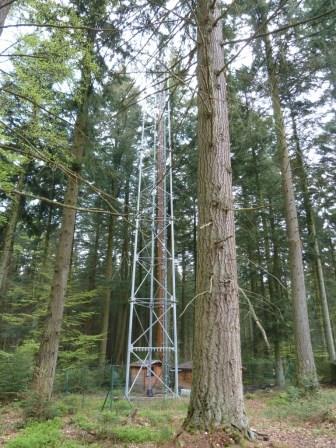
The site is a mixed mature forest composed mainly of Fagus Sylvatica, Pseudotsuga menziesii and Picea abies. The soil (100-150 cm deep) is a silty and stony soil with B structural horizon composed by schist and phyllades. Fluxes of CO2 and water vapour and micrometeorological measurements are performed above the forest by an eddy-covariance system installed on a tower since 1996. During the successive measurement years, several complementary campaigns have been organised : forest inventory, automatic soil respiration measurements, advection, ecosystem water budget, diffusion of CO2 and stable isotopes in soil, volatile organic compounds fluxes, soil carbon content inventory, monthly evolution of nitrogen deposition... Research activities are carried out by the University of Liège (GxABT) and the Université catholique de Louvain (UCL) within the ICOS infrastructure.
-
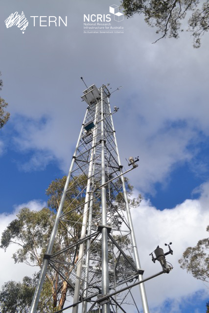
The Victorian Dry Eucalypt SuperSite is a member of the Australian SuperSite Network (SuperSites, http://www.supersites.net.au/), a facility within the Australian Terrestrial Ecosystem Network (TERN, http://www.tern.org.au/) and has two nodes (Whroo and Wombat). The Victorian Dry Eucalypt SuperSite - Whroo site near Shepparton was established in 2011. The vegetation is dominated by two main Eucalypt species: Eucalyptus microcarpa (Grey Box) and Eucalyptus leucoxylon (Yellow Gum). Smaller numbers of Eucalyptus sideroxylon (Ironbark) and Acacia pycnantha (Golden Wattle) are also found on site. The surrounding area includes the Whroo Historical area, and Rushworth State containing remnant native vegetation. Key research objectives include: • What are the elements of structure, composition, functions and processes of the dry eucalypt forests of South Eastern Australia required for the sustainable management of these ecosystems? • What is the carbon sink/source strength of a dry sclerophyll forest and what is their contribution to Australia’s National Carbon Inventory? • What is the magnitude of emission and/or uptake of non-CO2 greenhouse gases, such as nitrous oxide and methane of dry eucalypt forest? • How will climate variability, drought or fire influence the ecosystem processes of dry eucalypt forest? . The site is on the lands of the Ngurai-illam-wurrung Aboriginal people.
-

Tronchaney, Conca di Torgnon, (Torgnon, Aosta), + 388330 + 5075950; Aosta Valley