
dissolved nutrient
Type of resources
Available actions
Topics
Keywords
Contact for the resource
Provided by
Years
Formats
Representation types
-
Nutrient survey (N and P concentrations)
-
Cabras Lagoon is located on the west coast of Sardinia (Italy), in the Gulf of Oristano (39°56’37’’N, 08°28’43’’E), and occupies about 2280 ha, with a mean water depth and maximum of 1.6 and 3 m respectively. The watershed of the site extends over approximately 430 km2. The input of freshwater into the lagoon is scarce and irregular because of the semi-arid Mediterranean climate. Most of the freshwater comes from the small Mare ‘e Foghe River, located in the north. The predominance of agriculture in the region and the release of poorly depurated urban waste account for the high nutrient loads deposited in Cabras Lagoon. The resident population of about 38,000 inhabitants is grouped in 19 urban centres, the largest being Cabras, which is located on the southeast coastal side of the lagoon. During the twentieth century, the lagoon and its watershed underwent several modifications as a consequence of human activities that affected the hydrology and hydraulics of the region. In addition, in the late 1970s, water exchange with the sea was altered by the dredging of a large canal, the Scolmatore (spillway), which connected the lagoon with the adjacent Gulf of Oristano. The canal was constructed to avoid flooding of adjacent land during the heavy rainfall that occurs in winter. In addition, a cement dam was built into the Scolmatore to prevent further increases in the lagoon’s salinity and artificial barriers were constructed to control the fish catch, thereby impeding direct communication between the lagoon and the sea. Now the only link to the sea is via four very narrow creeks that flow into the large canal from the southern part of the lagoon over the barrier. The lagoon has a high economic rating due to ex¬tensive fishery activities, involving about 300 people and those involved in related enterprises. In the site, in addition to the guard houses and warehouses of fishermen, there is also a restaurant, where the products of fishery in the lagoon are offered. In 1998, fish productivity reached 40,000 kg km-2, corresponding to a catch of 850 tonnes but these values fell to around 20,000 kg km-2 and less than 80 tonnes after 1999. In fact, its high trophic status has often exposed the lagoon to important dystrophic crises, which have caused large reductions in its fishing productivity. Scientific monitoring has been carried out since the strong dystrophic crisis that affected Cabras Lagoon during the summer of 1999, killing the whole aquatic biota. A long-term series of data is available and derives from high-frequency measurements and samplings to assess environmental and biological parameters. In particular the data concern the main trophic descriptors (Secchi depth, temperature, pH, conductivity, dissolved oxygen and saturation, alkalinity, NH4-N, NO2-N, NO3-N, total nitrogen, soluble reactive phosphorus, total phosphorus, dissolved silica) and phytoplankton abundances, as chlorophyll a, cell densities and biomass, class and species composition. The activity was interrupted in 2009.
-
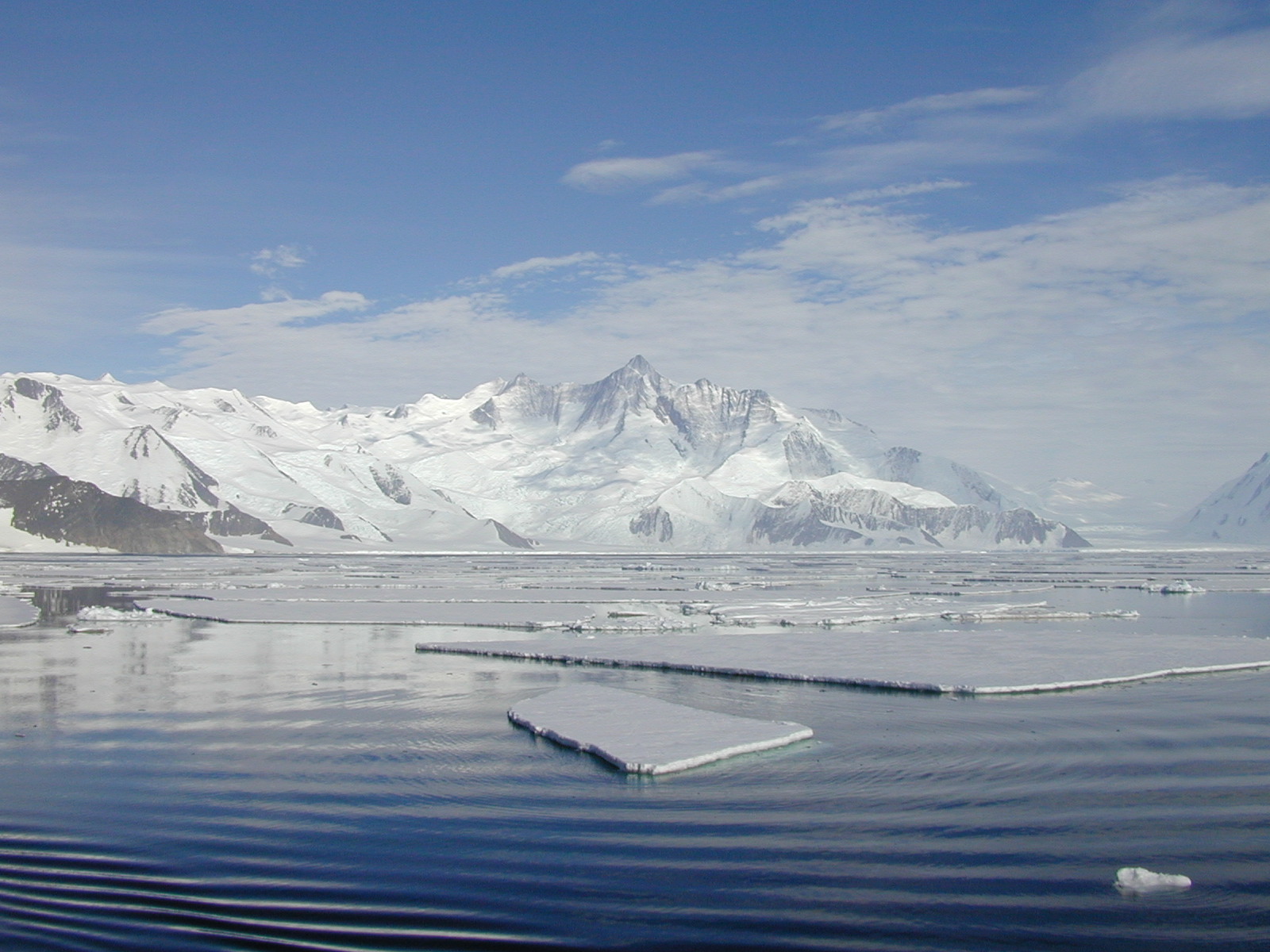
The mooring A is located in an open sea area close to Franklin Island, characterized by both clay bottom sediment and a flat morphology. The station can be considered as representative of the productivity and sedimentary conditions of the southern part of the Ross Sea, one of the areas considered to be affected by greater productivity rate.The study of mooring can be consider part of the activities conduct in the framework of the research project "ABIOCLEAR - Antarctic biogeochemical cycles - climatic and paleoclimatic reconstructions. (Resp. M. Ravaioli)". Such Project is the natural prosecution of previous research activity carried out from 1987. Objectives : Study of the particle fluxes towards the marine bottom sediment, in particular with the aim to obtain quali/quantitative estimate of the biogenica component coming from the primary production. Analysis of the vertical rain rate processes and, therefore, the marine cycle of the main biogenic particles such as Carbon and Silica. Try to obtain mass budgets of these parameters, estimating their cycle in the water column until the burial processes in sediments. From apparent accumulate rate calculated in the bottom sediment we will tried to discriminate the real vertical fluxes (Rain Rate) from the horizontal input from sediment remobilization processes. Acquisition and elaboration of long time series of data. Collection of bottom Sediment samples to estimate the variations of the productivity and the paleoproductivity in the area. Historical time series of Mooring A: Primary productivity data (every three years), fitoplancton, New and regenerated productivity, Seasonal, annual and interannual fluxes measure, monthly Particles samples, current velocity, water salinity, temperature and torbidity, Water-sediment interface measure. Biogeochemical parameters. Radiometrical Data, Mineralogical and grain size characterization. Nutrient, metals. Biostratigraphy interpretations. Lidar data are also available from 1997.
-
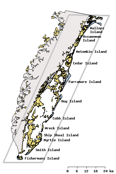
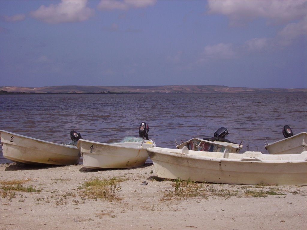
Research activities of the VCR/LTER focus on the mosaic of transitions and steady-state systems that comprise the barrier-island/lagoon/mainland landscape of the Eastern Shore of Virginia. Primary study sites are located on Hog Island, Parramore Island and mainland marshes near Nassawadox VA. The VCR/LTER uses field laboratory and housing facilities at the Anheuser-Busch Coastal Research Center in Oyster, VA.
-
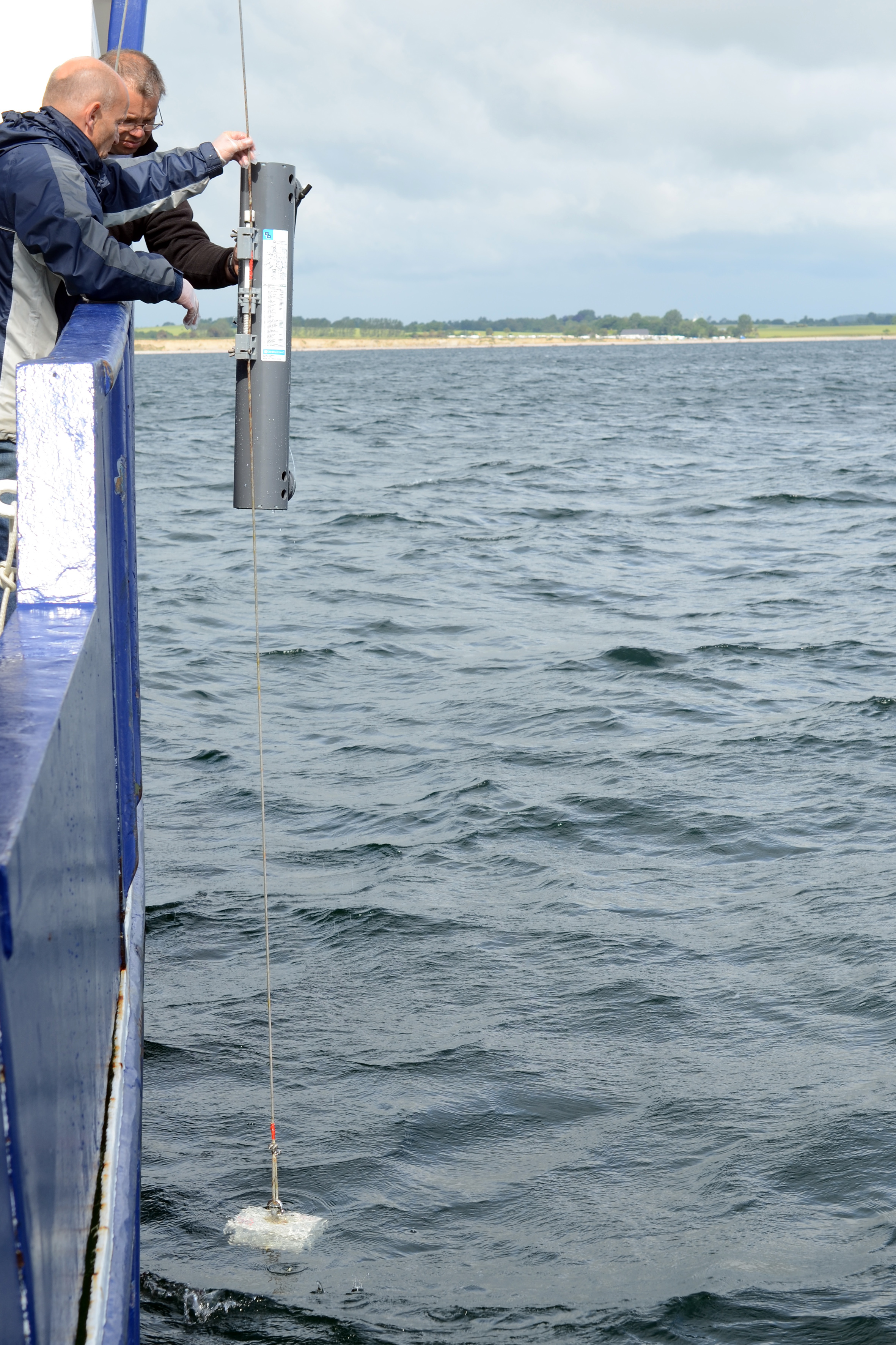
The site of the Boknis Eck Time Series (BE) is located at the entrance of the Eckernförde Bay (54°31.2' N, 10°02.5' E) in the southwestern Baltic Sea. It has a water depth of 28 m with muddy sediments. Riverine inputs into the Eckernförde Bay are negligible and thus the overall hydrographic setting at BE is dominated by the regular inflow of North Sea water through the Kattegat and the Great Belt. Seasonal stratification occurs usually from mid-March until mid-September and causes pronounced hypoxia which sporadically become anoxic.
-
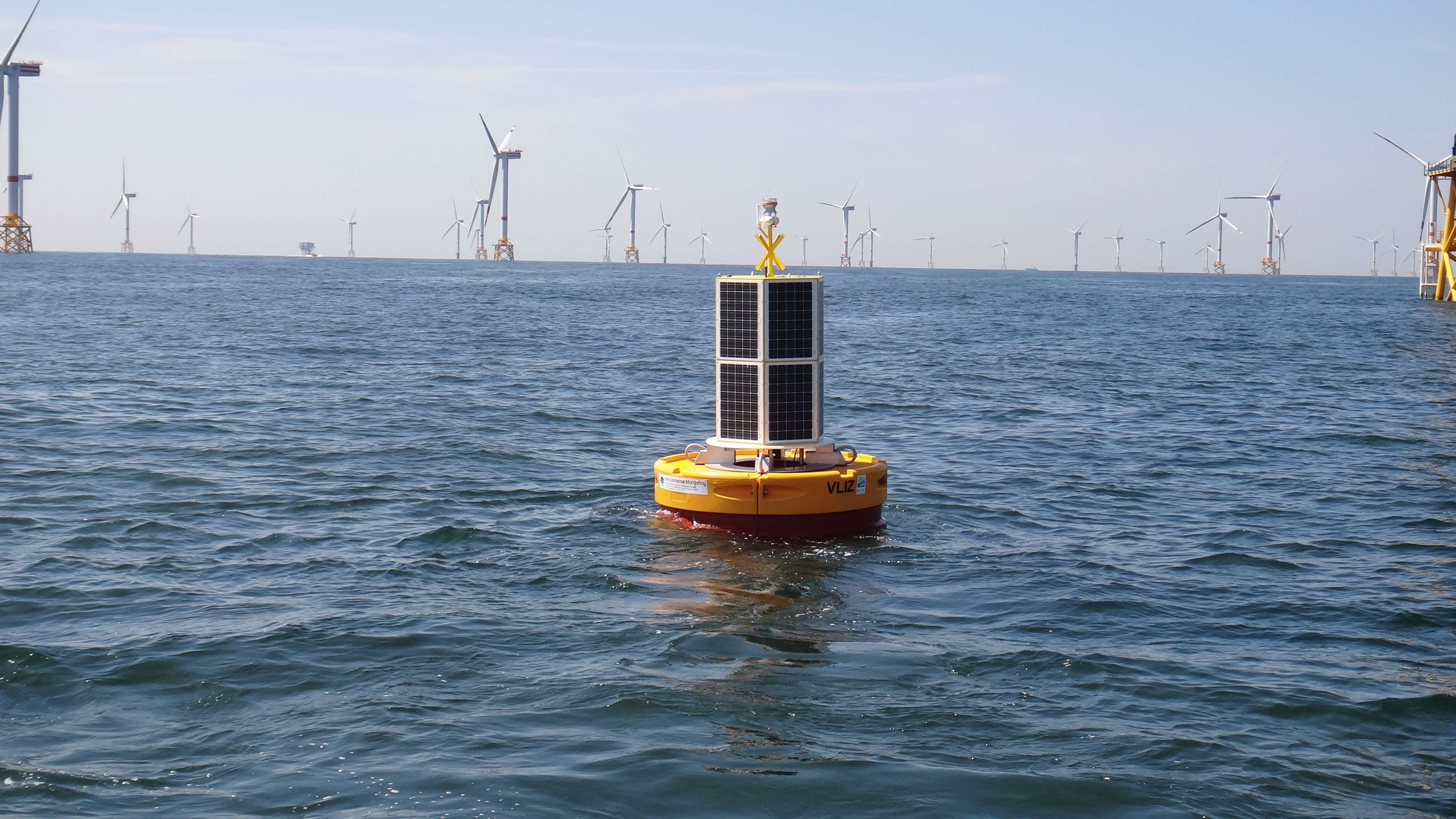
The site consists of a marine databuoy equipped with a suite of sensors that monitor water quality parameters and acoustic receivers for the detection of Porpoises and tagged fish. The buoy is moored near an offshore windmill farm, approx. 30km off the coast on the Belgian Continental Shelf.
-
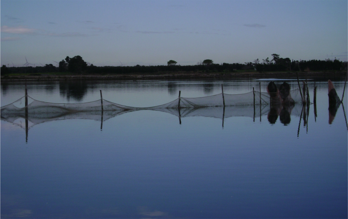
The Alimini Grande Lake has an elongate shape that develops almost parallel to the Adriatic coastline and overall its extension is 1,37 sqkm. It is linked to the Alimini Piccolo by a canal called Lu Strittu, 1300 metres long and from 10 up to 30 meters wide. The chemical-physical characteristics of the waters such as temperature, salinity and dissolved oxygen concentration have been studied for long time. The average salinity is 26.8 with a minimum of 2.7 in winter and a maximum of 41 in summer. Regarding the temperature, it shows the typical seasonal trend with the least minimum temperature recorded between December and January. The freshwater inflow from Traugnano, Strittu e Zuddeo canals descharges a load of nutrients collected from the catchment area surrounding Alimini Grande. Nevertheless on the basis of the measured nitrogen and phosphorus concentrations the lagoon can be considered mesotrophic, due to the water turnover and above all to the assimilation of nutrients by phytoplankton and bacteria. The lagoon is a nutrient trap, the rates of nitrogen and phosphorus salts in entrance are bigger than those exiting in the sea. For this reason, the lagoon has a relevant ecological function, confining and transferring the nutrients through the food webs within the area and acting as an ecological filter for the marine ecosystems. The Alimini Grande catchment basin has a surface of approximately 71 sqkm and almost 94% of the catchment basin (66 sqkm) is cultivated above all with olives and other sowing fields, requiring more than 300 tonnes per year of fertilizers (nitrogen and phosphorus total) and 3 tonnes of pesticide. The agricultural areas and the artificial surfaces as urban and industrial centers could have a potentially adverse impact on the lagoon because of the run-off waters inflowing through the hydrographic basin that provide high nutrient quantity, organic material and other pollutants. The lagoon is included in the Site of Community Importance (SCI) “Laghi Alimini” (CODE IT9150011) of the “Natura 2000 network”, according to the Habitat Directive 92/43/CEE. Some of the habitats of the lagoon are typical of the dune ecosystem and are of high naturalistic value, as the coastal dunes with junipers considered of priority interest, being present in less than 5% of the EU territory. The Alimini Lake biodiversity is so extraordinary that includes more than half of the vegetable species in Salento. The area is internationally known as located on the avifauna migratory route towards the northern Adriatic coast. In the last years the quantity and the diversity of wintering and migratory aquatic birds, such as the Mallard, Pochard, Coot and other Anatidae have been increasing.Currently the Alimini Lakes are subjects of study by the Department of Biological and Environmental Sciences and Technologies of the University of Salento aiming at the improvement of basic and applied ecological research activities on transitional waters.
-
The Moorea Coral Reef LTER site encompasses the coral reef complex that surrounds the island of Moorea, French Polynesia (17°30'S, 149°50'W). Moorea is a small, triangular volcanic island 20 km west of Tahiti in the Society Islands of French Polynesia.
-
UK ECN site. The River Esk rises on the uplands of the North York Moors National Park and is the only major river in the county of Yorkshire that drains directly into the North Sea. The catchment is sparsely populated without the pressures of industrialisation and urbanisation affecting other rivers in the Region. Open moorland characterises much of the catchment and is an important habitat for a wide variety of wildlife. Within the Esk valley there are six Sites of Special Scientific Interest (SSSIs), two of which extend south and cross the boundary of the Derwent catchment. The source of the Esk is upstream of Westerdale, where a series of small streams (becks) known as the Esklets merge to form the River Esk. Many of these moorland streams are affected by natural "flushes" of acidity, as well as iron run-off from natural ironstone strata and old mineral workings, making some of these becks an ochreous-orange colour after periods of rainfall. The combination of the two factors restrict the invertebrate fauna in these head-streams. The majority of the River Esk downstream of the Esklets has very good water quality, with the diverse invertebrate fauna dominated by mayflies, stoneflies, caddisflies and other pollution sensitive groups. This good water quality is also very important in sustaining other species such as salmon, sea trout, dippers and otters. The ECN site is at Briggswath (NGR: NZ 868 081), approximately 2km upstream of the tidal limit. At this point the river is approximately 15m wide, and in normal summer flows the depths vary between 20cm and 30cm.
-
UK ECN site. The River Stinchar is situated in South Ayrshire. It rises close to Loch Doon and flows for 46km before entering the Firth of Clyde at Ballantrae. It has a catchment area of 340km2 and its average flow is 11.2 cumecs. The catchment is largely rural with only a few small and scattered communities. Farming is mostly dairy cattle and sheep rearing, and there have been some pollution problems associated with the latter in particular through spillages of sheep dip chemicals. The upper part of the catchment is extensively forested with conifers for commercial use. The granitic geology and the maturity of the trees have resulted in low pH values in the uppermost routine sampling point. Part of the flow of the upper reaches of the river is diverted by an aqueduct to feed water into the Loch Braden water supply reservoir. The ECN site is situated in the lowest reach of the river where the acidity has been buffered by the base cations in the lower part of the catchment.