
dissolved organic carbon in water
Type of resources
Available actions
Topics
Keywords
Contact for the resource
Provided by
Years
Formats
Representation types
-
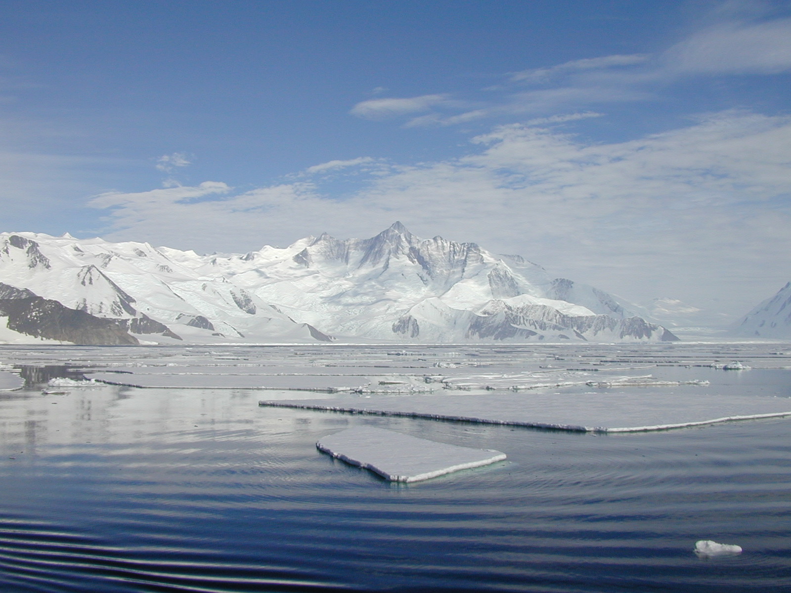
The mooring A is located in an open sea area close to Franklin Island, characterized by both clay bottom sediment and a flat morphology. The station can be considered as representative of the productivity and sedimentary conditions of the southern part of the Ross Sea, one of the areas considered to be affected by greater productivity rate.The study of mooring can be consider part of the activities conduct in the framework of the research project "ABIOCLEAR - Antarctic biogeochemical cycles - climatic and paleoclimatic reconstructions. (Resp. M. Ravaioli)". Such Project is the natural prosecution of previous research activity carried out from 1987. Objectives : Study of the particle fluxes towards the marine bottom sediment, in particular with the aim to obtain quali/quantitative estimate of the biogenica component coming from the primary production. Analysis of the vertical rain rate processes and, therefore, the marine cycle of the main biogenic particles such as Carbon and Silica. Try to obtain mass budgets of these parameters, estimating their cycle in the water column until the burial processes in sediments. From apparent accumulate rate calculated in the bottom sediment we will tried to discriminate the real vertical fluxes (Rain Rate) from the horizontal input from sediment remobilization processes. Acquisition and elaboration of long time series of data. Collection of bottom Sediment samples to estimate the variations of the productivity and the paleoproductivity in the area. Historical time series of Mooring A: Primary productivity data (every three years), fitoplancton, New and regenerated productivity, Seasonal, annual and interannual fluxes measure, monthly Particles samples, current velocity, water salinity, temperature and torbidity, Water-sediment interface measure. Biogeochemical parameters. Radiometrical Data, Mineralogical and grain size characterization. Nutrient, metals. Biostratigraphy interpretations. Lidar data are also available from 1997.
-
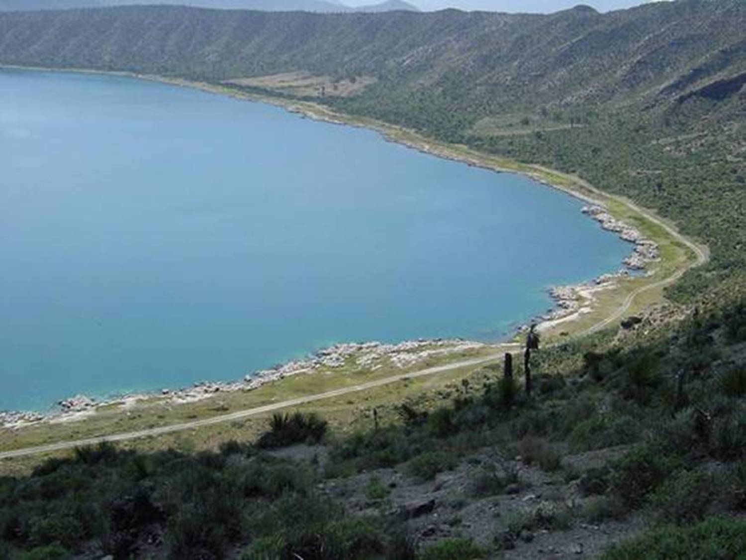
Lago Alchichica se localiza a una elevación de 2300 msnm con una profundidad 62 m y es de agua salobre.Habitan organismos endémicos y se encuentran rocas calizas de particular interés por los microorganismos que viven en ellas. Se encuentra en la Cuenca Oriental de Puebla.
-
Runoff and runoff chemistry at LTER Zöbelboden, Austria
-
HYBAM observatory runs a network of 17 stations for hydrological, sediment and geochemistry sampling in the Amazon basin. The infrastructure is shared between the partners in each country including France, Brazil, Peru, Bolivia, Colombia and Ecuador. ADCPs are used for river water flow measurements. Samples are processed in different laboratories at Manaus and Brasilia University (Brazil), Lima University (Peru) and Toulouse University (GET laboratory in France). For comparisons with other large tropical rivers, one stations is maintained along the Orinoco River (Venezuela) and Congo River (Congo) HYBAM data are used in a large variety of programs in relation to hydrology, geomorphology, geochemistry, climatology, climate change, carbon cycle, remote sensing and isotopic tracers. The data produced by the HYBAM observatory are made available online on its website (www.ore-hybam.org) to provide to the research community long term assessments on the hydrology of world largest basin.
-
The site of the Boknis Eck Time Series (BE) is located at the entrance of the Eckernförde Bay (54°31.2' N, 10°02.5' E) in the southwestern Baltic Sea. It has a water depth of 28 m with muddy sediments. Riverine inputs into the Eckernförde Bay are negligible and thus the overall hydrographic setting at BE is dominated by the regular inflow of North Sea water through the Kattegat and the Great Belt. Seasonal stratification occurs usually from mid-March until mid-September and causes pronounced hypoxia which sporadically become anoxic.
-
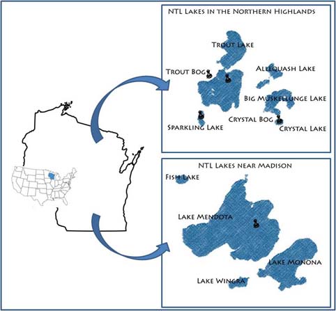
Our primary study sites include a set of seven northern Wisconsin and four southern Wisconsin lakes and their surrounding landscapes. The project, which started in 1981, is administered by the Center for Limnology at the University of Wisconsin-Madison.
-
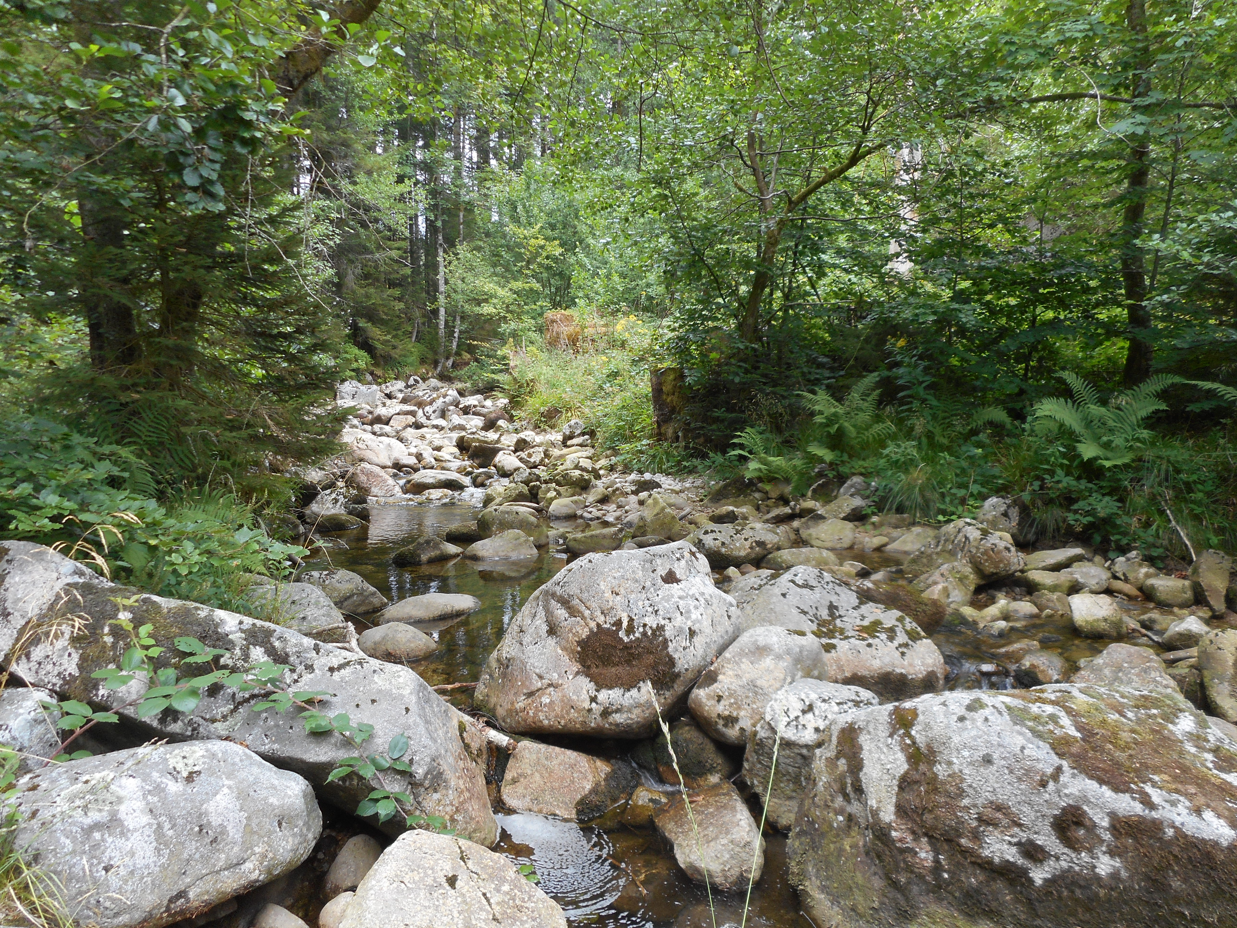
The observatory consists of 16 headstreams (15 in the Moselle River watershed, 1 in the Rhône River watershed), draining forest (mixed coniferous, beech) watersheds on sandstone and granites at very different altitudes.
-
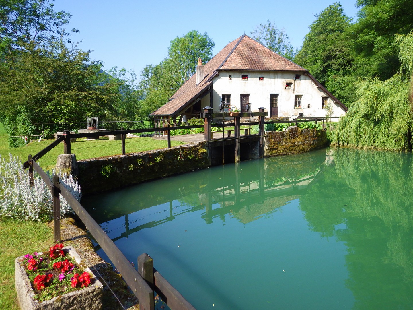
The Jurassic Karst scheme in place since 2009 aims to characterise the long-term evolution of the karst aquifer system of the Jura mountains. The specific topographical context of the Jura mountains allows the study of these aquifers at increasing altitudes along a climatic gradient. The plant cover and soil types vary along this gradient, thereby modulating the biogeochemical functioning of the infiltration zone of the karst hydrosystems. Four karst springs are monitored at sites of increasing altitude: Fourbanne site (Doubs valley, near Baume-les-Dames): altitude 330 m, catchment surface 30 km2; Lods site (upper Loue valley): altitude 380 m, approx. catchment surface 35 km2; Fertans (Amancy plateau): altitude 530 m, approx. catchment surface 1 km2; Mouthe (source of Doubs river): altitude 950 m, approx. catchment surface 50 km2. A number of physico-chemical parameters are monitored continuously on all sites, and supplemented weekly by automatic sampling at Fourbanne, Lods and Fertans. Contact : Marc Steinmann; Chrono-Environment Laboratory – University of Franche-Comté
-
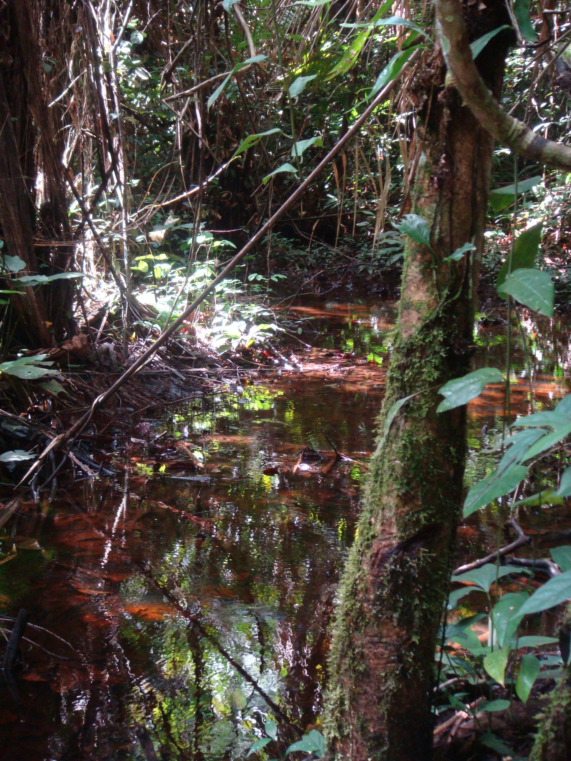
National Network Name : rbv_czo Nested watersheds in humid tropical forest of Cameroon from the Mengong experimental watershed (0.6 km2) to the Nyong River at Olama (18500 km2) Granitoid bedrock secondary forest low anthropogenic pressure Monitoring initiated in 1994 for some parameters more details at : https://mtropics.obs-mip.fr/
-
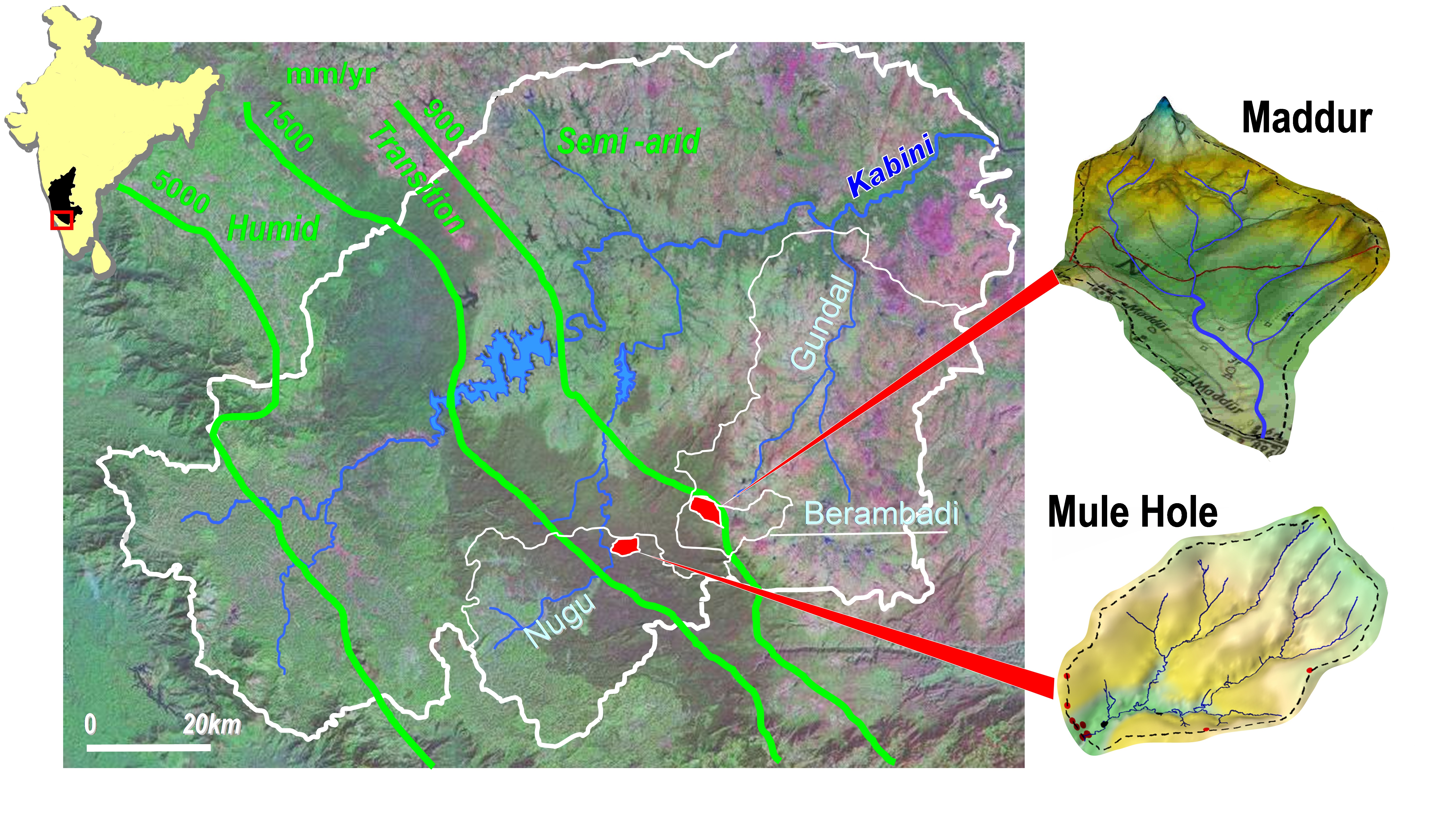
Paired experimental watersheds in sub-humid tropical climate, plus nested watersheds, located in South India in the Kabini watershed. The experimental watersheds are: (1) Mule Hole (semi-deciduous dry forest), monitored since 2003, 4.3 km2; (2) Maddur (cultivated), monitored since 2005, 7.1 km2; (3) Berambadi (higher order of/including Maddur watershed), monitored since 2010, 80km2; for evaluating the influence of agriculture on water and biogeochemical cycle in sub-humid tropics, and the effect of the monsoon variability on these cycles