
dissolved organic nitrogen in soil
Type of resources
Available actions
Topics
Keywords
Contact for the resource
Provided by
Years
Formats
Representation types
-

Hydrometeorological and biogeochemical observations within 5 embedded catchments (from 0.2 to 14.5 km2). Alpine Mediterranean climate with heavy rainfall and flash floods in automn. The geology is mainly granite. The land use is mainly grassland and forest. More information at http://www.ohmcv.fr
-
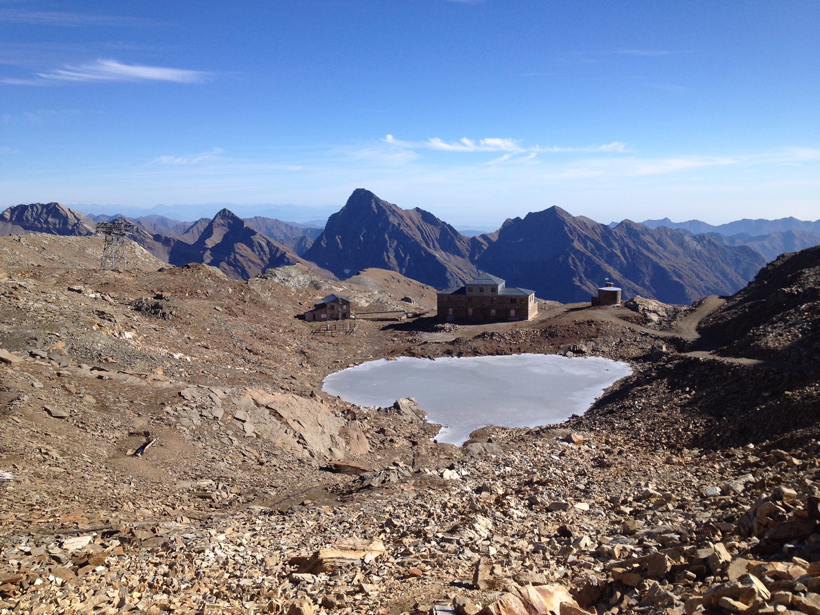
The "Istituto Scientifico Angelo Mosso" research site is located on the watershed between Piedmont and Valle d'Aosta (NW-Italy), in the Municipality of Alagna Valsesia (Monte Rosa massif). The Scientific Laboratories of the "Angelo Mosso Institute" at Col d’Olen (2901 m a.s.l.), the heart of this research site, were built between 1905 and 1907, when it became clear that the Capanna Regina Margherita on Monte Rosa (4554 m a.s.l.), as a high-elevation research centre, had become insufficient to the increasing number of requests for use by the international scientific community. From here the idea promoted by Angelo Mosso (1846-1910), professor of human physiology at the University of Turin, to add an additional structure to the Observatory of the Capanna Regina Margherita for make larger laboratories available to researchers and allow study stays at high elevation. This project soon became a reality thanks to the intervention of Queen Regina Margherita, Ministries of Education and Agriculture, the Italian Alpine Club and various personalities of the time. The research conducted at the Institute did not concern only human physiology, but also other disciplines, including alpine meteorology and glaciology, thanks also to the presence of the Meteorological Observatory that flanked the Institute, directed in the years 1925-40 by Umberto Monterin. It is now home to an automatic snow and weather station, managed by the Alpine Troops-Meteomont service. In addition to the University of Turin, the research groups that operate at the site and contribute to data collection and implementation are currently CNR-IRSA, Alpine Troops Command-Service Meteomont, Monterosa 2000 SpA and Monterosa SpA (Monterosa Ski), Protected areas of Valsesia, ARPA Piemonte, ARPA Valle d'Aosta and Sesia Val Grande Geopark. In addition to the valuable historical series of climate data, a series of research activities are devoted to the study of snow-soil-vegetation interactions, with particular reference to carbon dynamics e soil nitrogen (Magnani et al. 2017a,b; Freppaz et al. 2019). In addition, investigations are performed focusing on the chemical characteristics of high-elevation surface waters, fed by different cryospheric features such as rock glaciers, glaciers, and permafrost (Colombo et al. 2018a,b; 2019a,b; 2020; Vione et al., 2021). New research lines, aimed at investigating the most recent environmental challenges, have been added to the previous ones. For instance, investigations on sources and routes of atmospheric carbon and nitrogen species are ongoing. References: Colombo N. et al. (2018a), https://doi.org/10.1002/esp.4257. Colombo N. et al. (2018b), https://doi.org/10.1016/j.scitotenv.2018.05.098. Colombo N. et al. (2019a), https://doi.org/10.1016/j.scitotenv.2019.06.233. Colombo N. et al. (2019b), https://doi.org/10.1007/s00027-019-0670-z. Colombo N. et al. (2020), https://doi.org/10.1016/j.catena.2020.104700. Freppaz M. et al. (2019), https://doi.org/10.3897/natureconservation.34.30737. Magnani A. et al. (2017a), https://doi.org/10.1657/AAAR0016-037. Magnani A. et al. (2017b), https://doi.org/10.1016/j.catena.2017.03.007. Vione D. et al. (2021), https://doi.org/10.1016/j.scitotenv.2020.143464.
-
Soil data of LTER Zöbelboden, Austria. Soil inventory is carried out since 1992 on regular positions (approx 65) in the catchment measuring soil chemistry. Soil water chemistry is measured in forest plots (2-3) using lysimeter sampling and analyses on a bi-weekly to monthly basis. Soil hydraulic characterizations exist for the major soil types in the catchment. Soil CO2 and N2O respiration data is available for some years
-
Waroneu is a 83 ha forested catchment located in the east of Belgium (« Hertogenwald »: Duke's forest) within the municipality of Baelen. In 2011, it was covered with 38% conifers (mainly Picea abies), 45% deciduous trees (Fagus sylvatica, Quercus robur, Betula pendula), and 17% open space. Biogeochemistry (nutrient and organic carbon in throughfall, rainfall, soil solution and outlet) has been studied since 1991. The catchment was limed in 1992 with 3T/ha dolomite and 200 kg/ha potassium sulfate. Since 2013, biogeochemistry and soil microbial parameters (microbial biomass, N mineralization, basal respiration) are studied in 6 intensive plots, reflecting major combinations of vegetation and upper soil caracteristics within the catchment.
-
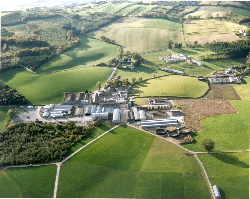
UK ECN site. A lowland grassland site situated at the Agri-Food and Biosciences Institute, Co. Down, Northern Ireland and representative of grassland in much of the north-western United Kingdom. There are several long-term field experiments ongoing on the site. A large part of the site is estate woodland (Hillsborough Forest) consisting of mature mixed woodland and conifer plantation. Many of the vegetation plots are located within this forested area, as are sections of the butterfly, carabid beetle, spider and bird transects. The Hillsborough premises had formerly been the home of Marquis of Downshire and then during the 1st world war had been used for cropping by local farmers. When the war ended agric commodities prices collapsed and large portions of the farm became derelict with rough grazing let out by public auction on a conacre basis from 1922-1926. The research station at Hillsborough was originally established in 1926 and incorporated by the Agricultural Research Station Act N.I. 1927. By 1931 263 acres was actively farmed.In 2006 the Agricultural Research Institute was amalgamated to form what is now called AGRI Food and Biosciences Institute.
-
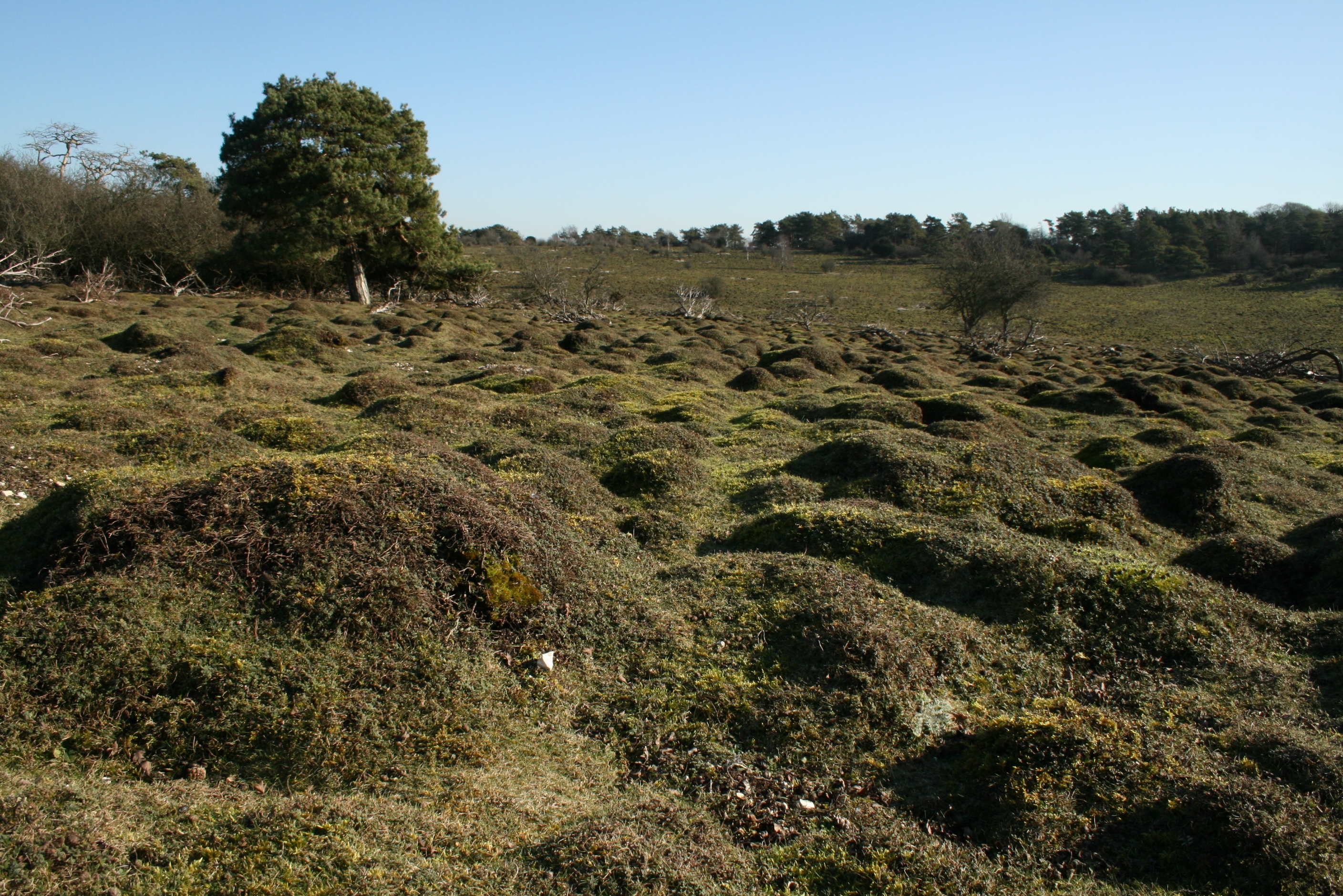
UK ECN site. Dstl Porton Down is located in Southern England on the Wiltshire/Hampshire border. It is owned by Defence Science and Technology Laboratory (Dstl) and is used to deliver high-impact science and technology (S&T) for the UK's defence, security and prosperity. It has been closed to the public for over 100 years, resulting in it missing out on the agricultural revolution which affected the rest of the country. This is why it constitutes the largest uninterrupted tract of semi-natural chalk grassland in Britain. Over 1500 hectares is designated as a Site of Special Scientific Interest (SSSI), a Special Area of Conservation (SAC) and a Special Protection Area (SPA). The ECN monitoring takes place at the heart of the site on the chalk downland and takes in some of the sites special features. The ECN protocols that are undertaken on the site include Atmospheric chemistry, Precipitation chemistry and Weather data. Ecological data includes Rabbits, Birds, Butterflies, Moths, Ground Predators and Spiders.
-
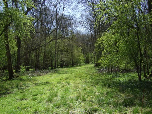
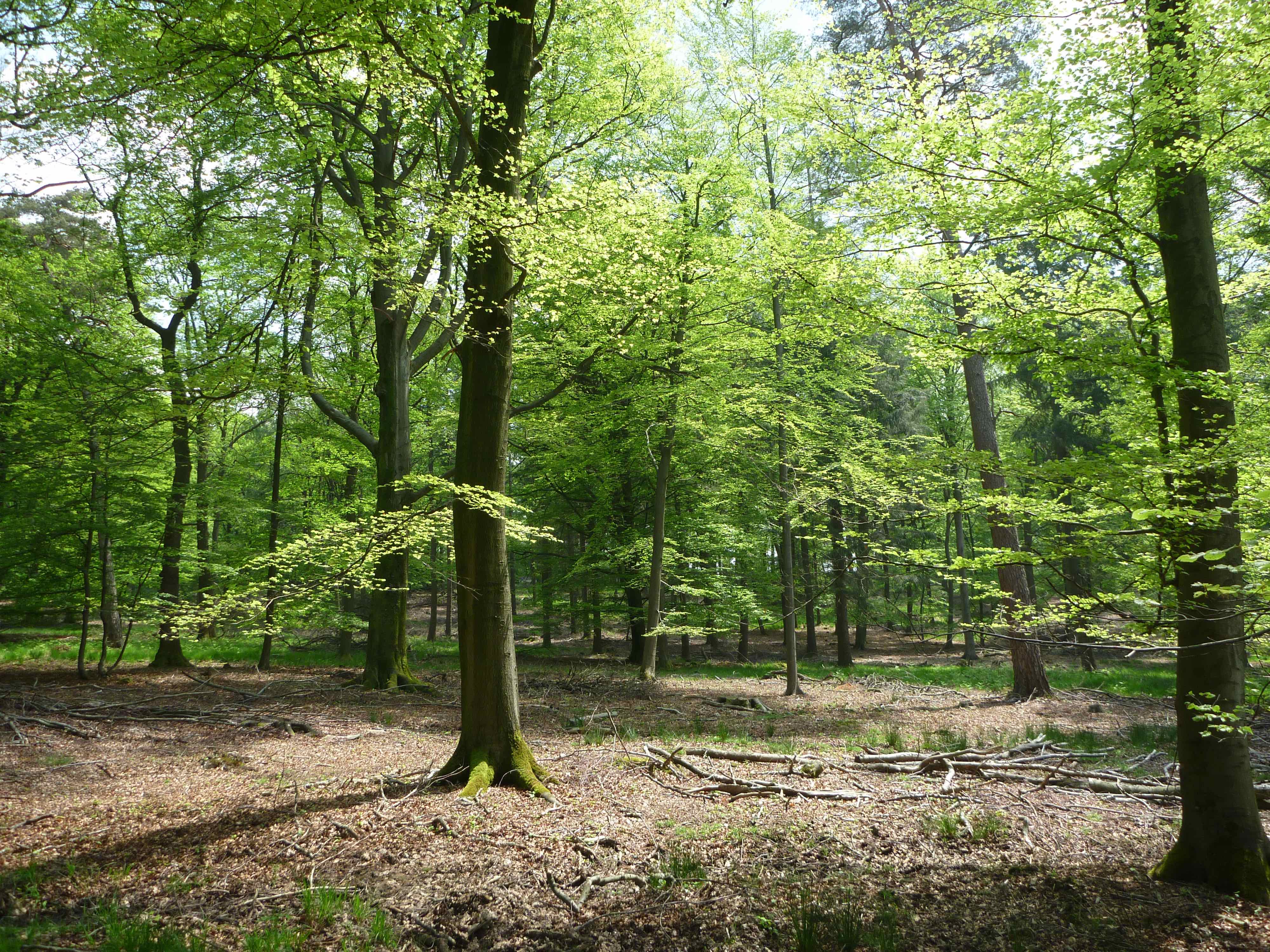
Wytham is 5 km north west of Oxford and consists of mixed woodland, mainly deciduous, and organic mixed farmland. Roughly a third of the wooded area is ancient woodland which, to our knowledge, has never been cleared and there has been continuity of tree cover since the prehistoric 'wild wood'. It has however had a long history of management, which for many hundreds of years took the form of coppicing. Within the woodland there are patches of semi-natural grassland, of both ancient and recent origin, and scrub.
-
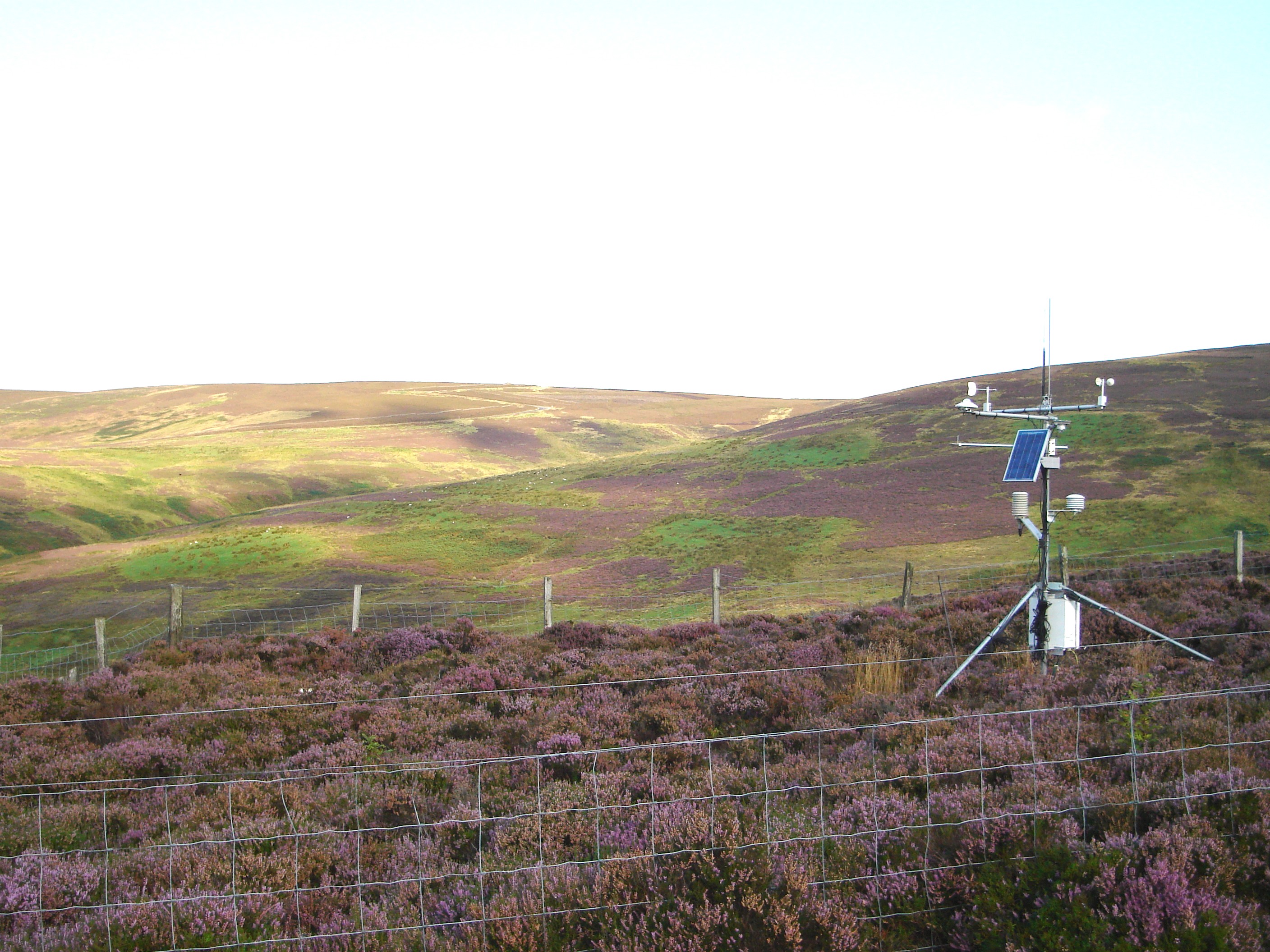
UK ECN site. Glensaugh is one of two terrestrial ECN sites currently managed by the James Hutton Institute. Glensaugh Research station is 35 miles south west of Aberdeen, NE Scotland (NGR NO 671783), on the edge of the Grampian hills and covers over 1100 hectares. The dominant cover is semi-natural vegetation, and there is a small amount of woodland (5ha) and some short term and permanent grassland (150ha). Much of the ECN monitoring is carried out towards the northern boundary of the research station in the small upland catchment of the Birnie Burn. Winters can be severe and snow may lie in patches until late March. The target sampling site is located at an altitude of 300m on heather dominated (Calluna vulgaris) moorland interspersed with patches of blaeberry (Vaccinium myrtillus). It has a westerly aspect and straight slopes of up to 20 degrees. The soil is predominantly freely draining humus iron podzol of the Strichen Series. The water chemistry sampling point, flume and in-stream measurements are made on the Birnie Burn at an altitude of 240m. The catchment area above the sampling point is around 100ha. Precipitation and atmospheric chemistry samples are collected adjacent to the stream at a similar altitude.
-
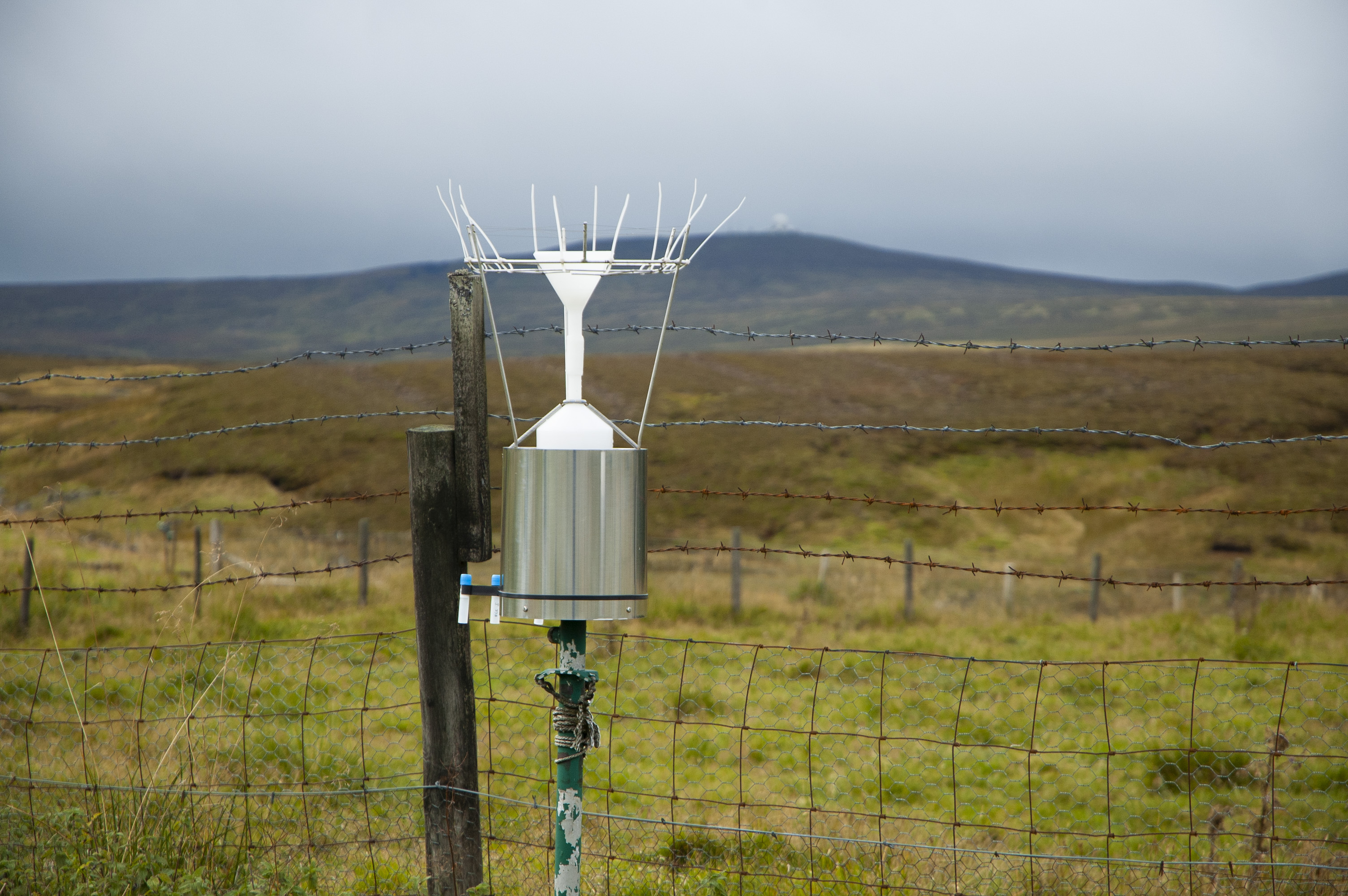
Moor House - Upper Teesdale is an upland site in the north of England that is dominated by moorland and grassland vegetation. UK ECN site. Moor House-Upper Teesdale, in the North Pennine uplands, is England's highest and largest terrestrial National Nature Reserve (NNR), a UNESCO Global Geopark and a European Special Protection Area. Habitats include exposed summits, blanket peatlands, upland grasslands, pastures, hay meadows and deciduous woodland. The site is grazed by sheep and comprises of two areas. The Moor House area extends from the upper edge of the Eden Valley, over the Great Dun Fell (848 m), Little Dun Fell and Knock Fell to the River Tees. The geology comprises alternating strata of limestone, sandstone and shale into which the dolerite of the Great Whin Sill intrudes. The gently sloping eastern side of the area is overlain by poorly-drained glacial till, which has led to the development of blanket bog with peat 1-3 m deep. The vegetation is dominated by Eriophorum, Calluna vulgaris and Sphagnum moss. The soils and vegetation on the western side are more variable. The Upper Teesdale area protects unique communities of arctic-alpine plants and other flora and fauna. From Cow Green Reservoir it extends southwards to the summit of Mickle Fell (788 m) and eastward, down the Tees, to High Force waterfall. The geology, soils and vegetation of much of the area are similar to Moor House, but 'sugar limestone' soils, along with damp river-side soils, support many of the rarer plant species.
-
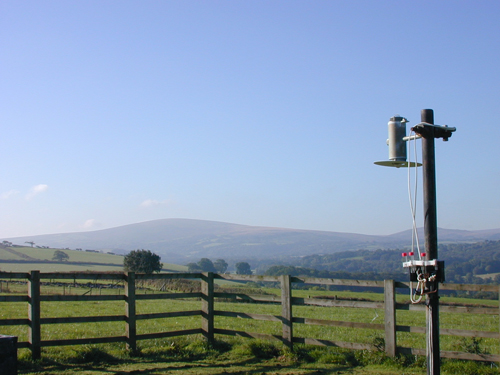
UK ECN site. North Wyke (latitude 3o 54’ W; longitude 50o 46’N) lies in undulating countryside 7 km to the north of Dartmoor National Park, midway between the villages of South and North Tawton. The site covers 250 ha, of which 200 ha are grassland and 50 ha are deciduous woodland at an altitude of 120 m to 180 m. A lowland grassland site typical of conditions in wetter, western Britain, with predominately impermeable clays of the Culm Measures. ECN is funded through the Rothamsted Long-Term Experiments National Capability (LTE- NCG). Details available at http://www.rothamsted.ac.uk/long-term-experiments-national-capability.