
dissolved organic phosphorus
Type of resources
Available actions
Topics
Keywords
Contact for the resource
Provided by
Years
Formats
Representation types
-
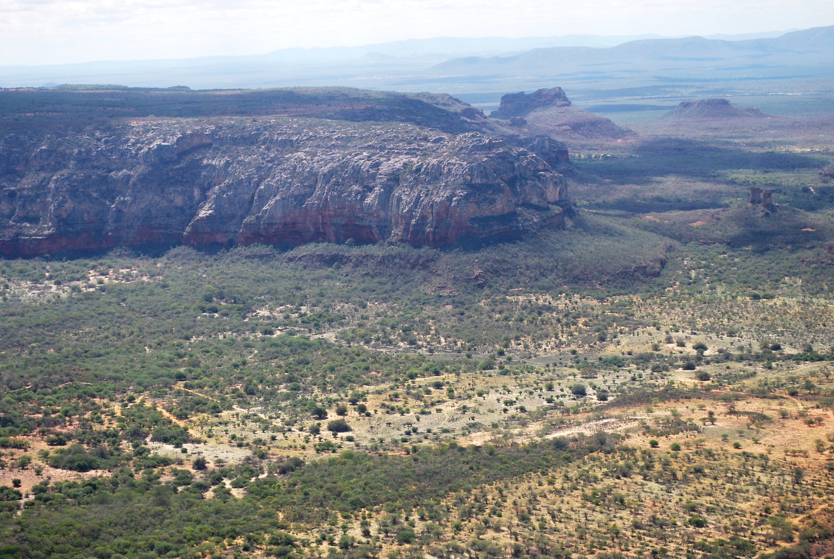
The present proposal aims to assess how human disturbance and changes in rainfall regime affect the Caatinga ecosystem’s biota at different levels of biological organization (i.e, from populations to ecosystem level), by correlating these aspects with the theoretical reference shown in macro trends already documented in the tropics. The project will be developed in Catimbau National Park, a polygon of approximately 63,000 ha, and one of the most important protected areas in the Caatinga. The Park presents vocation for ecological studies of long-term and thus to become an LTER site due to a series of reasons: (1) it has a biological, archaeological and landscape heritage of inestimable value, (2) it shelters areas with different historical land use and anthropic disturbance on the vegetation of Caatinga, (3) there are already in place several research initiatives and training of human resources, and (4) in term of unit management aspects, logistics and infrastructure are favorable for long-term initiatives. Furthermore, the implementation and achievement of this project’s objectives are centered on: (1) establishment of a set of 30 permanent plots, (2) periodic multi-taxa inventories, (3) continuous monitoring of environmental and anthropogenic variables (4) consolidation of biological, land usage and environmental data on the basis of GIS type and (5) dissemination / transfer of information through a wide range of instruments.This proposal will be implemented by a network composed of 23 researchers supported by a number of undergraduate / graduate students, all from six national institutions and three other overseas. The main core of the graduate programs are Plant Biology, Biology Animal and Fungal Biology, all at the Federal University of Pernambuco (UFPE). In summary, the "LTER Catimbau National Park" is an important proposal and has the ability to expand knowledge about how dry biota respond to land use changes and precipitation, with all the implications that these answers may have for the management of biodiversity and the achievement of sustainable development in semi-arid regions.
-
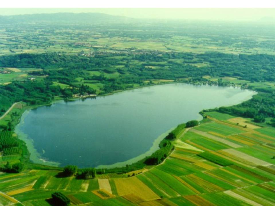
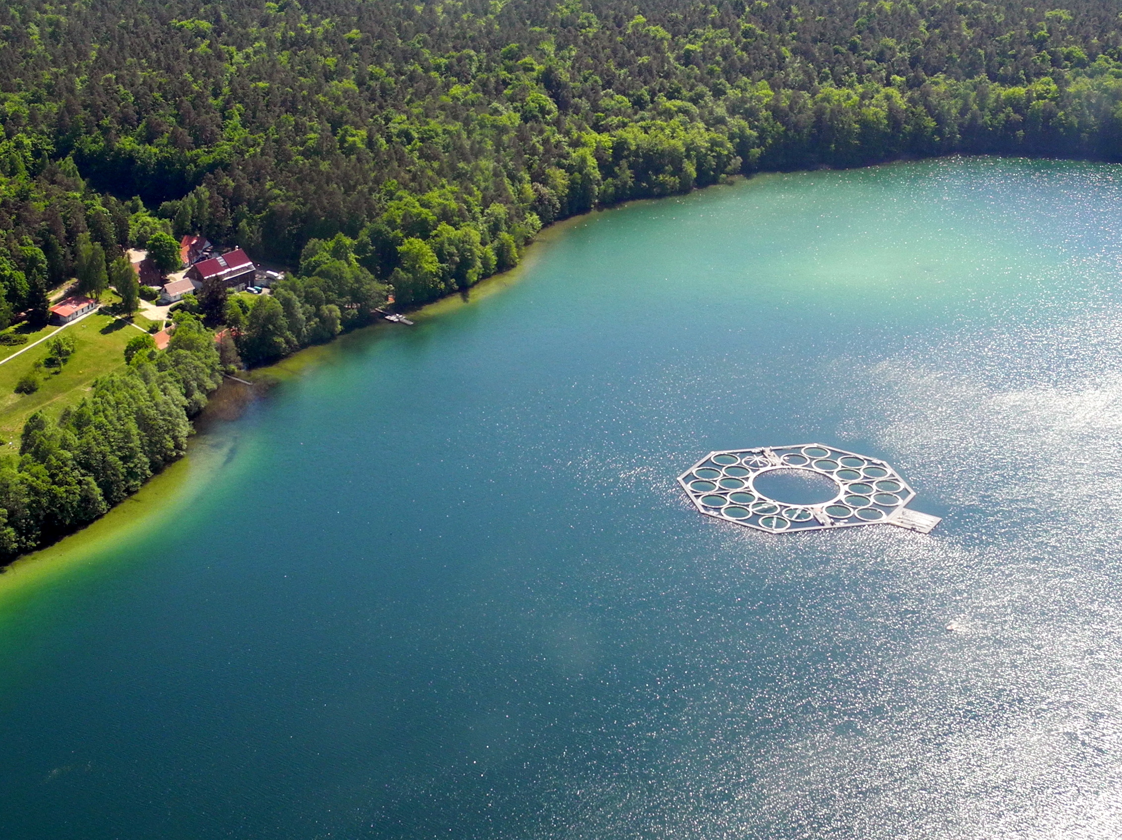
Lake Candia is a small and shallow lake, located in North-Westerm Italy. The mean elevation is 226 m a.s.l., the surface is 1,5 km², the max depth 7,7 m, the mean depth 4,7 m and the volume 0,007 km3. Lake Candia has suffered during its evolution a natural increase of its trophic state, undergoing a process of eutrophication culminated with a marked worsening of his ecological quality since the '60s. In the late '70s and mid '80s, this ecosystem was affected by fish mortality episodes and by the enormous development of emerged and submerged aquatic macrophytes. The systematic scientific study of Lake Candia began in 1985, when the CNR of Verbania was asked to perform a limnological research with the aim to propose a possible restoration intervention. In addition to the control of pollution sources from the basin, environmentally sound technologies were applied to reduce the effects of eutrophication, such as biomanipulation of the aquatic food chain and macrophyte control and management.The experiment conducted in Lake Candia has shown that significant improvements can be achieved through the management of a specific key components of the biocenosis of the lake. Data collection activities on hydrochemistry, phytoplankton, zooplankton, fish fauna, macrophytes, as well as physical limnology, took place from 1986 until 2012. To date, only hydrometeorological data collection (precipitation, air temperature, wind, solar radiation and lake levels), started in 1987, is active. LTER specific topics are: Long-term analysis of changes in community functional diversity of phyto-and zooplankton. Evaluation of the lake ecosystem response to short and intense rainfall events, in relation to the increase of nutrients input through runoff.
-
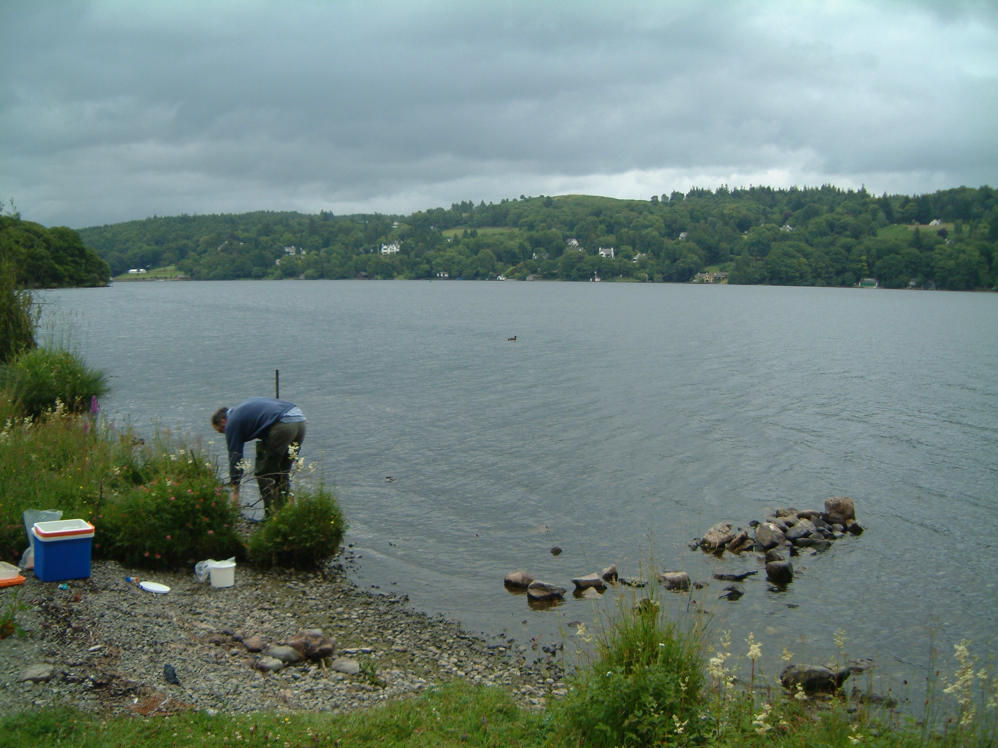
UK ECN site. Windermere is in NW England in the English Lake District, an area of great natural beauty and a tourist destination since the 18th century. The dominant geological structure of the Lake District is a dome of Paleozoic rocks formed by uplift in the Tertiary producing a radial drainage pattern later enhanced during the Pleistocene glaciation, with major lakes occupying bedrock basins in steep-sided, flat-floored valleys. Windermere is the largest natural lake in England with a surface area of 14.8km2 and altitude of only 40m. The lake is divided by a shallow sill into two basins; North Basin (NB) (surface area c. 8km2, maximum depth 64m) and South Basin (SB) (surface area c. 6.7km2, maximum depth 42m). Windermere (ECN site (2o58'W 54o23'N)), has a catchment of 180km2 draining into the lake via two main rivers, several small tarns (lakes) and streams. The catchment is mainly uplands, grazed by sheep all year but also used intensively for recreational purposes. The valley villages are major tourist destinations with consequent increases in sewage input to the lake. Over the past 50 years levels of dissolved reactive phosphorus in the lake have more than doubled, reaching their highest levels in the 1980s. The effluent discharged into SB from the main sewage works is now P-stripped to reduce the nutrient loading to the lake. The lake is a Site of Special Scientific Interest (SSSI), a source of potable water, a major recreational facility and a specialised fishery (for charr, Salvelinus alpinus). The Freshwater Biological Association and latterly the Centre for Ecology & Hydrology have had a laboratory on the shore of Windermere for over 50 years resulting in a large body of scientific literature based on Lake District lakes.
-
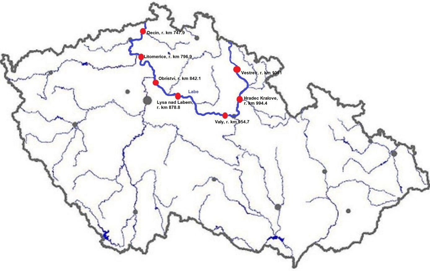
The Elbe River is one of the major rivers in Central Europe. It springs at an altitude of about 1,400 meters in the Giant Mountains in the north of the Czech Republic. It flows through eastern, middle, and northern Bohemia, and its catchment area includes most of Bohemia. The Elbe traverses the northeastern part of Germany and flows into the North Sea. The total river length is 1,094 km. In the Czech Republic, the monitored river length is 371 km and the catchment area includes 49,933 km2. The average flow at the Czech-German borders is 311 m3 s-1. Many weirs dam the watercourse of Elbe River in the Czech Republic. This artificial intervention is crucial for the characteristics of the riverbed, its width, depth, and bottom substrate. The width of the riverbed in the monitored area ranges from approx. 10 m on the upper course to approx. 150 m on the lower course and river sections above the weirs. The depth of the river varies from 0.5 m in the upper parts and below the weirs to more than 5 m in the lower course and above the weirs. The bottom substrate varies from the stony, gravelly, and sandy fractions in shallow and fast-running sections to muddy/silty fractions in slow-running sections above the weirs. The main tributaries of the Elbe in Bohemia are Metuje, Orlice, Jizera, Ploučnice, Vltava, Ohře and Bílina rivers. The catchment area is densely populated. The river is exposed to various sources of pollution (organic, agricultural, and industrial) and hydromorphological pressures (straightening, shortening, regulation of meanders, and fragmentation of river continuity). There are seven permanent monitoring sites on the Elbe River in the Czech Republic: Děčín (river kilometer 747.9), Litoměřice (796.9), Obříství (842.1), Lysá nad Labem (878.8), Valy (954.7), Hradec Králové (994.4) and Vestřev (1051). The Elbe basin long term environmental research has been organised by the Ministry of Environment of the Czech Republic and cooperation institutions since 1993. More than 600 physicochemical parameters, including sensory properties of water, are regularly monitored in at least nine different types of matrices (water, sediment, periphyton, floats, sedimentable floats, benthos, fish tissues, fish fry, and Dreissena polymorpha tissue) and using passive samplers. Among the main monitored characteristics belong balances of macroelements (carbon, nitrogen, oxygen, phosphorus), concentrations of inorganic salts, heavy metals and various organic pollutants such as pesticides, personal care products (including drugs) and other anthropogenic substances in the environment. Characteristics such as abundance and species composition are regularly monitored in fish, macrophytes, macrozoobenthos, phytobenthos and plankton.
-
Measurements of lake chemistry are part of lake monitoring, which is usually carried out by monthly sampling at many regular lake sites (5 to 17 sites depending on the intensity of the measurements over the years). The integrated sample represents the whole water column of this polymictic shallow lake with a mean lake depth of 1.2m. The measurement satisfy the analytical standards of Ö-Norm in Austria.
-
Lake Stechlin is a a deep clear-water lake located in a nature reserve approximately 80 km north of Berlin, Germany (53°10°N, 13°02° E), at 59 m elevation.The lake basin was formed during the last continental glaciation some 12,000 years ago and today is situated at the transition between temperate/maritime and temperate-continental climates.The drainage basin is almost completely covered by forest (95%), with the exception of the area of a former nuclear power plant and a small village, which diverts its wastewater into a different drainage basin. The shoreline of Lake Stechlin is largely undeveloped with no notable infrastructure. The seepage lake is essentially fed by precipitation and groundwater, resulting in a theoretical water retention time of greater than 40 years.
-
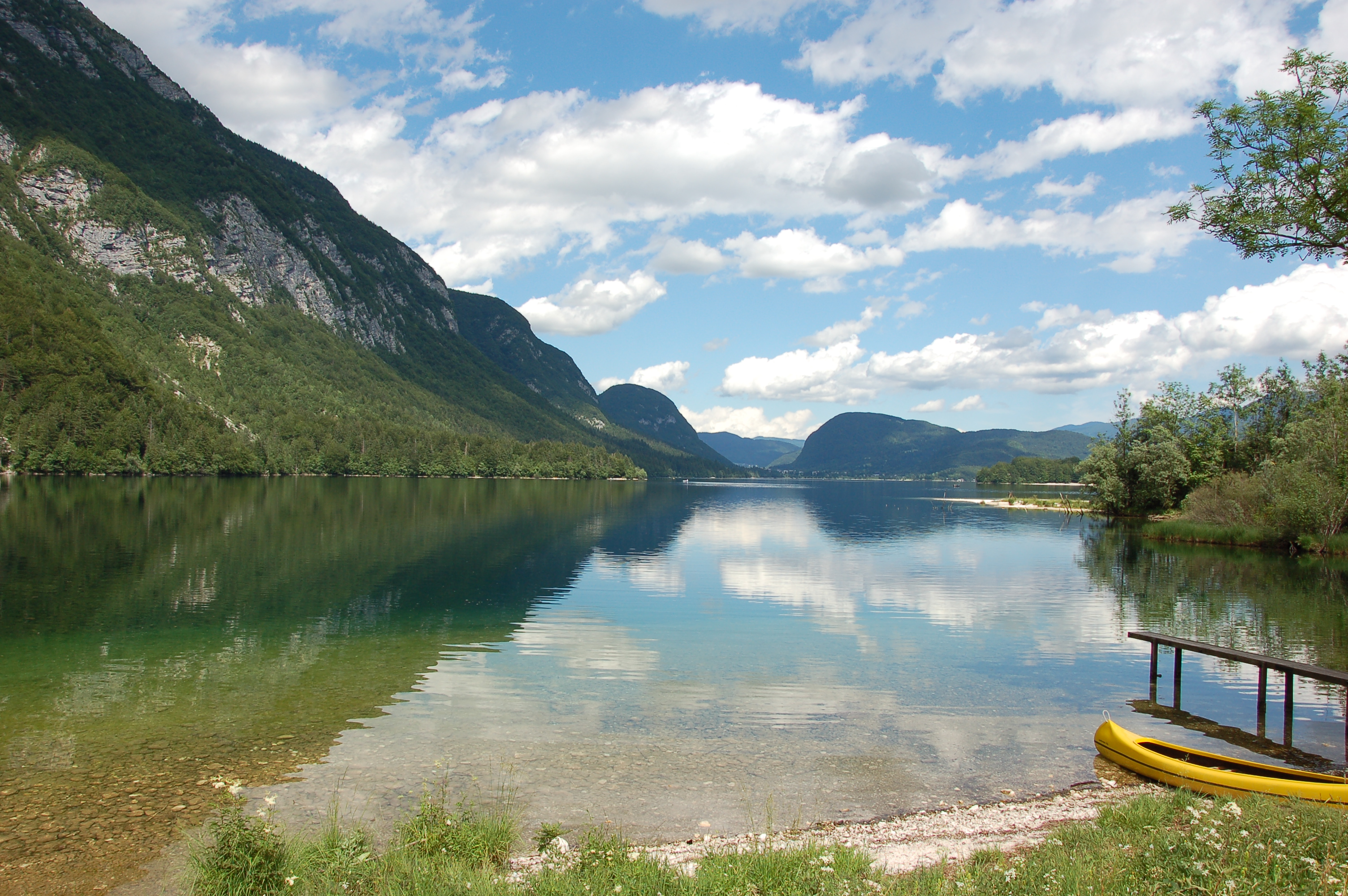
Lake Bohinj is of tectonic-glacial origin and was transformed by the Bohinj glacier. Its surface area is 3.28 km 2 , its volumeWeather conditions and chlorophyll concentrations determine long-term macrophyte community dynamics of Lake...92.5 × 10 6 m 3 and its maximum depth 45 m. It is located at an altitude of 525 m a.s.l. and issurrounded by mountains that are up to 2000 m high. Lake Bohinj is conditioned by the main inflow from River Savica and by several karst springs from the base of Mount Komarča and has a single outflow, River Sava Bohinjka. The residence time of the water in Lake Bohinj is about 4 months, which means that the total volume of the water in Lake Bohinj changes three times a year. The surrounding watershed comprises around 94.3 km2 and is mostly uninhabited, with a large portion extending above the tree line; therefore, the input of nutrients into Lake Bohinj is moderate. This watershed receives about 3300 mm of rainfall a year. Long-term temper-atures show a tendency to a rise. In winter, usually in January, the surface water cools and the lake can be frozen over. From 1961 to 1990, Lake Bohinj was frozen over for a mean of > 50 days/year, while in the decade from 1991 to 2000, the mean number of days with ice cover was reduced to 31 days/year. Since 1990, the lake did not freeze completely in individual years. The majority of the lake catchment area consists of carbon-ate rock, and therefore, the main lake sediment fraction is carbonate, while quartz and feldspar represent a minor part.
-
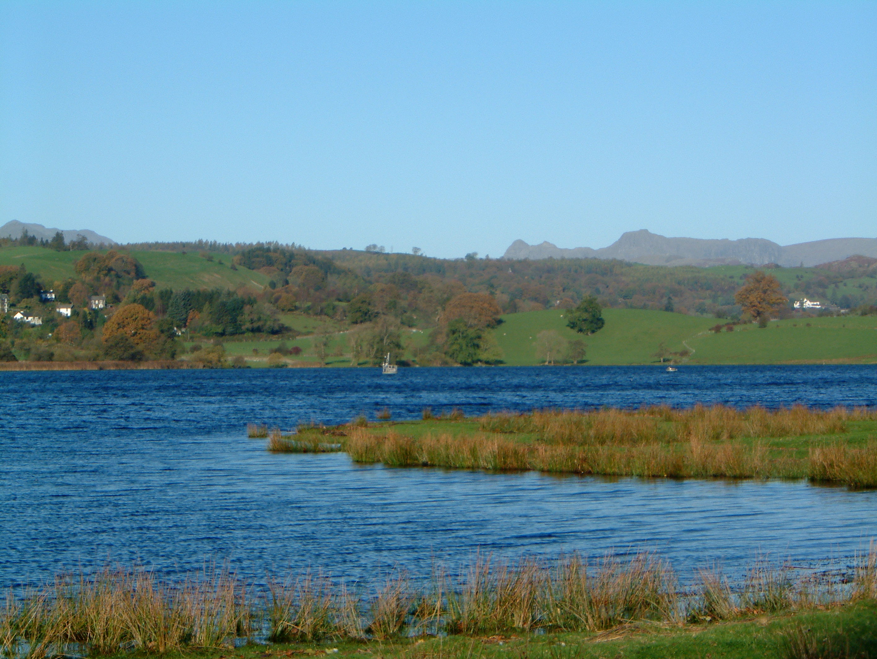
UK ECN Site. Esthwaite Water is a natural lake situated in a glacial valley and is generally agreed to be the most productive or eutrophic lake in the English Lake District. It lies approximately 65 m above sea level and has an area of 1 km2 and a maximum depth of 15.5 m. The average retention time is 90 days. The catchment area is 17.1 km 2 and the hills are composed geologically of Bannisdale slates and grits. The surrounding land is used chiefly for agricultural purposes and forestry. The lake is a grade 1 Site of Special Scientific Interest and has been a designated "Ramsar" site since November 1991. The diverse aquatic invertebrate fauna includes a number of species with restricted distributions in Britain, one of which is the flatworm, Bdellocephala punctata. The slender naiad, Najas flexilis, which is listed as Nationally Scarce, has been found in Esthwaite Tarn. Artificial enrichment of the lake occurs by input from the Hawkshead Sewage Treatment Works (which has operated a continuous programme of phosphate stripping since 1989) and originally from effluents from the fish farm which used to be situated towards the south of the lake. The lake undergoes summer stratification with oxygen depletion regularly below 7 m and sometimes as shallow as 5 m. The phytoplankton tends to be dominated by diatoms in spring and by cyanobacteria for much of the summer.
-
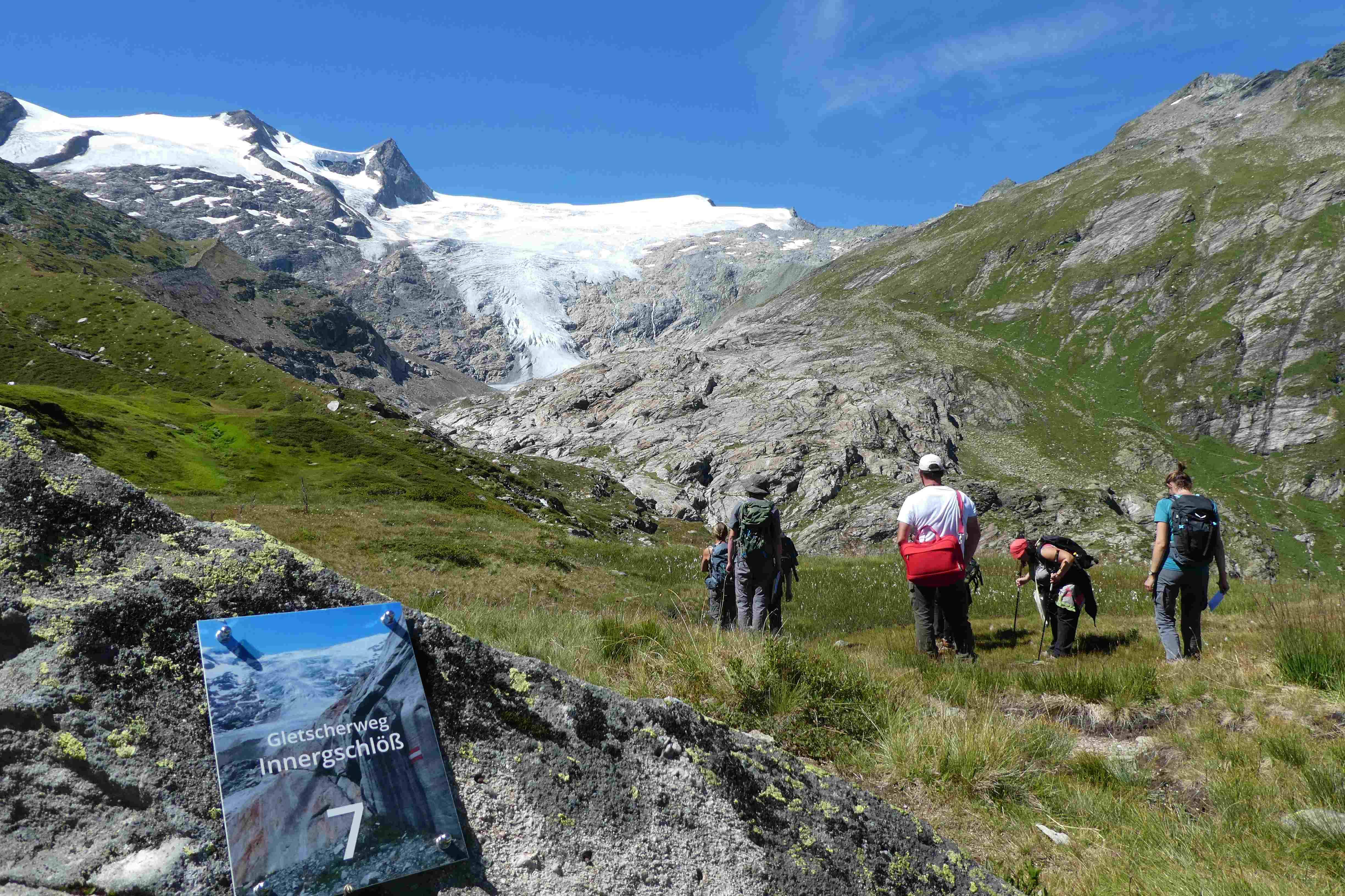
Hohe Tauern NP was established more than 40 years ago as one of the biggest protected areas in Central Europe to protect at long-term wide areas of the Austrian main-ridge of the Alps. The 1.856 square kilometre Hohe Tauern National Park is split into a 1.213 square kilometre core zone and a 643 square kilometre buffer zone and stretches over three provinces. Until the first and largest national park in Austria was actually created, the three provinces of Carinthia, Salzburg and Tyrol had to establish the corresponding legal framework. The Provincial Parliament of Carinthia passed the legislation to create the Hohe Tauern National Park in 1981. Salzburg followed with its national park legislation in 1984, followed by Tyrol in 1992. In this 40 years Hohe Tauern NP established the Nationalpark idea in its region working together with all stakeholders (land owners, tourism, majors, hunting organisations, governmental departments…). The International Union for the Conservation of Nature IUCN awarded Carinthia in 2001 and Salzburg and Tyrol in 2006 with the international recognition of a national park with its "Category II" listing. The distinction that the national park has with a core zone, where nature can develop without human influence and a buffer zone, where traditional cultivation could be continued was key for gaining this international recognition. Contractual agreements between landowners, hunters and the national park paved the way and were pioneering for many protected areas. Hohe Tauern NP contains 3 main zones: - core zone (km²): 1.078 - buffer zone (km²): 643 - special protected areas (km²): 135 About 845 km² of the area is nature zone, which remains untouched by humans (no land use based on IUCN criteria, i.e. no hunting, no grazing). The altitudinal belts from the valleys to the summits of the three-thousand-metre-tall mountains represent an exceptional biodiversity. This is home to many plants and wildlife species originating from the Central Asian tundra, the Arctic and even Southern Europe. The preservation of all significant Alpine ecosystems across large areas of the Hohe Tauern National Park has been unimpaired. More than one third of all plant species recorded in Austria can be found in the national park. For mammals, birds, reptiles and amphibians, this figure is at around 50%. Even those animals that were nearly extinct in almost all of Europe at the beginning of the 19th century are now provided a safe habitat in the Hohe Tauern National Park. This impressive biodiversity is a result of the different prevailing climatic, geological, geomorphological and hydrological conditions in the high mountains and the differing adaptation strategies of the plants and animals. The Tauern Window – a unique tectonic window in terms of shape and size – provides insight into the deepest tectonic layer of the Alps and is thus key for understanding the geological structure of the Alps. Rocks of differing ages, different origins and different chemical composition harbour a genuine hoard of up to 200 different minerals. Nature protection (ecosystems/Natura2000 habitats) and species conservation projects play a big role in the work and history of Hohe Tauern NP (e.g. bearded vulture, ibex, golden eagle, …). The NP and its work do not stop at the protected areas borders and for a lot of species it is important that the whole region is aware of its impacts on biodiversity. According to the altitude gradation of the Hohe Tauern National Park "high mountain habitat types" are typical. Based on the aerial photo interpretation of the National Park montane to alpine grassland and pastures dominate with a third. This also reflects the zoning with the outer zone in the sense of an Alpine cultural landscape zone with alpine pastures – and the transition to the high alpine core zone. The core zone is formed by the "eternal ice" of the glaciers around the highest mountains of Austria as well as scree slopes with and without pioneer vegetation dominate. CORINE Land Cover L3 (2018): 35 % bare rocks, 24 % natural grasslands, 20 % sparsely vegetated areas, 9 % coniferous forest, 7 % glaciers and perpetual snow, 2 % moors and heathland, 1 % pastures.
-
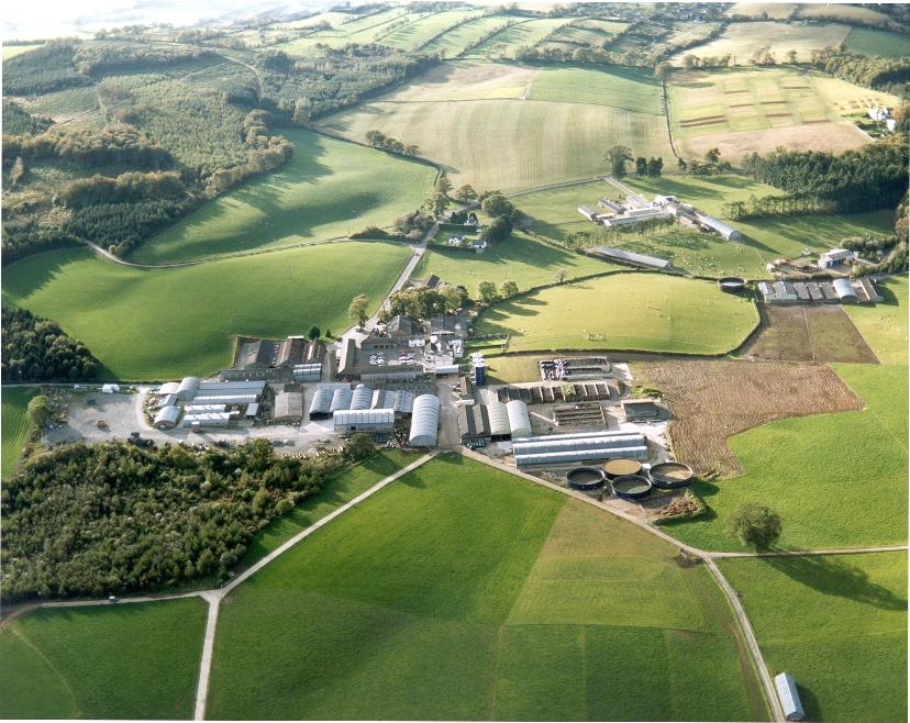
UK ECN site. A lowland grassland site situated at the Agri-Food and Biosciences Institute, Co. Down, Northern Ireland and representative of grassland in much of the north-western United Kingdom. There are several long-term field experiments ongoing on the site. A large part of the site is estate woodland (Hillsborough Forest) consisting of mature mixed woodland and conifer plantation. Many of the vegetation plots are located within this forested area, as are sections of the butterfly, carabid beetle, spider and bird transects. The Hillsborough premises had formerly been the home of Marquis of Downshire and then during the 1st world war had been used for cropping by local farmers. When the war ended agric commodities prices collapsed and large portions of the farm became derelict with rough grazing let out by public auction on a conacre basis from 1922-1926. The research station at Hillsborough was originally established in 1926 and incorporated by the Agricultural Research Station Act N.I. 1927. By 1931 263 acres was actively farmed.In 2006 the Agricultural Research Institute was amalgamated to form what is now called AGRI Food and Biosciences Institute.