
disturbance pattern
Type of resources
Available actions
Topics
Keywords
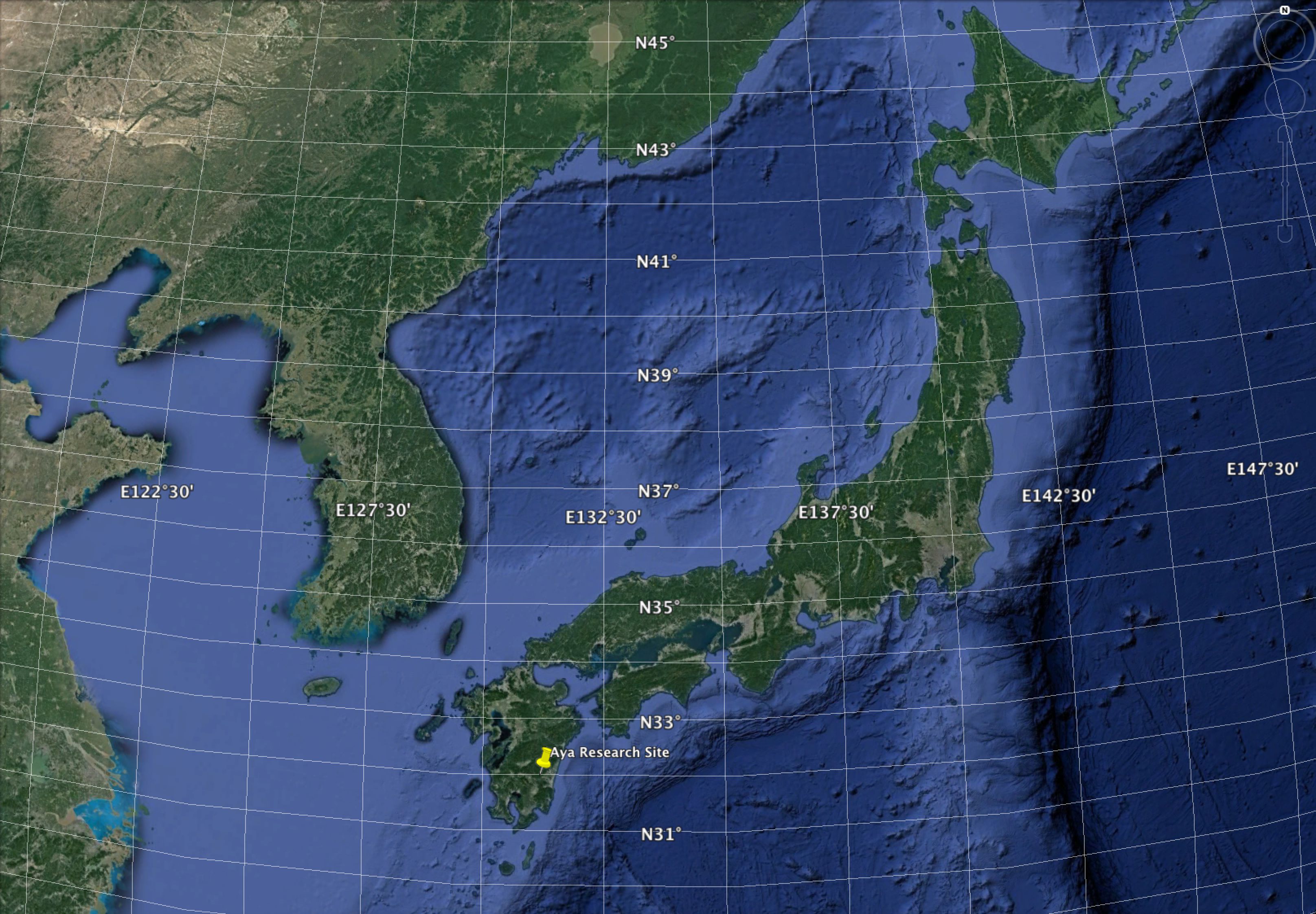
Contact for the resource
Provided by
Years
Formats
Representation types
-
Maps of (annual) forest disturbance (wind throw, bark beetle infestation) at the catchment of LTER Zöbelboden, Austria
-
evergreen broad-leaved forest The mature and old-growth forests dominated by Distylium racemosum, Quercus acuta, Q. salicina, Percea thunbergii and other species. In total, more than 50 tree species are found in the 4-ha plot.
-
Georeferenced areas burnt by wildfires, recorded by the Portuguese Institute for Nature Conservancy and Forests, a series from 1990-2014
-
Areas of Project Terraprima "Shrub Control" (http://www.terraprima.pt/en/projecto/1) with identification of the year and month of intervention
-
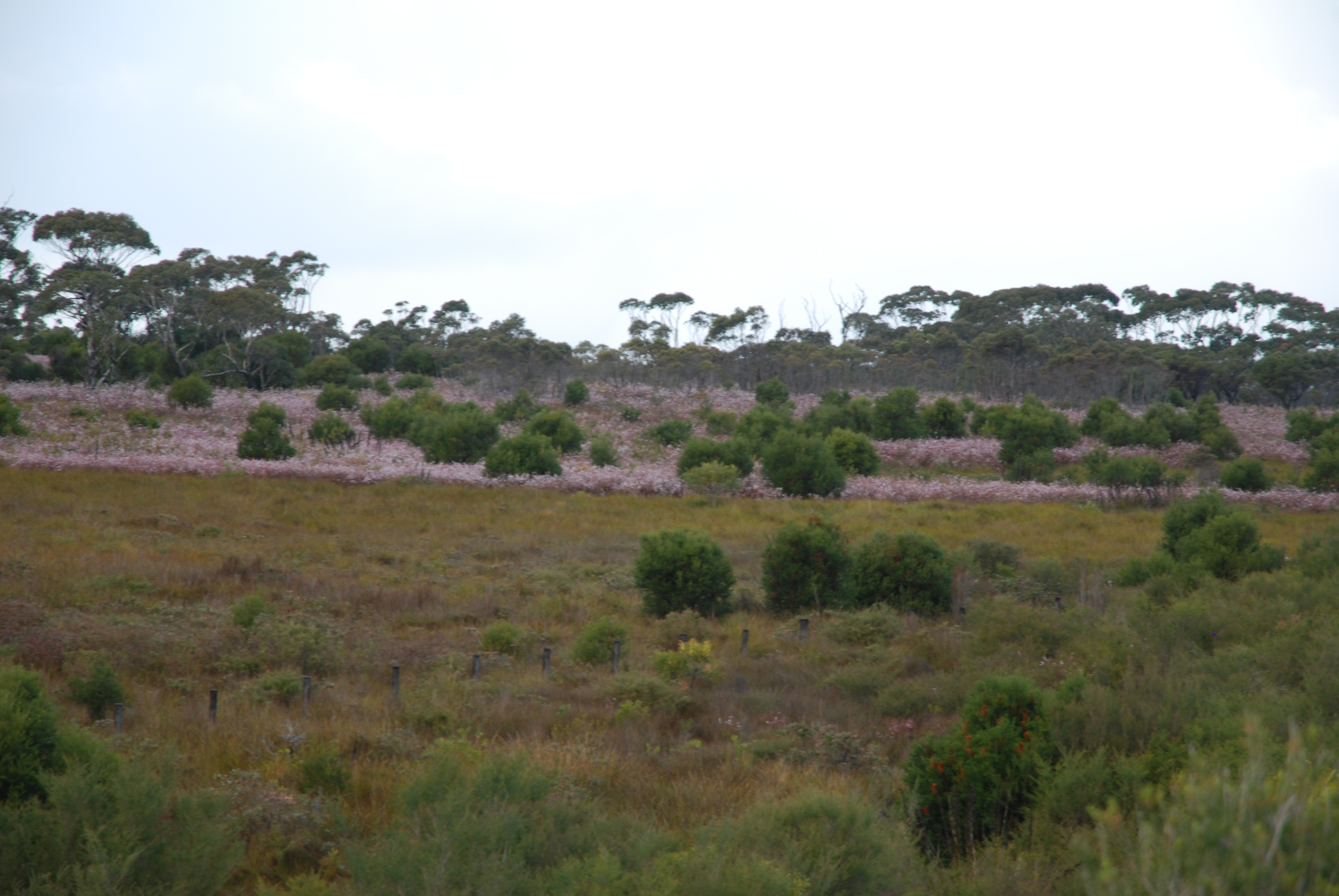
The Upland Heath Swamps Plot Network is located in the Dharawal National Park, near Sydney, NSW. Sampling of vegetation is stratified along the soil moisture gradient and across the range of structural variability in the vegetation. Thus, three categories of soil moisture and three categories of vegetation structure (based on the height and form of shrubs) are sampled in a factorial design at 60 sites in upland swamps scattered throughout the study area (Keith & Myerscough 1993). Temporal visits are conducted every 5 years or when fires occur. Between 2012 and 2018 the Upland Heath Swamps Plot Network was a member of Long Term Ecological Research Network (LTERN), Australia, a facility of the Australian Government's Terrestrial Ecosystem Research Network (TERN).
-
GIS thematic data on human activity and infrastructure in the Park, covering a.o. (1) tourism infrastructure and activity (trails, shelters, campsites, caves accessible to tourists, museums, sports and leisure infrastructure, educational facilities, etc. - as well as tourist traffic counts); (2) roads and other transport facilities (incl. cable car); (3) buildings (dense housing and individual objects), (4) geodetic/cadastral layers, land parcels, (5) cultural heritage (historic monuments incl. religious objects, remnants of past mining activity, historic sheep/cattle grazing infrastructure such as shepherd huts, etc.); (6) other infrastructure (e.g. power lines, water takeup points, meteo stations, etc.). Also, data on anthropogenic pressure: environmental impact and damage of human activity available.
-
The mature and old-growth forests dominated by Quercus serrata, Fagus Japonica, F. crenata and other species. In total, more than 60 tree species are found in the 6-ha plot.
-
The Desert Uplands Plot Network is located in the Northern Desert Uplands of Queensland, Australia with each of the 50 (originally 60) bird monitoring plots 1 ha in size, and located at least 1 km from any other site, 500 m from any water point and 50 m from the nearest access track. As at June 2016, temporal visits have been conducted in 2004, 2005, 2006, 2008, 2013 and 2014. Between 2012 and 2018 the Desert Uplands Plot Network was a member of Long Term Ecological Research Network (LTERN), Australia, a facility of the Australian Government's Terrestrial Ecosystem Research Network (TERN).
-
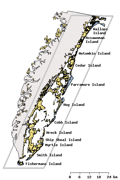
Research activities of the VCR/LTER focus on the mosaic of transitions and steady-state systems that comprise the barrier-island/lagoon/mainland landscape of the Eastern Shore of Virginia. Primary study sites are located on Hog Island, Parramore Island and mainland marshes near Nassawadox VA. The VCR/LTER uses field laboratory and housing facilities at the Anheuser-Busch Coastal Research Center in Oyster, VA.
-
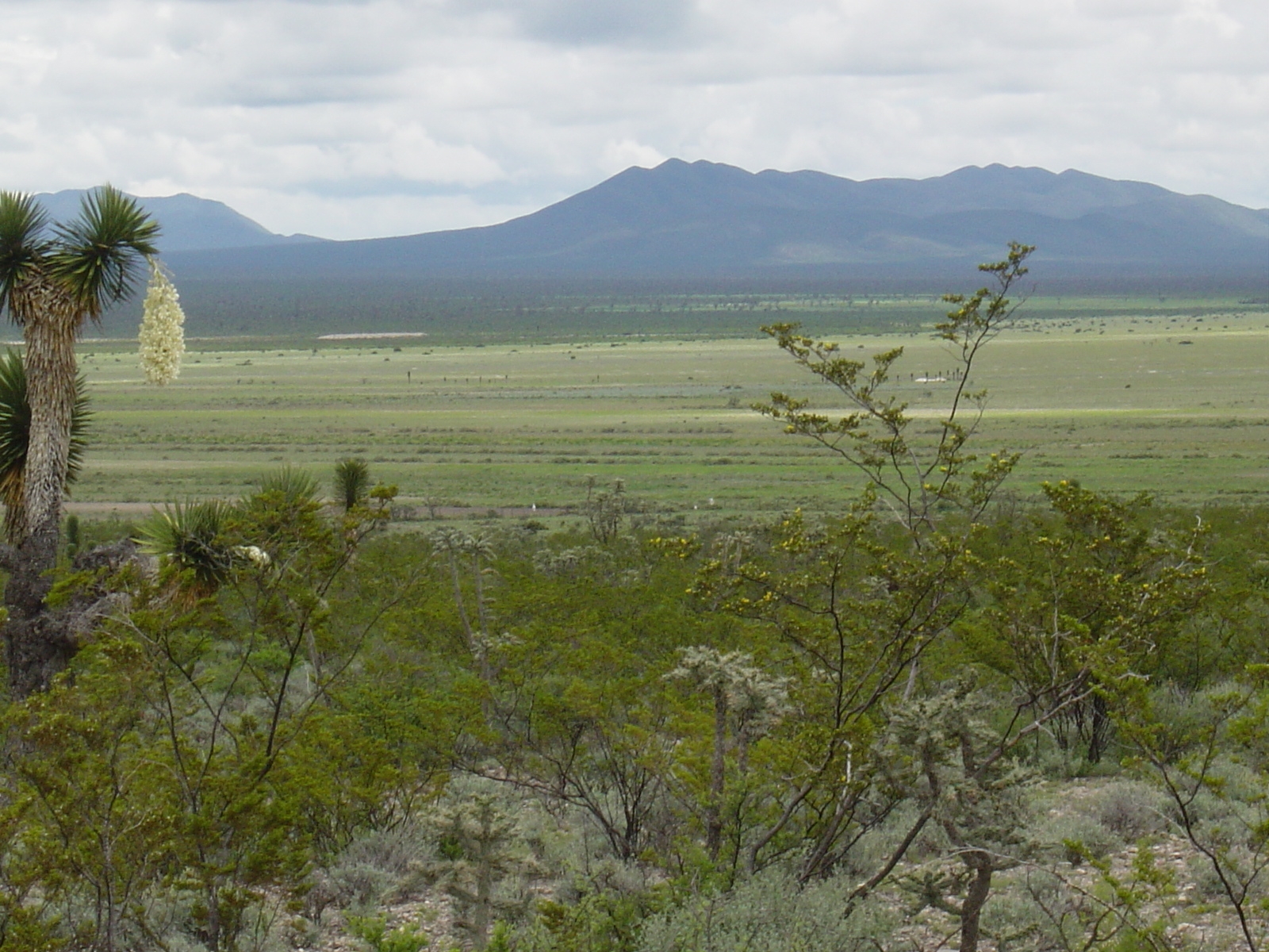
Los esfuerzos de investigación se enfocan a la región del altiplano mexicano conocida como “El Tokio”, donde se distribuyen los pastizales gipsófilos y salinos en el noreste de México y la cual es reconocida como una región prioritaria para la conservación de especies de aves residentes endémicas y migratorias. El área se caracteriza por valles intermontanos en los cuales se presentan suelos con altos contenidos de yeso y carbonatos de calcio, así como pastizales de porte bajo que no rebasan los 15 cm de altura en promedio. En estos valles habita el perrito llanero mexicano (Cynomys mexicanus), especie clave en el ecosistema. La vegetación circundante a estos valles está caracterizada por matorrales de gobernadora (creosote bush) con elementos sobresalientes de Yucca. El área es fuertemente impactada por actividades agrícolas y ganaderas, las cuales se llevan a cabo desordenadamente y sin medidas de mitigación.