
drought resistance
Type of resources
Available actions
Topics
Keywords
Contact for the resource
Provided by
Years
Formats
Representation types
-
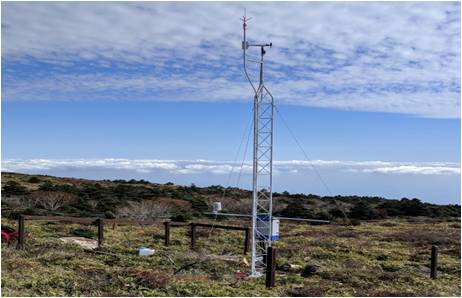
Mt Halla San is in Jeju Island, the only volcanic subtropical island, in South Korea. Every year the island is hit by several typhoons. It has shaped unique environmental characteristics and biodiversity. In addition the mountain is one of the most popular vacation sites with growing ecological concern.
-

The Hölstein site is located in in the eastern part of the Swiss Jura mountains (47°26’16.4’’, 7°46’31.1’’; 540 m a.s.l.), in a mixed, temperate forest with an exceptionally high biodiversity and a vigorous tree regeneration. The research plot has a size of 1.6 ha and comprises 540 mature trees. The main tree species are Fagus sylvatica and Picea abies with an admixture of Abies alba, Quercus petraea, Pinus sylvestris, Acer pseudoplatanus, Carpinus betulus, Fraxinus excelsior and Sorbus torminalis. A canopy crane is installed in the center of the research area to access the tree canopies for in situ measurements and for sampling of leaf material. Rainout shelters will be installed in 2019 for conducting a long-term throughfall exclusion experiment.
-
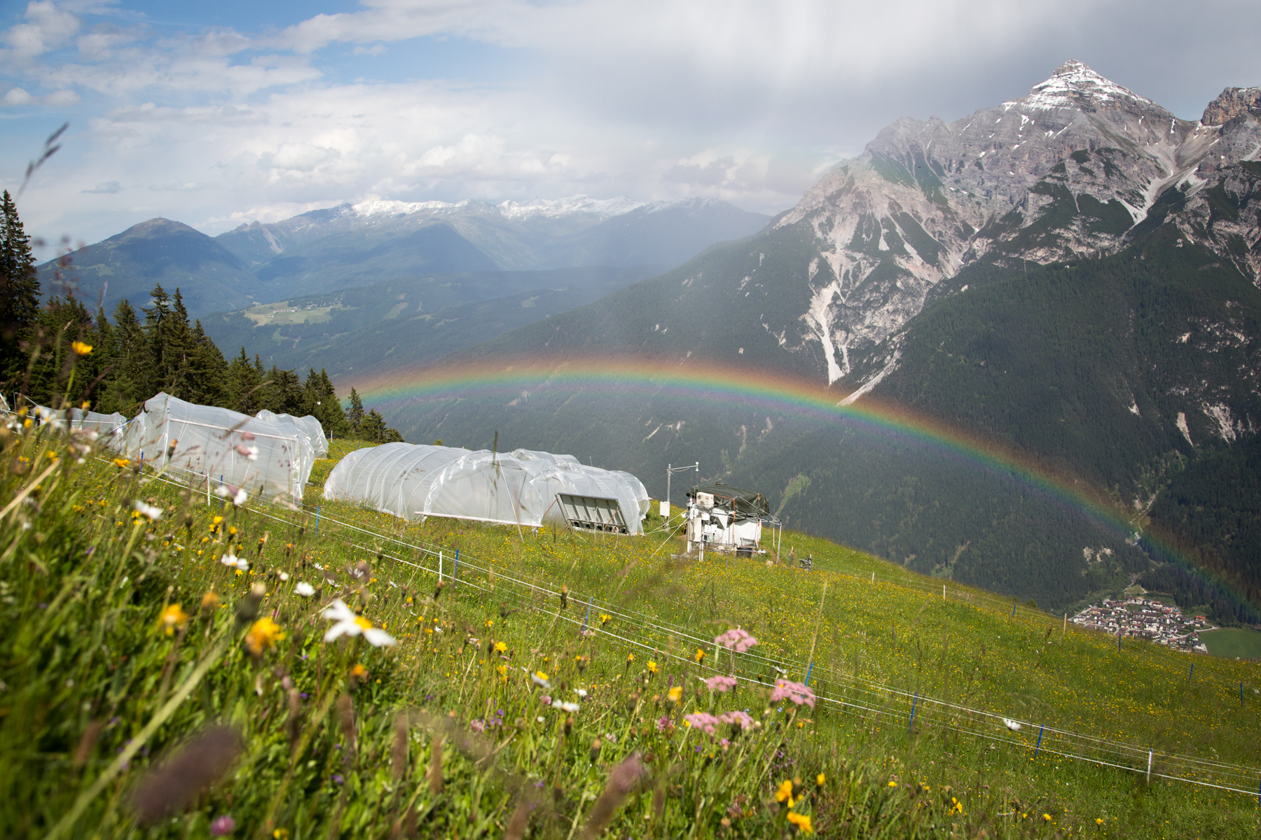
'Tyrolean Mountain Grassland and -Forest' currently consits of 'Stubai - combination of Neustift meadows and Kaserstattalm' (DEIMS.iD: https://deims.org/324f92a3-5940-4790-9738-5aa21992511c). Additional forested research locations may be added in the future.
-

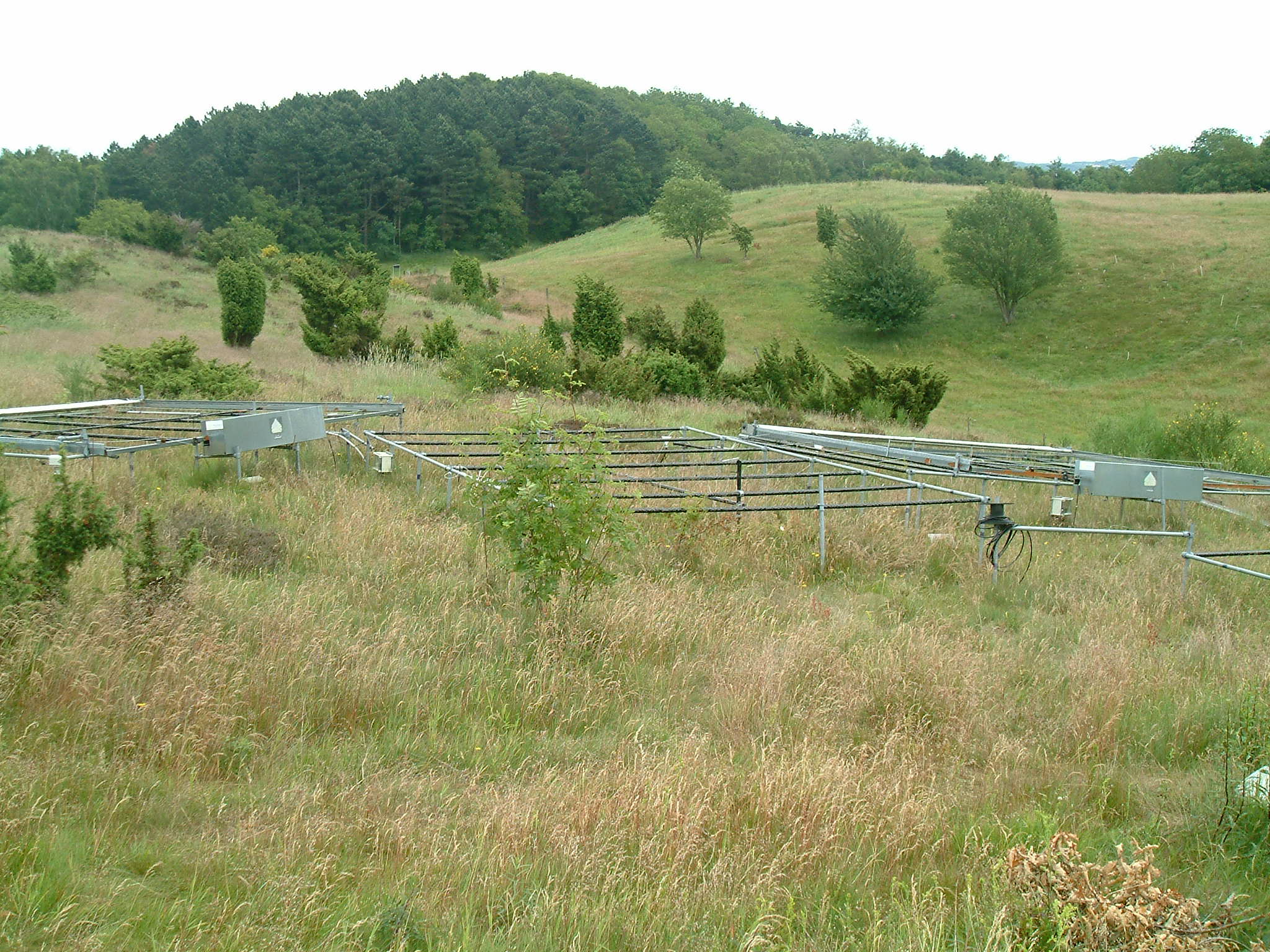
As the largest contiguous pine forest in Switzerland, the Pfyn forest in Canton Valais (46° 18' N, 7° 36' E, 615 m ASL) offers the best conditions for such measurements. In light of this, a WSL research team installed a long-term experiment of 20 years duration in the Pfyn forest. The average temperature here is 9.2°C, the yearly accumulated precipitation is 657 mm (average 1961-1990). The pines in the middle of the forest are about 100 years old and 10.8 m high. The test area has 876 trees covering 1.2 ha divided into 8 plots of 1'000 m2 each (Image 4). Between the months of April and October four of these plots are irrigated by a sprinkler system providing an additional 700 mm of water, annually. In the other four plots, the trees grow under natural, hence relatively dry conditions.
-
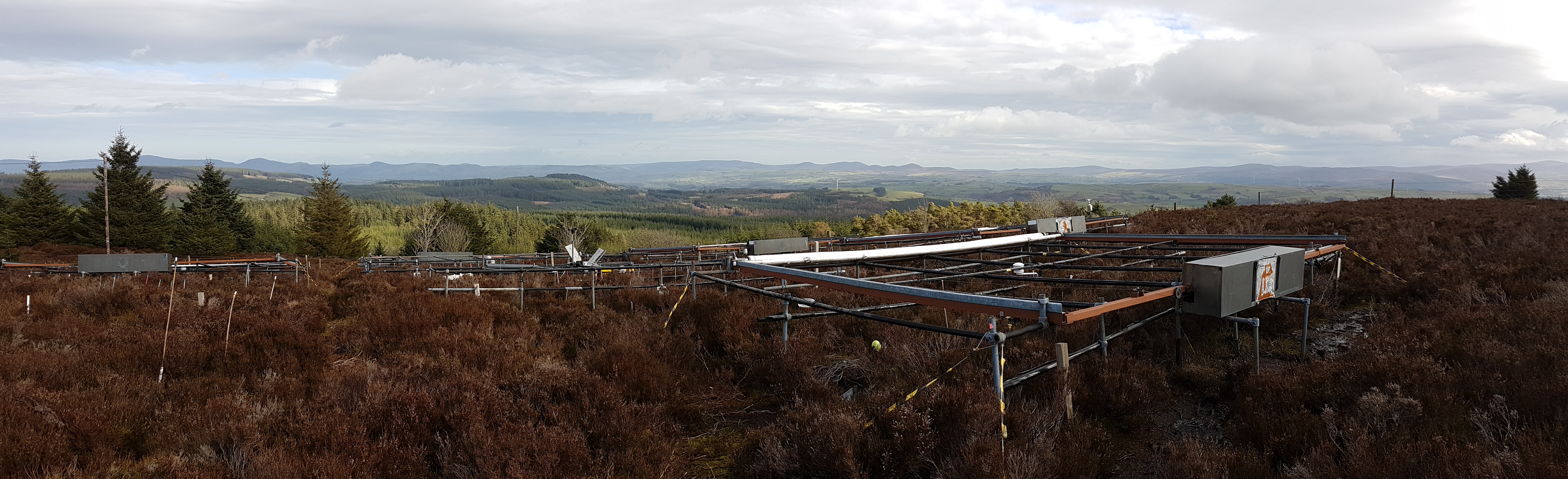
The site is located in Clocaenog Forest in North East Wales (53o 03’ 19’’N -03o 27’ 55’’ W). It is a typical upland west-atlantic moorland, dominated by the evergreen shrub Calluna vulgaris (heather). Heather makes up >60% of the plant biomass at the site, but Vaccinium myrtillus and Empetrum nigrum are also present.
-
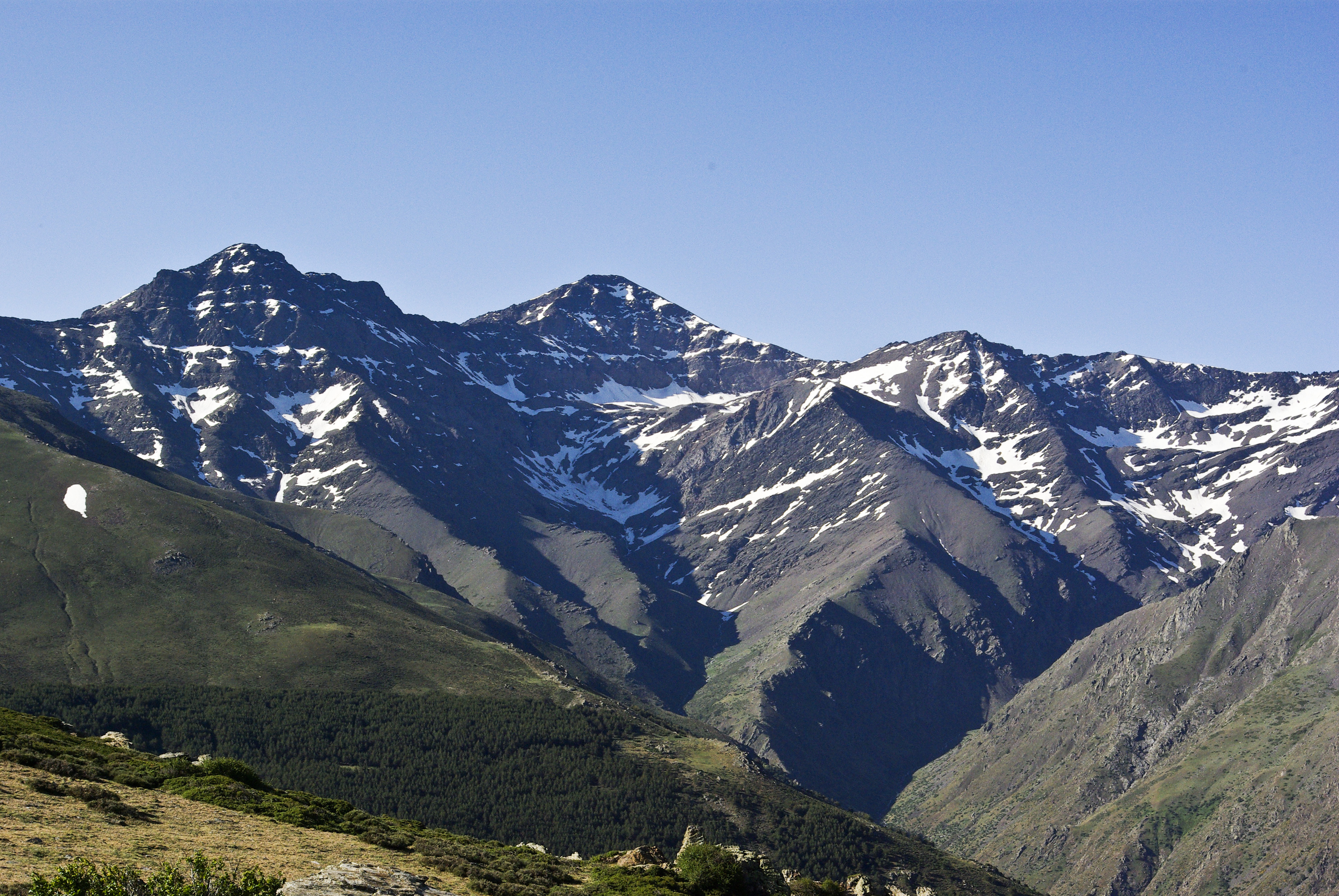
Mountain site, alpine forests Sierra Nevada (Andalusia, SE Spain), is a mountainous region with an altitudinal range between 860 m and 3482 m a.s.l. covering more than 2000 km2. The climate is Mediterranean, characterized by cold winters and hot summers, with pronounced summer drought (July-August). The annual average temperature decreases in altitude from 12-16ºC below 1500 m to 0ºC above 3000 m a.s.l., and the annual average precipitation is about 600 mm. Additionally, the complex orography of the mountains causes strong climatic contrasts between the sunny, dry south-facing slopes and the shaded, wetter north-facing slopes. Annual precipitation ranges from less than 250 mm in the lowest parts of the mountain range to more than 700 mm in the summit areas. Winter precipitation is mainly in the form of snow above 2000 m of altitude. The Sierra Nevada mountain range hosts a high number of endemic plant species (c. 80; Lorite et al. 2007) for a total of 2,100 species of vascular plants (25% and 20% of Spanish and European flora, respectively), being considered one of the most important biodiversity hotspots in the Mediterranean region. This mountain range has several legal protections: Biosphere Reserve MAB Committee UNESCO; Special Protection Area and Site of Community Importance (Natura 2000 network); and National Park. The area includes 61 municipalities with more than 90,000 inhabitants. The main economic activities are agriculture, tourism, cattle raising, beekeeping, mining, and skiing.
-
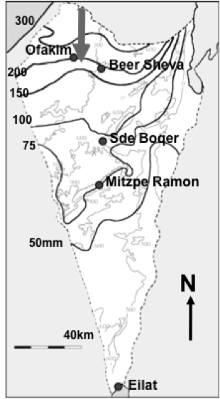
Designation: Ecosystem research and management under land-use and climate change. Climate: Mean annual precipitation 150-200mm between November and April; mean maximum summer temperature 34° C, mean minimum winter temperature 6° C. (Data avialable for 15-min interval meteorological measurements and daily summaries for rainfall, air and soil humidity and temperature, wind velocity and direction, from 1997 to the present.) Principal biomes: Semiarid shrub land (shrub-grass steppe), rocky and loessial watersheds, ephemeral streams. Vegetation is dominated by patch-forming dwarf shrubs (Noaea mucronata, Atractylis serratuloides and Thymelea hirsuta) with species-rich annual winter vegetation in the inter shrub (dominated by Stipa capensis and other grasses) and shrub patch understory (dominated by Anagallis arvensis and other forbs). As a result of drought there are also two new sub biomes: crust land and grass land. Management: Livestock grazing excluded in central watershed (20 ha) since 1987; restricted/controlled grazing by Bedouin sheep herds in surroundings; in the outer parts of the area native and exotic trees were planted in 1985-87 in contour dykes (‘shikhim’) on the slopes and in terraces in the riverbed. Research: 1. Long-term experiments (up to 20 years) for monitoring changes in abundance, diversity, species composition and distribution, and development of biological soil crusts (BSC), perennial plants (dwarf shrubs) and winter annuals in relation to rainfall, soil disturbance, patch distribution, and livestock grazing. 2. long term hydrological studies on rainfall-runoff relationship under natural and manipulation experiments. 3. Short-term experiments and surveys (1 to 5 years) A. for testing hypotheses about the detailed processes, mechanisms and interactions involved in the development, dynamics and stability of shrub- and BSC-dominated patches, their landscape mosaic patterns and their feed-back relationships with flows of materials through the landscape; B. for testing hypothesis on the effect of geodiversity on the stability of shrub land to extreme drought and understanding state changes in drylands. 4. Long term studies on cross scale-cross level interactions in natural and human modified landscape. 5. Network-related research including regional comparisons of herbaceous plant productivity in open rangeland along the Israeli North-South rainfall gradient, and global comparison of woody plant diversity effects on ecosystem functionality of most dryland regions of the world.
-

Historically, the role of the Galapagos Islands has been considered critical due to the evolutionary diversification induced by natural and historical isolation. The Galapagos National Park was established in 1959, based on its historical importance associated with Charles Darwin's voyage and its rare and endemic biodiversity, composed of unique vertebrate and plant communities (Rozzi et al. 2010). In 1978, the Galapagos Islands were declared a UNESCO World Heritage Site, a critical factor associated with this national park (Rozzi et al. 2010). The Galapagos Islands are a pristine area with local and regional climates influenced by the interaction of ocean currents and winds driven by the Inter-Tropical Convergence Zone; ITCZ (Conroy et al. 2008, Trueman and d'Ozouville 2010). The long-term programme includes forty natural aquatic ecosystems (lakes, ponds, lagoons and swamps) that will be sampled on the islands of San Cristobal, Santa Cruz, Isabela and Floreana, where possible along a lowland-highland gradient. The number of sampling points will vary according to environmental heterogeneity and the presence of a littoral region, among other factors.
-

Monitoring stations in Aukštaitija NP started functioning in 1993. Aukstaitija station (LT01) was founded in strict reserve zone of Aukstaitija national park in Ažvinčių old forest, Versminis river closed basin. The area of the basin is 101.5 ha. The lowest place is at 159.5 m, the highest - 188.6 m above sea level. Geographical co-ordinates of the basin are: longitude - 26*03*20* - 26*04*50*, latitude - 55*26*00* - 55*26*53*. The climate is characterised as average cold with high humidity and abundant precipitation. The average air temperature is 5.8 C, average precipitation - 682 mm. Length of vegetation period - 189 days. Side glavioacvalic accumulation forms with sand, gravel and stones are typical for river basin and in the western part of the basin, with the decrease of surface altitude transfers into fliuvioglacial terrace delta plain with fine sand, and at the source- into marsh accumulation forms with organic sediments. At the eastern side of the basin, which has higher altitudes, the typical for this basin glavioacvalic accumulation forms transfer into gravel sand. Carbonates start foaming at 45 cm depth (Gulbinas et al., 1996). The saturation of the river water with the oxygen is very weak. The average yearly oxygen concentration equals to 2.9 mg/l (minimal allowable concentration – 6 mg/l). The pH value of the water fluctuates from 7.10-7.75 mg/l, which indicates the alkalisation of the water. Concentration of hydro-carbonate ions varies in the intervals of 148-224 mg/l. Concentrations of sulphates and chlorides are very small. Calcium and magnesium ions are dominating in the media of cations. Concentration of natrium ions is insignificant – 2 mg/l 9DLK=120 mg/l), concentration of kalium ions reaches only tenths of mg/l (DLK=50 mg/l). According to the size of mineralisation the river water could be described as having average mineralisation levels. Concentrations of nitrogen materials (ammonium nitrogen, nitrates) are small, compared to maximum allowable concentrations (DLK) set for surface waters. Concentrations of phosphates are small. Silicium concentrations fluctuate from 2 mg/l to 9 mg/l (Čeponienė, 1997). Main ecosystems Coniferous multi-layered forest stands are prevailing in the basin, which are mainly pine trees with a mixture of spruce. Those stands usually have a second and third tree layer with abundant under layer vegetation. Spruce stands are also of complicated structure. The second and third spruce layer with abundant under layer vegetation are common. Remarkable amounts of territory are occupied by mixed conifer-deciduous or mixed conifer forests. Pure birch stands in more wet habitats in the vicinity of Versminis river source can also be found. According to the forest stand age they are old pure overmature or with accompanying forest stands of several age classes. It is mainly multi-aged and multi-layered over mature pine and spruce stands. In addition The study was based on monitoring data on crown defoliation of more than 3000 Scots pine (Pinus sylvestris L.) trees from 20 permanent observation stands (POS) annually obtained between 1994 and 2009 in Aukstaitija national park (ANP), located in the eastern part of Lithuania (Fig. 1). Over 16yr period mean values of crown defoliation of every sample pine stand were computed annually. Therefore the total number of treatments made N=320. These stands were classified according to stand maturity: 4 sapling stands (45 to 50 years – Table 1, section “Stand maturity”, group 1), 5 middle aged stands (61 – 80 years – group 2), 4 premature stands (81-100 years – group 3), 3 mature stands (101-120 years – group 4) and 4 over mature stands (> 121 years – group 5). Main characteristics of the considered stands are compiled in table 1. All stands represent the prevailing in Lithuania Pinetum vaccinio-myrtilosum forest type.
-
Mols Bjerge National Park or Nationalpark Mols Bjerge is a Danish national park in the area known as Mols Bjerge (lit.: Mols Hills) in Syddjurs Municipality, Central Jutland, inaugurated on the 29th of August 2009. The protected area, measures 180 square kilometres (69 sq mi) in size. The Mols Hills, reaching a height of 137 metres (449 ft), are centrally located in the park, and take up 2,500 ha. "More than half of all wild Danish plant species" can be found at Mols Bjerge. The park comprise most of the southern parts of the headland of Djursland. It is bounded on the east by the sea of Kattegat, the forests of Kaløskovene in the west and to the south by multiple inlets, coves and plains of glacially generated moraine. The town of Ebeltoft, along with villages and summer house residence areas, are considered part of the park. Land in the national park is held under both private and state ownership. Nearly 33% of the park is cultivated and 80% of the hill area is under private ownership. Mols Bjerge National Park has a rolling and widely varying topography of woodlands and open countryside, created with the end of the last ice age. Elevation in the park area varies in height rising to a maximum of 137 metres (449 ft) in Mols Hills, with many types of habitats such as heath, forests, pastures, bogs, meadows, a variety of coastal habitats and sea