
dry matter content
Type of resources
Available actions
Topics
Keywords
Contact for the resource
Provided by
Years
Formats
Representation types
-
In order to combat the eutrophication of Lake Balaton, the Kis-Balaton Water Protection System (KBWPS) was initiated in the early 1980s. Originally, the KBWPS consisted of an 18 km2 shallow (less than 1.3 m) artificial lake system (Lake Hídvégi) and a 16 km2 wetland, which were constructed on the site of the former Kis-Balaton wetland in the mid-1980s. Later, the wetland part of the KBWPS was significantly enlarged (over 50 km2). Lake Hídvégi was designed to retain nutrients and provide ideal conditions for algae growth, while the wetland component of the KBWPS prevented these algae from entering Lake Balaton. Regular limnological, ornithological, ichthyological and plant ecological measurements are carried out in both Lake Hídvég and the wetland part of the KBWPS.
-
Rich fen and grassland communites formerly used for haymaking in the transition between the middle boreal and northern boreal vegetation zone, and in the transition between oceanic and continental vegetation sections in Central Norway
-
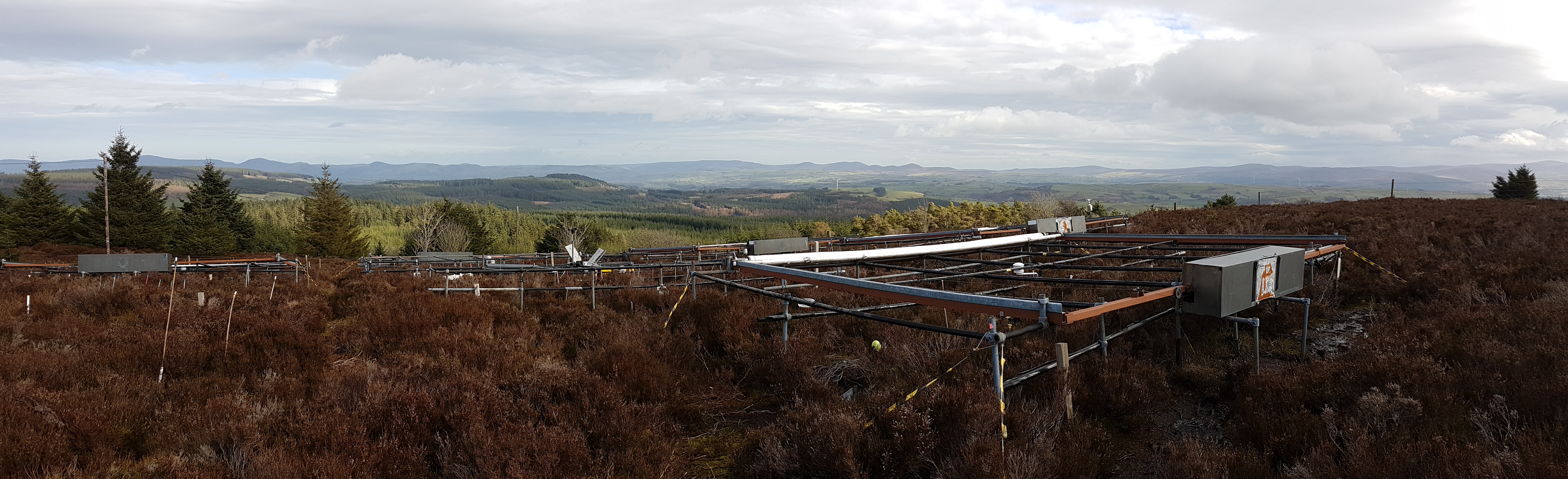
The site is located in Clocaenog Forest in North East Wales (53o 03’ 19’’N -03o 27’ 55’’ W). It is a typical upland west-atlantic moorland, dominated by the evergreen shrub Calluna vulgaris (heather). Heather makes up >60% of the plant biomass at the site, but Vaccinium myrtillus and Empetrum nigrum are also present.
-
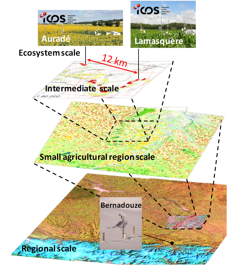
The Regional Spatial Observatory (OSR), labeled in 2007 by the National Institute of Sciences of the univers (INSU), is supported by the Center of Spatial Studies of the BIOSPHERE (CESBIO, OMP). The mission of the OSR aims at documenting on the long term the effects of the climate change and the increasing anthropogenic pressures on the hydrologic and agro-ecologic evolutions in the South-West of France near Toulouse, for various spatial and temporal scales.
-

Berchtesgaden National Park was established in 1978 and is the only German national park located at the Alps. It comprises three major valleys and covers an elevantional range from 600 to 2700 m. Ecosystems include montane mixed forest and subalpine coniferous forest, alpine grasslands, pastures and rocky habitats. The Department for Research and Monitoring is linked to the Techincal University of Munich. It conducts monitoring on climate, hydrology, ecosystem dynamics and biodiversity. Main research topics include drivers of natural ecosystem dynamics, human impacts on ecosystems and climate change effects on ecosystems.
-

The Cairngorms National Park is one of 15 National Parks in the UK (one of two in Scotland) and is Britain's largest National Park (4,528 km2). It is the location for some of the most spectacular landscapes in Britain and is home to an incredible diversity of wildlife and plants. http://cairngorms.co.uk/the-park/facts-figures/ The aims of the National Park are: • To conserve and enhance the natural and cultural heritage of the area; • To promote sustainable use of the natural resources of the area; • To promote understanding and enjoyment (including enjoyment in the form of recreation) of the special qualities of the area by the public; • To promote sustainable economic and social development of the area’s communities. Cairngorms National Park, seven broad habitats can be identified: • Enclosed farmlands • Woodlands • Open waters (rivers, lochs, wetlands and floodplains) • Mountains • Moorland • Semi-natural grasslands • Urban • Population of c17,500 • 25.8% of population over 60 (higher than Scottish average) • Average health index in top 25% of Scotland (based on deprivation indices) • Extensive core paths network • 55 Munros including 5 summits over 4000 feet • 3 ski centres • National Cycle Network Route 7 • 1 Long Distance Route (Speyside Way) • Relatively low atmospheric pollution • Annual precipitation over 2250mm on summits and under 900mm in straths • Average annual snow cover 200 days on summits and 50 days on low-ground • Prevailing winds from south-west
-

Monitoring stations in Aukštaitija NP started functioning in 1993. Aukstaitija station (LT01) was founded in strict reserve zone of Aukstaitija national park in Ažvinčių old forest, Versminis river closed basin. The area of the basin is 101.5 ha. The lowest place is at 159.5 m, the highest - 188.6 m above sea level. Geographical co-ordinates of the basin are: longitude - 26*03*20* - 26*04*50*, latitude - 55*26*00* - 55*26*53*. The climate is characterised as average cold with high humidity and abundant precipitation. The average air temperature is 5.8 C, average precipitation - 682 mm. Length of vegetation period - 189 days. Side glavioacvalic accumulation forms with sand, gravel and stones are typical for river basin and in the western part of the basin, with the decrease of surface altitude transfers into fliuvioglacial terrace delta plain with fine sand, and at the source- into marsh accumulation forms with organic sediments. At the eastern side of the basin, which has higher altitudes, the typical for this basin glavioacvalic accumulation forms transfer into gravel sand. Carbonates start foaming at 45 cm depth (Gulbinas et al., 1996). The saturation of the river water with the oxygen is very weak. The average yearly oxygen concentration equals to 2.9 mg/l (minimal allowable concentration – 6 mg/l). The pH value of the water fluctuates from 7.10-7.75 mg/l, which indicates the alkalisation of the water. Concentration of hydro-carbonate ions varies in the intervals of 148-224 mg/l. Concentrations of sulphates and chlorides are very small. Calcium and magnesium ions are dominating in the media of cations. Concentration of natrium ions is insignificant – 2 mg/l 9DLK=120 mg/l), concentration of kalium ions reaches only tenths of mg/l (DLK=50 mg/l). According to the size of mineralisation the river water could be described as having average mineralisation levels. Concentrations of nitrogen materials (ammonium nitrogen, nitrates) are small, compared to maximum allowable concentrations (DLK) set for surface waters. Concentrations of phosphates are small. Silicium concentrations fluctuate from 2 mg/l to 9 mg/l (Čeponienė, 1997). Main ecosystems Coniferous multi-layered forest stands are prevailing in the basin, which are mainly pine trees with a mixture of spruce. Those stands usually have a second and third tree layer with abundant under layer vegetation. Spruce stands are also of complicated structure. The second and third spruce layer with abundant under layer vegetation are common. Remarkable amounts of territory are occupied by mixed conifer-deciduous or mixed conifer forests. Pure birch stands in more wet habitats in the vicinity of Versminis river source can also be found. According to the forest stand age they are old pure overmature or with accompanying forest stands of several age classes. It is mainly multi-aged and multi-layered over mature pine and spruce stands. In addition The study was based on monitoring data on crown defoliation of more than 3000 Scots pine (Pinus sylvestris L.) trees from 20 permanent observation stands (POS) annually obtained between 1994 and 2009 in Aukstaitija national park (ANP), located in the eastern part of Lithuania (Fig. 1). Over 16yr period mean values of crown defoliation of every sample pine stand were computed annually. Therefore the total number of treatments made N=320. These stands were classified according to stand maturity: 4 sapling stands (45 to 50 years – Table 1, section “Stand maturity”, group 1), 5 middle aged stands (61 – 80 years – group 2), 4 premature stands (81-100 years – group 3), 3 mature stands (101-120 years – group 4) and 4 over mature stands (> 121 years – group 5). Main characteristics of the considered stands are compiled in table 1. All stands represent the prevailing in Lithuania Pinetum vaccinio-myrtilosum forest type.
-
Vestskoven is a 15 km2 ongoing afforestation area located 15 km west of central Copenhagen. Since 1967 arable land has successively been bought up for afforestation in order to establish a large forest area for outdoor activities and wood production. In 1998, afforestation chronosequences in oak (Quercus robur) and Norway spruce (Picea abies) were established as a research platform to quantify soil carbon dynamics, water recharge, nitrogen budgets and ground vegetation species diversity. The soil and grund vegetation species composition were resampled in the chronosequences after 13 years in 2011. Since 2003, an ICP-Forests Level II/Core plot with integrated monitoring under the UN Convention on Long-Range Transboundary Air Pollution (CLRTAP) is placed in an oak stand. Monitoring has developed over time. There is no time limit on the monitoring financed by the Ministry of Environment and Food in Denmark.
-
Suserup Skov (19.2 ha) is an old growth temperate forest dominated by beech Fagus sylvatica, pedunculate oak Quercus robur, ash Fraxinus excelsior, wych elm Ulmus glabra, and black alder Alnus glutinosa, admixed with lime Tilia platyphyllos and sycamore maple Acer pseudoplatanus. KU/IGN-SNB, is a 19,2 ha old-growth beech-dominated mixed deciduous forests on western Zealand owned by Sorø Academy. The forest use dates back to 4200 BC. A conservation act was placed on the forest in 1925 for biological and recreational purposes but allowing a minimum odd felling until the act was updated in 1961 to a non-intervention forest. The forest is unique at European level in terms of nonintervention, and the long-term status as non-intervention forest has led to a unique steady state in biomass and accumulation of dead wood, thus serving as an important reference site for unmanaged temperate deciduous forest development. There are long-term data records of e.g. biomass, dead organic matter, soil, forest structure, flora and fungi starting from 1992. The platform is included in a series of paired managed and non-intervention forests for studies of forest structure, biodiversity and biogeochemistry in mature and old beech-dominated forests. Suserup Forest includes an ICP Forests level II plot (2001-). Upgrades: eLTER master sites: soil moisture content (TDR), remote sensing of growth and forest structure, LAI, NDVI (Lidar, camera), continuous plant phenology (web cam),and insect monitoring (optical sensors) as biodiversity measures, ambient air quality and air pollution.
-
Beech forest in the Central italian Apennines