
dry matter yield
Type of resources
Available actions
Topics
Keywords
Contact for the resource
Provided by
Years
Formats
Representation types
-
The Experimental Farm Groß Enzersdorf is a research and teaching facility of BOKU University of Natural Resources and Life Sciences, Vienna. It was founded in 1902 as a donation to the university by the Austrian emperor; it is a typical arable farm of 140 ha arable fields in Gross-Enzersdorf, Lower Austria. The farm is run in conventional agriculture, but 26 ha are converted to organic farming since more than 20 years. Another 35 ha acreage in Tulln, Lower Austria, plus 6 ha of experimental garden in the city of Vienna, 21. district, are additionally managed by the farm and available for experiments with arable crops, vegetables and fruit species. The experiments include two long-term field experiments that are descibed individually as related plots. These experiments are focussed on long term effects (i) of crop rotation and fertlization since 1906, and (ii) of soil tillage treatments since 1996. The whole farm beyond can be used for any kind of soil, plant or atmosphere observations in experimental settings, representing a typical Pannonian agricultural environment. It is equipped with complete sets of agricultural machinery for large scale farming operation as well as for small experimental plots. On the farm there is also a weather observation station installed by the Austrian Zentralanstalt für Meteorologie und Geodynamik (ZAMG).
-
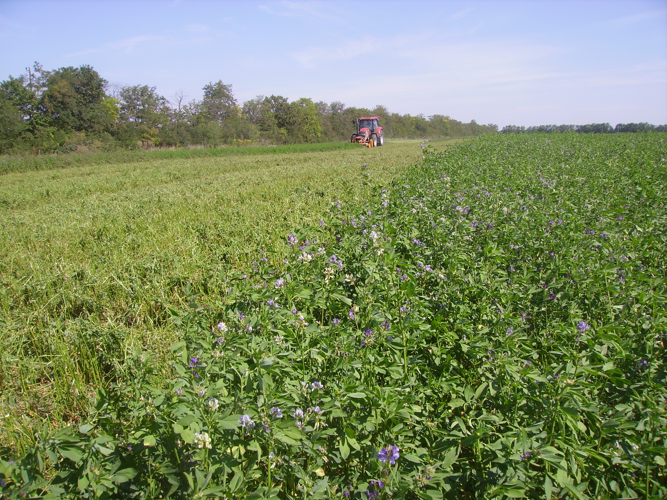
SITES Lönnstorp research station is situated in the Scanian agricultural landscape between Malmö and Lund and has a focus on the design, sustainable development and assessment of arable cropping systems, in conventional and organic farming. The research station is available for research within ecology, agronomy, environmental science, agroecology and other disciplines. SITES Lönnstorp research station have access to 60 hectares of conventional and 18 hectares of organic farm land, mainly cultivated with annual crops, representative for agricultural practise in southern Sweden. The station is also a part of SITES, Swedish Infrastructure for Ecosystem Science. SITES is a nationally co-ordinated infrastructure for terrestrial and limnological field research. In 2016, SAFE (SITES Agroecological Field Experiment) was established at the research station. SAFE make it possible to compare four different agroecosystems, a conventional reference system, an organic system, a perennial system and an agroecological intensified system.
-
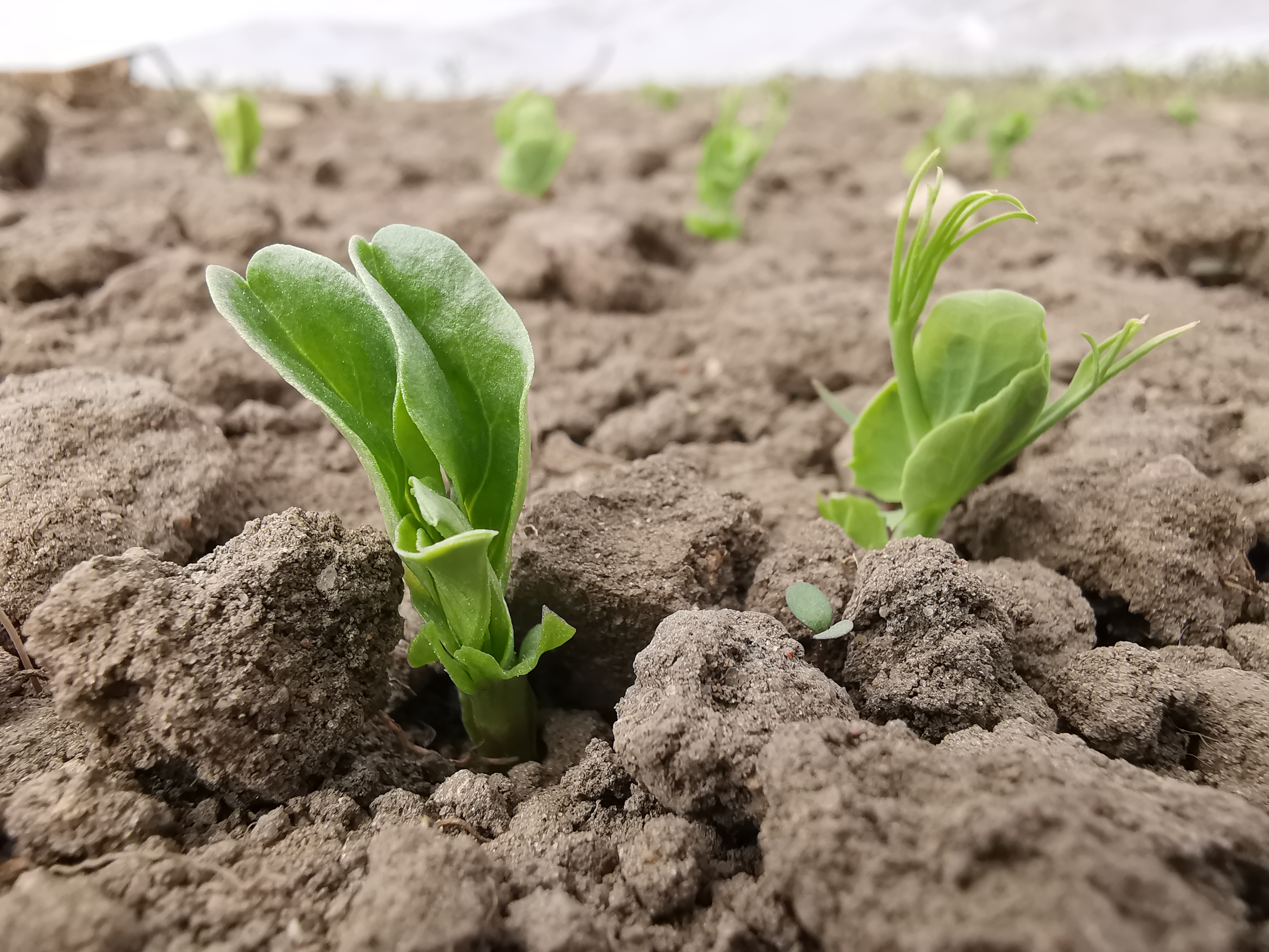
The Rutzendorf Experimental Station is an agricultural research site of the University of Natural Resources and Live Sciences Vienna (BOKU), belonging to the Landwirtschaftliche Versuchswirtschaften GmbH. It is representative for the productive soils managed as arable land in the Marchfeld area (Lower Austria). The soil is described as a silty loamy Calcaric Phaeozem (WRB), a Chernozem according to Austrian soil classification. Management on the farm is without livestock, no organic fertilizers are applied. The farm was converted to organic farming in the production year 2002/03. The 8-year crop rotation comprises luzerne (2 yrs), winter wheat*, grain maize, spring barley*, field peas*, winter wheat, winter rye. Cover crop mixtures are grown where indicated in the crop rotation with an asteric. Current research questions include to study (i) the long-term sustainability and productivity of the stockless organic arable system compared to a livestock-keeping system, (ii) the mitigation of climate change effects on the soil-plant system by reducing soil cultivation intensity, and (iii) the development of biodiversity following the conversion to organic farming and enhancement of landscape elements. Regularly meteorological data, crop yields and quality, physical, chemical and biological soil traits, weed species and diaspores, springtails, wild bees and other animal species are assessed. Studies have been conducted as research projects financed nationally and by the European Union, e.g. in two EIP projects.
-
The Jornada Basin Long-Term Ecological Research (LTER) program is part of a national network of long-term ecological research sites funded by the US National Science Foundation (NSF). The Jornada LTER program has been continuously funded since 1982 to develop general principles governing changes between grassland and shrubland ecosystems based on long-term data collected in the Chihuahuan Desert. Research themes at the Jornada LTER focus on vegetation change, climate and land use impacts on ecosystem function, and the role of dryland processes in structuring communities and landscapes. We translate our findings to dryland ecosystems around the world, and forecast the dynamics of future ecosystem states in response to changing climate and land use. The Jornada Basin is located in southern New Mexico, USA, approximately 25 km northeast of the city of Las Cruces (32.6 N -106.7 W, elevation 1315 m). Annual precipitation is 24 cm and maximum temperatures average 13 C in January and 36 C in June. The study site is near the northern extent of the Chihuahuan Desert, which is the largest of the North American warm deserts, in a region has undergone large shifts in the relative dominance of grasslands and shrublands over the past century. We partner closely with the USDA-ARS Jornada Experimental Range (JER) and the NMSU Chihuahuan Desert Rangeland Research Center (CDRRC), allowing us to benefit from a long history of rangeland research, and to contribute to science-based management and sustainability practices.The Jornada Basin LTER project is administered by New Mexico State University.
-
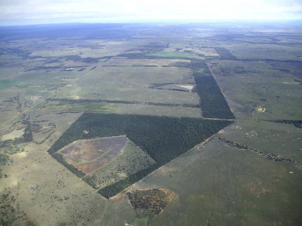
The aim of the Brigalow Catchment Study is to determine the effects of land clearing and land use change on hydrology, water quality, soil fertility and crop and animal productivity in the Brigalow Belt bioregion of central Queensland, Australia
-
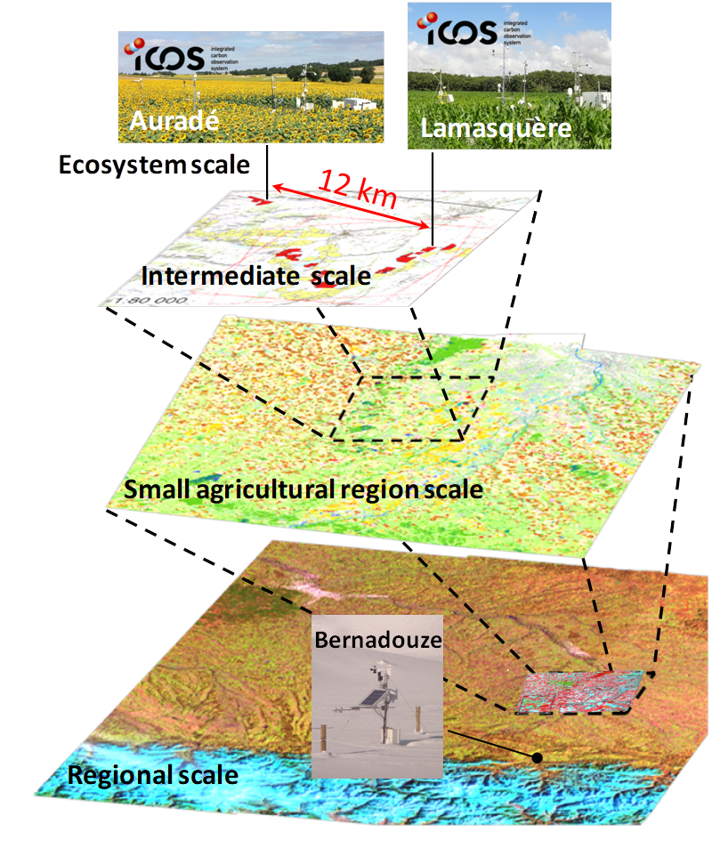
The Regional Spatial Observatory (OSR), labeled in 2007 by the National Institute of Sciences of the univers (INSU), is supported by the Center of Spatial Studies of the BIOSPHERE (CESBIO, OMP). The mission of the OSR aims at documenting on the long term the effects of the climate change and the increasing anthropogenic pressures on the hydrologic and agro-ecologic evolutions in the South-West of France near Toulouse, for various spatial and temporal scales.
-

Berchtesgaden National Park was established in 1978 and is the only German national park located at the Alps. It comprises three major valleys and covers an elevantional range from 600 to 2700 m. Ecosystems include montane mixed forest and subalpine coniferous forest, alpine grasslands, pastures and rocky habitats. The Department for Research and Monitoring is linked to the Techincal University of Munich. It conducts monitoring on climate, hydrology, ecosystem dynamics and biodiversity. Main research topics include drivers of natural ecosystem dynamics, human impacts on ecosystems and climate change effects on ecosystems.
-

The ZA PYGAR covers the whole Garonne river basin up to the upper part of the Gironde estuary (La Reole station). Within this territory, research is structured around 4 main sites: the Pyrénées mountains, covering the upstream part of the Garonne river basin (PYRénées site), the farmland of the foothills of the Pyrénées (Vallées et Coteaux de Gascogne site), the Garonne river (Axe Fluvial Garonne site) and the basin of two tributaries of the Garonne river in the Massif Central moutains (Aveyron-Viaur site).
-
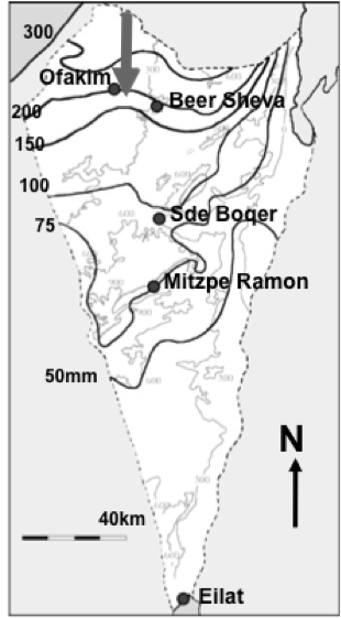
Designation: Ecosystem research and management under land-use and climate change. Climate: Mean annual precipitation 150-200mm between November and April; mean maximum summer temperature 34° C, mean minimum winter temperature 6° C. (Data avialable for 15-min interval meteorological measurements and daily summaries for rainfall, air and soil humidity and temperature, wind velocity and direction, from 1997 to the present.) Principal biomes: Semiarid shrub land (shrub-grass steppe), rocky and loessial watersheds, ephemeral streams. Vegetation is dominated by patch-forming dwarf shrubs (Noaea mucronata, Atractylis serratuloides and Thymelea hirsuta) with species-rich annual winter vegetation in the inter shrub (dominated by Stipa capensis and other grasses) and shrub patch understory (dominated by Anagallis arvensis and other forbs). As a result of drought there are also two new sub biomes: crust land and grass land. Management: Livestock grazing excluded in central watershed (20 ha) since 1987; restricted/controlled grazing by Bedouin sheep herds in surroundings; in the outer parts of the area native and exotic trees were planted in 1985-87 in contour dykes (‘shikhim’) on the slopes and in terraces in the riverbed. Research: 1. Long-term experiments (up to 20 years) for monitoring changes in abundance, diversity, species composition and distribution, and development of biological soil crusts (BSC), perennial plants (dwarf shrubs) and winter annuals in relation to rainfall, soil disturbance, patch distribution, and livestock grazing. 2. long term hydrological studies on rainfall-runoff relationship under natural and manipulation experiments. 3. Short-term experiments and surveys (1 to 5 years) A. for testing hypotheses about the detailed processes, mechanisms and interactions involved in the development, dynamics and stability of shrub- and BSC-dominated patches, their landscape mosaic patterns and their feed-back relationships with flows of materials through the landscape; B. for testing hypothesis on the effect of geodiversity on the stability of shrub land to extreme drought and understanding state changes in drylands. 4. Long term studies on cross scale-cross level interactions in natural and human modified landscape. 5. Network-related research including regional comparisons of herbaceous plant productivity in open rangeland along the Israeli North-South rainfall gradient, and global comparison of woody plant diversity effects on ecosystem functionality of most dryland regions of the world.
-

The Cairngorms National Park is one of 15 National Parks in the UK (one of two in Scotland) and is Britain's largest National Park (4,528 km2). It is the location for some of the most spectacular landscapes in Britain and is home to an incredible diversity of wildlife and plants. http://cairngorms.co.uk/the-park/facts-figures/ The aims of the National Park are: • To conserve and enhance the natural and cultural heritage of the area; • To promote sustainable use of the natural resources of the area; • To promote understanding and enjoyment (including enjoyment in the form of recreation) of the special qualities of the area by the public; • To promote sustainable economic and social development of the area’s communities. Cairngorms National Park, seven broad habitats can be identified: • Enclosed farmlands • Woodlands • Open waters (rivers, lochs, wetlands and floodplains) • Mountains • Moorland • Semi-natural grasslands • Urban • Population of c17,500 • 25.8% of population over 60 (higher than Scottish average) • Average health index in top 25% of Scotland (based on deprivation indices) • Extensive core paths network • 55 Munros including 5 summits over 4000 feet • 3 ski centres • National Cycle Network Route 7 • 1 Long Distance Route (Speyside Way) • Relatively low atmospheric pollution • Annual precipitation over 2250mm on summits and under 900mm in straths • Average annual snow cover 200 days on summits and 50 days on low-ground • Prevailing winds from south-west